
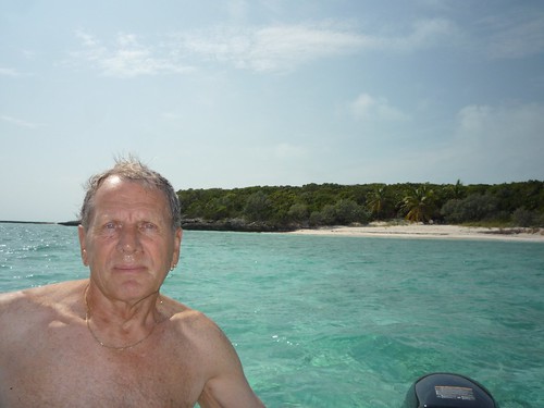
Rockin' on RobinLeigh
The High Seas adventures of the sailing vessel RobinLeigh
24 June 2007 | Somewhere north of the Greek island of Milos
14 June 2007 | The Cyclades islands, Greece
06 June 2007 | The island of Tinos, Greece
05 June 2007 | The island of Tinos, Greece
04 June 2007 | Korthion on the island of Andros - Greece
01 June 2007 | Korthion bay on the island of Andros, Greece
31 May 2007 | The island of Patmos, Greece
25 May 2007 | Nisis Marathos island, Greece
24 May 2007 | Pandeli harbor - the island of Leros
24 May 2007 | The West coast of Turkey and the Greek islands
24 May 2007 | Dalyan Turkey
20 May 2007 | Mersincik bay, Turkey
17 May 2007 | Marmaris Turkey
13 May 2007 | Somewhere south of Gocek, Turkey
11 May 2007 | Kekova Roads, Turkey
10 May 2007 | Port Genovese, Turkey
09 May 2007 | The Turkish Lycian coast
03 May 2007 | Kemer Marina, Turkey
02 May 2007 | Kemer Marina, Turkey
02 May 2007 | Kemer Marina, Turkey
Junkanoo and Geocaching at Rock Sound
28 February 2011 | Rock Sound, Eleuthera
Sunny and 78F
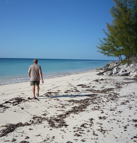
Rock Sound was a great place to hang out for a few days. A large shallow bay with few waves and miles of white sand for anchoring, you can almost forget you're on a boat. Quiet nights and long sunny days made us a bit lazy.
One day we visited the restaurant where we had lunched while traveling by car. The food was just as good the second time and the staff was very friendly. They invited to an event the next day that they put on for cruise ship passengers that come down by car on a tour of the island. The cruise ships visit the south-western tip of the island so we've never actually seen one, only their native inhabitants - tourists...
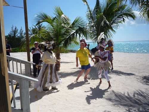
We watched a demonstration of how to make conch salad and listened to island music for a few hours. At the end of the event some dancers came out and did a dance that is popular during Junkanoo (the Bahamian version of Mardi Gras that happens in the Fall). The dancers were entertaining and so were the tourists :-)
While at this location we found out about a Geocache in the cave next to one of the "blue holes". The blue holes are formed by seawater that enters through the crevasses in the limestone that makes up most of the island. There are also lots of caves and one local told us you can get from the east (bayside) to the west (ocean side) through the underground tunnels. That must be at least 2 miles underground so we decided to pass on that one!
We stored the directions for the geocache on the ipad in the morning and made our way to the cave system. The directions were very well written and the cave was pretty impressive. We even surprised a few dozen of Bahamian bats at one point, causing them to fly around over our heads.
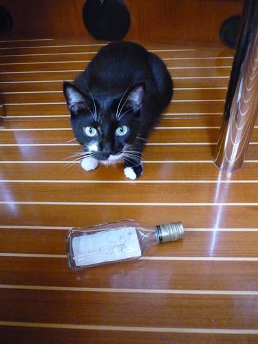
When we got to the place where the cache was supposed to be hidden we could not find it. It was an older cache that had not been maintained so we were not surprised. It was still a great adventure. Since the cache was no longer there we decided to make a new one near that location for future trekkers. The Cache is called "Tucker One", in honor of our cat, and it is a small whiskey bottle with a note inside. Charles will create a geocache entry for it soon on the web so people can find it.
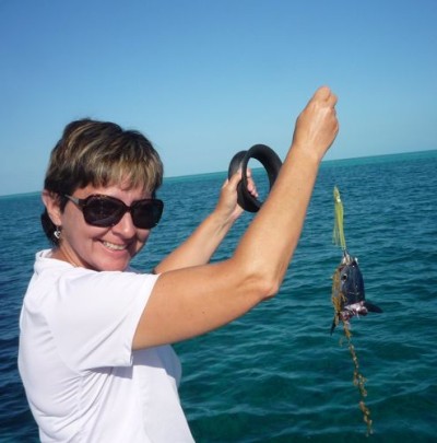
We had a nice sail from Eleuthera to the Exumas on Saturday, fishing the whole way. One line was on a spool and we were not watching it closely. By the time we saw it had something on it we only had a fish head left. Some Barracuda ate well that morning.
More photos here
Next post from the Exumas!
One day we visited the restaurant where we had lunched while traveling by car. The food was just as good the second time and the staff was very friendly. They invited to an event the next day that they put on for cruise ship passengers that come down by car on a tour of the island. The cruise ships visit the south-western tip of the island so we've never actually seen one, only their native inhabitants - tourists...
We watched a demonstration of how to make conch salad and listened to island music for a few hours. At the end of the event some dancers came out and did a dance that is popular during Junkanoo (the Bahamian version of Mardi Gras that happens in the Fall). The dancers were entertaining and so were the tourists :-)
While at this location we found out about a Geocache in the cave next to one of the "blue holes". The blue holes are formed by seawater that enters through the crevasses in the limestone that makes up most of the island. There are also lots of caves and one local told us you can get from the east (bayside) to the west (ocean side) through the underground tunnels. That must be at least 2 miles underground so we decided to pass on that one!
We stored the directions for the geocache on the ipad in the morning and made our way to the cave system. The directions were very well written and the cave was pretty impressive. We even surprised a few dozen of Bahamian bats at one point, causing them to fly around over our heads.
When we got to the place where the cache was supposed to be hidden we could not find it. It was an older cache that had not been maintained so we were not surprised. It was still a great adventure. Since the cache was no longer there we decided to make a new one near that location for future trekkers. The Cache is called "Tucker One", in honor of our cat, and it is a small whiskey bottle with a note inside. Charles will create a geocache entry for it soon on the web so people can find it.
We had a nice sail from Eleuthera to the Exumas on Saturday, fishing the whole way. One line was on a spool and we were not watching it closely. By the time we saw it had something on it we only had a fish head left. Some Barracuda ate well that morning.
More photos here
Next post from the Exumas!
Keep Left!
21 February 2011
We arrived at Hatchett Bay on the island of Eleuthera with the hope of finding a mooring or a safe spot to anchor. The bay is a man made, created by blasting an opening through the limestone to connect a lake to the Eleuthera bight (map of harbor). It looked like it would provide good protection from most winds.
The sign at the town entrance says "Hatchett Bay - the safest harbor on Eleuthera"; the cruising guide said otherwise. It warned of out of date or missing moorings, poor holding in the anchorage, and problems with theft. We were determined to find out who was right.
We pulled into the harbor around 4:30 pm and found a number of moorings close to the dock with reasonably good hardware and good depth all around. There was great protection from the gusty NE winds so we slept well that night.
The next day we visited the town and found everyone there to be friendly and helpful. We also met other cruisers and found they had been there for some time. It seems free parking in a safe harbor is hard to pass up. We bought groceries at the local store and arranged to rent a car on Friday to explore the island.
Wednesday night we had dinner at the "Front Porch", a cute restaurant that sits on a hill overlooking the harbor. Francis prepared us fish with Bahamian spices and vegetables and it was delicious. This restaurant is well worth a visit by land or sea.
On Friday we went to pick up our car from the gas station and found it was not available. The fellow who was supposed to give us the car had gone to Nassau for the day. On the walk back to the dingy we talked about what to do and had almost decided to head south to another harbor when Francis called to us from the Front Porch and asked how things were going. We told him about the car problem and he called us up to the restaurant.
15 minutes later he had arranged a car for us at the airport 10 miles down the road. His friend Falcon drove us down to pick it up. When we picked up the car we decided to keep it for 2 days to make sure we saw the entire island. We found the car rental process very informal. David Cooper (airport employee) gave us his personal car for 2 days for $160 cash. We told him we would leave it at the Front Porch in Hatchett Bay for him to pick up Sunday morning and he said to just leave it unlocked with the keys under the floor mat. David did not ask to see a drivers license or any other form of identification but we gave him our boat card and assured him he could find us through Francis at the Front Porch.

Eleuthera is 110 miles long and skinny. At it's narrowest point (the glass window bridge) it is only a few hundred feet wide from the bay to the Atlantic. The single, primary road "Queen's highway" is paved without a center line and runs the length of the island. Other roads might be paved but are more likely to be sand, gravel, or dirt.
Here are some high points from our 2 day trip:
Day 1 -
*Successfully acquired a car and learning to "keep left" on the road (they drive on the left side here). Charles drove both days so he gets a blue ribbon for mastering this skill.
*We headed north and made out first stop the Glass Window Bridge. THis bridge was built over a natural limestone hole where water used to pass from the deep Atlantic side to the shallow turquoise bight.
*Drove south to the Current Cut, a narrow passage from the bight to west side of the island on the way to Spanish Wells. The tides run fierce here and we saw a dive boat in the channel with people doing a drift dive with the current.
*At the NW corner of the island we parked the car and took a small ferry over to Spanish Wells for a walk and lunch. Spanish Wells is a colorful cluster of houses on St. George's Cay, 1km (2/3 mile) off the coast of northwest Eleuthera. Arriving by ferry the town looks a lot like the small fishing harbors we have seen in New England. The houses have New England saltbox styling but bright tropical coloring. The town is small and you can easily walk it but the primary mode of transportation is a golf cart - there were hundreds of them.
Arriving after 12:00 we noticed all the shops closed for lunch. we walked on the main road until we found a popular lunch spot -"The Generation Gap". Talking to the the locals at lunch we decided the island felt more like a village than a tourist destination. We strolled around the town for a while longer and then hopped on the ferry to resume our tour of the island.
*From the ferry dock we headed to Preacher's Cave, northeast of North Eleuthera Airport. In this barren and isolated backwater, the Eleutherian Adventurers (that was their chartered name) found shelter during the mid-17th century, when they were shipwrecked with no provisions. The road to this historic landmark has just been redone making it an easier drive.
Preacher's Cave is one of the most historically important sites in The Bahamas -- the point from which the origins of the country emerged. Set amid scrub and bush, the Preacher's Cave looks something like an amphitheater, with niches carved into its walls for seating for the community's elders, and a central boulder allegedly used as either a pulpit or an altar. The devout Eleutherian Adventurers held religious services inside the cave, which is pierced by natural holes in the roof, allowing light and rainfall to intrude.
For several years after they were stranded on reefs near this site, the settlers developed an elaborate series of religious and cultural codes and bylaws, which in some ways factored into the legal and social codes of The Bahamas. The landscapes around this cave are rich with buried workaday artifacts from that early impromptu community, and much excavation work remains to be done, a project of ongoing interest to the Bahamian government. DNA tests of skeletons unearthed from the cave have drawn distinct links between the Eleutherian Adventurers and the modern-day residents of Spanish Wells.
*Before hopping on the ferry to Spanish Wells we met a woman who spends 10 weeks a year on Harbor Island and she told us we really needed to visit. Back in the car and past the airport we hopped on another ferry to Harbor Island.
This island gets more traffic from the 'rich and famous' than most other islands in the Bahamas but we saw no celebrities this day. The island was actually very quiet. Even "Valentines marina", normally full this time of year, only had a few visiting boats.
We walked around Harbor island for about an hour, enjoying the colorful homes and beautiful tropical landscaping. After a short ice-cream break, we hopped on the ferry and returned to the mainland.
*Toward the end of day 1 we drove west past the airport and visited one of the larger supermarkets on the island, picking up a hitchhiker along the way (the most popular mode of transportation on the island). We bought a good supply of milk, bread, and other necessities and headed back to the boat.
Day 2 was devoted to the south side of the island... We had seen the top third of the island the day before.
* We drove a good distance south before stopping - Our first destination was an abandoned marina about 20 miles south of Hatchett Bay. It was reported to be out of business and abandoned but we heard there was a really good French restaurant at the harbor. We wanted to see if we could tie up at the old marina for a few nights and have a nice meal at the restaurant. The marina was without water or electricity but the dock looked good and the depths coming in looked OK as well. Charles visited the restaurant and picked up a menu. The food looked really good and the owner was very friendly. We made a note to stop here on our way south.
* We took a lot of side trips to the Atlantic side of the island and found an amazing variety of communities. From festive community parks on beautiful protected bays, to exclusive private islands, to ancient resorts. We had read about the private island of Windemere Bay in the guide so we wanted to check it out. The island gained notoriety when Prince Charles wad there with very pregnant Princess Di and a photographer snapped a picture of her in a bikini. Since then the island has had it's share of trouble, the hotel is no longer open and there is always some rumor of fighting among the residents but it remains a private and exclusive place and the gate guard said if we wanted to see the place we had to come with an approved real estate agent.
We also stumbled on to one of the oldest Golf and Beach Resorts in the islands. The "Cotton Bay Club" was formed in the early 1940s by the founder of PanAm Airlines. It must have been splendid in the day but when we approached the place it first looked like the remains of an ancient civilization. What used to be a club house was covered with vines and surrounded by old growth and the building next to is was collapsed with trees growing out of it. The golf course had reverted to a natural, tropical state. We thought the entire place was abandoned until we spotted the first house overlooking the Atlantic. Each home was beautiful maintained and unique, they looked like something out of "Architectural Digest". One home stood out because it was only a shell, it looked to have been lost in a fire and never rebuilt. We walked around the ruins to check out the ocean view.
*We continued south, taking any side road we could find that was drivable. Sometimes we came to a dead end and had to double back but the trips were well worth it. We made it as far south as Davis Harbor at Wemyss Bight then turned around and headed North.
On the way back to Hatchett Bay we stopped at Governor's Harbor to explore some of the side streets. This is the Government seat of the island and the architecture here is more colonial. Some of the homes on the waterfront looked to be a few hundred years old.
*We ended our tour back at the Front Porch and enjoyed a drink on the patio while we told Francis and our new cruising friends about our adventures on the island. Many thanks to Francis for making our stay at Hatchett Bay so memorable and enjoyable.
Check out Photos of our adventures here: http://www.flickr.com/photos/nothinglikeit/sets/72157626106114812/
The sign at the town entrance says "Hatchett Bay - the safest harbor on Eleuthera"; the cruising guide said otherwise. It warned of out of date or missing moorings, poor holding in the anchorage, and problems with theft. We were determined to find out who was right.
We pulled into the harbor around 4:30 pm and found a number of moorings close to the dock with reasonably good hardware and good depth all around. There was great protection from the gusty NE winds so we slept well that night.
The next day we visited the town and found everyone there to be friendly and helpful. We also met other cruisers and found they had been there for some time. It seems free parking in a safe harbor is hard to pass up. We bought groceries at the local store and arranged to rent a car on Friday to explore the island.
Wednesday night we had dinner at the "Front Porch", a cute restaurant that sits on a hill overlooking the harbor. Francis prepared us fish with Bahamian spices and vegetables and it was delicious. This restaurant is well worth a visit by land or sea.
On Friday we went to pick up our car from the gas station and found it was not available. The fellow who was supposed to give us the car had gone to Nassau for the day. On the walk back to the dingy we talked about what to do and had almost decided to head south to another harbor when Francis called to us from the Front Porch and asked how things were going. We told him about the car problem and he called us up to the restaurant.
15 minutes later he had arranged a car for us at the airport 10 miles down the road. His friend Falcon drove us down to pick it up. When we picked up the car we decided to keep it for 2 days to make sure we saw the entire island. We found the car rental process very informal. David Cooper (airport employee) gave us his personal car for 2 days for $160 cash. We told him we would leave it at the Front Porch in Hatchett Bay for him to pick up Sunday morning and he said to just leave it unlocked with the keys under the floor mat. David did not ask to see a drivers license or any other form of identification but we gave him our boat card and assured him he could find us through Francis at the Front Porch.
Eleuthera is 110 miles long and skinny. At it's narrowest point (the glass window bridge) it is only a few hundred feet wide from the bay to the Atlantic. The single, primary road "Queen's highway" is paved without a center line and runs the length of the island. Other roads might be paved but are more likely to be sand, gravel, or dirt.
Here are some high points from our 2 day trip:
Day 1 -
*Successfully acquired a car and learning to "keep left" on the road (they drive on the left side here). Charles drove both days so he gets a blue ribbon for mastering this skill.
*We headed north and made out first stop the Glass Window Bridge. THis bridge was built over a natural limestone hole where water used to pass from the deep Atlantic side to the shallow turquoise bight.
*Drove south to the Current Cut, a narrow passage from the bight to west side of the island on the way to Spanish Wells. The tides run fierce here and we saw a dive boat in the channel with people doing a drift dive with the current.
*At the NW corner of the island we parked the car and took a small ferry over to Spanish Wells for a walk and lunch. Spanish Wells is a colorful cluster of houses on St. George's Cay, 1km (2/3 mile) off the coast of northwest Eleuthera. Arriving by ferry the town looks a lot like the small fishing harbors we have seen in New England. The houses have New England saltbox styling but bright tropical coloring. The town is small and you can easily walk it but the primary mode of transportation is a golf cart - there were hundreds of them.
Arriving after 12:00 we noticed all the shops closed for lunch. we walked on the main road until we found a popular lunch spot -"The Generation Gap". Talking to the the locals at lunch we decided the island felt more like a village than a tourist destination. We strolled around the town for a while longer and then hopped on the ferry to resume our tour of the island.
*From the ferry dock we headed to Preacher's Cave, northeast of North Eleuthera Airport. In this barren and isolated backwater, the Eleutherian Adventurers (that was their chartered name) found shelter during the mid-17th century, when they were shipwrecked with no provisions. The road to this historic landmark has just been redone making it an easier drive.
Preacher's Cave is one of the most historically important sites in The Bahamas -- the point from which the origins of the country emerged. Set amid scrub and bush, the Preacher's Cave looks something like an amphitheater, with niches carved into its walls for seating for the community's elders, and a central boulder allegedly used as either a pulpit or an altar. The devout Eleutherian Adventurers held religious services inside the cave, which is pierced by natural holes in the roof, allowing light and rainfall to intrude.
For several years after they were stranded on reefs near this site, the settlers developed an elaborate series of religious and cultural codes and bylaws, which in some ways factored into the legal and social codes of The Bahamas. The landscapes around this cave are rich with buried workaday artifacts from that early impromptu community, and much excavation work remains to be done, a project of ongoing interest to the Bahamian government. DNA tests of skeletons unearthed from the cave have drawn distinct links between the Eleutherian Adventurers and the modern-day residents of Spanish Wells.
*Before hopping on the ferry to Spanish Wells we met a woman who spends 10 weeks a year on Harbor Island and she told us we really needed to visit. Back in the car and past the airport we hopped on another ferry to Harbor Island.
This island gets more traffic from the 'rich and famous' than most other islands in the Bahamas but we saw no celebrities this day. The island was actually very quiet. Even "Valentines marina", normally full this time of year, only had a few visiting boats.
We walked around Harbor island for about an hour, enjoying the colorful homes and beautiful tropical landscaping. After a short ice-cream break, we hopped on the ferry and returned to the mainland.
*Toward the end of day 1 we drove west past the airport and visited one of the larger supermarkets on the island, picking up a hitchhiker along the way (the most popular mode of transportation on the island). We bought a good supply of milk, bread, and other necessities and headed back to the boat.
Day 2 was devoted to the south side of the island... We had seen the top third of the island the day before.
* We drove a good distance south before stopping - Our first destination was an abandoned marina about 20 miles south of Hatchett Bay. It was reported to be out of business and abandoned but we heard there was a really good French restaurant at the harbor. We wanted to see if we could tie up at the old marina for a few nights and have a nice meal at the restaurant. The marina was without water or electricity but the dock looked good and the depths coming in looked OK as well. Charles visited the restaurant and picked up a menu. The food looked really good and the owner was very friendly. We made a note to stop here on our way south.
* We took a lot of side trips to the Atlantic side of the island and found an amazing variety of communities. From festive community parks on beautiful protected bays, to exclusive private islands, to ancient resorts. We had read about the private island of Windemere Bay in the guide so we wanted to check it out. The island gained notoriety when Prince Charles wad there with very pregnant Princess Di and a photographer snapped a picture of her in a bikini. Since then the island has had it's share of trouble, the hotel is no longer open and there is always some rumor of fighting among the residents but it remains a private and exclusive place and the gate guard said if we wanted to see the place we had to come with an approved real estate agent.
We also stumbled on to one of the oldest Golf and Beach Resorts in the islands. The "Cotton Bay Club" was formed in the early 1940s by the founder of PanAm Airlines. It must have been splendid in the day but when we approached the place it first looked like the remains of an ancient civilization. What used to be a club house was covered with vines and surrounded by old growth and the building next to is was collapsed with trees growing out of it. The golf course had reverted to a natural, tropical state. We thought the entire place was abandoned until we spotted the first house overlooking the Atlantic. Each home was beautiful maintained and unique, they looked like something out of "Architectural Digest". One home stood out because it was only a shell, it looked to have been lost in a fire and never rebuilt. We walked around the ruins to check out the ocean view.
*We continued south, taking any side road we could find that was drivable. Sometimes we came to a dead end and had to double back but the trips were well worth it. We made it as far south as Davis Harbor at Wemyss Bight then turned around and headed North.
On the way back to Hatchett Bay we stopped at Governor's Harbor to explore some of the side streets. This is the Government seat of the island and the architecture here is more colonial. Some of the homes on the waterfront looked to be a few hundred years old.
*We ended our tour back at the Front Porch and enjoyed a drink on the patio while we told Francis and our new cruising friends about our adventures on the island. Many thanks to Francis for making our stay at Hatchett Bay so memorable and enjoyable.
Check out Photos of our adventures here: http://www.flickr.com/photos/nothinglikeit/sets/72157626106114812/
In the Middle of Nowhere
17 February 2011 | White Cay Anchorage - Berry Islands
We moved to the east side of the Berry Islands on Feb 10th, hoping to find more civilization and maybe a restaurant where we could enjoy some Bahamian cooking. We tried for Little Harbor Cay but the anchorage was not right for the wind so we settled for White Cay, 2 miles north of Little Harbor. We were drawn to the area by a note in the cursing guide and a comment from a sailor a few weeks earlier: "If you go to the Berrys, be sure and stop by Flo's". More on that part later...
We found the White Cay anchorage to be beautiful. It was also deserted. Aside from two lounge chairs sitting on White Cay beach, there was no evidence of civilization. Strong winds were forecast for the next few days so we took advantage of the calm sunny morning to explore.
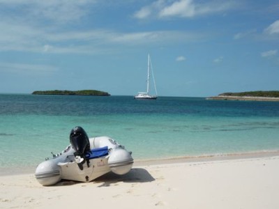
The guide described a blue hole on Hoffmans Cay to the north that looked very interesting. We read over the directions on how to get there and hopped in the dingy. The guide said "Go to the beach at the middle of the island with the tree on it." This seemed to imply that there was only one beach on the island with a tree on it. That was not the case. We picked the beach that looked the most likely and there was a trail. We figured we had guessed right. After walking back and forth across the island and finding no blue hole, we gave up and went back to the boat for the GPS.
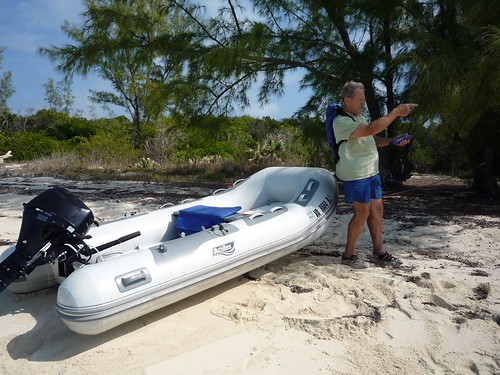
Our next trip was more productive - we found a beach with a tree and the trail looked more like the one described in the guide. We climbed the ridge and we were soon looking down into a very deep and clear lake.
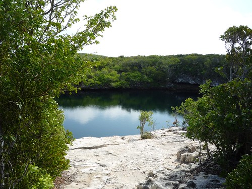
We were not brave enough to dive off the 25 foot ledge so we navigated to the edge of the blue hole and jumped in from there. The salt water pond is at least 600 feet deep and is filled from the ocean through caves in the porous stone and coral.
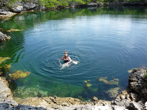
We saw fairly large grouper swimming around the edge of the pond but we're not sure if they came into the pond that size or as minnows. Hopefully nothing larger with teeth was lurking in the deep water!
We had a nice swim in the blue hole and before heading back to the boat we visited Robinson Crusoe beach.
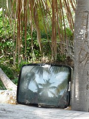
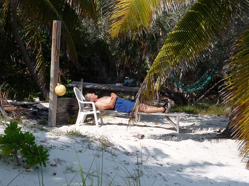
The tiny island is called Big Gaulding Cay but the nickname for the beach is very appropriate. Landing on the beach we saw a makeshift table and bench, a hammock, a few shady palm trees and a television. Yep, sitting on the table was the picture tube from a small TV.
We enjoyed our sandwiches and lemonade in the shade of the palm trees but finally had to escape back to the dingy when the mosquitos and other biting insects discovered us.
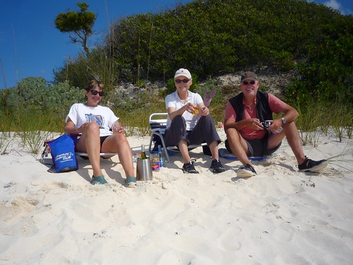
We stopped by another boat in the anchorage, "Aries Too", to say hello - Douglas and Linda invited us over for drinks later. Drinks turned into a delicious meal (Linda is an amazing cook) and we spent a number of hours on their boat swapping stories and enjoying their company.
After a few really windy and cloudy 'do nothing' days the sun came back out. We took the dingy over to our closest beach on White Cay and explored. Linda and Douglas came over later with drinks and snacks and we sat on the beach in the lounge chairs some kind sailors had left behind.
The next morning we went on a dingy field trip with Linda and Douglas a few miles south to Little Harbor Cay. We had yet to visit "Flo's"!
Chester met us there and we asked him how things were going. He said things had been pretty quiet and told us that his Mom, the famous Flo, had passed away a few months earlier at the age of 80. She was quite a figure in the islands and Chester told us they had services in the Berry Islands AND Nassau so all of her friends could pay their respect. Chester plans to keep the outpost and restaurant going (he was the one who originally built the the place and he brought his Mom in as parter later on). He said he could not do lunch for us because he had to leave but invited us to walk around the island and visit the beach on the ocean side. We had a great time exploring the windward side of the island and found all sorts of interesting things washed in by the waves and weather.
The winds had finally eased up and we were out of bread and milk, so we decided to sail away from White Cay in search of civilization. Our next destination was 75 miles away on the island of Eleuthera. We pulled up anchor at 2 am under a 2/3 moon and headed across North Providence Channel.
Little Bear (a rescue from the last anchorage) will be watching out for coral and sand bars along the way...
View all photos here: White Cay Anchorage
We found the White Cay anchorage to be beautiful. It was also deserted. Aside from two lounge chairs sitting on White Cay beach, there was no evidence of civilization. Strong winds were forecast for the next few days so we took advantage of the calm sunny morning to explore.
The guide described a blue hole on Hoffmans Cay to the north that looked very interesting. We read over the directions on how to get there and hopped in the dingy. The guide said "Go to the beach at the middle of the island with the tree on it." This seemed to imply that there was only one beach on the island with a tree on it. That was not the case. We picked the beach that looked the most likely and there was a trail. We figured we had guessed right. After walking back and forth across the island and finding no blue hole, we gave up and went back to the boat for the GPS.
Our next trip was more productive - we found a beach with a tree and the trail looked more like the one described in the guide. We climbed the ridge and we were soon looking down into a very deep and clear lake.
We were not brave enough to dive off the 25 foot ledge so we navigated to the edge of the blue hole and jumped in from there. The salt water pond is at least 600 feet deep and is filled from the ocean through caves in the porous stone and coral.
We saw fairly large grouper swimming around the edge of the pond but we're not sure if they came into the pond that size or as minnows. Hopefully nothing larger with teeth was lurking in the deep water!
We had a nice swim in the blue hole and before heading back to the boat we visited Robinson Crusoe beach.
The tiny island is called Big Gaulding Cay but the nickname for the beach is very appropriate. Landing on the beach we saw a makeshift table and bench, a hammock, a few shady palm trees and a television. Yep, sitting on the table was the picture tube from a small TV.
We enjoyed our sandwiches and lemonade in the shade of the palm trees but finally had to escape back to the dingy when the mosquitos and other biting insects discovered us.
We stopped by another boat in the anchorage, "Aries Too", to say hello - Douglas and Linda invited us over for drinks later. Drinks turned into a delicious meal (Linda is an amazing cook) and we spent a number of hours on their boat swapping stories and enjoying their company.
After a few really windy and cloudy 'do nothing' days the sun came back out. We took the dingy over to our closest beach on White Cay and explored. Linda and Douglas came over later with drinks and snacks and we sat on the beach in the lounge chairs some kind sailors had left behind.
The next morning we went on a dingy field trip with Linda and Douglas a few miles south to Little Harbor Cay. We had yet to visit "Flo's"!
Chester met us there and we asked him how things were going. He said things had been pretty quiet and told us that his Mom, the famous Flo, had passed away a few months earlier at the age of 80. She was quite a figure in the islands and Chester told us they had services in the Berry Islands AND Nassau so all of her friends could pay their respect. Chester plans to keep the outpost and restaurant going (he was the one who originally built the the place and he brought his Mom in as parter later on). He said he could not do lunch for us because he had to leave but invited us to walk around the island and visit the beach on the ocean side. We had a great time exploring the windward side of the island and found all sorts of interesting things washed in by the waves and weather.
The winds had finally eased up and we were out of bread and milk, so we decided to sail away from White Cay in search of civilization. Our next destination was 75 miles away on the island of Eleuthera. We pulled up anchor at 2 am under a 2/3 moon and headed across North Providence Channel.
Little Bear (a rescue from the last anchorage) will be watching out for coral and sand bars along the way...
View all photos here: White Cay Anchorage
To the Berry Islands
09 February 2011 | Bimini to Berry Islands
75-80F and sunny
After a few days at Bimini Sands marina, we were ready to continue our passage into the Bahamas. We made sure to leave the marina at high tide so as not to repeat the hilarious sand bar incident from a few days before.
We headed a few miles south to Cat Cay and anchored off Gun Cay resort for the evening. Around 9pm the winds kicked up exposing us to a pretty good swell. Our anchor started dragging and try as we might we could not get it to reset in the soft sand and grass. The wind was not predicted and did not bode well for a midnight bank crossing. We would try the bank in the morning if the wind was lighter and more southerly.
Rather than fight with the anchor all night we decided to head for the almost empty marina called Gun Cay Yacht Club. A private marina which charges an arm and a leg to park your boat, we hoped to rest on the wall next to the private air strip for the night and get out of there for a few bucks the next morning. We tied up to the wall with care and had a pretty good night's sleep while the SE winds continued to blow.
By morning things had settled and the wind had shifted to the South, giving us a good angle to sail across the bank. We had a great sail for most of the day and were amazed to watch the depth meter show a consistent 12 - 18 feet for most of the passage.
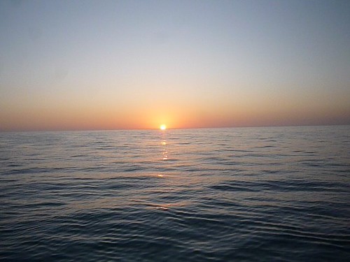
At 5:30 we steered to a spot .5 mile off the well traveled GPS route and dropped our anchor just before sunset. The winds were very light out of the South and we were parked in the middle of nowhere! Aside from the stars above us, the only landmarks we had were a few other boats anchored off in the distance. We spent a peaceful night on the bank and took some time to explore a beautiful night sky without city lights. The Milky Way was well defined and with a small sliver of a moon, there were more stars than we could count.
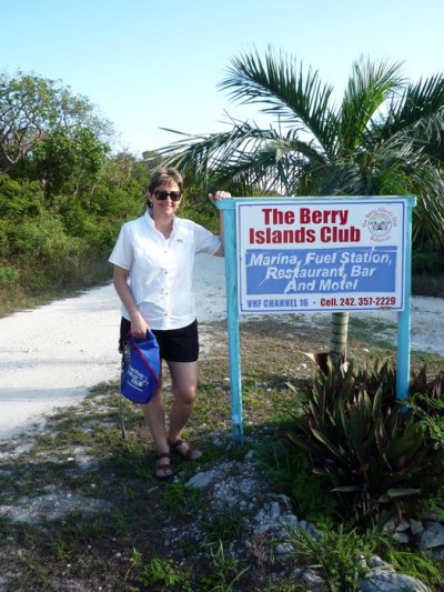
Winds were light the next morning so we motored the remaining 30 miles off the bank and into the Berry Islands. We headed for the East side of Chub Cay and grabbed a mooring at the Berry Island YC. The mooring was brand new and chained to a HUGE concrete block so we felt pretty secure. We visited the house at the end of the dock to pay for our mooring. While talking to the guy at the bar we noticed the big screen TV and asked if we could come up and watch the Superbowl later. He said there would be someone there and to come up around 7pm.
We got to the bar at 7 and the game had already started. There were a few locals there and some people from other boats and we all picked sides and started cheering for our teams. Some of the local guys really got into the game and as the shouting got louder someone turned up the volume on the TV. This, of course, led to even louder shouting and by the time the Packers had successfully beaten the Steelers, our ears were ringing. We were happy to have had a chance to watch the game (and the commercials) but were VERY ready to return to the quiet of the boat.
While at this anchorage we snorkeled at a coral head near the shore in about 7 feet of water that had lots of tropical fish. We saw glasseye snapper, yellowtail snapper, grunts, nassau grouper, squirrelfish, queen triggerfish, bar jacks, and some tiny fairy basslets. The second day I was approaching the reef from the dingy and as I swam over one large formation I saw what was at least a 5 foot Nurse shark hanging out under the ledge. I'm not sure who was more startled but we both took off fast in different directions. I've seen lots of Nurse sharks, but rarely this close and being the first shark of the season I was spooked! I hung around the reef for a bit longer but also paid attention to the surrounding area in case any more large predators were around.
We went for a walk on the island to see what type of activity was there and quickly found out that the economy there had suffered badly from the recession. There are around 60 permanent residents now and the large new development called "Frazers Hog Key Resort" has not progressed since 2006. The skeleton crew of 4-5 guys take care of the administrative buildings but nothing like what is suggested by the web site the developer maintains.
The skeleton operation does have wifi and when we spotted the antenna on the top of the building we hoisted our new super-wifi receiver to see if we could get a signal. It is 1.5 miles from us on the boat but we're doing quite well with a weak signal.
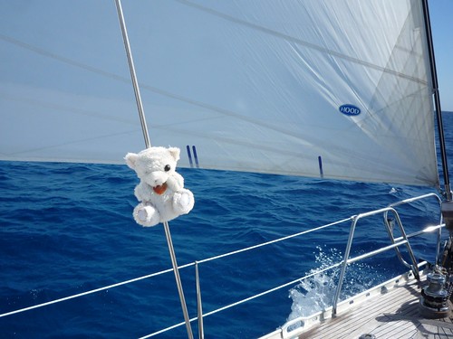
We also explored the 'booty beach' at the south end of the island. This is the beach that gets most of the washed up debris and you never know what you might find. The shelling was really good and there were lots of fishing nets and shoes - there are always shoes. We spotted a little one-eyed teddy bear along the way and decided to adopt him and give him a new life on RobinLeigh. He'll likely be in many future photos (see photo link at bottom of this post).
Last night we invited Debbie and John from Shamrock over for a drink. Another boat with a single-hander on board had come in a few hours earlier. When we saw him headed back to his boat with his dingy we called him over as well. Mark showed up a few minutes later with his guitar and played for us for a while before going ashore for dinner.
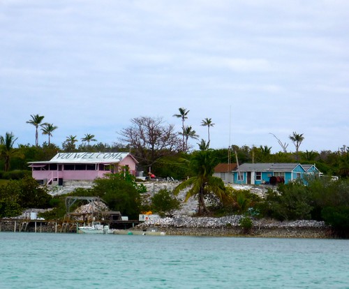
Tomorrow (Thursday) we will head around to the east side of the Berry islands to a place called Little Harbor Cay. There is a place there called Flo's that is supposed to be a cafe / general store and we remembered someone telling us if we visit the Berry Islands we must stop at "Flo's".
More later...
Follow this to photos and video: To the Berry Islands
We headed a few miles south to Cat Cay and anchored off Gun Cay resort for the evening. Around 9pm the winds kicked up exposing us to a pretty good swell. Our anchor started dragging and try as we might we could not get it to reset in the soft sand and grass. The wind was not predicted and did not bode well for a midnight bank crossing. We would try the bank in the morning if the wind was lighter and more southerly.
Rather than fight with the anchor all night we decided to head for the almost empty marina called Gun Cay Yacht Club. A private marina which charges an arm and a leg to park your boat, we hoped to rest on the wall next to the private air strip for the night and get out of there for a few bucks the next morning. We tied up to the wall with care and had a pretty good night's sleep while the SE winds continued to blow.
By morning things had settled and the wind had shifted to the South, giving us a good angle to sail across the bank. We had a great sail for most of the day and were amazed to watch the depth meter show a consistent 12 - 18 feet for most of the passage.
At 5:30 we steered to a spot .5 mile off the well traveled GPS route and dropped our anchor just before sunset. The winds were very light out of the South and we were parked in the middle of nowhere! Aside from the stars above us, the only landmarks we had were a few other boats anchored off in the distance. We spent a peaceful night on the bank and took some time to explore a beautiful night sky without city lights. The Milky Way was well defined and with a small sliver of a moon, there were more stars than we could count.
Winds were light the next morning so we motored the remaining 30 miles off the bank and into the Berry Islands. We headed for the East side of Chub Cay and grabbed a mooring at the Berry Island YC. The mooring was brand new and chained to a HUGE concrete block so we felt pretty secure. We visited the house at the end of the dock to pay for our mooring. While talking to the guy at the bar we noticed the big screen TV and asked if we could come up and watch the Superbowl later. He said there would be someone there and to come up around 7pm.
We got to the bar at 7 and the game had already started. There were a few locals there and some people from other boats and we all picked sides and started cheering for our teams. Some of the local guys really got into the game and as the shouting got louder someone turned up the volume on the TV. This, of course, led to even louder shouting and by the time the Packers had successfully beaten the Steelers, our ears were ringing. We were happy to have had a chance to watch the game (and the commercials) but were VERY ready to return to the quiet of the boat.
While at this anchorage we snorkeled at a coral head near the shore in about 7 feet of water that had lots of tropical fish. We saw glasseye snapper, yellowtail snapper, grunts, nassau grouper, squirrelfish, queen triggerfish, bar jacks, and some tiny fairy basslets. The second day I was approaching the reef from the dingy and as I swam over one large formation I saw what was at least a 5 foot Nurse shark hanging out under the ledge. I'm not sure who was more startled but we both took off fast in different directions. I've seen lots of Nurse sharks, but rarely this close and being the first shark of the season I was spooked! I hung around the reef for a bit longer but also paid attention to the surrounding area in case any more large predators were around.
We went for a walk on the island to see what type of activity was there and quickly found out that the economy there had suffered badly from the recession. There are around 60 permanent residents now and the large new development called "Frazers Hog Key Resort" has not progressed since 2006. The skeleton crew of 4-5 guys take care of the administrative buildings but nothing like what is suggested by the web site the developer maintains.
The skeleton operation does have wifi and when we spotted the antenna on the top of the building we hoisted our new super-wifi receiver to see if we could get a signal. It is 1.5 miles from us on the boat but we're doing quite well with a weak signal.
We also explored the 'booty beach' at the south end of the island. This is the beach that gets most of the washed up debris and you never know what you might find. The shelling was really good and there were lots of fishing nets and shoes - there are always shoes. We spotted a little one-eyed teddy bear along the way and decided to adopt him and give him a new life on RobinLeigh. He'll likely be in many future photos (see photo link at bottom of this post).
Last night we invited Debbie and John from Shamrock over for a drink. Another boat with a single-hander on board had come in a few hours earlier. When we saw him headed back to his boat with his dingy we called him over as well. Mark showed up a few minutes later with his guitar and played for us for a while before going ashore for dinner.
Tomorrow (Thursday) we will head around to the east side of the Berry islands to a place called Little Harbor Cay. There is a place there called Flo's that is supposed to be a cafe / general store and we remembered someone telling us if we visit the Berry Islands we must stop at "Flo's".
More later...
Follow this to photos and video: To the Berry Islands
| Vessel Name: | RobinLeigh |
| Vessel Make/Model: | Trintella 49A |
| Hailing Port: | Destin, Florida - Currently headed for the Bahamas |
| Crew: | Charles and Robin |
| About: | Mostly full time cruising since 1998, we've traveled over 60,000 sea miles and are still looking for the perfect anchorage... |
| Extra: |
Gallery not available
The Usual Suspects
Who: Charles and Robin
Port: Destin, Florida - Currently headed for the Bahamas