
SVs Saraoni and Sundari
09 April 2024 | The Broadwater, Gold Coast, Australia
03 March 2024 | Hope Harbour marina, Gold Coast, Australia
03 January 2024 | Karragarra Channel, South Moreton Bay Islands, Queensland
15 December 2023 | Riverheads, Mary River, Great Sandy Strait, Queensland
23 October 2023 | Great Keppel Island
07 August 2023 | Trinity Inlet, Cairns, North Queensland
23 July 2023 | Trinity Inlet, Cairns, Far North Queensland.
07 July 2023 | Cairns
19 May 2023 | North West island, Capricornia Cays, Queensland
15 May 2023 | Burnett River, Bundaberg, Queensland.
29 April 2023 | Manly marina, Moreton Bay, Queensland, Australia
04 March 2023 | South Auckland, New Zealand
18 January 2023 | Gold Coast Broadwater, Queensland
17 November 2022 | Collie, Southern WA, Australia
29 October 2022 | Albany, SW Australia
14 October 2022 | Augusta, WA, Australia
15 August 2022 | Karragarra Passage, Southern Moreton Bay, Queensland, Australia
14 July 2022 | Raby Bay, off Moreton Bay, Queensland
13 June 2022 | Camooweal, Far West Queensland
20 May 2022 | Alice Springs, Northern Territory, Australia
We survived the Panama Canal!
18 February 2015 | La Playita, Amador Peninsula, Panama City
Alison, hot and dry!
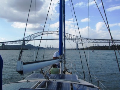
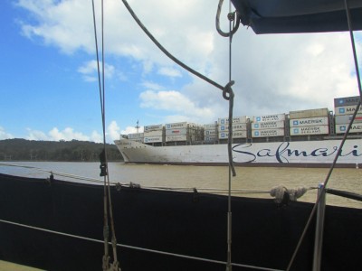
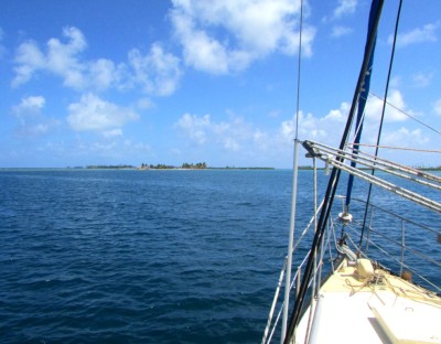
Photo shows Saraoni heading for the Bridge of Americas after completing the Panama Canal Transit in fine fettle. We are now in the Pacific!
We are now safely anchored at the bumpy La Playita anchorage on the Pacific side of the Panamanian isthmus after a successful and comparatively smooth canal transit.
The day before this unpredictable adventure started we had to pick up 8 old car tyres covered in rubbish bags, plus 4 extra strong and long ropes that would stretch from the top of the lock wall down to the yacht. These came courtesy of taxi driver Tito, who is making plenty of money at the moment ferrying the items all over the place as well as supplying "fumigation certificates" of dubious legality for the Galapagos!
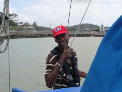
We also had to pick up CB and Taun, from the U.S boat Palarran, who had volunteered to be line handlers for a transit they were unlikely to be doing any time soon in their own boat (except for their eventual return after a circumnavigation?). With Geoff and Sue, this made up the compulsory 4 linehandlers needed by the Panama Canal Authority for each transit, despite the fact that 2 are usually superfluous because the yacht is likely to be rafted up to at least one other.
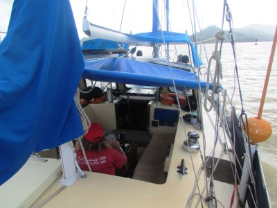
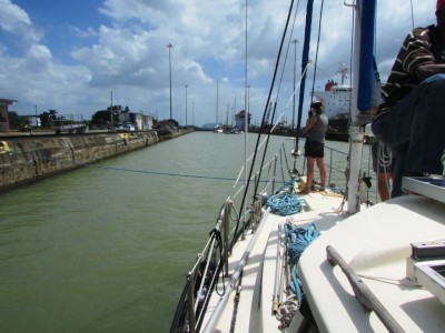
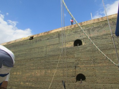
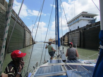
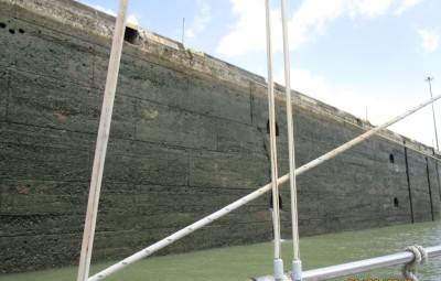
CB and Taun had left Palarran at La Playita and all we needed to do was drop them off at their boat once we arrived. Some rather interesting manoeuvres were required for this epic journey. The first of these was rafting up with a catamaran and a traditional ketch before entering each lock. Once in each lock those of us on the two side boats had to tie the ropes on to lines thrown to us from the shore. The catamaran was in the centre, so did most of the steering under power, while each side boat supplied forward or reverse when needed. The three boat raft was quite difficult to orientate at times in the Gatun locks, especially with the amount of turbulence coming from the large Panamanian registered ship in front of us, as well as the spurts of water as the lock filled.
At one point in the first chamber, Saraoni was squeezed against the port side wall, but no damage was done. The rest of the up locking through the three chambers went quite smoothly. We managed to get through to Gatun Lake in the daylight and tied up at one of the two large buoys in the lee of the shore - again tied up to other yachts - 6 in total by 10 pm. Three other yachts came through just after us.
The next day was the motoring stint across Gatun Lake, following the channel through numerous islands left behind when the area was flooded during the canal construction. This was a lovely area, seemingly completely pristine with no evidence that it was an artificial creation. We eventually passed the familiar town of Gamboa and the point where the Chagres River enters the lake and then went along the 7 mile Gaillard Cut, which is the part of the canal which had to be dug out of solid land. The down locks of San Miguel and the two Miraflores locks were by this time a piece of cake and we were spat out into the Pacific at around 2.30 pm.
Capn Al steers the boat through Gatun lake
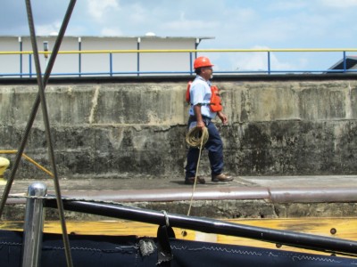
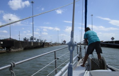
Linehandler at San Pedro Miguel lock
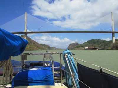
Centennial Bridge at the end of the Gaillard Cut
Viktor, the second adviser, flashes a golden smile near Gamboa.
Sue handles the bow rope in the Miraflores Lock
Up, up and away!
Open sesame!
We are now safely anchored at the bumpy La Playita anchorage on the Pacific side of the Panamanian isthmus after a successful and comparatively smooth canal transit.
The day before this unpredictable adventure started we had to pick up 8 old car tyres covered in rubbish bags, plus 4 extra strong and long ropes that would stretch from the top of the lock wall down to the yacht. These came courtesy of taxi driver Tito, who is making plenty of money at the moment ferrying the items all over the place as well as supplying "fumigation certificates" of dubious legality for the Galapagos!
We also had to pick up CB and Taun, from the U.S boat Palarran, who had volunteered to be line handlers for a transit they were unlikely to be doing any time soon in their own boat (except for their eventual return after a circumnavigation?). With Geoff and Sue, this made up the compulsory 4 linehandlers needed by the Panama Canal Authority for each transit, despite the fact that 2 are usually superfluous because the yacht is likely to be rafted up to at least one other.
CB and Taun had left Palarran at La Playita and all we needed to do was drop them off at their boat once we arrived. Some rather interesting manoeuvres were required for this epic journey. The first of these was rafting up with a catamaran and a traditional ketch before entering each lock. Once in each lock those of us on the two side boats had to tie the ropes on to lines thrown to us from the shore. The catamaran was in the centre, so did most of the steering under power, while each side boat supplied forward or reverse when needed. The three boat raft was quite difficult to orientate at times in the Gatun locks, especially with the amount of turbulence coming from the large Panamanian registered ship in front of us, as well as the spurts of water as the lock filled.
At one point in the first chamber, Saraoni was squeezed against the port side wall, but no damage was done. The rest of the up locking through the three chambers went quite smoothly. We managed to get through to Gatun Lake in the daylight and tied up at one of the two large buoys in the lee of the shore - again tied up to other yachts - 6 in total by 10 pm. Three other yachts came through just after us.
The next day was the motoring stint across Gatun Lake, following the channel through numerous islands left behind when the area was flooded during the canal construction. This was a lovely area, seemingly completely pristine with no evidence that it was an artificial creation. We eventually passed the familiar town of Gamboa and the point where the Chagres River enters the lake and then went along the 7 mile Gaillard Cut, which is the part of the canal which had to be dug out of solid land. The down locks of San Miguel and the two Miraflores locks were by this time a piece of cake and we were spat out into the Pacific at around 2.30 pm.
Capn Al steers the boat through Gatun lake
Linehandler at San Pedro Miguel lock
Centennial Bridge at the end of the Gaillard Cut
Viktor, the second adviser, flashes a golden smile near Gamboa.
Sue handles the bow rope in the Miraflores Lock
Up, up and away!
Open sesame!
Between Two Oceans
17 February 2015 | Colon, Panama
Alison
Big ships and Big Locks: a Taste of Things to Come!
After a boisterous sail from Portobelo we entered the Colon breakwater for the second time this year and anchored outside Club Nautico, one of the few access points to the land in Colon Port, just North of the cruise ship terminal and the shopping mall, Colon 2000. This time we strolled down to the shopping centre from Club Nautico. We made sure all bank cards and cameras were locked away in the boat though!
We are transiting the Panama canal this afternoon and go through the Gatun locks at 1 am GMT approx. There is a webcam at the lock if you are interested in seeing what the Panama canal is like. 5 yachts are down to transit today. The weather is looking favourable with the wind down from the 20 to 25 knots we have been experiencing. Once through the three chambered Gatun locks, where we are lifted up into the Gatun lake, we take a mooring buoy in the lake for the night before continuing the transit the next day. Gatun used to be the largest man made one in the world and is surrounded by jungle. Two other yachties are line handling, as well as ourselves and Geoff's sister Sue, so Saraoni is going to be more crowded than usual. The 2nd day we go down into the Pacific through the San Pedro Miguel lock and the two chambered Miraflores locks.
http://www.pancanal.com/eng/photo/camera-java.html
The Croc in the Laundry
12 February 2015 | Portobelo
Geoff, squally and damp
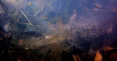
Young croc in the little pool near our Portobelo anchorage
First there was the croc in the swimming pool. Now there is the croc in the wash room - albeit a rather small one, estimated at about a metre long. Little Saraoni doesn't get many visitors, but the arrival of sister Sue from snowbound Sheffield plus the extra guests onboard during the upcoming transit has forced us to search for a nearby water source. Fortunately, a bubbling creek nearby on the North shore of Portobelo Harbour has provided us with a free source of clean fresh water for washing and drinking.
Just on the seaward side of the little creek is a small pool, right next to the sea and on the boundary of El Otro Lado, an upscale mini resort. As Alison and Sue were gazing into the creek, a young croc was seen at the surface of the pool. It soon decided to drop down to the bottom, but a session with the mask and snorkel soon revealed the croc, balefully eyeing up the human intruders! Presumably it has being sheltering in there free from predators in the nearby bay and mangrove creeks. Even the eco aware workers at the resort had not seen their interesting free guest!
The last two weeks have been busy. After booking the transit, two of us helped Timo and Nicole on Canadian yacht Sisu through the canal - with the obligatory night in Lake Gatun. This was quite a smooth process and an insight and valuable learning experience for our own transit. The advisers were an amiable and entertaining trio - two on the first day through the Gatun locks and the third through the 25 mile of Lake Gatun and the Gaillard cut, then the two "down" locks of San Miguel and Miraflores.
Sisu in Miraflores lock
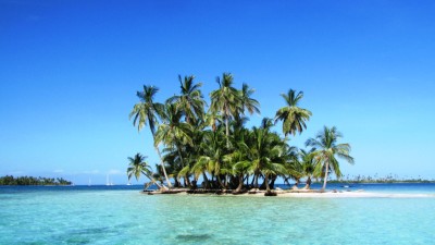
Then a small weather window opened up for a brief dash down to the San Blas Islands - a bash it was on the eastward bound trip, but almost perfect wind free conditions for the next few days gave a taste of this lovely area, although we had to motor the whole way back. We anchored and visited the Chicheme, East Lemmon and West Lemmon reefs and cays. We had avoided these on the last trip mainly because of what seemed to be too many boats, but the contrast with the mainland was too hard to resist.
Back to the San Blas
In addition to the mad dash to the San Blas, we have explored the forts around Portobelo, spotted and listened to howlers everywhere, walked to Panamarina and back, as well as a small valley called the Canada del Amor, below a massive nunnery, paddled and motored up the river, spied a three toed sloth asleep and curled up in a bare tree hanging over the main highway into town and snorkelled just about everywhere we could. The congos in Portobelo have been up and about, paryoding the conquistadors and former slavers, but we learned the main festival was next month when both the congos and diablos are busy entertaining the locals.
Portobelo anchorage from the Santiago Fort
Portobelo Harbour from the San Fernando Fort
Howler at Puerto Lindo
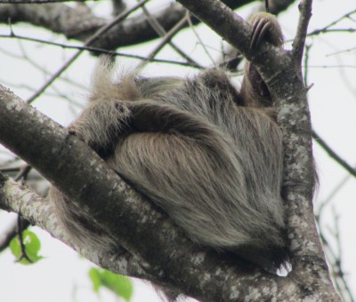
Three toed sloth spotted at Portobelo
We now expect to be in the Pacific Ocean on Wednesday 18th Feb - almost 7 years after leaving the Pacific as we passed into the Torres Strait and entered the Arafura Sea round Cape York!
First there was the croc in the swimming pool. Now there is the croc in the wash room - albeit a rather small one, estimated at about a metre long. Little Saraoni doesn't get many visitors, but the arrival of sister Sue from snowbound Sheffield plus the extra guests onboard during the upcoming transit has forced us to search for a nearby water source. Fortunately, a bubbling creek nearby on the North shore of Portobelo Harbour has provided us with a free source of clean fresh water for washing and drinking.
Just on the seaward side of the little creek is a small pool, right next to the sea and on the boundary of El Otro Lado, an upscale mini resort. As Alison and Sue were gazing into the creek, a young croc was seen at the surface of the pool. It soon decided to drop down to the bottom, but a session with the mask and snorkel soon revealed the croc, balefully eyeing up the human intruders! Presumably it has being sheltering in there free from predators in the nearby bay and mangrove creeks. Even the eco aware workers at the resort had not seen their interesting free guest!
The last two weeks have been busy. After booking the transit, two of us helped Timo and Nicole on Canadian yacht Sisu through the canal - with the obligatory night in Lake Gatun. This was quite a smooth process and an insight and valuable learning experience for our own transit. The advisers were an amiable and entertaining trio - two on the first day through the Gatun locks and the third through the 25 mile of Lake Gatun and the Gaillard cut, then the two "down" locks of San Miguel and Miraflores.
Sisu in Miraflores lock
Then a small weather window opened up for a brief dash down to the San Blas Islands - a bash it was on the eastward bound trip, but almost perfect wind free conditions for the next few days gave a taste of this lovely area, although we had to motor the whole way back. We anchored and visited the Chicheme, East Lemmon and West Lemmon reefs and cays. We had avoided these on the last trip mainly because of what seemed to be too many boats, but the contrast with the mainland was too hard to resist.
Back to the San Blas
In addition to the mad dash to the San Blas, we have explored the forts around Portobelo, spotted and listened to howlers everywhere, walked to Panamarina and back, as well as a small valley called the Canada del Amor, below a massive nunnery, paddled and motored up the river, spied a three toed sloth asleep and curled up in a bare tree hanging over the main highway into town and snorkelled just about everywhere we could. The congos in Portobelo have been up and about, paryoding the conquistadors and former slavers, but we learned the main festival was next month when both the congos and diablos are busy entertaining the locals.
Portobelo anchorage from the Santiago Fort
Portobelo Harbour from the San Fernando Fort
Howler at Puerto Lindo
Three toed sloth spotted at Portobelo
We now expect to be in the Pacific Ocean on Wednesday 18th Feb - almost 7 years after leaving the Pacific as we passed into the Torres Strait and entered the Arafura Sea round Cape York!
How long is a piece of string?
24 January 2015 | Portobelo, Colon, Panama
Geoff, dry and sunny

We have just returned from the Port of Cristobal / Colon to complete the first part of the canal transit procedures. To go through the canal we need to pay a huge fee (around $1,000), as well as fulfil a number of exacting requirements in terms of boat specifications, ropes, fenders and line handlers - the four compulsory people who are in charge of keeping the boat in place in the locks, even if two or three yachts are tied together. There are two main lock systems - the Gatun locks which raise us up into the Gatun lake and the Pedro Miguel / Miraflores locks which take us back down into the Pacific.
You can't pay up unless your boat has been 'measured', for which we had to sail 20 miles down to Colon to the anchorage known as the "Flats". The measurement ensures that your boat can fit nicely in place when the transit through the locks is taking place as well as determines the fee. On top of the $1,000, a buffer fee of around $900 is added which is a returnable deposit just in case your engine breaks down or you somehow slow down the machinery of canal movements by your actions.
The last time we were officially measured was when we paid a guy in Airlie Beach in Queensland to use a tape measure to find out how long we were. He discovered that our South Coast 36 yacht was 36 feet long or 10.9 metres! This was in itself an indication of woeful Aussie maths because the registration plaque in our fore cabin boldly states that we are supposed to be 12 metres long (40 feet!)
The guy at the Flats jumped on board with a measuring tape together with a briefcase bristling with forms. We had to help him with the measurement and lo and behold we were now 44 feet long or 13.3 metres! This was a bit of a revelation as we had been absolutely convinced that Saraoni had been steadily shrinking since we had started living aboard some 17 years ago!
Fortunately, our newly found 44 feet still means that we pay the same as a 50 foot boat and a 20 foot boat, which makes one wonder why we were measured in the first place!
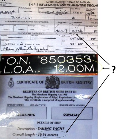
The fluctuating length of Saraoni!
Never mind the measurement, the admeasurer from the Panama Canal Authority was jovial enough and asked us heaps of questions (did we have a toilet?, were we going to cook a meal for the adviser?, how much anchor chain did we have? and many more interesting questions). Being co captains we take in turns being captain in each different country so its Geoff's turn for Galapagos and Alison's turn for French Polynesia. There is no place on the multitude of forms for two captains' signatures!
The trade wind was blowing as it does constantly at this time of year and had blown us down from Portobelo, but with a well timed easing of the wind and swell we were able to plug back up to our pleasant anchorage here near the jungle and the pelicans.
The Flats is a good enough anchorage but it is impossible getting ashore and you are surrounded by giant dinosaur like cranes and all manner of busy shipping passing to and from the canal with constant rocking and rolling as they pass. There is another anchorage on the other side of the Colon peninsula - Club Nautico, but it is a bit confined and on a lee shore. The plus side is that it is close and easy to get diesel and water and a stone's throw from a good supermarket. In fact, this part of Colon must be the 'posh' area! It does have its collection of partially sunken ships, too, which seems to be a common feature around here.
We don't go through the canal until mid February and are presently assembling our four linehandlers as well as do a last few jobs on the boat before we enter the Pacific. We will probably stock up for the long Pacific crossing when we have transited the canal and are on the Panama City side.
At least we have found out that there is no bribery or uncertainty like the Suez Canal where the pilot refused to take our compulsory tip because he thought it wasn't enough. At times being on a yacht in a country where the gulf between rich and poor is so great that communication becomes difficult. Panama is uncomfortably poor in some places, but at least some of the indigenous Indians do get some respect and fiercely defend their land and confidently wear traditional dress when they see fit.
The dimension discrepancy explained:
Any cruiser would know that the length differences are just due to whether the overhangs (the bits of boat that protrude at the front or back) are included in the measurement but for the sake of non boaty readers this is the explanation for the fluctuations in Saraoni's size.
When the boat was first built in New South Wales it was called "Tekin JB" and was registered under Australian (and British) rules at the time which included the integral bowsprit, making it 40 feet or 12 metres - which is still enshrined on our Aussie registration plaque affixed to the forward bulkhead.
By 1998 when we bought Tekin and renamed it Saraoni, the rules had changed in both countries and the bowsprit was excluded, leaving the deck measurement only i.e. 36 feet or 10.9 metres.
The Panama Canal Authority is only interested in what can fit or not fit into the locks, so measures the boat from the very front of the bowsprit to the very back of the dinghy hanging from the davits, which makes us 44 feet or 13.3 metres!
The only other measurement is that made by Shelter Bay marina - the only one at the Atlantic end of the canal where the tape measure comes out again and the length would be (if we were there) the front of the bowsprit to the back of the davits, i.e. 42 feet or 12.7 metres.
And as for the perception of the two owners? Well, Saraoni has definitely been getting smaller and smaller as the collection of cruising junk just keeps on getting bigger and bigger!
You can't pay up unless your boat has been 'measured', for which we had to sail 20 miles down to Colon to the anchorage known as the "Flats". The measurement ensures that your boat can fit nicely in place when the transit through the locks is taking place as well as determines the fee. On top of the $1,000, a buffer fee of around $900 is added which is a returnable deposit just in case your engine breaks down or you somehow slow down the machinery of canal movements by your actions.
The last time we were officially measured was when we paid a guy in Airlie Beach in Queensland to use a tape measure to find out how long we were. He discovered that our South Coast 36 yacht was 36 feet long or 10.9 metres! This was in itself an indication of woeful Aussie maths because the registration plaque in our fore cabin boldly states that we are supposed to be 12 metres long (40 feet!)
The guy at the Flats jumped on board with a measuring tape together with a briefcase bristling with forms. We had to help him with the measurement and lo and behold we were now 44 feet long or 13.3 metres! This was a bit of a revelation as we had been absolutely convinced that Saraoni had been steadily shrinking since we had started living aboard some 17 years ago!
Fortunately, our newly found 44 feet still means that we pay the same as a 50 foot boat and a 20 foot boat, which makes one wonder why we were measured in the first place!
The fluctuating length of Saraoni!
Never mind the measurement, the admeasurer from the Panama Canal Authority was jovial enough and asked us heaps of questions (did we have a toilet?, were we going to cook a meal for the adviser?, how much anchor chain did we have? and many more interesting questions). Being co captains we take in turns being captain in each different country so its Geoff's turn for Galapagos and Alison's turn for French Polynesia. There is no place on the multitude of forms for two captains' signatures!
The trade wind was blowing as it does constantly at this time of year and had blown us down from Portobelo, but with a well timed easing of the wind and swell we were able to plug back up to our pleasant anchorage here near the jungle and the pelicans.
The Flats is a good enough anchorage but it is impossible getting ashore and you are surrounded by giant dinosaur like cranes and all manner of busy shipping passing to and from the canal with constant rocking and rolling as they pass. There is another anchorage on the other side of the Colon peninsula - Club Nautico, but it is a bit confined and on a lee shore. The plus side is that it is close and easy to get diesel and water and a stone's throw from a good supermarket. In fact, this part of Colon must be the 'posh' area! It does have its collection of partially sunken ships, too, which seems to be a common feature around here.
We don't go through the canal until mid February and are presently assembling our four linehandlers as well as do a last few jobs on the boat before we enter the Pacific. We will probably stock up for the long Pacific crossing when we have transited the canal and are on the Panama City side.
At least we have found out that there is no bribery or uncertainty like the Suez Canal where the pilot refused to take our compulsory tip because he thought it wasn't enough. At times being on a yacht in a country where the gulf between rich and poor is so great that communication becomes difficult. Panama is uncomfortably poor in some places, but at least some of the indigenous Indians do get some respect and fiercely defend their land and confidently wear traditional dress when they see fit.
The dimension discrepancy explained:
Any cruiser would know that the length differences are just due to whether the overhangs (the bits of boat that protrude at the front or back) are included in the measurement but for the sake of non boaty readers this is the explanation for the fluctuations in Saraoni's size.
When the boat was first built in New South Wales it was called "Tekin JB" and was registered under Australian (and British) rules at the time which included the integral bowsprit, making it 40 feet or 12 metres - which is still enshrined on our Aussie registration plaque affixed to the forward bulkhead.
By 1998 when we bought Tekin and renamed it Saraoni, the rules had changed in both countries and the bowsprit was excluded, leaving the deck measurement only i.e. 36 feet or 10.9 metres.
The Panama Canal Authority is only interested in what can fit or not fit into the locks, so measures the boat from the very front of the bowsprit to the very back of the dinghy hanging from the davits, which makes us 44 feet or 13.3 metres!
The only other measurement is that made by Shelter Bay marina - the only one at the Atlantic end of the canal where the tape measure comes out again and the length would be (if we were there) the front of the bowsprit to the back of the davits, i.e. 42 feet or 12.7 metres.
And as for the perception of the two owners? Well, Saraoni has definitely been getting smaller and smaller as the collection of cruising junk just keeps on getting bigger and bigger!
Divers at last!
17 January 2015 | Portobelo, Panama
Alison, cloudy, drizzly, windy
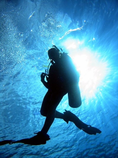
After completing our online PADI open water dive course we had 3 days of water activities to complete with an instructor. The 1st required a stay in Panama City for a day or so to learn about equipment and buoyancy and the last 2 days in the open water in the Caribbean Sea not far from Drake Island and most conveniently just around the corner from our anchorage in Portobelo. The first day was a lovely day with blue skies and clear water just off Playa Huerta at the corner of Portobelo Harbour, but the second day was not so pleasant - scudding clouds and squally rain.
We had to put theory to practice very quickly as the online course lacks the viewing and handling of some quite complex bits of equipment. The instructor, Christian, was a young bilingual Panamanian who delivered the course perfectly. We shared him with 2 Panamanians who for a while like us were dancing around between the surface and the seabed while we were all trying to balance weights with an inflatable jacket. When the weights are put on you slowly begin to sink and with too many weights you would sit firmly on the seabed. The inflatable jacket (BCD) allows the diver to fill it with air so that buoyancy is under control. On the surface, you half fill the jacket with air and by slowly letting it out, sink more gradually. Coming up, you basically float upwards and slowly add air and fill the jacket completely when on the surface. Takes a bit of practice. There is a tendency to want to lean forward when sitting in the boat as the tank is surprisingly heavy let alone the lead weights. Christian the instructor said we had to go in backwards. That took a bit of Dutch courage although you don't have worry about sinking as the BCD takes care of that and you can't run out of air as the regulator is grasped firmly in the mouth.
The PADI certificate will allow us to be able to hire equipment and fill tanks as we cross the Pacific. We have owned and used a hooker dive system for the last 6 years and it has been very useful, but somehow it has rarely been used for what we really wanted to use it for - explore the undersea world.
Ghosts of the Spanish Main on Panama’s North Coast
03 January 2015 | Panamarina, Costa Arriba, Panama
Geoff; hot, muggy and windy
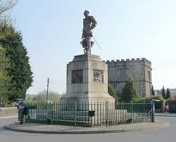
The Drake statue in Tavistock - an odd link to Panama
We are back in Panamarina on the Costa Arriba of Panama. The swell is up to 3 to 4 m with the upsurge in the trade wind. It's not really that windy here, although it's blowing a gale plus in the stretch between the ABCs and Cartagena. The entrance into Panamarina is effectively barred as big breakers smash onto the surrounding reefs and even the entrance channel has breaking waves on it. Some boats have moved off the moorings to anchor further into the sheltered mangrove anchorage, and others closer to the land are rolling with the half metre swell in the moorings, but we are well sheltered where we are, despite pitching more than we did when here last.
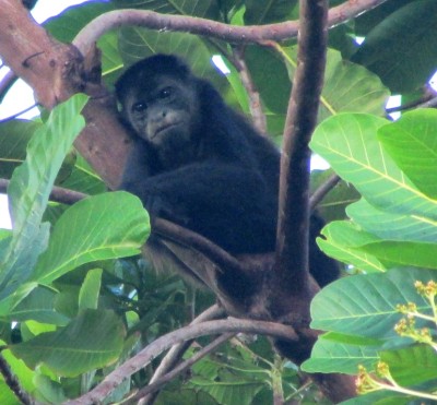
The local troops of howlers are very active, and have been howling in the daytime, perhaps to balance the noise coming from the reef - or maybe there are turf disputes of their own!. Toucans and toucanets have been swooping around, too - it's their nesting season. We want to slip round to the more convenient anchorage in Portobelo. It is only 7 miles around the point, but no one is moving in or out of here at present.
This coast is redolent of the ghosts of the Spanish Main - the 200 odd years of Spanish colonial power before Spain was ravaged by Napoleon and before the colonies in South and Central America dealt the final death blow to control from Madrid by a successful war for independence.
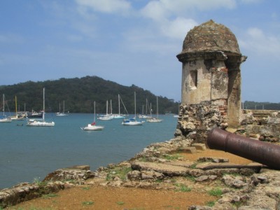
Panama was a crucial trade route in the early years as untold gold, and particularly silver, was shipped up from Bolivia and Peru and hauled over the narrowest part of the Americas to the two key ports on the Atlantic - Nombre de Dios and then Portobelo. Drake sacked, levelled and totally looted Nombre de Dios (one account says that he left much of the silver behind because it "was too heavy to carry off!") so the Spanish moved their main port to heavily fortified Portobelo.
Drake's ghost has been following us around quite a bit last year. First we came across Drake Bay in Mendocino County, California, named after Drake's supposed stopover on the world's second known circumnavigation after Magellan. His ghost turned up again in Cartagena in Colombia and here in Panama he has been everywhere - even a remote bay on the Osa Peninsula in Costa Rica we visited was named after his presence.
Drake was born in Tavistock in Devon - Alison's old home town from childhood. She never knew about the bronze nineteenth century statue in Tavistock with the plaque depicting Drake's final burial off Portobelo with the inscription "Portobelo - Colon". He died of dysentery after a disastrous late campaign ordered by Queen Elizabeth the First. His coffin, together with two ships and a lot of loot, has never been found, despite the scene of the burial being a popular dive spot - we are due to dive off Drake's Island next week!
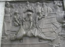
Drake ceremoniously chucked over the side off Portobelo - at the bottom of the Tavistock statue by Boehm, 1883
Drake was quite a man of his times - pirate, slave trader, privateer, circumnavigator, Admiral and Mayor of Plymouth - he probably would have been tried for serious crimes against humanity today in the Hague. He was involved in the first slavery operations between West Africa and the Caribbean as well as giving support to genocide in Ireland during the slaughter of 600 Irish people, but his sailing genius is hard to beat - west about around two uncharted great capes in the sixteenth century makes modern circumnavigators, including us, seem like total amateurs!
Henry Morgan's exploits were even more of a black spot in Spanish history here in Panama. As so much silver was passing across the isthmus on its way to enrich the Spanish crown and their lackeys, places like Old Panama, Portobelo and the Fort of San Lorenzo were sitting ducks. Morgan apparently rowed a bunch of pirates up the Chagres River, marched on old Panama and burned it to the ground, making off with a fortune. Morgan was eventually given the Governor's job in Jamaica, but died of drinking too much rum!
A British Admiral, Vernon, dealt the final death blow to the Panama connection in 1739. In the war of Jenkin's Ear between Britain and Spain, he captured, levelled and then looted first Portobelo then Fort San Lorenzo at the mouth of the Chagres River, which now feeds the Panama Canal. The victories were so popular in Britain that many places were named "Portobelo" in memory of the battles - including Notting Hill's famous "Portobelo Road". The jingoistic song "Rule Britannia", despite already having being written, only become popular after Portobelo was destroyed.
The Spanish gave up with Panama after that and started shipping the silver from Bolivia's Silver Mountain at Potosi round Cape Horn. One wonders how many unseaworthy galleons got wrecked as they rounded the tip of South America?
Panama's fortunes weren't revived until the California gold rush of 1849, when thousands of gold seekers crossed the isthmus on their way between the East and West coasts of America. The Rio Chagres was the conduit for even more gold, but no pirates this time to snatch it!
We are back in Panamarina on the Costa Arriba of Panama. The swell is up to 3 to 4 m with the upsurge in the trade wind. It's not really that windy here, although it's blowing a gale plus in the stretch between the ABCs and Cartagena. The entrance into Panamarina is effectively barred as big breakers smash onto the surrounding reefs and even the entrance channel has breaking waves on it. Some boats have moved off the moorings to anchor further into the sheltered mangrove anchorage, and others closer to the land are rolling with the half metre swell in the moorings, but we are well sheltered where we are, despite pitching more than we did when here last.
The local troops of howlers are very active, and have been howling in the daytime, perhaps to balance the noise coming from the reef - or maybe there are turf disputes of their own!. Toucans and toucanets have been swooping around, too - it's their nesting season. We want to slip round to the more convenient anchorage in Portobelo. It is only 7 miles around the point, but no one is moving in or out of here at present.
This coast is redolent of the ghosts of the Spanish Main - the 200 odd years of Spanish colonial power before Spain was ravaged by Napoleon and before the colonies in South and Central America dealt the final death blow to control from Madrid by a successful war for independence.
Panama was a crucial trade route in the early years as untold gold, and particularly silver, was shipped up from Bolivia and Peru and hauled over the narrowest part of the Americas to the two key ports on the Atlantic - Nombre de Dios and then Portobelo. Drake sacked, levelled and totally looted Nombre de Dios (one account says that he left much of the silver behind because it "was too heavy to carry off!") so the Spanish moved their main port to heavily fortified Portobelo.
Drake's ghost has been following us around quite a bit last year. First we came across Drake Bay in Mendocino County, California, named after Drake's supposed stopover on the world's second known circumnavigation after Magellan. His ghost turned up again in Cartagena in Colombia and here in Panama he has been everywhere - even a remote bay on the Osa Peninsula in Costa Rica we visited was named after his presence.
Drake was born in Tavistock in Devon - Alison's old home town from childhood. She never knew about the bronze nineteenth century statue in Tavistock with the plaque depicting Drake's final burial off Portobelo with the inscription "Portobelo - Colon". He died of dysentery after a disastrous late campaign ordered by Queen Elizabeth the First. His coffin, together with two ships and a lot of loot, has never been found, despite the scene of the burial being a popular dive spot - we are due to dive off Drake's Island next week!
Drake ceremoniously chucked over the side off Portobelo - at the bottom of the Tavistock statue by Boehm, 1883
Drake was quite a man of his times - pirate, slave trader, privateer, circumnavigator, Admiral and Mayor of Plymouth - he probably would have been tried for serious crimes against humanity today in the Hague. He was involved in the first slavery operations between West Africa and the Caribbean as well as giving support to genocide in Ireland during the slaughter of 600 Irish people, but his sailing genius is hard to beat - west about around two uncharted great capes in the sixteenth century makes modern circumnavigators, including us, seem like total amateurs!
Henry Morgan's exploits were even more of a black spot in Spanish history here in Panama. As so much silver was passing across the isthmus on its way to enrich the Spanish crown and their lackeys, places like Old Panama, Portobelo and the Fort of San Lorenzo were sitting ducks. Morgan apparently rowed a bunch of pirates up the Chagres River, marched on old Panama and burned it to the ground, making off with a fortune. Morgan was eventually given the Governor's job in Jamaica, but died of drinking too much rum!
A British Admiral, Vernon, dealt the final death blow to the Panama connection in 1739. In the war of Jenkin's Ear between Britain and Spain, he captured, levelled and then looted first Portobelo then Fort San Lorenzo at the mouth of the Chagres River, which now feeds the Panama Canal. The victories were so popular in Britain that many places were named "Portobelo" in memory of the battles - including Notting Hill's famous "Portobelo Road". The jingoistic song "Rule Britannia", despite already having being written, only become popular after Portobelo was destroyed.
The Spanish gave up with Panama after that and started shipping the silver from Bolivia's Silver Mountain at Potosi round Cape Horn. One wonders how many unseaworthy galleons got wrecked as they rounded the tip of South America?
Panama's fortunes weren't revived until the California gold rush of 1849, when thousands of gold seekers crossed the isthmus on their way between the East and West coasts of America. The Rio Chagres was the conduit for even more gold, but no pirates this time to snatch it!
Christmas in Boquete
26 December 2014 | Boquete, Panama
Alison cool and windy
Misty Hlls behind Boquete town
Trying to move around in a 'Christian' country over Christmas is like swimming against the current, so we decided to spend a few days in the little Chiriqui mountain town of Boquete, which sits on the south eastern flanks of Panama's highest mountain - Volcan Baru.
Boquete is not quite the ordinary small Panamanian service town. It's about the same size as bustling San Vito, in Costa Rica, we had stayed in for a couple of nights while we ventured into La Amistad (Friendship) national park, but is more cosmopolitan. Americans, in particular, have bought land in the Chiriquí highlands and the influx of money into the area has diversified and boosted the local economy. Boquete is one of the few places in Panama (like Bocas del Toro, on the Caribbean coast) that has attracted tourists. This may sound ominous, but they have not really affected the town very much despite the number of restaurants and coffees shops that are sprinkled around the area.
The town is in lovely, hilly country, with a mix of coffee fincas, jungle covered hills and valleys and small farms. The attractive town square with its noisy grackle bird colonies is a mix of wandering Panamanian families, Indians from across the divide, here to work in the fincas, and wealthier foreign residents and tourists. An old railway station with a carriage lies on one side of the square. It's a long time since a railway trundled up this way from David, but somehow the abandoned station nicely fitted into the general ambience of the central part of the town.

Ngobe Indian woman in traditional dress at Christmas in Boquete

Christmas fruit stall discussion
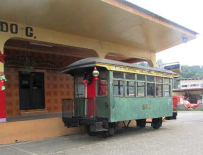
Redundant Chiriquí carriage next to old Boquete railway station - Boquete is now served by old US school buses - red devils!
The weather has been very windy and wet, so we have been put off the idea of climbing Volcan Baru as a 28 km walk in possibly cold, blustery conditions didn't seem appealing. The trick we learned about Baru is to camp at the top and break the long slog in half, but the normal pattern of clear mornings and cloudy, wet afternoons seemed to have been replaced by stormier weather although we frequently did see Baru's gnarled, knobbly top appear above the countryside. At 3,500 metres, it can often be sub-zero at the top of Baru overnight.
We settled on two local walks instead. The Sendero del Quetzales, based on an old indigenous trail, is one of Panama's best known walking trails that links Boquete and the village of Cerro Punta behind Baru. The green, blue and red feathered quetzal, basis of the Mayan Quetzalcoatl serpent-cum-god legend and Guatemala's national emblem and currency, is found in this area. They have a characteristic call, mostly heard from May onwards in the breeding season, but we didn't see any of them on the trail, which wound through beautiful, cloud forest.
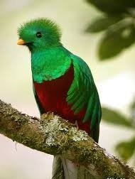
Photo shows the quetzal - not our photo this time - they're hard to see, although we did hear them!!
Cloud forest behind Volcan Baru
The Pianista trail, not far from Boquete, where we are headed tomorrow, leads up to the top of the divide and then disappears into dense jungle on the way to Bocas province. It's the site of this year's mysterious and somewhat gruesome deaths of two Dutch girls who went missing for months and then were found in chewed up bits and pieces over the divide! Like similar disappearances in Corcovado National Park in Costa Rica that have led to strict guiding rules, nobody knows what went wrong, but it is a reminder of just how dangerous the jungle can be if you step too far off the track in the mist!
Trying to move around in a 'Christian' country over Christmas is like swimming against the current, so we decided to spend a few days in the little Chiriqui mountain town of Boquete, which sits on the south eastern flanks of Panama's highest mountain - Volcan Baru.
Boquete is not quite the ordinary small Panamanian service town. It's about the same size as bustling San Vito, in Costa Rica, we had stayed in for a couple of nights while we ventured into La Amistad (Friendship) national park, but is more cosmopolitan. Americans, in particular, have bought land in the Chiriquí highlands and the influx of money into the area has diversified and boosted the local economy. Boquete is one of the few places in Panama (like Bocas del Toro, on the Caribbean coast) that has attracted tourists. This may sound ominous, but they have not really affected the town very much despite the number of restaurants and coffees shops that are sprinkled around the area.
The town is in lovely, hilly country, with a mix of coffee fincas, jungle covered hills and valleys and small farms. The attractive town square with its noisy grackle bird colonies is a mix of wandering Panamanian families, Indians from across the divide, here to work in the fincas, and wealthier foreign residents and tourists. An old railway station with a carriage lies on one side of the square. It's a long time since a railway trundled up this way from David, but somehow the abandoned station nicely fitted into the general ambience of the central part of the town.
Ngobe Indian woman in traditional dress at Christmas in Boquete
Christmas fruit stall discussion
Redundant Chiriquí carriage next to old Boquete railway station - Boquete is now served by old US school buses - red devils!
The weather has been very windy and wet, so we have been put off the idea of climbing Volcan Baru as a 28 km walk in possibly cold, blustery conditions didn't seem appealing. The trick we learned about Baru is to camp at the top and break the long slog in half, but the normal pattern of clear mornings and cloudy, wet afternoons seemed to have been replaced by stormier weather although we frequently did see Baru's gnarled, knobbly top appear above the countryside. At 3,500 metres, it can often be sub-zero at the top of Baru overnight.
We settled on two local walks instead. The Sendero del Quetzales, based on an old indigenous trail, is one of Panama's best known walking trails that links Boquete and the village of Cerro Punta behind Baru. The green, blue and red feathered quetzal, basis of the Mayan Quetzalcoatl serpent-cum-god legend and Guatemala's national emblem and currency, is found in this area. They have a characteristic call, mostly heard from May onwards in the breeding season, but we didn't see any of them on the trail, which wound through beautiful, cloud forest.
Photo shows the quetzal - not our photo this time - they're hard to see, although we did hear them!!
Cloud forest behind Volcan Baru
The Pianista trail, not far from Boquete, where we are headed tomorrow, leads up to the top of the divide and then disappears into dense jungle on the way to Bocas province. It's the site of this year's mysterious and somewhat gruesome deaths of two Dutch girls who went missing for months and then were found in chewed up bits and pieces over the divide! Like similar disappearances in Corcovado National Park in Costa Rica that have led to strict guiding rules, nobody knows what went wrong, but it is a reminder of just how dangerous the jungle can be if you step too far off the track in the mist!
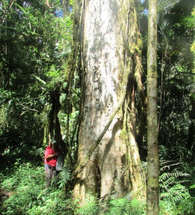
Exploring the Jungles of Costa Rica
22 December 2014 | San Vito, Costa Rica
Alison and Geoff

Photos show from top left: three toed sloth (Osa Peninsula); Keel billed toucan (La Amistad); White faced capuchin monkeys (Osa);scarlet macaws (Osa)
We have left Saraoni for a couple of weeks in Panamarina and have been hiking and wildlife watching in some of Costa Rica's national parks. We have seen quite a variety of wildlife from Cara Blanca monkeys whose male chucks sticks from the trees above when you walk under them as a warning. The remainder of the family just idly gawps then continues to crash through the trees.
Meanwhile the scarlet macaws are as messy and noisy as the Australian red tailed black cockatoos and their food source has some similarities too. They take a nibble out of an almond on the sea shore almond tree, break a few leaves off and then fly off squawking normally in pairs to the next tree and repeat the same action. Can't forget the three toed sloth which lives in one type of tree, the Cercropia, and when it's not eating the leaves it's idling on a branch and moves so little that lichen grows on its fur. We spotted one on a road in Drake Bay on the Pacific coast because it decided to move a limb which was the only way we could spot it as it's so well camouflaged.
We camped 3 nights in Amistad International Friendship National Park which is a park that is shared by Costa Rica and Panama. We had to wait 2 hours for a bus at the road junction and we reckon the bus that took us to around 3 kilometres from the park was the slowest we had ever been on. Just managed to get to the ranger station before dark after hiking up about 400 metres of altitude over 3 kilometres of dirt road. The park was empty of visitors but had one of the nicer camping sites we have come across. The park straddles the Talamanca Range on both sides of the border, but is mostly trackless impenetrable wilderness.
We were able to follow an old, overgrown road deep into the forest called the Valle de Silencio. We spotted some stunning toucans sitting on a branch and there were a lot of other birds, including hummingbirds. Rainforest provides so much cover for birds and mammals that such secretive species as anteaters, tapirs and the 6 cats, including jaguar and puma are difficult to see, except with "captcha" cameras, which we saw placed in strategic spots in the jungle track, presumably by researchers.
Heading back over the border to Panama tomorrow and are considering climbing Panama's highest mountain - Volcan Baru - just under 3,500 m high.
Through Hell and High Water
05 December 2014 | Panamarina, Panama
Alison
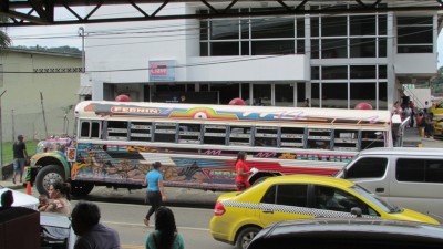
A red devil going the wrong way at Sabanitas Junction
Driving rain, a torch that wouldn't work, a paddle in the dark, a trudge through a flooded creek, a bus that never came and all to get to Colon and Panama City - Panama's third largest and largest cities respectively!
We made it eventually, but the day started at 4 am after it had been raining very heavily almost all night. The idea was to get the only bus that stopped outside the marina entrance, but it was still pouring down as we got off the boat. We intended on leaving the dinghy at the pontoon with the outboard on, but didn't relish the idea of coming back and finding it completely waterlogged, so the outboard was hauled out and the paddle to the shore began.
There were no lights on the shore so it was a question of stumbling through the marina complex to the bus stop - but no bus came - probably not surprising considering the road was only a dirt road and the pot holes were awash with muddy water! The worst part was tying up the dinghy in the driving rain and not being able to make out land from sea. A slight error of judgement could have seen a waterlogged camera, computer and cell phone.
We have only been here 5 days and the buses never come when they are supposed to. We've now worked out why they're called 'red devils". It's a hell of a job trying to get on a devil bus and you can go red in the face waiting for one in the hot sun!
To cut a long story short we did get on a bus and to Colon, paid for our much needed 60 metres of anchor chain at a very good price and arranged delivery. Colon has had a very bad reputation for years. The last time we were in the city in 1983 we had arrived by train from Panama City and it was regarded as too dangerous to walk around even then. Locals reckon it's not as bad as it's made out to be and we had no incident hanging around the bus station and boarding the 3 dollar express bus to Panama City. No threats, no hold ups and no muggings.
Colon's fortunes have waxed and waned with the rise and fall of transisthmic transport. It's last glory days were in the early twentieth century when the Americans built the Panama Canal. The income from the recently built cruise ship port, massive free zone and revamped railway to Panama City seem to have bypassed many of the inhabitants, who still live in relative squalor.
Panama City is a completely different sort of place - it's a huge, relatively modern and difficult place to orientate oneself in. We arrived at the 1 km long Allbrook mall, which doubles as the city's main transport hub and managed to work out what was really a very good transport system - a one card fits all electronic 'tarjeta' for the metro and most of the buses - a dirt cheap flat fare of 25 cents a ride. That means a ride from Tocumen International Airport right through to the city centre costs only 25 cents!
PC has quite a few things worth seeing - the Metropolitano National Park with monkeys, sloths and anteaters within the city boundaries, the ruins at Panama Viejo and the tarted up old part of the city at Casco Viejo, but these will have to wait another day. We spent one night at a cheapie along the Via Espana and had to rush back to meet the guy who sold us the anchor chain. From what we've seen so far, either Colon or Panama City will be good places to stock up for the long Pacific trip next year - most things we want are cheap and easily available.
Meanwhile, back in Portobelo, the torrential rain had caused a fatal mud slide killing two young children. We have delayed our dive training by a month hoping that the rain eases this month. The Atlantic coast gets about three times the rainfall that the Pacific Coast gets but the dry season's start may not be until January. Meanwhile we're off soon by bus to Southern Costa Rica. We are going to walk in to Corcovado National Pak on the Osa Peninsula then spend a few days in the Talamanca Mountains in the trans national La Amistad International Park - both full of Central American wildlife.
Here at Panamarina we are also on the edge of Panama's Portobelo National Park and it seems that on some days monkeys of three different species - the white faced capuchins, mantled howlers and spiders are falling out of the trees like fruits. There are also many birds - parrots, toucans, anis, kiskadees, hummingbirds, tanagers, kingfishers, woodpeckers, herons and birds of prey as well as vultures. We haven't spotted any sloths yet, but they also live around here, although are difficult to spot - like Aussie koalas.
God won't fail you - so drive like the devil!
30 November 2014 | Panamarina, near Portobelo, Panama
Geoff and Alison; hot, windy and humid
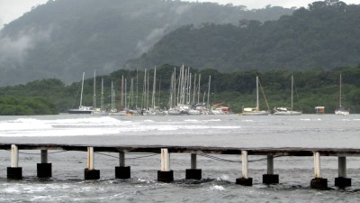
Photo shows Panamarina from the village of Cacique
We have arrived at Panamarina - just around the corner from Colon and the Atlantic end of the canal. We had an exciting time getting here from the San Blas! The trade wind decided to pay its first visit to the Panamanian coast since the start of the wet season. The wind was up, the seas were up and our adrenaline factor was way up as we threaded our way through the reefs west of Porvenir to clear Punta San Blas with the breakers crashing on either side of us.
As we cleared the reefs and the point, the seas regularised somewhat, although there was the odd 3 metre swell around. With a 15 knot wind just abaft the wind and a favourable current at last we made good time sailing the 40 mile stretch to Isla Grande. There we debated the wisdom of going straight down the "wide, deep" channel between Isla Grande and the mainland, chased by what appeared to be large, breaking waves and risked it. Pretty interesting!
We then decided to junk the idea of doing the same through the narrower, shallower Isla Linton channel and went around the island to the safety and security of the Isla Linton anchorage in company with some 70 other anchored boats - some of which appeared to have the Caribbean disease and had been sadly abandoned. The environment around here is hilly and jungly, with some impoverished Antillean fishing communities, touristy stuff and expats who have bought up some of the old fincas.
The next day we called up Panamarina and made our way around the little mangrove islands to the entrance with what had grown by then to a much bigger swell factor.
Mon Dieu (Panamarina is French run!) - where was the entrance amongst all those huge breakers? We spotted two sets of poles and made our way in, just scraping our way through the last pair of flags. Panamarina consists of several sets of moorings and the boat will be here while we go to Costa Rica - it's much cheaper than the alternative, Shelter Bay, which is located in Bahia de Limon, inside the breakwaters.
We have already made the 3 km walk out along the dirt road to the main road four times - it's a lovely walk through the green, verdant countryside with howler monkeys and many birds around. On the main road we managed to find a "Red Devil" (Diablo Rojo) - the local bus that connects the Costa Arriba with Colon. These buses are old American school buses with colours and decorations that rival Indian buses for personality, together with fervent messages to God. It seems that God is such a good guy that the driver can drive like the devil and his passengers will be safe! The buses are a hoot - and hoot they do, often! The only problem is that with so many Panamanians driving their own cars there simply aren't enough of them!
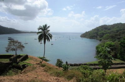
We've made one trip to the shops at Portobelo - not far around the coast, but 15 km by road. The little town, on the South side of a well protected harbor was once the richest town in all the Americas. All the loot stolen from the Incas made its way up to old Panama, across land to the Rio Chagres (the original Rio de Oro) and to Portobelo, where it was loaded on to galleons. Not surprisingly, looting Portobelo itself was a favourite pastime for the likes of Drake, Henry Morgan and every privateer and pirate worth their name!
Portobelo is not so flash these days. The ruins are in ruins and a fair amount of the town seems to be following suit with some very seedy, yet colourful locals and that applies to the yachties as much as it does the inhabitants of the town!
Tomorrow is Panama's Independence Day (from Spain - it has another independence Day from Colombia) so everything is shut. The swell is subsiding, the wind abating and we are poring over our old PADI book so that we can get the theory done without having to spend too much time on the shaky, local internet. There is some good walking around here on the edge of Portobelo National Park and the mangroves and little islands to explore before heading off to Costa Rica next week.
We have arrived at Panamarina - just around the corner from Colon and the Atlantic end of the canal. We had an exciting time getting here from the San Blas! The trade wind decided to pay its first visit to the Panamanian coast since the start of the wet season. The wind was up, the seas were up and our adrenaline factor was way up as we threaded our way through the reefs west of Porvenir to clear Punta San Blas with the breakers crashing on either side of us.
As we cleared the reefs and the point, the seas regularised somewhat, although there was the odd 3 metre swell around. With a 15 knot wind just abaft the wind and a favourable current at last we made good time sailing the 40 mile stretch to Isla Grande. There we debated the wisdom of going straight down the "wide, deep" channel between Isla Grande and the mainland, chased by what appeared to be large, breaking waves and risked it. Pretty interesting!
We then decided to junk the idea of doing the same through the narrower, shallower Isla Linton channel and went around the island to the safety and security of the Isla Linton anchorage in company with some 70 other anchored boats - some of which appeared to have the Caribbean disease and had been sadly abandoned. The environment around here is hilly and jungly, with some impoverished Antillean fishing communities, touristy stuff and expats who have bought up some of the old fincas.
The next day we called up Panamarina and made our way around the little mangrove islands to the entrance with what had grown by then to a much bigger swell factor.
Mon Dieu (Panamarina is French run!) - where was the entrance amongst all those huge breakers? We spotted two sets of poles and made our way in, just scraping our way through the last pair of flags. Panamarina consists of several sets of moorings and the boat will be here while we go to Costa Rica - it's much cheaper than the alternative, Shelter Bay, which is located in Bahia de Limon, inside the breakwaters.
We have already made the 3 km walk out along the dirt road to the main road four times - it's a lovely walk through the green, verdant countryside with howler monkeys and many birds around. On the main road we managed to find a "Red Devil" (Diablo Rojo) - the local bus that connects the Costa Arriba with Colon. These buses are old American school buses with colours and decorations that rival Indian buses for personality, together with fervent messages to God. It seems that God is such a good guy that the driver can drive like the devil and his passengers will be safe! The buses are a hoot - and hoot they do, often! The only problem is that with so many Panamanians driving their own cars there simply aren't enough of them!
We've made one trip to the shops at Portobelo - not far around the coast, but 15 km by road. The little town, on the South side of a well protected harbor was once the richest town in all the Americas. All the loot stolen from the Incas made its way up to old Panama, across land to the Rio Chagres (the original Rio de Oro) and to Portobelo, where it was loaded on to galleons. Not surprisingly, looting Portobelo itself was a favourite pastime for the likes of Drake, Henry Morgan and every privateer and pirate worth their name!
Portobelo is not so flash these days. The ruins are in ruins and a fair amount of the town seems to be following suit with some very seedy, yet colourful locals and that applies to the yachties as much as it does the inhabitants of the town!
Tomorrow is Panama's Independence Day (from Spain - it has another independence Day from Colombia) so everything is shut. The swell is subsiding, the wind abating and we are poring over our old PADI book so that we can get the theory done without having to spend too much time on the shaky, local internet. There is some good walking around here on the edge of Portobelo National Park and the mangroves and little islands to explore before heading off to Costa Rica next week.
The Croc in the "Swimming Pool"
24 November 2014 | East Holandes Cays, San Blas, Panama
Alison and Geoff
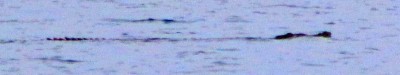
Photo shows the 3 metre long crocodile in the swimming pool
We are anchored in the well protected anchorage in the East Holandes Cays nicknamed "The Swimming Pool", surrounded by reef and numerous coconut loaded cays. The anchorage is one of the most popular in the San Blas and one of the few where one encounters other yachts. There are numerous coral patches in the large lagoon which are great for snorkelling. And, despite the distance from the Nargana cell phone tower (10 miles), we can get internet here!
We had spent this morning googling "Caribbean crocodiles', mainly because Andrew on "Eye Candy", anchored further down the coast at Snug Harbour had reported on the morning radio net having seen a "large croc" near the boat. Nobody really believed him and we thought he had been eating Kuna mushrooms or had had a glass of rum too many, but good old Google came up with the information that there were indeed "large Caribbean crocodiles", extinct in most other places, still present on the Kuna Yala coast.
Just going up on deck we spotted a strangely moving log, swimming against the wind not far away, just behind the British boat "Macushla" with Mark and Sue on board who had arrived the previous day from Santa Marta. It was a crocodile in the swimming pool - about 3 metres long, leisurely patrolling the lagoon and reefs. It looked just like an Aussie salt water croc, which we had seen many times before in the Northern Territory or Far North Queensland.
No doubt we will be keeping an eye open for reptilian monsters when we go swimming from now on, although apparently the older Kunas say that their crocs are safe and don't attack people - only dogs.
Funnily enough, that's just what the Papua New Guineans said about "their" crocs in Milne Bay when we were there in the late nineties. If a croc ate someone, they used to say that it was a "spirit crocodile," that turned from human form into crocodile and back as it liked and not a "real crocodile." Our crocodile in the Kuna swimming pool looked pretty life like to us!
Another Day at the (San Blas) Office
22 November 2014 | Holandes Cays, San Blas, Panama
Alison hot, calm and humid
The little islet of Waisaladup in the Green Island cay reef complex was the home of dozens of pelicans. Saraoni is anchored in the distance on the left
We've been out amongst the myriad of cays and reefs that crowd in the Western San Blas. The weather has been kind every day, with light sea and land breezes, the occasional shower with convective build up over the land in the day and at sea at night - a transition rhythm before the return of the north east trades, expected back sometime next month. They are waxing and waning further east and north, sending a swell in this direction to crash on the more exposed reefs, alerting us of their presence.
We are still busy tapping away on our computers, fulfilling the dreams and pockets of unseen clients thousands of kilometres away, dentists, lawyers, language translators, solar energy suppliers, whatever.
We have several large bills coming our way soon, so our little office amongst the blinding white coral sands, coconut crowded islets and aquamarine sea is busy. First, there is the Panama clearance, cruising permit and visas, next the two PADI dive courses and a sorty into the Costa Rican jungle on the Osa Peninsula, the canal transit and the stopover in the Galapagos. It's all go - or at least it's all going from our bank account - a perpetual hole that needs constant refilling!
These little cays are the Kunas' coconut farms, each one belonging to a different set of families, pretty in any weather. The reefs have good coral growth, but in our estimation seem to lack a healthy fish life - the reefs are well fished, no doubt, although most seem deserted of people, except for the odd sailing dugout and an anchored yacht.
From here we will track back to the mainland at Gaigar to search for rainforest creatures, then leave the San Blas for our stay in Panamarina - 60 nm to the west from here.


Islets in the Western San Blas
We've been out amongst the myriad of cays and reefs that crowd in the Western San Blas. The weather has been kind every day, with light sea and land breezes, the occasional shower with convective build up over the land in the day and at sea at night - a transition rhythm before the return of the north east trades, expected back sometime next month. They are waxing and waning further east and north, sending a swell in this direction to crash on the more exposed reefs, alerting us of their presence.
We are still busy tapping away on our computers, fulfilling the dreams and pockets of unseen clients thousands of kilometres away, dentists, lawyers, language translators, solar energy suppliers, whatever.
We have several large bills coming our way soon, so our little office amongst the blinding white coral sands, coconut crowded islets and aquamarine sea is busy. First, there is the Panama clearance, cruising permit and visas, next the two PADI dive courses and a sorty into the Costa Rican jungle on the Osa Peninsula, the canal transit and the stopover in the Galapagos. It's all go - or at least it's all going from our bank account - a perpetual hole that needs constant refilling!
These little cays are the Kunas' coconut farms, each one belonging to a different set of families, pretty in any weather. The reefs have good coral growth, but in our estimation seem to lack a healthy fish life - the reefs are well fished, no doubt, although most seem deserted of people, except for the odd sailing dugout and an anchored yacht.
From here we will track back to the mainland at Gaigar to search for rainforest creatures, then leave the San Blas for our stay in Panamarina - 60 nm to the west from here.
Islets in the Western San Blas
Nargana Village
22 November 2014 | San Blas Islands
Alison
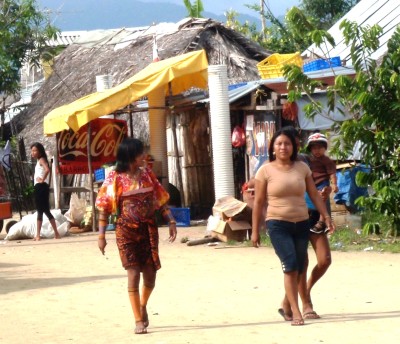
Photo shows the Nargana high street - it's a vehicle less island - not even a motorbike!
We have just dropped back to the village of Nargana to pick up a few supplies before going further out to Holandes Cay to an anchorage called the swimming pool. Nargana is one of two villages on two separate islands joined by a low bridge and less than half a mile from the mainland and the Rio Diablo.
There are no roads for miles, so everything comes in and out of the islands by Colombian boats that act as the trucks on the marine highway. They don't seem to take much out but they bring in fruit and veg, propane and store goods. We haven't spotted any motorised traffic at all. They use wheelbarrows to take goods from the wharf and some is even neatly on the ground a stone's throw from the boats that have just offloaded it. Most of the items are new clothing. The stores take care of basic food, mainly tins and packets, but beer and wine can be found in the bodega.
Every Kuna village is near the mainland, close to a river or two, although it appears that most villages are on an island, not on the mainland itself. The rivers supply freshwater and a route inland to family small holdings, as well as a place to find forest raw materials. Up the Rio Diablo, opposite Nargana, across a shallow bar, there are many riverside gardens that no doubt meet most of the nutritional needs of the villagers. It is a busy river of life, not just for the Kuna, but for much wildlife as well.
The Kunas are fiercely independent, but they still have a foot in the western world. Women in traditional dress (beaded legs, sarong, molas and blouse)stand side by side to those in modern attire. School kids are nattily dressed in semi traditional clothes semi western school outfit - a combination that just about fits the Kuna in 2014!
A cell phone tower dominates the Nargana skyline and the sound of a light plane echoes in the early morning sun, but sailing canoes - simple timber dugouts - drift by in the wind, if there is any, or paddled from place to place wherever they are needed.
A Magic Day in Kuna Land
17 November 2014 | Nargana, San Blas, Panama
Geoff, hot and sultry

Serious visit from the Panamanian Coast Guard!
Not sure who Saint Blas was, but the Kunas call their 300 km strip of land and sea Kuna Yala -Kuna Land. For several months of the year, Kuna Land is a pretty wet place, with swirling clouds and thunderstorms that seem to form and drift without any sense of purpose or direction. Fortunately, it is hardly ever windy.
Despite still being firmly embedded in Panama's long wet season, the day we sailed (?) from Snug Harbour up towards the maze of reefs which protect the North West of San Blas archipelago was a stunner. With nary a swell from anywhere and vivid blue sky, it was a magic day of slow motoring up to Nargana Island - another "Snug Harbour".

Nary a swell on the way through Kuna Yala
We passed Niadup, then Tigre - the island where the Kuna revolt against heavy handed Panamanian authorities led to bloodshed as well as a relatively comfortable autonomy. The Kunas got their property not so long after Panama broke away itself from Gran Colombia, with Uncle Sam being heavily involved in both newly born territories - Panama because of the canal, Kuna land because....who knows?
A pod of spotted dolphins spent an hour or two playing on our bow wave, taking it in turn to surf. It's been a common experience in many parts of the world, but it's still a fantastic sight.
As we neared the maze of reefs and cays to the East of Nargana we stopped for a snorkel and swim at one small island. Pelicans dove after sardines, a couple of dugouts paddled by and we saw at least a dozen langostinas hiding in their coral crevices - escapees from searching hands.
A few Colombian trading boats passed on their way up and down the Kuna Sea Highway. The San Blas has only one road in from the InterAmericana - a rutted, dirt track that leads in to Carti, near El Porvenir. Cargo has to come in and out from Miramar on the end of the Costa Arriba road, 20 nm to the West of Punta San Blas or from Capurgana, just inside Colombia, 180 nm to the South East.
Nargana and the island across the bridge from it - Corazon de Jesus - are supposed to be the least traditional of the Kuna islands and have a bank (!), several government buildings, a hotel or two, several shops and an airstrip. You can buy just about everything to keep you alive here including Panamanian beer cans for $1 each and Chilean wine casks for $4.50.
Yesterday we motored in the dinghy for a long way up the nearby Rio Diablo. Jungly smallholdings lined the banks past the sea side mangroves. Parrots flew overhead, herons perched on the banks; the water was fresh just past the entrance and several boats were collecting water from a point up stream, while others were doing their laundry downstream. A sign marks the point at which washing stops and then motors are forbidden. Many locals paddled their heavy dugouts up and down.
There is a lot to explore around here. There are a myriad openings through mangrove covered islands and many, many reef and cay complexes that lead from here up towards Punta San Blas where we turn left for Colon.


Stopover at Farewell Island
Not sure who Saint Blas was, but the Kunas call their 300 km strip of land and sea Kuna Yala -Kuna Land. For several months of the year, Kuna Land is a pretty wet place, with swirling clouds and thunderstorms that seem to form and drift without any sense of purpose or direction. Fortunately, it is hardly ever windy.
Despite still being firmly embedded in Panama's long wet season, the day we sailed (?) from Snug Harbour up towards the maze of reefs which protect the North West of San Blas archipelago was a stunner. With nary a swell from anywhere and vivid blue sky, it was a magic day of slow motoring up to Nargana Island - another "Snug Harbour".
Nary a swell on the way through Kuna Yala
We passed Niadup, then Tigre - the island where the Kuna revolt against heavy handed Panamanian authorities led to bloodshed as well as a relatively comfortable autonomy. The Kunas got their property not so long after Panama broke away itself from Gran Colombia, with Uncle Sam being heavily involved in both newly born territories - Panama because of the canal, Kuna land because....who knows?
A pod of spotted dolphins spent an hour or two playing on our bow wave, taking it in turn to surf. It's been a common experience in many parts of the world, but it's still a fantastic sight.
As we neared the maze of reefs and cays to the East of Nargana we stopped for a snorkel and swim at one small island. Pelicans dove after sardines, a couple of dugouts paddled by and we saw at least a dozen langostinas hiding in their coral crevices - escapees from searching hands.
A few Colombian trading boats passed on their way up and down the Kuna Sea Highway. The San Blas has only one road in from the InterAmericana - a rutted, dirt track that leads in to Carti, near El Porvenir. Cargo has to come in and out from Miramar on the end of the Costa Arriba road, 20 nm to the West of Punta San Blas or from Capurgana, just inside Colombia, 180 nm to the South East.
Nargana and the island across the bridge from it - Corazon de Jesus - are supposed to be the least traditional of the Kuna islands and have a bank (!), several government buildings, a hotel or two, several shops and an airstrip. You can buy just about everything to keep you alive here including Panamanian beer cans for $1 each and Chilean wine casks for $4.50.
Yesterday we motored in the dinghy for a long way up the nearby Rio Diablo. Jungly smallholdings lined the banks past the sea side mangroves. Parrots flew overhead, herons perched on the banks; the water was fresh just past the entrance and several boats were collecting water from a point up stream, while others were doing their laundry downstream. A sign marks the point at which washing stops and then motors are forbidden. Many locals paddled their heavy dugouts up and down.
There is a lot to explore around here. There are a myriad openings through mangrove covered islands and many, many reef and cay complexes that lead from here up towards Punta San Blas where we turn left for Colon.
Stopover at Farewell Island
A Step Back in Time in the Timeless San Blas
15 November 2014 | Snug Harbour, San Blas Islands, Panama
Alison - cool and calm
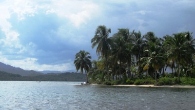
1 of 400 odd islands in the San Blas. This one was in Snug Harbour
We cautiously approached the road less isthmus that joins Central America with South America known as the Darien Gap and made landfall after a 36 hour sail from Cartagena at the unspoilt archipelago of the San Blas Islands. Before arrival we had been encased in a 4 hour downpour reducing visibility to virtually zero.
However, the small palm fringed coral islands soon unfolded in the Playon Chico area and we navigated our way around the reefs using the Bauhaus electronic charts and fortunately they were spot on.
We were last in this vicinity in 1983 when we walked, muled, and canoed from Turbo in Colombia to El Real on the Pacific side of Panama. This was a 12 day journey of dripping rainforests, tranquil rivers and encounters with jaguars or tigres as they call them here. It was unlikely we would have ever glimpsed this haven as we were about 50 miles inland as we crossed between the two great oceans.
One luxury motor yacht was anchored in the large expanse of water called Snug Harbour when we dropped anchor but apart from that there was nothing else but the luxuriant rainforest backdrop and some delightful palm covered, uninhabited islands.
We have since our arrival met a number of Kuna locals in dugout canoes that paddled out from the village of Playon Chica a mile or so away. One sold us bananas and local bread, another a lobster and the third asked for a $10 anchoring fee and said we could stay for a day, a week, a month or a year and no more to pay. He came out with a very official looking receipt book did hid business and then paddled back to the village. Certainly a far cry from the suffocating bureaucracy Colombia dishes out where the Port Captain wants something, the customs want something and immigration wants something let alone the compulsory agent he or she wants something too. Not sure what we would have done if we had forgotten to bring US dollars as there are no ATM machines to be found.
One thing we don't need to worry about here and that is theft. No pulling the dinghy up at night as we had to Cartagena and for that matter in many of the Caribbean islands.
We have been here three days now and have walked along deserted beaches and visited the village to buy a sim card. Yes - there is a cell phone tower popping up off a nearby island! We've gone snorkelling a number of times on a nearby reef and been on an escorted boat trip in our dinghy up a nearby creek with our new friend Arkin. Arkin gave us a conch shell to 'ward off tormentas' some bananas, bread and sold us one of his wife's molas. We reciprocated and gave him a shirt, some fishing line, some hooks, a small knife and two little solar lights we used when camping in the U.S. Arkin has been teaching us some Kuna and we've been teaching him some English!
It does help to speak Spanish here as little understandable English is spoken and as Spanish is the Kunas' second language they are comparatively easy to understand. Today we intend to go for walk, visit the village and perhaps a snorkel later on. It's all so reminiscent of the 10 years we spent in PNG where there are uncertain boundaries between traditional and modern.
The San Blas Islands, of course, have never been really isolated through history as this coastline has been a haven for mercenaries, misfits, missionaries and adventurers for centuries and with such sheltered anchorages nestled amongst the islands and reefs many a mariner will have set foot on these islands in years gone by either to seek refuge from a summer storm, grab a refreshing coconut from one of the thousands swaying in the breeze or to hide booty to collect at a later date.
Sir Francis Drake, a buccaneer of Queen Elizabeth 1st era, ransacked the main Spanish colony not far away from here in a bay called Nombre de Dios in his determination to grab Spanish bounty on the Queen's behalf - not long after sacking Cartagena in Colombia. He apparently died of dysentry just off the coast and he was supposedly buried in a lead coffin with some of the plunder but no one has been able to find the remains. No doubt there are a few galleons lying in Davy Jones full of plundered booty.
Apart from all the chaos of those early days, tranquility exists here albeit because no doubt the Americans resisted the temptation to support extending the inter-American highway to link south with north.

Langostina

Playon chico village

Traditional sailing canoe

In the rio with Arkin
We cautiously approached the road less isthmus that joins Central America with South America known as the Darien Gap and made landfall after a 36 hour sail from Cartagena at the unspoilt archipelago of the San Blas Islands. Before arrival we had been encased in a 4 hour downpour reducing visibility to virtually zero.
However, the small palm fringed coral islands soon unfolded in the Playon Chico area and we navigated our way around the reefs using the Bauhaus electronic charts and fortunately they were spot on.
We were last in this vicinity in 1983 when we walked, muled, and canoed from Turbo in Colombia to El Real on the Pacific side of Panama. This was a 12 day journey of dripping rainforests, tranquil rivers and encounters with jaguars or tigres as they call them here. It was unlikely we would have ever glimpsed this haven as we were about 50 miles inland as we crossed between the two great oceans.
One luxury motor yacht was anchored in the large expanse of water called Snug Harbour when we dropped anchor but apart from that there was nothing else but the luxuriant rainforest backdrop and some delightful palm covered, uninhabited islands.
We have since our arrival met a number of Kuna locals in dugout canoes that paddled out from the village of Playon Chica a mile or so away. One sold us bananas and local bread, another a lobster and the third asked for a $10 anchoring fee and said we could stay for a day, a week, a month or a year and no more to pay. He came out with a very official looking receipt book did hid business and then paddled back to the village. Certainly a far cry from the suffocating bureaucracy Colombia dishes out where the Port Captain wants something, the customs want something and immigration wants something let alone the compulsory agent he or she wants something too. Not sure what we would have done if we had forgotten to bring US dollars as there are no ATM machines to be found.
One thing we don't need to worry about here and that is theft. No pulling the dinghy up at night as we had to Cartagena and for that matter in many of the Caribbean islands.
We have been here three days now and have walked along deserted beaches and visited the village to buy a sim card. Yes - there is a cell phone tower popping up off a nearby island! We've gone snorkelling a number of times on a nearby reef and been on an escorted boat trip in our dinghy up a nearby creek with our new friend Arkin. Arkin gave us a conch shell to 'ward off tormentas' some bananas, bread and sold us one of his wife's molas. We reciprocated and gave him a shirt, some fishing line, some hooks, a small knife and two little solar lights we used when camping in the U.S. Arkin has been teaching us some Kuna and we've been teaching him some English!
It does help to speak Spanish here as little understandable English is spoken and as Spanish is the Kunas' second language they are comparatively easy to understand. Today we intend to go for walk, visit the village and perhaps a snorkel later on. It's all so reminiscent of the 10 years we spent in PNG where there are uncertain boundaries between traditional and modern.
The San Blas Islands, of course, have never been really isolated through history as this coastline has been a haven for mercenaries, misfits, missionaries and adventurers for centuries and with such sheltered anchorages nestled amongst the islands and reefs many a mariner will have set foot on these islands in years gone by either to seek refuge from a summer storm, grab a refreshing coconut from one of the thousands swaying in the breeze or to hide booty to collect at a later date.
Sir Francis Drake, a buccaneer of Queen Elizabeth 1st era, ransacked the main Spanish colony not far away from here in a bay called Nombre de Dios in his determination to grab Spanish bounty on the Queen's behalf - not long after sacking Cartagena in Colombia. He apparently died of dysentry just off the coast and he was supposedly buried in a lead coffin with some of the plunder but no one has been able to find the remains. No doubt there are a few galleons lying in Davy Jones full of plundered booty.
Apart from all the chaos of those early days, tranquility exists here albeit because no doubt the Americans resisted the temptation to support extending the inter-American highway to link south with north.
Langostina
Playon chico village
Traditional sailing canoe
In the rio with Arkin
The Multi Faceted Nature of Cartagena
06 November 2014
Geoff - hot and windless
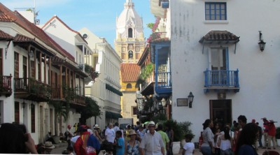
Busy street scene in old Cartagena
Cartagena - or Cartagena de Indias - to give the city its full title is a microcosm of urban Colombia and probably the rest of South America, too. This city of some one and a half million presents a number of faces - the lovely old town, small but beautifully preserved, is Cartagena's gift to the world. The narrow streets and plazas with their flower bedecked balconies belong in a long forgotten world when the nascent Spanish colony was bombarded by pirates and freebooters, yet it managed to survive and prosper and retained its valuable port and harbor with its rich human melting pot. We're not exactly fans of old cities, but even we have to admit that Cartagena's Centro district is hard to beat.
The rest of the city is modern Cartagena, with its stalactite condominiums, hotels and apartment blocks, super modern shopping malls and sprawling work a day market places and barrios with the population living in relative squalor.
Modern Colombia is still a place of huge gaps in wealth, despite the emergence of a relative 'democracy' after several decades of armed struggle between armed Maoist revolutionaries on the extreme left and the death squads and quasi military on the extreme right. Theoretically, the death squads attempted to keep the old order - the revolutionaries a new, fairer order for the campesinos and urban poor, but 'la violencia' meant atrocities by far too many with the anarchic vacuum being occupied for far too long by the cocaine trade. Now, it's hard to imagine that Colombia ever had a troubled past when looking around today. We felt safe walking in all quarters of the city and saw no violence or confrontations.
We are almost ready for our last overnight passage in the Atlantic. On our reckoning, we have already had 39 nights at sea since leaving Gibraltar and passing out into the Atlantic Ocean. Our trip across to the San Blas Islands of the Kunas in Panama will be our 40th and last in this ocean - a 170 nm trip to the Ingles Cays. The weather is temperamental and not necessarily favourable at the moment, though not very windy. If we leave on Sunday, we expect to get light winds from the North to North West most of the way.
Cartagena is deservedly a hugely popular place for boaties even though it's not that crowded at the moment. Within an easy stroll from the building chaos going on at Club Nautico, you can get to an upmarket supermarket (Carulla), several malls and shopping centers, a huge home center / hardware store (in the Caribe Mall), many small restaurants and bars, chandleries, the bustling Bazurto market as well as the older and quaintly attractive districts of Getsemani and Centro. It's been a good stop but we are ready to move on.


Images from Cartagena's old town: chess players taking a long time over a move; preparation for Independence Day and a street scene.
Cartagena - or Cartagena de Indias - to give the city its full title is a microcosm of urban Colombia and probably the rest of South America, too. This city of some one and a half million presents a number of faces - the lovely old town, small but beautifully preserved, is Cartagena's gift to the world. The narrow streets and plazas with their flower bedecked balconies belong in a long forgotten world when the nascent Spanish colony was bombarded by pirates and freebooters, yet it managed to survive and prosper and retained its valuable port and harbor with its rich human melting pot. We're not exactly fans of old cities, but even we have to admit that Cartagena's Centro district is hard to beat.
The rest of the city is modern Cartagena, with its stalactite condominiums, hotels and apartment blocks, super modern shopping malls and sprawling work a day market places and barrios with the population living in relative squalor.
Modern Colombia is still a place of huge gaps in wealth, despite the emergence of a relative 'democracy' after several decades of armed struggle between armed Maoist revolutionaries on the extreme left and the death squads and quasi military on the extreme right. Theoretically, the death squads attempted to keep the old order - the revolutionaries a new, fairer order for the campesinos and urban poor, but 'la violencia' meant atrocities by far too many with the anarchic vacuum being occupied for far too long by the cocaine trade. Now, it's hard to imagine that Colombia ever had a troubled past when looking around today. We felt safe walking in all quarters of the city and saw no violence or confrontations.
We are almost ready for our last overnight passage in the Atlantic. On our reckoning, we have already had 39 nights at sea since leaving Gibraltar and passing out into the Atlantic Ocean. Our trip across to the San Blas Islands of the Kunas in Panama will be our 40th and last in this ocean - a 170 nm trip to the Ingles Cays. The weather is temperamental and not necessarily favourable at the moment, though not very windy. If we leave on Sunday, we expect to get light winds from the North to North West most of the way.
Cartagena is deservedly a hugely popular place for boaties even though it's not that crowded at the moment. Within an easy stroll from the building chaos going on at Club Nautico, you can get to an upmarket supermarket (Carulla), several malls and shopping centers, a huge home center / hardware store (in the Caribe Mall), many small restaurants and bars, chandleries, the bustling Bazurto market as well as the older and quaintly attractive districts of Getsemani and Centro. It's been a good stop but we are ready to move on.
Images from Cartagena's old town: chess players taking a long time over a move; preparation for Independence Day and a street scene.
From Tayrona to Cartagena
30 October 2014 | Cartagena de Indias, Colombia
Alison, hot and humid
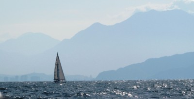
The Australian sloop "Eye Candy" in light wind under the ramparts of the Sierra Nevada de Santa Marta - picos Bolivar and Colon off to the right
We cleared out of Santa Marta, bristling with permisos of various kinds from a number of Colombian authorities, courtesy of Dino, the agente, and a fistful of pesos - 460,000 to be exact. With our newly found legality we decided to divert back up to the Tayrona National Park which we had passed on the way in from Aruba. The national park protects a beautiful stretch of coastline at the foot of the Sierra Nevada de Santa Marta with its 5 indented bays - from east to west - Cinto, Neguanje, Gairaca, Chengue and Concha.
The 5 bays are a common stopping off point on the way westward, but it is before any port of entry and some boats have been told to move on by the Colombian Coast Guard. Going back to Tayrona from Santa Marta is against the wind and current as we discovered as soon as we turned the corner inshore of Isla Aguja. We persevered, motoring straight into the chop, past Bahia Concha and Chengue and into Bahia Gairaca - one of the best protected of the bays. The surroundings were scrub covered -not thick forest - but there were some nice beaches around the bay and the water was flat.
Here we met up with Australians Andrew and Clare on their boat "Eye Candy" who had just arrived from Aruba - a common voice on the radio nets. Ashore, we also met up with Renaldo Garcia, a fisherman who lived in a house on the beach. He pointed out how to get to a rough road which linked the bays to the main coast highway. Renaldo turned out to be quite a philosopher and was eager to find out what we thought about Colombia and how it compared to the Colombia of the early 80s when we were last here. The road made a nice walk and we saw two toucans early on but not much other wildlife. The road took us over a hill to the third bay - Neguanje - with a surf beach and a small fisherman's community and some tourist shacks.
From Tayrona we backtracked to Taganga Bay and then took off early in the morning to Cartagena. The start of the trip out from the protection of the Santa Marta peninsula revealed the Sierra Nevada in all its glory although the swell was short and steep for a while with very little wind until later in the morning.
The trip was uneventful and the passage across the mouth of the dreaded Magdalena River was not as bad as some people had reported - a bit bouncy and dirty looking, but no dead cows or other nasties floating out in the sea off the mouth.
We made the Boca Chica entrance (main shipping channel) to Cartagena early the next morning - much earlier than expected because of a surprise favourable current and pleasant sailing conditions, so we didn't try and enter the very shallow Boca Grande entrance to the North. This meant we had to do 13 miles extra diversion, but the way in to the harbour was clearly marked and the weather was quite calm. The city skyline in the fading moonlight was startling - rows of stalactite like skyscrapers piercing high into the sky. We are now safely anchored just off Club Nautico's marina near the old city.
We will probably be here for a week or so to see the old city, which is a world heritage site, and collect a few items which may be harder to source in Panama. The weather statistics for October and November seem to have been confirmed by reality that they are the best two months to make the passage along what has been touted as the world's fifth roughest sailing route.

Saraoni quietly at anchor in Gairaca Bay - photo courtesy of Eye Candy

Lovely Neguanje Bay - the second of Tayrona's 5 bays from the east.

Bocagrande skyline in Cartagena - the stalactite sensation!
We cleared out of Santa Marta, bristling with permisos of various kinds from a number of Colombian authorities, courtesy of Dino, the agente, and a fistful of pesos - 460,000 to be exact. With our newly found legality we decided to divert back up to the Tayrona National Park which we had passed on the way in from Aruba. The national park protects a beautiful stretch of coastline at the foot of the Sierra Nevada de Santa Marta with its 5 indented bays - from east to west - Cinto, Neguanje, Gairaca, Chengue and Concha.
The 5 bays are a common stopping off point on the way westward, but it is before any port of entry and some boats have been told to move on by the Colombian Coast Guard. Going back to Tayrona from Santa Marta is against the wind and current as we discovered as soon as we turned the corner inshore of Isla Aguja. We persevered, motoring straight into the chop, past Bahia Concha and Chengue and into Bahia Gairaca - one of the best protected of the bays. The surroundings were scrub covered -not thick forest - but there were some nice beaches around the bay and the water was flat.
Here we met up with Australians Andrew and Clare on their boat "Eye Candy" who had just arrived from Aruba - a common voice on the radio nets. Ashore, we also met up with Renaldo Garcia, a fisherman who lived in a house on the beach. He pointed out how to get to a rough road which linked the bays to the main coast highway. Renaldo turned out to be quite a philosopher and was eager to find out what we thought about Colombia and how it compared to the Colombia of the early 80s when we were last here. The road made a nice walk and we saw two toucans early on but not much other wildlife. The road took us over a hill to the third bay - Neguanje - with a surf beach and a small fisherman's community and some tourist shacks.
From Tayrona we backtracked to Taganga Bay and then took off early in the morning to Cartagena. The start of the trip out from the protection of the Santa Marta peninsula revealed the Sierra Nevada in all its glory although the swell was short and steep for a while with very little wind until later in the morning.
The trip was uneventful and the passage across the mouth of the dreaded Magdalena River was not as bad as some people had reported - a bit bouncy and dirty looking, but no dead cows or other nasties floating out in the sea off the mouth.
We made the Boca Chica entrance (main shipping channel) to Cartagena early the next morning - much earlier than expected because of a surprise favourable current and pleasant sailing conditions, so we didn't try and enter the very shallow Boca Grande entrance to the North. This meant we had to do 13 miles extra diversion, but the way in to the harbour was clearly marked and the weather was quite calm. The city skyline in the fading moonlight was startling - rows of stalactite like skyscrapers piercing high into the sky. We are now safely anchored just off Club Nautico's marina near the old city.
We will probably be here for a week or so to see the old city, which is a world heritage site, and collect a few items which may be harder to source in Panama. The weather statistics for October and November seem to have been confirmed by reality that they are the best two months to make the passage along what has been touted as the world's fifth roughest sailing route.
Saraoni quietly at anchor in Gairaca Bay - photo courtesy of Eye Candy
Lovely Neguanje Bay - the second of Tayrona's 5 bays from the east.
Bocagrande skyline in Cartagena - the stalactite sensation!
A la Orden! En Barranquilla
24 October 2014
Geoff and Alison, Santa Marta marina, hot
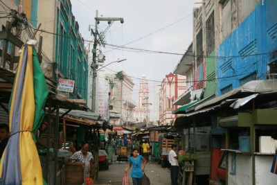
Photo shows an alley in the old town near San Nicolas Cathedral
We had never intended going to Colombia's fourth largest city near the mouth of the Magdalena River - Colombia's longest, which rises far to the South in the Andes and carves a huge valley between the Central and Eastern Cordilleras.
We had intended visiting Salamanca National Park instead - a swampy lagoon area sandwiched between the Magdalena's last gasp at reaching the sea and the ocean itself - reportedly a home to huge numbers of birds as well as agoutis, alligators and otters. The sea in this gulf seemed remarkably calm as we sped by in the bus, but we did see a few traditional sailing boats just off the beach on the ocean side as well as in the main lagoon itself. However, access to the reserve seemed to be almost impossible without a vehicle, so on we barrelled to the great industrial metropolis half way between Santa Marta and Cartagena.
We had booked a hotel in Barranquilla's historic centre - a snip at $20 - including an ensuite, air con, satellite TV, a reasonably clean bed, coffee from an urn on tap and a smiling manager. Now Barranquilla is NOT a tourist town - which Santa Marta could sort of be classed as - Colombian tourists mostly from the highlands, anyway. In fact, we might very well have been the only two tourists in town in this sprawling city of a million and a half - the size of Sheffield or Auckland. Barranquilla made its mark as a river port, close to the mouth of the muddy Magdalena. It still has a busy port, but is now a centre of industry - here the popular Hypalon AB inflatable dinghies are made and exported all over the Atlantic. Anchor chain can be regalvanised here, too.
It's a no frills city with no pretensions of charm - a spectacularly unspectacular place. The old town has been eclipsed over the years by the newer Northern half, where the posh people hang out, but is still a pulsating mix of market stalls and small, modern business stores. "A La Orden! (at your service)" is the most common expression from the stall holders - sort of like a Colombian version of Turkey's 'Merhaba' or Nepal's 'Namaste', although it's actually an invitation to buy something instead.
It seems to be a feature of what little we have seen of Colombian towns is the tendency to have a small nucleus of shops all of the same kind. If one stall is selling spectacles or watches, there are dozens of other selling the same close by. Then there are stalls selling fresh veggies, fruit or fish and rather dubious chunks of meat - right next door are many others. Then there are the 'ferreteria' cities, the intersections where all there seem to be are bicycle shops with repair and assembly franchises spilling out on to the streets, 'fan corner' where fans are sold and fixed and 'motorcycle alley' where there are a score of motorcycle stores.
We can't really recommend Barranquilla to any visitor - but it's home to many, getting on with life in this corner of Colombia.
Colombia -a haven for nature's small gems
17 October 2014 | Santa Marta Marina
Alison
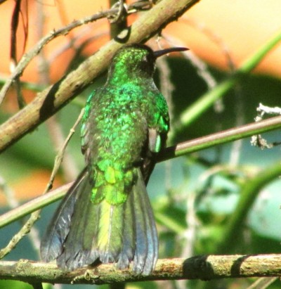
Emerald hummingbird, near Minca
We were greeted by hundreds of pelicans when we arrived at Cabo de la Vela and several pods of dolphins scrutinised us too but our research about Colombia was never extensive enough to discover that it was home to 1881 bird species - the largest number for any country in the world. There is no reason to leave until we have least seen a few. The last two days we spent at a small reserve up in the Sierra Nevada de Santa Marta foothills just one hour by shared car. The nearest small community to the reserve is called Minca and has a number of small guesthouses. We hiked 4 kms further on to Faunal just before Pozo Azul waterfalls.
The family at Faunal let out a couple of rooms for bird fanatics and they are keen conservationists wanting to ensure that birds and other species have their space. They had constructed a simple feeder to attract birds that are fruit or nectar eaters as these birds so often can be heard but not seen. Brilliant little hummingbirds continually buzzed around us, waiting their turn at the flowers or feeders and even took an interest in our clothes!
Sebastian, the bird expert of the two brothers, could speak fluent English and he enjoyed sharing his knowledge of many Colombian birds. The surrounding area is secondary forest on the slopes of the Sierra Nevada de Santa Marta and has a number of mammals, too. We heard the familiar sound of howlers nearby in the morning and there are armadilloes, night monkeys, deer, taira, porcupines and even ocelots in the forest.

Blue and Grey Tanager

Female red backed tanager

Red Naped Tanager

Mot mot

Red capped woodpecker

Red backed tanager

Squirrel

Giant woodpecker
We were greeted by hundreds of pelicans when we arrived at Cabo de la Vela and several pods of dolphins scrutinised us too but our research about Colombia was never extensive enough to discover that it was home to 1881 bird species - the largest number for any country in the world. There is no reason to leave until we have least seen a few. The last two days we spent at a small reserve up in the Sierra Nevada de Santa Marta foothills just one hour by shared car. The nearest small community to the reserve is called Minca and has a number of small guesthouses. We hiked 4 kms further on to Faunal just before Pozo Azul waterfalls.
The family at Faunal let out a couple of rooms for bird fanatics and they are keen conservationists wanting to ensure that birds and other species have their space. They had constructed a simple feeder to attract birds that are fruit or nectar eaters as these birds so often can be heard but not seen. Brilliant little hummingbirds continually buzzed around us, waiting their turn at the flowers or feeders and even took an interest in our clothes!
Sebastian, the bird expert of the two brothers, could speak fluent English and he enjoyed sharing his knowledge of many Colombian birds. The surrounding area is secondary forest on the slopes of the Sierra Nevada de Santa Marta and has a number of mammals, too. We heard the familiar sound of howlers nearby in the morning and there are armadilloes, night monkeys, deer, taira, porcupines and even ocelots in the forest.
Blue and Grey Tanager
Female red backed tanager
Red Naped Tanager
Mot mot
Red capped woodpecker
Red backed tanager
Squirrel
Giant woodpecker
Bienvenido a Santa Marta!
16 October 2014 | Santa Marta, Colombia
Alison, hot
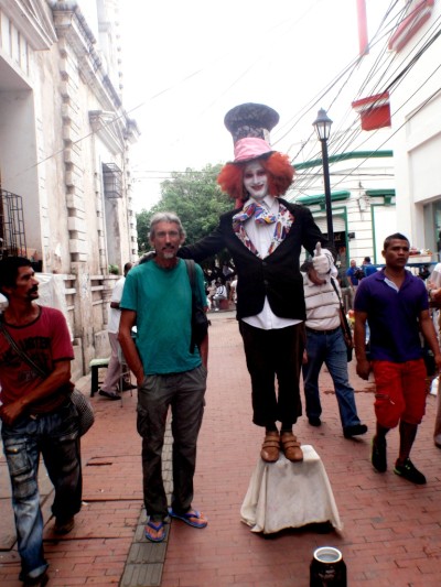
No! That's not Alison's brother Toby with Geoff but a friendly native of Santa Marta! Que tal?
Santa Marta is a city of 500,000 fronting the Caribbean. It's apparently the oldest of Colombia's cities and it still has a historic district at its heart, although the city must have long been eclipsed as a port by Cartagena de Las Indias, 160 km to the South West, because Cartagena has such a good harbour. Santa Marta's harbour is well protected from the normal trade winds and certainly there has been hardly any wind since we arrived, but the whole port looks dangerously exposed to anything out of the west.
We've quite warmed to Santa Marta after initial culture shock at being back squarely in the 3rd world. It's sort of like 1950s Spain married to honky tonk Asia with bustling streets and lots of basura and noise. There's nothing Caribbean about it except the heat. After the islands, everything seems refreshingly cheap! Restaurants, supermarkets, beer, veggies and fruit; I even got a new pair of specs off a street vendor that fitted my short sighted prescription (opposite of reading glasses) for $5 ("sorry" said the vendor - "that type is pretty expensive!"). There is a huge sprawling market but there are also several large supermarkets of varying splendour. We found one of them selling new, folding bikes for $100 each, so we will replace our by now rusty relics we bought only two and a half years ago in Greece. The Spanish spoken here is easy to understand, sounding the same as that spoken in the Canaries - the final 's' is left off, 'z' and 'c" are 's' rather than the Castillian 'th' and 'll' is 'y' or even 'zh' rather than 'ly'. Do' servesa' por favor! Grasia'
The marina is not so cheap and nor are the antiquated clearance formalities, but we have persevered. The marina is well run, with plenty of space and water and electricity thrown in and an air conditioned room to sit in with wifi. It has a modern fingerprint identification system for the ablution blocks and the cold room, but they don't always seem to pick up on the print!
There are plenty of places to explore in this huge country and some cruisers leave their boats here and trot off to Ecuador, Peru and beyond during the summer hurricane season. There are also motor launches belonging to the elite of Santa Marta - they all seem to have Delaware as their port which is pretty odd. They fill up at the weekend with a partying bunch of Colombians and head off to Taganga Bay just around the corner or perhaps round to one of the 5 bays in Tayrona National park - we hope to go camping there before we leave for Panama.
It's the wet season here along this coast, no doubt right through to Panama, with daily thunderstorms and downpours. Perhaps because of the steepness of the mountains nearby or because of insufficiently large storm drains, the streets overflow with filthy water after every downpour - which then flows straight into the harbour. Pooh!

Taganga Bay
Santa Marta is a city of 500,000 fronting the Caribbean. It's apparently the oldest of Colombia's cities and it still has a historic district at its heart, although the city must have long been eclipsed as a port by Cartagena de Las Indias, 160 km to the South West, because Cartagena has such a good harbour. Santa Marta's harbour is well protected from the normal trade winds and certainly there has been hardly any wind since we arrived, but the whole port looks dangerously exposed to anything out of the west.
We've quite warmed to Santa Marta after initial culture shock at being back squarely in the 3rd world. It's sort of like 1950s Spain married to honky tonk Asia with bustling streets and lots of basura and noise. There's nothing Caribbean about it except the heat. After the islands, everything seems refreshingly cheap! Restaurants, supermarkets, beer, veggies and fruit; I even got a new pair of specs off a street vendor that fitted my short sighted prescription (opposite of reading glasses) for $5 ("sorry" said the vendor - "that type is pretty expensive!"). There is a huge sprawling market but there are also several large supermarkets of varying splendour. We found one of them selling new, folding bikes for $100 each, so we will replace our by now rusty relics we bought only two and a half years ago in Greece. The Spanish spoken here is easy to understand, sounding the same as that spoken in the Canaries - the final 's' is left off, 'z' and 'c" are 's' rather than the Castillian 'th' and 'll' is 'y' or even 'zh' rather than 'ly'. Do' servesa' por favor! Grasia'
The marina is not so cheap and nor are the antiquated clearance formalities, but we have persevered. The marina is well run, with plenty of space and water and electricity thrown in and an air conditioned room to sit in with wifi. It has a modern fingerprint identification system for the ablution blocks and the cold room, but they don't always seem to pick up on the print!
There are plenty of places to explore in this huge country and some cruisers leave their boats here and trot off to Ecuador, Peru and beyond during the summer hurricane season. There are also motor launches belonging to the elite of Santa Marta - they all seem to have Delaware as their port which is pretty odd. They fill up at the weekend with a partying bunch of Colombians and head off to Taganga Bay just around the corner or perhaps round to one of the 5 bays in Tayrona National park - we hope to go camping there before we leave for Panama.
It's the wet season here along this coast, no doubt right through to Panama, with daily thunderstorms and downpours. Perhaps because of the steepness of the mountains nearby or because of insufficiently large storm drains, the streets overflow with filthy water after every downpour - which then flows straight into the harbour. Pooh!
Taganga Bay
| Vessel Name: | Saraoni (1) and Sundari (2) |
| Vessel Make/Model: | South Coast 36 and Beneteau 473 respectively |
| Hailing Port: | Lamb Island, Australia |
| Crew: | Alison and Geoff Williams |
| About: | |
| Extra: | CONTACT DETAILS Telephone / SMS number +61 456 637 752 (Australian mobile no.) +64 28 432 5941 NZ mobile no.) Email yachtsundari@gmail.com (main email address) |
Saraoni (1) and Sundari (2)'s Photos - Main
.JPG) |
A collection of photos taken while teaching and cruising in PNG's Milne Bay Province
74 Photos
Created 29 April 2023
|
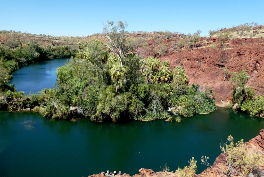 |
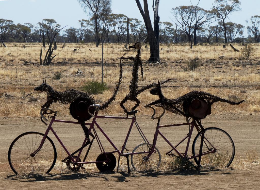 |
Some rather idiosyncratic metal sculptures in outback Queensland between Aramac and Lake Dunn
8 Photos
Created 27 September 2020
|
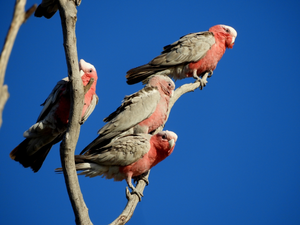 |
Birds and other critters on our Queensland inland safari
12 Photos
Created 27 September 2020
|
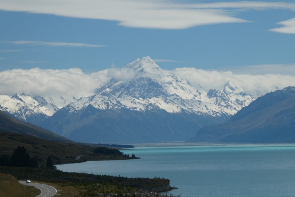 |
A collection of photos taken during the Tiki Tour of the Southern half of the South Island, November / December 2019
40 Photos
Created 15 December 2019
|
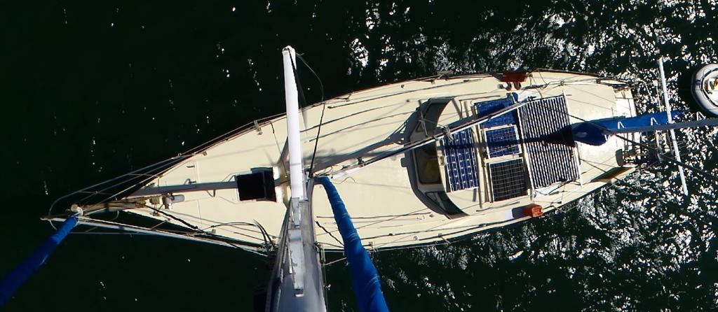 |
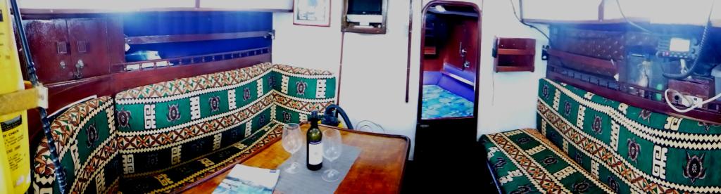 |
Photos taken of Saraoni. All interior photos were taken in the last week.
10 Photos
Created 2 April 2019
|
 |
50 Photos
Created 27 June 2014
|
 |
The ABCs - Aruba, Bonaire and Curacao are mostly low lying dry, scrubby islands in the Western Caribbean near the Venezuelan coastline
15 Photos
Created 21 May 2014
|
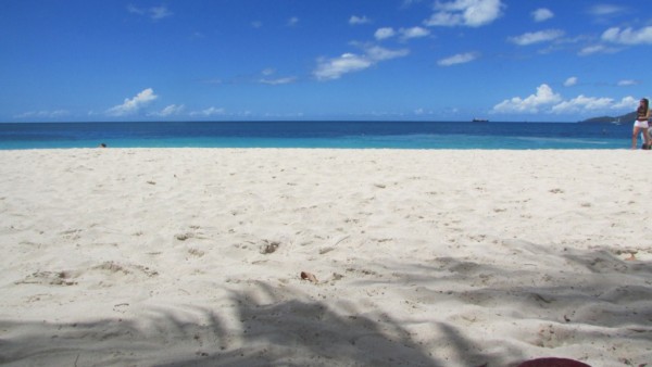 |
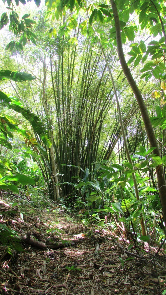 |
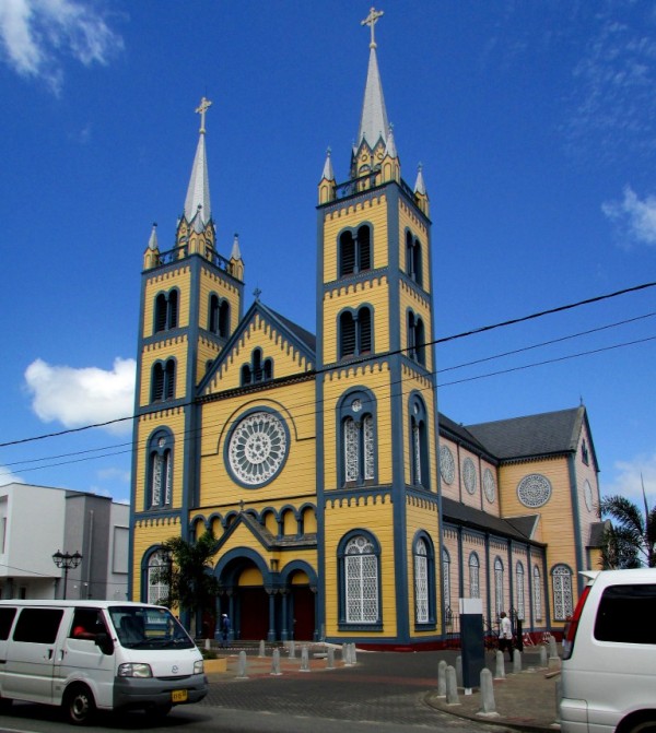 |
Images taken in and around Suriname's capital
40 Photos
Created 9 February 2014
|
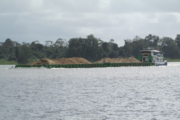 |
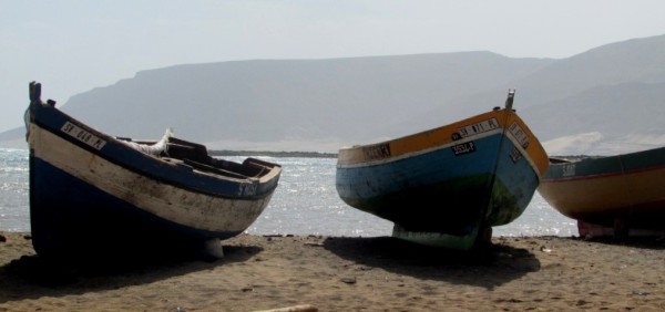 |
Images of the 2 islands in the Cape Verde island group we visited on our way across the Atlantic in 2013 - Sao Vicente and Santo Antaao.
37 Photos
Created 26 December 2013
|
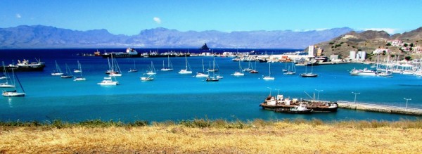 |
 |
 |
 |
 |
 |
Unexpected meeting with old friends "in the woods".
6 Photos
Created 24 June 2013
|
 |
A brother found amongst the gorges of the Cevennes
5 Photos
Created 10 June 2013
|
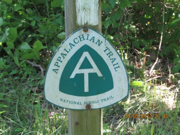 |
Photographic images of our long walk along the Appalachian mountains in the USA
26 Photos
Created 10 June 2013
|
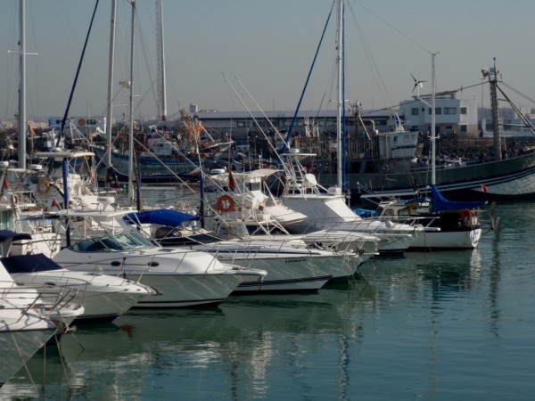 |
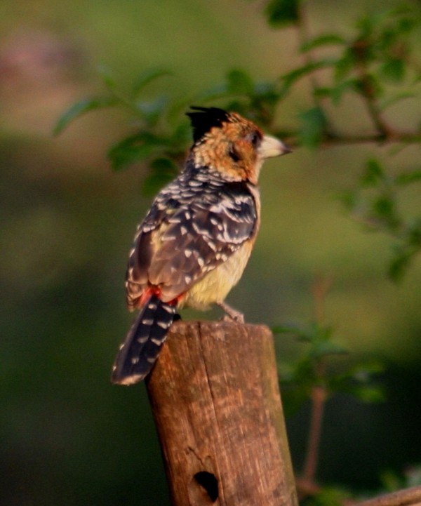 |
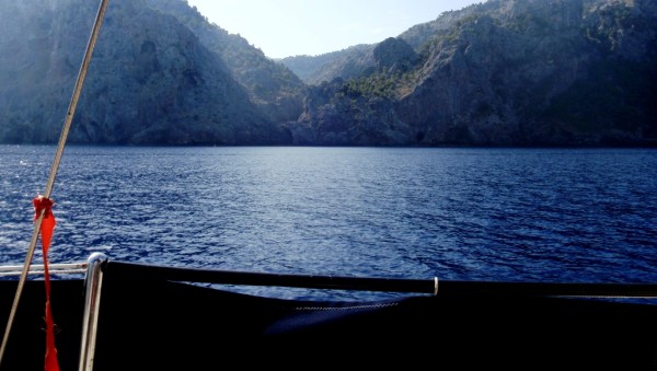 |
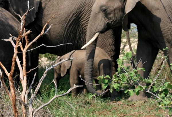 |
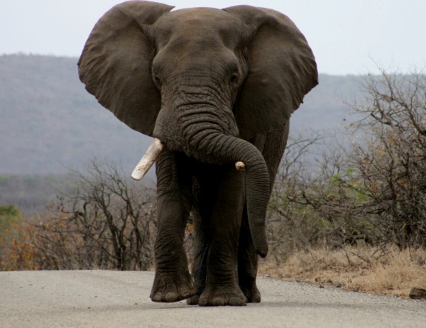 |
 |
 |
Greece is in the throes of a recession, but they still have the last laugh - never far from the sun, the sea, colour, culture and bags of history. The photos document our Aegean odyssey from May to September 2011
31 Photos
Created 17 December 2011
|
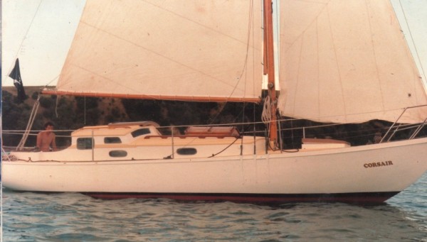 |
O.K. We're mad, but we somehow prefer a home on the sea to one on dry land.
12 Photos
Created 17 December 2011
|
 |
Kathmandu, Patan and Bhaktapur - the three ancient city states of the Kathmandu valley have mediaeval architectural wonders in their Durbars and old town areas - a meshing and merging of Hinduism, Buddhism and materialism
9 Photos
Created 17 December 2011
|
 |
Some of the shots taken of us while on one of our 30 odd days on the three main mountain trails we walked in the Anapurnas and Helambu region of Nepal's side of the Himalayas
10 Photos
Created 15 December 2011
|
 |
People make the Himalayas a unique place to walk through. From Hindu rice and buffalo farmers in the foothills to the Buddhist villages in the highlands so influenced by Tibetan ancestry and trade over the passes
16 Photos
Created 15 December 2011
|
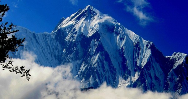 |
Nepal has ten of the world's highest mountains within its boundaries or shared with India and Tibet - these are truly giant peaks!
22 Photos
Created 15 December 2011
|
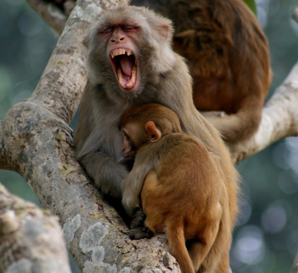 |
These were all photographed in the wilds of Chitwan and Bardia National Parks - which are two of the last havens of biodiversity in Nepal's low lying Terai district.
18 Photos
Created 14 December 2011
|
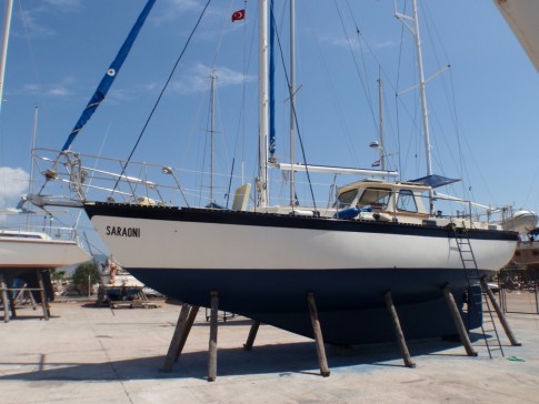 |
Saraoni hauled out on Finike's hardstand for biennial maintenance and painting
3 Photos
Created 26 April 2011
|
 |
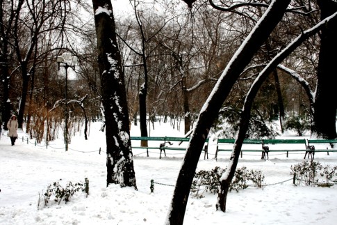 |
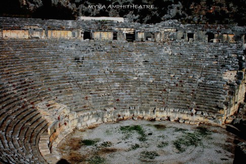 |
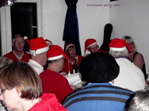 |
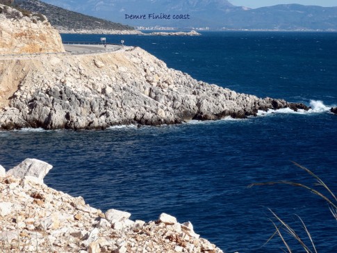 |
 |
 |
 |
 |
The small rocky island of Kastellorizou is Greece's most remote island
7 Photos
Created 11 December 2010
|
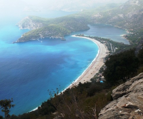 |
Cruising and walking Turkey's Lycian coast September and October 2010
19 Photos
Created 11 December 2010
|
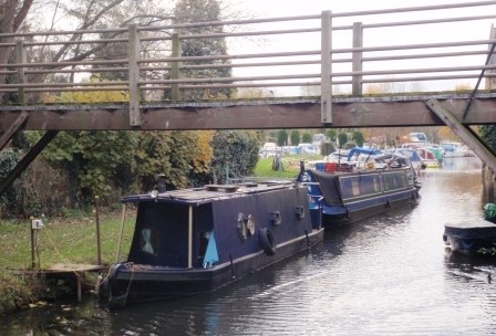 |
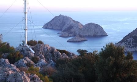 |
Images taken while walking sections of the 500 km Lycian Way or Lykia Yolu on the South West Mediterranean Coast of Turkey
11 Photos
Created 9 November 2010
|
Exploring as Much as We Can Until We Can't
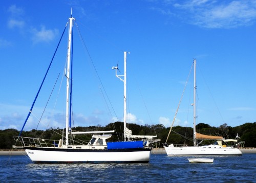
Who: Alison and Geoff Williams
Port: Lamb Island, Australia
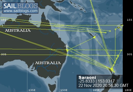
Blog Categories by Year
- 2023 Aust NZ
- 2022 Aust
- 2021 Aust
- 2020 Aust, NZ
- 2019 Aust, NZ
- 2018 New Cal Aust and NZ
- 2017 NZ, Aust, Tonga, Fiji, New Caledonia
- 2016 NZ Niue and Canada
- 2015 Pacific Crossing Panama to NZ, Galapagos, French Polynesia, Cooks, American Samoa and Tonga
- 2015 and 2014 Suriname Colombia Panama and Costa Rica
- 2014 U.S. Cycle trip
- 2014 Caribbean Islands Trinidad to Aruba
- 2014 Atlantic Crossing Cape Verdes to Suriname
- 2013 Cape Verdes, West Africa
- 2013 Canaries Post USA
- 2013 U.S.A. Hiking Trips Appalachians and Cascades
- 2013 Canaries Pre U.S.A.
- 2013 Morocco
- 2012 South Africa and Swaziland
- 2012 Mediterranean Spain and France
- 2012 Italy
- 2012 and 2011 Greece
- 2011 A Quarter Century on the Sea
- 2011 Nepal
- 2011 and 2010 Turkey
- 2010 Oman Yemen the Red Sea and Israel
- 2010 South Asia: India and Sri Lanka
- 2009 Malaysia and Thailand
- 2009 and 2008 Aust and SE Asia
- 2007 Australia
- 2006 NZ to New Caledonia and Australia
- A Tale of Three Boats
- 1978 to 2018 Perspectives on a Long Journey
SailBlogs Friends

