
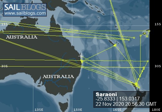
SVs Saraoni and Sundari
09 April 2024 | The Broadwater, Gold Coast, Australia
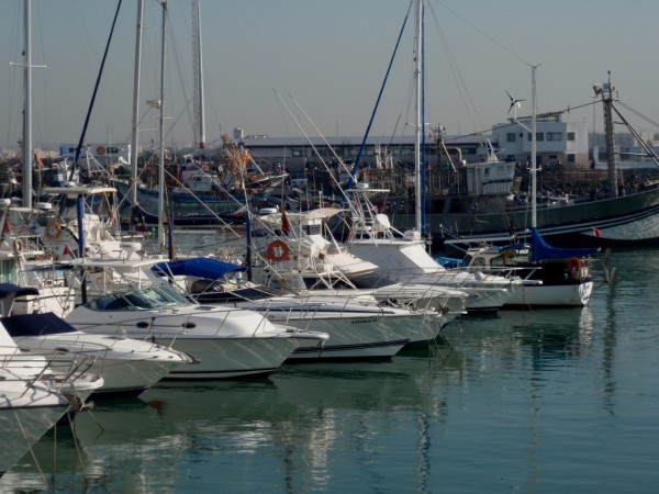
03 March 2024 | Hope Harbour marina, Gold Coast, Australia
03 January 2024 | Karragarra Channel, South Moreton Bay Islands, Queensland
15 December 2023 | Riverheads, Mary River, Great Sandy Strait, Queensland
23 October 2023 | Great Keppel Island
07 August 2023 | Trinity Inlet, Cairns, North Queensland
23 July 2023 | Trinity Inlet, Cairns, Far North Queensland.
07 July 2023 | Cairns
19 May 2023 | North West island, Capricornia Cays, Queensland
15 May 2023 | Burnett River, Bundaberg, Queensland.
29 April 2023 | Manly marina, Moreton Bay, Queensland, Australia
04 March 2023 | South Auckland, New Zealand
18 January 2023 | Gold Coast Broadwater, Queensland
17 November 2022 | Collie, Southern WA, Australia
29 October 2022 | Albany, SW Australia
14 October 2022 | Augusta, WA, Australia
15 August 2022 | Karragarra Passage, Southern Moreton Bay, Queensland, Australia
14 July 2022 | Raby Bay, off Moreton Bay, Queensland
13 June 2022 | Camooweal, Far West Queensland
20 May 2022 | Alice Springs, Northern Territory, Australia
Israel - nation under siege
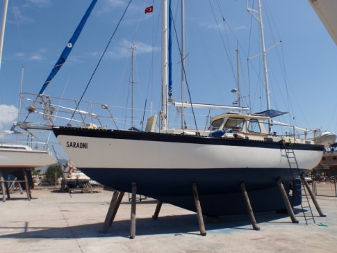
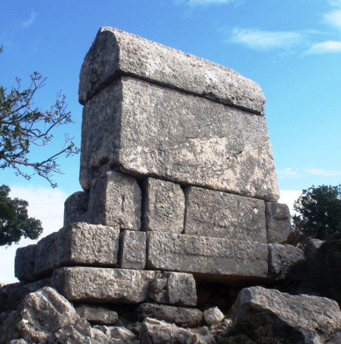
24 June 2010 | Alanya, Turkey
Alison - Hot and calm
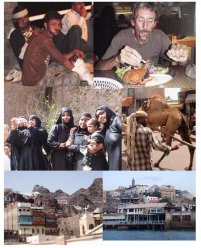
Pics from top left :
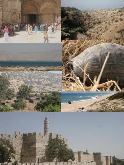
Jerusalem's Church of the Holy Sepulchre wıth holy tourists in an unholy land; Golan Heıghts gorge; Sea of Galilee; Israeli tortoise; Abandoned Syrian vıllage ın occupied Golan; Ashkelon's beach;
bottom: walls of Jerusalem's old city
We sailed the 120 nm from Port Said to Ashkelon on the Southern Israeli coast with the help of a light north westerly wind after being escorted into the Eastern Mediterranean by a small family of bottlenose dolphins. More noisily, the Israeli Navy also shadowed our movements as we neared the waters off the Gaza strip overnight and we were then subjected to a welcome by a gunboat and a grilling and search from friendly security personnel after docking in the marina.
Israel, we discovered, was a nation obviously under siege - a modern, affluent country with a huge migrant population from a multitude of countries, but especially Russia, somehow seemed to have dug itself into a hole as a nation with its intransigent attitude towards the Palestinians. Not long after our arrival in Ashkelon, the infamous fatal commando raid on one of a number of (Turkish) aid ships bound to beat the blockade of Gaza caught international headlines and provoked a large internal debate within Israel itself.
As we moved everywhere in Israel, especially on the public transport system, hordes of young men and women doing compulsory national service nonchalantly carried M16's or Uzis and we noted that even innocent school parties of children had armed guards constantly carrying rifles present.
We had originally come to Israel to pick up some mail from England and found time to visit Jerusalem, Tel Aviv, the Sea of Galilee and part of the Golan Heights towards the Syrian border. We would have completed part of one of Israel's three well planned long distance walking trails, but temperatures had already soared into the late 30's or even low 40's in the daytime and water for camping scarce, so we were content to go exploring the beautiful gorges and water holes in a small part of the Golan within sight of Mount Hermon.
Most of our yachtie friends who had made the diversion to Israel had come to see the Holy Land sites of Bethlehem, Nazareth and Jerusalem and the magnificent Nabbutean carvings in Petra, Jordan. In spite of our atheism it was quite amazing to be moving through places that had been so much part of our early childhood education and to reflect on the labyrinthine complexity of repeated conquest and degeneration of each succeeding civilisation in this part of the Middle East.
The mail never arrived and time was passing so we regretfully gave up the idea of exploring the Dead Sea, Negev craters and En Gedi oasis and set sail on the two day passage to Cyprus with a great weather window opening up promising a fair south westerly wind all the way to Famagusta or beyond.
Middle of the Suez Canal
23 May 2010 | Suez Canal
Alison NW 10 knots
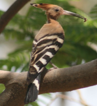
Pıc shows a hoopoe. These lıttle bırds look lıke a cross between a woodpecker and a kıngfısher and were very common all over İsmailia.
We are currently transiting the second half of the Suez Canal to Port Said. The canal is more like a narrow canal with steep sandy banks than the southern half that passed through a couple of lakes. Before leaving this morning we had spent several days in Ismailia awaiting weather, paperwork and spending three days in Cairo.
Ismailia is a desert town transformed into an oasis, tapping water through man made channels from the River Nile. It is actually quite green and has some parks with bird life in them and trees showered with flowers. The markets are full of fruit and veg and the women are dressed in headscarves and burkas. It is almost western except for the voluminous rubbish scattered just about everywhere.
Ismailia and Cairo
17 May 2010 | Ismailia
Alison and Geoff
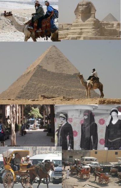
We made it to Cairo by public bus from Ismailia some 100 km away and stayed in a 0 star hotel in the heart of the downtown area. The city centre was surprisingly European in character with busy streets and quiet, shady side alleys.
The whole downtown came alive at night with throngs of Cairoans, the cinema, clothes shops and pastry and sweet shops getting the most attention. Men and women, young and old were seen holding hands more often than we have seen in any other Islamic country while some women were seen puffing on the shisha pipe in some of the coffee shops.
The Nile was actually quite pleasant and didn't seem too polluted considering the thousands of miles it has come before reaching Cairo and there were still a few feluccas to be seen sailing across the river - these days strictly for the tourist trade.
We spent a few hours visiting the pyramids and the Sphinx at El Giza. The whole area couldn't have changed much since the pyramids were first constructed as there were no mass tourist facilities, except for the huge hotels built outside. If you wanted a guided tour you could go by camel or horse and cart or on foot. It was hot, dusty and smoggy. The smog is probably relatively new but not the dust and heat. Geoff got inadvertantly carried away by a camel owner into the sandy desert beyond. He was eventually returned and asked for a couple of dollars in payment.
The Suez Canal
12 May 2010 | In the Suez Canal
Alison, 15-20 knot northerly
We arrived at Port Suez and a day later with a pilot on board were transiting the canal. The pilot is hardly necessary as the navigation through the canal is easy, but the pilot is still compulsory. The ships move southwards in a convoy, then another convoy moves northwards while smaller boats like yachts fit somewhere in between. As 10 am approached we were already to go and were told that we had to wait until 2 pm as a warship (very small and American) was transiting. All eventually went to schedule and off we went. It was rather nerve racking passing so close to big ships but we soon had a bit more space when the convoy had passed but we ended up arriving in Ismailia in the dark. Ismailia is a compulsory stop for all smaller boats about 80 kms along the canal from Port Said (Mediterranean) and Port Suez (Red Sea).
Arrival at Port Suez
11 May 2010 | Port Suez
Alison No wind
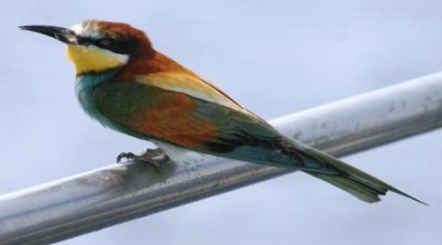
The picture shows a bee eater which must have got disoriented as it spent a couple of hours perched on the pulpit while sailing in to Suez.
We were in no hurry to race on ofter reaching Port Ghalib, but the ideal weather window turned up after 9 days in the marina so off we went. Unfortunately the only weather forecasts we can get for the Red sea are computer models. The general trends are normally correct but the predicted wind speeds appear to waver a bit so we take a chance. All we know is that there will be headwinds in this part of the Red Sea.
We spent the first night gently motoring into a light headwind and arrived at the tourist complex of Hurghada and stopped for a short break and then eventually anchored for the night at Endeavour Harbour at the mouth of the Gulf of Suez, where we had a swim and snorkel amongst lion fish. We contemplated the weather for the next 150 miles to Port Suez and reached the conclusion that if we didn't linger we would get light, variable winds all the way.
We left at 6am with 3 other yachts. In the day we could see both sides of the Gulf shrouded by dramatic ranges of hills completely bare of vegetation. During the night the shores were lit up with strings of lights, maybe tourist resorts. There were also a number of oil complexes to dodge but they were well marked. The big ships went in their designated shipping lanes so we were well away from them. As the morning dawned we felt we were in the middle of an ocean as we could see no coast.
We had been experiencing a lovely southerly wind, but this came to an abrupt end and a confused sea emerged with a gusty 25 knotter on the nose with a dust storm. At 25 miles from the Suez canal we ducked into an anchorage to wait for the wind to drop, which it did, and at full speed ahead we arrived in good time at the Port Suez yacht club. All the other grotty yachters had bashed their way up earlier. So much for weather computer models.
Red Sea Summary
11 May 2010 | Port Suez
Alison No wind
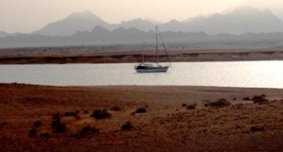
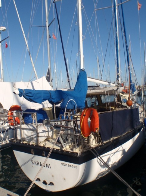
Summary of the Red Sea - photo is of Saraoni in Marsa Tarajal
We departed on the 14th March from Aden and are just about to tie up at the entrance to the Suez Canal on the 9th May. In this 8 week period we have covered more than 1,500 nautical miles anchored in more than 20 different anchorages, some for several days.
The scenery began with barren, windswept beaches and onto stark, bare volcanic land to flat ancient coralline islands and then we cut through desert landscapes some with an array of red, light browns and golden colours others bordered by distant bare mountain ranges. The sky was constantly clear which radiated onto deep, clear blue seas.
Sailing alongside the desert was truly amazing. At regular intervals swathes had been cut inland through the coral reefs to form natural harbours that provided welcomed sheltered and were rarely occupied by people. An addition to that, as there was not much living on the land, were the beautiful coral reefs surrounding these harbours.
Coral and sea life left alone by human interference. We observed turtles, rays and sharks regularly as well as a multitude of colourful fish, some species endemic to the Red Sea. Each place we could have stayed another day but were pushed on by the wind conditions, The southern part, up to Masawa, was dominated by favourable southerlies, 15 degrees north. But from here up to 30 degrees northerlies are the dominant wind. Too often, they blew too strongly to make any headway and when they eased off we had to make a mad dash as far as we could get, often missing places that we would have loved to have visited for a day or two.
We passed through Eritrea, Sudan and Eygpt. The feel of Islam lingered as we moved on. Women covered up or never seen. Men dressed in long, white or not so white long robes. Affluence was rarely seen, even in the bigger towns many of which had crumbling and partly completed buildings. Donkeys and camels were commonly used for transport and the buses both town and country were bursting at the seams.
The Red Sea and all that we saw was a great surprise and an unforgettable journey.
The Egyptian border
24 April 2010 | Marsa Umbeila
Geoff - 20 knots plus from NW
We are now in Marsa Umbeila, 2 miles South of the Sudan / Egyptian border and have been here for 5 days with the North West winds up and roaring. The marsa is one of the nicest places on the Red Sea coast : shallow, good holding and well sheltered. It's easy to get ashore at any time, despite the wind and there is good walking and fantastic coral reefs close by.
The marsa entrance like most of the others is lined by fringing reefs that drop off into the deep marsa channel, but Umbeila's is easier to get to than the others. The water is clearest when the wind isn't blowing, which is rare, but we have seen a few turtles and white tipped sharks and a lot of fish and coral.
The water is now noticeably cooler and the wet suits have been dragged out from their hiding places in the boat's recesses, not having been used since New Caledonia. In the desert nearby, goats and camels roam searching for edible green stuff of which there isn't much. The coastal mountain range looms close by but disappears at times in the haze. One or two vehicles with men in billowing robes have been seen, but it's a really desolate place to live in.
One of the most desolate places of all is the Egyptian border post very visible as a stark collection of tin huts on the coast just across the border fence. A week before we arrived, four yachties wandered across the border lured by offers of cups of tea by the border guards and then get promptly "arrested" by returning military. The incident played itself out rather bizarrely and the four - 2 kiwis and 2 Dutch - were relieved to be released in the middle of the night. Despite the many blogs and reports from earlier years we have seen little of any military anywhere on the Red Sea coast except in the few ports we have been in.
Beyond Marsa Umbeila, it is 100 miles or so across Egypt's Foul Bay and Ras Banas. We will aim to stop at Dolphin Reef, 20 miles past the Ras, where pods of dolphins are apparently happy to swim with humans.
Marsa hopping
19 April 2010 | Khor El Marob
Alison 20 knots NW
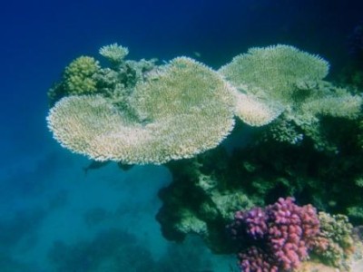
Pics from top left : Marsa Infeikal, underwater, camel, mountains near Khor El Marob, Risso's dolphins by Saraoni's bow.
We are now 10 miles from the Eygptian border enjoying the stunning scenery of desert, mountains and sparkling blue seas. Entering this marsa, an inlet carved into the desert, is like being in a place that is surreal. The scenery is like something from a massive oil painting painted by someone with a vivid imagination.
Photographs cannot do it justice as the majestic mountains emerge out of the desert landscape bordered by a deep blue sea whose colours are enhanced by the clear skies and ever shining sun. You have to close your eyes and reopen them to make sure what you see is true. On the way here we have hopped from one marsa to another along the desert coast through reefs and islets.
The seas are empty of other boats - no fishing fleets or coastal barges and the land is empty of human presence for the most par. In one place we saw a train of about 100 camels being herded along the coast. Apparently these are herded by Bedouin of Saudi origin, smuggling the camels from West Sudan along the coast and over the mountains into Egypt where camel meat is more highly valued than in Sudan.
In a Sudanese marsa
13 April 2010 | Marsa Fijab
Alison NW 20 knots, clear skies
We motorsailed from Suakin to Port Sudan via the Umbria reef to have a swim. The water was clear but not too much sealife. We were aiming to snorkel around an old Italian 2nd world war shipwreck, the "Umbria", scuttled by it's captain on the way South to Massawa, to avoid the British taking it's cargo of war munitions, but we actually unknowingly sailed over it rather than swum over it! It must have disintegrated somewhat and was lying well below sea level, although the two funnels were supposedly on the surface.
Port Sudan, rather unbelievably a well kept, modern port was nice and calm despite the comings and goings of large ships.
We are now anchored in Marsa Fijab, an anchorage surrounded by low islands and coral reefs. It is quite windy and hard to get ashore but we finally managed to connect our 3G phone to the laptop and at a Sudanese pound a day (40 US cents) can get internet as long as a phone tower is reasonably close which it is : about a mile away. The 9 boats also wind bound in here are all merrily clicking away in one of the most remote spots in the world!
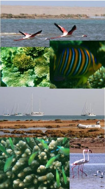
The marsa has some good coral life and birdlife typical of these shores : flamingos, ospreys, crab plovers and other waders and huge goliath herons, Africa's largest. A few nomadic camel herders and fishermen live nearby and their camels wander over the beach.
The forecast is for a few days of calm weather in two days time : these periods are when the little groups of Northbound yachts all make their passage a bit further up towards the Mediterranean : this is still 700 miles away!
Port Sudan, rather unbelievably a well kept, modern port was nice and calm despite the comings and goings of large ships.
We are now anchored in Marsa Fijab, an anchorage surrounded by low islands and coral reefs. It is quite windy and hard to get ashore but we finally managed to connect our 3G phone to the laptop and at a Sudanese pound a day (40 US cents) can get internet as long as a phone tower is reasonably close which it is : about a mile away. The 9 boats also wind bound in here are all merrily clicking away in one of the most remote spots in the world!
The marsa has some good coral life and birdlife typical of these shores : flamingos, ospreys, crab plovers and other waders and huge goliath herons, Africa's largest. A few nomadic camel herders and fishermen live nearby and their camels wander over the beach.
The forecast is for a few days of calm weather in two days time : these periods are when the little groups of Northbound yachts all make their passage a bit further up towards the Mediterranean : this is still 700 miles away!
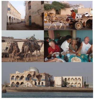
The Red Sea and Sudan
07 April 2010 | Suakin, Sudan
Alison and Geoff - Headwinds
Sudan - Suakin
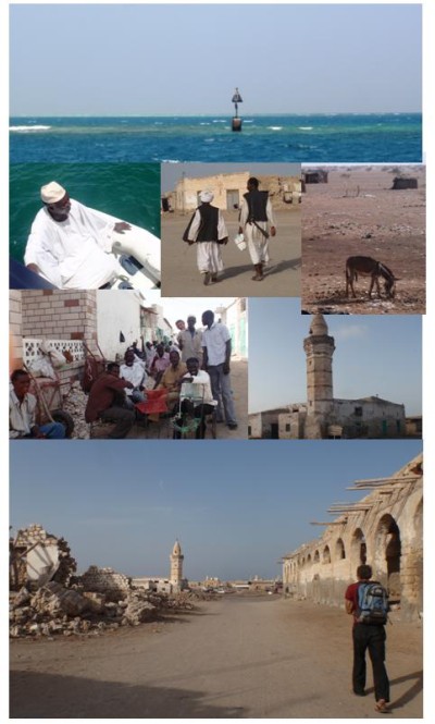
Pics from top : Shubuk channel reefs; Agent Mohammed uncomfortable in our small dinghy; Two old timers with sword; donkey in Sudan desert scene; friendly Port Sudan locals; ruins of old and (new) Suakin.
We were rather wondering if, in these stronger NW winds we would make any progress at all. We took off, anyway, for the 15 miles to the Sudanese port town of Suakin. The winds lightened and we gently motor sailed Northwards close to the coastal fringing reef. As we turned into the channel to the port we were entranced by the striking turquoise waters and even more entranced by the ruins of the ancient old slave port of Suakin, as we passed into the peaceful inner harbour.
Donkeys are used to cart water and just about everything else in this small town and the scene is almost Biblical. The small streets are dominated by men in robes in different shades of white sitting around or striding along carrying long swords in colourful scabbards.
Women are clearly almost absent from the scene. But the people are welcoming and we feel quite safe. Darker, more recent Sudanese history however links this old slave port with the genocide and struggle for liberation in the South, at the moment going through a fragile peace.
For generations the black African people of the South have suffered from exploitation, enslavement and virile racism by the Arabic people of the North and the Bashir regime in Khartoum has been implicated in blatant support of the Janjaweed militia that have been responsible for much of the death and destruction in Darfur. We have again landed in a troubled country about to go through questionable elections and it will be interesting to see how things pan out for the poor people of Sudan.
The Red Sea - pushing northwards
07 April 2010 | The Red Sea
Alison and Geoff - Light NNE sunny
Motor sailing northwards from Massawa / Dyfnein and Khor Nawarat
Pics from the top :
Beautiful Eritrean island of Dyfnein on the Northern Dahlak bank; yachties mneet the miliotary on Dyfnein's beach; French gaff schooner;tipi building crabs; yachts awaiting winds to abate
The next leg brought light NNE winds so we were able to motorsail but we couldn't leave too early as we couldn't clear out of the port of Massawa until 7 am. Our destination was Khor Nawarat, some 175 miles away. Studying the MaxSea charts we spotted a small island called Dyfnein 60 miles up the track which we thought would make a nice break.
As we progressed, we gathered from the VHF traffic that 2 or 3 other boats were in front of us heading that way so as we closed in on the island we asked them to make sure they were well lit as we would arrive after dark. All went well and we stayed a delightful 2 days there waiting for the Northerly to die down . The water was crystal clear so we did some snorkelling and also walks on the island and spotted flamingos, pelicans and many other birds as well as tipi building crabs.
The winds changed and off we went leading, by now, a fleet of 11 yachts. A nice 24 hour sail of 115 miles to the inconspicuous harbour of Khor Nawarat ensued. We anchored behind Bushy Island which gave us some nice shelter from the Southerly gusts. After some shut eye and a walk on the island we took advantage of the favourable winds and headed 50 miles to Shubuk channel and Long Island.
All these areas are flat and desert like with occasional, scant vegetation but no big trees although the seas abound in marine life. Dolphins, fish and seabirds are commonly seen and it is actually easy to catch fish on a trolling line. A 2 m fish, species unidentified, was chasing the lure as it was being pulled in. One of the larger kiwi yachts had a fish smoker and was regular having fish smoking sessions on the beach.
At Long Island, a storm sidled past in the night - no rain, but a wind shift to NNW from NE ensued so the next morning we bashed our way through the reef strewn water of the Shubuk channel. It is reasonably well beaconed but eye navigation is also necessary. We spent the night at our first marsa, Esh Sheik Ibraham. Well sheltered from the lumpy seas but careful eye navigation was required between the reefs.
Eritrea - Asmara
07 April 2010
Alison and Geoff - Cool
Asmara
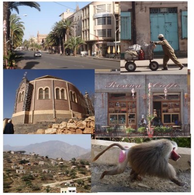
Pics from top : Asmara's main boulevard; doing the shopping?; coptic church; patisserie/cafe; highland village; male hamadryas baboon on roadside
7 of us boarded a minibus from Massawa for the 4 hour journey to Asmara which is 2300 m up in the Abyssinian mountains. What a journey through the desert! Herds of camels and goats and donkeys were spotted on the side of the road. Overall not much habitation but awesome scenery as the minibus snaked its way up the good, contoured road into the mountains. There were a few small towns and it was hard to imagine how people could make a living in such harsh surroundings.
Asmara was quite a surprise, a bustling metropolis compared to Massawa. Very clean and with wide, tree lined boulevards. A hotel was found for 10 US dollars and then a restaurant, Italian style of course, then a wander around. A visit to the outdoor metal recycling centre was an eye opener as anything and everything was being made from recycled 200 litre drums. Welding, hammering and moulding were all underway. And then another Italian restaurant!
The Sunday morning train journey was one of the Asmara attractions but we opted to go to the rubbish dump to find Hamadyras baboons. They apparently have breakfast and lunch there. Some of the other yachties went shopping while others did the 4 hour train journey. After a 40 minute walk we found a good viewpoint of the edge of the rubbish dump and watched the baboons through binoculars and took some photos with the zoom lens. It was nice to see some wildlife in a country devastated by war and still in the throes of recovery.
Eritrea - Massawa
07 April 2010 | Red Sea
Alison and Geoff - Hot and calm
Massawa
Pics from top : quiet steet in the old town; donkey cart; camel loads; yacties eating alla Italiana; bombed out palazzo (Governor's palace)
On arrival in the port we observed the unloading of food aid from the holds of large ships, grain products for those people who have not yet fully recovered from the ravages of war. We assumed that it was headed for the refugees displaced from war affected Darfur in Southern Sudan.
Ruined buildings mixed with new bordered the harbour. The ruins were caused by the long struggle for liberation by the Eritreans from their latest colonial master - Ethipopia. In previous decades, the Ottomans, the Italians and the British had all left a mark on this small African country with a a long Red Sea coastline.
The war in Massawa was particularly bitter as the port was a valuable outlet for Ethiopian trade. The old town of Massawa is now a sleepy place with southern European stone architecture dating back to the colonial Italian days. We soon discovered that Eritrea is also a "permit" country. We needed visas to visit Asmara, the capital, 40 US dollars each, easy to get, permits from the tourism office to go on the 115 km road to Asmara and to get diesel.
A bit of waiting around but all was done and the taxi driver dropped us off at Beaches Bar with other yachties for lunch. Italian food was available as well as cheap beer. People were ordering pizza, lasagne, spaghetti, beefburgers and the local dish, shiro, all at a fraction of western prices and it was only a 30 minute walk back to the harbour. There are some bars on the harbour front as well.
The Red Sea-sailing to Massawa
07 April 2010
Alison and Geoff - Northerly winds
Pics from top : Southerly gale at anchor at Ras Terma; Anfile bay island anchorage; Marsa Dudo and SV "Sundance"; Shumma island beach barbie; Adjuz island; friendly fishing dhow at Adjuz
It was time now to study the weather patterns in this area, so some gribs and buoyweather spot forecasts were downloaded from Sailmail. We established that soon we would be at the convergence zone, where sailing stops and motoring begins.
The second night at Mersa Dudo the wind dropped and all was calm. The wind shifted gently to the land and we motor sailed northwards to Anfile Island which was almost flat and covered in coral fossils and Adjuz Island, which had a nice anchorage off a sandspit and where local fishermen traded a mackerel. We made an involuntary stop on the sandbank, going aground for nearly all day until some heaving and shoving, sand tunneling and throttle use cleared us off at the seconf high tide of the day.
Next stop was Shumma Island, where we anchored behind the reef with several other yachts. Good for snorkelling and we all had a great beach barbecue, but the wind blew up from the NW, so in the morning we made the 30 mile track for the port of Massawa. Sailing half the way after a wind shift to the North East. We dropped the anchor just in time to visit the port authorities, pay our money and have a look around.
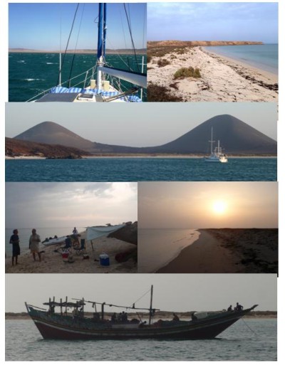
The Red Sea- Cruising northwards
07 April 2010 | Red Sea
Alison and Geoff - Southerly gales
Cruising northwards
We departed at 2 am for the Gates of Sorrow intending on staying on the Eastern side to stay out of the shipping channel. The wind was quite a steady 15 knot ENE so we weren't surprised when it reached 20 to 25 as we sailed briskly into the Red Sea at dawn. As we crossed the shipping lane to the Eritrean (African) side of the Red Sea the winds increased slowly to almost 40 knots astern (not unknown in these waters).
We finally anchored at the little island of Fatuma Deset, which was windy but good holding. Yachts on the same passage spread out as they worked out how to tackle the strong winds. Some, in a hurry, took advantage of the Southerly blow and raced Northwards. We, however, were intent on cruising, not racing. The wind dropped a little overnight but on leaving in the morning it was soon up to 30 knots as we rounded the point at Ras Terma.
Awe inspiring mountainous desert scenery lay before us. Even though getting ashore was out of the question, we could watch the pencil thin Eritreans fishing in the shallows and zoomed in on a group of flamingos feeding in one corner of the bay. The American yacht, "Sundance" crept into another corner of the bay and also sat out the screaming wind. We set out at dawn heading for Mersa Dudo, some 50 miles up the Red Sea. The wind howled and whistled as usual but good progress was made and as we turned the point we were greeted by vast, volcanic scenery almost bare of vegetation. There was no sign of habitation except some stone fishing huts.
Departing Aden
07 April 2010 | The Red Sea
Alison and Geoff - light ENE
Onward bound to the Red Sea
Pics from the top : Ras Imran, Yemen, American yacht Frenzy 2, Ras Imran's beach; Bab el Mandeb scenes at dawn
It has been nearly a month since we left Aden in a light breeze to our first beach anchorage in Yemen's desert like landscape, Ras Imran, a delightfully quiet, crescent shaped bay. We went for a stroll along the beach and climbed up one of the bare hills around the bay.
Next stop was Ras Al Arai, the stepping stone to the Bab El Mandeb, the pass into the Red Sea. This anchorage had a small bustling village on its shores surrounded by bare desert scenery. We didn't go ashore but noticed women clad in black wandering along the beach. Quite a lot of loud music blared out of the village as the evening progressed so life was obviously not too gloomy.
The Colonel and the Queen
13 March 2010 | Aden, Yemen
Geoff, moderate easterlies, dry.
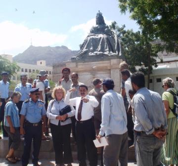
We're off down the coast of Yemen tomorrow after our short stay in Aden.
The winds are strong from the East, but we will take two days to reach the Bab el Mandeb : southern gateway to the Red Sea and then another week along the Eritrean coast to Massawa. We're in cruise mode after so many long, boring, sea passages! The next three African countries we visit are some of the world's poorest and the chances are this blog will be hard to update until Egypt.
The Port Colonel turned up for the official reception without his favourite plastic bag of qat, but resplendent in uniform and complete with an entourage of officers, Yemeni TV photographers and journalists plus a few men with serious looking guns. By this time, the assorted yachties had somewhat dispersed, with the Europeans, sniffing home, now so much closer, eager to make the last 1000 miles or so up to the Med as quickly as possible.
The reception took an unusual turn when the Colonel suddenly went walkabout with all of us following in his path like mice after the Pied Piper. Along the main road with the gun touting military holding up the traffic we strolled down to the little park where the gate key was searched for in vain. Another gate was breached and in we all trouped right up to a monstrously ugly statue of Queen Victoria (!) This was obviously the colonel's piece de resistance and we all posed for a photo shoot in front of the grande dame of British imperialism, of which the long dead Aden Protectorate (seized in the nineteenth century by the British from Arab chieftains as a base for combating piracy) was a small part.
According to the U.S., Yemen is one of those countries in potential danger of becoming a "failed state" due to the insurgency supposedly led by an Al Qaeda led faction in the North. For us transients, at least here in Aden, and for those who had flown up to Yemen's architecturally spectacular capital Sana'a, the atmosphere had never been more comfortable and friendly. Yemen seems to be getting it's main income from overseas remittances from workers in Saudi Arabia and the Gulf states, but was in no sense of the word chaotic or disordered.
Salaam Aleykum - Welcome to Aden!
12 March 2010 | Aden Harbour
Alison and Geoff /windy southeasterlies
Pics top left clockwise show :
Happy qat chewers (note the cheek bulge); happy proast eater; happy Yemeni girls on a day out; unhappy camel carrying a cart in old Aden;
steep volcanic cliffs above Crater and scene above the Port.
It was mid morning when we saw the first sight of the massive rock faces lining the Yemen coast loom out of the haze. The 20 boat convoy was still intact 10 miles from the port of Aden and yachts one by one called up port control to announce their impending arrival.
As we approached the turning point to the harbour a commanding voice came from Port Control warning us to hold back as a large ship was entering the harbour. Once inside there was a bit of a scramble to find a suitable anchoring spot as the 14 boat Vasca da Gamma rally heading Eastabout were still in port. We laid the anchor and then cleared customs and immigration within an hour. They issued us with shore passes and were very accommodating and did not set a time limit on our stay. Aden was to prove to be the friendliest and easiest going of all our Asian stopovers : "Welcome, Welcome to Yemen" was a common greeting from everybody we met.
We went for a walk around the small town and were picked up in a shared taxi by some other yachties and did a quick trip to the suburb of Crater and to Lulus Mall which has a supermarket that sells eveything at very reasonable prices. They had a variety of feta cheeses and halva as well. Fruit and veg were the cheapest we had seen. By that time we could hardly keep our eyes open and went back to the yacht and were surprised to find that we had anchored right opposite a rowdy bar that stayed open until 5 am. Not what you would expect in a Muslim country.
The most noticeable feature of Aden is the women covered from head to toe in black. Occasionally a slit of an eye might be seen. The men, however are dressed in trousers and shirts western style unlike Cochin where there were many loin cloths in evidence and Salalah long white gowns with matching hat.
The streets are narrow and congested with beat up cars and minibuses. The city itself sits underneath ancient volcanic hills bare of vegetation. Some houses are precariously balanced amongst and atop rocky outcrops towering above the harbour.
"Arab Town" is another place we visited bustling with men selling qat, a narcotic leaf which men, women and children chew by the cheekful. You have to chew quite a lot : the taxi driver gave some to Geoff to chew but it was pretty bland : a bit like Pacific island kava. One interesting feature in the small suburb near to the anchorage is the presence of a fenced and gated park reminiscent of those found in inner London. Many black clothed women were with their children playing on swings and slides and there was even the odd man wandering around with young children swinging from his hands.
The small restaurants that abound the streets serve "proast", a plate with divisions for different veg and meat and cost less than $2 a plate.
We filled our fuel tanks eventually after hustling and bustling at the fuel pontoon and ended up paying 63c a litre. Cheaper at the garage but we were not allowed to take containers through the port gates.
The port authorities are putting on an official reception for all the visiting yachties tomorrow and we leave soon after for the "Gates of Sorrow" : the Bab el Mandeb, the narrow entrance to the Red Sea and we will be anchoring for the first time on the shores of the East African nation of Eritrea.
Pirate alley conquered
12 March 2010 | Aden, Yemen
Alison / windy south easterlies
Convoy through Pirate Alley (from Salalah to Aden)
Pics from top left clockwise show:
Joost, the "Flying Dutchman", young convoy leader, talking to Mohammed, Salalah's amiable yachtie agent; We catch up with Hafskip, Joost's boat at the front of the convoy; Here come the Yanks : Delta group catches up with Saraoni (again); two Yemeni skiffs pass Rendezvous Cay : friends or foe ? : they stop to take pictures for their family photo album (!); Orinoco Flo : with young Brits on board, happy to arrive off Aden's steep cliffs
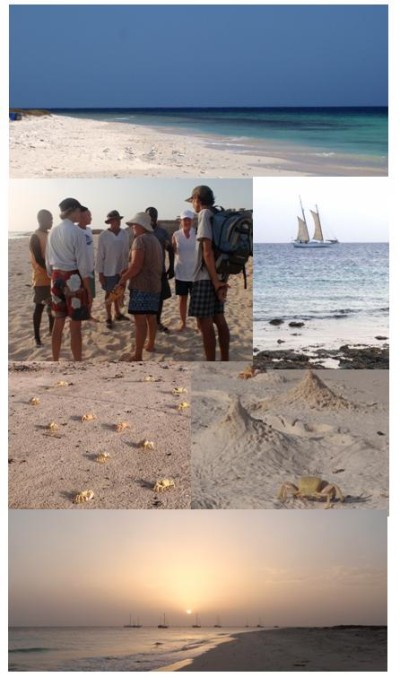
We left Salalah in the company of 19 other yachts at 9 am and after leaving the port boundary quickly assembled into our groups of 5 and into a diamond shape as we proceeded into one of the most pirate infested waters of the world.
The nights were sometimes like a scene from an unruly school classroom. One boat refused to keep up because it didn't want to be next to another yacht. We got bullied by one yacht because he was so scared of being pirate bait that he kept trying to push in front of us. A 55 footer suddenly did a 90 degree turn with no-one on watch. It took a lot of horn blowing and spotlighting to awake them. Another boat alongside us also did a sudden 90 degree turn in front of us. Another lot of horn blowing also took place.
In addition, a tearaway yacht made a mad dash through the convoy while we all stopped to check engine oil. The occupants were asleep. Later, another did a u turn in the middle of the night and started chasing a small fishing boat, which was weaving it's way through the fleet. This actually happened during a watch change and the new watch thought that the small white light on the fishing boat was a yacht light he was supposed to follow. There was also some general complaining about yacht speed.
Joost, the young leader, gave the rogues a good telling off in the morning and pleaded with the watch keepers to stay awake. He did a fine job and people stopped questioning his allotted speed however slow it was. His was the smallest and slowest boat, but was the leader.
During the day we were sometimes only 100 m from each other and at night we spread out as pirate attack was more unlikely. We did encounter some speed boats (Yemeni skiffs) which came through the fleet. One or two of them stopped to take pictures on their mobile phones (!) and another asked for biscuits. In the first practice exercise we were left behind, so requested that we be moved to the front as we are the second slowest boat. This was eventually granted even though the front line had been booked by early payers.
After a day, one yacht's engine failed so we had to stop for a while to sort out the problem. Following the cleaning of filters and with several attempts at trying to motor sail, Joost decided the boat should be towed so speed could be maintained. There simply was not enough wind to sail at reasonable speeds. There were a few delays but the seas were generally slight to moderate so the convoy managed to maintain reasonable speeds and we were all glad to reach the relative security of Aden and a good night's sleep.
The amazing thing about the five day 650 mile event was that 20 yachts could keep so close together for such a long period of time. There were no real mutineers and everyone, in the end, had done their best to protect against a pirate attack. We were unarmed and used the safety in numbers scenario and stopping and formed a tight group if there was any threat, which happened a couple of times but were both false alarms. Normally cruising up a coast, even friends might be 2 or 3 miles apart and just congregate at safe anchorages.
Read Report at>
http://www.noonsite.com/Members/sue/R2010-05-05-1
Pics from top left clockwise show:
Joost, the "Flying Dutchman", young convoy leader, talking to Mohammed, Salalah's amiable yachtie agent; We catch up with Hafskip, Joost's boat at the front of the convoy; Here come the Yanks : Delta group catches up with Saraoni (again); two Yemeni skiffs pass Rendezvous Cay : friends or foe ? : they stop to take pictures for their family photo album (!); Orinoco Flo : with young Brits on board, happy to arrive off Aden's steep cliffs
We left Salalah in the company of 19 other yachts at 9 am and after leaving the port boundary quickly assembled into our groups of 5 and into a diamond shape as we proceeded into one of the most pirate infested waters of the world.
The nights were sometimes like a scene from an unruly school classroom. One boat refused to keep up because it didn't want to be next to another yacht. We got bullied by one yacht because he was so scared of being pirate bait that he kept trying to push in front of us. A 55 footer suddenly did a 90 degree turn with no-one on watch. It took a lot of horn blowing and spotlighting to awake them. Another boat alongside us also did a sudden 90 degree turn in front of us. Another lot of horn blowing also took place.
In addition, a tearaway yacht made a mad dash through the convoy while we all stopped to check engine oil. The occupants were asleep. Later, another did a u turn in the middle of the night and started chasing a small fishing boat, which was weaving it's way through the fleet. This actually happened during a watch change and the new watch thought that the small white light on the fishing boat was a yacht light he was supposed to follow. There was also some general complaining about yacht speed.
Joost, the young leader, gave the rogues a good telling off in the morning and pleaded with the watch keepers to stay awake. He did a fine job and people stopped questioning his allotted speed however slow it was. His was the smallest and slowest boat, but was the leader.
During the day we were sometimes only 100 m from each other and at night we spread out as pirate attack was more unlikely. We did encounter some speed boats (Yemeni skiffs) which came through the fleet. One or two of them stopped to take pictures on their mobile phones (!) and another asked for biscuits. In the first practice exercise we were left behind, so requested that we be moved to the front as we are the second slowest boat. This was eventually granted even though the front line had been booked by early payers.
After a day, one yacht's engine failed so we had to stop for a while to sort out the problem. Following the cleaning of filters and with several attempts at trying to motor sail, Joost decided the boat should be towed so speed could be maintained. There simply was not enough wind to sail at reasonable speeds. There were a few delays but the seas were generally slight to moderate so the convoy managed to maintain reasonable speeds and we were all glad to reach the relative security of Aden and a good night's sleep.
The amazing thing about the five day 650 mile event was that 20 yachts could keep so close together for such a long period of time. There were no real mutineers and everyone, in the end, had done their best to protect against a pirate attack. We were unarmed and used the safety in numbers scenario and stopping and formed a tight group if there was any threat, which happened a couple of times but were both false alarms. Normally cruising up a coast, even friends might be 2 or 3 miles apart and just congregate at safe anchorages.
Read Report at>
http://www.noonsite.com/Members/sue/R2010-05-05-1
Oman - desert nation
02 March 2010 | Oman
Geoff and Alison - light southwesterlies
Pictures show from top left : a herd of camels, the coast near the Yemen border, fishermen at Al-Mugsail and a wadi North East of Salalah city.
A visit to Oman would not have been complete without a visit to the mountains and desert and of course, to see some camels. We drove for several kilometres towards the Yeman border and spotted herds of camels, goats and cows wandering among the rocky, desert landscape.
There was very little vegetation in sight and we wondered what the animals found to eat. It was rather interesting to see that some of the camel herders were tending the animals in 4WD's. Not unlike the modern, western farmer who, these days, would probably be bumping around on a quad bike. The camels are pretty bold and just wander across the main highways in expectation that all traffic would stop for them. Which it did, even though, perhaps, not too willingly.
We climbed high onto a mountain range which was shrouded in mist and quite cool. Dry river valleys (wadis) cut through the rocky terrain, which in the rainy season might have some water in them. We weren't really sure, but road signs indicated that rain was a distinct possibility. We also visited some blow holes, overhanging sea cliffs and saw some flamingos and other migratory birds.
| Vessel Name: | Saraoni (1) and Sundari (2) |
| Vessel Make/Model: | South Coast 36 and Beneteau 473 respectively |
| Hailing Port: | Lamb Island, Australia |
| Crew: | Alison and Geoff Williams |
| About: | |
| Extra: | CONTACT DETAILS Telephone / SMS number +61 456 637 752 (Australian mobile no.) +64 28 432 5941 NZ mobile no.) Email yachtsundari@gmail.com (main email address) |
Saraoni (1) and Sundari (2)'s Photos - Main
.JPG) |
A collection of photos taken while teaching and cruising in PNG's Milne Bay Province
74 Photos
Created 29 April 2023
|
 |
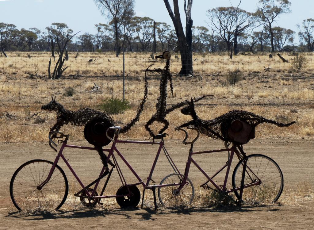 |
Some rather idiosyncratic metal sculptures in outback Queensland between Aramac and Lake Dunn
8 Photos
Created 27 September 2020
|
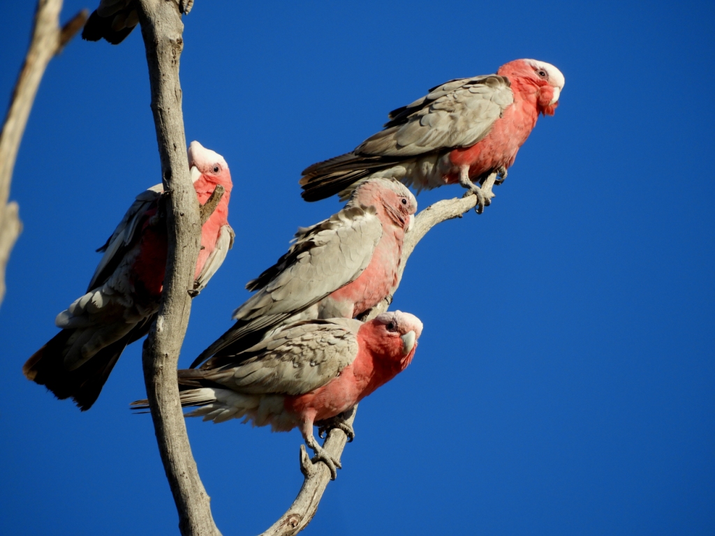 |
Birds and other critters on our Queensland inland safari
12 Photos
Created 27 September 2020
|
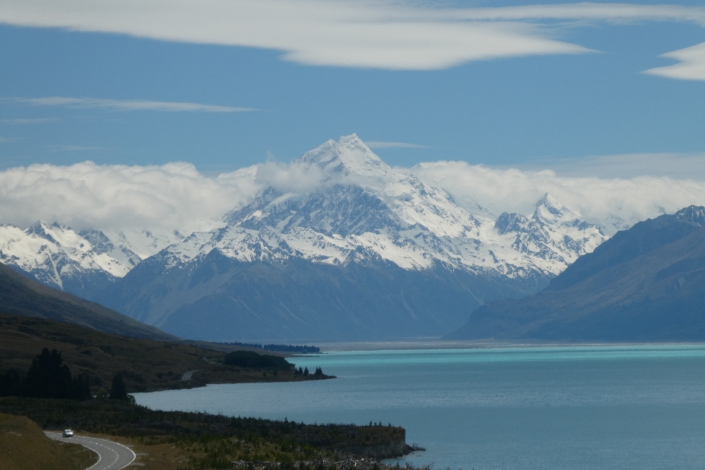 |
A collection of photos taken during the Tiki Tour of the Southern half of the South Island, November / December 2019
40 Photos
Created 15 December 2019
|
 |
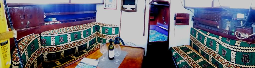 |
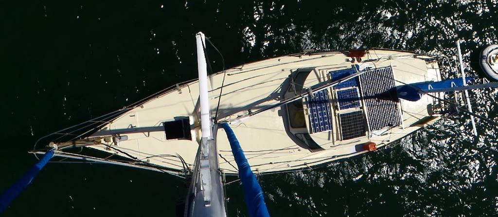
Photos taken of Saraoni. All interior photos were taken in the last week.
10 Photos
Created 2 April 2019
|
 |
50 Photos
Created 27 June 2014
|
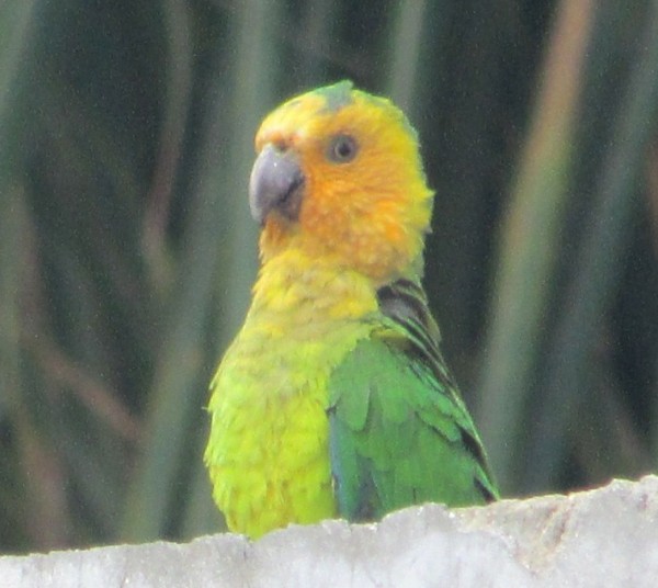 |
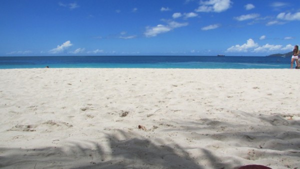
The ABCs - Aruba, Bonaire and Curacao are mostly low lying dry, scrubby islands in the Western Caribbean near the Venezuelan coastline
15 Photos
Created 21 May 2014
|
 |
 |
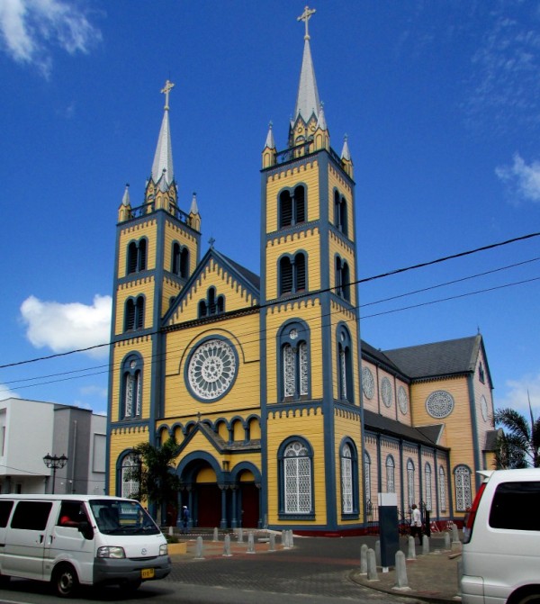 |
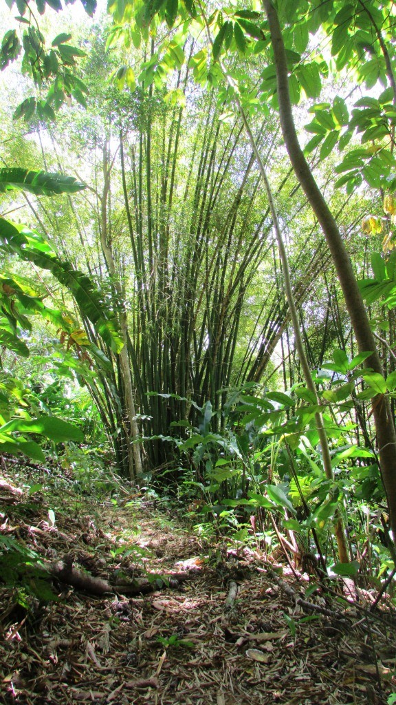
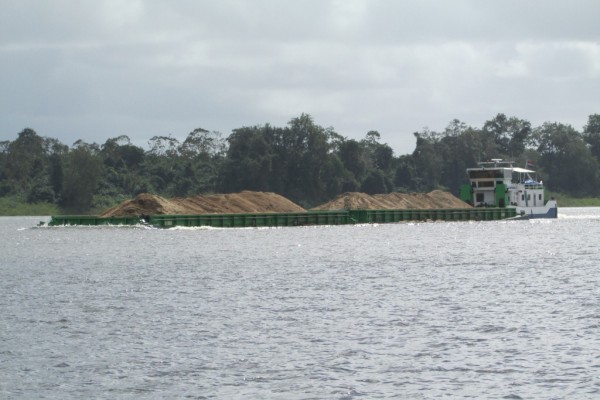
Images taken in and around Suriname's capital
40 Photos
Created 9 February 2014
|
 |
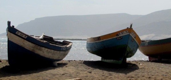 |
Images of the 2 islands in the Cape Verde island group we visited on our way across the Atlantic in 2013 - Sao Vicente and Santo Antaao.
37 Photos
Created 26 December 2013
|
 |
 |
 |
 |
 |
 |
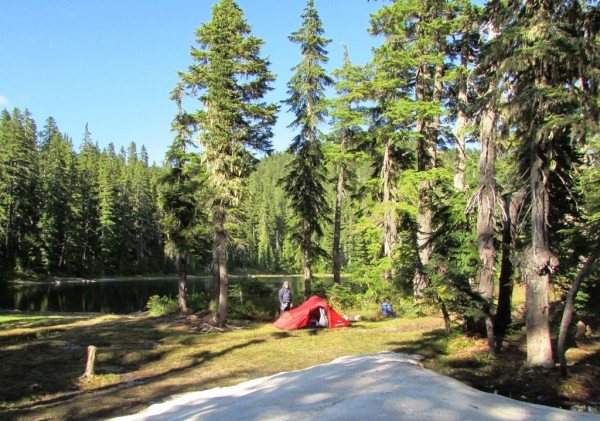
Unexpected meeting with old friends "in the woods".
6 Photos
Created 24 June 2013
|
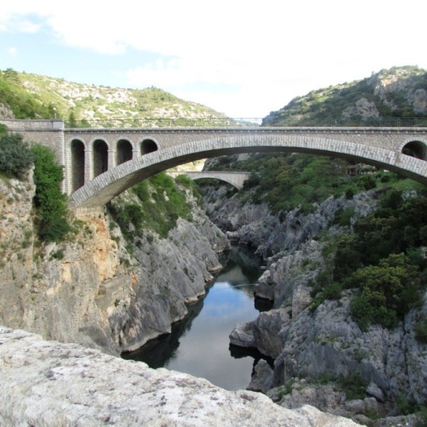 |
A brother found amongst the gorges of the Cevennes
5 Photos
Created 10 June 2013
|
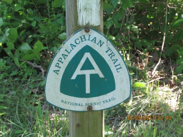 |
Photographic images of our long walk along the Appalachian mountains in the USA
26 Photos
Created 10 June 2013
|
 |
 |
 |
 |
 |
 |
 |
Greece is in the throes of a recession, but they still have the last laugh - never far from the sun, the sea, colour, culture and bags of history. The photos document our Aegean odyssey from May to September 2011
31 Photos
Created 17 December 2011
|
 |
O.K. We're mad, but we somehow prefer a home on the sea to one on dry land.
12 Photos
Created 17 December 2011
|
 |
Kathmandu, Patan and Bhaktapur - the three ancient city states of the Kathmandu valley have mediaeval architectural wonders in their Durbars and old town areas - a meshing and merging of Hinduism, Buddhism and materialism
9 Photos
Created 17 December 2011
|
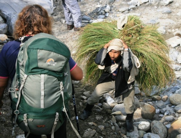 |
Some of the shots taken of us while on one of our 30 odd days on the three main mountain trails we walked in the Anapurnas and Helambu region of Nepal's side of the Himalayas
10 Photos
Created 15 December 2011
|
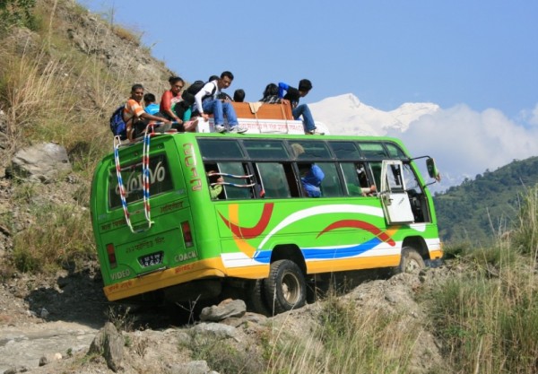 |
People make the Himalayas a unique place to walk through. From Hindu rice and buffalo farmers in the foothills to the Buddhist villages in the highlands so influenced by Tibetan ancestry and trade over the passes
16 Photos
Created 15 December 2011
|
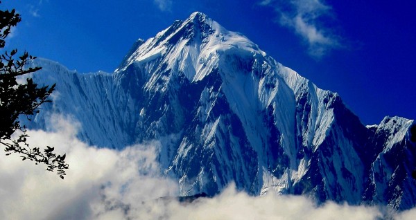 |
Nepal has ten of the world's highest mountains within its boundaries or shared with India and Tibet - these are truly giant peaks!
22 Photos
Created 15 December 2011
|
 |
These were all photographed in the wilds of Chitwan and Bardia National Parks - which are two of the last havens of biodiversity in Nepal's low lying Terai district.
18 Photos
Created 14 December 2011
|
 |
Saraoni hauled out on Finike's hardstand for biennial maintenance and painting
3 Photos
Created 26 April 2011
|
 |
 |
 |
 |
 |
 |
 |
 |
 |
The small rocky island of Kastellorizou is Greece's most remote island
7 Photos
Created 11 December 2010
|
 |
Cruising and walking Turkey's Lycian coast September and October 2010
19 Photos
Created 11 December 2010
|
 |
 |
Images taken while walking sections of the 500 km Lycian Way or Lykia Yolu on the South West Mediterranean Coast of Turkey
11 Photos
Created 9 November 2010
|
Exploring as Much as We Can Until We Can't
Who: Alison and Geoff Williams
Port: Lamb Island, Australia
Blog Categories by Year
- 2023 Aust NZ
- 2022 Aust
- 2021 Aust
- 2020 Aust, NZ
- 2019 Aust, NZ
- 2018 New Cal Aust and NZ
- 2017 NZ, Aust, Tonga, Fiji, New Caledonia
- 2016 NZ Niue and Canada
- 2015 Pacific Crossing Panama to NZ, Galapagos, French Polynesia, Cooks, American Samoa and Tonga
- 2015 and 2014 Suriname Colombia Panama and Costa Rica
- 2014 U.S. Cycle trip
- 2014 Caribbean Islands Trinidad to Aruba
- 2014 Atlantic Crossing Cape Verdes to Suriname
- 2013 Cape Verdes, West Africa
- 2013 Canaries Post USA
- 2013 U.S.A. Hiking Trips Appalachians and Cascades
- 2013 Canaries Pre U.S.A.
- 2013 Morocco
- 2012 South Africa and Swaziland
- 2012 Mediterranean Spain and France
- 2012 Italy
- 2012 and 2011 Greece
- 2011 A Quarter Century on the Sea
- 2011 Nepal
- 2011 and 2010 Turkey
- 2010 Oman Yemen the Red Sea and Israel
- 2010 South Asia: India and Sri Lanka
- 2009 Malaysia and Thailand
- 2009 and 2008 Aust and SE Asia
- 2007 Australia
- 2006 NZ to New Caledonia and Australia
- A Tale of Three Boats
- 1978 to 2018 Perspectives on a Long Journey
SailBlogs Friends

