
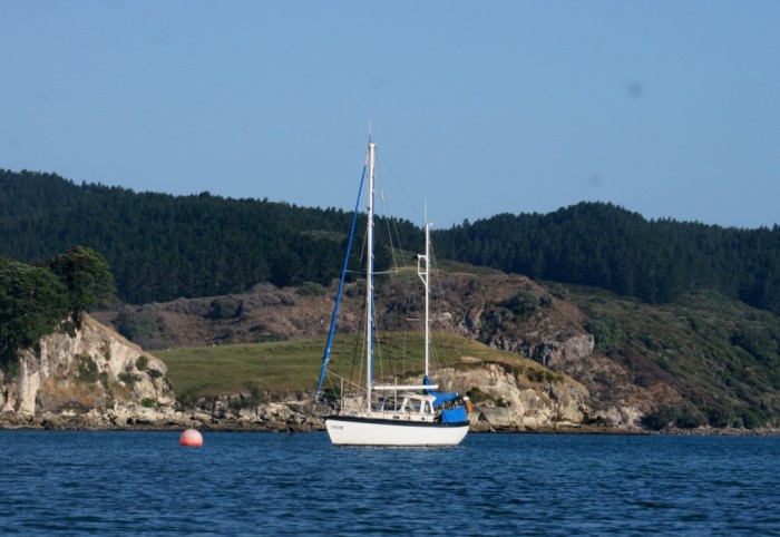
SVs Saraoni and Sundari
09 April 2024 | The Broadwater, Gold Coast, Australia
03 March 2024 | Hope Harbour marina, Gold Coast, Australia
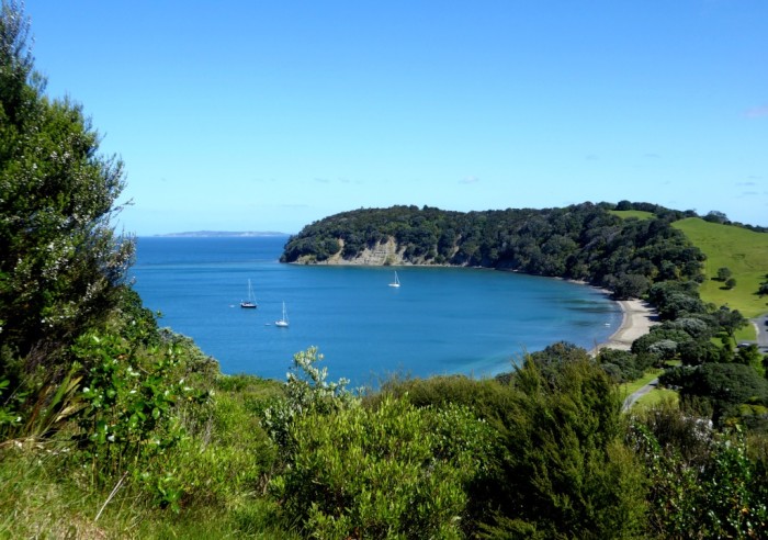
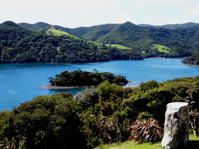
03 January 2024 | Karragarra Channel, South Moreton Bay Islands, Queensland
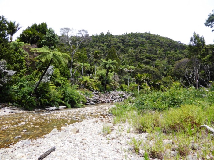
15 December 2023 | Riverheads, Mary River, Great Sandy Strait, Queensland
23 October 2023 | Great Keppel Island
07 August 2023 | Trinity Inlet, Cairns, North Queensland
23 July 2023 | Trinity Inlet, Cairns, Far North Queensland.
07 July 2023 | Cairns
19 May 2023 | North West island, Capricornia Cays, Queensland
15 May 2023 | Burnett River, Bundaberg, Queensland.
29 April 2023 | Manly marina, Moreton Bay, Queensland, Australia
04 March 2023 | South Auckland, New Zealand
18 January 2023 | Gold Coast Broadwater, Queensland
17 November 2022 | Collie, Southern WA, Australia
29 October 2022 | Albany, SW Australia
14 October 2022 | Augusta, WA, Australia
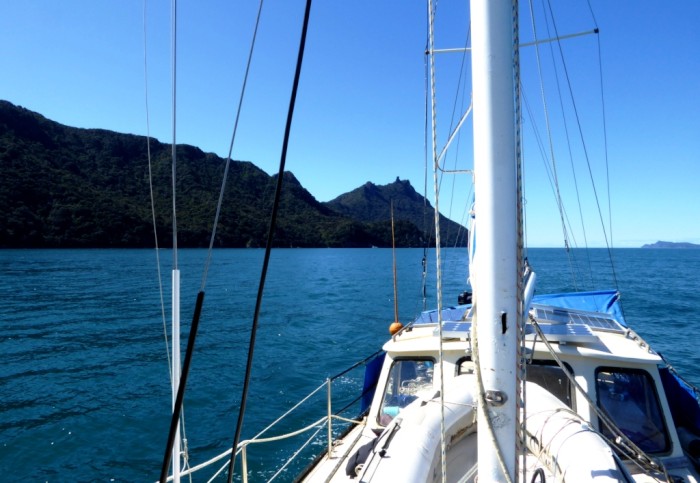
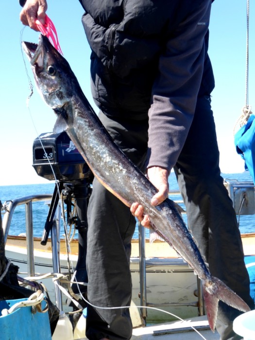
15 August 2022 | Karragarra Passage, Southern Moreton Bay, Queensland, Australia
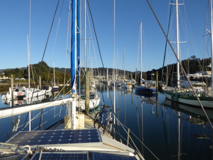
14 July 2022 | Raby Bay, off Moreton Bay, Queensland
13 June 2022 | Camooweal, Far West Queensland
20 May 2022 | Alice Springs, Northern Territory, Australia
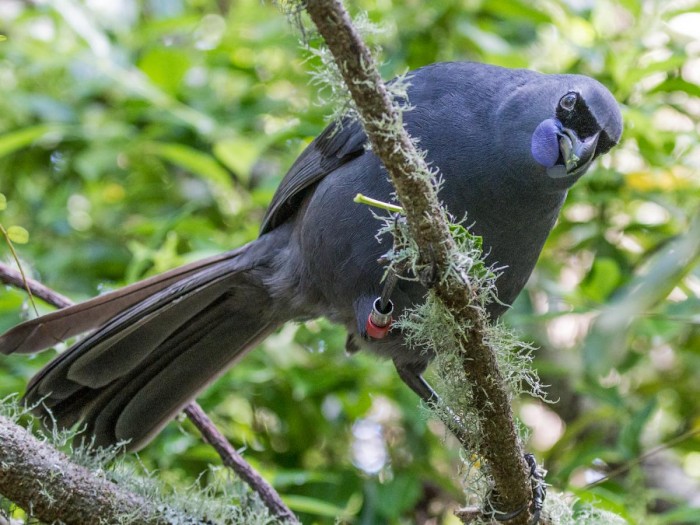
Tiritiri Matangi - Bird Island!
24 December 2016 | Kawau Bay
Alison and Geoff, windy and cool
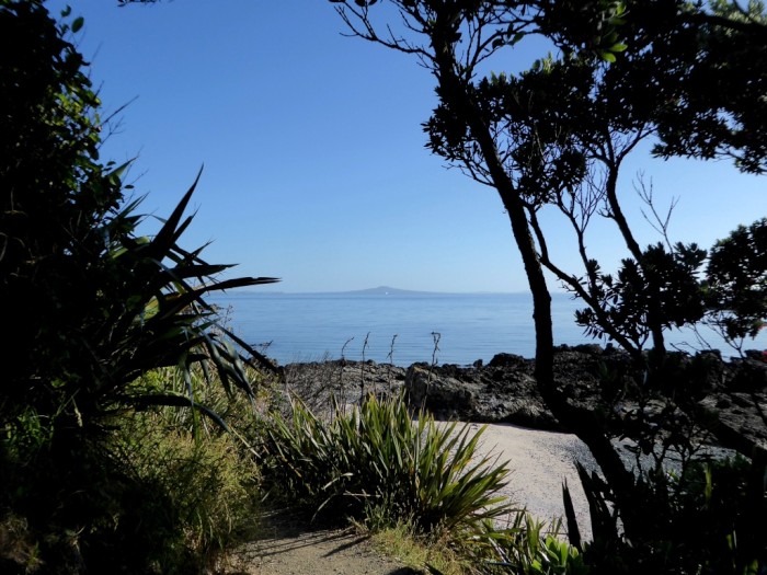
Photo shows the unmistakable volcanic hump of Rangitoto Island just off the Auckland Coast from Tiritiri Matangi's shore in the Hauraki Gulf.
The small island of Tiritiri Matangi lies just off the end of the Whangaparaoa Peninsula in the Hauraki Gulf. It's a place we like to visit whenever possible. It is an open sanctuary managed by DOC with a lot of help from volunteers. It was one of the earliest of the restoration sites to open its doors to visitors. Most of the island sanctuaries are closed unless you have a permit - the reason being it's hard to control re-invasions of little mammals and other unwanted invaders, especially as it is a painstaking business ridding these places from them in the first place.
NZ's native fauna and flora has a hard job surviving, at least the species that have evolved on the mainland, as the introduction of more competitive (and smarter?) animals and plants from around the world has seen a precipitous decline in what was here before people turned up. It was bad enough after the arrival of the first Polynesians, but got even worse after Europeans turned up. The British colonists didn't take to the NZ bush and brought in anything that reminded them of home with disastrous consequences.
There is an ongoing attempt to try and reverse the disappearance and extinction of truly native species and the island sanctuaries are a key part of the strategy. Places like Tiritiri allow NZers to experience what NZ might have been like hundreds of years ago.
It's taken a long time to get Tiritiri to where it is now. It started with almost bare grassland and a few native bird species. Unwanted mammals, including rats, mice, stoats rabbits and hedgehogs were eradicated and have been kept out by a combination of poisoned bait and traps.
Plants, especially trees, had to be planted in their tens of thousands and bird species that had long gone from the island were painstakingly reintroduced from other islands where they were still surviving. That included stitchbird / hihi; saddleback / tieke; parakeets/ kakariki; robins; kokako; whiteheads. Takahe and little spotted kiwi were rescued from the South island, almost extinct in their home ranges. Tiritiri has been such a success that it is now a source of bird populations for re-introductions elsewhere.
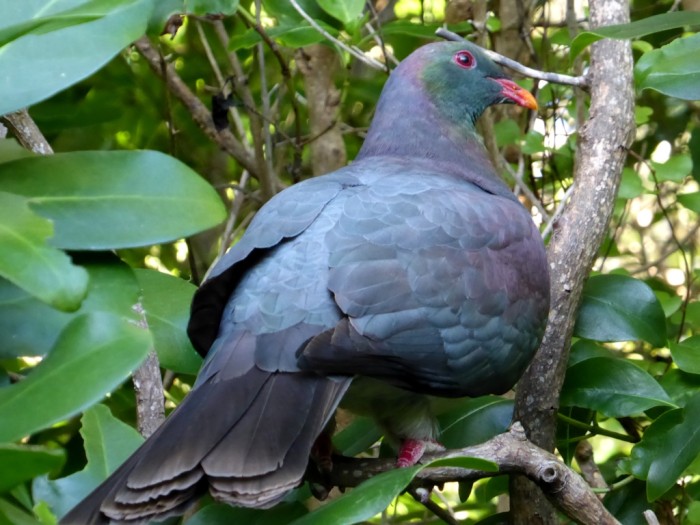
Kereru / NZ pigeon
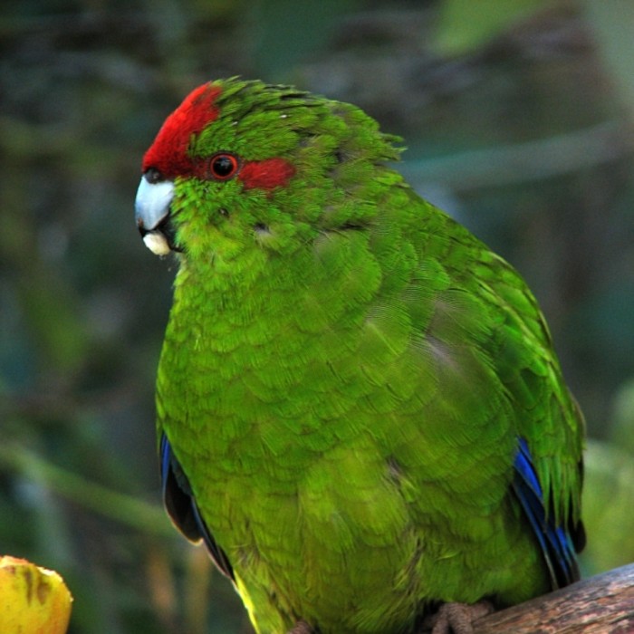
Kakariki / red fronted parakeet: mini version of the larger kaka parrot
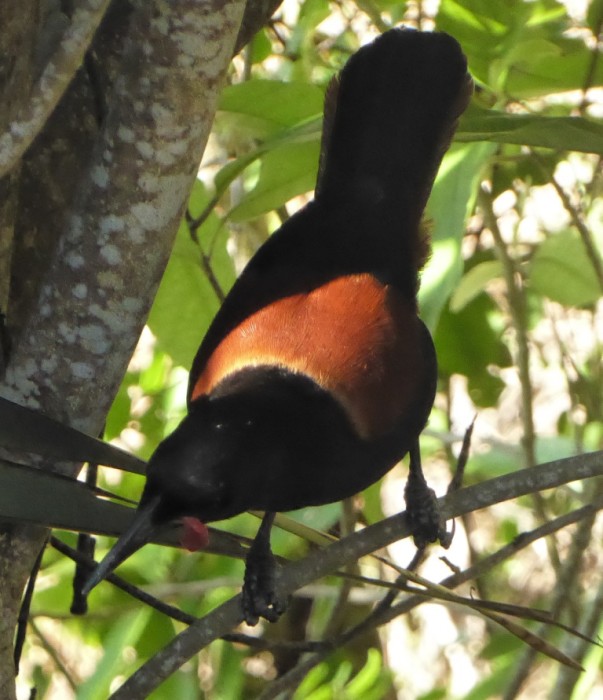
Tieke / saddleback / : noisy but vulnerable!
Kokako/ wattled crow: seen but not heard on this trip; heard but not seen in Pureora Forest on our Te Araroa walk earlier in the year.
It's hard anchoring at Tiritiri because you need a light NE wind and no swell to anchor safely. Fortunately, the conditions were just right after motor sailing across from the tip of the Coromandel Peninsula in light winds. We managed two trips ashore and were waken up in the early morning with a true dawn chorus: hundreds of bellbirds, tuis, saddlebacks, kereru, kakariki, gulls, oystercatchers and other birds, including quite a few British settlers (skylarks, blackbirds and thrushes) all squawking away in unison.
These restoration sites really depend on volunteer help, or lots of money, or both and that's a hard ask. The Key Government recently declared that they were going to commit to a "pest free NZ" by 2050, but only allocated $25 million to it. The cost of ridding NZ of mammals it doesn't want (possums, mustelids etc) has been estimated at over 50 billion dollars so maybe the announcement was all hot air and aimed at sidelining the recent Labour/ Greens agreement to cooperate in the run up to next year's election. We'll see!
We are currently anchored in the Kawau / Mahurangi area and heading back towards Tutukaka soon.
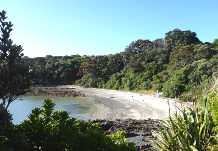
Tiritiri Matangi - Hobbe's Beach
The small island of Tiritiri Matangi lies just off the end of the Whangaparaoa Peninsula in the Hauraki Gulf. It's a place we like to visit whenever possible. It is an open sanctuary managed by DOC with a lot of help from volunteers. It was one of the earliest of the restoration sites to open its doors to visitors. Most of the island sanctuaries are closed unless you have a permit - the reason being it's hard to control re-invasions of little mammals and other unwanted invaders, especially as it is a painstaking business ridding these places from them in the first place.
NZ's native fauna and flora has a hard job surviving, at least the species that have evolved on the mainland, as the introduction of more competitive (and smarter?) animals and plants from around the world has seen a precipitous decline in what was here before people turned up. It was bad enough after the arrival of the first Polynesians, but got even worse after Europeans turned up. The British colonists didn't take to the NZ bush and brought in anything that reminded them of home with disastrous consequences.
There is an ongoing attempt to try and reverse the disappearance and extinction of truly native species and the island sanctuaries are a key part of the strategy. Places like Tiritiri allow NZers to experience what NZ might have been like hundreds of years ago.
It's taken a long time to get Tiritiri to where it is now. It started with almost bare grassland and a few native bird species. Unwanted mammals, including rats, mice, stoats rabbits and hedgehogs were eradicated and have been kept out by a combination of poisoned bait and traps.
Plants, especially trees, had to be planted in their tens of thousands and bird species that had long gone from the island were painstakingly reintroduced from other islands where they were still surviving. That included stitchbird / hihi; saddleback / tieke; parakeets/ kakariki; robins; kokako; whiteheads. Takahe and little spotted kiwi were rescued from the South island, almost extinct in their home ranges. Tiritiri has been such a success that it is now a source of bird populations for re-introductions elsewhere.
Kereru / NZ pigeon
Kakariki / red fronted parakeet: mini version of the larger kaka parrot
Tieke / saddleback / : noisy but vulnerable!
Kokako/ wattled crow: seen but not heard on this trip; heard but not seen in Pureora Forest on our Te Araroa walk earlier in the year.
It's hard anchoring at Tiritiri because you need a light NE wind and no swell to anchor safely. Fortunately, the conditions were just right after motor sailing across from the tip of the Coromandel Peninsula in light winds. We managed two trips ashore and were waken up in the early morning with a true dawn chorus: hundreds of bellbirds, tuis, saddlebacks, kereru, kakariki, gulls, oystercatchers and other birds, including quite a few British settlers (skylarks, blackbirds and thrushes) all squawking away in unison.
These restoration sites really depend on volunteer help, or lots of money, or both and that's a hard ask. The Key Government recently declared that they were going to commit to a "pest free NZ" by 2050, but only allocated $25 million to it. The cost of ridding NZ of mammals it doesn't want (possums, mustelids etc) has been estimated at over 50 billion dollars so maybe the announcement was all hot air and aimed at sidelining the recent Labour/ Greens agreement to cooperate in the run up to next year's election. We'll see!
We are currently anchored in the Kawau / Mahurangi area and heading back towards Tutukaka soon.
Tiritiri Matangi - Hobbe's Beach
Season's Greetings to All!
19 December 2016 | On passage from Great Mercury Island to Kawau
Alison and Geoff, lovely blue sky and 10 knots SW wind
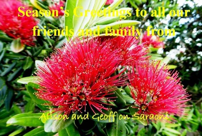
Photo is of the Upper North Island's glorious Christmas show, the red flowers of coastal pohutukawa trees
2016, Wow, what a year! We are really glad we were never born in Syria! Not that long ago, when based in Finike, Turkey, quite a number of people we knew visited Syria and remarked how friendly the people were. Most really enjoyed their trips and their impressions of Syria were generally favourable. Not long after, the Arab Spring precipitated a Middle Eastern chain reaction. The Assad regime over reacted in Damascus with brutal force, leading to the mess Syria is in now, although many other players have been at least partly to blame.
Some other big political dramas this year (Trump / Brexit etc.) too, which everyone is going to be at least indirectly affected by. Some of the trends in the U.S. and parts of Europe are more than a little scary.
Our year has been quite mellow by comparison. Maybe because we have got so used to making long journeys over the last 10 years, we just sort of kept on doing more of them! In January and February we completed 500 km on foot of New Zealand's sometimes tortuous Te Araroa trail from Tutukaka to the Volcanic Plateau, while in June to September we plodded along for 2,000 km between Vancouver in Canada's B.C. to Calgary in Alberta on 2 wheels. In between, we've sailed almost the length of our local swimming pool, from Whangaroa in the north to Whangamata in the South with many more whanga in between! We also slipped in a very enjoyable week on the Pacific island of Niue, "The Rock".
Money's been trickling in faster than it's been going out, after all the tapping away in our floating office. We've even done a bit of teaching in between! We haven't sold our Takahue Valley land block in the Far North yet and are waiting to do so before searching for any more acquisitions closer to where we keep Saraoni when we are not sailing around on it.
The boat is looking better, although progress on smartening up the interior seems to have become infinitely slow and tedious at times, especially as we have been living in and around all the chaos. We think we should be all set to take off to Fiji next year for the winter and early spring. Just to tone up our muscles and get reacquainted with N.Z.'s West Island, we are flying to Sydney on 1st Feb and cycling along the NSW South Coast, past East Gippsland and then over the Victorian Alps via Wangaratta to Melbourne. At least, that's the plan.
As for us right now, we are heading across the Gulf to Kawau Island from the Coromandel and hope to anchor off Tiritiri Matangi Island, one of N.Z,'s oldest restoration sites.
We wish all our friends and family, as well as anybody caught up in tragic conflicts this year, the very best for 2017.
Whangamata harbour, East Coromandel Coast
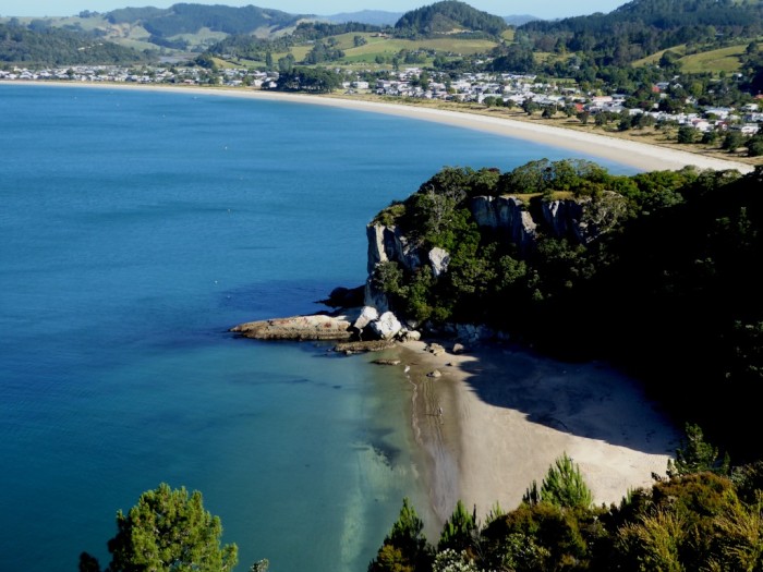
Lonely Bay in the foreground; Cook's beach in the background. We spent our first Christmas together camped in the manuka behind Lonely Bay with a large flagon of red wine nearly 40 years ago!
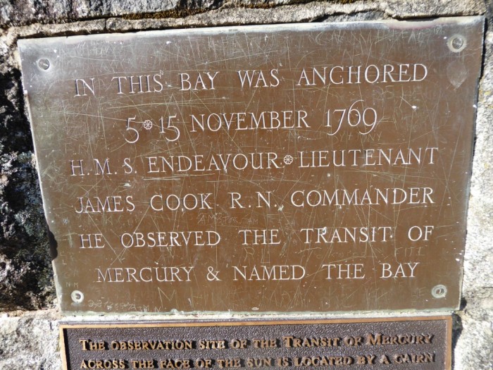
Cook beached the "Endeavour" here to scrub the bottom on his first expedition to NZ
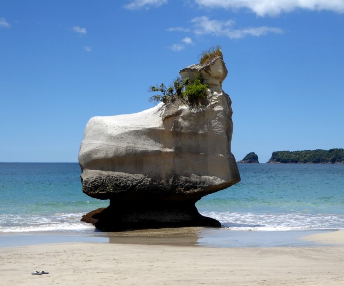
A much photographed rock at Cathedral Cove, near Hahei
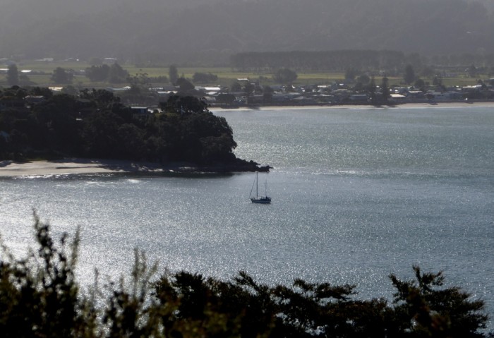
Crowded anchorage at Flaxmill Bay just outside Whitianga Harbour
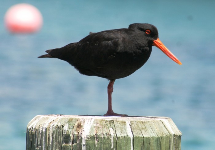
Oystercatcher at Mercury Cove
Mercury Cove at Great Mercury Island; free mooring courtesy of the islands' owners!
2016, Wow, what a year! We are really glad we were never born in Syria! Not that long ago, when based in Finike, Turkey, quite a number of people we knew visited Syria and remarked how friendly the people were. Most really enjoyed their trips and their impressions of Syria were generally favourable. Not long after, the Arab Spring precipitated a Middle Eastern chain reaction. The Assad regime over reacted in Damascus with brutal force, leading to the mess Syria is in now, although many other players have been at least partly to blame.
Some other big political dramas this year (Trump / Brexit etc.) too, which everyone is going to be at least indirectly affected by. Some of the trends in the U.S. and parts of Europe are more than a little scary.
Our year has been quite mellow by comparison. Maybe because we have got so used to making long journeys over the last 10 years, we just sort of kept on doing more of them! In January and February we completed 500 km on foot of New Zealand's sometimes tortuous Te Araroa trail from Tutukaka to the Volcanic Plateau, while in June to September we plodded along for 2,000 km between Vancouver in Canada's B.C. to Calgary in Alberta on 2 wheels. In between, we've sailed almost the length of our local swimming pool, from Whangaroa in the north to Whangamata in the South with many more whanga in between! We also slipped in a very enjoyable week on the Pacific island of Niue, "The Rock".
Money's been trickling in faster than it's been going out, after all the tapping away in our floating office. We've even done a bit of teaching in between! We haven't sold our Takahue Valley land block in the Far North yet and are waiting to do so before searching for any more acquisitions closer to where we keep Saraoni when we are not sailing around on it.
The boat is looking better, although progress on smartening up the interior seems to have become infinitely slow and tedious at times, especially as we have been living in and around all the chaos. We think we should be all set to take off to Fiji next year for the winter and early spring. Just to tone up our muscles and get reacquainted with N.Z.'s West Island, we are flying to Sydney on 1st Feb and cycling along the NSW South Coast, past East Gippsland and then over the Victorian Alps via Wangaratta to Melbourne. At least, that's the plan.
As for us right now, we are heading across the Gulf to Kawau Island from the Coromandel and hope to anchor off Tiritiri Matangi Island, one of N.Z,'s oldest restoration sites.
We wish all our friends and family, as well as anybody caught up in tragic conflicts this year, the very best for 2017.
Whangamata harbour, East Coromandel Coast
Lonely Bay in the foreground; Cook's beach in the background. We spent our first Christmas together camped in the manuka behind Lonely Bay with a large flagon of red wine nearly 40 years ago!
Cook beached the "Endeavour" here to scrub the bottom on his first expedition to NZ
A much photographed rock at Cathedral Cove, near Hahei
Crowded anchorage at Flaxmill Bay just outside Whitianga Harbour
Oystercatcher at Mercury Cove
Mercury Cove at Great Mercury Island; free mooring courtesy of the islands' owners!
Kia Ora Coromandel
23 November 2016 | Great Mercury Island. Coromandel East Coast
Geoff and Alison, sunny and warm
Photo shows stunning Coralie Bay on the east side of Great Mercury island off the Coromandel Coast.
We finally left Port Fitzroy in very calm conditions but soon the wind picked up from the south west and we more or less surfed into Tryphena at the bottom of GBI. There the wind howled all night up to 40 knots and the boat rocked and rolled in the not very well protected anchorage. The next morning on a good forecast we set off across the Colville Channel with a good beam wind. As we were getting into the lee of the bulk of Mount Moehau at the end of the Coromandel Peninsula, the nowcasting weather reports on Channel 20 progressively reported increasing winds at the Channel Island station - up to 35 knots again! Luckily, we escaped the worst and beam sailed it all down to Great Mercury in the company of enthusiastic common dolphins.
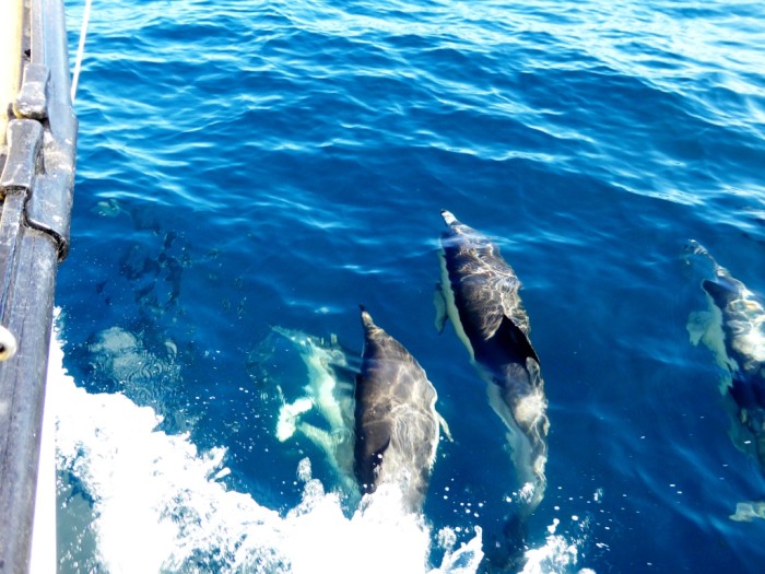
Friendly common dolphins on the Coromandel coast
Huruhi Harbour, better known as Mercury Cove, is the only all weather anchorage around the North East Coromandel coast, but is a well protected if relatively small spot. Great Mercury is jointly owned by multi millionaires Michael Fay and David Richwhite, but they allow yachties like us to wander at will over this lovely island. Even the large moorings are free to use if you get there before anyone else! The island is now pest free after an operation paid for jointly by DOC and Michael Fay. The island was a stepping stone for pests to get to the other islands nearby. Kakas are here and nesting petrels, but much of the land is run as a sheep farm and there are plenty of pine trees too. Obviously these aren't considered pests!
We are off tomorrow to catch the high tide into Whangamata Harbour 36 miles South. The high pressure ridge, which is now giving us sunny, warm, but windy weather persists for 1 more day!
We finally left Port Fitzroy in very calm conditions but soon the wind picked up from the south west and we more or less surfed into Tryphena at the bottom of GBI. There the wind howled all night up to 40 knots and the boat rocked and rolled in the not very well protected anchorage. The next morning on a good forecast we set off across the Colville Channel with a good beam wind. As we were getting into the lee of the bulk of Mount Moehau at the end of the Coromandel Peninsula, the nowcasting weather reports on Channel 20 progressively reported increasing winds at the Channel Island station - up to 35 knots again! Luckily, we escaped the worst and beam sailed it all down to Great Mercury in the company of enthusiastic common dolphins.
Friendly common dolphins on the Coromandel coast
Huruhi Harbour, better known as Mercury Cove, is the only all weather anchorage around the North East Coromandel coast, but is a well protected if relatively small spot. Great Mercury is jointly owned by multi millionaires Michael Fay and David Richwhite, but they allow yachties like us to wander at will over this lovely island. Even the large moorings are free to use if you get there before anyone else! The island is now pest free after an operation paid for jointly by DOC and Michael Fay. The island was a stepping stone for pests to get to the other islands nearby. Kakas are here and nesting petrels, but much of the land is run as a sheep farm and there are plenty of pine trees too. Obviously these aren't considered pests!
We are off tomorrow to catch the high tide into Whangamata Harbour 36 miles South. The high pressure ridge, which is now giving us sunny, warm, but windy weather persists for 1 more day!
No Sex in the Bath Please!
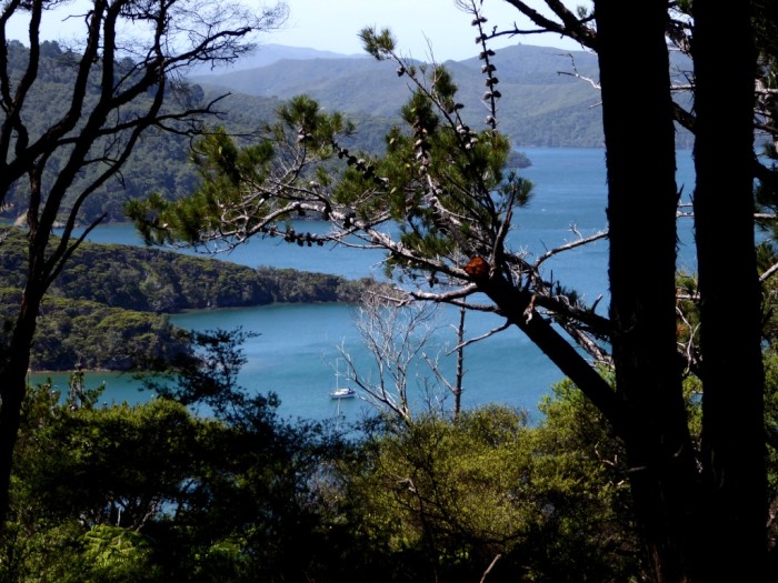
19 November 2016 | Smokehouse Bay, Great Barrier Island, Hauraki Gulf
Alison and Geoff, sunny and windy
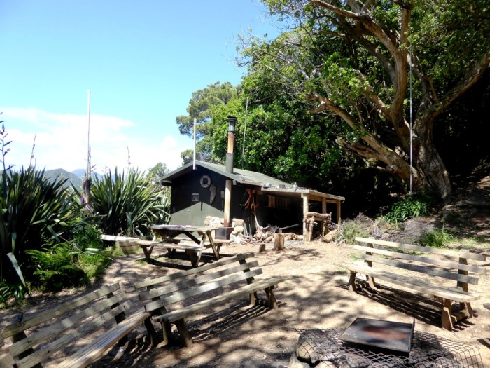
Photo shows the bath house at Smokehouse Bay and outside seating area
Not for the first time in our lives we have been anchored in Smokehouse Bay on the West side of Port Fitzroy on Auckland's Great Barrier Island. This is where one ends up when the wind whistles from the west, which is precisely what it has been doing for the last few days. It's easy to get stuck out at the Barrier, especially at this time of the year when the westerlies rarely let up. They're often blowing at gale force, and before the cell phone tower was installed you had to climb up the steep hill behind Smokehouse to get a signal from the mainland, 25 nm away and let your employer know you couldn't get back to work!
Smokehouse Bay has one of those unique features which in this day and age of entrenched neoliberal economics and heady capitalism is very unusual. Many years ago, an enthusiastic yachtie liked the place so much (probably had no choice!) that he managed to acquire the land around it and over time built some very useful facilities: a cabin with a bath and shower, a firewood heater to heat up the water, wash tubs, a water tank, loo and seats to sit around a fire and have a yak with whoever dropped in. The land was eventually QEII covenanted and remains privately owned but in public access. Everything is available free of charge and maintained by whoever is around.
Just before we left NZ in 2006, a fierce storm caused a mammoth slip and swept everything away, but it was soon rebuilt with yachtie volunteer help and is now better than ever. There's even a small "library" inside with "the book of the week". Outside off the beach is a cleaning grid, where you can lean up your boat and clean it off, although theoretically, you are not supposed to use antifoul any more.
A high is due to spread settled weather over the top half of NZ soon. 26 boats that have been waiting in North Minerva left yesterday to time their arrival in NZ with the expected better weather. We too will be off down the Coromandel Coast.
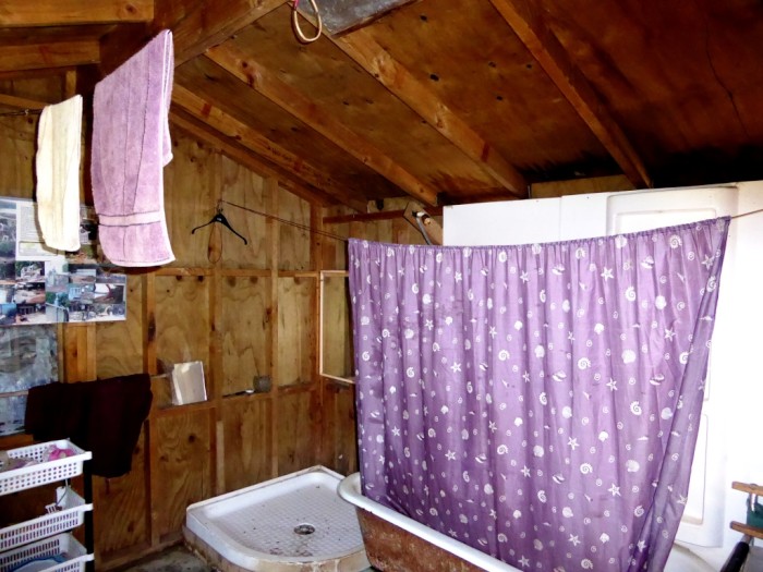
Bath and shower at Smokehouse. Hot water is piped in from a firewood burner.
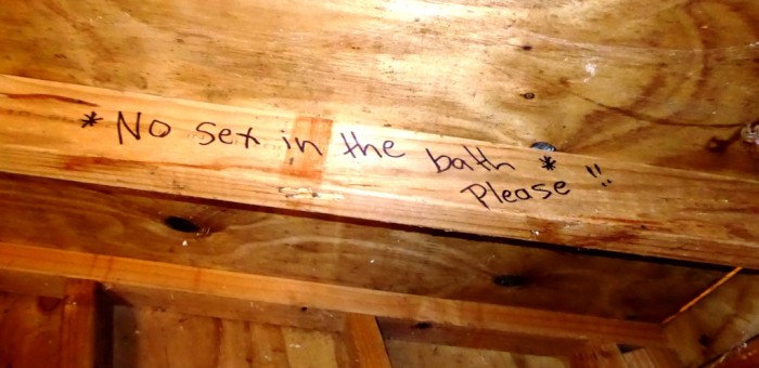
There's a queue outside so get on with it!
Saraoni from the hill behind Smokehouse Bay
Mount Hirakimata / Hobson
The cleaning grid at Smokehouse Bay
Yachts at Smokehouse Bay
Not for the first time in our lives we have been anchored in Smokehouse Bay on the West side of Port Fitzroy on Auckland's Great Barrier Island. This is where one ends up when the wind whistles from the west, which is precisely what it has been doing for the last few days. It's easy to get stuck out at the Barrier, especially at this time of the year when the westerlies rarely let up. They're often blowing at gale force, and before the cell phone tower was installed you had to climb up the steep hill behind Smokehouse to get a signal from the mainland, 25 nm away and let your employer know you couldn't get back to work!
Smokehouse Bay has one of those unique features which in this day and age of entrenched neoliberal economics and heady capitalism is very unusual. Many years ago, an enthusiastic yachtie liked the place so much (probably had no choice!) that he managed to acquire the land around it and over time built some very useful facilities: a cabin with a bath and shower, a firewood heater to heat up the water, wash tubs, a water tank, loo and seats to sit around a fire and have a yak with whoever dropped in. The land was eventually QEII covenanted and remains privately owned but in public access. Everything is available free of charge and maintained by whoever is around.
Just before we left NZ in 2006, a fierce storm caused a mammoth slip and swept everything away, but it was soon rebuilt with yachtie volunteer help and is now better than ever. There's even a small "library" inside with "the book of the week". Outside off the beach is a cleaning grid, where you can lean up your boat and clean it off, although theoretically, you are not supposed to use antifoul any more.
A high is due to spread settled weather over the top half of NZ soon. 26 boats that have been waiting in North Minerva left yesterday to time their arrival in NZ with the expected better weather. We too will be off down the Coromandel Coast.
Bath and shower at Smokehouse. Hot water is piped in from a firewood burner.
There's a queue outside so get on with it!
Saraoni from the hill behind Smokehouse Bay
Mount Hirakimata / Hobson
The cleaning grid at Smokehouse Bay
Yachts at Smokehouse Bay
Parrots, Penguins and a Whole Heap of Wind
12 November 2016 | Port Fitzroy, Great Barrier Island, Hauraki Gulf
Geoff and Alison, windy and very changeable!
Update after SI quake and tsunami. Woke up at 7 am this morning. No siren in this remote spot so didn't know anything about the warning to get up a hill. No movement here, but not surprising as long way from SI East Coast. Friends in Whangamata just down the Coromandel Coast got off their boat at 2 in the morning "to go up a hill". Another yacht in Whangaruru North of Tutukaka was also woken up by sirens and they got out and eventually ended up here! Glad we weren't in Kaikoura but not too bad fatality wise.
Photo shows Little Barrier Island from Cooper's Castle on Great Barrier Island in the Hauraki Gulf. Sheltered Port Fitzroy in the foreground
We are on Plan B. Plan A, the cycle trip, has been put on hold as we have been swamped by requests for web content from the invisible people in invisible places around the world who provide us with a living as we float around our giant swimming pool. We are going with the flow (of money) before it dries up!
We're now out at the "Barrier", Auckland's best natural asset, after a nice beam reach down to Kawau and a few days of variable weather in Mahurangi Harbour in the outer Hauraki Gulf. We haven't been here since 2005 but it's much the same. It's hard to imagine that Great Barrier Island is so close to a city of one and a half million people yet seems a million miles away.
Kaka parrots wheel over Port Fitzroy, cackling and whistling, penguins (the same species as our Tutukaka ones) patrol the open water, gannets plunge dive and shags nest in the trees. Since we were last here, the Glenfern sanctuary, Tony Bouzaid's restoration project near the village of Port Fitzroy has gone into public ownership as an Auckland regional park, which is great news. DOC has been making noises about making the North end of the island completely pest free but their budget has been curtailed.
With westerly winds we have been pinned down on the western side of the main harbour and have dinghied in to Smokehouse Bay and the rebuilt yachtie base there, with the free washing and bath facilities, shed and library.
It's still Spring weather here, with fronts rushing by every two or three days. We've already had two gales at anchor since leaving Tutukaka more than a week ago. It's been painful listening to the progress of yachts heading to NZ from the islands. Many have been hit by strong winds, big swells or are still waiting in places like Kandavu, Noumea, Norfolk Island and North Minerva. Last night we spent all night with a howling northerly as Saraoni pivoted and cavorted on anchor in Wairahi Bay.
We may continue from here down the East coast of Coromandel if nature allows us or swing round through the inner Gulf closer to Auckland.
One thing that has changed here is the mobile phone access. We have been able to follow the full horror of the U.S. election drama and the subsequent inevitable dissection of why it happened.
Sullivan's Bay at the mouth of Mahurangi harbour near Auckland
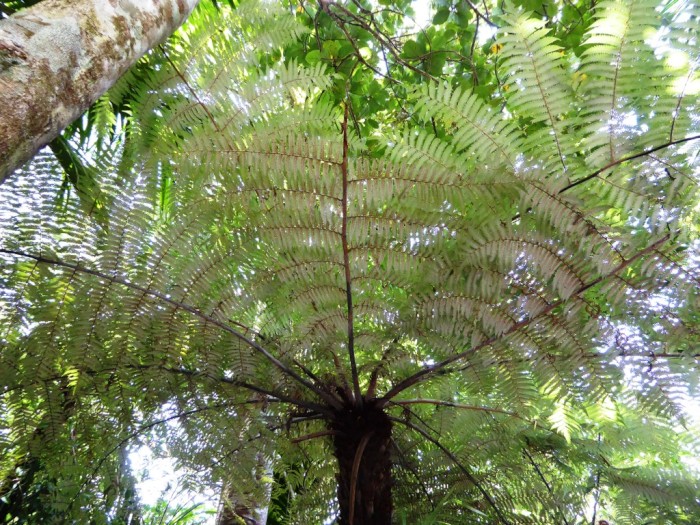
Silver Fern (ponga) in the bush on the Cooper's Castle track, GBI
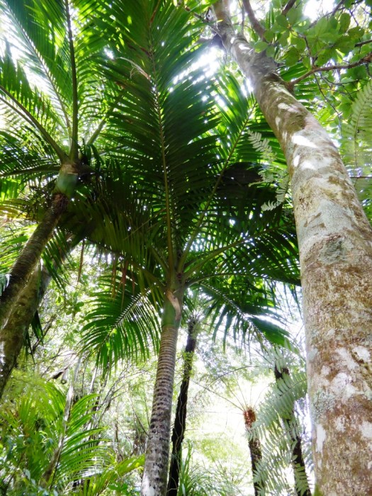
Nikau palms GBI - NZ's only native palm tree
The Kaiaraara Valley GBI
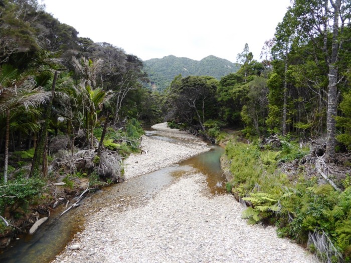
Kaiaraara River near the sea GBI
Rarohara bay in Port Fitzroy Harbour GBI
Photo shows Little Barrier Island from Cooper's Castle on Great Barrier Island in the Hauraki Gulf. Sheltered Port Fitzroy in the foreground
We are on Plan B. Plan A, the cycle trip, has been put on hold as we have been swamped by requests for web content from the invisible people in invisible places around the world who provide us with a living as we float around our giant swimming pool. We are going with the flow (of money) before it dries up!
We're now out at the "Barrier", Auckland's best natural asset, after a nice beam reach down to Kawau and a few days of variable weather in Mahurangi Harbour in the outer Hauraki Gulf. We haven't been here since 2005 but it's much the same. It's hard to imagine that Great Barrier Island is so close to a city of one and a half million people yet seems a million miles away.
Kaka parrots wheel over Port Fitzroy, cackling and whistling, penguins (the same species as our Tutukaka ones) patrol the open water, gannets plunge dive and shags nest in the trees. Since we were last here, the Glenfern sanctuary, Tony Bouzaid's restoration project near the village of Port Fitzroy has gone into public ownership as an Auckland regional park, which is great news. DOC has been making noises about making the North end of the island completely pest free but their budget has been curtailed.
With westerly winds we have been pinned down on the western side of the main harbour and have dinghied in to Smokehouse Bay and the rebuilt yachtie base there, with the free washing and bath facilities, shed and library.
It's still Spring weather here, with fronts rushing by every two or three days. We've already had two gales at anchor since leaving Tutukaka more than a week ago. It's been painful listening to the progress of yachts heading to NZ from the islands. Many have been hit by strong winds, big swells or are still waiting in places like Kandavu, Noumea, Norfolk Island and North Minerva. Last night we spent all night with a howling northerly as Saraoni pivoted and cavorted on anchor in Wairahi Bay.
We may continue from here down the East coast of Coromandel if nature allows us or swing round through the inner Gulf closer to Auckland.
One thing that has changed here is the mobile phone access. We have been able to follow the full horror of the U.S. election drama and the subsequent inevitable dissection of why it happened.
Sullivan's Bay at the mouth of Mahurangi harbour near Auckland
Silver Fern (ponga) in the bush on the Cooper's Castle track, GBI
Nikau palms GBI - NZ's only native palm tree
The Kaiaraara Valley GBI
Kaiaraara River near the sea GBI
Rarohara bay in Port Fitzroy Harbour GBI
Big Stumpy Steals the Show
27 October 2016 | Tutukaka
Geoff and Alison, warm and sunny
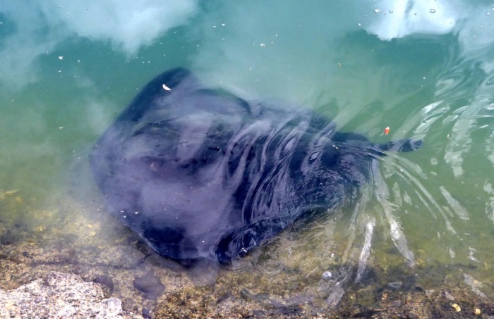
Photo shows "Big Stumpy" patrolling Tutukaka's inner harbour, near the Game Fishing Club. His tail is unnaturally short, probably because the sting ray was caught by a fisherman in younger life and his tail damaged by the hook.
We are back in Tutukaka for a week or so before heading off on two wheels again.
There are still a few penguins around, but not as many as before when the breeding season was in swing, so the nights are quiet, apart from sporadic calls from morepork owls and the odd kiwi call. At high tide, when the inner marina is a little clearer and cleaner, short-tailed sting rays have been making their rounds. One of us saw 7 yesterday, right inside the marina, including two that were over a metre wide from one wing tip to the other.
That's not that big according to someone who was watching one of the stingrays. They can reach 4 metres in width - bigger than the manta rays we saw plenty of in the Marquesas last year, but not as attractive.
We've often speculated why sting rays come into the marina. It's not just here, as we saw sting rays in the Coromandel's Whitianga marina when we were last holed up there.
The guy we were talking to who recognises two particular local sting rays, nicknamed "Big Stumpy" and "Little Stumpy" because of their unnaturally shortened tails, thinks it's because they are hiding from orcas (NZ orcas feed almost exclusively on sting rays in shallow coastal water). We suspect it's a bit more mundane than that - they're here because they are attracted to fish offal and scraps thrown into the marina from fishermen.
Easy Come Easy Go?
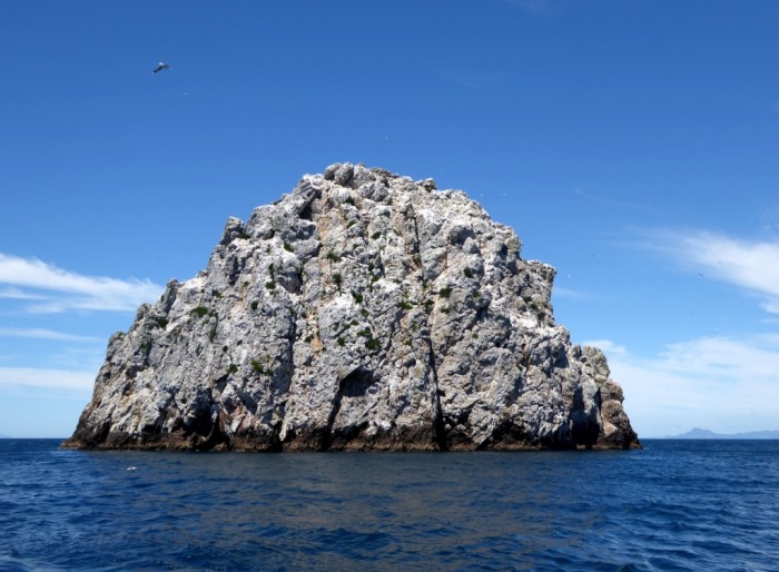
Photo shows the Sugarloaf - an andesitic rocky outcrop 9 miles from the entrance to Tutukaka Harbour. The white blobs are nesting gannets, with one in flight at top left.
We thought we were pretty smart sailing across the Pacific, but there are smarter creatures than us. Millions of birds migrate every year between various parts around the Pacific to New Zealand's coasts every year. In fact, most make the journey twice a year, every year!
This is the time for migrant birds to arrive and feed up in the Southern hemisphere summer and breed, if that's what they do. On leaving Whangarei Heads on the way back to Tutukaka we came across tens of thousands of shearwaters looking for food off the shore. They are also called mutton birds, because in the past they were eaten. There are several different species. A few spend all of their time down here, but most migrate to the Northern hemisphere during the Southern winter. Buller's shearwaters nest in the hundreds of thousands, previously millions, in the Poor Knights islands off Tutukaka, sharing their burrows with rather morose tuatara. They fly every year right across the Pacific to the NW coast of the U.S. and Canada!
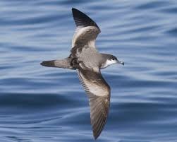
Buller's shearwater
There are even more remarkable journeys. Sugarloaf, a volcanic rock stack 9 miles off the Tutukaka coast, and the Pinnacles, are breeding home to thousands of Australasian gannets. We sailed in rather lumpy seas with a dying southerly to the Sugarloaf a couple of days ago. At first, all we could see was lumps of whitish rock. Soon we saw that every scrap of possible landing spot was occupied by a gannet nest. The Pinnacles were the same. 12 years ago we saw a bunch of lazy fur seals out here on the one single possible haul out spot on these precipitous islands, but there were none today. Perhaps they are heading down to the nearest breeding colony nearer Wellington.
Young gannets, once they have fledged, fly direct to the Australian coast without stopping. It's a route many young human kiwis take, but not so young as these birds and they certainly don't fly under their own steam! Most of the gannets come back after a few years of life in Oz but what makes them go there in the first place and what makes them come back?
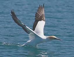
Australasian gannet
Thousands of bar-tailed godwits are also arriving if they haven't already done so. They aim mainly for the muddy, shellfish rich waters of the Thames estuary and the large harbours, like the Manukau and Kaipara. These are waders and are part of a large armada of birds that regularly migrate between the two hemispheres, alternating as they go to keep feeding in the best months of the year. We took 9 months to get from Panama to NZ. The godwits fly non-stop from Alaska to New Zealand and Tasmania, a distance even further than ours. In late March, they fly back again! When we sailed over from French Polynesia we were impressed by the early Polynesian migrations that used bush materials ocean going catamarans and pandanus sails, but the birds knock the socks off any human endeavour.
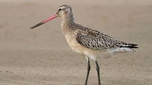
Bar-tailed godwit
We are back in Tutukaka for a week or so before heading off on two wheels again.
There are still a few penguins around, but not as many as before when the breeding season was in swing, so the nights are quiet, apart from sporadic calls from morepork owls and the odd kiwi call. At high tide, when the inner marina is a little clearer and cleaner, short-tailed sting rays have been making their rounds. One of us saw 7 yesterday, right inside the marina, including two that were over a metre wide from one wing tip to the other.
That's not that big according to someone who was watching one of the stingrays. They can reach 4 metres in width - bigger than the manta rays we saw plenty of in the Marquesas last year, but not as attractive.
We've often speculated why sting rays come into the marina. It's not just here, as we saw sting rays in the Coromandel's Whitianga marina when we were last holed up there.
The guy we were talking to who recognises two particular local sting rays, nicknamed "Big Stumpy" and "Little Stumpy" because of their unnaturally shortened tails, thinks it's because they are hiding from orcas (NZ orcas feed almost exclusively on sting rays in shallow coastal water). We suspect it's a bit more mundane than that - they're here because they are attracted to fish offal and scraps thrown into the marina from fishermen.
Easy Come Easy Go?
Photo shows the Sugarloaf - an andesitic rocky outcrop 9 miles from the entrance to Tutukaka Harbour. The white blobs are nesting gannets, with one in flight at top left.
We thought we were pretty smart sailing across the Pacific, but there are smarter creatures than us. Millions of birds migrate every year between various parts around the Pacific to New Zealand's coasts every year. In fact, most make the journey twice a year, every year!
This is the time for migrant birds to arrive and feed up in the Southern hemisphere summer and breed, if that's what they do. On leaving Whangarei Heads on the way back to Tutukaka we came across tens of thousands of shearwaters looking for food off the shore. They are also called mutton birds, because in the past they were eaten. There are several different species. A few spend all of their time down here, but most migrate to the Northern hemisphere during the Southern winter. Buller's shearwaters nest in the hundreds of thousands, previously millions, in the Poor Knights islands off Tutukaka, sharing their burrows with rather morose tuatara. They fly every year right across the Pacific to the NW coast of the U.S. and Canada!
Buller's shearwater
There are even more remarkable journeys. Sugarloaf, a volcanic rock stack 9 miles off the Tutukaka coast, and the Pinnacles, are breeding home to thousands of Australasian gannets. We sailed in rather lumpy seas with a dying southerly to the Sugarloaf a couple of days ago. At first, all we could see was lumps of whitish rock. Soon we saw that every scrap of possible landing spot was occupied by a gannet nest. The Pinnacles were the same. 12 years ago we saw a bunch of lazy fur seals out here on the one single possible haul out spot on these precipitous islands, but there were none today. Perhaps they are heading down to the nearest breeding colony nearer Wellington.
Young gannets, once they have fledged, fly direct to the Australian coast without stopping. It's a route many young human kiwis take, but not so young as these birds and they certainly don't fly under their own steam! Most of the gannets come back after a few years of life in Oz but what makes them go there in the first place and what makes them come back?
Australasian gannet
Thousands of bar-tailed godwits are also arriving if they haven't already done so. They aim mainly for the muddy, shellfish rich waters of the Thames estuary and the large harbours, like the Manukau and Kaipara. These are waders and are part of a large armada of birds that regularly migrate between the two hemispheres, alternating as they go to keep feeding in the best months of the year. We took 9 months to get from Panama to NZ. The godwits fly non-stop from Alaska to New Zealand and Tasmania, a distance even further than ours. In late March, they fly back again! When we sailed over from French Polynesia we were impressed by the early Polynesian migrations that used bush materials ocean going catamarans and pandanus sails, but the birds knock the socks off any human endeavour.
Bar-tailed godwit
Whangarei’s Te Kakano Takes Seed
21 October 2016 | Marsden Point, Whangarei Harbour
Geoff and Alison, windy but sunny
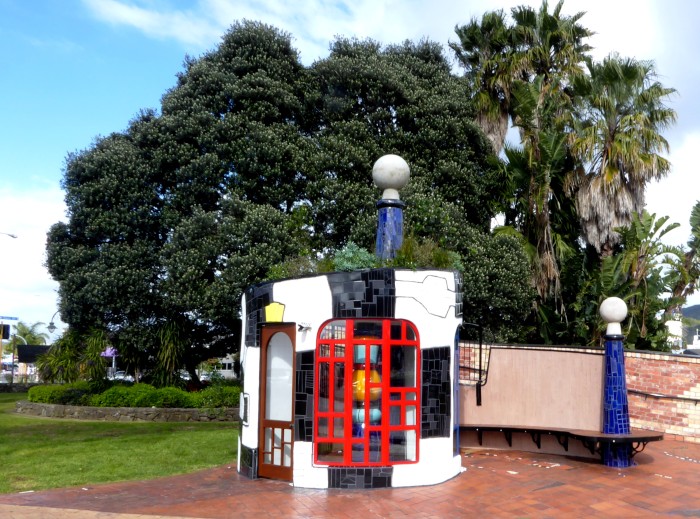
Photo shows the newly unveiled Hundertwasser folly, Te Kakano, (the seed) by the Town Basin.
We are on our way back to Tutukaka after a month in Whangarei’s Town Basin, collecting stuff for Saraoni’s makeover and even doing some teaching. The weather is typical of a Southern Ocean spring, oscillating from wet, cold and windy to warm and sunny, sometimes several times in the same day! Whangarei is also in transition, as one by one yachts are arriving in increasing numbers on the Northland coast. Many will end up mooring in the Basin after spending the sailing season crossing the Pacific or circulating amongst the islands not so far to the North. Some we know from last year are making their second trip down to NZ. We were still in Tonga’s Ha’apai group this time last year, enjoying lovely weather and listening in to the early birds making their way South.
The Town Basin has grown and become a more interesting place since we first came here many years ago, not just because of its international yachtie flavour. The Hatea Loop, kid’s playground, i-Site, numerous cafes and restaurants make it an all week attraction. Now the Hundertwasser folly, Te Kakano has just been built, in bright coloured mosaic tiles and koru design with a garden on its roof, supposedly a taste of the Hundertwasser Art Gallery and Contemporary Maori Arts Centre to be built next year if fund raising reaches its goal. It has been a contentious issue in conservative Whangarei, but the link with eccentric Austrian artist Friendesreich Hundertwasser is quite strong. He spent his last 20 years in Northland with the most obvious public contribution being the colourful Kawakawa toilets near the Bay of Islands.
We’re leaving the gritty Saraoni upgrade stuff to later and taking off on the bikes for a month. Northland roads are all hilly and windy, so will be a good test of our leg muscles after the Canadian trip. We have booked a motorbike test for early December and may buy 2 new motorbikes for when we want to get further and faster than pedal power.
Brr....It's Cold in the Winterless North!
08 September 2016 | Tutukaka marina
Alison and Geoff, cold and windy
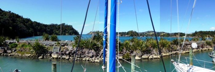
Photo shows our high tide front window view at Tutukaka - cold and clear at the moment.
We have arrived back in New Zealand and right now it's a lot colder than we'd hoped!
We now have to work a bit to pay back some of the money we spent, even though our online work did cover a quite a bit of the cost.
The highlights of the trip were definitely the Khutzamateen grizzly bear sanctuary near the B.C. / Alaska border as we never got to see one on the highway. The 4 day hike into the heart of the Canadian Rockies around Jasper was definitely well worth it as we actually managed to get away from the traffic of the busy highways and see some of the magnificent Canadian nature at first hand.
We had no accidents, which was just as well, particularly as we didn't take out any sort of travel or health insurance! The Canadians, even though a little aloof, are pretty well mannered on their highways.
It would have been nice to have seen a few more moose and other native animals but it seems the quiet wheels of a cycle interrupt them as much as the harsh brakes of a logging truck so apart from some small animals spotted in rock crevices and a few herds of elk and caribou in the national park, seeing wildlife was not a daily occurrence.
Saraoni was pretty well in the same condition when we returned as when we left. There was no water in the bilge and surprisingly the engine started almost immediately. We decided to leave all the solar panels attached to the batteries and that obviously paid off.
We turned off the wind generator while we were away. At 12 years old, it needs new bearings, cone and blades and right now it is grinding around in the midst of a southerly gale!
Returning to NZ means planning the next adventure and the 12 month list includes doing some refitting work in the Town Basin in Whangarei where things we need are easily accessible. Saraoni certainly desperately needs an upgrade, but that is going to take quite a long time, so we will have to break it up.
Anyway, when the boat begins to look a bit more respectable we'll probably head off on another cycle trip to the Coromandel Peninsula and the centre of the North Island and do some hiking in the volcanoes area, as well as complete the canoe trip down the Whanganui River, which we didn't do earlier this year.
We hope to at some time early next year fit in a trip to Australia and next May or June we will try to catch a weather window and spend most of the winter in Fiji and some of the other Pacific Islands. So not much sitting around for us at the moment!!!
Update - now anchored in Parua Bay, the most sheltered spot in Whanagrei Harbour. Spotted a very friendly fur seal swimming around in our part of the bay today, a rather odd sight. Fur seals hang around the Poor Knights in winter but we have never seen them in the harbour. No sign of the large pod of orcas that made a visit a week or so ago, searching for sting rays in the shallows.
Tied up on a pile berth in Whangarei Town Basin.
Passing Bream Head at the entrance to Whangarei Harbour in calm spring weather - pity it didn't last!
Not sure what this fish was that we caught on the way South from Tutukaka
Fitting a new 240 Watt solar panel in Whangarei
OK.....So We Can Kiss Goodbye to Summer!
23 August 2016 | Canmore, Alberta, Canada
Alison and Geoff, cold and cloudy
Photo shows the new snow fall behind Canmore, Alberta... the end of a short summer?
Plop, plop, plop...the last two weeks squirrels have been bombarding each of our campsites with freshly matured pine cones. We think its what Canadians call "The Fall!" As soon as the cones have formed a pile, the squirrels dismember them and either eat or bury the seeds - noisily!
Parks Canada has been advising all visitors to Banff and Jasper NPs of the bear berry season - grizzlies and black bears are actively foraging for berries ready for hibernation. Summer doesn't last very long in this part of the world and it seems to have definitely disappeared yesterday when an icy cold blast arrived with a fresh "fall" of snow!
Fortunately, summer was at least three days long, just when we wanted it, as we pedalled over two 2,000 m passes past rapidly disappearing glaciers and the most fantastic scenery along the 230 km long Icefields Parkway between Jasper and Lake Louise and then the shorter 60 odd km stretch to busy Banff.
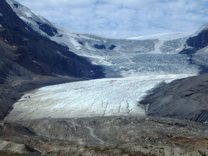
The Athabasca Glacier at the Columbia Icefield
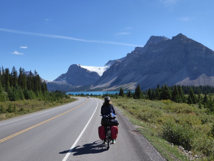
Cycling down from Bow Summit, with Bow Lake in the background.
Lake Louise
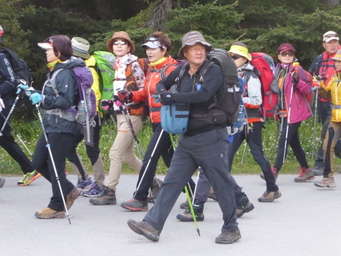
Hikers from Korea at Lake Louise
The thousands of summer visitors disappeared for once, as the Bow Valley Parkway between Lake Louise and Banff was closed for a 1,500 strong bike race and rally. Somehow we managed to be the only two tourists on that stretch of road, much to the delight of the bikers, who had come from all over for the Gran Fondo event. It was such a difference cycling along a quiet, empty road. A black bear came out in the open behind us and sniffed around, obviously enjoying the peace and quiet! Perhaps Parks Canada will make a bike only day along the Parkway more common next year during the centennial?
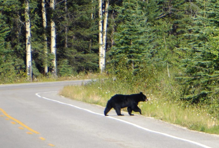
Black bear enjoying a quiet road on the Bow Valley Parkway
Banff NP is a bit of a contradiction as it not only has beautiful mountain scenery, it also encloses 2 towns, Banff and Lake Louise, a freeway (Highway 1), the smaller Parkways and a busy railway!
National park policy somehow has to balance the competing interests of 2 million annual visitors, commercial reality and the welfare of the park's wildlife and plant life. Not an enviable job.
We are now in touristy Canmore on the edge of the Rockies. We will be cycling soon into Calgary and make a diversion to Edmonton to see Sharon and Reg, home for the summer from their yacht, "Pea Soup". We last saw them in Panama last year. We are due to land back in Auckland on Sept.3rd, hopefully with Spring in the air, the kowhai flowering and the tuis chortling!
Plop, plop, plop...the last two weeks squirrels have been bombarding each of our campsites with freshly matured pine cones. We think its what Canadians call "The Fall!" As soon as the cones have formed a pile, the squirrels dismember them and either eat or bury the seeds - noisily!
Parks Canada has been advising all visitors to Banff and Jasper NPs of the bear berry season - grizzlies and black bears are actively foraging for berries ready for hibernation. Summer doesn't last very long in this part of the world and it seems to have definitely disappeared yesterday when an icy cold blast arrived with a fresh "fall" of snow!
Fortunately, summer was at least three days long, just when we wanted it, as we pedalled over two 2,000 m passes past rapidly disappearing glaciers and the most fantastic scenery along the 230 km long Icefields Parkway between Jasper and Lake Louise and then the shorter 60 odd km stretch to busy Banff.
The Athabasca Glacier at the Columbia Icefield
Cycling down from Bow Summit, with Bow Lake in the background.
Lake Louise
Hikers from Korea at Lake Louise
The thousands of summer visitors disappeared for once, as the Bow Valley Parkway between Lake Louise and Banff was closed for a 1,500 strong bike race and rally. Somehow we managed to be the only two tourists on that stretch of road, much to the delight of the bikers, who had come from all over for the Gran Fondo event. It was such a difference cycling along a quiet, empty road. A black bear came out in the open behind us and sniffed around, obviously enjoying the peace and quiet! Perhaps Parks Canada will make a bike only day along the Parkway more common next year during the centennial?
Black bear enjoying a quiet road on the Bow Valley Parkway
Banff NP is a bit of a contradiction as it not only has beautiful mountain scenery, it also encloses 2 towns, Banff and Lake Louise, a freeway (Highway 1), the smaller Parkways and a busy railway!
National park policy somehow has to balance the competing interests of 2 million annual visitors, commercial reality and the welfare of the park's wildlife and plant life. Not an enviable job.
We are now in touristy Canmore on the edge of the Rockies. We will be cycling soon into Calgary and make a diversion to Edmonton to see Sharon and Reg, home for the summer from their yacht, "Pea Soup". We last saw them in Panama last year. We are due to land back in Auckland on Sept.3rd, hopefully with Spring in the air, the kowhai flowering and the tuis chortling!
A Hike in The Heart of the Canadian Rockies
12 August 2016 | Jasper Town, Alberta, Canada
Alison and Geoff , cool and showery
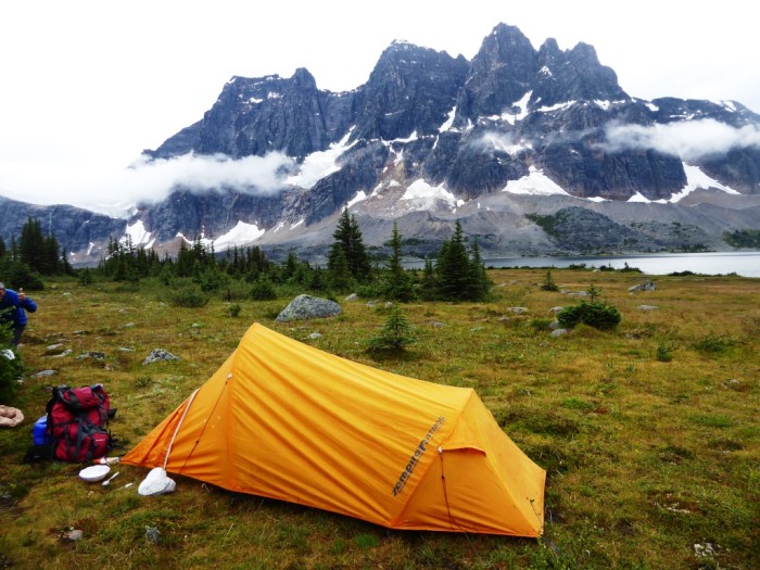
Photo shows Camp Saraoni high up in the Tonquin Valley with Amethyst Lake and the Ramparts in the background.
After 1,600 km riding along busy highways we were ready for a rest from the constant noise and contact with people and their machines.
Jasper, Banff, Yoho and Kootenay National parks are the four adjoining crowning glories of Canada's Rocky Mountain national park system, but at this time of year are bursting at the seams with holiday makers from all parts of Canada and many other countries too, who have made a beeline here. The two campgrounds close to Jasper have 1,000 campsites between them alone and they are all completely full every night! Yikes!
The summer crowd and a "town" elk near Jasper town
It was time to swap bikes for boots and head for the hills. Whenever we have gone more than a few kilometres on foot away from a road we have usually found we lose the crowds quite easily and that's exactly what we wanted!
We found that dismounting from a cycle, packing a backpack for a 4 day hike into the heart of the continental divide was easier than we thought.
In fact because we had already cycled up hill and over dale for so long, a mere 50 km on a hiking trail was a lot easier and we had no oversized RVs or logging trucks to contend with. Jasper has a number of possible multi day hikes, but because of the popularity of the area and limited summer hiking time you have to book up backcountry campsites and pay for them whatever the weather and whether you actually make it to your chosen campsite or not.
Canada's national parks have been suffering from slow financial strangulation from the previous long years of conservative government and now have poor infrastructure and expensive fees, something that many Canadians we met on the trail are well aware of and hope that the new government is going to address.
On our chosen, booked route, we had to climb up to a 2100 m pass, the Maccarib, down the other side to Tonquin Valley's Amethyst Lake and up and over into the Astoria River valley.
Heading up the Portal Valley
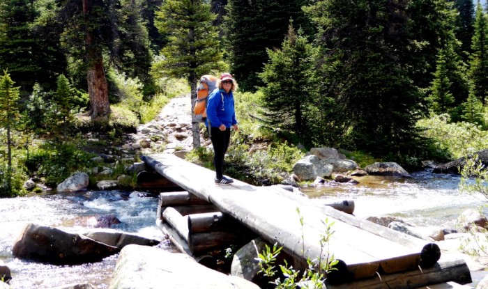
Alison on one of dozens of timber bridges
What we did experience was stunning mountain scenery, lots of rain, muddy trails, a few other wilderness seekers, endangered caribou (reindeer), pikas and marmots. The last two are cute as can be alpine rodents that love to hang out in rock falls or tussock. The pikas are like rats without tails and huge eyes. They go "eek" whenever they feel like it. Marmots are more like oversized hamsters that whistle to each other when alarmed.
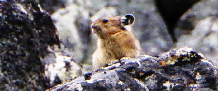
"Eeek" - a pika in a rockfall
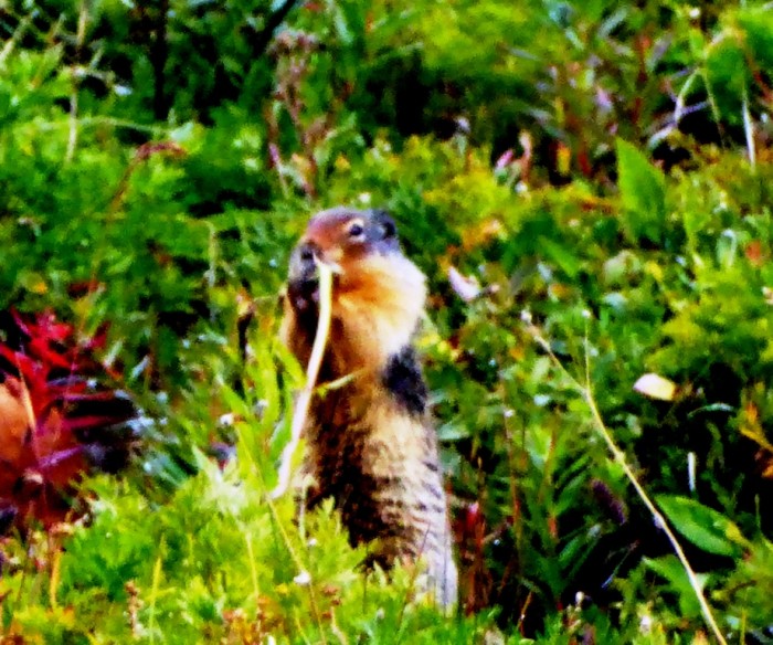
Marmot on Maccarib Pass
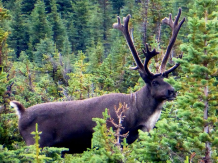
Woodland caribou stag in a meadow in the Tonquin Valley
A lonely old, male grizzly bear at the lower Astoria valley end had been worrying Parks Canada staff since Spring as he had been acting a bit grumpy with hikers and had even tried to stop them from passing. All of the campgrounds had bear poles or bins (in fact even Jasper town centre has bear bins too) for food storage, but we didn't see any bear signs until close to Grumpy's known whereabouts, where there were signs that he was suffering from berry diarrhoea!
Grumpy's berry diarrhoea!
We're back in town now and heading off down the Icefields Parkway in the direction of Banff (280 km away) tomorrow. The highway is renowned for its beauty but of course now we have to share it with thousands of motor bikes, RVs, cars and even a few crazy bikers like us!
After 1,600 km riding along busy highways we were ready for a rest from the constant noise and contact with people and their machines.
Jasper, Banff, Yoho and Kootenay National parks are the four adjoining crowning glories of Canada's Rocky Mountain national park system, but at this time of year are bursting at the seams with holiday makers from all parts of Canada and many other countries too, who have made a beeline here. The two campgrounds close to Jasper have 1,000 campsites between them alone and they are all completely full every night! Yikes!
The summer crowd and a "town" elk near Jasper town
It was time to swap bikes for boots and head for the hills. Whenever we have gone more than a few kilometres on foot away from a road we have usually found we lose the crowds quite easily and that's exactly what we wanted!
We found that dismounting from a cycle, packing a backpack for a 4 day hike into the heart of the continental divide was easier than we thought.
In fact because we had already cycled up hill and over dale for so long, a mere 50 km on a hiking trail was a lot easier and we had no oversized RVs or logging trucks to contend with. Jasper has a number of possible multi day hikes, but because of the popularity of the area and limited summer hiking time you have to book up backcountry campsites and pay for them whatever the weather and whether you actually make it to your chosen campsite or not.
Canada's national parks have been suffering from slow financial strangulation from the previous long years of conservative government and now have poor infrastructure and expensive fees, something that many Canadians we met on the trail are well aware of and hope that the new government is going to address.
On our chosen, booked route, we had to climb up to a 2100 m pass, the Maccarib, down the other side to Tonquin Valley's Amethyst Lake and up and over into the Astoria River valley.
Heading up the Portal Valley
Alison on one of dozens of timber bridges
What we did experience was stunning mountain scenery, lots of rain, muddy trails, a few other wilderness seekers, endangered caribou (reindeer), pikas and marmots. The last two are cute as can be alpine rodents that love to hang out in rock falls or tussock. The pikas are like rats without tails and huge eyes. They go "eek" whenever they feel like it. Marmots are more like oversized hamsters that whistle to each other when alarmed.
"Eeek" - a pika in a rockfall
Marmot on Maccarib Pass
Woodland caribou stag in a meadow in the Tonquin Valley
A lonely old, male grizzly bear at the lower Astoria valley end had been worrying Parks Canada staff since Spring as he had been acting a bit grumpy with hikers and had even tried to stop them from passing. All of the campgrounds had bear poles or bins (in fact even Jasper town centre has bear bins too) for food storage, but we didn't see any bear signs until close to Grumpy's known whereabouts, where there were signs that he was suffering from berry diarrhoea!
Grumpy's berry diarrhoea!
We're back in town now and heading off down the Icefields Parkway in the direction of Banff (280 km away) tomorrow. The highway is renowned for its beauty but of course now we have to share it with thousands of motor bikes, RVs, cars and even a few crazy bikers like us!
Beneath the Rocky Mountains 3 Days From Anywhere
30 July 2016 | McBride, B.C., Canada
Alison and Geoff, cold and thundery
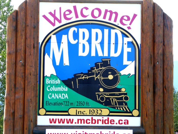
We have reached the tiny town of McBride, population around 500, probably less in the 8 months of winter and a lot more right now, swollen by the summer tourist traffic on Highway 16.
McBride owes its existence as most of the little towns on this road do, to the railway and the highway. It is 205 km from Prince George to the west, and 170 km to Jasper in the East with not much in between except lots of trees! It took us three days to get from Prince George to here and we slept in the woods on the way without any complaints from the local bear population!
The scenery has returned to a familiar BC theme of big mountains and lots of forest after the flat and rather monotonous Fraser Plateau area. We have been following, out of sight, BC's largest river, the Fraser, which runs along the Fraser Trench, a Northern version of the San Andreas Fault, with the Rocky Mountains to the North and the Cariboo Mountains to the South.
For once, the highway has been quite quiet, with much fewer big truck and crazy RV drivers to intimidate us. We have seen our first Canadian moose by the roadside, but no other big mammals, despite all the warning signs. We have now cycled some 1,500 km of road from Vancouver with about 500 to go. We have replaced 2 tyres and mended a couple of punctures and replaced a spoke, but all is well on 2 wheels x 2 otherwise.
After several weeks of cloudy, drizzly weather, the sun started to shine in Prince George and we had a week of hot weather - had summer arrived in Canada? From everybody's account, the miserable weather has been the same everywhere in the west from Vancouver to the Yukon and Alaska.
As our final few weeks take us high into the Rockies and along the famous Icefields parkway between Jasper and Banff, where the scenery is supposed to be some of the best in the world, we can only hope the 'summer' holds. We expect to be rolling into Calgary in Alberta by the end of August, from where we make our way back to LA and Kiwiland.
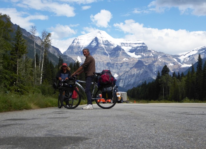
Mt Robson - the Canadian Rockies highest mountain looks like a huge ice cream cone!
McBride owes its existence as most of the little towns on this road do, to the railway and the highway. It is 205 km from Prince George to the west, and 170 km to Jasper in the East with not much in between except lots of trees! It took us three days to get from Prince George to here and we slept in the woods on the way without any complaints from the local bear population!
The scenery has returned to a familiar BC theme of big mountains and lots of forest after the flat and rather monotonous Fraser Plateau area. We have been following, out of sight, BC's largest river, the Fraser, which runs along the Fraser Trench, a Northern version of the San Andreas Fault, with the Rocky Mountains to the North and the Cariboo Mountains to the South.
For once, the highway has been quite quiet, with much fewer big truck and crazy RV drivers to intimidate us. We have seen our first Canadian moose by the roadside, but no other big mammals, despite all the warning signs. We have now cycled some 1,500 km of road from Vancouver with about 500 to go. We have replaced 2 tyres and mended a couple of punctures and replaced a spoke, but all is well on 2 wheels x 2 otherwise.
After several weeks of cloudy, drizzly weather, the sun started to shine in Prince George and we had a week of hot weather - had summer arrived in Canada? From everybody's account, the miserable weather has been the same everywhere in the west from Vancouver to the Yukon and Alaska.
As our final few weeks take us high into the Rockies and along the famous Icefields parkway between Jasper and Banff, where the scenery is supposed to be some of the best in the world, we can only hope the 'summer' holds. We expect to be rolling into Calgary in Alberta by the end of August, from where we make our way back to LA and Kiwiland.
Mt Robson - the Canadian Rockies highest mountain looks like a huge ice cream cone!
Big Mountains, Big Rivers and Big Fish Along the Yellowhead Highway
18 July 2016 | Houston, B.C.
Alison and Geoff, warm and sunny
Looking back at the Coast Mountains on a section of Highway 16 near the Hazeltons.
Highway 16, also called the Yellowhead Highway, named after a 19th century blonde Iroquois French fur trapper, starts on the island of Haida Gwaii and runs through the Coast Mountains, across the Fraser Plateau, through the Rockies and across the plains to Winnipeg, Manitoba. We have followed it from Prince Rupert, on the coast, along the huge Skeena River and now its tributary, the Bulkley.
The road has been quite busy, as it is the main artery connecting Northern B.C. with the rest of the country, but it traverses remote wilderness areas with a smattering of roadside towns and First Nations settlements. We have seen more wilderness in this area than any time since we were last in Northern Australia (the great oceans apart!) - conifer forests to the horizon, hardly a fence in sight and always the snow covered mountain chains and the turbulent rivers.
"If you go down to the woods today...." We did get a big surprise yesterday. Not a moose, but a black bear mum and 5 cubs ambling within spitting distance of our tent in the little village of Topley!
The Skeena and its tributaries are major routes for adult salmon and steelhead, a sea going trout. Five species of salmon make their run up the rivers from mid July onwards to lay their eggs in the shallow, gravelly beds many hundreds of kilometres from the sea, then they die.
The first part of the highway, as it wends its way through the Coast Mountains, has a number of small indigenous settlements. Indigenous people have used this area for thousands of years but suffered badly like many indigenous people worldwide during the period of European expansion. The original inhabitants were decimated by disease during the nineteenth century, caught in a pincer movement of colonisation from the B.C. coast and from the east, overland along the river valleys. The survivors were settled on small 'reserves', tiny in comparison to their old traditional land area.
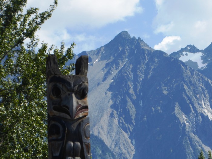
Totem pole at 'Ksan village near Old Hazelton
The 20th century was in some ways worse as the communities became marginalised. Canadian citizenship was not offered until 1956!
They are recovering something of their self respect today, relearning their old culture and flexing their bargaining power over land rights.
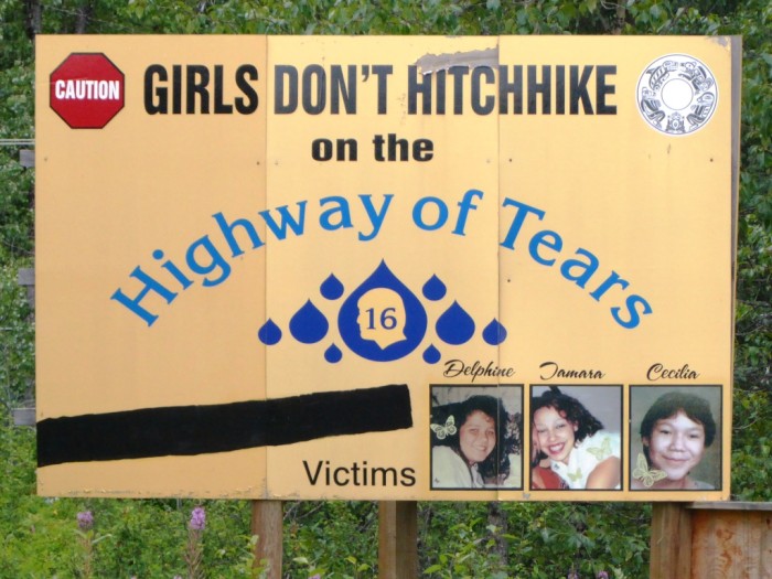
The Highway has a bit of a reputation for unsolved disappearances, mainly, but not all, of indigenous young women. No one knows whether these were murders, or whether young people simply left home and went somewhere else, never to contact their families again. The authorities have been criticized for not doing enough to solve the disappearances along the so-called "Highway of Tears."
Highway 16, also called the Yellowhead Highway, named after a 19th century blonde Iroquois French fur trapper, starts on the island of Haida Gwaii and runs through the Coast Mountains, across the Fraser Plateau, through the Rockies and across the plains to Winnipeg, Manitoba. We have followed it from Prince Rupert, on the coast, along the huge Skeena River and now its tributary, the Bulkley.
The road has been quite busy, as it is the main artery connecting Northern B.C. with the rest of the country, but it traverses remote wilderness areas with a smattering of roadside towns and First Nations settlements. We have seen more wilderness in this area than any time since we were last in Northern Australia (the great oceans apart!) - conifer forests to the horizon, hardly a fence in sight and always the snow covered mountain chains and the turbulent rivers.
"If you go down to the woods today...." We did get a big surprise yesterday. Not a moose, but a black bear mum and 5 cubs ambling within spitting distance of our tent in the little village of Topley!
The Skeena and its tributaries are major routes for adult salmon and steelhead, a sea going trout. Five species of salmon make their run up the rivers from mid July onwards to lay their eggs in the shallow, gravelly beds many hundreds of kilometres from the sea, then they die.
The first part of the highway, as it wends its way through the Coast Mountains, has a number of small indigenous settlements. Indigenous people have used this area for thousands of years but suffered badly like many indigenous people worldwide during the period of European expansion. The original inhabitants were decimated by disease during the nineteenth century, caught in a pincer movement of colonisation from the B.C. coast and from the east, overland along the river valleys. The survivors were settled on small 'reserves', tiny in comparison to their old traditional land area.
Totem pole at 'Ksan village near Old Hazelton
The 20th century was in some ways worse as the communities became marginalised. Canadian citizenship was not offered until 1956!
They are recovering something of their self respect today, relearning their old culture and flexing their bargaining power over land rights.
The Highway has a bit of a reputation for unsolved disappearances, mainly, but not all, of indigenous young women. No one knows whether these were murders, or whether young people simply left home and went somewhere else, never to contact their families again. The authorities have been criticized for not doing enough to solve the disappearances along the so-called "Highway of Tears."
The Inside Passage and the Great Bear Rainforest
08 July 2016 | Prince Rupert, B.C., Canada
Alison and Geoff; cloudy and cool
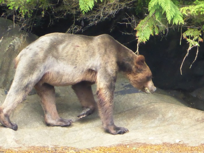
Photo shows a lone male grizzly with his distinctive shoulder 'hump' along the Khutzeymateen coast.
We are in Prince Rupert, a busy and slightly seedy port town, a short hop south of the Alaskan panhandle. We arrived a couple of days ago after a 450 km, 15 hour trip at 20 knots on a B.C. ferry from Port Hardy at the top of Vancouver Island. Prince Rupert is supposed to be the wettest, cloudiest city in Canada, and it certainly seems to be living up to its reputation!
The ferry trip to here traverses half of Canada's section of the 'Inside Passage', the 1400 km route through mostly sheltered waters that stretches from Washington's Puget Sound up to Glacier Bay in Alaska. The area north of Vancouver Island is a huge and beautiful, almost pristine, wilderness of inlets, rivers, islands, mountains and conifer forest which to date has largely escaped logging and other exploitation.
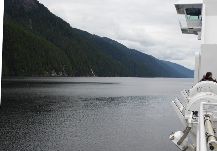
The Grenville Channel section of the Inside Passage. This 70 km long stretch is only 400m wide at one point. Moose and elk have been seen swimming across, despite the turbulent tides
There are a few settlements, mostly scattered First Nations villages and reputably more bears and wolves than anywhere else in Canada, including the white variety of the black bear called the kermode or spirit bear. Partly for that reason the area has been fairly recently named the 'Great Bear Rainforest'.
Travelling at 20 knots makes photography and wildlife viewing difficult but we did see plenty of orcas, humpback whales, seals and seal lions but no bears, wolves, elk or moose. We were lucky that the rain and fog relented and we had good visibility as we sped North on the comfortable, if expensive, ferry.
We spent today up a remote inlet called the Khutzeymateen, almost on the Alaskan border, and came across 8 or 9 grizzlies, including a mum and her 3 cubs. We also had a chance to watch orcas close up and humpbacks using their distinctive bubble net method of feeding.
The grizzlies are normally hard to see at this time of the year elsewhere, as we discovered in Yellowstone 2 years ago, as they range high up in the mountains after a spring feed in the valleys, but here in the Khutzeymateen and other close by inlets they feed off nutritious sedgegrass growing by the coast. They fatten up later in the fall when the salmon run is on.
Tomorrow we are off cycling again towards the Canadian Rockies, 1100 km away. The 2 crappy bikes and the 60 year olds wobbling along on them are all in good shape so far!
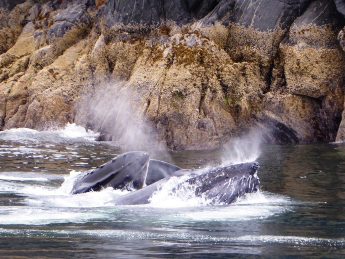
Humpbacks feeding - a mother and calf. They have come back from Hawai'i, where breeding and calving takes place, to these nutrient and food rich waters to feed.
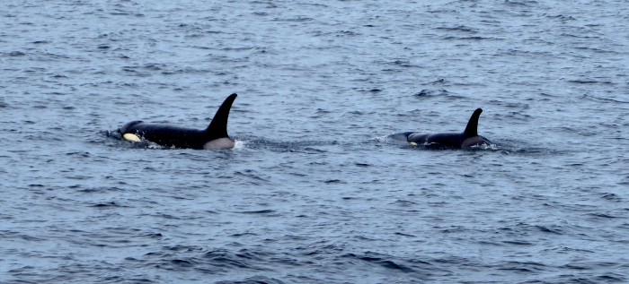
Orca pod in the Seaforth Channel just off Prince Rupert. These are so called 'resident orcas'. They still move fast like their NZ rellies and its hard to predict exactly where any one individual pod might be. Like Ingrid Visser's Northland orcas, many of the BC residents and transients have been identified from their distinctive dorsal fin marks. This pod had several calves and are searching for salmon.
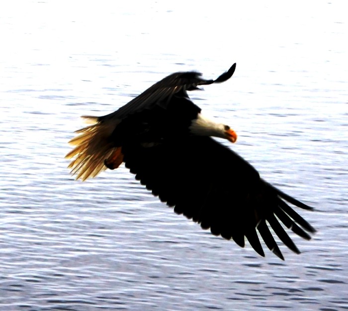
Bald eagle. The eagles were being thrown scraps of fish from the boat we were on, like the kites and sea eagles get treated to, in Langkawi
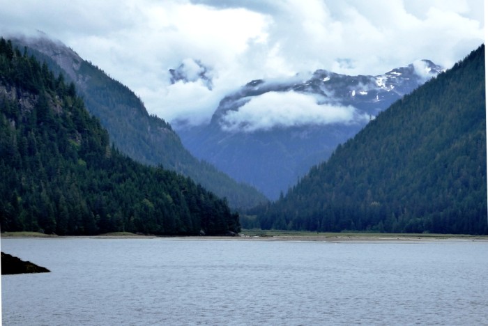
Looking up the Khutzeymateen inlet. The area up past the end of the inlet has been declared a sanctuary to protect the grizzly population in particular.
We are in Prince Rupert, a busy and slightly seedy port town, a short hop south of the Alaskan panhandle. We arrived a couple of days ago after a 450 km, 15 hour trip at 20 knots on a B.C. ferry from Port Hardy at the top of Vancouver Island. Prince Rupert is supposed to be the wettest, cloudiest city in Canada, and it certainly seems to be living up to its reputation!
The ferry trip to here traverses half of Canada's section of the 'Inside Passage', the 1400 km route through mostly sheltered waters that stretches from Washington's Puget Sound up to Glacier Bay in Alaska. The area north of Vancouver Island is a huge and beautiful, almost pristine, wilderness of inlets, rivers, islands, mountains and conifer forest which to date has largely escaped logging and other exploitation.
The Grenville Channel section of the Inside Passage. This 70 km long stretch is only 400m wide at one point. Moose and elk have been seen swimming across, despite the turbulent tides
There are a few settlements, mostly scattered First Nations villages and reputably more bears and wolves than anywhere else in Canada, including the white variety of the black bear called the kermode or spirit bear. Partly for that reason the area has been fairly recently named the 'Great Bear Rainforest'.
Travelling at 20 knots makes photography and wildlife viewing difficult but we did see plenty of orcas, humpback whales, seals and seal lions but no bears, wolves, elk or moose. We were lucky that the rain and fog relented and we had good visibility as we sped North on the comfortable, if expensive, ferry.
We spent today up a remote inlet called the Khutzeymateen, almost on the Alaskan border, and came across 8 or 9 grizzlies, including a mum and her 3 cubs. We also had a chance to watch orcas close up and humpbacks using their distinctive bubble net method of feeding.
The grizzlies are normally hard to see at this time of the year elsewhere, as we discovered in Yellowstone 2 years ago, as they range high up in the mountains after a spring feed in the valleys, but here in the Khutzeymateen and other close by inlets they feed off nutritious sedgegrass growing by the coast. They fatten up later in the fall when the salmon run is on.
Tomorrow we are off cycling again towards the Canadian Rockies, 1100 km away. The 2 crappy bikes and the 60 year olds wobbling along on them are all in good shape so far!
Humpbacks feeding - a mother and calf. They have come back from Hawai'i, where breeding and calving takes place, to these nutrient and food rich waters to feed.
Orca pod in the Seaforth Channel just off Prince Rupert. These are so called 'resident orcas'. They still move fast like their NZ rellies and its hard to predict exactly where any one individual pod might be. Like Ingrid Visser's Northland orcas, many of the BC residents and transients have been identified from their distinctive dorsal fin marks. This pod had several calves and are searching for salmon.
Bald eagle. The eagles were being thrown scraps of fish from the boat we were on, like the kites and sea eagles get treated to, in Langkawi
Looking up the Khutzeymateen inlet. The area up past the end of the inlet has been declared a sanctuary to protect the grizzly population in particular.
Happy Canada Day!
01 July 2016 | Port McNeil, Vancouver Island
Alison and Geoff Williams
Greetings to all our Canadian friends and all those from the Pacific NW who would normally call this home, but are spending time elsewhere. It's bloody freezing here at the top end of Vancouver Island, although we have had 3 days of sunshine as we pedalled through millions of conifer trees and millions of hills up the coast.
The campsite manager here told us to stick all our food in the laundry room "because we are in prime bear country". Actually, we saw more bear poo along the Sunshine Coast highway and haven't been too bothered when we camped wild on the way up here but guess there must be some bears around somewhere although the most interesting wildlife we have seen so far is some huge, black slugs.
Apart from the humming birds which we have seen in many places, we have also seen and heard a lot of woodpeckers, sometimes resonating through the woods like a discordant, percussion orchestra!
The logging industry is very noticeable up here, with plenty of logging trucks hurtling along Highway 19 in both directions and scars all over the beautiful mountain scenery, even close to the snowline. For some reason, the trees are clear felled in discrete patches, then left to regrow.
We are hopping on our last ferry ride in a day or two, if the sun reappears, up to Prince Rupert, near the Alaskan border. Next stop north would be Ketchikan, but we will probably head south east towards the Rockies and leave Alaska for some later time, perhaps when we have bought fur coats (artificial ones of course).
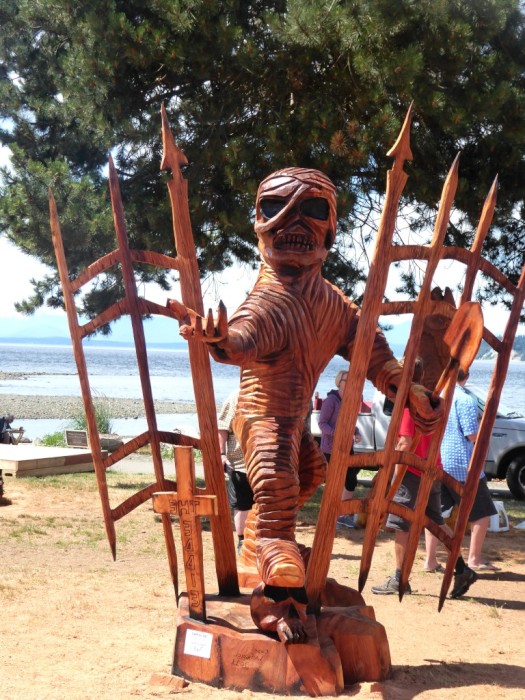
At Willow Point, just South of Campbell River , wood carvers gather to convert raw cedar or oregon log chunks into something artistic. The products are scattered around town and across Vancouver Island.
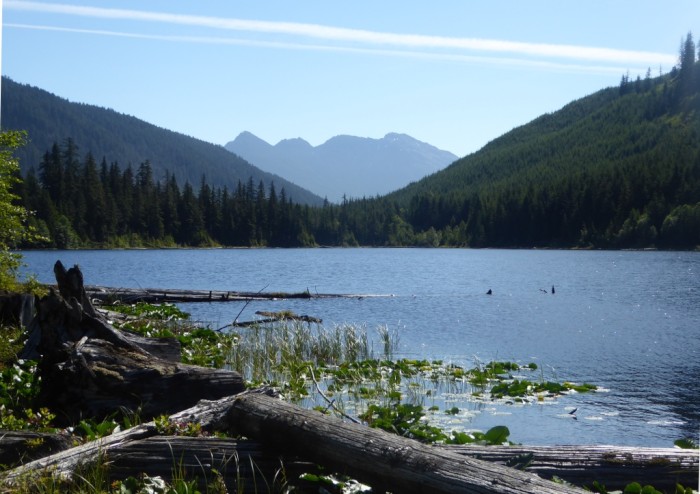
Keta Lake, one of many along Highway 19 between Campbell River and Port Hardy.
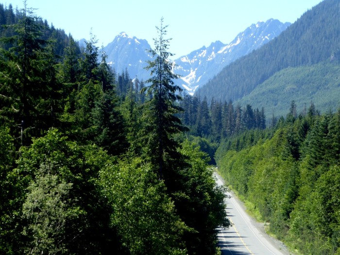
Everywhere on Vancouver island there are beautiful, craggy snowcapped mountains and conifer forest. Lovely weather when this photo along Highway 19 was taken!
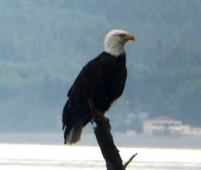
A bald eagle along the stony beach east of Port McNeil.
The campsite manager here told us to stick all our food in the laundry room "because we are in prime bear country". Actually, we saw more bear poo along the Sunshine Coast highway and haven't been too bothered when we camped wild on the way up here but guess there must be some bears around somewhere although the most interesting wildlife we have seen so far is some huge, black slugs.
Apart from the humming birds which we have seen in many places, we have also seen and heard a lot of woodpeckers, sometimes resonating through the woods like a discordant, percussion orchestra!
The logging industry is very noticeable up here, with plenty of logging trucks hurtling along Highway 19 in both directions and scars all over the beautiful mountain scenery, even close to the snowline. For some reason, the trees are clear felled in discrete patches, then left to regrow.
We are hopping on our last ferry ride in a day or two, if the sun reappears, up to Prince Rupert, near the Alaskan border. Next stop north would be Ketchikan, but we will probably head south east towards the Rockies and leave Alaska for some later time, perhaps when we have bought fur coats (artificial ones of course).
At Willow Point, just South of Campbell River , wood carvers gather to convert raw cedar or oregon log chunks into something artistic. The products are scattered around town and across Vancouver Island.
Keta Lake, one of many along Highway 19 between Campbell River and Port Hardy.
Everywhere on Vancouver island there are beautiful, craggy snowcapped mountains and conifer forest. Lovely weather when this photo along Highway 19 was taken!
A bald eagle along the stony beach east of Port McNeil.
Beauty in the Clouds
23 June 2016 | Kent's Beach nr Powell River, Sunshine Coast, BC
Alison and Geoff, weather improving?
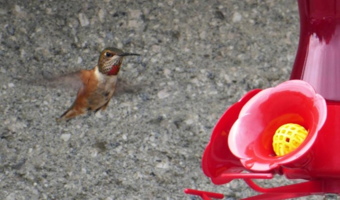
Photo shows a rufous hummingbird. They migrate up the Pacific coast in late spring when the flowers they prefer begin to bloom.
We are now at the end of the Sunshine Coast Highway near a town called Powell River. It has been cold, grey and drizzly, with steady rain last night.
We crossed over on our second BC ferry today and were amazed to see a couple of pairs of hummingbirds hovering around a feeder near the Earls Cove ferry terminal - delicate beauties - with a backdrop of soaring peaks and misty inlets. This area is a huge cruising ground and we regret not having Saraoni instead of the bikes, but that's a whole new ball game to think about!
The BC ferry arrives out of the Sunshine Coast murk at Earl's Cove
We have met some interesting locals and learned about the bears, coyotes, fishing and logging as well as what are called First Nation people here and now at last the sky has sort of cleared, so perhaps the Sunshine Coast will live up to its name! Wonder if it was a Canadian who first gave the nickname "winterless North" to Northland?
Tweedledum and Tweedledee on a Canadian cycling extravaganza
21 June 2016 | Sechelt, Sunshine coast, BC
Alison and Geoff
Photo shows us in our matching $5 Red Cross op shop jackets with matching crappy white bikes at a provincial park on the Sunshine Coast - Tweedledum and Tweedledee!
We are on the oddly named Sunshine Coast on the mainland of the Canadian province of British Columbia, also rather oddly named as it seems more like its big brother below the 49th parallel.
We arrived in Vancouver in the dead of the night from Sacramento with no Canadian dollars and no clue where we were or where our hotel was. Vancouver regularly gets chosen as the"best place in the world to live" but obviously whoever chose the city hadn't been down East Hastings Street, where our hotel was. The streets were grubby and full of sad looking homeless people. The busiest building was the Salvation Army centre nearby with around 200 people queued up outside, presumably for food.
Vancouver has had similar housing affordability problems as Auckland and like the NZ government, neither the BC or the Canadian federal government seems to know what to do about it other than turn a blind eye to the consequences.
Of course, not everywhere was so shocking. Down by the waterfront, there were the famous views across to the snow covered mountains. Vancouver has a large Chinese community, many of whom have been here for years as they have in other cities along the Pacific North American Coast. Chinatown was fascinating with many stores selling stuff we have never seen before and no labels in English, either.
The hotel manager at the place we were staying seemed to echo Vancouver's diversity. An ethic Indian with a Zanzibari (Shirazi) mum and a Gujarati dad, born in Tanzania, a Shia by religion and Gujarati by culture and presumably Canadian as much as anything else after 30 years on the B.C. coast.
We bought 2 cheap bikes from a large store called Canadian Tire, loaded them up with all the bike gear and headed over the Lion's Gate bridge to the mainland and headed west. The route takes us along the hilly Sunshine Coast with a couple of ferry crossings, then we cross over to Vancouver Island, which protects the coast from adverse wind and waves.
We then plan to take another ferry from the north end of Vancouver Island up to the town of Prince Rupert near the Alaskan border. If we haven't died by then we will take the Yellowhead Highway, 1000 km to Jasper NP in the Canadian Rockies. After that, the plan evaporates!
Simply Stunning! California's Sierra Nevada
15 June 2016 | Sacramento, California, USA
Alison and Geoff, cool and cloudy
Photo shows Yosemite Falls in the Yosemite Valley in California's Sierra Nevada
We are in Sacramento, California's state capital, a historic, but otherwise seemingly dull, widely spaced out city with its streets conveniently (for us) labelled numerically and alphabetically so we can't get lost! We are hanging around tapping away in the public library before getting the Amtrak (train) to San Diego, then Vancouver in Canada.
We have had a busy week, landing in L.A. and setting off straight away to see our old yachtie companions between Australia and the Med, Judy and Dave ex Freebird. They swallowed the anchor some time ago, but have steadily made their way closer to the Pacific Ocean again, settling on the coast between San Diego and L.A.
Yikes! The I5 (interstate) - the busy 6 lane freeway in Southern California
We made our way up to the Sierra Nevada, the mountain range that separates California's central valley and the Nevada desert. It has the world's largest trees, the giant sequoias and the highest mountain in the lower 48 states, Mt. Whitney.
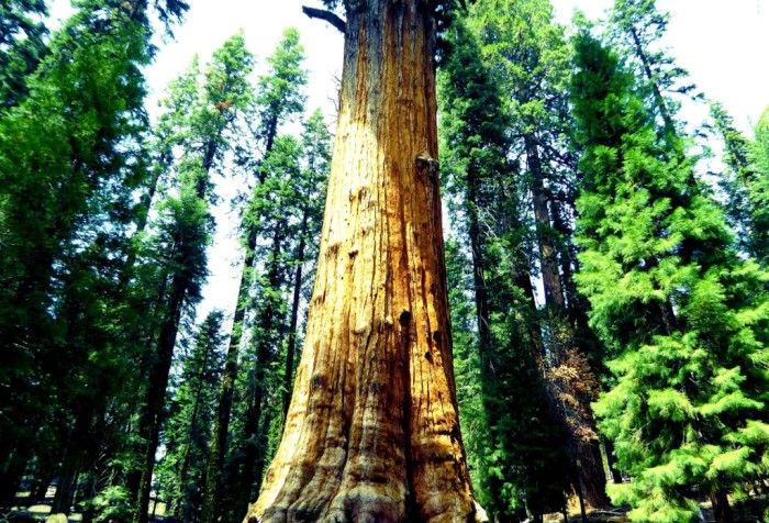
General Sherman - one of the world's 2 largest trees by volume. It's not the oldest, which is another giant sequoia, estimated to be 3,200 years old
We were lucky with the weather and got to see many of the remaining old giants in Sequoia National Park, then the waterfalls and granite walls of Yosemite. Around 7 million people visit Yosemite National Park every year, twice the number of tourists that visit NZ every year. It seemed that there were nearly that number in the Yosemite Valley the day we were there and it was bumper to bumper at times, but the views were phenomenal.
Click here for an interesting update on comments about effects of climate change made by U.S. President Obama on a visit to Yosemite a day ago
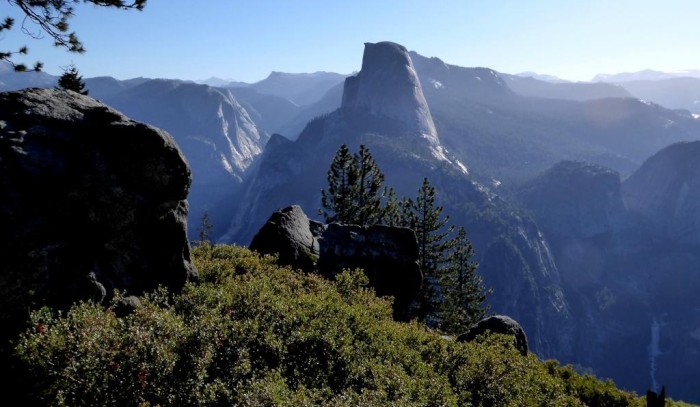
Half Dome at Yosemite
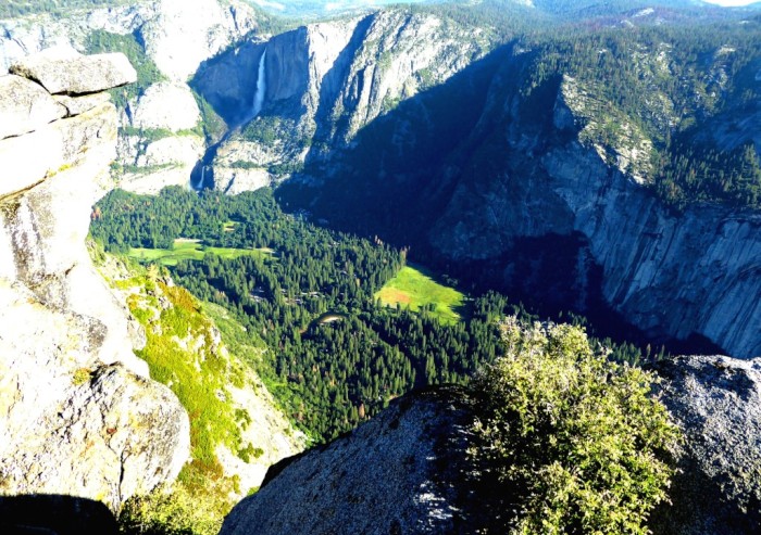
Yosemite Valley from Glacier Point
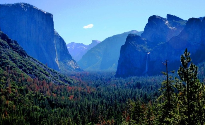
The Yosemite Valley from the entrance tunnel
We found more space in the higher parts of Yosemite towards Tuolomne Meadows, where we found our old friend, the Pacific Crest Trail. It passes this point on its rambling way between Mexico and Canada. According to the notice on the Tuolomne store door, three times as many hikers are tackling the PCT after the film "Wild" was released.
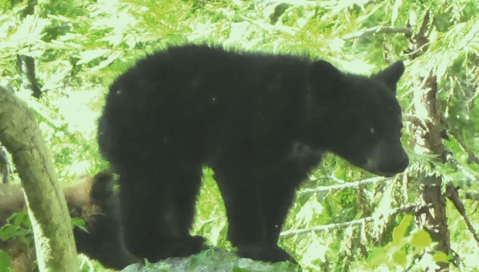
Black bear cub in Sequoia NP near the Lodgepole campground.
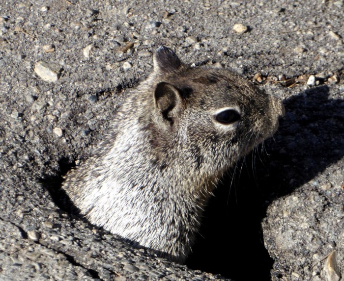
Cheeky ground squirrel at the Glacier Point lookout, Yosemite
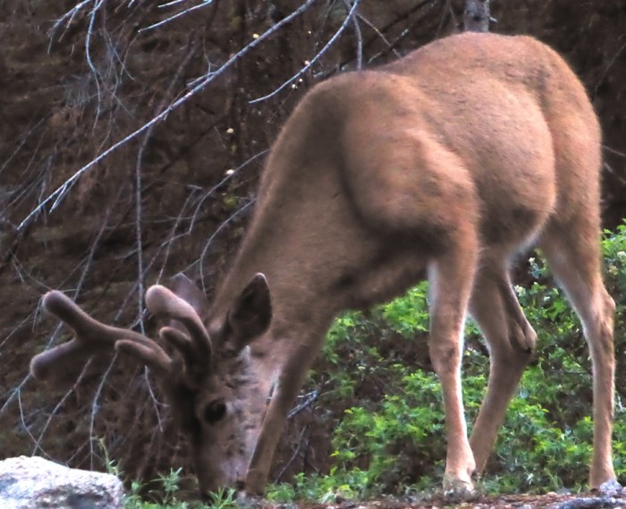
Mule deer buck near Yosemite Valley roadside
Every time we have visited the U.S. there is a mass shooting. The country is going through another bout of agonising after the latest killings in Orlando. The fact that the somewhat farcical lead up to the presidential election is taking place makes the discussion about gun control and Islamic extremism more potent.
The U.S. is certainly a more complex place than it might seem from outside and we are not sure whether we undesrtand its collective psyche any better this time round. It will be interesting to compare and contrast this huge country with its northern neighbour.
We are in Sacramento, California's state capital, a historic, but otherwise seemingly dull, widely spaced out city with its streets conveniently (for us) labelled numerically and alphabetically so we can't get lost! We are hanging around tapping away in the public library before getting the Amtrak (train) to San Diego, then Vancouver in Canada.
We have had a busy week, landing in L.A. and setting off straight away to see our old yachtie companions between Australia and the Med, Judy and Dave ex Freebird. They swallowed the anchor some time ago, but have steadily made their way closer to the Pacific Ocean again, settling on the coast between San Diego and L.A.
Yikes! The I5 (interstate) - the busy 6 lane freeway in Southern California
We made our way up to the Sierra Nevada, the mountain range that separates California's central valley and the Nevada desert. It has the world's largest trees, the giant sequoias and the highest mountain in the lower 48 states, Mt. Whitney.
General Sherman - one of the world's 2 largest trees by volume. It's not the oldest, which is another giant sequoia, estimated to be 3,200 years old
We were lucky with the weather and got to see many of the remaining old giants in Sequoia National Park, then the waterfalls and granite walls of Yosemite. Around 7 million people visit Yosemite National Park every year, twice the number of tourists that visit NZ every year. It seemed that there were nearly that number in the Yosemite Valley the day we were there and it was bumper to bumper at times, but the views were phenomenal.
Click here for an interesting update on comments about effects of climate change made by U.S. President Obama on a visit to Yosemite a day ago
Half Dome at Yosemite
Yosemite Valley from Glacier Point
The Yosemite Valley from the entrance tunnel
We found more space in the higher parts of Yosemite towards Tuolomne Meadows, where we found our old friend, the Pacific Crest Trail. It passes this point on its rambling way between Mexico and Canada. According to the notice on the Tuolomne store door, three times as many hikers are tackling the PCT after the film "Wild" was released.
Black bear cub in Sequoia NP near the Lodgepole campground.
Cheeky ground squirrel at the Glacier Point lookout, Yosemite
Mule deer buck near Yosemite Valley roadside
Every time we have visited the U.S. there is a mass shooting. The country is going through another bout of agonising after the latest killings in Orlando. The fact that the somewhat farcical lead up to the presidential election is taking place makes the discussion about gun control and Islamic extremism more potent.
The U.S. is certainly a more complex place than it might seem from outside and we are not sure whether we undesrtand its collective psyche any better this time round. It will be interesting to compare and contrast this huge country with its northern neighbour.
The cocks crow, the warm wind blows and the sun shines in Niue
28 May 2016 | The Island of Niue
Alison and Geoff, warm and sunny
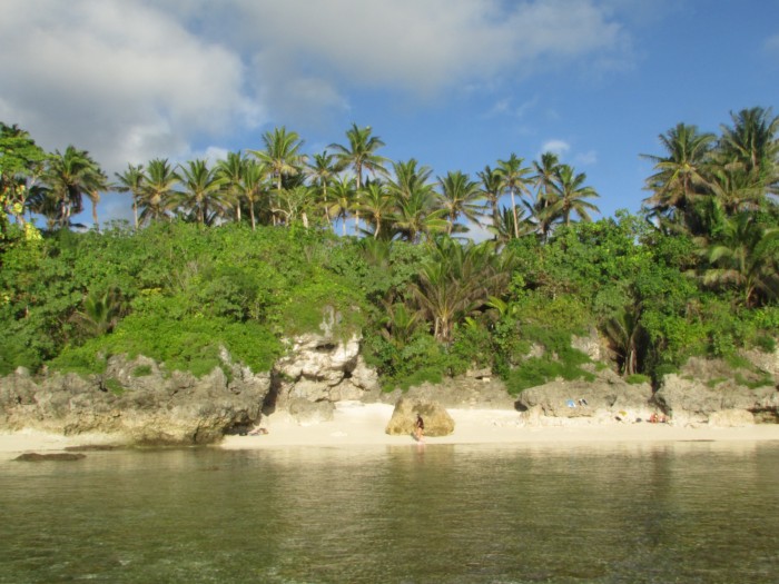
Photo shows one of Niue's tiny coral sand beaches across the narrow fringing reef near the Alofi police station.
A budget Air New Zealand flight and a quick decision whisks us away from the cold winter storms of northern New Zealand to the shorts and t-shirt weather of Niue and it's not even too hot as the trade wind blows constantly. It's almost home away from home as yachts drift in and out of the picturesque anchorage nestled below the coral cliffs in crystal clear waters.
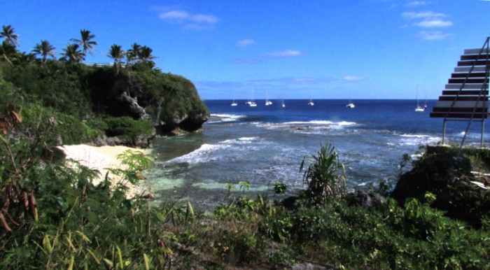
Some of the ARC yachts on the Niue Yacht Club moorings off Alofi
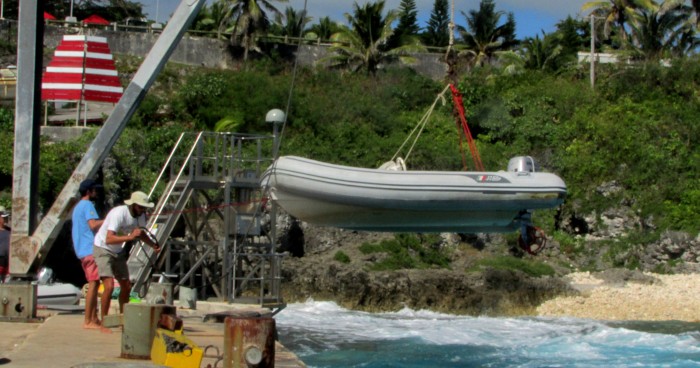
The only way to get small boats in and out is with a winch because of the swell waves crashing on to the reef
Niue is a single independent nation some 20 kilometres long and 15 kilometres wide. It has become famed as a whale watching destination between July and September but at the moment apart from the daily movement of the 1300 population the only other sounds are the early morning cockerels crowing 2 hours before dawn and the sounds of the waves crashing on the coral cliffs.
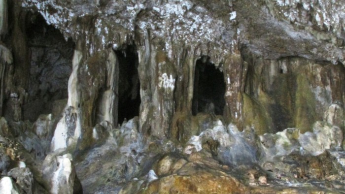
Much of the Niue coast is riddled with huge caves, part of the upraised atoll sea wall.
Even though it can be prone to cyclones it will never be affected by global warming as the island sits on a raised coral platform embedded in sea caves that rise up to 30 metres from the sea. The highest point is 69 m.
It was first inhabited in the 9th century by intrepid Samoan explorers who somehow clambered over the rugged, indented cliffs onto the relatively flat platform above. It was scorned by European explorers who couldn't find much to plunder. At that time they couldn't have stayed long enough to discover the fresh spring waters lodged in the ground topped up yearly by the 4.5 metres of rainfall. No need for chlorination here.
In the early days up to 20,000 residents inhabited the island but many drifted to New Zealand, Australia and the U.S. seeking work and a different life but many still maintain family ties and homes on the island.
The island was a NZ colony, initially grabbed by the British at the end of the 19th century until 1974 when a referendum decided its fate which was to be self-governing. However all Niueans have NZ passports and drift between the two countries on the twice weekly flight.
No age group seems to dominate the island, just a mix of young and old. The monthly ship brings in all supplies and of course tropical fruit and vegetables grow prolifically throughout the island.
It has a few unusual species such as the nocturnal coconut crab, the uga, and the deadly banded sea snake known in Niuean as the katuali.
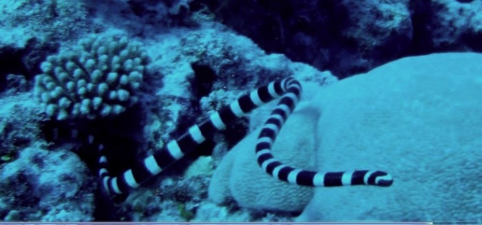
The Niuean banded sea snake or katuali is very common and VERY friendly, or just plain nosy. It also has 10 times the venom of a cobra!
Whales use the island's sheltered waters in the southern winter to raise their young before migrating back south in October to feed in Antarctic waters. Some are so well known that they have been given names, recognised by their distinctive tail fluke patterns.
We have already biked 60 kms. of the coast and are renting a car for a day or 2 to see the rest of the island. A dive has been scheduled for this afternoon.
A budget Air New Zealand flight and a quick decision whisks us away from the cold winter storms of northern New Zealand to the shorts and t-shirt weather of Niue and it's not even too hot as the trade wind blows constantly. It's almost home away from home as yachts drift in and out of the picturesque anchorage nestled below the coral cliffs in crystal clear waters.
Some of the ARC yachts on the Niue Yacht Club moorings off Alofi
The only way to get small boats in and out is with a winch because of the swell waves crashing on to the reef
Niue is a single independent nation some 20 kilometres long and 15 kilometres wide. It has become famed as a whale watching destination between July and September but at the moment apart from the daily movement of the 1300 population the only other sounds are the early morning cockerels crowing 2 hours before dawn and the sounds of the waves crashing on the coral cliffs.
Much of the Niue coast is riddled with huge caves, part of the upraised atoll sea wall.
Even though it can be prone to cyclones it will never be affected by global warming as the island sits on a raised coral platform embedded in sea caves that rise up to 30 metres from the sea. The highest point is 69 m.
It was first inhabited in the 9th century by intrepid Samoan explorers who somehow clambered over the rugged, indented cliffs onto the relatively flat platform above. It was scorned by European explorers who couldn't find much to plunder. At that time they couldn't have stayed long enough to discover the fresh spring waters lodged in the ground topped up yearly by the 4.5 metres of rainfall. No need for chlorination here.
In the early days up to 20,000 residents inhabited the island but many drifted to New Zealand, Australia and the U.S. seeking work and a different life but many still maintain family ties and homes on the island.
The island was a NZ colony, initially grabbed by the British at the end of the 19th century until 1974 when a referendum decided its fate which was to be self-governing. However all Niueans have NZ passports and drift between the two countries on the twice weekly flight.
No age group seems to dominate the island, just a mix of young and old. The monthly ship brings in all supplies and of course tropical fruit and vegetables grow prolifically throughout the island.
It has a few unusual species such as the nocturnal coconut crab, the uga, and the deadly banded sea snake known in Niuean as the katuali.
The Niuean banded sea snake or katuali is very common and VERY friendly, or just plain nosy. It also has 10 times the venom of a cobra!
Whales use the island's sheltered waters in the southern winter to raise their young before migrating back south in October to feed in Antarctic waters. Some are so well known that they have been given names, recognised by their distinctive tail fluke patterns.
We have already biked 60 kms. of the coast and are renting a car for a day or 2 to see the rest of the island. A dive has been scheduled for this afternoon.
The Penguin Pad
20 May 2016 | Tutukaka, Northland, NZ
Geoff and Alison, cool at night, warm in the daytime
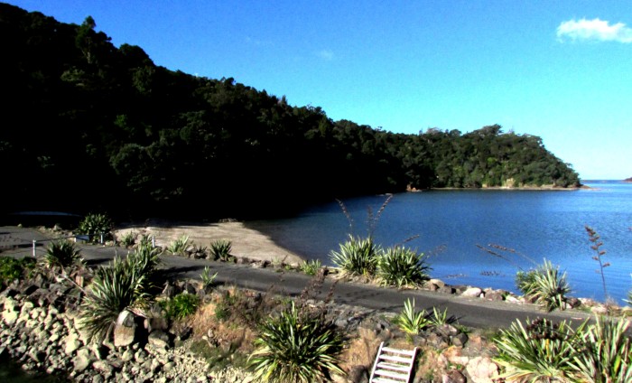
Photo shows the outer harbour beyond the breakwater (foreground) from Saraoni's spreaders. Penguins are nesting in the cracks between the large rocks that make up the breakwater. The nearest and loudest pair is nesting under the flax bush at bottom right.
We are back behind the Tutukaka marina breakwater and so are the penguins.
These are (little) blues and are a little smaller than the Galapagos penguins we saw last year in Isabela. In fact, they are the world's smallest penguins. The pairs share the incubating and chick caring, once eggs are laid a little later in the year. They make a hell of a noise just before dawn, a sort of braying, donkey like noise. Once they start up, it's hard to sleep. The closest pair to us is using a large clump of flax just metres from our bow. There are 5 other pairs at last count along the line of rocks towards the fuel wharf.
The penguins normally head out of the main harbour offshore to do their feeding just before dawn and return on dusk, but for some reason or other, only one penguin is jumping into the water each morning out of the whole colony at the moment. The others seem to be staying in their rocky holes all day and night. Perhaps they are moulting, which takes 2 - 3 weeks every year, but that normally finishes much earlier - around Feb or March, so we don't know what is going on! Perhaps they are too busy on Facebook? Nigel, Whangarei DOC's bird guy, speculated that they may be busy "cementing their relationships", whatever that means!
For all the usual imported predator reasons, plus human disturbance, road kill etc. there are not many of NZ's 3 species of penguins nesting successfully on the mainland. Most of them are now only nesting on predator free offshore islands. It looks as if the Tutukaka penguins nest here because of the structure of the breakwater. Dogs and feral cats can't get at them and ad hoc local predator control keeps the stoats away. The famous Oamaru (SI) penguins, where visitors can see up to 200 little blues arriving in the evening, took to nesting in an abandoned quarry. Perhaps because the income from visitors goes towards controlling potential predators, that particular colony is doing ok.
In the winter season, there are far fewer boats moving in and out of the marina, so the local wildlife has it more to themselves. The bottom of the food chain are the large schools of sprats and pilchards, which are kai for just about everything around here. The feeding frenzy starts just before dawn, with trevally and other predators chasing the little bait fish. Then, as the sun comes up, pied shags and black cormorants, gannets, terns, white faced herons and kingfishers take over.
At night, normally just after sunset or just before dawn, we can hear kiwi calling: a male and a female in the bush above the marina and several others from the Te Maika area across the harbour. A female kiwi was making her harsh call in the bush just above the marina office half an hour after dawn this morning. One wonders just how many kiwis (the human variety) have ever heard or seen a wild kiwi. More common are the morepork owls (ruru). About half a dozen call all around from the bush: they seem to spend more time yakking to each other than hunting!
The other obvious creatures here are the rays: short tailed and long tailed rays wander around inside the shallow shores, looking for crabs and molluscs and occasionally eagle rays or bottle nosed dolphins find their way into the marina.
We are getting the boat bedded down for the winter before we take off and checking everything we need to do when we have more time when we get back. We have also managed to resurrect our sailing dinghy, the rig of which has survived 10 years in the Kaitaia backblocks with the cows jumping all over it.
Tutukaka has 9 small beaches of its own, separated by rocky headlands and Philip Island in the middle. They're just right for a sail and a sundowner, although by 6 it's already dark and too chilly to hang around!
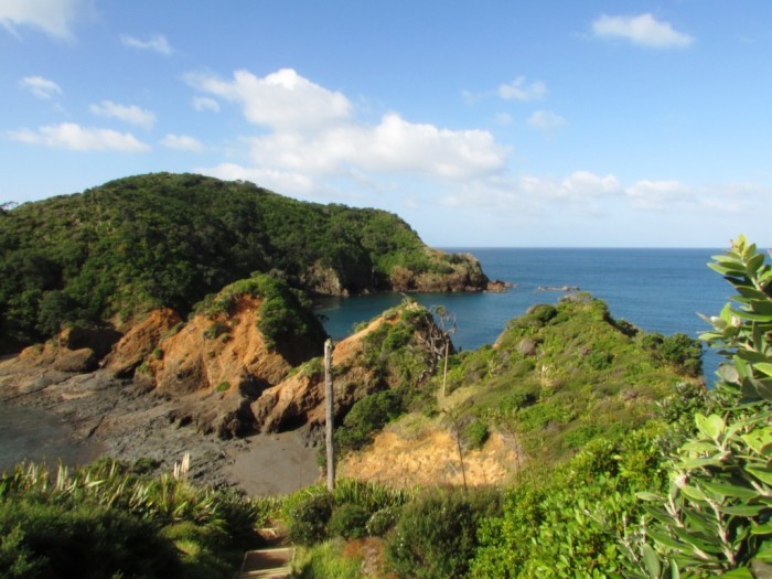
Kukutuwhao Island (Lighthouse Island) at the end of the Tutukaka DOC reserve
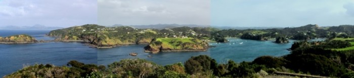
Tutukaka harbour from the lighthouse on Kukutuwhao Island
We are back behind the Tutukaka marina breakwater and so are the penguins.
These are (little) blues and are a little smaller than the Galapagos penguins we saw last year in Isabela. In fact, they are the world's smallest penguins. The pairs share the incubating and chick caring, once eggs are laid a little later in the year. They make a hell of a noise just before dawn, a sort of braying, donkey like noise. Once they start up, it's hard to sleep. The closest pair to us is using a large clump of flax just metres from our bow. There are 5 other pairs at last count along the line of rocks towards the fuel wharf.
The penguins normally head out of the main harbour offshore to do their feeding just before dawn and return on dusk, but for some reason or other, only one penguin is jumping into the water each morning out of the whole colony at the moment. The others seem to be staying in their rocky holes all day and night. Perhaps they are moulting, which takes 2 - 3 weeks every year, but that normally finishes much earlier - around Feb or March, so we don't know what is going on! Perhaps they are too busy on Facebook? Nigel, Whangarei DOC's bird guy, speculated that they may be busy "cementing their relationships", whatever that means!
For all the usual imported predator reasons, plus human disturbance, road kill etc. there are not many of NZ's 3 species of penguins nesting successfully on the mainland. Most of them are now only nesting on predator free offshore islands. It looks as if the Tutukaka penguins nest here because of the structure of the breakwater. Dogs and feral cats can't get at them and ad hoc local predator control keeps the stoats away. The famous Oamaru (SI) penguins, where visitors can see up to 200 little blues arriving in the evening, took to nesting in an abandoned quarry. Perhaps because the income from visitors goes towards controlling potential predators, that particular colony is doing ok.
In the winter season, there are far fewer boats moving in and out of the marina, so the local wildlife has it more to themselves. The bottom of the food chain are the large schools of sprats and pilchards, which are kai for just about everything around here. The feeding frenzy starts just before dawn, with trevally and other predators chasing the little bait fish. Then, as the sun comes up, pied shags and black cormorants, gannets, terns, white faced herons and kingfishers take over.
At night, normally just after sunset or just before dawn, we can hear kiwi calling: a male and a female in the bush above the marina and several others from the Te Maika area across the harbour. A female kiwi was making her harsh call in the bush just above the marina office half an hour after dawn this morning. One wonders just how many kiwis (the human variety) have ever heard or seen a wild kiwi. More common are the morepork owls (ruru). About half a dozen call all around from the bush: they seem to spend more time yakking to each other than hunting!
The other obvious creatures here are the rays: short tailed and long tailed rays wander around inside the shallow shores, looking for crabs and molluscs and occasionally eagle rays or bottle nosed dolphins find their way into the marina.
We are getting the boat bedded down for the winter before we take off and checking everything we need to do when we have more time when we get back. We have also managed to resurrect our sailing dinghy, the rig of which has survived 10 years in the Kaitaia backblocks with the cows jumping all over it.
Tutukaka has 9 small beaches of its own, separated by rocky headlands and Philip Island in the middle. They're just right for a sail and a sundowner, although by 6 it's already dark and too chilly to hang around!
Kukutuwhao Island (Lighthouse Island) at the end of the Tutukaka DOC reserve
Tutukaka harbour from the lighthouse on Kukutuwhao Island
Last of the Summer Wine?
14 May 2016 | Off Bland Bay, Northland, NZ
Geoff and Alison, warm and calm
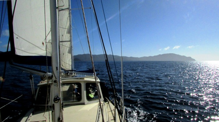
Photo shows Saraoni in the sun off Bland Bay with Cape Brett in the distance
Just left Whangamumu harbour on the way back to Tutukaka. It's not far off the official start of winter here in NZ, but the sun is shining with a light northerly breeze and plenty of blue sky. It's been so warm that we actually jumped in the water yesterday with the dive gear to clean the crap off the hull.
The media and the NZ Metservice has been predicting the "end of autumn" for some time, and for sure the winds have turned to the west after what seems to have been weeks from the east. Westerly winds tend to be prevalent when the high pressure systems that pass from west to east move to the North of NZ - a winter pattern. Easterly winds are more common in summer when the high pressure is to the south. Whatever, it makes for a smooth run along the Northland coast with only a very gentle swell.
Saraoni will be put to sleep in its Tutukaka berth while we head up to Niue by Air NZ in just over a week. Think we will miss out on the first humpbacks arriving, but we'll have a look out on the way up!
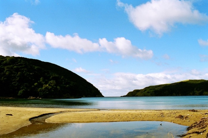
Whangamumu from the head of the harbour. It was a whaling station for twenty years or so at the beginning of the twentieth century - southern right whales unfortunately swam close by on their annual migration, but got trapped in nets laid for them just inside the harbour heads. Southern rights were hunted like many whales to near extinction.. They are now very slowly recovering. Whangamumu is surrounded by public conservation land and is a lovely anchorage in westerlies, slowly reverting back to nature.
Just left Whangamumu harbour on the way back to Tutukaka. It's not far off the official start of winter here in NZ, but the sun is shining with a light northerly breeze and plenty of blue sky. It's been so warm that we actually jumped in the water yesterday with the dive gear to clean the crap off the hull.
The media and the NZ Metservice has been predicting the "end of autumn" for some time, and for sure the winds have turned to the west after what seems to have been weeks from the east. Westerly winds tend to be prevalent when the high pressure systems that pass from west to east move to the North of NZ - a winter pattern. Easterly winds are more common in summer when the high pressure is to the south. Whatever, it makes for a smooth run along the Northland coast with only a very gentle swell.
Saraoni will be put to sleep in its Tutukaka berth while we head up to Niue by Air NZ in just over a week. Think we will miss out on the first humpbacks arriving, but we'll have a look out on the way up!
Whangamumu from the head of the harbour. It was a whaling station for twenty years or so at the beginning of the twentieth century - southern right whales unfortunately swam close by on their annual migration, but got trapped in nets laid for them just inside the harbour heads. Southern rights were hunted like many whales to near extinction.. They are now very slowly recovering. Whangamumu is surrounded by public conservation land and is a lovely anchorage in westerlies, slowly reverting back to nature.
| Vessel Name: | Saraoni (1) and Sundari (2) |
| Vessel Make/Model: | South Coast 36 and Beneteau 473 respectively |
| Hailing Port: | Lamb Island, Australia |
| Crew: | Alison and Geoff Williams |
| About: | |
| Extra: | CONTACT DETAILS Telephone / SMS number +61 456 637 752 (Australian mobile no.) +64 28 432 5941 NZ mobile no.) Email yachtsundari@gmail.com (main email address) |
Saraoni (1) and Sundari (2)'s Photos - Main
.JPG) |
A collection of photos taken while teaching and cruising in PNG's Milne Bay Province
74 Photos
Created 29 April 2023
|
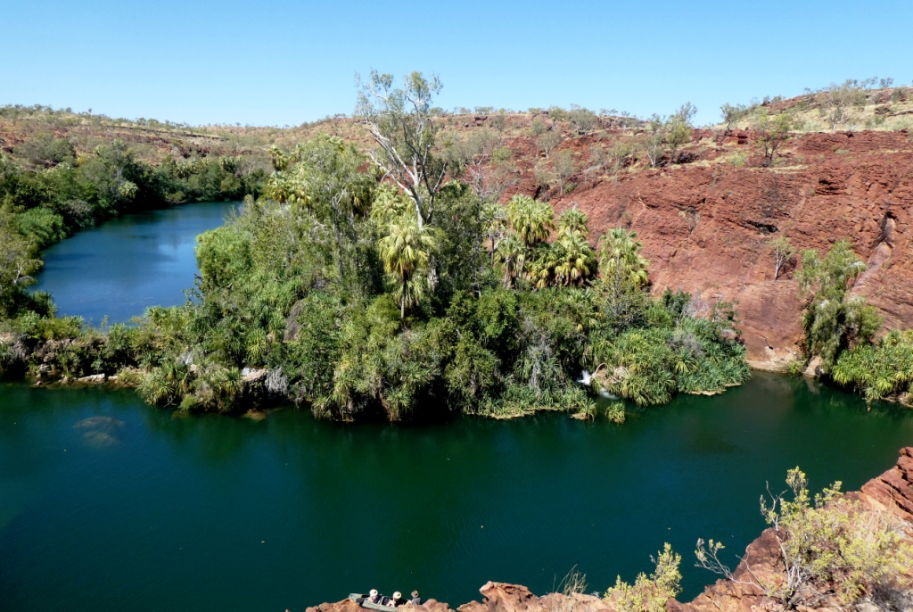 |
 |
Some rather idiosyncratic metal sculptures in outback Queensland between Aramac and Lake Dunn
8 Photos
Created 27 September 2020
|
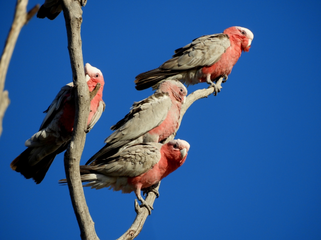 |
Birds and other critters on our Queensland inland safari
12 Photos
Created 27 September 2020
|
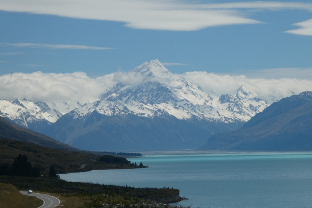 |
A collection of photos taken during the Tiki Tour of the Southern half of the South Island, November / December 2019
40 Photos
Created 15 December 2019
|
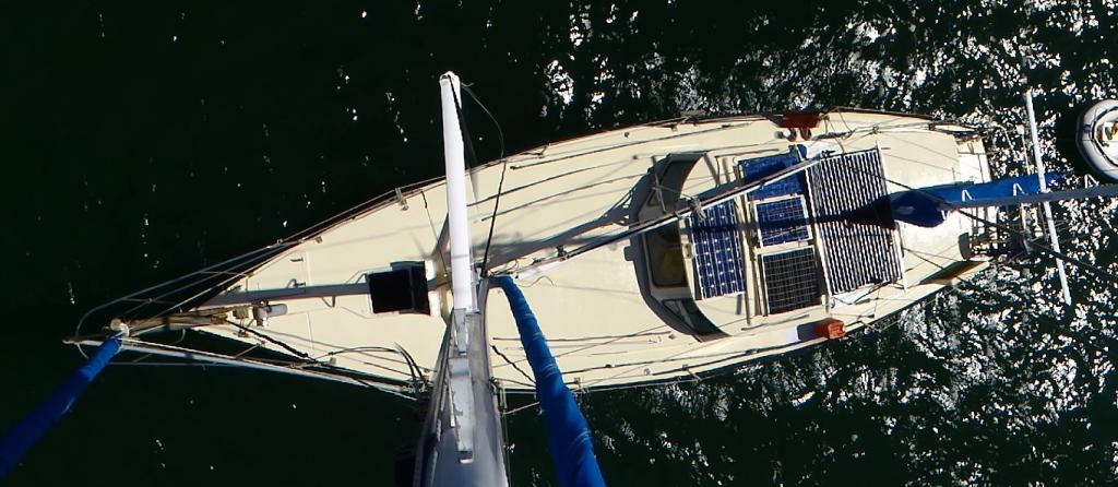 |
 |
Photos taken of Saraoni. All interior photos were taken in the last week.
10 Photos
Created 2 April 2019
|
 |
50 Photos
Created 27 June 2014
|
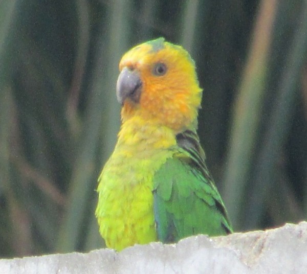 |
The ABCs - Aruba, Bonaire and Curacao are mostly low lying dry, scrubby islands in the Western Caribbean near the Venezuelan coastline
15 Photos
Created 21 May 2014
|
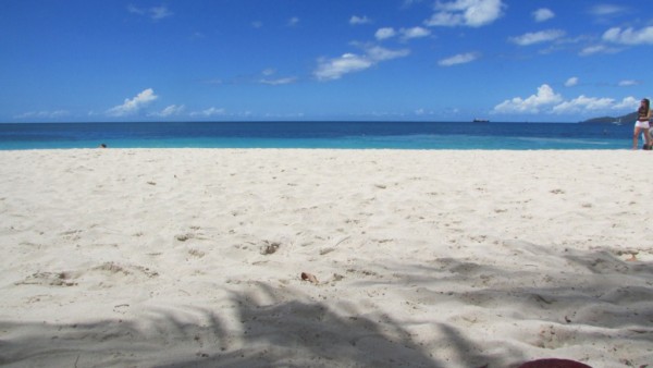 |
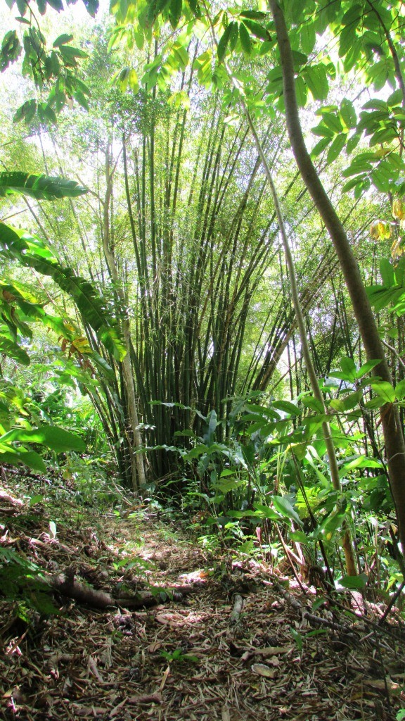 |
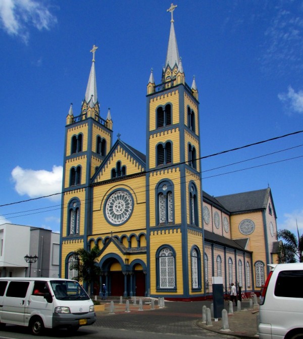 |
Images taken in and around Suriname's capital
40 Photos
Created 9 February 2014
|
 |
 |
Images of the 2 islands in the Cape Verde island group we visited on our way across the Atlantic in 2013 - Sao Vicente and Santo Antaao.
37 Photos
Created 26 December 2013
|
 |
 |
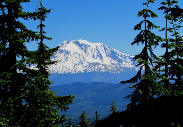 |
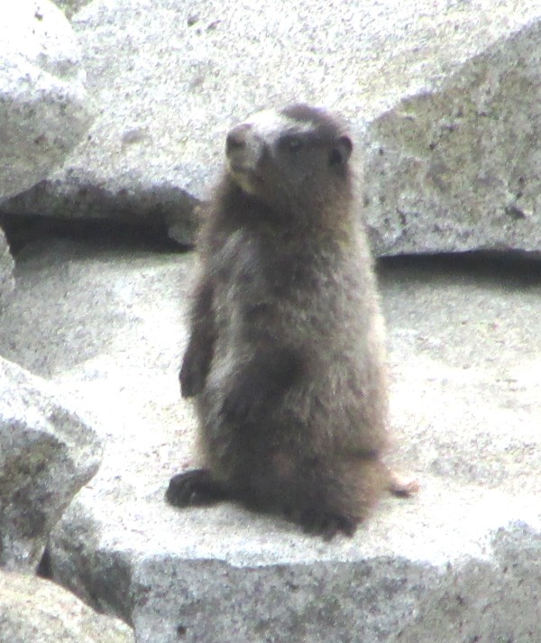 |
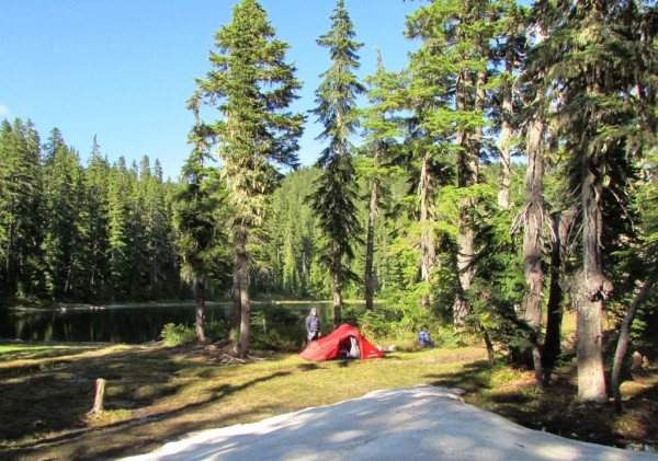 |
 |
Unexpected meeting with old friends "in the woods".
6 Photos
Created 24 June 2013
|
 |
A brother found amongst the gorges of the Cevennes
5 Photos
Created 10 June 2013
|
 |
Photographic images of our long walk along the Appalachian mountains in the USA
26 Photos
Created 10 June 2013
|
 |
 |
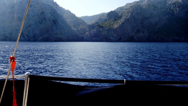 |
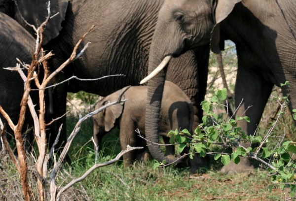 |
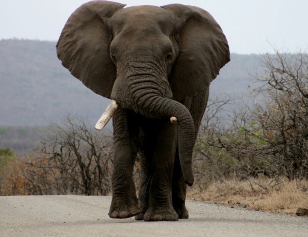 |
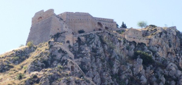 |
 |
Greece is in the throes of a recession, but they still have the last laugh - never far from the sun, the sea, colour, culture and bags of history. The photos document our Aegean odyssey from May to September 2011
31 Photos
Created 17 December 2011
|
 |
O.K. We're mad, but we somehow prefer a home on the sea to one on dry land.
12 Photos
Created 17 December 2011
|
 |
Kathmandu, Patan and Bhaktapur - the three ancient city states of the Kathmandu valley have mediaeval architectural wonders in their Durbars and old town areas - a meshing and merging of Hinduism, Buddhism and materialism
9 Photos
Created 17 December 2011
|
 |
Some of the shots taken of us while on one of our 30 odd days on the three main mountain trails we walked in the Anapurnas and Helambu region of Nepal's side of the Himalayas
10 Photos
Created 15 December 2011
|
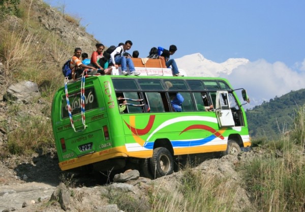 |
People make the Himalayas a unique place to walk through. From Hindu rice and buffalo farmers in the foothills to the Buddhist villages in the highlands so influenced by Tibetan ancestry and trade over the passes
16 Photos
Created 15 December 2011
|
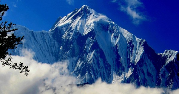 |
Nepal has ten of the world's highest mountains within its boundaries or shared with India and Tibet - these are truly giant peaks!
22 Photos
Created 15 December 2011
|
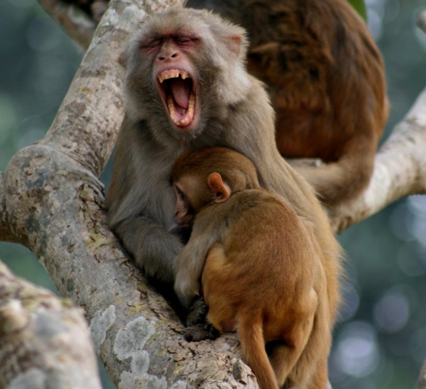 |
These were all photographed in the wilds of Chitwan and Bardia National Parks - which are two of the last havens of biodiversity in Nepal's low lying Terai district.
18 Photos
Created 14 December 2011
|
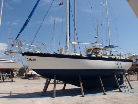 |
Saraoni hauled out on Finike's hardstand for biennial maintenance and painting
3 Photos
Created 26 April 2011
|
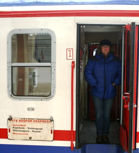 |
 |
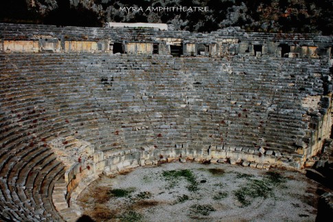 |
 |
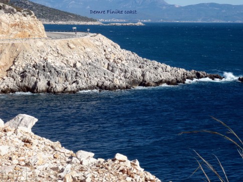 |
 |
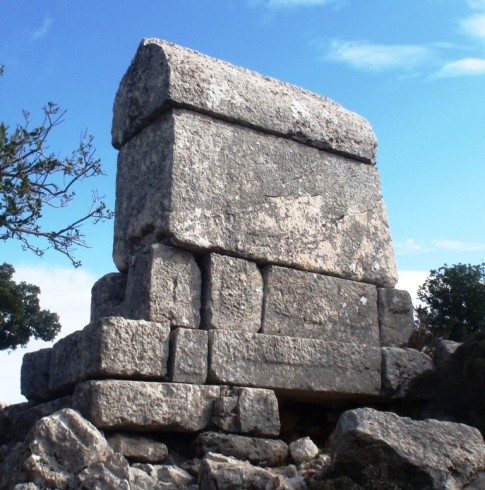 |
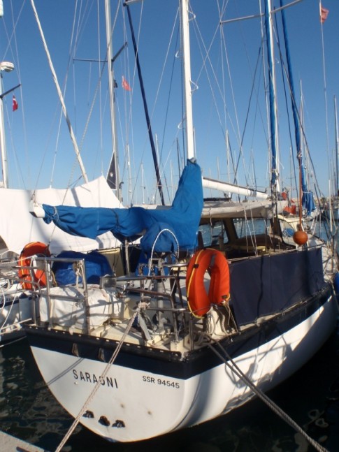 |
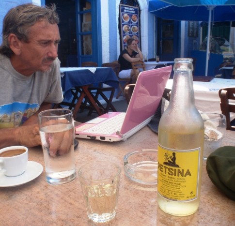 |
The small rocky island of Kastellorizou is Greece's most remote island
7 Photos
Created 11 December 2010
|
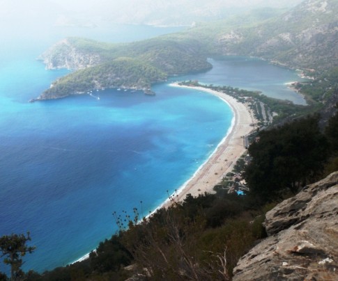 |
Cruising and walking Turkey's Lycian coast September and October 2010
19 Photos
Created 11 December 2010
|
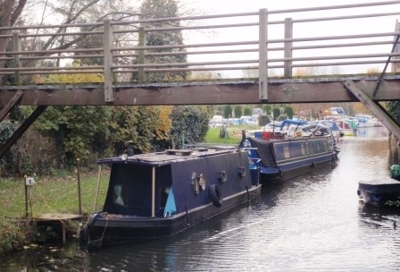 |
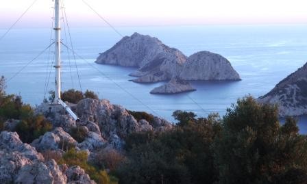 |
Images taken while walking sections of the 500 km Lycian Way or Lykia Yolu on the South West Mediterranean Coast of Turkey
11 Photos
Created 9 November 2010
|
Exploring as Much as We Can Until We Can't
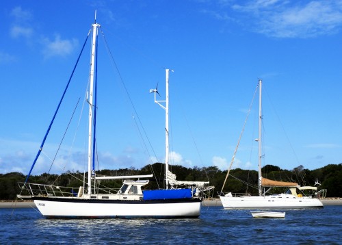
Who: Alison and Geoff Williams
Port: Lamb Island, Australia
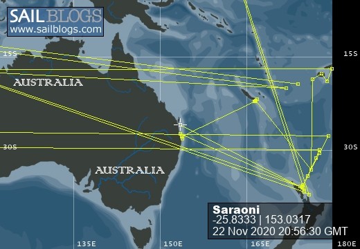
Blog Categories by Year
- 2023 Aust NZ
- 2022 Aust
- 2021 Aust
- 2020 Aust, NZ
- 2019 Aust, NZ
- 2018 New Cal Aust and NZ
- 2017 NZ, Aust, Tonga, Fiji, New Caledonia
- 2016 NZ Niue and Canada
- 2015 Pacific Crossing Panama to NZ, Galapagos, French Polynesia, Cooks, American Samoa and Tonga
- 2015 and 2014 Suriname Colombia Panama and Costa Rica
- 2014 U.S. Cycle trip
- 2014 Caribbean Islands Trinidad to Aruba
- 2014 Atlantic Crossing Cape Verdes to Suriname
- 2013 Cape Verdes, West Africa
- 2013 Canaries Post USA
- 2013 U.S.A. Hiking Trips Appalachians and Cascades
- 2013 Canaries Pre U.S.A.
- 2013 Morocco
- 2012 South Africa and Swaziland
- 2012 Mediterranean Spain and France
- 2012 Italy
- 2012 and 2011 Greece
- 2011 A Quarter Century on the Sea
- 2011 Nepal
- 2011 and 2010 Turkey
- 2010 Oman Yemen the Red Sea and Israel
- 2010 South Asia: India and Sri Lanka
- 2009 Malaysia and Thailand
- 2009 and 2008 Aust and SE Asia
- 2007 Australia
- 2006 NZ to New Caledonia and Australia
- A Tale of Three Boats
- 1978 to 2018 Perspectives on a Long Journey
SailBlogs Friends

