
The Voyages of s/v Silverheels III
...a virtual ship's logbook, and some thoughtful (unabashed?) reflections on our sea-going experiences.
04 November 2017 | Somewhere in the Eastern Caribbean
18 October 2017 | Le Marin, Martinique in the French West Indies
25 January 2017 | Gosier, Guadeloupe
19 January 2017 | Le Gosier, Guadeloupe
19 January 2017 | Le Gosier, Guadeloupe
19 January 2017 | St Pierre, Martinique
06 January 2017
01 January 2017 | Fort Du France, Martinique
28 December 2016 | Grand Anse d'Arlet, Martinique
24 December 2016
14 November 2016 | St Anne, Martinique
06 October 2016 | St Anne, Martinique
04 October 2016
20 July 2016 | Rodney Bay, St Lucia
15 June 2016
15 June 2016
13 June 2016
13 June 2016 | Grand Anse d'Arlets
13 June 2016 | Grand Anse d'Arlets
09 May 2016 | Deshaies, Guadeloupe
Much More then Just the Volcano
13 April 2014 | Little Bay, Montserrat
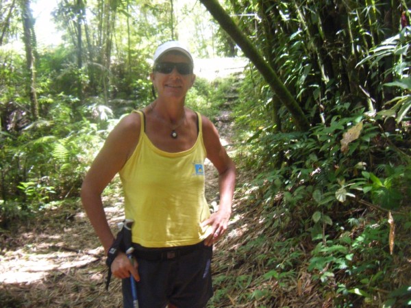
Lynn
After getting anchored, and cursing the damage to the main sail (to be fixed in the future), it was time to get the dinghy back into going ashore mode rather than being a barge. But first a better breakfast than GORP (good old raisins and peanuts) was required. And coffee, we definitely needed coffee.
Once food, nap and dinghy were done, we went ashore to make ourselves legal in Montserrat. Apparently it used to be a slight nuisance, but now it is quite easy, with just a little bit of office hopping. We caught the Immigration officer in, but nobody would have been stressed if we had seen her the next day or two, either. They even have you cleared out of the country if you leave within 72 hours of your arrival. If you depart after that, you need to go in and get a clearance. Convenient! It was amusing to see the reaction of the Customs officer’s face when I asked him what there was to see and do in Montserrat, besides the volcano, as he basically drew a blank. It is acknowledged by many people here that it is a quiet island.
After getting the paperwork done, Ken and I took a little stroll around the immediate area around the Seaport. It doesn’t look like Monserrat has lots of nice swimming beaches, but the one here has some development happening, including public washrooms and showers. Some people were enjoying the water and the beach, and others were working on the development adjacent to the Seaport. There are lots of signs of development in the area.
We found a cute little bar called “Ponty’s Bar and Restaurant” hidden by a cliff under a palm tree with a deck overlooking the anchorage. It has coconut palms to shade, and a great breeze to cool. Add in some of the coldest beer in the Caribbean and you have a winning combination. John was a gracious host and chatted with us as we enjoyed our beverages. We made a date to join the “crowd” for the Sunday afternoon barbecue. Popular with locals and tourists alike, this looks like an opportunity to chat with people. Beer finished, we went home to the boat. BTW, he also had a nice barbecue there on Sundays.
This morning I got up to go for my run. With only the cruising guide map to give me any idea of where the roads went, I took off with only the barest idea of where I was going. I eventually found the airport, which is nowhere near sea level and only for small planes, and followed my way out to “Hangman’s Hill” (named for a plantation owner who was cruel to his slaves who eventually went up there and hung himself). Let me be clear about Montserrat, it is NOT a flat place. A 200 foot climb is commonplace here. I once thought it would be neat to do the Montserrat “Run the Volcano” ½ marathon, but not after experiencing the hills on this island; it would be a very hard run. Well, maybe I would do it.
After breakfast, Ken and I put on our walking shoes, grabbed one of the hydration bags and headed out to explore. The tenuous plan was to take a bus to Salem, the main town (of sorts) of Montserrat, and conveniently located where you can see the volcano and the damage caused by it. The Montserrat Volcano Observatory is located on a hill overlooking Salem and the south end of the island.
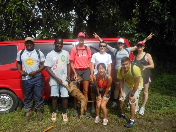
We met the crews of ‘Mezzaluna’ and ‘Recetta’ as we walked. Apparently their sail down the day before ours was not much better. They were in a mode to find goat waters (the national dish, according to Ann) and some groceries. They had done an island tour the previous day. We were in a mode to see things, and continued on our way.
We walked on, observing the nice roads, typically nice views, and spoke with a few people. We walked some more. We did see the same three buses pass by, but never really got around to flagging them. The main road is not busy with traffic, and wide enough to give ample room for vehicles and pedestrians. We came upon the “Hilltop Café”, by some sugar mill ruins, which is also a youth center. They have every type of coffee concoction you may want available, but even better, they have a collection of pictures from the days before the volcano acted up in the mid-1990’s, as well pictures of the events; paraphernalia associated with “Arrow”, the Montserrat native who gave the world that cruise ship and resort anthem “Hot, Hot, Hot” (there’s an ear worm for you… c’mon, “Olay, olay, olay, olay… feelin’ hot, hot, hot!”) He also tried to give us directions for the Oriole Trail Nature Walk, but apparently we didn’t get the directions right as we missed most of it. Maybe another time.
We got back to the main road after our botched attempt at the trail, and continued on after getting some drinks. Plantain chips we had purchased earlier were also devoured. Then we continued to walk. It had almost become the task to walk to Salem, forgoing our rather sensible idea of taking the bus.
The main west coast road of Montserrat is beautiful. It goes up, and it goes down. It has serpentine switchbacks for some of those ups and downs. Some parts of it are like walking through a glade in a garden or the rainforest, while other parts prove that there are some people living around there. Views abound, and while it was a long walk, the road seemed to make it easy, as we wanted to see what was up around the next corner (maybe even Salem!).
We finally turned a corner and saw the “Welcome to Salem” sign. One or two more curves and we could see the volcano in its’ full glory. With the topography of the island, you generally can’t see the volcano. There is a spine of hills or mountains that actually protected the north part of the island from the volcano’s pyroclastic flows when “Soufriere” was erupting. Before arriving in Montserrat, we both envisioned a smoking monster of a volcano looming over a small huddle of houses at the north end of the island. It is nothing like that at all. Unless you are in the right parts of the island, you can’t even see the smoke coming from the caldera, never mind the actual mountain. However, when you can see the volcano, complete with smoke coming out of the top, it isn’t easy to ignore.
While tired from walking for about 3 or more hours by this point, we felt the need to make the push for the Volcano Observatory. This required walking to an elevation of about 800 feet (we probably started at about 300 feet in Salem) and a further 1.5 miles more, give or take a little bit. But it seemed anticlimactic to NOT do this last bit. We would come back for some chicken and a cold drink from the bar.
While the observatory was closed, the helipad provided an excellent viewpoint of the volcano and some of the destruction it had caused. We could see the remnants of the town of Plymouth, where they are collecting the sand and gravel spewed out during the eruptions and exporting it. Smoke and steam could be seen close to the caldera, casting my mind back to the Valley of Desolation in Dominca. The main areas of flow were obvious, but the majority of it was hidden by a hill, or it was around the south side of the volcano, where we couldn’t see. Strangely, my GPS watch said we had walked 6.66 miles to get there. There were certainly some hellish things to be seen. Amazing to think how in such as short span of time, so many people’s lives were changed when the previously quiet volcano woke up.
We walked back down into town, in time to see Peter White’s bus in front of the bar. Ken and I had seen his bus numerous times during our walk. We asked him how long he was going to be waiting, since we had absolutely no intention of walking back. “Long enough for you to get a drink” he said as he smiled at us. It only cost us $5.00 EC each to get back to the boat, as much as our “Tings” cost us at the bar. Both would have been appreciated at even twice the price! The GPS watch said that we had climbed more than 3200 feet during our 8-plus mile walk. No wonder our feet were aching!
Montserrat is a beautiful island, and while the volcano certainly has had a huge impact on the inhabitants of the island, including emergency warning horns visible around the island, it is not the only thing to see. There are hiking trails, flora and fauna native only to Montserrat to be seen, and wonderful people to meet. But if you don’t like hills, this is not a good place to visit!
Once food, nap and dinghy were done, we went ashore to make ourselves legal in Montserrat. Apparently it used to be a slight nuisance, but now it is quite easy, with just a little bit of office hopping. We caught the Immigration officer in, but nobody would have been stressed if we had seen her the next day or two, either. They even have you cleared out of the country if you leave within 72 hours of your arrival. If you depart after that, you need to go in and get a clearance. Convenient! It was amusing to see the reaction of the Customs officer’s face when I asked him what there was to see and do in Montserrat, besides the volcano, as he basically drew a blank. It is acknowledged by many people here that it is a quiet island.
After getting the paperwork done, Ken and I took a little stroll around the immediate area around the Seaport. It doesn’t look like Monserrat has lots of nice swimming beaches, but the one here has some development happening, including public washrooms and showers. Some people were enjoying the water and the beach, and others were working on the development adjacent to the Seaport. There are lots of signs of development in the area.
We found a cute little bar called “Ponty’s Bar and Restaurant” hidden by a cliff under a palm tree with a deck overlooking the anchorage. It has coconut palms to shade, and a great breeze to cool. Add in some of the coldest beer in the Caribbean and you have a winning combination. John was a gracious host and chatted with us as we enjoyed our beverages. We made a date to join the “crowd” for the Sunday afternoon barbecue. Popular with locals and tourists alike, this looks like an opportunity to chat with people. Beer finished, we went home to the boat. BTW, he also had a nice barbecue there on Sundays.
This morning I got up to go for my run. With only the cruising guide map to give me any idea of where the roads went, I took off with only the barest idea of where I was going. I eventually found the airport, which is nowhere near sea level and only for small planes, and followed my way out to “Hangman’s Hill” (named for a plantation owner who was cruel to his slaves who eventually went up there and hung himself). Let me be clear about Montserrat, it is NOT a flat place. A 200 foot climb is commonplace here. I once thought it would be neat to do the Montserrat “Run the Volcano” ½ marathon, but not after experiencing the hills on this island; it would be a very hard run. Well, maybe I would do it.
After breakfast, Ken and I put on our walking shoes, grabbed one of the hydration bags and headed out to explore. The tenuous plan was to take a bus to Salem, the main town (of sorts) of Montserrat, and conveniently located where you can see the volcano and the damage caused by it. The Montserrat Volcano Observatory is located on a hill overlooking Salem and the south end of the island.
We met the crews of ‘Mezzaluna’ and ‘Recetta’ as we walked. Apparently their sail down the day before ours was not much better. They were in a mode to find goat waters (the national dish, according to Ann) and some groceries. They had done an island tour the previous day. We were in a mode to see things, and continued on our way.
We walked on, observing the nice roads, typically nice views, and spoke with a few people. We walked some more. We did see the same three buses pass by, but never really got around to flagging them. The main road is not busy with traffic, and wide enough to give ample room for vehicles and pedestrians. We came upon the “Hilltop Café”, by some sugar mill ruins, which is also a youth center. They have every type of coffee concoction you may want available, but even better, they have a collection of pictures from the days before the volcano acted up in the mid-1990’s, as well pictures of the events; paraphernalia associated with “Arrow”, the Montserrat native who gave the world that cruise ship and resort anthem “Hot, Hot, Hot” (there’s an ear worm for you… c’mon, “Olay, olay, olay, olay… feelin’ hot, hot, hot!”) He also tried to give us directions for the Oriole Trail Nature Walk, but apparently we didn’t get the directions right as we missed most of it. Maybe another time.
We got back to the main road after our botched attempt at the trail, and continued on after getting some drinks. Plantain chips we had purchased earlier were also devoured. Then we continued to walk. It had almost become the task to walk to Salem, forgoing our rather sensible idea of taking the bus.
The main west coast road of Montserrat is beautiful. It goes up, and it goes down. It has serpentine switchbacks for some of those ups and downs. Some parts of it are like walking through a glade in a garden or the rainforest, while other parts prove that there are some people living around there. Views abound, and while it was a long walk, the road seemed to make it easy, as we wanted to see what was up around the next corner (maybe even Salem!).
We finally turned a corner and saw the “Welcome to Salem” sign. One or two more curves and we could see the volcano in its’ full glory. With the topography of the island, you generally can’t see the volcano. There is a spine of hills or mountains that actually protected the north part of the island from the volcano’s pyroclastic flows when “Soufriere” was erupting. Before arriving in Montserrat, we both envisioned a smoking monster of a volcano looming over a small huddle of houses at the north end of the island. It is nothing like that at all. Unless you are in the right parts of the island, you can’t even see the smoke coming from the caldera, never mind the actual mountain. However, when you can see the volcano, complete with smoke coming out of the top, it isn’t easy to ignore.
While tired from walking for about 3 or more hours by this point, we felt the need to make the push for the Volcano Observatory. This required walking to an elevation of about 800 feet (we probably started at about 300 feet in Salem) and a further 1.5 miles more, give or take a little bit. But it seemed anticlimactic to NOT do this last bit. We would come back for some chicken and a cold drink from the bar.
While the observatory was closed, the helipad provided an excellent viewpoint of the volcano and some of the destruction it had caused. We could see the remnants of the town of Plymouth, where they are collecting the sand and gravel spewed out during the eruptions and exporting it. Smoke and steam could be seen close to the caldera, casting my mind back to the Valley of Desolation in Dominca. The main areas of flow were obvious, but the majority of it was hidden by a hill, or it was around the south side of the volcano, where we couldn’t see. Strangely, my GPS watch said we had walked 6.66 miles to get there. There were certainly some hellish things to be seen. Amazing to think how in such as short span of time, so many people’s lives were changed when the previously quiet volcano woke up.
We walked back down into town, in time to see Peter White’s bus in front of the bar. Ken and I had seen his bus numerous times during our walk. We asked him how long he was going to be waiting, since we had absolutely no intention of walking back. “Long enough for you to get a drink” he said as he smiled at us. It only cost us $5.00 EC each to get back to the boat, as much as our “Tings” cost us at the bar. Both would have been appreciated at even twice the price! The GPS watch said that we had climbed more than 3200 feet during our 8-plus mile walk. No wonder our feet were aching!
Montserrat is a beautiful island, and while the volcano certainly has had a huge impact on the inhabitants of the island, including emergency warning horns visible around the island, it is not the only thing to see. There are hiking trails, flora and fauna native only to Montserrat to be seen, and wonderful people to meet. But if you don’t like hills, this is not a good place to visit!
Comments
| Vessel Name: | Silverheels III |
| Vessel Make/Model: | Hinterhoeller, Niagara 35 Mk1 (1979) |
| Hailing Port: | Toronto |
| Crew: | Lynn Kaak and Ken Goodings |
| About: | After five summers and winters living on our boat in Toronto Harbour, we've exchanged those cold Canadian winters for Caribbean sunshine. "Nowadays, we have ice in our drinks, not under the boat." |
| Extra: |
Silverheels III's Photos - Silverheels III (Main)
Photos 1 to 14 of 14 |
1 |
 |
 |
 |
 |
 |
 |
 |
 |
 |
 |
 |
 |
 |
 |
1 |
 |
 |
The completely biased and unabashed musings from the crew of Silverheels III
Who: Lynn Kaak and Ken Goodings
Port: Toronto
SailBlogs Friends


