Travels on the Inside Passage
A log of cruising adventures in coastal areas of British Columbia, Canada and in Southeast Alaska.
07 September 2014 | Ganges, B.C.
05 September 2014 | Quadra Island, B.C
25 August 2014 | Posted at Kwatsi Bay
19 August 2014 | Posted at Kwatsi Bay
15 August 2014 | Posted at Kwatsi Bay
15 August 2014 | Posted at Kwatsi Bay
14 August 2014 | Posted in Port McNeill
14 August 2014 | Posted in Port McNeill
14 August 2014 | Posted in Port McNeill
28 July 2014 | Posted in Port McNeill
26 July 2014 | Posted in Port McNeill
25 July 2014 | Posted in Port McNeill
22 July 2014 | Jennis Bay, Drury Inlet
Seymour Inlet
15 August 2014 | Posted at Kwatsi Bay
Pleasant summer weather.
Monday, 11 August 2014
Another sunny day awaits our explorations so we get going and check out Strachan Bay. There is a floating home, logging camp and booming area on the north shore; and another floating home at the outlet of Pack Lake. The anchorage in the south cove looks attractive, but the day is just starting so we continue on.
We travel down Belize Inlet to Mignon Point, where Belize joins Seymour Inlet. We head east to pass in front of the Nakwakto Rapids, which are running at full song on the flooding tide. The overfalls at Turret Island are impressive. We pass approximately one-half mile from Turret Island and experience a good bit of turbulence. We pass through the maelstrom of current quickly by throttling up the engine and are soon in quiet water. Seven miles past the rapids, Seymour Inlet turns sharply inland at Harriet Point. We explore Charlotte Bay, finding two logging camps and numerous crab pots. Moving on to Wawatle Bay, there is more evidence of logging and the wind is funneling in to the bay.
Anchorages are becoming harder to find and we have been under way for four hours so we make a strategic decision. We will back-track down Seymour, exit through the rapids at high-slack tide and make for Skull Cove. It is now 1500 and the slack is at 1715. We spend some time checking out Nugent Sound; another logging camp. Our timing is impeccable and we transit Nakwakto Rapids at slack tide.
The change to ebb helps us down the narrow Schooner Channel to Skull Cove. Sharon remarks "We're Home!" This is the fourth time that we have anchored here over the years. The coastal fog has set in and there are two other boats in the outer-most cove, we pass them and anchor in the inner part where we usually do. The fog persists through the night and is so heavy that there is condensation laying on the decks and rails, almost as if it had been raining. The seawater temperature dropped about 20 degrees from the inlet temperatures, hence the heavy fog.
Tuesday, 12 August 2014
This morning finds more dense fog dripping out of the sky. We are in need of a few things and are going to spend some time back at Port McNeill. We listen as the weather forecast plays the same broken record "Fog patches dissipating late in the day. Northwest wind building to 15 by late afternoon." Fog is the lesser of two evils on Queen Charlotte Strait. The tide is flooding this morning and will help us move along. We choose a late departure, 1030, in hopes that the fog will lift. It does not. We head down Ripple Passage, pass Willoughby Rock with its guardian green buoy, and find the Echo Islands in the Deserter Group. From there it is an 18 nautical mile run on course 148° True to Pultney Point on Malcom Island.
There are a few boats heading down the mainland coast and we track them with radar and AIS. When we get on course for Malcom Island, there is no more traffic but we still keep a sharp lookout for debris in the water. As we are about to cross the Gordon Channel, a main shipping lane, we spot the "SS Volendam" on the AIS display. She is off our starboard bow, opposite the Gordon Islands, heading east for Blackfish Sound at 20 knots. Our plot shows that she will cross our track ahead of us by 500 yards (one-quarter of a nautical mile). This is safe enough but we still are uneasy being that close to a large passenger liner in dense fog. The bridge watch on the "Volendam" hails on the radio "to the vessel 4 miles east of the Gordon Islands heading southeast". That's us! Rob calls back and exchanges position and passing expectations. Sirena offers to change course to port to open up the closing distance (or CPA, closest point of approach). The "Volendam" concurs with our intentions and we both proceed without further incident. Shortly thereafter, the fog begins to lift and we spot Malcom Island in the distance. We also see the stern of the cruise ship heading away from us. The rest of the passage is routine and we are able to find a place to moor at the town dock. Marieke, the daughter of Max and Anca who own Kwatsi Bay Marina, helps us find a place and takes our lines. She has a wealth of local knowledge and tells us where to find our immediate needs.
Comments
| Vessel Name: | Sirena |
| Vessel Make/Model: | Grand Banks 36 Europa |
| Hailing Port: | Bellingham WA |
| Crew: | Rob and Sharon |
| About: | We are retired and cruise the waters of the Pacific Northwest. |
| Extra: | "Sirena" is a 1989 Grand Banks trawler. She has a single engine and all the amenities to make life on board comfortable. |
Gallery not available
M/Y SIRENA
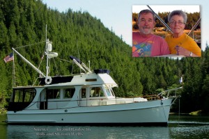
Who: Rob and Sharon
Port: Bellingham WA
SailBlogs Friends

