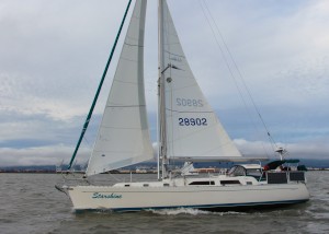
Sailing on Starshine
| Vessel Name: | Starshine |
| Vessel Make/Model: | Outbound 44 |
| Hailing Port: | San Francisco, CA |
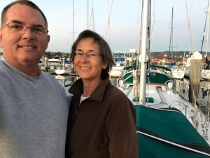
| Crew: | Pat and Melodie Williams |
| About: | We have been "working the plan" since 2004 when Pat began taking sailing lessons. That lead to a few sailing vacations on sailboats. Melodie took some classes too. We purchased our boat in 2011. |
27 February 2019 | Alameda California
26 February 2019 | Mazatlan to San Francisco
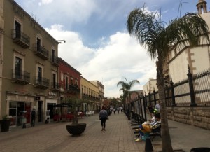
26 February 2019 | Mazatlan Sinaloa Mexico
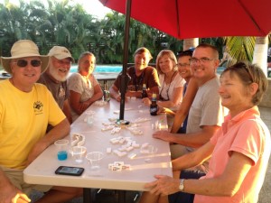
01 May 2018 | El Cid - Mazatlan
09 April 2018 | Marina Mazatlan
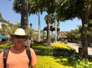
07 March 2018 | La Cruz de Huanacaxtle
23 January 2018 | La Cruz de Huanacaxtle
04 December 2017 | La Cruz de Huanacaxtle
24 October 2017 | Oakland, CA
04 September 2017 | South Lake Tahoe CA
04 September 2017 | Culver OR
04 September 2017 | Culver OR
04 September 2017 | Redmond Oregon
17 July 2017 | Polson Montana
31 May 2017 | Our new Camper in Ira Texas
04 May 2017 | Nuevo Vallarta, Riviera Nayarit Mexico
04 April 2017 | La Cruz Anchorage
12 March 2017 | Chamela Bay
12 March 2017 | Tenicatita Bay
18 February 2017 | La Cruz de Huanacaxtle
Recent Blog Posts
27 February 2019 | Alameda California
Goodbye Starshine
Melodie and I have accepted an offer on Starshine. We close escrow on March 8, 2019.
26 February 2019 | Mazatlan to San Francisco
The Baja Bash
Preparing for the Baja Bash (the trip north from Mexico to California). They call it “The Bash” because the prevailing winds and waves are from the northwest. So you are basically going uphill (if that makes any sense).
26 February 2019 | Mazatlan Sinaloa Mexico
Summer 2018
As many of you who have followed our blog over the last four years you’ll note that I have not given it any attention since last spring. So let me fill in the blanks.
Navigating
12 September 2014 | Port San Luis
Pat
We made our way from Morro Bay to Port San Luis, near Avila Beach.
We took a mooring at one of their guest moorings. It was good to be out of the swell, but there was still quite a bit of wind. We used the free water taxi to take a ride into the beach. We walked 1 1/2 miles over to the little town of Avila. There isn't much there, it's cute, but small. We covered everything we wanted to see in about 30 minutes. The only other point of interest here is the Diablo Canyon Nuclear Power Plant. I don't think they give daily tours though.
Port San Luis was our jump off point for rounding Point Arguello and Point Conception. Point Conception is considered by some to be the "Cape Horn" of the west coast. I had been around Point Mendocino in 2009. I wanted to avoid any drama at sea.
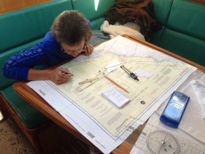
I entered our way points into our B&G MFD and came up with a route to Santa Barbara. Our plan was to leave at around 2000 hours and arrive at 0900 the next day. Melodie checks my work by zooming in on the display to ensure I haven't missed any hazards. Melodie asked me what "Note A" was on the chart. I didn't have the answer so we looked it up in the Coast Pilot. The answer had to do with missile firing from Vandenburg AFB.
Melodie also wanted to practice her navigation chart plotting. She plotted each of our way points on the paper chart.
The trip went well and Melodie stood her night watches well. There was much more ship traffic than the trip down to Morro Bay. There are also the oil rig platforms to avoid around Santa Barbara.
We rounded Point Conception at 0230 without any problems. We arrived in Santa Barbara at 0850 and got a guest slip. We'll be here for a few days before heading to Santa Cruz island.
The highlight today was the trip to the grocery store to refill on perishables.
We're having the crew of s/v Nova over for cocktails. They are also signed up for the Baja Ha-Ha. They are from Encinal YC, our neighbors in Oakland. Gotta run so we're ready for visitors!
We took a mooring at one of their guest moorings. It was good to be out of the swell, but there was still quite a bit of wind. We used the free water taxi to take a ride into the beach. We walked 1 1/2 miles over to the little town of Avila. There isn't much there, it's cute, but small. We covered everything we wanted to see in about 30 minutes. The only other point of interest here is the Diablo Canyon Nuclear Power Plant. I don't think they give daily tours though.
Port San Luis was our jump off point for rounding Point Arguello and Point Conception. Point Conception is considered by some to be the "Cape Horn" of the west coast. I had been around Point Mendocino in 2009. I wanted to avoid any drama at sea.
I entered our way points into our B&G MFD and came up with a route to Santa Barbara. Our plan was to leave at around 2000 hours and arrive at 0900 the next day. Melodie checks my work by zooming in on the display to ensure I haven't missed any hazards. Melodie asked me what "Note A" was on the chart. I didn't have the answer so we looked it up in the Coast Pilot. The answer had to do with missile firing from Vandenburg AFB.
Melodie also wanted to practice her navigation chart plotting. She plotted each of our way points on the paper chart.
The trip went well and Melodie stood her night watches well. There was much more ship traffic than the trip down to Morro Bay. There are also the oil rig platforms to avoid around Santa Barbara.
We rounded Point Conception at 0230 without any problems. We arrived in Santa Barbara at 0850 and got a guest slip. We'll be here for a few days before heading to Santa Cruz island.
The highlight today was the trip to the grocery store to refill on perishables.
We're having the crew of s/v Nova over for cocktails. They are also signed up for the Baja Ha-Ha. They are from Encinal YC, our neighbors in Oakland. Gotta run so we're ready for visitors!
Comments
Gallery not available