Sequoia Changing Latitudes
30 August 2023 | St. Helens, Oregon
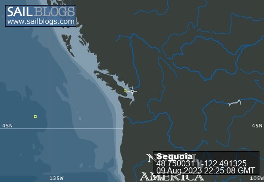
09 August 2023 | Bellingham, Washington
21 July 2023 | Boat: Bellingham; C&B: Scappoose
10 July 2023 | Egmont, Sunshine Coast, B.C., Canada
02 July 2023 | Walsh Cove, Desolation Sound, B.C., Canada
23 June 2023 | Westview/Powell River B.C.
18 June 2023 | Ganges, Saltspring Island, B.C., Canada
22 June 2019 | Scappoose, Oregon
27 May 2019 | Back home in Oregon
09 May 2019 | Villas Alturas Hotel, Costa Rica
02 May 2019 | San Vito, Costa Rica
23 April 2019 | Golfito, Costa Rica
11 April 2019 | Panama City, Panama
04 April 2019 | Shelter Bay Marina, Colon, Panama
22 March 2019 | Jamaica
11 March 2019 | Zar Par Marina, Boca Chica, Dominican Republic
18 February 2019 | Culebra Island, Puerto Rico
31 January 2019 | Simpson Bay Lagoon, Sint Maarten
21 January 2019 | Nelson's Dockyard, English Harbour, Antigua
04 January 2019 | Portsmouth, Dominica
Bellingham, Barkley Sound and home
30 August 2023 | St. Helens, Oregon
Barbara Johnston | Cloudy
I believe I last left you with us saying goodbye to our German friends and their two boys. That was in Bellingham. After a couple of days of laundry and grocery shopping, we welcomed our friends Mark & Fern, who have cruised with us in a number of different places, including Sweden, Portugal and on previous occasions in Desolation Sound and the Columbia River. This time our plans were to sample a bit of the San Juan Islands and then take the boat out the Strait of Juan de Fuca to the much wilder environment of Barkley Sound.
But wait! There was assembling in Bellingham a remarkable convergence of boats and people from Sauvie Island Yacht Club. Such an event was certainly appropriate for celebration, and we all converged for dinner together the night before we were to leave to head over to the San Juans. Lucas and Amy Larimore were there, with plans to take their new (to them) boat, Neverland, back to Portland. Richard Sandefur was there to provide some assistance on the passage. Tim Hryciw was there, aboard his boat, Maria Victoria. And of course we were there, together with Mark and Fern - 8 of us SIYC members altogether. What a festive, remarkable occasion.

We decided first to go to Spencer Spit on Lopez Island in the San Juans. This is a Washington State Park, with a number of mooring buoys and access to roads and trails. Mark and Fern explored ashore, and on our second day there, Craig and I decided to bicycle across Lopez Island to Lopez Village, where the Saturday Market would be going strong and lots of groceries would be available in a supermarket. Without having been there before (except perhaps as a child), I’ve always thought that Lopez Island was relatively flat and easy to bicycle. It turns out that’s not actually the case. In retrospect, I think just bicycling to Lopez Village was enough, but then we had to bicycle back as well on what was actually a very hot day!
The farmers market was nice, although they didn’t have much produce. We bought some blueberries and a large amount of green beans, as well as a small round of Chevre cheese. After that we found a fabulous taco cart with a long line; we had a great burrito and tacos. Then we found the grocery store and loaded ourselves up for the trip back to the boat.
While we were gone, Mark and Fern had slowly explored the shoreline in the dinghy and had seen lots of interesting sights. We decided to move on the next day to a harbor on the southeast end of Lopez Island (Wambaugh Bay) which had been recommended by the ranger at Spencer Spit. Unfortunately when we got there, the bay was quite crowded. We tried putting down the anchor in an open area but were unable to get the anchor to hold. The reason was obvious when we pulled up the anchor – it was covered with a blanket of kelp. It’s great that the kelp forests are re-establishing themselves, but it does make anchoring there nearly impossible. So we moved on to MacKaye Harbor on the south end of Lopez Island with a plan to cross to Port Angeles the next day.
During the afternoon in MacKaye Harbor, we were visited by a couple of kayaks. Father and son wanted to leave their boat on anchor for the night while they visited friends on shore, and they asked if we would be willing to watch the boat, and text them if there were any problem. We said “sure.” The fellow promised to text us when he got ashore, sending his contact information. It turns out the name of the boat was “Inconceivable” which got us all on a kick of quoting lines from the Princess Bride, which all ended with “Inconceivable” and finally Inigo Montoya saying, “I do not think that word means what you think it means!” Much hilarity ensued.
Halfway across the Strait of Juan de Fuca the next morning, Craig got to work researching Canadian customs ports of entry. It used to be that you could clear customs in Ucluelet, which is what we were planning on. We hoped to jump from Port Angeles (in the United States) to Neah Bay (in the US) to Ucluelet in Barkley Sound (Canada). Well, his research disclosed that the Ucluelet customs station has been closed since early in the Covid 19 pandemic. The only place to enter Canada (from where we were) was Victoria, back over our right shoulder. So, U-turn, we headed for Victoria and cleared customs there. Victoria, of course, is a lovely place; it’s always delightful to spend time there.
During that same passage across the strait, the cello parts for Newport Symphony’s September concerts came in via my email. I therefore needed to immediately start work putting in bowings and getting the bowed parts scanned and emailed back to the orchestra librarian. That process starts with printing out the parts. It turns out that Victoria was probably the best possible place to do that.
So after runs to the UPS store, the grocery store and a nice restaurant, we were ready to fall into bed and get a very early start the next morning, northwest along the west coast of Vancouver Island. Wind, wave and tidal current predictions indicated that our best time to make the distance to Port Renfrew (our next stop) would be to start out at first light. It was a relatively calm passage; little wind meant that we motored all the way.
We’ve never been to Port Renfrew before. The bay is called Port San Juan, and we’ve always thought it didn’t look sufficiently well protected on the charts and so we’ve bypassed it. Well, now they’ve built a breakwater-protected marina (“Pacific Gateway Marina”) which makes a big difference. We were fortunate that they did have space for us. 95% of the marina is populated by 20-25 foot fishing boats and everyone there is crazy about salmon fishing. We saw hundreds of beautiful Chinook salmon in buckets and trays coming off these relatively tiny boats. Sadly, we didn’t have enough time to befriend any of our dock-mates who might have sent a slab of fish our way.
About every 30 feet along the docks there is a fish cleaning station and the seagulls are hyper-aware of when fish cleaning is going on, and the likely resulting scraps of fish and guts that are likely to be thrown into the water. But the obvious ruler of the marina’s airspace is the Bald Eagle. When he (or she) approached a fish cleaning station, all the seagulls fled to a safe distance. When the eagle landed on the breakwater to inspect or rebalance the load of fish scraps, all the seagulls launched up into the air and kept a good (but watchful) distance. When the eagle, satisfied with the load of fish scraps, headed off to a group of trees onshore, the seagulls immediately came back, taking up their stations, one per riprap boulder.
Late that afternoon, Fern and I walked along the road above the marina toward a bridge crossing the San Juan River. The scenery was wild and spectacular, particularly as seen from the bridge.
The next morning, once again, we planned on a departure at first light. The tidal current would be in our favor for most of the morning and the wind wasn’t predicted to rise until the afternoon. The little fishing boats were also up at first light, leaving the marina for a nearby fishing ground which we would pass on our way out. The fishers, though, cranked their monster outboards up to full throttle, which made for a somewhat rough exit for us from the bay.
Once again it was an easy passage, at least for the first part of the trip. Whales were seen. But the rollers coming in from the Pacific became larger and larger, causing our motion to become more difficult. By the time we neared Cape Beale (the south entrance to Barkley Sound), both Fern and I had retired to our bunks to wait out the uncomfortable motion.
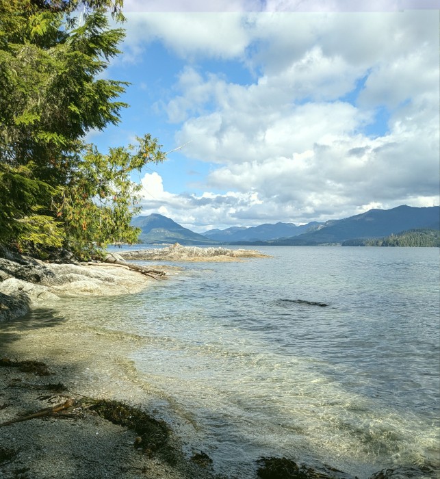
Rounding the corner into Barkley Sound, the motion became much easier and the wind nearly disappeared. We headed for Effingham Bay, one of the outer anchorages in the Broken Group. We were all struck with the beauty and wildness of the place and many pictures were taken. Mark and Fern rowed away in the dinghy and examined all the beauty up close to the shoreline.
The forecast for the next day was ominous, promising 20 knot winds with gusts up to 40, reaching into Effingham Bay, so we relocated to Turtle Bay – not quite as stunning but nevertheless beautiful. We spent one night there with no wind at all and then headed for Bamfield, a small town on the south shore of Barkley Sound. Bamfield is located in a narrow inlet running south from Barkley Sound. The western side can’t be reached at all by road, and the easiest way to get from one end to the other is by boat or boardwalk. The eastern side can be reached by road, but oh what a road (so we heard). 80 miles of logging road, graveled, potholed…
Bamfield is a popular place. Every transient moorage berth was full. Many boats travelled up and down the inlet and there was no realistic place to anchor. So we moved to Port Desire, the next inlet to the east. (On the chart it was printed as Port Désiré, but it turned out the locals were using an English pronunciation. So much for that bit of hoped-for exoticism!) There we were able to find room to anchor, and we were somewhat of a curiosity because the focus of that little bay is 100% on fishing. At one of the fishing resorts we briefly tied up to, the dock attendant was a young woman visiting from the Philippines, and she said she’d never seen a boat like ours, and that we’d really made her day!
Once we were successfully anchored, we made a dinghy expedition into Bamfield. We tied up at the dock adjacent to the restaurant called “The Bamfield Wreckage” where we intended to have dinner later. Even getting tied up there was not straightforward. It appeared to be a government dock, but people on the dock said it wasn’t clear that there was anyplace for dinghies to tie up. One of those fellows offered to let us raft onto the side of his little fishing boat; an offer we gladly accepted. We admired his catch of the day (3 salmon) and then set out for a walk along the boardwalk. We walked north past small businesses, homes, docks and finally the Coast Guard station. There were beautiful flowers, interesting yard signs and creative garden sculptures. We stopped at the general store and spent an outrageous amount of money on a very few groceries plus ice cream cones for the four of us. Outside the store, the boardwalk widened out and 8 or 10 local residents were sitting there, chatting or taking advantage of the store’s WiFi. We also took a seat and made some necessary phone calls that wouldn’t be possible back on the boat (there was no cell signal whatsoever in Port Desire.)
We walked beyond the Coast Guard station up the hill to the west, where there was a park with gorgeous ocean views and a newly constructed mortise and tenon roofed platform, probably intended for community events. Our friend Mark, a fine woodworker and craftsman, was impressed by the beautiful work, and lamented that this style of construction (without any metal fasteners) would not be permitted by US building departments.
Our boardwalk outing was followed by dinner at The Bamfield Wreckage. They offered amazingly good food and interesting conversations with their servers. One of our servers wore a shirt celebrating Bamfield’s fungus festival, with the shirt legend: “I am an amateur mycologist with questionable morels” and an art nouveau depiction of several morel mushrooms. He told us all about the festival, which apparently takes place in September, and which he said might not be so great this year because everything has been so dry this summer.
Skipping ahead, our last full day with Mark and Fern we spent near Lucky Creek, at the northeast corner of Barkley Sound. The creek bed fills up at high tide making it possible to dinghy to a series of waterfalls. Beyond that you’re meant to climb successive waterfalls or bypass them by trail, reaching a lake where cliff diving is possible. Numerous sources give this expedition a “don’t miss” rating. We gave it a try, but neither Craig nor I were up for the waterfall climbs or the very primitive, undeveloped trail. Mark and Fern did reach the lake and reported that a group of adventurous twenty-something young men were cliff diving, primarily for the enjoyment of a young woman who was with them, and anyone else who wanted to watch.
During that day smoke moved into the area from forest fires 50 miles north of us. By sundown, the sun was a striking orange and everything else was mostly gray. That smokey atmosphere continued into the next day when we moved to Ucluelet for a carefully choreographed crew exchange. Our friend Alicia arrived in Ucluelet in her car, there was a bit of social time together for all of us, and then Mark and Fern loaded their things into Alicia’s car and drove it back to Portland. Everyone was well prepared, and the transition proceeded seamlessly.
While we were on the dock in Ucluelet we had conversations with several local residents, including a young couple restoring an old fishing boat and a First Nations server in the Floathouse Restaurant. The young couple were living simply, but appeared to have come from a privileged background, and they saw themselves someday moving up to a boat like Sequoia. They viewed Ucluelet as an easy, friendly place to live. The server, though, told us about her problems finding work, especially in the winter, having to live on unemployment insurance with her 13 year old son, and the difficulties of finding an affordable place to live in Ucluelet, even though she had lived there all her life. The contrast was stark, and it highlighted the difference in viewpoints depending on one’s background, class and ethnicity.
We left Ucluelet the next morning. We spent one day at Turtle Bay in the mists and rain and then moved on to Robber’s Passage. The Port Alberni Yacht Club maintains an outstation at Robber’s Passage which they make available to all comers (for a fee). All the members of the PAYC are fishers; they have no sailboats among their membership. Some of the docks have adjacent picnic tables and tent spaces right there on wider portions of the dock. Most of the visitors were on fishing boats in the 18-24 foot range, and all had trailered their boat from elsewhere in Canada or the US and launched in the waters of Barkley Sound. They went fishing from early in the morning until late in the afternoon, coming back with impressive catches of Chinook salmon. Then they set up their barbecues and socialized into the evening. All seemed to be staying for several days. Club members were also there in a separate area with wide docks, picnic tables and club-owned barbecues. Many were curious about our trip and our boat.
For our part, we relaxed and explored the island along the many well-maintained trails that led to shorelines, beaches and cliff-top overlooks. The views were spectacular and both Alicia and I took hundreds of pictures. During this period we were also looking at weather forecasts from various sources and planning our trip south and our return to the Portland area. The goal was to find two days with moderate favorable winds and not much wave activity. We found what appeared to be the best possible window which would occur on August 24-25. Enough wind to allow us to sail, and not much wave action.
We departed the PAYC docks mid-morning on the 24th. (The timing was determined by our anticipated travel time and the optimum time to cross the Columbia River bar.) That first day the winds proved to be somewhat less than predicted, but we were able to get in several hours of sailing. The rest of the time we used the engine to supplement what the sails could provide. At one point that afternoon we were visited by a pod of dolphins in search of a fun bow wave to ride. They gave us a 10 minute view of their fun and then moved on in search of something else.
At midday we heard from Tim Hryciw that he anticipated leaving Neah Bay aboard Maria Victoria so that he’d be on a course that would more or less intersect our own. We did indeed see Maria Victoria in the distance that afternoon and we proceeded south, about 20 miles off the coast. We lost sight of each other during the night, but traveled in parallel all the way to our adjacent berths at St. Helens Marina, where we arrived the afternoon of August 26th.
Mark and Fern were there to meet us, so that Alicia could head directly home in her car.
That’s it for the Johnston boat travels during the summer of 2023. I hope you enjoyed reading about it. We welcome any questions you may have, and we’ll do our best to answer them
But wait! There was assembling in Bellingham a remarkable convergence of boats and people from Sauvie Island Yacht Club. Such an event was certainly appropriate for celebration, and we all converged for dinner together the night before we were to leave to head over to the San Juans. Lucas and Amy Larimore were there, with plans to take their new (to them) boat, Neverland, back to Portland. Richard Sandefur was there to provide some assistance on the passage. Tim Hryciw was there, aboard his boat, Maria Victoria. And of course we were there, together with Mark and Fern - 8 of us SIYC members altogether. What a festive, remarkable occasion.
We decided first to go to Spencer Spit on Lopez Island in the San Juans. This is a Washington State Park, with a number of mooring buoys and access to roads and trails. Mark and Fern explored ashore, and on our second day there, Craig and I decided to bicycle across Lopez Island to Lopez Village, where the Saturday Market would be going strong and lots of groceries would be available in a supermarket. Without having been there before (except perhaps as a child), I’ve always thought that Lopez Island was relatively flat and easy to bicycle. It turns out that’s not actually the case. In retrospect, I think just bicycling to Lopez Village was enough, but then we had to bicycle back as well on what was actually a very hot day!
The farmers market was nice, although they didn’t have much produce. We bought some blueberries and a large amount of green beans, as well as a small round of Chevre cheese. After that we found a fabulous taco cart with a long line; we had a great burrito and tacos. Then we found the grocery store and loaded ourselves up for the trip back to the boat.
While we were gone, Mark and Fern had slowly explored the shoreline in the dinghy and had seen lots of interesting sights. We decided to move on the next day to a harbor on the southeast end of Lopez Island (Wambaugh Bay) which had been recommended by the ranger at Spencer Spit. Unfortunately when we got there, the bay was quite crowded. We tried putting down the anchor in an open area but were unable to get the anchor to hold. The reason was obvious when we pulled up the anchor – it was covered with a blanket of kelp. It’s great that the kelp forests are re-establishing themselves, but it does make anchoring there nearly impossible. So we moved on to MacKaye Harbor on the south end of Lopez Island with a plan to cross to Port Angeles the next day.
During the afternoon in MacKaye Harbor, we were visited by a couple of kayaks. Father and son wanted to leave their boat on anchor for the night while they visited friends on shore, and they asked if we would be willing to watch the boat, and text them if there were any problem. We said “sure.” The fellow promised to text us when he got ashore, sending his contact information. It turns out the name of the boat was “Inconceivable” which got us all on a kick of quoting lines from the Princess Bride, which all ended with “Inconceivable” and finally Inigo Montoya saying, “I do not think that word means what you think it means!” Much hilarity ensued.
Halfway across the Strait of Juan de Fuca the next morning, Craig got to work researching Canadian customs ports of entry. It used to be that you could clear customs in Ucluelet, which is what we were planning on. We hoped to jump from Port Angeles (in the United States) to Neah Bay (in the US) to Ucluelet in Barkley Sound (Canada). Well, his research disclosed that the Ucluelet customs station has been closed since early in the Covid 19 pandemic. The only place to enter Canada (from where we were) was Victoria, back over our right shoulder. So, U-turn, we headed for Victoria and cleared customs there. Victoria, of course, is a lovely place; it’s always delightful to spend time there.
During that same passage across the strait, the cello parts for Newport Symphony’s September concerts came in via my email. I therefore needed to immediately start work putting in bowings and getting the bowed parts scanned and emailed back to the orchestra librarian. That process starts with printing out the parts. It turns out that Victoria was probably the best possible place to do that.
So after runs to the UPS store, the grocery store and a nice restaurant, we were ready to fall into bed and get a very early start the next morning, northwest along the west coast of Vancouver Island. Wind, wave and tidal current predictions indicated that our best time to make the distance to Port Renfrew (our next stop) would be to start out at first light. It was a relatively calm passage; little wind meant that we motored all the way.
We’ve never been to Port Renfrew before. The bay is called Port San Juan, and we’ve always thought it didn’t look sufficiently well protected on the charts and so we’ve bypassed it. Well, now they’ve built a breakwater-protected marina (“Pacific Gateway Marina”) which makes a big difference. We were fortunate that they did have space for us. 95% of the marina is populated by 20-25 foot fishing boats and everyone there is crazy about salmon fishing. We saw hundreds of beautiful Chinook salmon in buckets and trays coming off these relatively tiny boats. Sadly, we didn’t have enough time to befriend any of our dock-mates who might have sent a slab of fish our way.
About every 30 feet along the docks there is a fish cleaning station and the seagulls are hyper-aware of when fish cleaning is going on, and the likely resulting scraps of fish and guts that are likely to be thrown into the water. But the obvious ruler of the marina’s airspace is the Bald Eagle. When he (or she) approached a fish cleaning station, all the seagulls fled to a safe distance. When the eagle landed on the breakwater to inspect or rebalance the load of fish scraps, all the seagulls launched up into the air and kept a good (but watchful) distance. When the eagle, satisfied with the load of fish scraps, headed off to a group of trees onshore, the seagulls immediately came back, taking up their stations, one per riprap boulder.
Late that afternoon, Fern and I walked along the road above the marina toward a bridge crossing the San Juan River. The scenery was wild and spectacular, particularly as seen from the bridge.
The next morning, once again, we planned on a departure at first light. The tidal current would be in our favor for most of the morning and the wind wasn’t predicted to rise until the afternoon. The little fishing boats were also up at first light, leaving the marina for a nearby fishing ground which we would pass on our way out. The fishers, though, cranked their monster outboards up to full throttle, which made for a somewhat rough exit for us from the bay.
Once again it was an easy passage, at least for the first part of the trip. Whales were seen. But the rollers coming in from the Pacific became larger and larger, causing our motion to become more difficult. By the time we neared Cape Beale (the south entrance to Barkley Sound), both Fern and I had retired to our bunks to wait out the uncomfortable motion.
Rounding the corner into Barkley Sound, the motion became much easier and the wind nearly disappeared. We headed for Effingham Bay, one of the outer anchorages in the Broken Group. We were all struck with the beauty and wildness of the place and many pictures were taken. Mark and Fern rowed away in the dinghy and examined all the beauty up close to the shoreline.
The forecast for the next day was ominous, promising 20 knot winds with gusts up to 40, reaching into Effingham Bay, so we relocated to Turtle Bay – not quite as stunning but nevertheless beautiful. We spent one night there with no wind at all and then headed for Bamfield, a small town on the south shore of Barkley Sound. Bamfield is located in a narrow inlet running south from Barkley Sound. The western side can’t be reached at all by road, and the easiest way to get from one end to the other is by boat or boardwalk. The eastern side can be reached by road, but oh what a road (so we heard). 80 miles of logging road, graveled, potholed…
Bamfield is a popular place. Every transient moorage berth was full. Many boats travelled up and down the inlet and there was no realistic place to anchor. So we moved to Port Desire, the next inlet to the east. (On the chart it was printed as Port Désiré, but it turned out the locals were using an English pronunciation. So much for that bit of hoped-for exoticism!) There we were able to find room to anchor, and we were somewhat of a curiosity because the focus of that little bay is 100% on fishing. At one of the fishing resorts we briefly tied up to, the dock attendant was a young woman visiting from the Philippines, and she said she’d never seen a boat like ours, and that we’d really made her day!
Once we were successfully anchored, we made a dinghy expedition into Bamfield. We tied up at the dock adjacent to the restaurant called “The Bamfield Wreckage” where we intended to have dinner later. Even getting tied up there was not straightforward. It appeared to be a government dock, but people on the dock said it wasn’t clear that there was anyplace for dinghies to tie up. One of those fellows offered to let us raft onto the side of his little fishing boat; an offer we gladly accepted. We admired his catch of the day (3 salmon) and then set out for a walk along the boardwalk. We walked north past small businesses, homes, docks and finally the Coast Guard station. There were beautiful flowers, interesting yard signs and creative garden sculptures. We stopped at the general store and spent an outrageous amount of money on a very few groceries plus ice cream cones for the four of us. Outside the store, the boardwalk widened out and 8 or 10 local residents were sitting there, chatting or taking advantage of the store’s WiFi. We also took a seat and made some necessary phone calls that wouldn’t be possible back on the boat (there was no cell signal whatsoever in Port Desire.)
We walked beyond the Coast Guard station up the hill to the west, where there was a park with gorgeous ocean views and a newly constructed mortise and tenon roofed platform, probably intended for community events. Our friend Mark, a fine woodworker and craftsman, was impressed by the beautiful work, and lamented that this style of construction (without any metal fasteners) would not be permitted by US building departments.
Our boardwalk outing was followed by dinner at The Bamfield Wreckage. They offered amazingly good food and interesting conversations with their servers. One of our servers wore a shirt celebrating Bamfield’s fungus festival, with the shirt legend: “I am an amateur mycologist with questionable morels” and an art nouveau depiction of several morel mushrooms. He told us all about the festival, which apparently takes place in September, and which he said might not be so great this year because everything has been so dry this summer.
Skipping ahead, our last full day with Mark and Fern we spent near Lucky Creek, at the northeast corner of Barkley Sound. The creek bed fills up at high tide making it possible to dinghy to a series of waterfalls. Beyond that you’re meant to climb successive waterfalls or bypass them by trail, reaching a lake where cliff diving is possible. Numerous sources give this expedition a “don’t miss” rating. We gave it a try, but neither Craig nor I were up for the waterfall climbs or the very primitive, undeveloped trail. Mark and Fern did reach the lake and reported that a group of adventurous twenty-something young men were cliff diving, primarily for the enjoyment of a young woman who was with them, and anyone else who wanted to watch.
During that day smoke moved into the area from forest fires 50 miles north of us. By sundown, the sun was a striking orange and everything else was mostly gray. That smokey atmosphere continued into the next day when we moved to Ucluelet for a carefully choreographed crew exchange. Our friend Alicia arrived in Ucluelet in her car, there was a bit of social time together for all of us, and then Mark and Fern loaded their things into Alicia’s car and drove it back to Portland. Everyone was well prepared, and the transition proceeded seamlessly.
While we were on the dock in Ucluelet we had conversations with several local residents, including a young couple restoring an old fishing boat and a First Nations server in the Floathouse Restaurant. The young couple were living simply, but appeared to have come from a privileged background, and they saw themselves someday moving up to a boat like Sequoia. They viewed Ucluelet as an easy, friendly place to live. The server, though, told us about her problems finding work, especially in the winter, having to live on unemployment insurance with her 13 year old son, and the difficulties of finding an affordable place to live in Ucluelet, even though she had lived there all her life. The contrast was stark, and it highlighted the difference in viewpoints depending on one’s background, class and ethnicity.
We left Ucluelet the next morning. We spent one day at Turtle Bay in the mists and rain and then moved on to Robber’s Passage. The Port Alberni Yacht Club maintains an outstation at Robber’s Passage which they make available to all comers (for a fee). All the members of the PAYC are fishers; they have no sailboats among their membership. Some of the docks have adjacent picnic tables and tent spaces right there on wider portions of the dock. Most of the visitors were on fishing boats in the 18-24 foot range, and all had trailered their boat from elsewhere in Canada or the US and launched in the waters of Barkley Sound. They went fishing from early in the morning until late in the afternoon, coming back with impressive catches of Chinook salmon. Then they set up their barbecues and socialized into the evening. All seemed to be staying for several days. Club members were also there in a separate area with wide docks, picnic tables and club-owned barbecues. Many were curious about our trip and our boat.
For our part, we relaxed and explored the island along the many well-maintained trails that led to shorelines, beaches and cliff-top overlooks. The views were spectacular and both Alicia and I took hundreds of pictures. During this period we were also looking at weather forecasts from various sources and planning our trip south and our return to the Portland area. The goal was to find two days with moderate favorable winds and not much wave activity. We found what appeared to be the best possible window which would occur on August 24-25. Enough wind to allow us to sail, and not much wave action.
We departed the PAYC docks mid-morning on the 24th. (The timing was determined by our anticipated travel time and the optimum time to cross the Columbia River bar.) That first day the winds proved to be somewhat less than predicted, but we were able to get in several hours of sailing. The rest of the time we used the engine to supplement what the sails could provide. At one point that afternoon we were visited by a pod of dolphins in search of a fun bow wave to ride. They gave us a 10 minute view of their fun and then moved on in search of something else.
At midday we heard from Tim Hryciw that he anticipated leaving Neah Bay aboard Maria Victoria so that he’d be on a course that would more or less intersect our own. We did indeed see Maria Victoria in the distance that afternoon and we proceeded south, about 20 miles off the coast. We lost sight of each other during the night, but traveled in parallel all the way to our adjacent berths at St. Helens Marina, where we arrived the afternoon of August 26th.
Mark and Fern were there to meet us, so that Alicia could head directly home in her car.
That’s it for the Johnston boat travels during the summer of 2023. I hope you enjoyed reading about it. We welcome any questions you may have, and we’ll do our best to answer them
Bellingham and the San Juan Islands
09 August 2023 | Bellingham, Washington
Barbara Johnston | Partly cloudy, warm
Here we are, dear friends and family, in Bellingham, waiting out some rain showers. We came back from our Oregon and California “adventures” 10 days ago and have spent six of those days with our Austrian exchange student from many years ago (Cori) and her husband (Jens) and two young boys (Finn, 12½ and Simon, 10). Aboard Sequoia it was an adventure in group living; we really did have a fabulous time. These boys are almost like grandchildren to us. But we have no experience with grandparenting, so it really was an adventure, with many rewards.
From Bellingham we crossed into the San Juan Islands and headed north to Sucia Island. It’s been many years since we have spent any significant time in the San Juans (nearly always choosing to go north to Desolation Sound as we did earlier this summer.) But I think I had forgotten the charm and beauty of these islands, despite a heavy load of visitors. Facilities have been upgraded in many cases, and I have the impression that the population of boaters may still be slightly less than before the pandemic.
Sucia is an ideal island to visit with children. Finn and Simon were at work almost as soon as we had the anchor down. They helped with inflating the dinghy, launching the dinghy, lowering the outboard and securing it in place and making sure that everything else was shipshape. (To be fair, the boys have a fair amount of sailing experience in the Baltic Sea, but it has been several years since their grandparents sold the sailboat.) It wasn’t long before they were both in the dinghy, exploring the Echo Bay anchorage and spotting a variety of sea creatures on the bottom in shallow areas. They recruited Jens and Cori to take them ashore, where they had a good hike.
Sucia is full of trails, going off in all directions. The next day, we all went ashore. Craig and I hiked to Fossil Bay and back. We all met on the beach of Echo Bay. Cori had made a nice lunch which we enjoyed sitting on beached logs under the shade of madrona trees and backed up to what appeared to be an eroding old shell mound (Native American garbage pile, created before the Europeans came). A superb addition to the lunch was a gift of freshly grilled salmon from a fisherman on the Shallow Bay beach. (I suspect the boys stood close by, admiring the fish, and that was what resulted in the contribution to our lunch.) Cori tells me that beaches in the Baltic have no drift logs piled up on the shores. I’m sure we saw that when we sailed in the Baltic 6 years ago, but somehow it didn’t register.
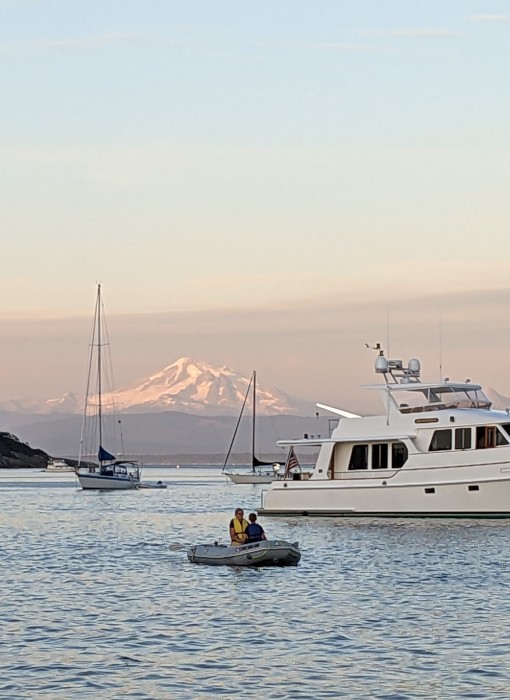
That afternoon the boys went off with the dinghy again, while Cori and Jens explored more trails and shores; Craig and I went back to the boat to fuel up our personal reserves after the high activity level led by Finn and Simon. Dinghying continued well into the evening. The header for this blog post shows Cori and Simon heading back to the boat in front of majestic Mt. Baker, at dusk.
On our third day together on the water, we headed over to Friday Harbor to get hot showers and stoke up on supplies (do you have any idea how much food pre-teen boys eat?? I had been making a liter of fresh yogurt about once a week on the boat, but with Finn and Simon aboard the rate increased to once a day.) We were actually able to sail for a brief time on the way to Friday Harbor – first time we’ve seen any significant wind in days.
We didn’t see any significant tourist attractions while in Friday Harbor, but we took care of the necessaries. For Finn and Simon, number one on the list was to fill the fuel tank for the dinghy motor. At Sucia Island they had taken it down to about 2% of capacity. The motor was starting to cough on our last trip back to the boat. We also took care of laundry, had a nice dinner out at a Thai restaurant and the aforementioned hot showers and grocery shopping.
Next stop: Deer Harbor on Orcas Island. It’s a lovely marina, with picnic tables, barbecues, a nice little store with ice cream cones for the kids and fresh food for breakfast and lunch. There was a swimming pool on offer, but we found out it was not heated, and enthusiasm evaporated. Instead we went on what was supposed to have been a long walk, but instead evolved into a blackberry picking expedition. We had failed to bring any bags or boxes, so most of the berries went into mouths. We did send Finn and Simon out the next morning, and they came back with enough berries to enhance our morning yogurt and cereal bowls. I went for a walk that morning, and found a dedicated path atop a cliff, backed by gorgeous houses and grounds owned by the rich, and perhaps famous. I’m sure it’s a beautiful spot to live, but the expensive detailing is somewhat overwhelming.
With that, our time with Cori, Jens, Finn and Simon was about to expire, so we returned to Bellingham yesterday, getting in a bit more sailing, nearly all against a strong current. They stayed with us last evening and we went to a sushi restaurant on the other side of Squalicum Marina. The kids love the conveyor belt delivery of various sushi options. Cori and I biked over there while the rest went in their car (a rented Tesla). The family slept on the boat and departed for the south yesterday morning. They are finishing up a six-week motor exploration of the west coast before they return to Germany in about a week. Cori very kindly used their car to take me on an extensive shopping trip to supply up for our next guests. Today is our “in between” day to relax and clean the boat from top to bottom.
Home is beginning to lure us back. I expect to write one more log entry, which should include time in Barkley Sound on the outside of Vancouver Island. Stay tuned!
From Bellingham we crossed into the San Juan Islands and headed north to Sucia Island. It’s been many years since we have spent any significant time in the San Juans (nearly always choosing to go north to Desolation Sound as we did earlier this summer.) But I think I had forgotten the charm and beauty of these islands, despite a heavy load of visitors. Facilities have been upgraded in many cases, and I have the impression that the population of boaters may still be slightly less than before the pandemic.
Sucia is an ideal island to visit with children. Finn and Simon were at work almost as soon as we had the anchor down. They helped with inflating the dinghy, launching the dinghy, lowering the outboard and securing it in place and making sure that everything else was shipshape. (To be fair, the boys have a fair amount of sailing experience in the Baltic Sea, but it has been several years since their grandparents sold the sailboat.) It wasn’t long before they were both in the dinghy, exploring the Echo Bay anchorage and spotting a variety of sea creatures on the bottom in shallow areas. They recruited Jens and Cori to take them ashore, where they had a good hike.
Sucia is full of trails, going off in all directions. The next day, we all went ashore. Craig and I hiked to Fossil Bay and back. We all met on the beach of Echo Bay. Cori had made a nice lunch which we enjoyed sitting on beached logs under the shade of madrona trees and backed up to what appeared to be an eroding old shell mound (Native American garbage pile, created before the Europeans came). A superb addition to the lunch was a gift of freshly grilled salmon from a fisherman on the Shallow Bay beach. (I suspect the boys stood close by, admiring the fish, and that was what resulted in the contribution to our lunch.) Cori tells me that beaches in the Baltic have no drift logs piled up on the shores. I’m sure we saw that when we sailed in the Baltic 6 years ago, but somehow it didn’t register.
That afternoon the boys went off with the dinghy again, while Cori and Jens explored more trails and shores; Craig and I went back to the boat to fuel up our personal reserves after the high activity level led by Finn and Simon. Dinghying continued well into the evening. The header for this blog post shows Cori and Simon heading back to the boat in front of majestic Mt. Baker, at dusk.
On our third day together on the water, we headed over to Friday Harbor to get hot showers and stoke up on supplies (do you have any idea how much food pre-teen boys eat?? I had been making a liter of fresh yogurt about once a week on the boat, but with Finn and Simon aboard the rate increased to once a day.) We were actually able to sail for a brief time on the way to Friday Harbor – first time we’ve seen any significant wind in days.
We didn’t see any significant tourist attractions while in Friday Harbor, but we took care of the necessaries. For Finn and Simon, number one on the list was to fill the fuel tank for the dinghy motor. At Sucia Island they had taken it down to about 2% of capacity. The motor was starting to cough on our last trip back to the boat. We also took care of laundry, had a nice dinner out at a Thai restaurant and the aforementioned hot showers and grocery shopping.
Next stop: Deer Harbor on Orcas Island. It’s a lovely marina, with picnic tables, barbecues, a nice little store with ice cream cones for the kids and fresh food for breakfast and lunch. There was a swimming pool on offer, but we found out it was not heated, and enthusiasm evaporated. Instead we went on what was supposed to have been a long walk, but instead evolved into a blackberry picking expedition. We had failed to bring any bags or boxes, so most of the berries went into mouths. We did send Finn and Simon out the next morning, and they came back with enough berries to enhance our morning yogurt and cereal bowls. I went for a walk that morning, and found a dedicated path atop a cliff, backed by gorgeous houses and grounds owned by the rich, and perhaps famous. I’m sure it’s a beautiful spot to live, but the expensive detailing is somewhat overwhelming.
With that, our time with Cori, Jens, Finn and Simon was about to expire, so we returned to Bellingham yesterday, getting in a bit more sailing, nearly all against a strong current. They stayed with us last evening and we went to a sushi restaurant on the other side of Squalicum Marina. The kids love the conveyor belt delivery of various sushi options. Cori and I biked over there while the rest went in their car (a rented Tesla). The family slept on the boat and departed for the south yesterday morning. They are finishing up a six-week motor exploration of the west coast before they return to Germany in about a week. Cori very kindly used their car to take me on an extensive shopping trip to supply up for our next guests. Today is our “in between” day to relax and clean the boat from top to bottom.
Home is beginning to lure us back. I expect to write one more log entry, which should include time in Barkley Sound on the outside of Vancouver Island. Stay tuned!
From Egmont to Scappoose
21 July 2023 | Boat: Bellingham; C&B: Scappoose
Barbara Johnston | Clear and very warm
As I write this we are on an Amtrak train, on our way from Bellingham to Portland. The dissonance between where we’ve been and where we are now is palpable. Despite the various crises we’ve had aboard Sequoia this summer, we did settle into a very pleasant and relaxed lifestyle, with a constantly changing view of gorgeous coastal scenery, varied wildlife, interesting people and a variety of ocean-going vessels and contraptions.
This is our mid-summer hiatus. We left Sequoia at an early hour this morning and expect to be home before dinnertime. But let me go back and tell you what we’ve been up to.
I last left you at Hardy Island, where we enjoyed a very pleasant anchorage with a resident seal who was constantly coming around to check on us and make sure we weren’t, secretly, throwing fish scraps overboard. Most of the boats were anchored in a cove adjacent to the Hardy Island Provincial Marine Park. We decided to anchor instead at an adjacent narrow inlet. The anchorage would only work if we also put a line on shore. On one side of the inlet was a steep cliff and several predecessor boats had left firmly anchored heavy line and sometimes chain arrangements hanging down the side of the cliff. Craig rowed over to the cliff wall and evaluated the available attachment points and selected the best. (Some of the boats we’ve seen have very athletic owners, crew members or even children, who will gladly scale steep walls to secure their shore line around the best looking tree trunk or other likely attachment point. We are, I’m afraid, without those assets, so we do our best with what we see. Some of Canada’s Provincial Parks have government-installed chains for attaching shore lines, but Hardy Bay is not so equipped.)
But I digress. One of the issues with a shore line is making it visible enough to be seen by other smaller boats who may be passing through the area. In this case we attached a couple of floating buoys to the floating line, making it – so we thought – very visible. But as we returned from a dinghy expedition into the park, we observed a small, motorized boat passing across our floating line. We stopped and talked to the fellow, and he said yes, he noticed a lurch, but apparently no ill effects.
From Hardy Island we backtracked just a bit to visit Egmont, home of impressive tidal rapids. Just getting TO or FROM Egmont requires careful consultation of the tide and current tables. And when we did arrive at our moorage, at BackEddy Marina, the current was flowing past the dock at 1.5 knots, docking was not easy, and required more than one try. While there we had a nice restaurant meal, but the highlight of that stop was our hike to see Skookumchuck Narrows and Sechelt Rapids. Regretfully it was not the right time for one of the extreme tidal flows which attracts the kayakers looking to surf the standing waves. Nevertheless, even at half that volume it was impressive. The trail turned out to be further away from the BackEddy Marina than we expected, and the trail itself was longer than we expected (or maybe we’re just older than the last time we hiked this trail, probably 15 years ago). It was a gorgeous hike, through dense groves of tall cedar trees with sunlight filtering through. We didn’t quite make it the last ¼ mile, as the trail became more and more rough with extended webs of tree roots and irregular rock fields. But it was definitely worth the effort.
When we got back to the trailhead, we must have looked pretty pathetic, because a car full of British tourists offered to give us a lift back to the BackEddy Marina. We protested not much at all, and three of the four Brits got out of the car and sat on logs while the fourth gave us the offered lift. He was, of course, a real charmer and we learned a bit about why he and his wife return to BC every summer (they have a daughter who lives in Whistler, but also there is the attraction of the gorgeous BC coastline.)
The next day we continued our journey southward, crossing tracks with ever more ferries and pleasure boats of every description. We wound up that night at Smugglers Cove, another BC Provincial Park near the south end of Texada Island. Smugglers Cove is a small, somewhat confined anchorage, and the Parks department has installed 38 shoreline attachment points. (The Waggoner’s cruising guide doubts whether it’s actually possible to fit 38 boats in there.) Fortunately for us there were only about 6 boats in there, all using a shore line tie. We watched all the different ways our fellow cruisers have fun. On one side of us there was a charter boat with four guys aboard. They all went swimming in the 66 degree water, then they all had a turn in the two kayaks. After dinner, they spent the hours until dark singing what sounded like sea chanteys and ballads. When we woke in the morning they were gone. Lots of folks had their kayaks and paddle boards out, and one woman rowed her kayak all around the anchorage with her Scotty dog standing alertly on the bow.
We crossed the Strait of Georgia that day in almost no wind at all. We still had soap suds in the polluted water tank and were hoping for a nice sail so that the suds would give the tank interior a good scrubbing. Not that day.
We were able to get space in the Nanaimo Boat Basin that Wednesday night, but they warned us that we might not be able to stay Thursday night, and CERTAINLY not Friday, because they were full up with reservations for the “Silly Boat Festival”. (I still have no idea what’s involved in being a “silly” boat”. Nanaimo has three successive weekend boating festivals: Dragonboat Racing, followed by “Silly”, followed by the famous Nanaimo Bathtub Races.) We were concerned about having a “place” in Nanaimo, because our daughter Laura was flying in on a float plane on Friday morning, to join us for an extended weekend. So, on Wednesday and Thursday we did a lot of boat chores (including more work on the offending water tank) and we stoked up with groceries and other supplies. We had a lovely dinner out at one of Nanaimo’s many fine eateries, and fortunately the Boat Basin was able to provide us the Thursday night moorage. Thursday was a street fair on Nanaimo’s main street which several people told us we “MUST SEE!” (I hate to say it, but it was like so many other street fairs – too many people, commercial food carts, clothing stands, pottery booths and kids’ activities). Watching the people was more fun than the booths.
We rode our bikes for many of our errands, including to a wonderful Middle Eastern deli, and enjoyed people watching along the waterfront promenade. Much to our amazement, Peter and Susan Gierga (Sauvie Island Yacht Club members) popped up. They had anchored their Penelope in the Newcastle Island anchorage and were dinghying over to the Boat Basin for their errands. We had them aboard for a drink and helped them get access to showers. It’s lovely to unexpectedly see familiar faces in a new environment.
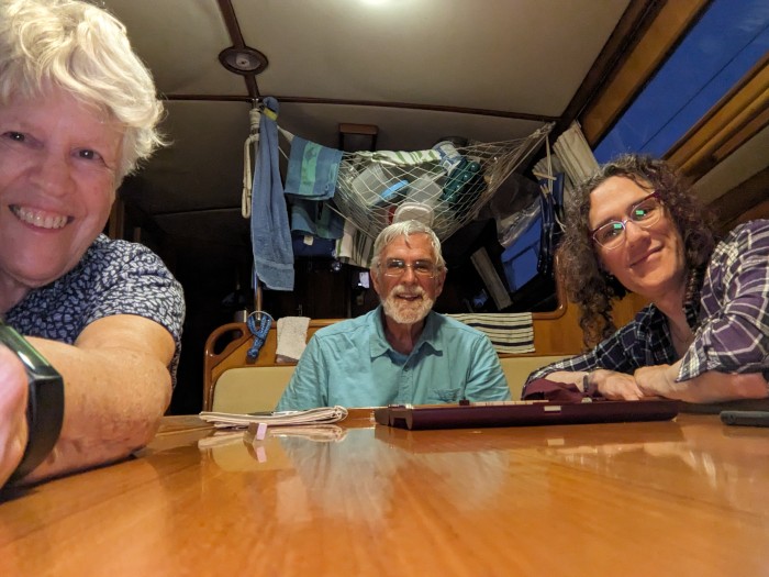
On Friday Laura came in on her 10:15 am Kenmore Air floatplane. The marina was willing to accommodate us with a couple of extra hours of moorage so that we could time our passage through Dodd Narrows a bit better with the predicted tidal currents. That night we anchored at the north end of Thetis Island. This has been a favorite anchorage for many years – most recently when we had Ray and Alicia McCracken aboard and were approached in our anchorage by two adult and one baby orca (killer whales), and then later that evening experienced a drop-dead gorgeous blood-red sunset. There were no such momentous events this time, but it was a good spot for peace and relaxation. Relaxation included a game of Scrabble, which Laura won by an overwhelming score. (See photo at the top of this blog entry.)
The next day we sailed to the south end of the Gulf Islands and stayed for two nights at Otter Cove on North Pender Island. The first of those two days, we went ashore at the Gulf Islands National Park, spoke at length with a couple of rangers, and explored some of the historic buildings. The next day we returned and went to the Pender Island Museum, which had some lovely “old timey” exhibits including a pump organ that they allow you to play (and I did), a stereoscope with viewable cards you can view (and Laura did) and a wind up gramophone (which none of us tried). After that, Craig went off fishing while Laura and I did a five-mile hike out to the tip of Roes Island and then to Roes Lake and back. It was interesting talking to many of the people we met along the trail. Most of them, it seemed, were locals and several expressed surprise at seeing people from Portland and Seattle. There were lots of dogs on the trail, most very friendly, and some anxious for a swim in the lake.
Later that day we moved Sequoia onto the dock at the Otter Bay Marina, mostly so that we could all get a shower. I will say, though, that Otter Bay Marina seems like a very nice resort, with two swimming pools and well-maintained facilities. It’s worth returning to, I think.
On Monday we sailed (and yes I do mean SAILED) from Otter Bay to Bellingham. It was the first good wind we have seen in many weeks. Unfortunately, our route took us against strong tidal currents most of the way, so we really felt pushed and pulled by the conflicting forces of wind and current. All in all, though it was a gorgeous day for sailing and for arriving back in the States.
On Tuesday Laura helped us with lots of boat chores, and then we had a nice dinner aboard with Laura and Alex, a friend she invited. Alex was also able to take Laura to the Amtrak station after dinner to catch her train home.
36 hours later and we’re on the train to Portland – almost there, so my timing writing this blog is excellent! I’ll be home for 36 hours and then heading down the freeway to my chamber music workshop in Sacramento. I understand I’ll be heading into a ferocious heat wave, so very light clothing is the order of the day (except those times when our activity takes place in an OVER air conditioned room.) The workshop is one of my favorite activities of the year, and there are a number of friends I’m looking forward to seeing and playing with again.
In the meantime, Craig will be at home, doing some needed chores there, picking blueberries and also in his workshop machining some boatie-bits.
And two weeks hence, we’ll be back on the boat again.
This is our mid-summer hiatus. We left Sequoia at an early hour this morning and expect to be home before dinnertime. But let me go back and tell you what we’ve been up to.
I last left you at Hardy Island, where we enjoyed a very pleasant anchorage with a resident seal who was constantly coming around to check on us and make sure we weren’t, secretly, throwing fish scraps overboard. Most of the boats were anchored in a cove adjacent to the Hardy Island Provincial Marine Park. We decided to anchor instead at an adjacent narrow inlet. The anchorage would only work if we also put a line on shore. On one side of the inlet was a steep cliff and several predecessor boats had left firmly anchored heavy line and sometimes chain arrangements hanging down the side of the cliff. Craig rowed over to the cliff wall and evaluated the available attachment points and selected the best. (Some of the boats we’ve seen have very athletic owners, crew members or even children, who will gladly scale steep walls to secure their shore line around the best looking tree trunk or other likely attachment point. We are, I’m afraid, without those assets, so we do our best with what we see. Some of Canada’s Provincial Parks have government-installed chains for attaching shore lines, but Hardy Bay is not so equipped.)
But I digress. One of the issues with a shore line is making it visible enough to be seen by other smaller boats who may be passing through the area. In this case we attached a couple of floating buoys to the floating line, making it – so we thought – very visible. But as we returned from a dinghy expedition into the park, we observed a small, motorized boat passing across our floating line. We stopped and talked to the fellow, and he said yes, he noticed a lurch, but apparently no ill effects.
From Hardy Island we backtracked just a bit to visit Egmont, home of impressive tidal rapids. Just getting TO or FROM Egmont requires careful consultation of the tide and current tables. And when we did arrive at our moorage, at BackEddy Marina, the current was flowing past the dock at 1.5 knots, docking was not easy, and required more than one try. While there we had a nice restaurant meal, but the highlight of that stop was our hike to see Skookumchuck Narrows and Sechelt Rapids. Regretfully it was not the right time for one of the extreme tidal flows which attracts the kayakers looking to surf the standing waves. Nevertheless, even at half that volume it was impressive. The trail turned out to be further away from the BackEddy Marina than we expected, and the trail itself was longer than we expected (or maybe we’re just older than the last time we hiked this trail, probably 15 years ago). It was a gorgeous hike, through dense groves of tall cedar trees with sunlight filtering through. We didn’t quite make it the last ¼ mile, as the trail became more and more rough with extended webs of tree roots and irregular rock fields. But it was definitely worth the effort.
When we got back to the trailhead, we must have looked pretty pathetic, because a car full of British tourists offered to give us a lift back to the BackEddy Marina. We protested not much at all, and three of the four Brits got out of the car and sat on logs while the fourth gave us the offered lift. He was, of course, a real charmer and we learned a bit about why he and his wife return to BC every summer (they have a daughter who lives in Whistler, but also there is the attraction of the gorgeous BC coastline.)
The next day we continued our journey southward, crossing tracks with ever more ferries and pleasure boats of every description. We wound up that night at Smugglers Cove, another BC Provincial Park near the south end of Texada Island. Smugglers Cove is a small, somewhat confined anchorage, and the Parks department has installed 38 shoreline attachment points. (The Waggoner’s cruising guide doubts whether it’s actually possible to fit 38 boats in there.) Fortunately for us there were only about 6 boats in there, all using a shore line tie. We watched all the different ways our fellow cruisers have fun. On one side of us there was a charter boat with four guys aboard. They all went swimming in the 66 degree water, then they all had a turn in the two kayaks. After dinner, they spent the hours until dark singing what sounded like sea chanteys and ballads. When we woke in the morning they were gone. Lots of folks had their kayaks and paddle boards out, and one woman rowed her kayak all around the anchorage with her Scotty dog standing alertly on the bow.
We crossed the Strait of Georgia that day in almost no wind at all. We still had soap suds in the polluted water tank and were hoping for a nice sail so that the suds would give the tank interior a good scrubbing. Not that day.
We were able to get space in the Nanaimo Boat Basin that Wednesday night, but they warned us that we might not be able to stay Thursday night, and CERTAINLY not Friday, because they were full up with reservations for the “Silly Boat Festival”. (I still have no idea what’s involved in being a “silly” boat”. Nanaimo has three successive weekend boating festivals: Dragonboat Racing, followed by “Silly”, followed by the famous Nanaimo Bathtub Races.) We were concerned about having a “place” in Nanaimo, because our daughter Laura was flying in on a float plane on Friday morning, to join us for an extended weekend. So, on Wednesday and Thursday we did a lot of boat chores (including more work on the offending water tank) and we stoked up with groceries and other supplies. We had a lovely dinner out at one of Nanaimo’s many fine eateries, and fortunately the Boat Basin was able to provide us the Thursday night moorage. Thursday was a street fair on Nanaimo’s main street which several people told us we “MUST SEE!” (I hate to say it, but it was like so many other street fairs – too many people, commercial food carts, clothing stands, pottery booths and kids’ activities). Watching the people was more fun than the booths.
We rode our bikes for many of our errands, including to a wonderful Middle Eastern deli, and enjoyed people watching along the waterfront promenade. Much to our amazement, Peter and Susan Gierga (Sauvie Island Yacht Club members) popped up. They had anchored their Penelope in the Newcastle Island anchorage and were dinghying over to the Boat Basin for their errands. We had them aboard for a drink and helped them get access to showers. It’s lovely to unexpectedly see familiar faces in a new environment.
On Friday Laura came in on her 10:15 am Kenmore Air floatplane. The marina was willing to accommodate us with a couple of extra hours of moorage so that we could time our passage through Dodd Narrows a bit better with the predicted tidal currents. That night we anchored at the north end of Thetis Island. This has been a favorite anchorage for many years – most recently when we had Ray and Alicia McCracken aboard and were approached in our anchorage by two adult and one baby orca (killer whales), and then later that evening experienced a drop-dead gorgeous blood-red sunset. There were no such momentous events this time, but it was a good spot for peace and relaxation. Relaxation included a game of Scrabble, which Laura won by an overwhelming score. (See photo at the top of this blog entry.)
The next day we sailed to the south end of the Gulf Islands and stayed for two nights at Otter Cove on North Pender Island. The first of those two days, we went ashore at the Gulf Islands National Park, spoke at length with a couple of rangers, and explored some of the historic buildings. The next day we returned and went to the Pender Island Museum, which had some lovely “old timey” exhibits including a pump organ that they allow you to play (and I did), a stereoscope with viewable cards you can view (and Laura did) and a wind up gramophone (which none of us tried). After that, Craig went off fishing while Laura and I did a five-mile hike out to the tip of Roes Island and then to Roes Lake and back. It was interesting talking to many of the people we met along the trail. Most of them, it seemed, were locals and several expressed surprise at seeing people from Portland and Seattle. There were lots of dogs on the trail, most very friendly, and some anxious for a swim in the lake.
Later that day we moved Sequoia onto the dock at the Otter Bay Marina, mostly so that we could all get a shower. I will say, though, that Otter Bay Marina seems like a very nice resort, with two swimming pools and well-maintained facilities. It’s worth returning to, I think.
On Monday we sailed (and yes I do mean SAILED) from Otter Bay to Bellingham. It was the first good wind we have seen in many weeks. Unfortunately, our route took us against strong tidal currents most of the way, so we really felt pushed and pulled by the conflicting forces of wind and current. All in all, though it was a gorgeous day for sailing and for arriving back in the States.
On Tuesday Laura helped us with lots of boat chores, and then we had a nice dinner aboard with Laura and Alex, a friend she invited. Alex was also able to take Laura to the Amtrak station after dinner to catch her train home.
36 hours later and we’re on the train to Portland – almost there, so my timing writing this blog is excellent! I’ll be home for 36 hours and then heading down the freeway to my chamber music workshop in Sacramento. I understand I’ll be heading into a ferocious heat wave, so very light clothing is the order of the day (except those times when our activity takes place in an OVER air conditioned room.) The workshop is one of my favorite activities of the year, and there are a number of friends I’m looking forward to seeing and playing with again.
In the meantime, Craig will be at home, doing some needed chores there, picking blueberries and also in his workshop machining some boatie-bits.
And two weeks hence, we’ll be back on the boat again.
Heriot Bay to Hardy Island
10 July 2023 | Egmont, Sunshine Coast, B.C., Canada
Barbara Johnston | Sunny and breezy
Heriot Bay to Hardy Island
July 9, 2023
Does it seem like the places we’re going have a lot of English names? In this blog post I’m going to talk about Heriot Bay – and that makes me think about James Herriot, the veterinarian author of “All Creatures Great and Small”, his memoir of veterinary practice in rural Yorkshire in the ‘30s. I just happen to be reading one of his books now. And Hardy Island is right next to much bigger Nelson Island. Nelson and Hardy were heroes of the English Napoleonic War. Nelson was the Admiral of the British Fleet and Hardy was his Flag Captain. Both were aboard the HMS Victory at the Battle of Trafalgar, and Nelson was mortally wounded. As he lay dying on the ship’s deck, he was reported to have said “Kiss me, Hardy,” to his beloved friend. There is, of course, a lot more to their story, but that’s what leaps into my head as we visit these islands. Those early explorers had a lot of English heroes and royalty, Lords and Ladies whose names needed to be stamped on newly explored islands and coves.
When I last wrote, we were in Walsh Cove, thinking about heading south again so we could meet up with Laura in the middle of July. At that point, we believed she would not yet have her passport, so we needed to meet up in US waters. More recently her passport has arrived, so we’re now targeting Nanaimo as our meet-up point.
We have several favorite places and activities to be enjoyed as we head south. There’s also the need for an occasional run to the grocery store and a visit to a laundromat. We decided on Heriot Bay for our first stop. Heriot Bay is located on Quadra Island, in the southwest part of Desolation Sound. Quadra has ferry service from Vancouver Island, so quite a land-based tourism industry. Heriot Bay is also the ferry terminus for a Quadra to Cortes Island ferry, taking cars and passengers one more island to the east. The Heriot Bay Inn has great facilities for land-based tourists, as well as a little marina which sometimes has space. We found they did have space for us, so we headed there from Walsh Cove. We’d never been there before, so we were somewhat nonplussed by being put on the outside dock, directly in the path of waves from a north wind, as well as wash from the ferry which docks about 300 feet away. There was, of course a north wind. The wind plus the resulting waves plastered us hard against the dock. The wash from the ferry was minimal compared to those wind waves. Fortunately, at night the wind drops somewhat, so we were able to sleep on the boat OK.
We visited the Heriot Bay grocery store (twice), had a very nice dinner in the resort’s restaurant, and took full advantage of their shower and laundry facilities. Then, it was time to find a place where we wouldn’t be quite so pinned down by the wind and waves. We decided on Bird Cove, a “little notch” in Evans Bay on Read Island. We had been here once before, with Nancy Morris and Mike Giambattista on their boat, M/V Schnooksie, in 2008. It had been a fabulous place to catch many Dungeness crabs. And the Waggoner cruising guide said “one of the best protected anchorages…”
Well, neither of those things turned out to be true for us. No crabs. Poor holding ground. Little protection from the forecast 25 knot northwest winds. Our first afternoon there, we found what we thought would be a good spot and put out our anchor. We thought we would be the only boat in the cove, but it was not longer before a smaller boat came in and put his anchor down in very nearly the same location as ours. We were worried, but as the boats were swinging in the increasing wind, it appeared there would be no collisions. We kept the instruments on so that we could make sure we weren’t dragging. Well, at dusk, wind increasing, wouldn’t you know it, the anchor started to drag. Landmarks were going by at 1-2 knots. We pulled up the anchor, moved it further into the shallows at the head of the cove and put out all our chain (200 feet). That seemed to hold for the night, although we had ongoing concerns about whether we might collide with the little sailboat.
The next day the wind dropped significantly in the morning, and Craig set out a crab pot. But in the afternoon the wind came up again and at dusk we could see the anchor was dragging. Again, we reset the anchor, even closer to shore. As we finished that exercise, I could hear the skipper of the other boat saying, “f**k”. We got on the radio with him, and he was very concerned about a nighttime collision. The wind direction had changed somewhat, and it did put us very close to the other boat. Craig decided to stay up on “anchor watch” while I went to bed. An hour or so later, he could see we were indeed, again, dragging.
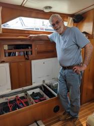
So, Craig decided to put out our back-up anchor, a 60 lb. Fortress FX-85 with a shank that’s about 5 feet long. We keep it knocked down in the bilge. We have used it only two other times in our 22 years on this boat. It is a huge job to get it assembled and deployed. Craig started the process, but it was inevitable that my help would be needed. We were successful deploying the anchor at about 2am. It held fast and did not drag, but our opinions of Bird Cove have somewhat changed. Craig got 3 hours of sleep that night; I got maybe 5, and we were exhausted. The next morning, we decided to head for Westview – a well-known and favorite stopping place of ours. We arrived there, and slept a lot that afternoon, followed by a full night’s sleep.
A special treat in Westview is that the Powell River Choral Festival, “Kathaumixw,” held every other year, was taking place while we were there. This is a festival that attracts excellent choirs from around the world. The choirs and some soloists compete for prizes and the gala concerts at the beginning and end are incredible musical spectacles. I really must hand it to the Powell River community – they really pull out all the stops and put on an amazing show. Such a small community – so much wonderful music. (I note that in June they have an orchestra festival – we happened to see the posters after the fact.) Our son, David participated in a Kathaumixw festival back in the late eighties, when he was a member of the Columbia Boys Choir. We reached Powell River back then aboard a previous sailboat, and were able to attend nearly every event David participated in.
This time, we chose one concert with three different choirs – interestingly, two of them had Oregon connections: the Willamette Master Chorus conducted by Paul Klemme (from Salem) and the Royal Voices of Charlotte conducted by Justin Smith. Dr. Smith had been a music professor at Marylhurst University in Lake Oswego, OR, before it suddenly and unfortunately closed several years ago. He moved to Queens University in North Carolina. This choir consists of Charlotte singers and Oregon singers, in about equal numbers. We had a chance to talk with singer Paul Sadilek, with whom we have both performed professionally.
The Willamette Master Chorus performed beautifully, which we knew they would, because we have performed with that group in a collaboration with the Newport Symphony. But the Royal Voices was really the standout choir of those three. Their vocal control, exquisite level of preparation and gorgeous sound was out of this world. It was fun seeing all three choirs and enjoying the enthusiasm of the audience.
To get to and from the performance, we had an adventure in public transport and met several different interesting people – always one of the best parts of travel.
Westview was also a good place for showers, laundry, and groceries, all of which we did. We also took our cleaning of the fouled water tank one step further and are very hopeful that it will be fit to hold water again before the end of the summer.
From Westview, we came south to the entrance to Jervis Inlet. Many boats turn eastward here and make the 40-mile slog to Princess Louisa Inlet. We’ve done that twice before and feel no necessity to do it again. Instead, we are anchored on the south side of Hardy Island, enjoying the beautiful views and the peaceful quiet. Tomorrow, we plan to go to Egmont. We hope to make the trek to see Sechelt Rapids at maximum ebb or maximum flood. There is a trail from the small town of Egmont, and these feet are anxious to be walking!
July 9, 2023
Does it seem like the places we’re going have a lot of English names? In this blog post I’m going to talk about Heriot Bay – and that makes me think about James Herriot, the veterinarian author of “All Creatures Great and Small”, his memoir of veterinary practice in rural Yorkshire in the ‘30s. I just happen to be reading one of his books now. And Hardy Island is right next to much bigger Nelson Island. Nelson and Hardy were heroes of the English Napoleonic War. Nelson was the Admiral of the British Fleet and Hardy was his Flag Captain. Both were aboard the HMS Victory at the Battle of Trafalgar, and Nelson was mortally wounded. As he lay dying on the ship’s deck, he was reported to have said “Kiss me, Hardy,” to his beloved friend. There is, of course, a lot more to their story, but that’s what leaps into my head as we visit these islands. Those early explorers had a lot of English heroes and royalty, Lords and Ladies whose names needed to be stamped on newly explored islands and coves.
When I last wrote, we were in Walsh Cove, thinking about heading south again so we could meet up with Laura in the middle of July. At that point, we believed she would not yet have her passport, so we needed to meet up in US waters. More recently her passport has arrived, so we’re now targeting Nanaimo as our meet-up point.
We have several favorite places and activities to be enjoyed as we head south. There’s also the need for an occasional run to the grocery store and a visit to a laundromat. We decided on Heriot Bay for our first stop. Heriot Bay is located on Quadra Island, in the southwest part of Desolation Sound. Quadra has ferry service from Vancouver Island, so quite a land-based tourism industry. Heriot Bay is also the ferry terminus for a Quadra to Cortes Island ferry, taking cars and passengers one more island to the east. The Heriot Bay Inn has great facilities for land-based tourists, as well as a little marina which sometimes has space. We found they did have space for us, so we headed there from Walsh Cove. We’d never been there before, so we were somewhat nonplussed by being put on the outside dock, directly in the path of waves from a north wind, as well as wash from the ferry which docks about 300 feet away. There was, of course a north wind. The wind plus the resulting waves plastered us hard against the dock. The wash from the ferry was minimal compared to those wind waves. Fortunately, at night the wind drops somewhat, so we were able to sleep on the boat OK.
We visited the Heriot Bay grocery store (twice), had a very nice dinner in the resort’s restaurant, and took full advantage of their shower and laundry facilities. Then, it was time to find a place where we wouldn’t be quite so pinned down by the wind and waves. We decided on Bird Cove, a “little notch” in Evans Bay on Read Island. We had been here once before, with Nancy Morris and Mike Giambattista on their boat, M/V Schnooksie, in 2008. It had been a fabulous place to catch many Dungeness crabs. And the Waggoner cruising guide said “one of the best protected anchorages…”
Well, neither of those things turned out to be true for us. No crabs. Poor holding ground. Little protection from the forecast 25 knot northwest winds. Our first afternoon there, we found what we thought would be a good spot and put out our anchor. We thought we would be the only boat in the cove, but it was not longer before a smaller boat came in and put his anchor down in very nearly the same location as ours. We were worried, but as the boats were swinging in the increasing wind, it appeared there would be no collisions. We kept the instruments on so that we could make sure we weren’t dragging. Well, at dusk, wind increasing, wouldn’t you know it, the anchor started to drag. Landmarks were going by at 1-2 knots. We pulled up the anchor, moved it further into the shallows at the head of the cove and put out all our chain (200 feet). That seemed to hold for the night, although we had ongoing concerns about whether we might collide with the little sailboat.
The next day the wind dropped significantly in the morning, and Craig set out a crab pot. But in the afternoon the wind came up again and at dusk we could see the anchor was dragging. Again, we reset the anchor, even closer to shore. As we finished that exercise, I could hear the skipper of the other boat saying, “f**k”. We got on the radio with him, and he was very concerned about a nighttime collision. The wind direction had changed somewhat, and it did put us very close to the other boat. Craig decided to stay up on “anchor watch” while I went to bed. An hour or so later, he could see we were indeed, again, dragging.
So, Craig decided to put out our back-up anchor, a 60 lb. Fortress FX-85 with a shank that’s about 5 feet long. We keep it knocked down in the bilge. We have used it only two other times in our 22 years on this boat. It is a huge job to get it assembled and deployed. Craig started the process, but it was inevitable that my help would be needed. We were successful deploying the anchor at about 2am. It held fast and did not drag, but our opinions of Bird Cove have somewhat changed. Craig got 3 hours of sleep that night; I got maybe 5, and we were exhausted. The next morning, we decided to head for Westview – a well-known and favorite stopping place of ours. We arrived there, and slept a lot that afternoon, followed by a full night’s sleep.
A special treat in Westview is that the Powell River Choral Festival, “Kathaumixw,” held every other year, was taking place while we were there. This is a festival that attracts excellent choirs from around the world. The choirs and some soloists compete for prizes and the gala concerts at the beginning and end are incredible musical spectacles. I really must hand it to the Powell River community – they really pull out all the stops and put on an amazing show. Such a small community – so much wonderful music. (I note that in June they have an orchestra festival – we happened to see the posters after the fact.) Our son, David participated in a Kathaumixw festival back in the late eighties, when he was a member of the Columbia Boys Choir. We reached Powell River back then aboard a previous sailboat, and were able to attend nearly every event David participated in.
This time, we chose one concert with three different choirs – interestingly, two of them had Oregon connections: the Willamette Master Chorus conducted by Paul Klemme (from Salem) and the Royal Voices of Charlotte conducted by Justin Smith. Dr. Smith had been a music professor at Marylhurst University in Lake Oswego, OR, before it suddenly and unfortunately closed several years ago. He moved to Queens University in North Carolina. This choir consists of Charlotte singers and Oregon singers, in about equal numbers. We had a chance to talk with singer Paul Sadilek, with whom we have both performed professionally.
The Willamette Master Chorus performed beautifully, which we knew they would, because we have performed with that group in a collaboration with the Newport Symphony. But the Royal Voices was really the standout choir of those three. Their vocal control, exquisite level of preparation and gorgeous sound was out of this world. It was fun seeing all three choirs and enjoying the enthusiasm of the audience.
To get to and from the performance, we had an adventure in public transport and met several different interesting people – always one of the best parts of travel.
Westview was also a good place for showers, laundry, and groceries, all of which we did. We also took our cleaning of the fouled water tank one step further and are very hopeful that it will be fit to hold water again before the end of the summer.
From Westview, we came south to the entrance to Jervis Inlet. Many boats turn eastward here and make the 40-mile slog to Princess Louisa Inlet. We’ve done that twice before and feel no necessity to do it again. Instead, we are anchored on the south side of Hardy Island, enjoying the beautiful views and the peaceful quiet. Tomorrow, we plan to go to Egmont. We hope to make the trek to see Sechelt Rapids at maximum ebb or maximum flood. There is a trail from the small town of Egmont, and these feet are anxious to be walking!
Walsh Cove and Refuge Cove
02 July 2023 | Walsh Cove, Desolation Sound, B.C., Canada
Barbara Johnston | Fair
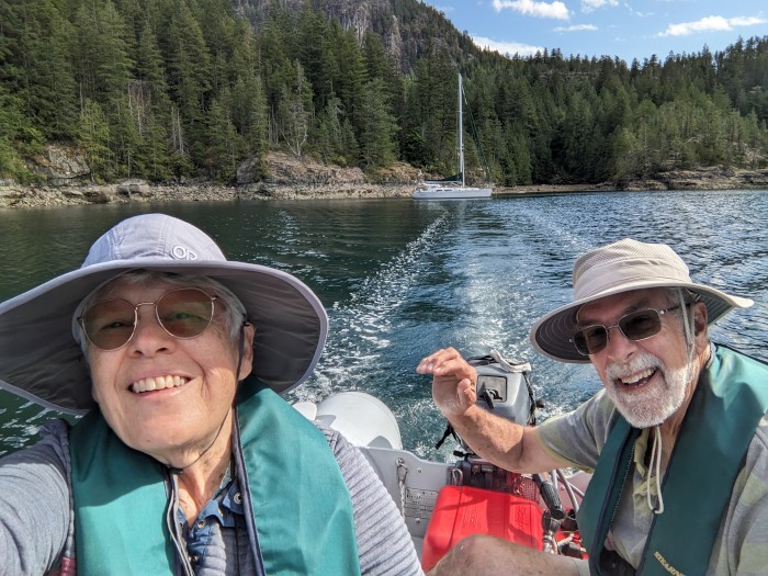
June 30, 2023
On Saturday, June 24, we departed civilization and made for Walsh Cove, a delightful, scenic, isolated, not-very-crowded Provincial Marine Park off Waddington Channel. This was our entry to Desolation Sound, which has been our cruising destination so often in the past.
When our kids were little, we came up here nearly every summer. Those were the days when we lived in Seattle and got two weeks of vacation. We figured out how to make the absolute most of those two weeks and maximize our time in Desolation Sound. A week before the vacation we sailed our boat (first a Columbia 26 and later an Islander Bahama 30) to Victoria (usually Oak Bay), tied her up, walked onto the Princess Marguerite (a Victoria to Seattle ferry), disembarked in Seattle and found our way home on public transportation. We put in another week’s work and then on Saturday morning took the Princess Marguerite again to Victoria, then onto our sailboat and headed north. With those smaller, slower sailboats, it took 5 days to make it to Desolation Sound. We’d get 5 days in Desolation Sound, then turn around and head back south – 15 days in all, before climbing again onto the Princess Marguerite in time to be back at work on Monday. The following weekend, of course, was our end-of-season retrieval of our little sailboat.
Now, in a larger boat, we can make it from Victoria to Desolation Sound in 3 days, and since we’re retired, we’re only limited by life’s vicissitudes. (We do miss having our kids with us, but this summer we’ll at least get to have Laura aboard for a few days in mid-July.) This summer we should have more than two weeks in Desolation Sound. We had originally planned to go further north, but life doesn’t always work out the way you plan. If you have a cruising sailboat, you learn to be flexible. Extremely flexible.
So let me tell you about the last week – we’ve been in Walsh Cove, then Refuge Cove, and now Walsh Cove again. When we were in Refuge Cove earlier this week, we considered the many places we might go in Desolation Sound, and a return to Walsh Cove topped the list. We stocked up on groceries and water and came back to this little gem of an anchorage.
Why do we like Walsh Cove so much? Not so many people come here. There is no commerce nearby; it’s just an indentation in the east coast of East Redonda Island, protected by three beautiful little islands from the winds that can whistle down the adjacent Waddington Channel. The cove is mostly too deep to anchor freelyThe Park Service has installed 10 or 15 shore anchors – basically a big eyebolt drilled into the rock with a chain hanging down. The idea is that you put your anchor out into the cove and then back up to the shore, stringing a floating line from your boat to the shore anchor. Some boats seem to do this easily; others struggle mightily, deploying their anchor multiple times, and sometimes seemingly give up in disgust and chugging off in search of another anchorage. Many of the boats strive for perfection, which seems to be the shortest shore line possible. The depth dropoff is impressively steep, so it is possible to get very close to the shore. Many of the boats that come here are locals. US flagged boats seem to be the exception. Since this is Friday, many local boats are showing up for the weekend. Last night we had only 4 boats here, but I’ll bet there will be 10 or 12 tonight.
The most prominent bird here seems to be the oystercatcher. It’s all black except for a bright orange beak. They like to fly around across the water in groups of 3 to many, blaring at each other like a group of traffic cops with whistles. They do this intermittently from dawn until well after dark. It makes me laugh every time.
It was a group of kayakers (camped out for the night on one of the adjacent islands) that told us the name of these birds. They said that the birds were named by Canadian kindergarteners through some sort of contest. Presumably the birds eat oysters? We are lacking a bird book this year, and while we’re here at Walsh Cove we are, of course, completely without internet. Those beautiful cliffs on all sides do not allow any cell phone signal to get through. There are tens of thousands of oysters on these shores, ready to puncture your inflatable dinghy if you venture too carelessly ashore. The oystercatchers are presumably the only ones eating oysters because harvesting them (or any bivalve shellfish) is strictly prohibited this time of year (concern about red tide poisoning).
One of the features of Walsh Cove is that fishing is permitted here and in the adjacent Waddington Channel. It’s even permitted for non-indigenous people (like us) to catch and keep King Salmon and most types of rockfish here (with strict limits on size). Craig went out yesterday morning and fished for salmon and rockfish. He was completely skunked on the salmon but did catch a dinner-sized rockfish (yum, yum!) He also caught a larger copper rockfish which is required to be released using a device that returns it to its original depth. So Craig had a first try with the device which seems to have worked well in the end. We hope the rockfish survived the trip!
One of the hallmarks of a cruising boat (in fact one of the definitions!) is “fixing your boat in exotic places.” Craig adhered to this maxim by repairing our swim-step shower. Over time it had developed an “always leaking” strategy, sure to hasten our depletion of our fresh water supplies. Fortunately, from our long-distance cruising days, we had all the necessary parts on hand. He had thought it would be a half-day repair, but in fact it only took about an hour and half. Showers on the swim step are wonderful, except when neighboring boats are too close. Craig has no scruples about it (“if they want to look, it’s up to them; no skin off my nose”) but I’m not quite so bold.
This morning we dinghied over to one of the islands that separates this cove from Waddington Channel. It’s an interesting exercise to find a landing spot that will still be good when the tide rises (or falls) a bit, and then to get past the slippery rocks and seaweed, through the sharp, crunchy oysters and mussels, and then up past the high tide line. We found a good spot for that and walked all around the island. It’s not quite the same as a five-mile hike, but it does allow us to stretch out muscles that really don’t get used aboard the boat. Also, beautiful vistas in every direction. On the way to the island we talked a bit with another cruising couple in a dinghy. They were just returning from checking their prawn trap, having scored only 4 prawns overnight. We’re planning on getting together with them tonight, and we’ll learn more about what promises to be their very interesting story.
Tomorrow we’re planning to move to an anchorage in Tenedos Bay, a bit south of here. According to our “Waggoner’s” guide, there are shore anchors in Tenedos Bay. Hopefully we can get there early enough to snag one. There are also supposed to be trails!
I haven’t said anything about Refuge Cove, which is quite different from this cove. Here, there are no facilities other than the shore anchors. In Refuge Cove, there’s lots of dock space, running water, laundry, showers (sort of), electricity (sort of), wifi (sort of) and a general store. A large area on the south end of East Redonda Island is owned by a housing co-op of 18 homeowners. The co-op leases shoreline areas to operators of the store, the restaurant and the docks. It appears all of the operators are in fact members of the co-op. This was all put in place decades ago, and the systems have not, by-and-large, been updated since. Craig found that the dock power (nominally 120 volts) was actually putting out 88 volts. He got in touch with the facilities manager and worked with him on how to remedy the situation. The system, which also serves all the co-op homeowners, needs an upgrade for a variety of reasons. The governmental authorities, however, will require so many upgrades in so many aspects of the facilities’ operation however, that there isn’t the will or the money to do it. So they’re thinking about just turning off the electricity to the docks.
They have a generator that turns off at 6pm. Supposedly there is still water pressure all night. But I found out to my dismay that a shower commenced at 6:30 pm may stop working unexpectedly, when you are still covered with soap. Fortunately, I was about 15 seconds past that stage when it happened, but it was still somewhat of a rude shock.
There are all sorts of interesting people who live and work at Refuge Cove. Many of them are members of the 18 families. We enjoyed a quite wonderful meal at the restaurant, which is in its pre-opening phase (official opening is July 1). The young couple that operates it seem very good at what they do, and are highly motivated for its success. Being out in the wilderness, with very high standards for their food, it’s quite expensive, and of course their season is very short (maybe 2 ½ months each summer). I wish them the very best of luck.
Another entrepreneur at Refuge Cove is the garbage barge operator. A resort in the wilderness does not accept people’s garbage. You have to take it with you or use the garbage barge. We dropped off one bag: $12.
This blog entry probably won’t actually be posted for a couple of days yet. But I think I’ll wind it up, because it’s getting pretty long. We hope you’re enjoying our adventures – we enjoy hearing from you if you do!
Summer Solstice
23 June 2023 | Westview/Powell River B.C.
Barbara Johnston | Warm
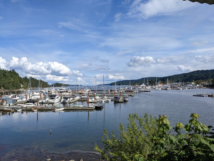
When I finished our last blog entry we were in Ganges on Saltspring Island. We enjoyed our time there and found the people to be exceedingly friendly. We walked a fair bit and enjoyed the beautiful views and the interesting shops. The weather was chancy and there were some real downpours.
We had hoped to empty and fill that diesel-sullied water tank. But it turned out that Saltspring Island is having a serious drought (despite the downpours), and they don’t want you to take any more water than you need to get to your next port. They also instruct “no grey water discharge" on various signs. Soap suds are definitely grey water. As it turns out, the reason they don’t want grey water is because Ganges harbour already has fairly dirty water. There is an immense amount of floating wood and detached seaweed, and who knows what more underwater. Thankfully, it does not appear to be human garbage. Presumably all that stuff is there due to tidal action in a long narrow inlet.
But, as it turned out, some piece of that tidal detritus wound up getting sucked into our raw water intake for the engine. We were about 3 or 4 miles into our day’s trip when the engine alarms started going off. Overheating engine. These are the moments when I’m very glad Craig is an engineer. He was able to diagnose the blockage in the cooling water intake fairly quickly. First step: close the through-hull fitting for the raw water inlet. It went “crunch”, obviously indicating there was something in the way. Then, the only question is how to spit it out. It turns out this is actually a fairly common problem – just one we have not encountered in our 30 or so years of owning a diesel-powered sailboat. We detoured into a little bay on the east side of Thetis Island, we anchored and Craig started inventing. There are 3 or 4 hoses that branch off from the raw water intake. All those hoses are, of course, below the waterline, so potentially detaching any of them is an opportunity to let lots of ocean into the boat. Eventually, Craig was able to plumb a different hose onto one of the fittings, and he attached it to our fresh water system, thus applying the system’s water pressure against whatever was stuck in the through-hull fitting. Third try, it actually worked! The blockage was fixed!
We got underway again rather quickly, because we needed to reach Dodd Narrows before the tide turned. As it turns out we got there an hour early and the four-knot current flowed with us as we passed through (it can flow as much as 11 knots at peak flood and peak ebb).
We anchored that night in a very crowded anchorage by Newcastle Island, across the channel from downtown Nanaimo. I think I slept about 10 hours that night. It had been an exhausting day.
The next morning we crossed over and got a spot in the municipal docks. Nanaimo is a lovely city, and I was sorry not to spend more time there. We did do some grocery shopping, had showers, did laundry and walked a fairly long distance on the waterfront promenade. Craig went off in search of some small hardware items and a fishing license. It turns out that they ONLY now sell fishing licenses online. There are lots of complicated rules, and many areas are closed to fishing. Craig also found out about a new requirement that you must have, and have at the ready while fishing, a device that returns a rockfish to the original depth where it was caught. (Some rockfish are the wrong size, or are a variety you are not allowed to catch.) There was a $12 version of the device, but it sold out long ago. The only alternative was $90. (It actually looks like a can opener.) The out-of-province license was $106. I think there were more fees than that as well. But now we’re all set, and hoping for some good catches this year.
We're on the route we followed so often (every summer) when our kids were little. Back then we had a much smaller boat, so couldn't go nearly as fast. But I still tend to think of these distances as really far. Crossing the Strait of Georgia from Nanaimo to Smuggler’s Cove used to be an all day thing. In this boat, in relatively calm conditions we can do it in 3 hours. We also now have the luxury of waiting for the most favorable weather whereas back then we had only 2 weeks before we had to be back at work, so you go at the earliest opportunity, no matter the weather.
Almost always when we have done that crossing before, we’ve had to make a major detour around Area Whiskey Golf. That’s a military exercise area, and they sometimes use live ammunition. So it was a great surprise to find out that this time the area was open. This time the warning was that naval vessels will be out there and may be firing blanks. But "you're free to transit". As we proceeded into area Whiskey Golf we could see the military ships up ahead, and they were actually emitting an AIS signal (in our experience, military ships always run silent, without any AIS signal). One of the ships, “Canadian warship 703” was periodically sending out announcements of UAV (drone) operations.
We ended up anchoring that night in Bargain Bay, a small bay just south of Pender Harbour. We’ve never been in there before, but it’s a nice anchorage surrounded by cliffs and beautiful forests, and dozens and dozens of homes ranging from modest to super-luxurious. That was the Summer Solstice, and indeed there was light in the sky as late as 11 pm.
We are in Westview, having arrived yesterday. It's probably been 10 years since we were last here, and they have certainly upgraded the port facilities. We're right out at the end, by the harbor entrance, and our neighbors are a large RCMP boat and a large Coast Guard boat. Today we're biked up to what used to be the Safeway and is now called "FreshCo" (still, apparently, a division of Safeway). After that it was laundry and other boat-tidying tasks. Last night we pumped the sullied water tank out (full of suds from the Dawn treatment). We waited until after the RCMP boat had gone out for their evening exercises. They presumably are set up to enforce environmental laws and we had no desire for them to see our suds emissions. Who knows what environmental laws we might be violating! They do allow grey water discharge here, but our suds might be pushing the definition. Anyway, we've now filled the tank up with municipal water, and there are only a few suds floating around in there. No smell of diesel. So we're definitely making progress!
We are enjoying Westview. For the first time on this trip we have been actually hot, wearing shorts and not wanting to be out in the sun. We did a bit of exploring, found some stores we haven't seen before, had showers, had a nice Thai dinner. Last night some First Nation guys arrived on our dock and were cleaning 2 King salmon and a ling cod. The salmon were beautiful, and as it turns only First Nation people are allowed catch the Kings. They asked if we had any plastic bags and offered to trade a piece of salmon for some plastic bags. Craig said sure, how about a piece big enough for 2 senior citizens to make dinner out of? They ended up giving us about 2 pounds-certainly enough to make 3 or 4 meals out of. (We cooked some of it for dinner this evening – it was absolutely wonderful!)
Tonight we’ve been dealing with first-world issues before we head out into the wilderness of Desolation Sound. There’s a certain amount of bureaucracy to assure our sublet of a slip in Bellingham in July. Also, back home, we’re trying to get a solar project ready for installation when we get back. Our contractor reports the county is requiring a massive amount of documentation which we’re effectively unable to do from here. Ah, such is life!
| Vessel Name: | Sequoia |
| Vessel Make/Model: | Outbound 44 |
| Hailing Port: | Portland, Or |
| Crew: | Craig & Barbara Johnston |
| About: | |
| Extra: |
Sequoia's Photos - Leaving the West Coast
Who we are...
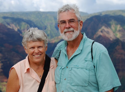
Who: Craig & Barbara Johnston
Port: Portland, Or
Gallery