
SV THIRD DAY
Following a 4 year Cruise in Mexico, the Boren Family is living aboard in Morro Bay, CA for the kids to attend Morro Bay High School. Once that is done....who knows....

19 August 2016
19 July 2016
31 May 2016
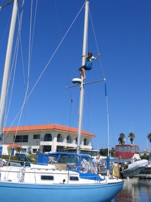
15 May 2016 | The Deck Project Day 1
11 March 2016
23 February 2016 | Morro Bay
13 December 2015 | Port San Luis, CA
27 September 2015
29 July 2015
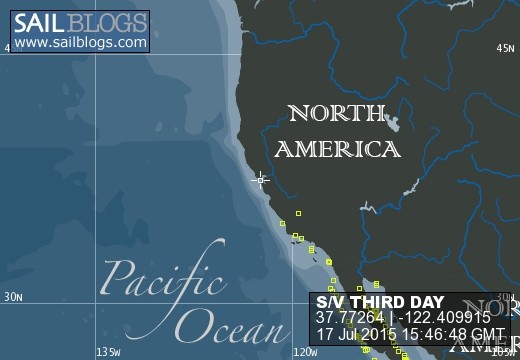
17 July 2015 | Port San Luis, CA
04 April 2015 | Confessions of a Live Aboard Hobo
08 February 2015 | One Nnight Taco Stand
06 January 2015 | Talking about RO Membranes
23 December 2014
08 December 2014 | Rich was playing with the Camera Again
01 November 2014 | Or 2 Years Back in the States
20 September 2014
08 September 2014 | Is it safe in an Anchorage
02 September 2014
09 August 2014 | 2900 Mile Round Trip
New Electronic Charts of Mexico
23 March 2012 | A Rate "Must Have" from Mr Go Simple
Capt Rich
My "go now and go simple" attitude to cruising doesn't come with a long list of "must have" items and cruising gear. But I have to admit, the new electronic charts just released by the authors of my two favorite cruising guides get added to my "must have" list.

The subject of electronic charts being "off" for many places in Mexico always comes up when your GPS shows you anchored in the middle of an island or 500ft inland on the La Paz Malacon. We have been using the two Mexico cruising guides by Sean and Heather for years and love them and tell anyone planning a cruise to Mexico to buy the two guide books, even if you have to cut out a few tacos, they are that valuable!


We are excited that they now have the data and way points listed in their books available on a downloadable program that you can load on your Ipad, Iphone, or computer that overlays their charts and data with Google earth and other charting programs. These new electronic charts from them are a great option for those looking for a cheap and accurate charting solution for their time cruising Mexico. It's also a bonus that they are fellow cruisers and great people themselves, which can make you feel good about buying their products and supporting their cruising kitty!
You can check out the New Electronic Charts as well as their books at their website here BlueLatitudepress.com
Comments
| Vessel Name: | THIRD DAY |
| Vessel Make/Model: | 1977 Hudson Force 50 |
| Hailing Port: | Morro Bay, California USA |
| Crew: | The Boren Family: Rich, Lori, Amy, Jason and Cortez the Cat |
| About: | Admiral: Lori Boren, Master: Jason Boren age 16, 1st Mate: Amy Boren age 17 |
| Extra: | |
| Home Page: | http://www.cruiserowaterandpower.com/ |
| Social: |
|
THIRD DAY's Photos - SV THIRD DAY (Main)
Photos 1 to 3 of 3 |
1 |
 |
 |
 |
1 |
 |
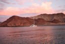
Images of one of our favorite anchorages
11 Photos
Created 15 October 2009
|
 |
 |
Photos of our new LED cabinn lights that use 1/10th the amount of power as our old school halogens.
4 Photos | 1 Sub-Album
Created 28 July 2009
|
 |
 |
 |
Photo Essay of the last two weeks at sea without internet access
6 Photos
Created 11 June 2009
|
|
 |
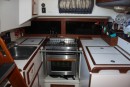
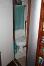
When you buy a 28yr old boat with the plans of a multi-year cruise, you have lots of work!
6 Photos
Created 27 January 2008
|
The Crew of S/V THIRD DAY
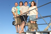
Who: The Boren Family: Rich, Lori, Amy, Jason and Cortez the Cat
Port: Morro Bay, California USA
Gallery

The Adventures of THIRD DAY
Sites we Recommend
- 4th Yr. 2012 Cruising Season
- Summer in the Mar de Cortez 2010
- Cruise RO Water and Power
- Mid-Cruise Boat Swap
- Cruising Mexico 2010
- Boat Layout Tour
- Things Cruisers Should Know
- Summer in the Sea of Cortez 2009
- Cruising Myths
- Cruising Mexico
- 2008 Baja Ha-ha
- Video Entry
- Kids Life Aboard
- Cruise Preparation
- '07 Car Trip to La Paz
- Baja Bash 2008
- 2007 Baja Ha ha
- Show All Posts
SailBlogs Friends
 WDE8791")


