Around the world with S/V Zephyr
The adventures of Bill & Tracy as they fulfill their lifes dream of sailing the world. We've dreamed of this for years and now is the time while the health is still good and there is money in the kitty to make it come true.
05 January 2019 | Aurora
07 December 2018 | Aurora, Colorado
03 December 2018 | Aurora
15 November 2018 | Aurora
06 November 2018 | Aurora
01 November 2018 | Aurora
30 October 2018 | Aurora
16 October 2018 | Aurora
16 October 2018 | Aurora
14 October 2018 | Aurora
12 October 2018 | Aurora, Colorado
24 September 2018 | Aurora, Colorado
11 September 2018 | Aurora, Colorado
03 September 2018 | Aurora, Colorado
30 August 2018 | Aurora, Colorado
23 August 2018 | Aurora, Colorado
21 August 2018 | Aurora, Colorado
17 August 2018 | Aurora, Colorado
16 August 2018 | Aurora, Colorado
15 August 2018 | Aurora, Colorado
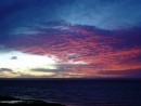
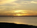
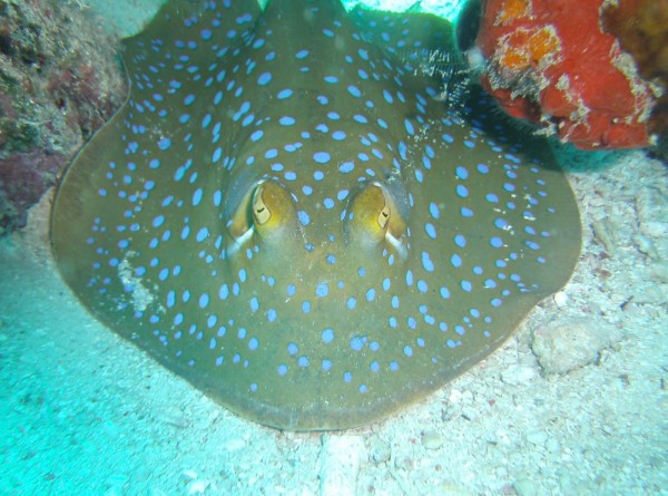
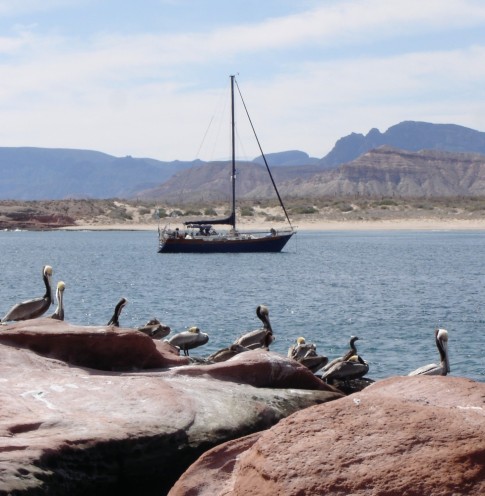
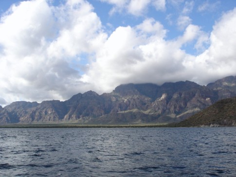
Out from San Evaristo.
18 January 2010 | Agua Verde
Bill Hudson
As the winds died over Saturday night and started the shift to start coming out of the South, we upped the anchor about 0730 on Sunday morning and headed out in just about calm seas. Pam Demonium was about 25 minutes ahead of us for the trip North on our next leg.
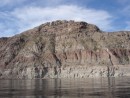
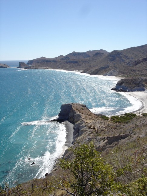
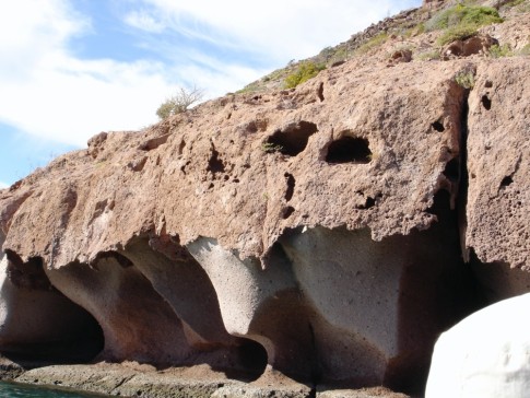
With the wind being so light, the motor kept us moving along at a good steady 6.5 to 7 knots, so we were buzzing right along. We thought we would stop at El Gato to look at their beautiful sandstone rock formations and perhaps spend the night--weather permitting. It's a much better anchorage for North winds though not tremendously protected from the wind. There are reefs on both sides of the inlet so we knew we would have to be careful getting in. One of our cruising guides(Gerry's) listed a waypoint to head in from. We put it in our Garmin chartplotter and motored in from that position at a heading of 220 degrees with no problem. The winds were still light but were slowly coming out of the South, so we decided to just make it a short stop and take some pictures from Zephyrs deck instead of launching Puff. With the winds from the South, we now knew we had to get to Agua Verde and it was another 18 miles down the channel.
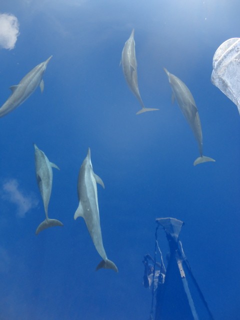
A quick lunch and we followed our track in on our chartplotter back out, turned left and started the last leg of the day. Tracy remarked that it had been a while since we had seen any marine animals(birds don't count). Within 30 minutes, we were set upon by a large pod(not sure if that is the right term) of dolphins splashing in Zephyr's wake. They only stayed a few minutes as they were heading South to our North. Not 30 minutes later, we saw Blue Whales off our port and starboard side with water blasting from their blow holes. These kids are some of the largest whales in the ocean. They were a good 200 yards away and that was just fine. They were also heading South. Warmer water perhaps? The Sun was still bright and the day was nice and warm. Into the mid 70's with just a bit of wind from the South so all was fine.
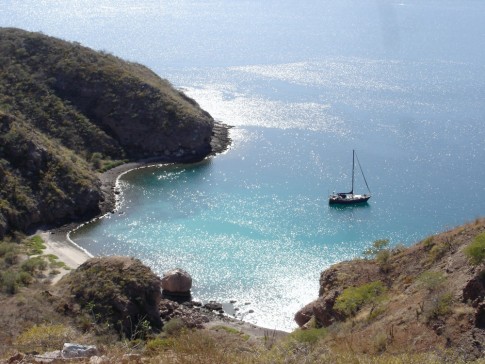
We avoided the reefs and rocks at San Marcial and rounded the point and slowly headed into Agua Verde. A trip of about 44 miles and we were there about 1500 even with the short stop at El Gato. We'd made good time.
Agua Verde is split into basically three places to anchor. The West cove is good protection for winds from the North. The center is right off the main beach and has little protection from the North but is alright with winds from the South. And then there is the East cove that is good in South winds. With the winds forecast to be out of the South for the next few days, we planned to be in there. When we rounded the point, there were three other boats already at anchor but still room for at least one more without getting too crowded. We slowly glided through the cove and chose a spot and dropped the anchor(25 30.958N 111 03.799W). We put Zephyr in reverse and set the anchor with 150 feet of chain out in about 20 feet of water. We were ready for what even came our way. Pam Demonium showed up about 40 minutes later and checked out the center anchorage before coming over to join us. One of the three boats that had been in the cove upped his anchor shortly after we arrived and headed to the West cove(heaven only knows why) and Pam Deminium took his spot for the night. We settled in for a nice evening with clear skies for a good night to sit out and see all the stars. Delightful!!
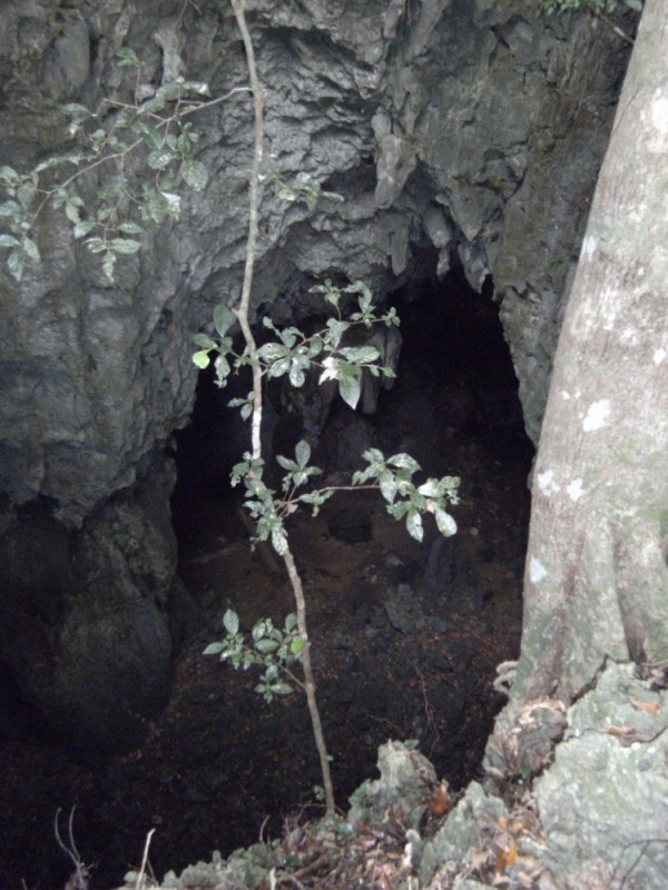
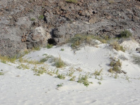
Today, off to see the caves at Punta Ballena and play on the beach. It's a couple of miles but I'm sure Puff and Dragon are up to it. Once we come back, it's into "town" to see what they have to see. Supposedly, there is a small tienda(store) and a restaurant. I guess we will see.
Have a great Monday everyone.
With the wind being so light, the motor kept us moving along at a good steady 6.5 to 7 knots, so we were buzzing right along. We thought we would stop at El Gato to look at their beautiful sandstone rock formations and perhaps spend the night--weather permitting. It's a much better anchorage for North winds though not tremendously protected from the wind. There are reefs on both sides of the inlet so we knew we would have to be careful getting in. One of our cruising guides(Gerry's) listed a waypoint to head in from. We put it in our Garmin chartplotter and motored in from that position at a heading of 220 degrees with no problem. The winds were still light but were slowly coming out of the South, so we decided to just make it a short stop and take some pictures from Zephyrs deck instead of launching Puff. With the winds from the South, we now knew we had to get to Agua Verde and it was another 18 miles down the channel.
A quick lunch and we followed our track in on our chartplotter back out, turned left and started the last leg of the day. Tracy remarked that it had been a while since we had seen any marine animals(birds don't count). Within 30 minutes, we were set upon by a large pod(not sure if that is the right term) of dolphins splashing in Zephyr's wake. They only stayed a few minutes as they were heading South to our North. Not 30 minutes later, we saw Blue Whales off our port and starboard side with water blasting from their blow holes. These kids are some of the largest whales in the ocean. They were a good 200 yards away and that was just fine. They were also heading South. Warmer water perhaps? The Sun was still bright and the day was nice and warm. Into the mid 70's with just a bit of wind from the South so all was fine.
We avoided the reefs and rocks at San Marcial and rounded the point and slowly headed into Agua Verde. A trip of about 44 miles and we were there about 1500 even with the short stop at El Gato. We'd made good time.
Agua Verde is split into basically three places to anchor. The West cove is good protection for winds from the North. The center is right off the main beach and has little protection from the North but is alright with winds from the South. And then there is the East cove that is good in South winds. With the winds forecast to be out of the South for the next few days, we planned to be in there. When we rounded the point, there were three other boats already at anchor but still room for at least one more without getting too crowded. We slowly glided through the cove and chose a spot and dropped the anchor(25 30.958N 111 03.799W). We put Zephyr in reverse and set the anchor with 150 feet of chain out in about 20 feet of water. We were ready for what even came our way. Pam Demonium showed up about 40 minutes later and checked out the center anchorage before coming over to join us. One of the three boats that had been in the cove upped his anchor shortly after we arrived and headed to the West cove(heaven only knows why) and Pam Deminium took his spot for the night. We settled in for a nice evening with clear skies for a good night to sit out and see all the stars. Delightful!!
Today, off to see the caves at Punta Ballena and play on the beach. It's a couple of miles but I'm sure Puff and Dragon are up to it. Once we come back, it's into "town" to see what they have to see. Supposedly, there is a small tienda(store) and a restaurant. I guess we will see.
Have a great Monday everyone.
Comments
| Vessel Name: | Zephyr |
| Vessel Make/Model: | Shin Fa 458 |
| Hailing Port: | Denver, Colorado |
| Crew: | Bill & Tracy Hudson |
| About: | We've been sailing since the early 80's on lakes in New Mexico and Colorado and finally took the plunge and bought Zephyr. |
| Extra: | |
| Home Page: | http::/www.sailblogs.com/member/svzephyr |
Zephyr's Photos - Main
Photos 1 to 54 of 54 |
1 |
 |
 |
 |
 |
 |
 |
 |
 |
 |
 |
 |
 |
 |
 |
 |
 |
 |
 |
 |
 |
 |
 |
 |
 |
 |
 |
 |
 |
 |
 |
 |
 |
 |
 |
 |
 |
 |
 |
 |
 |
 |
 |
 |
 |
 |
 |
 |
 |
 |
 |
 |
 |
 |
 |
1 |
 |
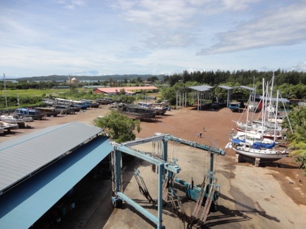 |
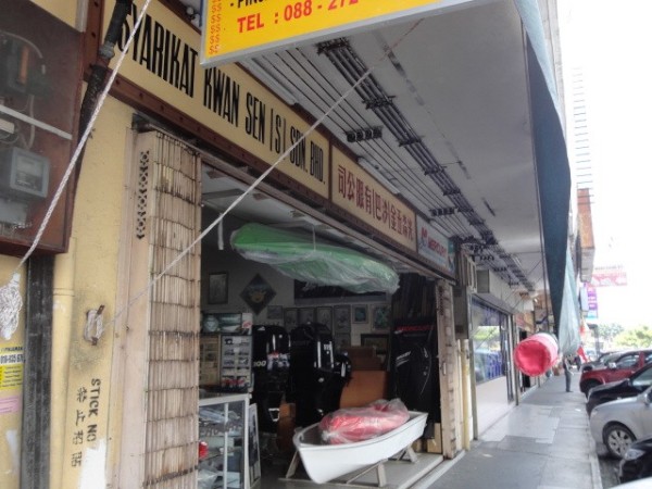
Around Kudat and the Penuwasa Boat Yard
39 Photos
Created 18 November 2013
|
 |
Up the hills till an opening shows up in front of you and then see if you can get down into it. Not always.
36 Photos
Created 16 November 2013
|
 |
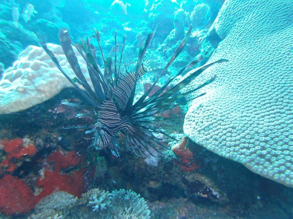
Some photos of our diving on the reef.
30 Photos
Created 16 November 2013
|
 |
Our trip around the north end of Borneo
20 Photos
Created 16 November 2013
|
 |
 |
Our trip around Malaysia starting at Tawau.
36 Photos
Created 21 October 2013
|
 |
 |
Our trip from Tawau around the top of Borneo down to Brunei.
6 Photos
Created 9 October 2013
|
 |
 |
 |
Pictures of our dives off Musket Cove Marina
20 Photos
Created 7 December 2011
|
 |
Avea Bay on South Huahine and on to Raiatea Island.
39 Photos
Created 25 July 2011
|
 |
 |
 |
My three days getting not only knowledge and some self confidence but nice and dirty.
8 Photos
Created 26 August 2010
|
 |
Heading South from Escondido.
23 Photos | 2 Sub-Albums
Created 30 April 2010
|
 |
 |
 |
A great place to spend time exploring.
48 Photos
Created 30 April 2010
|
 |
Honeymoon Cove on Isla Danzante
25 Photos | 1 Sub-Album
Created 30 April 2010
|
 |
 |
Our continuing adventure as we head North farther up the Sea Of Cortez.
47 Photos
Created 22 January 2010
|
 |
 |
Our visit to the famous "Mushroom Rock" bay.
12 Photos
Created 1 January 2010
|
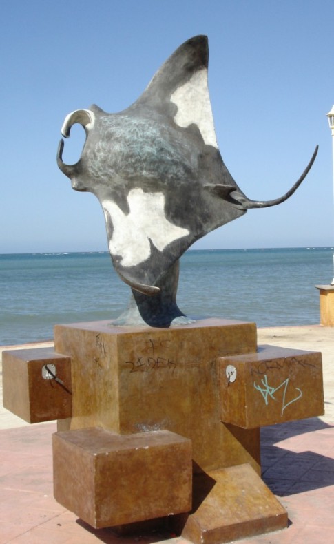 |
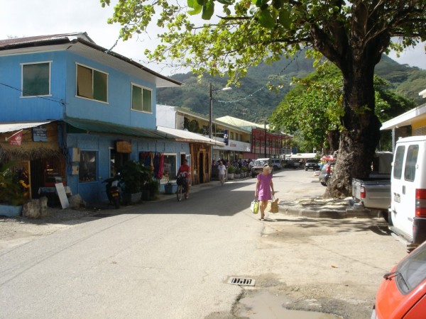
Art and statues along the waterfront as you walk through downtown La Paz, Mexico
13 Photos
Created 1 January 2010
|
 |
Still heading South but now in Cabo San Lucas
24 Photos
Created 8 December 2009
|
 |
Making our way South along the coast of Mexico
25 Photos
Created 28 November 2009
|
Bill & Tracy in Tahiti

Who: Bill & Tracy Hudson
Port: Denver, Colorado
Gallery