
Swingin' on a Star
Ship's log for the circumnavigating Saint Francis 50 catamaran, "Swingin on a Star".
01 April 2010 | Palau
13 July 2009 | Palau
05 July 2009 | Yacht Harbor
03 July 2009 | Peleliu
02 July 2009 | Palau
01 July 2009 | Two Dog Beach
30 June 2009 | Mecharchar
29 June 2009 | Mecharchar
28 June 2009 | Ulong
27 June 2009 | Ngeruktabel
17 June 2009 | Ngeruktabel
16 June 2009 | Ngeruktabel
15 June 2009 | Ngeruktabel
14 June 2009 | Ngeruktabel
13 June 2009 | Ngerutable
25 May 2009 | Yacht Harbor
30 April 2009 | Malakal
29 April 2009 | Koror
28 April 2009 | Malakal
27 April 2009 | Malakal
Dinghy Tour of Maupiti
21 September 2008 | Maupiti
Randy
It was cloudy most of the day today. Rain threatened in the morning but never came. After a slow first part of the day Hideko and I tossed our snorkeling gear into the dinghy and set out to circumnavigate the lagoon. Things are slow on Maupiti, but today was Sunday and things were down right comatose. We ate lunch on board doubting we would find an opportunity to eat elsewhere.
We set off to the west along the long sand bank that covers the southern end of the lagoon past motu Pitiahe. The deep water portion of the lagoon between the bank and the island has a lot of coral heads, many high enough to take a bite of fiberglass. It would be imprudent to take a large boat farther than the anchorage behind Pitiahe.
Much like Bora Bora, the one really nice beach on the main island is at the southwest point, Tereia Beach. As you reach the southwest part of the lagoon between Motu Auira and Tereia Beach the sand bank becomes a bridge between the main island and Auira with about a foot of water over it. We lifted the dinghy motor and "sailed" across the bank. The wind was up in the 15-20 knot range so we made good time by standing up in the boat broadside to the wind.
I think we saw perhaps 6 locals on the motu and mainland and perhaps two tourists up to this point. We identified the tourists walking from the motu to the island over the sand bank as we were going by (the Polynesians seem to use Carolina Skiffs or locally made craft to get around).
Once across the sand the deep water lagoon runs pretty much from shore to shore. It is not however an easy dinghy transit because there are coral heads running in long lines and exotic patterns from seabed to surface everywhere. It is like a maze trying to get through to the north. Every once in a while we had to cheat and tilt up the outboard to coast over one of the lines of coral after failing to find a pass to the other side.
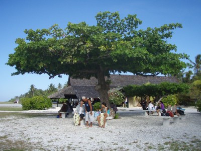
The motus are all a lovely mix of coral shoals and sandy beaches. The motus themselves are all covered in coconut palms. Most of the motus seemed sparsely inhabited and the majority seem to have small 1-5 room Pensions on them.
Maupiti itself is very dramatic as well. The mountains rise up from a thin skirt of lush greenery in sheer cliffs colored with blacks, grays, whites and speckles of color from the seabirds soaring along. There are no radio towers at the tops of these flat topped mountains but rather the odd towering palm tree rising up here and there like spikes in a crown. The coastline is rugged in most places with jutting blocks of black volcanic rock along the shore and scattered out into the shallows. Palm trees reach precariously out over the lagoon. It all reminds one of the proverbial lost island of the south pacific.
As we reached the northwest end of the lagoon the maze of coral relented and we turned into the wind to head east. The island affect in the lagoon is similar to that on the north and south sides of Bora Bora when the trades are up. There was a lot of chop and the gusts were up to 20 knots or so. Another large sand bank reaches down from the northern motus which allows you to get out of chop a bit.
We beached the dink in about 6 inches of water on the windward side of the northwestern tip of Motu Tuanai to take a look around. This is the east side of the big northern sand bank and there are some small sand islands here along with some sheltered lagoons that reach north to the barrier reef. We walked along the shore through hundreds of coconuts and coconut husks. The coconut crabs here were the largest we had ever seen, the size of normal eating crabs. Got me thinking.
The lagoon between little Motu Paeao and Motu Tuanai is filled with crystal clear water. The sun had come out and we could see squads of fish flying in all directions from the shallows as we walked along the beach. We found a mooring buoy here and a flat bottomed skiff with a guy spear fishing. Amazing the places you can get into if you know your way around. The motu seemed to be presently or perhaps formerly involved in Copra production (dried coconut meat used for its oil). We found several drying racks but it didn't look like they were in heavy use.
Our next stop was the air strip farther down Tuanai. Surprisingly we saw two ATRs come and go as we dinghied about today. The airport here is quite a public work. The strip reclaimed a fair bit of lagoon and the small harbor is perfect for the need and well done. Other than perhaps the Canaima Park near Angel Falls in Venezuela it is the most remote looking air outpost I have ever seen short of an unattended airstrip. They have one traditional Polynesian pandana roofed structure with a counter in the middle that says "Maeva Maupiti", guests on one side, bags and employees on the other. Much of the town seems to hang about here when planes arrive though no one is pushing crafts or souvenirs, they're just visiting.
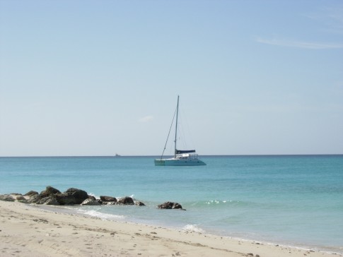
Another huge sand bank runs from the area south of the airport down to Motu Tiapaa on the east side of the pass. There is deep water in front of the town however. You can anchor just after the pass, where we are, off the town quay, or come through the deep water all the way to the area of the airport for a third anchorage if you are getting board (watch for the occasional coral head though).
On Maupiti, the flat bit at the bottom of the towering cliffs has just about enough room for one street and that is a fair description of town in Maupiti, one street. All bearings can be taken from the red roofed church, which is roughly in the center of town (i.e. we're one mile north of the church).
At the southeast end of town is the commercial wharf and a little basin where smaller boats can tie up. The gas station is right here as well. You might be able to fuel a small yacht up here directly if you were compact enough (and brave enough) to back into the little basin on a day when it was not congested with island boats.
To wrap up our tour we decided to head down the channel to the pass to see what conditions were like. I have been trying to get a look at it everyday in the AM and PM to gauge conditions. From our anchorage we can see the breakers south of Motu Pitiahe, matching this to what we see at the pass has been instructive.
This afternoon the pass was formidable but not as nasty as yesterday when we watched the Express blast its way out. Again we saw many fisherman plying the waters inside and outside the pass. It was Sunday but I guess you have to eat on Sunday as well, and in Maupiti, it looks as if autonomy is a valuable trait.
We returned to the boat just in time to get in an hour of reading before the sun boiled into the ocean on the western horizon. It was quite a day.
We set off to the west along the long sand bank that covers the southern end of the lagoon past motu Pitiahe. The deep water portion of the lagoon between the bank and the island has a lot of coral heads, many high enough to take a bite of fiberglass. It would be imprudent to take a large boat farther than the anchorage behind Pitiahe.
Much like Bora Bora, the one really nice beach on the main island is at the southwest point, Tereia Beach. As you reach the southwest part of the lagoon between Motu Auira and Tereia Beach the sand bank becomes a bridge between the main island and Auira with about a foot of water over it. We lifted the dinghy motor and "sailed" across the bank. The wind was up in the 15-20 knot range so we made good time by standing up in the boat broadside to the wind.
I think we saw perhaps 6 locals on the motu and mainland and perhaps two tourists up to this point. We identified the tourists walking from the motu to the island over the sand bank as we were going by (the Polynesians seem to use Carolina Skiffs or locally made craft to get around).
Once across the sand the deep water lagoon runs pretty much from shore to shore. It is not however an easy dinghy transit because there are coral heads running in long lines and exotic patterns from seabed to surface everywhere. It is like a maze trying to get through to the north. Every once in a while we had to cheat and tilt up the outboard to coast over one of the lines of coral after failing to find a pass to the other side.
The motus are all a lovely mix of coral shoals and sandy beaches. The motus themselves are all covered in coconut palms. Most of the motus seemed sparsely inhabited and the majority seem to have small 1-5 room Pensions on them.
Maupiti itself is very dramatic as well. The mountains rise up from a thin skirt of lush greenery in sheer cliffs colored with blacks, grays, whites and speckles of color from the seabirds soaring along. There are no radio towers at the tops of these flat topped mountains but rather the odd towering palm tree rising up here and there like spikes in a crown. The coastline is rugged in most places with jutting blocks of black volcanic rock along the shore and scattered out into the shallows. Palm trees reach precariously out over the lagoon. It all reminds one of the proverbial lost island of the south pacific.
As we reached the northwest end of the lagoon the maze of coral relented and we turned into the wind to head east. The island affect in the lagoon is similar to that on the north and south sides of Bora Bora when the trades are up. There was a lot of chop and the gusts were up to 20 knots or so. Another large sand bank reaches down from the northern motus which allows you to get out of chop a bit.
We beached the dink in about 6 inches of water on the windward side of the northwestern tip of Motu Tuanai to take a look around. This is the east side of the big northern sand bank and there are some small sand islands here along with some sheltered lagoons that reach north to the barrier reef. We walked along the shore through hundreds of coconuts and coconut husks. The coconut crabs here were the largest we had ever seen, the size of normal eating crabs. Got me thinking.
The lagoon between little Motu Paeao and Motu Tuanai is filled with crystal clear water. The sun had come out and we could see squads of fish flying in all directions from the shallows as we walked along the beach. We found a mooring buoy here and a flat bottomed skiff with a guy spear fishing. Amazing the places you can get into if you know your way around. The motu seemed to be presently or perhaps formerly involved in Copra production (dried coconut meat used for its oil). We found several drying racks but it didn't look like they were in heavy use.
Our next stop was the air strip farther down Tuanai. Surprisingly we saw two ATRs come and go as we dinghied about today. The airport here is quite a public work. The strip reclaimed a fair bit of lagoon and the small harbor is perfect for the need and well done. Other than perhaps the Canaima Park near Angel Falls in Venezuela it is the most remote looking air outpost I have ever seen short of an unattended airstrip. They have one traditional Polynesian pandana roofed structure with a counter in the middle that says "Maeva Maupiti", guests on one side, bags and employees on the other. Much of the town seems to hang about here when planes arrive though no one is pushing crafts or souvenirs, they're just visiting.
Another huge sand bank runs from the area south of the airport down to Motu Tiapaa on the east side of the pass. There is deep water in front of the town however. You can anchor just after the pass, where we are, off the town quay, or come through the deep water all the way to the area of the airport for a third anchorage if you are getting board (watch for the occasional coral head though).
On Maupiti, the flat bit at the bottom of the towering cliffs has just about enough room for one street and that is a fair description of town in Maupiti, one street. All bearings can be taken from the red roofed church, which is roughly in the center of town (i.e. we're one mile north of the church).
At the southeast end of town is the commercial wharf and a little basin where smaller boats can tie up. The gas station is right here as well. You might be able to fuel a small yacht up here directly if you were compact enough (and brave enough) to back into the little basin on a day when it was not congested with island boats.
To wrap up our tour we decided to head down the channel to the pass to see what conditions were like. I have been trying to get a look at it everyday in the AM and PM to gauge conditions. From our anchorage we can see the breakers south of Motu Pitiahe, matching this to what we see at the pass has been instructive.
This afternoon the pass was formidable but not as nasty as yesterday when we watched the Express blast its way out. Again we saw many fisherman plying the waters inside and outside the pass. It was Sunday but I guess you have to eat on Sunday as well, and in Maupiti, it looks as if autonomy is a valuable trait.
We returned to the boat just in time to get in an hour of reading before the sun boiled into the ocean on the western horizon. It was quite a day.
Comments
| Vessel Name: | Swingin' on a Star |
| Vessel Make/Model: | Saint Francis 50 |
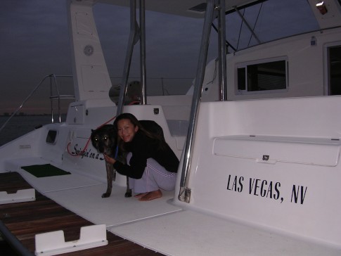
| Hailing Port: | Las Vegas, NV |
| Crew: | Randy Abernethy |
| Home Page: | http://swinginonastar.com |
Swingin' on a Star's Photos - Swingin on a Star (Main)
 |
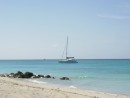
Selected photos of Swingin' on a Star at anchor.
7 Photos
Created 18 September 2007
|
 |
Swingin on a Star
Who: Randy Abernethy
Port: Las Vegas, NV
Gallery

History
Links
SailBlogs Friends

