
Swingin' on a Star
Ship's log for the circumnavigating Saint Francis 50 catamaran, "Swingin on a Star".
01 April 2010 | Palau
13 July 2009 | Palau
05 July 2009 | Yacht Harbor
03 July 2009 | Peleliu
02 July 2009 | Palau
01 July 2009 | Two Dog Beach
30 June 2009 | Mecharchar
29 June 2009 | Mecharchar
28 June 2009 | Ulong
27 June 2009 | Ngeruktabel
17 June 2009 | Ngeruktabel
16 June 2009 | Ngeruktabel
15 June 2009 | Ngeruktabel
14 June 2009 | Ngeruktabel
13 June 2009 | Ngerutable
25 May 2009 | Yacht Harbor
30 April 2009 | Malakal
29 April 2009 | Koror
28 April 2009 | Malakal
27 April 2009 | Malakal
Viru Harbor
06 December 2008 | The Western Province
Randy
We got up fairly early today. Well early for us now that we are back on a more "out of the danger zone" cruising schedule. It was time to head west, on to Gizo, where our genset spare parts will arrive.
As predicted, again there was no wind. This was one of the most no wind predictions I had ever seen. The entire day had nothing over 3 knots in the spot forecast. If that's not "no wind" I don't know what is. I'm ashamed to say it, but for the first time since we've owned the boat we didn't put up the main for a cruise over a couple miles. In retrospect there was no reason to. We might have gotten a couple of tenths of lift from a few distant squalls but we also may have achieved the same in drag here and there. There was no wind. It was flat calm. There was a swell running but we were in protected water most of the time so I didn't even have the rig stability excuse to raise the main. Oh well, it was a short 30 some mile trip to Viru Harbor.
We raised the anchor easily, with a little work on the break out. Once free of the bottom we motored slowly to the pass. I decided to try the left side of our track to test the local knowledge but as we got close, Hideko vetoed my exploration instincts and asked that we follow the track on the way out, to avoid drama. We compromised and stayed close but left of track.
It was still 11 feet deep for a long time. There may be deeper water here, but it is not in the center or north side of the pass. Still, eleven feet is plenty of water for most yachts, you just have to hope there are no isolated dangers when it starts to get that shallow with poor water visibility and two keels 7 meters apart.
Our next death defying feat was to transit Nono lagoon to the north. Even the name is ominous. Nono lagoon is more like a box canyon. The farther north you go the shallower and more coraly it gets, with fewer outlets to deep water. Makes you feel like a cow or a bad guy in one of those old John Wayne films. We had plotted a course into the lagoon in deep water and then across Hele Pass which had a sounding of 17 feet. Hele Bar, farther up was shallower still and all of the other cuts just had the ominous blue color with no soundings (which worked out to 11 feet near Penjuku).
Why not go around, you ask? Well if you want to go outside, you have to go way outside, or be willing to sail over an underwater volcano. There are a few volcanic islands, new within the last 50 years, and two recently active volcanoes here. The folks in Penjuku told us that they often see smoke billowing from the sea over here.
So Nono lagoon it was. It was a pretty nice day, though there were lots of rain clouds dumping over the islands. The visibility in the lagoon was not fabulous but we could still make out the shoals. The bottom goes from hundreds of feet in the channels to 10 or 20 on the shoals. I think you could pretty much sail where ever you wanted to in the south part of the lagoon as long as you stayed away from the really shallow bits attached to the little islands on the rim of the lagoon.
Hele passage goes through a large cut between two little groups of beautiful islands. The pass was easily navigated and we never saw less than 19 feet on the sounder (so really 20 or 21). Once outside we ran along the islands of the lagoon on our way past Vangunu island (extinct volcano and looking every inch of it) and up to New Georgia. The islands lining Nono have sandy beaches and coconut palms just like the brochure. There was even a nice little pure sand island in the chain.
New Georgia is the largest island of the Western Province of the Solomon Islands. It has several nice lagoons and bays along with Viru harbor. Viru is a harbor in every sense of the word. The Japanese used this as one of their last strongholds in the Solomons during WWII. You can see why. It is very deep, large inside with a narrow entrance, and has perfect depth for anchoring, 40-80 feet in great holding mud. You can see through to the entrance from much of the harbor but Tetepare island is the only thing the view unveils, as Tetepare sits right across the Blanche Channel from the entrance. If you wanted to wire into the mangroves this would be a great place to do it. We have not even scratched the surface of the Solomons from a cruising perspective, but I can easily say that this is the best harbor we have been in for quite some time.
The entrance is plenty wide but reef is charted fringing both sides. A large WWII Japanese gun sits upon the western cliff controlling the approach, though I couldn't spot it from the sea. There is a range (I believe unlit) that we used to enter the harbor and it was perfect. Our Navionics charts were also still matching the radar exactly as well so we had many concurring means of verifying our entrance. There is a large scale chart of the harbor available, so the paper and electronic charts inside seem to be very good by comparison to other areas nearby.
Once inside we motored back to the largest area of the deeper harbor and anchored smack in the middle. We try to stay as far from land as possible to avoid bugs. The hook dropped in 60 feet and we set it to the current 5 knot breeze, which was artificially generated by a squall passing to the east. Though we know we'll be spinning around with sea breeze, land breeze and squall affects throughout the day we still set the anchor. It is likely the anchor will never feel a tug (we have 250 feet of chain out) but if a surprise comes we're better off pivoting a set anchor than dragging on to a hopeful set.
The harbor is a lovely place. The villages are Seventh Day Adventists and it being Saturday, only a couple canoes stopped to say high on their way to take care of other matters. It was a wonderful and peaceful night in a beautiful and very secure anchorage.
Comments
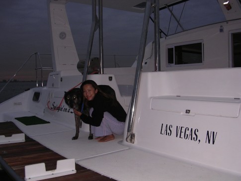
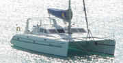
| Vessel Name: | Swingin' on a Star |
| Vessel Make/Model: | Saint Francis 50 |
| Hailing Port: | Las Vegas, NV |
| Crew: | Randy Abernethy |
| Home Page: | http://swinginonastar.com |
Swingin' on a Star's Photos - Swingin on a Star (Main)
 |
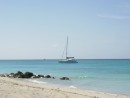
Selected photos of Swingin' on a Star at anchor.
7 Photos
Created 18 September 2007
|
 |
Swingin on a Star
Who: Randy Abernethy
Port: Las Vegas, NV
Gallery

History
Links
SailBlogs Friends

