
Swingin' on a Star
Ship's log for the circumnavigating Saint Francis 50 catamaran, "Swingin on a Star".
01 April 2010 | Palau
13 July 2009 | Palau
05 July 2009 | Yacht Harbor
03 July 2009 | Peleliu
02 July 2009 | Palau
01 July 2009 | Two Dog Beach
30 June 2009 | Mecharchar
29 June 2009 | Mecharchar
28 June 2009 | Ulong
27 June 2009 | Ngeruktabel
17 June 2009 | Ngeruktabel
16 June 2009 | Ngeruktabel
15 June 2009 | Ngeruktabel
14 June 2009 | Ngeruktabel
13 June 2009 | Ngerutable
25 May 2009 | Yacht Harbor
30 April 2009 | Malakal
29 April 2009 | Koror
28 April 2009 | Malakal
27 April 2009 | Malakal
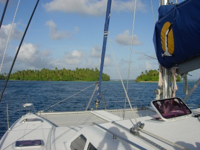
Anchored in Kapingamarangi
22 January 2009 | South Pacific
Randy
We had a nice passage to Kapingamarangi. The wind was mild but functional and sometimes perfect. The direction was pretty much east, which is always nice when you're sailing due north. The seas were pretty mellow for an ocean passage. We had a fair amount of squall activity by day but none at night. The radar was clear all last night.
It was our second time crossing the equator, now we've done south to north and north to south. We ran across one fishing boat on the 270 mile passage but other than that, nothing. We averaged about 8 knots for the trip, which was mandatory for our timely arrival at the Greenwich Passage into the Kapingamarangi lagoon. We left Nugarba Atoll at 5AM yesterday and arrived at Kaping 35 hours later (4PM today PNG time). We ran the motor for a bit when necessary to keep the speed up when the wind feel off.
We've been catching up with Whistler and Angelique via SSB. Angelique and Whistler are a few miles apart and stay in VHF contact. Whistler does not have an SSB but Angelique does, so we connect with them every few hours. They left around 9AM yesterday and will probably arrive in Kaping late tomorrow.
It had been fair weather the whole trip with only isolated, small squalls on the first day. We managed to stay dry with one slight course alteration. Today however, things were perfect, right until we got close to our destination.
Kapingamarangi's Greenwich passage has a bad reputation. Guides use words like, "devious", and phrases like "only to be used with local knowledge". The current is said to get up to 6 knots. Figuring out when slack will occur in an atoll pass is more black magic than science unless you know the place. If the swell is big and breaking over the windward side of the island continuously, you may never have a flood in the leeward passes. That said, just after high tide will probably be the low current point on such a day. If I'm not in the know I try to make the passes right after high tide.
Surprisingly Kaping has a tide station and our Navionics chip has the data. It seemed pretty accurate as well. We were shooting for a 15:30 pass transit. This was about an hour after high tide, hopefully slack.
As we approached we were running about a half hour late. Then Hideko, who was on watch, called me to the helm. I was laying in the cockpit looking up at the beautiful blue sky. At the helm Hideko pointed out a very large and nasty looking dark and layered cloud system. Right over Kaping. What luck.
We soldiered on, determined to make our date with the pass. To fail would mean floating around in the ocean for at least another 12 hours. If the storm was parked on the atoll when we arrived there would be no way we could enter, or even get close. It was already apparent that the Navionics chart of Kaping was more of a characature than a real chart. The shape of the atoll was close, but close would put you on the reef in several places. It is fixed a good half mile NNW of where the real island is. The chart also does not show the pass. Between the Navionics chart, the US Sailing Directions (126) and the South Pacific Anchorages book, I found the SPA with its sketch chart of the pass the most valuable.
As we closed on the stormy mass of cloud we could see white caps whipping up ahead. We reefed down as the wind climbed up to 30 knots. It was a big nasty storm system but I hadn't seen any lightening yet and we looked to be clear of the rain. So after heading up to reef we continued in.
We came in on the south western most island and then followed the reef to the west. On a calm day with poor vis this would be a dangerous foray for the first timer. The western extent of the reef was breaking presently, but likely because of the turbulent sea from the recent storm activity.
As we came along the reef we spotted a big piling. It marked the pass for heaven's sake. How nice, and unexpected. The sky was still overcast but we had fair visibility, the conditions were calm enough on the SW side of the reef and the sun was behind us. We were 30-45 minutes late but decided to make a go of it.
The pass is very deep and reasonably wide but there are strong currents and eddies in the entrance. I was watching the log and the SOG closely. It seemed we had about a knot of counter current but the eddies were threatening to turn us sideways. I powered up and moved through the pass at 5 knots SOG, though it would have been 6 without the current.
The most dramatic thing about this pass is the 90 degree right you have to make in the middle of the transit. There is a stick on the inside of the turn to mark the reef and the water is deep but when we went through there were nasty rips all around the area just after the bend. You really have to stay on the wheel and watch your track as you come through here.
In retrospect it wasn't that bad a pass, but it certainly deserves respect and you do have to be on you game when you go through. I would never attempt it with more than a couple of knots of current or with poor visibility. The pass can be found at position 01 01.770N, 154 45.554E (WGS84). Approach from the south and only in good light and with great care.
Once in we headed for the southeastern most island, straight along the inside of the reef. There is a patch of 20 foot water along the route but we found no real hazards. Once behind the windward islands we ran up to a sandy bit and anchored.
What a beautiful batch of islands. We were very glad to be anchored in paradise, rather than hove to in a squall in reefy waters.
Shortly after we anchored, the acting chief hailed us on the VHF. I was very surprised. Most islanders don't have a VHF, much less the inkling to hail you on one. The chief asked if we had a cruising permit straight away. I suppose the US affiliation has breed paranoia and excessive bureaucracy in the FSM, just like at home. I told the chief that we had filled all the paperwork and that we had two other yachts inbound. He was very friendly and had no problem with us checking in tomorrow.
Not one canoe or boat came to "lookabout". It is the most serene place we have been in some time. We got the boat put away and relaxed with a rum and coke while the sun made a spectacular exit.
Comments
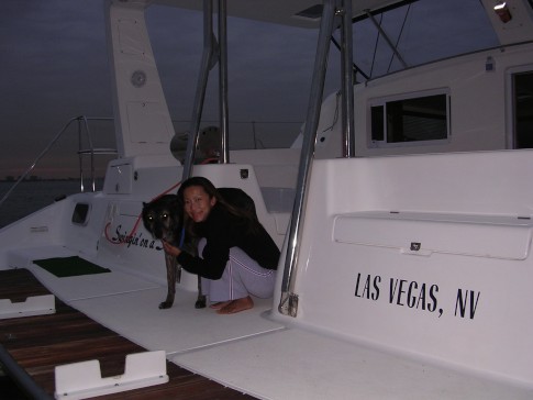
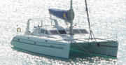
| Vessel Name: | Swingin' on a Star |
| Vessel Make/Model: | Saint Francis 50 |
| Hailing Port: | Las Vegas, NV |
| Crew: | Randy Abernethy |
| Home Page: | http://swinginonastar.com |
Swingin' on a Star's Photos - Swingin on a Star (Main)
 |
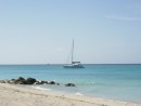
Selected photos of Swingin' on a Star at anchor.
7 Photos
Created 18 September 2007
|
 |
Swingin on a Star
Who: Randy Abernethy
Port: Las Vegas, NV
Gallery

History
Links
SailBlogs Friends

