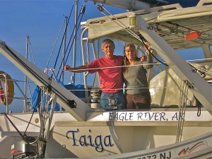
Log of Taiga
29 April 2014 | 14 05'N:060 57.7'E, Rodney Bay, St Lucia
27 April 2014 | 16 18.5'N:061 47.9'E, Deshaies, Guadeloupe
27 April 2014 | 17 09.1'N:062 37.9'E, Island of Nevis
27 April 2014 | 17 15'N:062 39.6'E, Island of St. Christopher
27 April 2014 | 17 55.5'N:062 52.2'E, Island of St. Barthelemy
07 April 2014 | 18 03'N:063 05.9'E, Island of St. Martin
07 April 2014 | 18 29.9'N:064 23.2'E, Norman Island to North Gorda Sound
07 April 2014 | 18 19.1'N:064 37.1'E, Soper's Hole, then Norman Island
05 April 2014 | 18 20.6'N:064 40.7'E, Round Bay, St. Johns, USVI
05 April 2014 | 18 20'N:064 58'E, St. Thomas, USVI
05 April 2014 | 18 18.4'N:065 17.8'E, Culebra Island, PR
05 April 2014 | 18 8.1'N:065 18'E, Bahia Salinas del Sur, Vieques
05 April 2014 | 18 5.5'N:065 28.2'E, Esperanza, Vieques
05 April 2014 | 17 57.5'N:066 17.5'E, Salinas, Puerto Rico
05 April 2014 | 17 53.2'N:066 31.8'E, Isla Caja de Muertos
05 April 2014 | 17 56.7'N:066 52.4'E, Bahia Guanica, P.R.
05 April 2014 | 18 04.5'N:067 11.3'E, Puerto Real, P.R.
08 March 2014 | 18 04.5'N:067 11.3'E, Puerto Real, P.R.
08 March 2014 | 19 17.2'N:069 19.8'E, Puerto del Valle
27 February 2014 | 19 24'N:069 45'E, Luperon to Puerto del Valle
A quieter place
05 April 2014 | 18 20.6'N:064 40.7'E, Round Bay, St. Johns, USVI
Jack
Thursday, March 27, 2014
Morning weather forecast called for increasing winds from the NNE for several days, so we looked at the navigation charts for a likely anchorage away from town, and picked Round Bay at the SE end of St. John, the second largest island of USVI. St. John is also mostly National Park, and that sounded good, so off we went for the 20 mile slog to windward. Around noon we turned the corner at Ram's Head, cruised up behind the shelter of Leduck Island and made our way to the head of Round Bay. There were only three other boats anchored there, there was no swell and very little development along the beach, so our criterion was met.
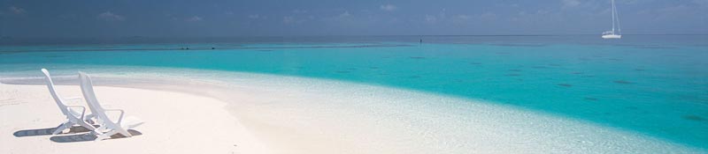
We ended up anchored in a sand patch within about 50 yards of the beach in a small nook of Round Bay, called Hansen Bay. There were two small sand beaches here with steep, rocky margins either side. All the islands in the Virgins are high, with steep, mostly rocky beaches. We learned that all the beaches are public, but access to them from the road can be across private property, which is usually restricted in some way. The beach nearest us was controlled by a very nice lady named Vie, who, with her lovely daughter Jasmine runs a small snack shack alongside the road. They have a gated entrance to the beach that is open during daylight hours at no charge. Behind the beach in the trees are a couple of changing shacks and separate outhouses. They have some kayaks to rent and the beach has some shady areas under trees, a bunch of beach lounge chairs in various states of repair scattered along the beach, and garbage cans near the shacks. The beach itself is about a hundred yards l ong, but the sand is limited to the actual beach. Wading out, you have to negotiate cobbles past about one foot depth.
We came ashore once or twice a day with our kayak and walked out the gate to the narrow, paved road and took a walk with Toby. The road follows the contours of the steep island, so some of the grades are quite long and steep probably exceeding 10% grade. This area is almost at the end of the road, and it gets quite a bit of traffic of rented jeeps coming from Cruz Bay, St Johns, with tourists armed with road maps and beach stuff, looking for one of the tiny, sandy beaches in this area. I suspect they're all thinking they'll get out to the very end of the road where no one else goes. Alas, they end up parked nose-to-tail, 20 or more jeeps per beach access along the narrow road, and then with carcasses parked cheek by jowl on the accessible sand beaches.
They all abandon the beaches and load up the jeeps by 5pm or so, to head back to their eco-tour cabins, then the beaches are empty until the next flood arrives around 10 the next morning.
The second day we were anchored here, two megayachts anchored in deeper water a quarter mile out from us. Out came the water toys, including the jet skis, stand-up paddle boards, runabouts towing ride-em banana rafts and giant inflatable lounges. Crew began shuttling guests to the tiny beach with more toys like various kinds of ball games, snorkeling gear and pop-up tents supplied with big coolers full of snacks and drinks, lounge chairs, tables, towels. One of these yachts, probably 200' long and maybe 6 decks high, erected an inflatable water slide that went from the top deck and spiraled down to the water. Cool.
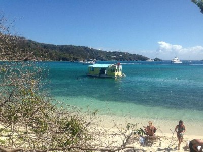
Next to arrive was a floating bar, apparently based across the bay in Coral Bay, built on a catamaran raft and powered by a couple of big outboard kickers. They dropped the hook between us and the beach and immediately were swamped by swimmers from the beach, including a bunch from the big yachts. Brilliant.
On our third morning we were ready to see if we could find someplace slightly less populated, so we picked up and headed over to Coral Bay. A quick turn through the anchorage convinced us that was enough of that. The bay is pretty small and there were something like 150 to 200 boats in there; many of them looking like they'll never move again. We exited and ran up into an arm of this huge area into Hurricane Hole. At last, we discovered a tiny cove with two park service buoys, both occupied, so we glided up into the head of the cove and dropped our hook to wait for a buoy. Sure enough, in early afternoon both buoys were free, so we attempted to pick up our anchor to move to a buoy. Whaddaya know, our anchor was stuck to the bottom and wouldn't come up. I dove in and discovered that the anchor was hooked under a giant chain stretched across the cove. A hurricane chain, apparently laid down for boats to hook into in case of a hurricane. According to the Park Service literature, boats have to make reservations to come in here in the event of an approaching hurricane, and space is limited. Boats used to tie up into the mangroves during a hurricane, but now that's forbidden.
Anyway, the water depth was about 20', and after two dives I managed to get our anchor dragged away from the chain, then got back aboard, and we hauled it up and moved over to and picked up the buoy for the night. We had the place all to ourselves overnight and it was great.
Morning weather forecast called for increasing winds from the NNE for several days, so we looked at the navigation charts for a likely anchorage away from town, and picked Round Bay at the SE end of St. John, the second largest island of USVI. St. John is also mostly National Park, and that sounded good, so off we went for the 20 mile slog to windward. Around noon we turned the corner at Ram's Head, cruised up behind the shelter of Leduck Island and made our way to the head of Round Bay. There were only three other boats anchored there, there was no swell and very little development along the beach, so our criterion was met.
We ended up anchored in a sand patch within about 50 yards of the beach in a small nook of Round Bay, called Hansen Bay. There were two small sand beaches here with steep, rocky margins either side. All the islands in the Virgins are high, with steep, mostly rocky beaches. We learned that all the beaches are public, but access to them from the road can be across private property, which is usually restricted in some way. The beach nearest us was controlled by a very nice lady named Vie, who, with her lovely daughter Jasmine runs a small snack shack alongside the road. They have a gated entrance to the beach that is open during daylight hours at no charge. Behind the beach in the trees are a couple of changing shacks and separate outhouses. They have some kayaks to rent and the beach has some shady areas under trees, a bunch of beach lounge chairs in various states of repair scattered along the beach, and garbage cans near the shacks. The beach itself is about a hundred yards l ong, but the sand is limited to the actual beach. Wading out, you have to negotiate cobbles past about one foot depth.
We came ashore once or twice a day with our kayak and walked out the gate to the narrow, paved road and took a walk with Toby. The road follows the contours of the steep island, so some of the grades are quite long and steep probably exceeding 10% grade. This area is almost at the end of the road, and it gets quite a bit of traffic of rented jeeps coming from Cruz Bay, St Johns, with tourists armed with road maps and beach stuff, looking for one of the tiny, sandy beaches in this area. I suspect they're all thinking they'll get out to the very end of the road where no one else goes. Alas, they end up parked nose-to-tail, 20 or more jeeps per beach access along the narrow road, and then with carcasses parked cheek by jowl on the accessible sand beaches.
They all abandon the beaches and load up the jeeps by 5pm or so, to head back to their eco-tour cabins, then the beaches are empty until the next flood arrives around 10 the next morning.
The second day we were anchored here, two megayachts anchored in deeper water a quarter mile out from us. Out came the water toys, including the jet skis, stand-up paddle boards, runabouts towing ride-em banana rafts and giant inflatable lounges. Crew began shuttling guests to the tiny beach with more toys like various kinds of ball games, snorkeling gear and pop-up tents supplied with big coolers full of snacks and drinks, lounge chairs, tables, towels. One of these yachts, probably 200' long and maybe 6 decks high, erected an inflatable water slide that went from the top deck and spiraled down to the water. Cool.
Next to arrive was a floating bar, apparently based across the bay in Coral Bay, built on a catamaran raft and powered by a couple of big outboard kickers. They dropped the hook between us and the beach and immediately were swamped by swimmers from the beach, including a bunch from the big yachts. Brilliant.
On our third morning we were ready to see if we could find someplace slightly less populated, so we picked up and headed over to Coral Bay. A quick turn through the anchorage convinced us that was enough of that. The bay is pretty small and there were something like 150 to 200 boats in there; many of them looking like they'll never move again. We exited and ran up into an arm of this huge area into Hurricane Hole. At last, we discovered a tiny cove with two park service buoys, both occupied, so we glided up into the head of the cove and dropped our hook to wait for a buoy. Sure enough, in early afternoon both buoys were free, so we attempted to pick up our anchor to move to a buoy. Whaddaya know, our anchor was stuck to the bottom and wouldn't come up. I dove in and discovered that the anchor was hooked under a giant chain stretched across the cove. A hurricane chain, apparently laid down for boats to hook into in case of a hurricane. According to the Park Service literature, boats have to make reservations to come in here in the event of an approaching hurricane, and space is limited. Boats used to tie up into the mangroves during a hurricane, but now that's forbidden.
Anyway, the water depth was about 20', and after two dives I managed to get our anchor dragged away from the chain, then got back aboard, and we hauled it up and moved over to and picked up the buoy for the night. We had the place all to ourselves overnight and it was great.
Comments
| Vessel Name: | Taiga |
| Vessel Make/Model: | Catana 44 |
| Hailing Port: | Eagle River, Alaska |
| Crew: | Jack and Sherri Hayden |
| About: | Taiga is a 1997 Catana 44 catamaran. We bought her in November, 2010 in Hampton, Virginia. This is our second sailboat and we love it. It is fast and comfortable. |
Gallery not available
Crew of Taiga
Who: Jack and Sherri Hayden
Port: Eagle River, Alaska