Joy of Cruising

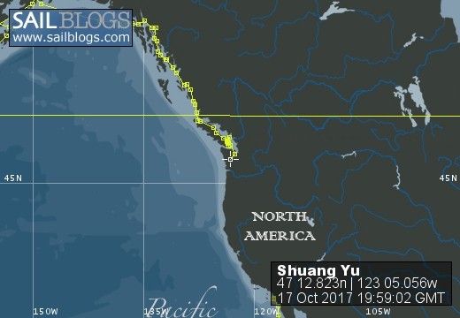
17 October 2017 | Boat position at Shelton: 47°12.82’N; 123°05.01’W
16 October 2017 | Boat position at Shilshole Marina: 47°40.65’N; 122°24.59’W
15 October 2017 | Boat position at Friday Harbor: 48°32.20’N; 123°0.59’W
27 September 2017 | Boat position on Granville Island: 49°16.35’N; 123°08.24’W
26 September 2017 | Boat position on Granville Island: 49°16.35’N; 123°08.24’W
22 July 2017 | Boat position at Granville Island: 49°16.35’N; 123°08.24’W
21 July 2017 | Boat position at Vancouver Rowing Club, Canada: 49°17.77’N; 123°07.85’W
20 July 2017 | Boat position at the Vancouver Rowing Club, Canada: 49°17.77’N; 123°07.85’W
19 July 2017 | Boat position at the Vancouver Rowing Club: 49°17.77’N; 123°07.85’W
18 July 2017 | Boat position in Active Pass: 48°51.64’N; 123°18.54’W
17 July 2017 | Boat position at Otter Cove, Pender Island, Canada: 48°47.84’N; 123°18.51’W
15 July 2017 | Boat position at Port Bedwell, Pender Island, Canada: 48 44.97'N; 123 13.97'W
14 July 2017 | Boat position at RVYC: 48 27.19'N; 123 17.73'W
13 July 2017 | Boat position at RVYC: 48 27.19'N; 123 17.73'W
12 July 2017 | Boat position at SNSYC: 48 40.44'N; 123 25.02'W
12 July 2017 | Boat position at SNSYC: 48 40.44'N; 123 25.02'W
11 July 2017 | Boat position at SNSYC: 48 40.44'N; 123 25.02'W
10 July 2017 | Boat position at Ganges: 48 51.00'N; 123 29.53'W
09 July 2017 | Boat position at Ganges: 48 51.00'N; 123 29.53'W
08 July 2017 | Boat position at Montague Harbour: 48 53.63'N; 123 24.03'W
Kodiak to Geographic Harbor
25 July 2016 | Boat position at Port Bailey: 57 55.093'N; 153 00.656'W
Pam Lau and Ted Berry

Picture: A sea otter at Port Bailey.
Weather: Cloudy and cool, (61 F or 16.5 C).
The morning of our departure from Kodiak to Seward, we were surprised to find S/V "Liv" docked right next to us. Since "Liv" was there and it was drizzling continuously, we decided to postpone our departure for one day. We invited "Liv", Jerry and Jessica for dinner. The fisherman across the pontoon had given us two huge chunks of halibut so we wanted to share it. We had tempura halibut, gyoza (dumplings), and miso/vegetable soup. Our guests enjoyed the dinner and we had some interesting conversation. After dinner, "Liv" shared their pictures of the grizzly bears they saw at Geographic Harbor. We were going to skip visiting there but after seeing the pictures and hearing their exciting stories, we changed our mind.
We left before 10:00 next morning and stopped to fuel up with diesel and kerosene. Diesel was very reasonable at $2.50/gallon. We did not have to pay federal tax and got a reduction on state sales tax because the diesel was for marine use. The kerosene was almost $9 a gallon, which is quite expensive; however, it is much cheaper than Dutch Harbor at $18 a gallon. No wonder few people have kerosene heaters in the United States.
We were careful to study the tides between Kodiak Island and Afognak Island because the tidal current can be six or seven knots and we did not want to go against it. The passages went well and it was interesting to see both islands at the same time at close range. Many fishing vessels passed us heading back to Kodiak.
When we went through "Whale Passage", we saw some whale spouts in the distance, but they were too far away to see if they surfaced. Whale Passage has a very strong current and we were doing 12 knots (speed over ground) at one stage. Shortly after we entered the Kupreanof Strait, we turned into Port Bailey. We saw many otters as we were coming in. They were so adorable, laying on their backs, cracking shell fish to eat. They are very shy though, as soon as we came close, they would dive under the water and swim away.
Port Bailey is a large bay with a old cannery on the south shore. There was a large cargo ship anchored in the bay, opposite the cannery. We were told that the cannery is no longer in operation but there seemed to be some activity going on because there were three barges and a functional looking tug or fishing boat tied to the dock. We also saw a motor boat traveling from the cannery to the cargo ship.
We passed the cannery and anchored in about 50 feet (about 15 meters) of water, everywhere else in the bay was quite deep. We read on some sailing blogs that the location can get windy, since there was no wind, we felt safe. As matter fact, the anchorage was flat and calm. It was like being on land! We were surrounded by high mountains to the north and west and low lying hills toward the south. It was a beautiful anchorage and we had a restful night.
Comments
| Vessel Name: | Shuang Yu |
| Vessel Make/Model: | Catalina 400 |
| Hailing Port: | San Diego |
| Crew: | Ted Berry and Pam Lau |
| Home Page: | www.sailblogs.com/member/tedandpam/ |
| Social: |
|
Shuang Yu's Photos - Main
 |
These pictures were taken from my two favorite events in Ensenada: the "Women Spanish Class" and the "Knitters and the Dabbers"
11 Photos
Created 9 February 2011
|
 |
Van, Cida, Ted and Pam went to the Catalina Islands from 12/10 to 12/17/2010.
No Photos
Created 14 January 2011
|
Who: Ted Berry and Pam Lau
Port: San Diego