
Offshore Hawaii
31 July 2011 | 48 43'N:125 35'W,
26 July 2011 | 47 14'N:140 33'W,
22 July 2011 | 44 38'N:152 26'W,
20 July 2011 | 42 54'N:157 44'W,
18 July 2011 | 39 16'N:159 15'W,
16 July 2011 | 34 20'N:159 34'W,
15 July 2011 | 31 56'N:159 31'W,
15 July 2011
12 July 2011 | 26 20'N:157 16'W,
21 June 2011 | 20 58'N:154 00'W,
18 June 2011 | 26 04'N:148 28'W,
16 June 2011 | 29 05'N:144 27'W,
14 June 2011
14 June 2011
14 June 2011
14 June 2011
14 June 2011
27 May 2011 | Semiahmoo Marina
12 May 2011
If It Ain't Broke, Just Wait!
14 June 2011
I think I may have made an error suggesting that life aboard was routine.
I sat down this morning at my computer and satellite phone to download the morning weather synoptic files only to find out that my connection to the satellite phone was lost. Of course this answer was conveyed to me by the communication program by meaningless error message - "error-697" suggesting that we call our service provider for assistance - completely useless if the only communication tool that you have to contact your satellite provider is a phone number and your satellite phone is out of order.
Thinking this was not a major problem - my backup system is using the pactor modem hooked up to the SSB which would allow me to download the grib weather files only to find out that the pactor modem could not be initialized, also secondary to a software glitch which I am unable to solve.
Fortunately there is a third backup - we are still able to keep in touch with our maritime network and contact Coast Guard channels that give offshore weather states and forecasts with our SSB.
Next our AIS unit fried! The solid-state circuitry inside, like any other electronic device is subject to failure not necessarily because of anything else other than it is electronic. This means that our position cannot be transponded to traffic around us, nor can we see them on our chart plotter. This is not a critical issue because in the daytime you have a visibility of over 14 nautical miles in which case if necessary you can always raise them on the VHF and ensure that if there is anything close to a collision course, we can instruct them to pass our stern and leave us undisturbed. In any case they can always see us because we have a radar deflector which is high enough on the mast that can be easily picked up on traffic's radar at the same distance.
At night, one does not have the ability to see the AIS signals on our chart plotter which would easily give us position of traffic around us, but a routine, turning on the radar every half-hour on night watches and sweeping the horizon provides the same information. It is not possible to leave the radar on all the time because it is a real power hog which leads me to the next issue.
GPS backup is not an issue - not surprisingly everyone was thinking the same thing and without telling each other we all brought our own handhelds so that at least we will always know our position!
Having all the electronics, auto helm steering the boat, refrigerator, running lights at night, household conveniences of water and shower pumps, salon lighting and the necessary AC power to charge computers, kindles and iPads is also a consideration in spite of our 8-100 amp battery bank.
Although we have a wind generator and solar panels, it is still necessary to run the engine for 2- 3 hours daily in order to keep the battery bank charged. A bigger alternator on the engine is a sure addition when I return to port.
All in all - it's back to basics. There is no substitute for proper seamanship. Although we have been modestly inconvenienced, the success of the voyage is not in question!
Comments
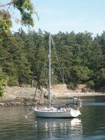
| Vessel Name: | S/V Telltales |
| Vessel Make/Model: | Island Packet 40 |
| Hailing Port: | Semiahmoo Marina |
| Crew: | Steve, Heather, Wayne, John, Kevin, Mark |
Gallery not available
S/V Telltales
Who: Steve, Heather, Wayne, John, Kevin, Mark
Port: Semiahmoo Marina