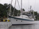
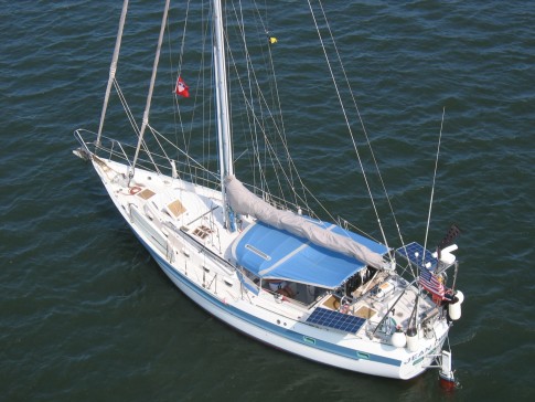
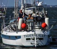
S/V Tiger Lilly
Rig heavy, reef early, and pray often; for God does not assure us an easy passage, but He does promise a safe anchorage...

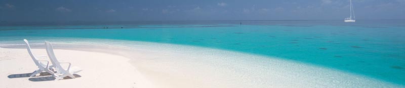
25 May 2018 | TRINCOMALEE, SRI LANKA
02 January 2018 | Clan Jeti Anchorage, Georgetown, Penang Island, Malaysia
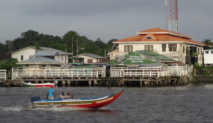
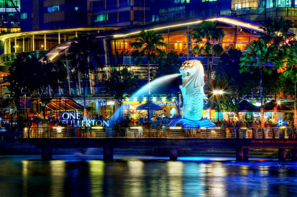
03 November 2016 | Singapore, Southeast Asia
02 October 2016 | Kumai River, Borneo
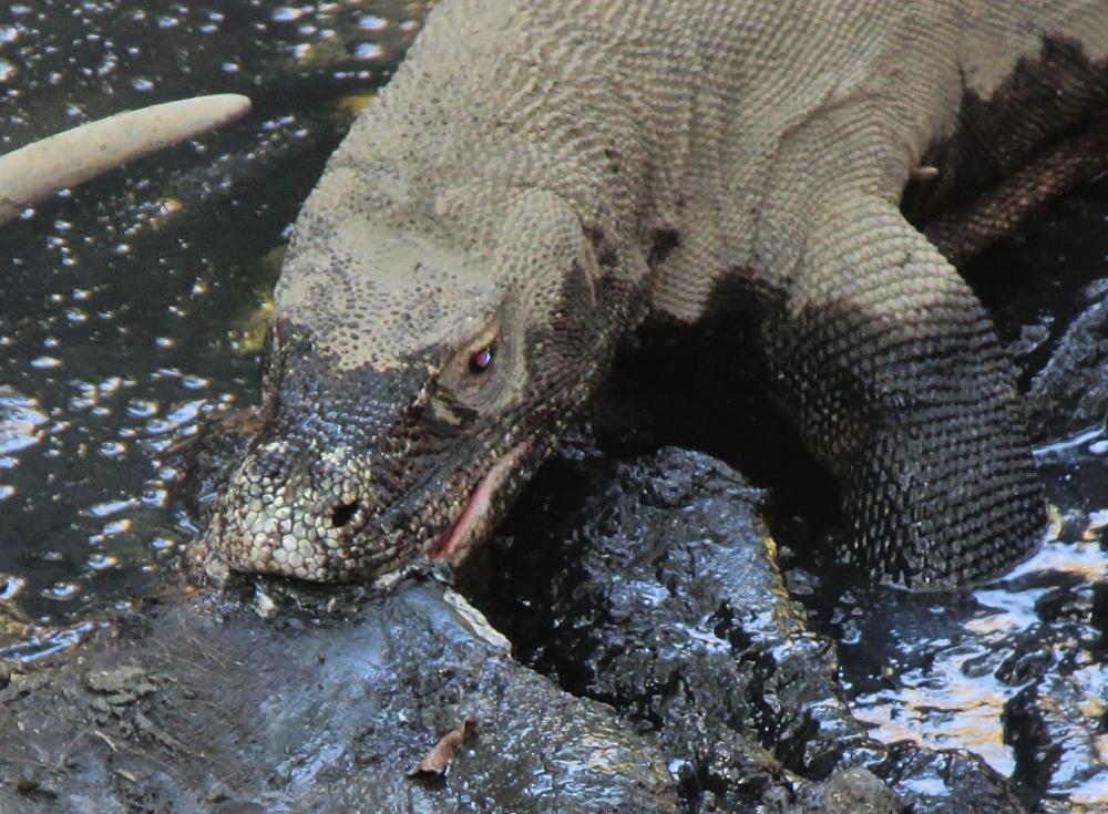
24 August 2016 | Rindja Island, Indonesia
22 July 2016 | Fannie Bay, Darwin, Northern Territory, Australia
14 June 2016 | Pancake Creek, Queensland, Australia
13 June 2016 | Pancake Creek, Queensland, Australia
11 June 2016 | Burnette Heads, Queensland, Australia
07 June 2016 | Mooloolaba, Queensland, Australia
11 May 2016 | Colmsie, Brisbane River, Queensland, Australia
23 December 2015 | Brisbane, Australia
13 August 2015 | Whangarei, New Zealand
07 August 2015 | Whangarei, New Zealand
23 July 2015 | Whangarei, New Zealand
12 April 2015 | Whangarei, New Zealand
11 February 2015 | Whangarei, New Zealand
25 January 2015 | Whangarei, New Zealand
24 September 2014 | BORA BORA, French Polynesia
23 September 2014 | Bora Bora
TIGER LILLY - GUYANA CRUISING NOTES - PART ONE
03 May 2013 | Mouth of the Essequibo River, Guyana
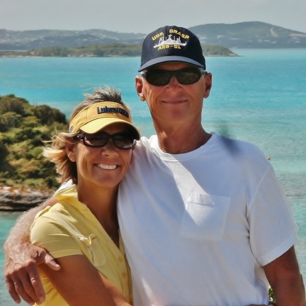
Tom & Lilly
WHY GUYANA?
For several years Tom had attended the annual Guyana Cruising Brief conducted by Kit Nascimento in Chaguaramas, Trinidad. Kit is a former Guyana Government Minister and public relations consultant; he currently owns the Hurakabra Resort on the Essequibo, and operates a tour company in Georgetown with his wife Gem. Kit would fly up to Trinidad to encourage cruisers to sail south and visit Guyana; and his interesting presentations were the source of our curiosity about Guyana. He would bring along an English fellow named Simon who had explored the Essequibo in his yacht, and could knowledgeably answer related navigation questions. Probably the highlight of Kit's presentation was the lovely Miss Guyana who would mingle with the crowd, and press the flesh (so to speak). Lilly sez: EYES IN THE BOAT, MISTER!
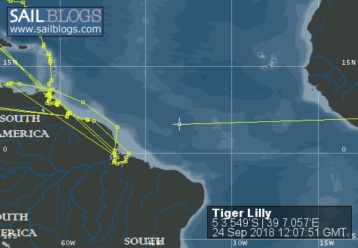
We are currently on our way down the east coast of South America, headed for Patagonia and the Fiords of Chile - so for us, Guyana is on the way. We stopped here after spending a month on the Rio Orinoco Delta; entering the Delta from the north on the Reo Macareo, and departing to the east from the mouth of the Rio Grande. We think that exploring the Rio Orinoco Delta and a cruise down the Guianas would make a spectacular off-season cruise for a Caribbean Cruiser willing to expand his horizons a bit. (For those who cut 7th grade Geography so they could do endless laps in a swimming pool - that would be you Lilly - The Guianas consist of the three countries on the northeast coast of South America: Guyana - formerly British Guyana; Suriname - formerly Dutch Guiana; and French Guiana.) Although the sail southeast is a beat, we found the sailing comfortable in light summer winds, and the 3 day passage down the coast very doable. By including the Rio Orinoco Delta in this cruise - a world class destination in its own right - the 100 mile beat from the Serpents Mouth to the Rio Grande is eliminated. (Lilly sez: And that's a TWO-FER!) The return trip to the Caribbean is easy and fast with the Trade Winds and the Guiana Current both heading the right way. Think about it - why not try somewhere NEW?
GETTING THERE
Here is a summary of our sail from the Reo Barima at the mouth of the Rio Grande in Eastern Venezuela to the Essequibo River in Guyana: It took us a total of three and a half days, anchoring on the Waini Coast two of three nights. The straight track was 220 miles, and we covered 275 miles in six tacks. We sailed long port tacks down the coast until the bottom came up to 14 ft of water, and then short starboard tacks out to Guiana Current and the ten fathom curve. The wind was on average 12 to 14 knots (in May), and out of the east-northeast to east-southeast; it would slack off to nil between 0400 and 0900 each morning. We anchored on the sling-mud in 25 to 30 feet (like the Guyanese fisherman) for 2 of our 3 nights on the coast. (Please see Part 2 of our Rio Orinoco Delta Pilot Notes for an explanation of the concept of sling-mud.) At night we could not see the unlit anchored fishing nets (black single flag on one end, and double black flags on the other), and after our first near-miss at twilight we elected not to sail inshore during the hours of darkness. We learned (the hard way) to anchor east (up-stream) of any fishing net in our vicinity so that when the fishermen returned during the night to recover their net it would not drift down on us with the current - which is exactly what happened on our second night. On the last night of our passage the wind backed into the northeast and we were able to sail all night parallel to the coast, until it quit just before dawn. In spite of what the naysayers back in Trinidad said, this passage was just not that difficult - once we figured out the tactics.
NAVIGATION ON THE ESSEQUIBO
From reading Doyle's excellent Guyana Annex in his Trinidad and Tobago Cruising Guide (available free online as an Adobe download on his website), we were aware that there were fishing net piles located at the mouth of the Essequibo, but until we actually got there and saw the situation we had no idea just how many there were; the piles appear to completely block the "ship channel." Apparently, there is little or no control of navigation on the Essequibo by the Guyana Port Captain, and the fishermen put these telephone pole sized pilings (often with nets strung between them) just about anywhere they want. Because of this situation, we recommend a DAYLIGHT-ONLY approach to the Essequibo for yachts. We were navigating in squally conditions (not surprising since we were here during the Rainy Season), and this was entirely challenging enough. The greatest concentration of fishing net piles was on a northwest-southeast axis in the vicinity of the charted "Essequibo" sea buoy, which of course, was nowhere to be found - the norm for aids to navigation on the Essequibo River. The charts have the single word "pile" south of the sea buoy, but this is misleading. There are literally HUNDREDS of piles at the mouth of the Essequibo River. After a bit of poking around, here is how we ran the gauntlet:
Approach point 07-03.850N 058-05.790W
Pile Passage at 07-00.988N 058-11.355W
Once we were clear of this initial line of piles, most of the nets and piles were on the north side of the "ship channel" and we easily skirted around them to the south. The Doyle Guide recommends that yachts not stop at Parika Stelling on the way in, and we certainly concur with this. Parika is a very busy commercial landing, and the fast ferry traffic is both numerous and FAST in the port area (read that reckless and in close-quarters). Doyle's recommendation is that yachts anchor for the first night at Roed-En-Rust, which is about 3 miles upstream of Parika, and about 20 miles from the "Essequibo" sea buoy. An entrance to the Essequibo River is a three-part problem: One, we were approaching after a three-day beat from the Rio Orinoco, and had little control over our arrival time (Our usual tactic of heaving-to to adjust our arrival time would not work in the northwest setting Guiana Current.) Two, because of the fishing net pile situation we needed to arrive in daylight; Three, we wanted to arrive on a flood tide since bucking 2-3 knots of ebb current is a non-starter for our nominal 5 knot motoring speed. When the wind quit in the pre-dawn hours of the last day of our passage, the flood at the mouth of the West Channel began setting down into shallow water. By this time Channel Fever had set in with the crew; and the preservation of domestic tranquility called for the judicious application of the auxiliary diesel. By the time we arrived at the non-existent sea buoy at noon the tide was on the ebb, and Roed-En-Rust (some 20 miles upstream) was not going to be our first anchorage. We had just spent 3 nights anchoring and sailing off-shore along Guyana's Waini coast, so we knew that with light summer winds and a sling-mud bottom this was one of the few places in the world we could safely anchor on a lee shore. We chose an initial anchorage at Enterprise Stelling on the south shore of Leguan Island in light easterly winds:
Enterprise Stelling Anchorage 06-54.874N 058-23.536W
This anchorage was northeast of the stelling (landing), off the sea-wall, and adjacent to a prominent church steeple. We had a nice dinner and a good night's rest, and were bright-eyed and bushy-tailed the next morning. We were ready to experience Guyana and her Mighty Essequibo River!
The next month of cruising under power on the Essequibo River revealed the following general conditions: The waypoints in Doyle's Guide were accurate and we usually stayed close to the guide's track; We had Doyle's Guyana annex on our iPad2 and referred to it often; The NAVIONICS charts on our iPad2 ($54USD for all the Caribbean, and the entire coast of South America) were very useful and went all the way up the river past Bartica, while the CMAP NT+ charts on our Furuno chart plotter only covered as far as Parika ($200USD from Trinidad to Rio de Janeiro - not nearly as good a deal, or as effective); The published charts (electronic and paper - we had both types onboard) are based on old surveys, and the shoals and channels in the river have moved around quite a bit - just be cautious when exploring off the waypoints; There is a lot of current in the river (sometimes in excess of three knots), and the ebb is stronger than the flood as a result of the downstream flow of the river - bring good ground tackle (read that - a big effective anchor, and plenty of chain); The holding is very good on the river with mud and clay bottoms; There are very few charted aids to navigation on-station or lit; There is no one answering on the VHF radio - even commercial vessels and large ferries do not answer Channel 16; There are a LOT of fishing nets, both free-floating and anchored, on the Essequibo - demanding a sharp look-out at all times, and daylight-only navigation on the river. The seaman's proverb, "Eternal vigilance is the price of safety" was our watchword.
UPSTREAM TO BARTICA
We arrived at the mouth of the Essequibo on a Friday evening, and were in no hurry to charge up the river to Bartica and pay weekend overtime rates at Immigration and Customs. (What we didn't know was that the Bartica Immigration and Customs offices have a very low-key attitude towards off-hour arrivals.) So we decided to take our own sweet time and arrive at Bartica on Monday morning. We followed Doyle's waypoints, left just after the flood had established itself at Leguan Island, and had an easy and enjoyable passage up to Stampa Island. (The previous day we noted that the current at Leguan Island went from slack to flood about 2 1/2 hours after the low at Parika, so that way we knew what time to be ready to head upstream on the flood.) About the only surprise we had on that first day on the river were the numerous fishing nets being set, and the need for a very sharp look-out. Unlike the nets we encountered along the coast, often the river fishermen had only one end of their nets marked, and sometimes the only indication of the presence of a net was the Styrofoam floats used to suspend the net in the water column - which look a lot like floating trash. More than one Styrofoam lunch box was honored by a Tiger Lilly full backing bell, and a few choice words! After a couple of close-calls, we decided that our normal procedure would be for both of us to be in the cockpit while we were underway on the Essequibo, and on multiple occasions this tactic paid off. We noted that if we stayed close to the east bank of the river, very close to where the fast ferries ran, we had a clearer channel. There is a lot of fast ferry traffic on the river, and the fishermen and the ferry boat captains have the net situation sorted out to their mutual satisfaction. Our first anchorage was at Stampa Island, some 26 miles up-stream from Leguan Island. We approached the island from the south since the channel was wider at the head of the island; we anchored off the southeast corner by the old saw mill. Our NAVIONICS electronic charts indicated that we were high and dry on the east bank of the river, but the fathometer told another story - we were anchored in 22 feet of water. On our second day on the river we motored about 10 miles up-stream to Calf Island. We anchored between Calf Island and Kaow Island - within sight of Bartica so we could pop into Bartica Monday morning and check-in. On Monday morning we navigated around Longden Rock to an anchorage off the Cool Breeze Dock at Bartica:
Cool Breeze Anchorage 06-24.193N 058-37.017W
Green conical roofs advertising Banks Premium Beer mark this landing, located just north of the large town market building (large green gable roof).
For several years Tom had attended the annual Guyana Cruising Brief conducted by Kit Nascimento in Chaguaramas, Trinidad. Kit is a former Guyana Government Minister and public relations consultant; he currently owns the Hurakabra Resort on the Essequibo, and operates a tour company in Georgetown with his wife Gem. Kit would fly up to Trinidad to encourage cruisers to sail south and visit Guyana; and his interesting presentations were the source of our curiosity about Guyana. He would bring along an English fellow named Simon who had explored the Essequibo in his yacht, and could knowledgeably answer related navigation questions. Probably the highlight of Kit's presentation was the lovely Miss Guyana who would mingle with the crowd, and press the flesh (so to speak). Lilly sez: EYES IN THE BOAT, MISTER!
We are currently on our way down the east coast of South America, headed for Patagonia and the Fiords of Chile - so for us, Guyana is on the way. We stopped here after spending a month on the Rio Orinoco Delta; entering the Delta from the north on the Reo Macareo, and departing to the east from the mouth of the Rio Grande. We think that exploring the Rio Orinoco Delta and a cruise down the Guianas would make a spectacular off-season cruise for a Caribbean Cruiser willing to expand his horizons a bit. (For those who cut 7th grade Geography so they could do endless laps in a swimming pool - that would be you Lilly - The Guianas consist of the three countries on the northeast coast of South America: Guyana - formerly British Guyana; Suriname - formerly Dutch Guiana; and French Guiana.) Although the sail southeast is a beat, we found the sailing comfortable in light summer winds, and the 3 day passage down the coast very doable. By including the Rio Orinoco Delta in this cruise - a world class destination in its own right - the 100 mile beat from the Serpents Mouth to the Rio Grande is eliminated. (Lilly sez: And that's a TWO-FER!) The return trip to the Caribbean is easy and fast with the Trade Winds and the Guiana Current both heading the right way. Think about it - why not try somewhere NEW?
GETTING THERE
Here is a summary of our sail from the Reo Barima at the mouth of the Rio Grande in Eastern Venezuela to the Essequibo River in Guyana: It took us a total of three and a half days, anchoring on the Waini Coast two of three nights. The straight track was 220 miles, and we covered 275 miles in six tacks. We sailed long port tacks down the coast until the bottom came up to 14 ft of water, and then short starboard tacks out to Guiana Current and the ten fathom curve. The wind was on average 12 to 14 knots (in May), and out of the east-northeast to east-southeast; it would slack off to nil between 0400 and 0900 each morning. We anchored on the sling-mud in 25 to 30 feet (like the Guyanese fisherman) for 2 of our 3 nights on the coast. (Please see Part 2 of our Rio Orinoco Delta Pilot Notes for an explanation of the concept of sling-mud.) At night we could not see the unlit anchored fishing nets (black single flag on one end, and double black flags on the other), and after our first near-miss at twilight we elected not to sail inshore during the hours of darkness. We learned (the hard way) to anchor east (up-stream) of any fishing net in our vicinity so that when the fishermen returned during the night to recover their net it would not drift down on us with the current - which is exactly what happened on our second night. On the last night of our passage the wind backed into the northeast and we were able to sail all night parallel to the coast, until it quit just before dawn. In spite of what the naysayers back in Trinidad said, this passage was just not that difficult - once we figured out the tactics.
NAVIGATION ON THE ESSEQUIBO
From reading Doyle's excellent Guyana Annex in his Trinidad and Tobago Cruising Guide (available free online as an Adobe download on his website), we were aware that there were fishing net piles located at the mouth of the Essequibo, but until we actually got there and saw the situation we had no idea just how many there were; the piles appear to completely block the "ship channel." Apparently, there is little or no control of navigation on the Essequibo by the Guyana Port Captain, and the fishermen put these telephone pole sized pilings (often with nets strung between them) just about anywhere they want. Because of this situation, we recommend a DAYLIGHT-ONLY approach to the Essequibo for yachts. We were navigating in squally conditions (not surprising since we were here during the Rainy Season), and this was entirely challenging enough. The greatest concentration of fishing net piles was on a northwest-southeast axis in the vicinity of the charted "Essequibo" sea buoy, which of course, was nowhere to be found - the norm for aids to navigation on the Essequibo River. The charts have the single word "pile" south of the sea buoy, but this is misleading. There are literally HUNDREDS of piles at the mouth of the Essequibo River. After a bit of poking around, here is how we ran the gauntlet:
Approach point 07-03.850N 058-05.790W
Pile Passage at 07-00.988N 058-11.355W
Once we were clear of this initial line of piles, most of the nets and piles were on the north side of the "ship channel" and we easily skirted around them to the south. The Doyle Guide recommends that yachts not stop at Parika Stelling on the way in, and we certainly concur with this. Parika is a very busy commercial landing, and the fast ferry traffic is both numerous and FAST in the port area (read that reckless and in close-quarters). Doyle's recommendation is that yachts anchor for the first night at Roed-En-Rust, which is about 3 miles upstream of Parika, and about 20 miles from the "Essequibo" sea buoy. An entrance to the Essequibo River is a three-part problem: One, we were approaching after a three-day beat from the Rio Orinoco, and had little control over our arrival time (Our usual tactic of heaving-to to adjust our arrival time would not work in the northwest setting Guiana Current.) Two, because of the fishing net pile situation we needed to arrive in daylight; Three, we wanted to arrive on a flood tide since bucking 2-3 knots of ebb current is a non-starter for our nominal 5 knot motoring speed. When the wind quit in the pre-dawn hours of the last day of our passage, the flood at the mouth of the West Channel began setting down into shallow water. By this time Channel Fever had set in with the crew; and the preservation of domestic tranquility called for the judicious application of the auxiliary diesel. By the time we arrived at the non-existent sea buoy at noon the tide was on the ebb, and Roed-En-Rust (some 20 miles upstream) was not going to be our first anchorage. We had just spent 3 nights anchoring and sailing off-shore along Guyana's Waini coast, so we knew that with light summer winds and a sling-mud bottom this was one of the few places in the world we could safely anchor on a lee shore. We chose an initial anchorage at Enterprise Stelling on the south shore of Leguan Island in light easterly winds:
Enterprise Stelling Anchorage 06-54.874N 058-23.536W
This anchorage was northeast of the stelling (landing), off the sea-wall, and adjacent to a prominent church steeple. We had a nice dinner and a good night's rest, and were bright-eyed and bushy-tailed the next morning. We were ready to experience Guyana and her Mighty Essequibo River!
The next month of cruising under power on the Essequibo River revealed the following general conditions: The waypoints in Doyle's Guide were accurate and we usually stayed close to the guide's track; We had Doyle's Guyana annex on our iPad2 and referred to it often; The NAVIONICS charts on our iPad2 ($54USD for all the Caribbean, and the entire coast of South America) were very useful and went all the way up the river past Bartica, while the CMAP NT+ charts on our Furuno chart plotter only covered as far as Parika ($200USD from Trinidad to Rio de Janeiro - not nearly as good a deal, or as effective); The published charts (electronic and paper - we had both types onboard) are based on old surveys, and the shoals and channels in the river have moved around quite a bit - just be cautious when exploring off the waypoints; There is a lot of current in the river (sometimes in excess of three knots), and the ebb is stronger than the flood as a result of the downstream flow of the river - bring good ground tackle (read that - a big effective anchor, and plenty of chain); The holding is very good on the river with mud and clay bottoms; There are very few charted aids to navigation on-station or lit; There is no one answering on the VHF radio - even commercial vessels and large ferries do not answer Channel 16; There are a LOT of fishing nets, both free-floating and anchored, on the Essequibo - demanding a sharp look-out at all times, and daylight-only navigation on the river. The seaman's proverb, "Eternal vigilance is the price of safety" was our watchword.
UPSTREAM TO BARTICA
We arrived at the mouth of the Essequibo on a Friday evening, and were in no hurry to charge up the river to Bartica and pay weekend overtime rates at Immigration and Customs. (What we didn't know was that the Bartica Immigration and Customs offices have a very low-key attitude towards off-hour arrivals.) So we decided to take our own sweet time and arrive at Bartica on Monday morning. We followed Doyle's waypoints, left just after the flood had established itself at Leguan Island, and had an easy and enjoyable passage up to Stampa Island. (The previous day we noted that the current at Leguan Island went from slack to flood about 2 1/2 hours after the low at Parika, so that way we knew what time to be ready to head upstream on the flood.) About the only surprise we had on that first day on the river were the numerous fishing nets being set, and the need for a very sharp look-out. Unlike the nets we encountered along the coast, often the river fishermen had only one end of their nets marked, and sometimes the only indication of the presence of a net was the Styrofoam floats used to suspend the net in the water column - which look a lot like floating trash. More than one Styrofoam lunch box was honored by a Tiger Lilly full backing bell, and a few choice words! After a couple of close-calls, we decided that our normal procedure would be for both of us to be in the cockpit while we were underway on the Essequibo, and on multiple occasions this tactic paid off. We noted that if we stayed close to the east bank of the river, very close to where the fast ferries ran, we had a clearer channel. There is a lot of fast ferry traffic on the river, and the fishermen and the ferry boat captains have the net situation sorted out to their mutual satisfaction. Our first anchorage was at Stampa Island, some 26 miles up-stream from Leguan Island. We approached the island from the south since the channel was wider at the head of the island; we anchored off the southeast corner by the old saw mill. Our NAVIONICS electronic charts indicated that we were high and dry on the east bank of the river, but the fathometer told another story - we were anchored in 22 feet of water. On our second day on the river we motored about 10 miles up-stream to Calf Island. We anchored between Calf Island and Kaow Island - within sight of Bartica so we could pop into Bartica Monday morning and check-in. On Monday morning we navigated around Longden Rock to an anchorage off the Cool Breeze Dock at Bartica:
Cool Breeze Anchorage 06-24.193N 058-37.017W
Green conical roofs advertising Banks Premium Beer mark this landing, located just north of the large town market building (large green gable roof).
Comments
| Vessel Name: | Tiger Lilly |
| Vessel Make/Model: | 1977 CSY44 walkover hull #55 |
| Hailing Port: | Green Cove Springs |
| Crew: | Lilly and Tom Service |
| About: | |
| Extra: | |
| Social: |
|
Tiger Lilly's Photos - Main
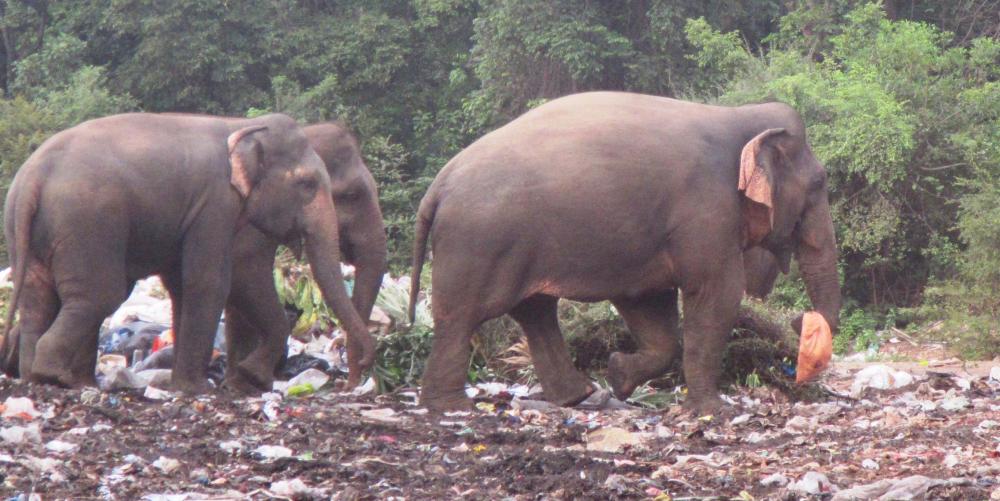 |
Approximately 100 Asian elephants live in and around the Trincomalee Landfill in northeast Sri Lanka. These huge creatures eat plastic strewn trash and garbage because they have been driven back from their natural habitat by the encroachment of farms.
38 Photos
Created 24 September 2018
|
 |
.JPG) |
.JPG) |
 |
 |
 |
 |
 |
 |
 |
S/V Tiger Lilly
Who: Lilly and Tom Service
Port: Green Cove Springs
Gallery