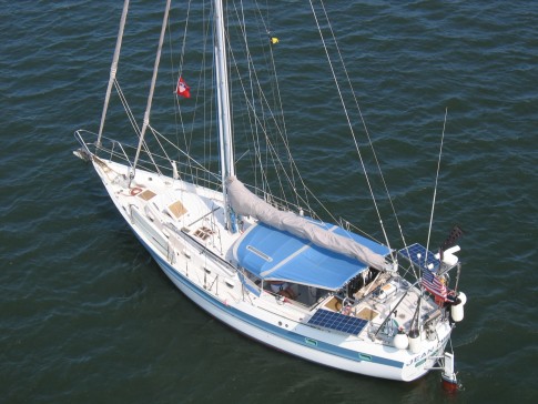
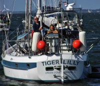
S/V Tiger Lilly
Rig heavy, reef early, and pray often; for God does not assure us an easy passage, but He does promise a safe anchorage...

25 May 2018 | TRINCOMALEE, SRI LANKA
02 January 2018 | Clan Jeti Anchorage, Georgetown, Penang Island, Malaysia
03 November 2016 | Singapore, Southeast Asia
02 October 2016 | Kumai River, Borneo
24 August 2016 | Rindja Island, Indonesia
22 July 2016 | Fannie Bay, Darwin, Northern Territory, Australia
14 June 2016 | Pancake Creek, Queensland, Australia
13 June 2016 | Pancake Creek, Queensland, Australia
11 June 2016 | Burnette Heads, Queensland, Australia
07 June 2016 | Mooloolaba, Queensland, Australia
11 May 2016 | Colmsie, Brisbane River, Queensland, Australia
23 December 2015 | Brisbane, Australia
13 August 2015 | Whangarei, New Zealand
07 August 2015 | Whangarei, New Zealand
23 July 2015 | Whangarei, New Zealand
12 April 2015 | Whangarei, New Zealand
11 February 2015 | Whangarei, New Zealand
25 January 2015 | Whangarei, New Zealand
24 September 2014 | BORA BORA, French Polynesia
23 September 2014 | Bora Bora
TIGER LILLY - GUYANA CRUISING NOTES - PART FOUR
02 June 2013 | Fort Island, Essequibo River, Guyana
Tom & Lilly
GEORGETOWN
Virtually everyone we talked to (including residents of Georgetown) told us that for security reasons, not to take our boat to Georgetown - so we didn't. Instead we took a fast ferry from Bartica with Joyce Davis and had an enjoyable day shopping and seeing the sights of Guyana's capital city. Basically, the plan was to take an early fast ferry from Bartica (leave at 0700 for the 1 hour ride), meet Joyce's taxi driver Prow at the landing in Parika Stelling, he would drive us to Georgetown (about 1 hour ride), shop / have lunch / tour Georgetown, leave Georgetown around 1600, arrive back at Parika Stelling around 1700, catch the fast ferry back to Bartica, and arrive back in Bartica around 1800 - just before dark. It was a good plan, however, we stayed too long in Georgetown, didn't catch a fast ferry at Parika until almost dark, and then had to run the river back to Bartica in the dark - not a red hot idea from a safety standpoint. We were glad we made the trip (once), it was interesting and we enjoyed the day, but we strongly recommend maintaining that depart Georgetown target of 1600. Here are some of the details: The fast ferry costs 2500GYD per person, per way. The use of an all-day driver is clearly the way to go. The cost is about $75USD for the day, and well worth it considering we would not have the time to learn the mini-bus (van) routes, we knew nothing about where to shop (but of course Joyce did), and when you do the math we would only have about 7 hours actually in Georgetown. Joyce's taxi driver is Vernon Prowler (Junior or Prow) and his telephone number is 662-0928 or 629-6307. Prow's brother is the Manager at the Scotia Bank in Bartica (site of the ATM machine), and he can be reached through him. Prow can carry 4 people in his taxi (reduce the per-person price by two couples going together) or he can rent a mini-van and take a larger group (priced accordingly). We liked Prow, and included him in our meals and refreshments. An alternative would be to take a Route #32 maxi-taxi from Parika Stelling (the fare is 400GYD per person) to Georgetown, and then figure out the what and where of shopping on your own. When we arrived in Georgetown, we went to a cafe called the Oasis (near the big wooden Anglican Cathedral) and drank coffee, checked our email, and organized the day. We had quite a varied shopping list and Prow really hustled so that we could get as much done as possible, and then see some of the sights of Georgetown. Lilly sez: LUNCH! WHERE'S LUNCH? After a few hours of shopping we stopped at an absolutely delightful Chinese restaurant for lunch - The New Thriving Restaurant at #32 Main Street, the Lunch Buffet cost $10USD per person plus drinks. Then more shopping, and sight-seeing as we zipped around the town. Prow was able to drive his taxi right out on the Parika wharf, which simplified loading all of our treasures and groceries. One of the downsides of overstaying our time in Georgetown was the best ferry boats had departed on their last run to Bartica for the day, and we got what was left. At any rate we made it back to Bartica safe, sound, and tired.
HURAKABRA RESORT
Kit Nascimento, the owner of the Hurakabra Resort, has been the driving force in bringing yachts to Guyana. He has worked very hard to get much of the information in place which yachties need to make the decision to sail to Guyana. Unfortunately, Kit does not seem to understand the average cruising couple, and he puts way too much emphasis on selling his expensive inland tours. (His wife Gem operates a tour business.) We rowed our dinghy down to the Hurakabra Resort while we were at Joyce's house and visited with Mike, the resort manager. He gave us a nice tour of the property, and we watched an enjoyable Guyana wildlife video at his cabin with his elderly next door neighbors - very nice folks. Kit and Gem live in Georgetown and are usually at the resort on the weekends. When we were there the resort was empty and the main house was in a state of disarray. The anchorage off the Hurakabra Resort is narrow and rocky; and since it is on the exposed west shore of the river it would be a good idea to be aboard your boat at slack tide with a brisk easterly wind, or anytime during a thunderstorm.
BACK DOWN RIVER
After almost a month in Guyana we had to move along, so we checked-out at the Bartica Immigration Office, paid our 2500GYD Customs departure fee, and then headed over to Atkinson's Trading Company to spend the remainder of our Guyana Dollars. Our first day heading down river took us as far as the Shanklands Resort, and we anchored there. Our next move was north from Shanklands, however, once we were north of Ampa Point (between waypoints GUYS13 and GUYS14) we ran out of water on a low tide and we had to turn around and go back south. Instead of waiting for the tide, we elected to go out into the "ship channel" marked on the NAVIONICS charts with 20 to 40 feet of water indicated. We ran hard aground at 06-34.162N 058-35.912W on what we now call Tiger Lilly Shoal. We were making a crossing from the west bank to the east bank, and following the "ship channel". We were running down-current in 20 feet of water on a strong ebb with an SOG of 7 knots when the bottom came up in about a boat length, and we put her well and proper up on that shoal. It took us about an hour of backing and filling to dig a hole and get the boat's head turned back into the current. Once we were head-to-current we could use the strong ebb to our advantage to slide and bump Tiger Lilly off the shoal. After a lot of trial and error, slowly poking around with the fathometer, we found safe water well to the north on Saxakalli Shoal (6-34.463N 058-36.063W), we finished the crossing, and returned to the Doyle Guide waypoints. With hindsight we can now see that it would have been better to wait for the tide, and stay on the waypoints. The surveys which the charts are based on are just too far out of date to provide accurate navigation information - there have been some major changes in the shoals and channels of the Essequibo River since the charts have been published. The remainder of our passage back down the river was uneventful - and we stayed on the Doyle Guide waypoints. There were plenty of fishing nets strung across the river, but we had a better awareness of the situation on our way back down the river.
FORT ISLAND
We had not seen any government officials on the Essequibo since we arrived, and the Immigration and Customs officials in Bartica did not make a big deal about our arrival or departure times or dates, so we decided to stop at Ford Island on the way back down the river. There is a small Coast Guard Station on Fort Island, but during a month of cruising the river we never saw a single Coast Guard patrol. There are three attractions a cruiser may want to stop and see on Fort Island: The Court of Policy, Fort Zeelandia, and the Fort Island Primary School. We anchored just north of the Fort Island Stelling; and kept well clear of the landing since the large ferry needs room to maneuver in the strong tidal current. The ramp on the landing makes a good dinghy dock, and access to the shore was easy. There is a paved brick walkway that runs north and south along the east side of the island, providing easy access to the school on the south end, the Court of Policy close to the Stelling, and Fort Zeelandia on the north end. The well-restored Court of Policy was the seat of the Dutch Government in the 18th Century; the building housed a church, the court, and a slave market. The antiquities were interesting, but we most enjoyed visiting the Fort Island Primary School. Take the walkway to its southern terminus, and turn right to reach the school house. Charline is the Headmistress and she welcomed us warmly. Her husband Syed is also an educator, and he tends the family farm. Charline is quite a motivated hard-working teacher. The schoolhouse was decorated with posters and the children's art work, and it was really a nice learning environment. We love to see children learning, and finding such a nice school in a developing country was all the more special - truly a ray of sunshine. If you stop to visit, or perhaps drop off some much appreciated school supplies, please tell Charline that Tiger Lilly said "Hello". Completed in 1749, Fort Zeelandia was built to protect the Dutch West India Company interests on the Essequibo, and the remaining structure and grounds are well maintained. Both the Fort Zeelandia and the Court of Policy have informative placards posted with good historical information. For us, Fort Island was an enjoyable two hour stop. As we picked up Tiger Lilly's anchor to continue down the river, millions of pale yellow butterflies came off the island, not unlike pastel snow fluttering across the chocolate colored surface of the Mighty Essequibo.
BERNHARD'S WEST CHANNEL WAYPOINTS
These waypoints were developed by Bernhard (S/V Meerstern), and they cut off about 30 miles on the passage to and from the north approach to the Essequibo.
WPA 07-23.000N 058-21.300W
01 07-10.400N 058-22.400W
02 07-08.800N 058-24.200W
03 07-01.500N 058-26.900W
04 06-56.998N 058-29.831W
05 06-53.327N 058-32.159W
06 06-49.345N 058-34.143W
07 06-48.445N 058-34.303W
08 06-45.690N 058-34.086W
09 06-43.130N 058-34.290W
10 06-41.040N 058-34.485W
GUYS09 06-36.250N 058-34.650W
We did not use these waypoints because we did not have them when we entered the Essequibo, and since we departed to the southeast (towards Suriname) we did not use them on our departure. The NAVIONICS electronic charts indicate the approach northeast of Tiger Island would benefit from a high tide. Bernhard said he also prefers to enter on a high, but it is not critical. The "wave" icons west of Tiger Island on the electronic charts indicate possible rough conditions. Bernhard reports that this is a highly unusual situation produced by a spring ebb tide bucking against a strong northeast wind. He said that in the twenty-plus years he has been entering the Essequibo through the West Channel, he has not encountered these conditions. We used the Leguan Island anchorage east of Enterprise Stelling as a departure staging point for hoisting the dinghy, stowing Tiger Lilly for sea, and resting-up prior to the beat southeast to Suriname.
Please don't let our unvarnished comments regarding Guyana give you the wrong impression - we are glad we came to this tropical frontier, and we recommend the beautiful natural resources and the warm friendly people of Guyana to other cruisers. Our objective with this Blog is to provide an augment to Doyle's excellent Cruising Guide to Guyana - which we used extensively; we write these practical notes for sailors, and we hope that you will find them useful. Hopefully, you too will come and experience this unique and beautiful place. If our Blog has encouraged you to come see Guyana, then we will have achieved our objective. Each sweeping reach of the Mighty Essequibo revealed a new vista to be savored, each turn of a Bartica street corner was a unique revelation to our senses, and each new Guyanese friend we made enriched our lives. Come and experience this land of many waters for yourself!
Comments
| Vessel Name: | Tiger Lilly |
| Vessel Make/Model: | 1977 CSY44 walkover hull #55 |
| Hailing Port: | Green Cove Springs |
| Crew: | Lilly and Tom Service |
| About: | |
| Extra: | |
| Social: |
|
Tiger Lilly's Photos - Main
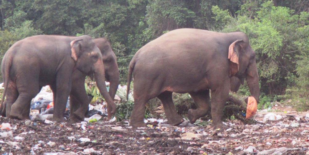 |
Approximately 100 Asian elephants live in and around the Trincomalee Landfill in northeast Sri Lanka. These huge creatures eat plastic strewn trash and garbage because they have been driven back from their natural habitat by the encroachment of farms.
38 Photos
Created 24 September 2018
|
 |
.JPG) |
.JPG) |
 |
 |
 |
 |
 |
 |
 |
S/V Tiger Lilly
Who: Lilly and Tom Service
Port: Green Cove Springs
Gallery