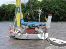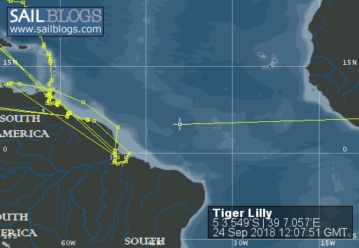
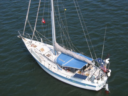
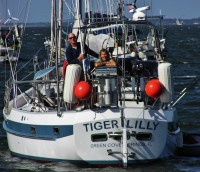
S/V Tiger Lilly
Rig heavy, reef early, and pray often; for God does not assure us an easy passage, but He does promise a safe anchorage...

25 May 2018 | TRINCOMALEE, SRI LANKA
02 January 2018 | Clan Jeti Anchorage, Georgetown, Penang Island, Malaysia
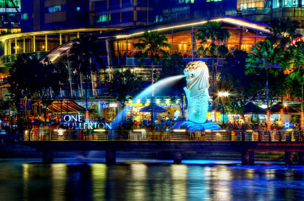
03 November 2016 | Singapore, Southeast Asia
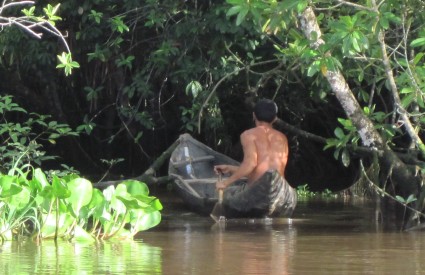
02 October 2016 | Kumai River, Borneo
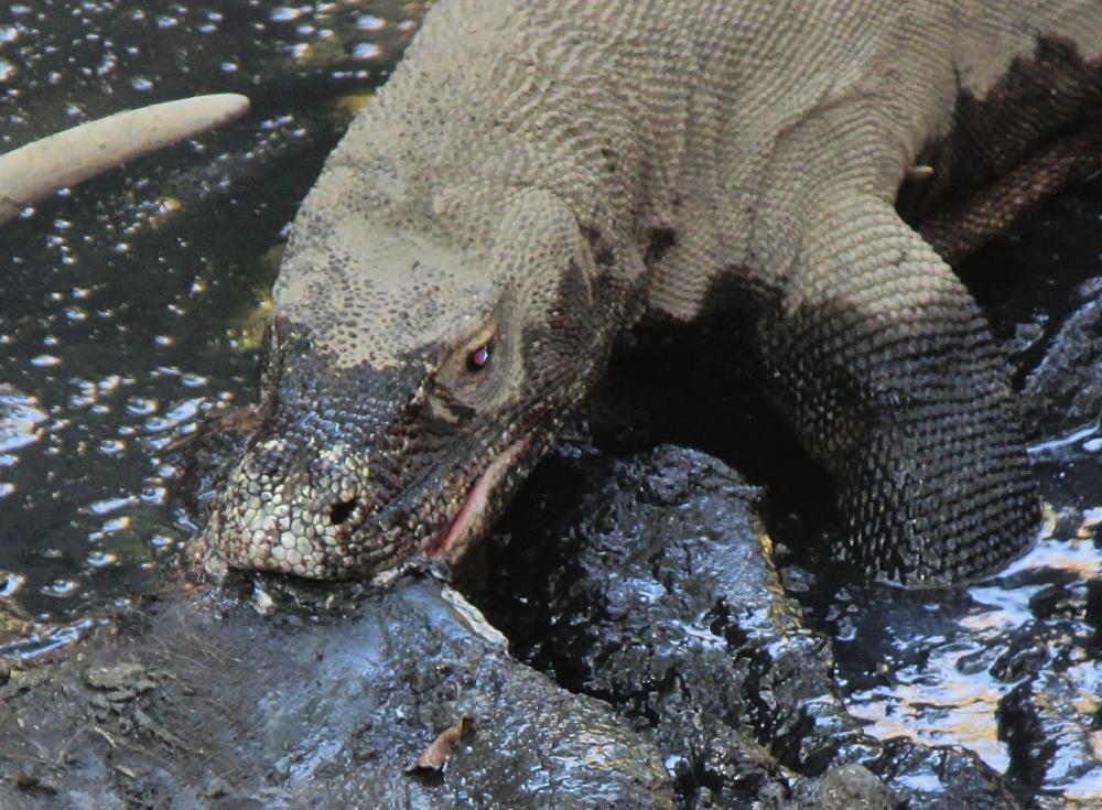
24 August 2016 | Rindja Island, Indonesia
22 July 2016 | Fannie Bay, Darwin, Northern Territory, Australia
14 June 2016 | Pancake Creek, Queensland, Australia
13 June 2016 | Pancake Creek, Queensland, Australia
11 June 2016 | Burnette Heads, Queensland, Australia
07 June 2016 | Mooloolaba, Queensland, Australia
11 May 2016 | Colmsie, Brisbane River, Queensland, Australia
23 December 2015 | Brisbane, Australia
13 August 2015 | Whangarei, New Zealand
07 August 2015 | Whangarei, New Zealand
23 July 2015 | Whangarei, New Zealand
12 April 2015 | Whangarei, New Zealand
11 February 2015 | Whangarei, New Zealand
25 January 2015 | Whangarei, New Zealand
24 September 2014 | BORA BORA, French Polynesia
23 September 2014 | Bora Bora
TIGER LILLY - RIO ORINOCO DELTA PILOT - Part 2 of 3
17 April 2013 | Eastern Venezuela
Tom and Lilly Service
RIO GRANDE
Once we were in the Rio Grande our objective was to get down-river as soon as we could. Based on the negative experience of some previous cruisers with the officials in charge of navigation on the Rio Grande, we wanted to get out towards the mouth of the river before we did any more exploring. In retrospect, perhaps our concerns were unfounded. There were no official vessels on the Rio Grande, and we only saw 2 large merchant ships, and 2 fishing trawlers. On the second day the Punta Barima pilot boat passed us going up stream, and they gave us a friendly wave and sounded their siren in welcome. When we did see the ships, we moved out of the channel well before they approached, monitored VHF Channel 16, and heard nothing. We did see a lot of local cargo being moved on the river in large open boats, usually powered by the ubiquitous twin Yamaha ENDURO 40's. Everyone had a friendly wave for us, and some of the boats came up alongside to have a look, - with nothing but smiles for Tiger Lilly. The Rio Grande had a lot of tidal current running, and when the ebb is opposing the predominant easterly wind, blowing right up the river, it can be rough. We motor-sailed with a reefed stays'l set to dampen the motion, and that worked out pretty well. The ebb is stronger than the flood (which works in the favor of a down-bound vessel) because the outflow of the river is superimposed over the tidal current, dampening the flood and strengthening the ebb. Our first anchorage was at Santa Elena Island (Mile 108), just across the river from the Village of Sacupana. This is where we found ourselves by mid-afternoon, and for security reasons we thought that we would like to be anchored in the vicinity of civilization on our first night on the Rio Grande. There was a lot of current running over the shallows west of Santa Elena. During the night when the current was on the ebb the wind got up brisk out of the east and Tiger Lilly danced and swung for the entire tide - the chain made a lot of noise dragging across that bank, but we never had much strain on the anchor. Early next morning we were off and making miles down the river. Our second anchorage on the Rio Grande was at Cano Noina (Mile 55). This was a much nicer anchorage, than Santa Elena. Lilly had fun rowing Grace in the company of several Waro teenage boys, and racing their dugout canoes. They seemed to be intrigued by the garrulous golden-headed white lady that rowed like a warrior! It wasn't long before she had them in Grace learning how to swing a set of oars. (But they could not imagine why the white people would paddle facing aft!) Early the next morning there they were back again, with their parents, uncles, brothers and sisters, to give Tiger Lilly a nice send-off as we got back underway. By 1400 we were at Mile 30 and making our approach to the Rio Amacuro on the south bank of the river - in a blinding rain squall. (As Jack Nicholson would comment, "Is there any other kind?")
RIO AMACURO
Both the C-MAP NT+ and the NAVIONICS electronic charts have the entrance to the Reo Amacuro wrong. There are shallows on both sides of the narrowing approach to the bar, and the charts show a least depth of 14 feet on the bar at low water, this part is correctly shown on the charts - the problem is that the actual channel is well to the west. But of course we did not know this on the way in. We were entering on a 6 foot high, with 25 knots of wind blowing up her skirt, and a strong flood setting us in. Having done the math, we were expecting some 20 feet of water. As we ran the bar the fathometer got down to 8 feet, the squall strengthened, and there was no way we were going to be able to bring her about in the narrow "channel" between the shallows - so we ran hard for the gap between the trees. Thankfully, the depth held at 8 feet, and then it got very deep, very fast - and the skipper could breathe again. The next surprise was a large steel barracks-barge at the mouth of the river with "ARMADA BOLIVARIANA DE VENEZUELA" on the side, and a Marine with an assault rifle waving us in. The Marines on the barge wanted us to come alongside, but the squally wind was setting on the barge and we wanted no part of that, so we did what we knew was best for us and we anchored in the channel just off the barge. Tom rowed over to the barge with our boat-papers while Lilly tended Tiger Lilly in the stream - anchored in 70 feet with a 2 knot flood current running up the river. The young Station Chief, Teniete of Fragata Lt. Carlos Redondo (about the same rank as a First Lieutenant in the US Marines), was quite pleased with our Venezuelan Embassy email, and after he examined our passports and boat papers told us that we were welcome to stay in Venezuela. Carlos was very friendly and told us about the Village of San Jose De Amacuro 12 miles up the Reo Amacuro at a fork in the river. The river was quite deep (50 to 80 feet), and it wasn't until we got to the fork that the river lessened to 35 feet. The homes along the river were connected by a common boardwalk; and we enjoyed strolling the paseo and meeting the friendly people - everyone seemed to be curious about us. Mayor Tomas Lugo and his son Jose welcomed us in good English and over the next few days we developed a warm friendship with their family. We visited their home, and they, along with several of Tomas' grandchildren, went for a little cruise aboard Tiger Lilly on the river. We were anchored on the outskirts of the village on the western fork. We found it was more peaceful to anchor away from the village power-plant, which was located at the river's fork and operated from sunset until about 2300. There are a couple of stores with basic provisions and supplies available in San Jose De Amacuro. There is plenty of gasoline available at the village, but no diesel fuel. Our visit to the Reo Amacuro was quite enjoyable, and one of the highlights of our cruise through the Rio Orinoco Delta. The area around San Jose De Amacuro is quite safe; the Armada (Venezuelan Navy) has a station at the mouth of the river (where we checked-in), and further upstream from the village on the western fork the Guardia (police) have an outpost near the gold dredging area. On the way out of the river, in much better conditions than our challenging entrance, we found the channel:
RA1 8-34.01N 060-28.31W (start the approach)
RA2 8-31.93N 060-28.69W
RA3 8-31.27N 060-28.31W (Armada Amacuro Barge)
This 3 mile approach to the mouth of the Reo Amacuro is well to the west of the charted channel, but this is where the water actually is. We recommend running the bar on the high tide; however, based on the depths we saw, it should be passable with a least depth of 12 feet at all but the lowest of tides. As you approach the mouth of the river, and well before the Armada's Barge is reached, the water will deepen to 60 feet. The Amacuro is narrow and deep, so just keep her between the trees and enjoy the ride!
REO BARIMA
We used the same high tide to transit from the Reo Amacuro to the Reo Barima, just 3 miles apart at the mouth of the Rio Grande. Our plan was to use the area just south of the Reo Barima Pilot Station as our staging anchorage to prepare Tiger Lilly for sea, and to wait for favorable winds to sail to Guyana. The C-MAP NT+ charts and the Open CPN - CM93 charts show the entrance channel of the Reo Barima to the north of its actual position, while the NAVIONICS charts (on our iPad2 application) show the channel to the south. Here is the track we used to enter the Reo Barima (at the time of high tide at Isla Ramon Isidro, just across the mouth of the Rio Grande):
RB1 8-35.02N 060-28.39W
RB2 8-35.01N 060-26.41W
RB3 8-34-71N 060-24.96W
There may be a better way in but this worked for us on a 6ft. high tide and a 7 foot draft. The minimum depth we saw on the bar was about 10ft. (at high tide) and this concurs with the 4 foot spots shown on the charts. However, in general we found the adjusted water depths at the mouth of the Rio Grande to be about 2 feet less than the charted depths. Once inside the mouth of the Reo Barima we saw water depths in the teens around the Punta Barima Pilot Station, and then 30 to 40 feet further up the river. The surprise as we entered the Reo Barima was the un-charted wreck of a merchant ship which was positioned between the entrance channel and the Pilot Station. We kept the wreck to the north (our port hand) as we entered, with water depths in the teens. We had to wait a few days for the wind to get out of the southeast along the Guyana coast (the direction we wanted to go), so we moved about 6 miles up-river to explore a cano at 8-33.45N 060-19.67W, on the north bank. This area is a vast coastal mangrove forest, with only about 6 miles separating the Tropical North Atlantic from the Reo Barima. Some 45 miles up the Reo Barima, just beyond the Venezuela - Guyana international border, is the Morawhanna Passage to the sea at Punta Guaini. We would have liked to use that route to the sea, but our navigation charts show it to be a very shallow entrance. Since that time we met a German fellow in Guyana, Bernhard of the S/V Meerstern, who has extensively explored many of Guyana's tropical rivers. Bernhard told us that he has been through that passage, and that with a high tide we could easily make it through this area with our 7 foot draft. Tomas Lugo, the Mayor of San Jose De Amacuro told us that passage between the frontier border between Venezuela and Guyana can be problematic since Venezuela does not recognize the international boarder, and Guyana is very sensitive about the pervasive smuggling operations on their northern border with Venezuela. In spite of these complications, the passage from the Punta Barima Pilot Station to Punta Guaini via the Reo Barima would be a very interesting possibility; but for us it will have to wait one more lifetime, as we are headed south on a one-way ticket to Cabo de Horno.
BEAT TO GUYANA
With a favorable set of GRIB files on the WINLINK from NOAA (no winds forecast south of east for the next 5 days) we set the mains'l for the first time in a month and started working our way out the mouth of the Rio Grande on a beat to Guyana. Tiger Lilly slipped along with a clean bottom, clean sea-water heat exchangers, and clean head plumbing thanks to the fresh, and slightly acidic, waters of the Rio Orinoco Delta. The underwater grunge and growth we accumulated in Trinidad was gone; and our spirits were high because we were free and sailing again! With an easterly Trade Wind forecast, the plan was to take a short starboard tack out to the Guiana Current (in about 45 feet of water), then put her over on the port tack and sail the longer leg southeast until we reached 12 to 14 feet of water along the coast - and then do it again and again. The wind was forecast by NOAA at Force 4; which agreed with the Pilot Charts for the northeast coast of South America for the month of May. Other sailors who had beat down this coast had warned us of the many unmarked fishing nets set along the beach, which proved to be a problem during the hours of darkness on the inshore tack. We had no intention of motor-sailing down this coast, however (not un-expectantly), the wind usually died sometime after midnight, and did not fill back in until mid-morning. The solution to both the fishing net hazard and the slack night winds was to anchor during the hours of darkness. The extensive soft mud banks which line the northeast coast of South America off the Guianas tend to dampen down the effects of the sea as it approaches the coast. The liquid mud layer which overlays the bottom marl and clay attenuates the lower half of the approaching waves, causing them to collapse in on themselves. This phenomenon was first described to us by a Brazilian PHD oceanographer in Chaguaramas (Gui of S/V Harmony). When we got to Guyana and met Bernhard and Sharmilla (of S/V Meerstern, and experienced sailors on this coast), they told us that the Amerindian fishermen call this dampening effect "sling-mud." Although we would not normally consider anchoring in the ocean along a lee shore - we found that the sling-mud effect made our offshore anchoring both safe and comfortable. The Waini Coast fishing fleet was very active, and we saw a lot of fishing boats anchored along the coast while they tended their nets; in fact, our first clue that we were approaching a net was usually the presence of a fishing boat in the area. We used their anchoring tactics, and we anchored just before sunset in about 20 feet of water; that seemed like a good depth to anchor, in less water the sea seemed rougher, and a greater depth put us out in the coastal traffic with a shorter scope of chain. We learned the hard way not to anchor down-current / down-wind from a fishing net. The anchored nets are usually set east to west across the current, and marked with a single black flag on one end and a double black flag on the other. The nets had no lights and no radar reflectors marking them, and sometimes only one end was flagged. Our initial logic for anchoring down-stream of a net was so that we would not inadvertently drag into it. But holding was not the problem; the holding was actually quite good in mud and sticky clay. We anchored in about 20 feet of water with 150 feet of chain, with a 66 pound Bruce well set; and the 3 to 4 feet of wave action was not uncomfortable as long as we set a triple-reefed main as a riding sail to keep her head to wind and sea. The problem with our anchoring tactics became obvious on the second night of anchoring on the Waini Coast - apparently blind luck and superstition had carried us through on the first night. We had just fallen off to sleep when we awoke to a "scratching" noise on the anchor chain, and the distinct smell of fish. It seems that after dark the fisherman had retrieved the previously anchored end of their net (which we had anchored behind and down-stream of) and then began drifting down-stream at a pretty good clip as they hauled the net in. When their net diagonally crossed Tiger Lilly's anchor chain it rode right up it to our anchor tray on the bow, and then squeezed the Tiger in a tight vee. This is the situation we found when we arrived on the bow with a razor knife in-hand - this Tiger had teeth. After quickly assessing the situation we did not hesitate, our boat was in serious danger; a few swipes with that razor knife and the net snapped back off both sides of our bow, and well clear of the bow. Tom slipped into the engine room and rotated the propeller shaft by hand - it was free. Then we shifted the rudder from stop to stop - no problem here either. We sat together in the dark cockpit, watching and waiting to see if the fishermen would give us a hard time about a problem which they caused. Apparently the skipper figured it out, picked up both ends of his net and anchored-off to sort it out and make repairs - end of incident. The lesson-learned in hind-sight is that it is wiser to anchor up-stream of a fishing net so that when it is retrieved the fishing boat and the net drifts away from the anchored yacht. Hopefully you can see that all these guidelines are cast in Jello as they are the result of only a single passage down this coast. (Although, we do intend to use these refined tactics to sail from Guyana to Suriname - with the added complication of the Wet Season's tropical waves.) After anchoring for the night, with a good breakfast under our belts, we would get underway at the gentlemanly hour of 0800, motor-sailing in the light wind as it filled-in, and charging-up the battery bank. By 0930 the engine was secured and we were back to tacking down the coast. Here is the box score on this passage: it took us three and a half days, anchoring in the evening before sunset, to make the 200 miles down the coast; the GPS Log indicated 275 miles sailed in six tacks. (The legs of our tacks were bent back towards each other by the current.) It really was not too difficult, once we figured out the when (during the hours of darkness), where (about 20 feet of water, up-stream of any fishing nets in our vicinity), and how (with a riding sail set for comfort) to anchor in Guyana's sling-mud.
ESSEQUIBO RIVER
On the last night of our sail to Guyana the wind backed into the northeast and stayed at Force 4 all night, and we were able to keep sailing well clear of the inshore fishing nets. By 0800 the wind was slack, rain squalls were raking the Mouths of the Essequibo, and Tiger Lilly was in the influence of the ebb at the mouth of the West Channel. The crew was coming down with a serious case of Channel Fever - so we started up Mister Perkins to take us the last 8 miles to the Essequibo sea buoy. (Lilly sez - Ladies, I was not ABOUT to spend another day, and night, tacking back and forth so that Popeye could say he sailed the entire way - START that flippin motor!) Even with Mister Perkins doing his part, it was nearly noon by the time we reached the Essequibo sea buoy - the currents at the mouths of the river are certainly formidable. Although we had read the section in Doyle's Trinidad and Tobago Guide which cover the Essequibo River, we were not mentally prepared for the proliferation of fishing nets and large pilings set right across the entire mouth of the river at the bar - and in the area marked as the "Ship Channel" on the charts. We hove-to and reconnoitered, confirmed we were in the correct position (there are no distinguishable NAVAIDS in the river), and then plunged through and ran the daunting gauntlet of pilings. When we were abeam of the main axis of the fish traps the pilings looked like the quills on the back of a porcupine, sticking out every which-way from horizon to horizon on both the port and starboard beams. Once through the initial mess, the situation began to sort itself out, and we were able to see a pattern of nets set to the north of the "Ship Channel" and we set our course to skirt them to the south. When one arrives from the sea it is difficult to time that arrival with the optimum tide for going up-river, and we were tired after sailing all night. We knew that we did not want to anchor off the busy rough-and-tumble landing at Parika, and the Doyle Guide's recommendation was even farther up-stream at Roed-En-Rust, a long way to go on the wrong tide. We anchored on the north shore of the river, along the sea wall of Leguan Island in 20 feet, just east of Enterprise Stelling (next to an abandoned church steeple, marked as "81FT" on the chart). We had a nice dinner, and a good night's sleep, so we would be ready to start exploring GUYANA on the morrow!
PHOTO GALLERY: Main / Ports of Call / South America / Venezuela / Rio Orinoco Delta Pilot
CONTINUED ON THE PREVIOUS BLOG
Comments
| Vessel Name: | Tiger Lilly |
| Vessel Make/Model: | 1977 CSY44 walkover hull #55 |
| Hailing Port: | Green Cove Springs |
| Crew: | Lilly and Tom Service |
| About: | |
| Extra: | |
| Social: |
|
Tiger Lilly's Photos - Main
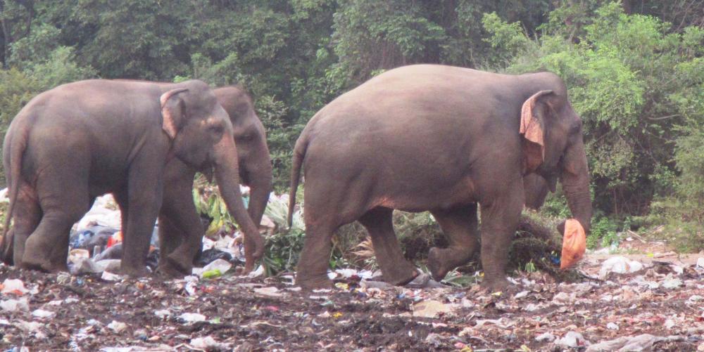 |
Approximately 100 Asian elephants live in and around the Trincomalee Landfill in northeast Sri Lanka. These huge creatures eat plastic strewn trash and garbage because they have been driven back from their natural habitat by the encroachment of farms.
38 Photos
Created 24 September 2018
|
 |
.JPG) |
.JPG) |
 |
 |
 |
 |
 |
 |
 |
S/V Tiger Lilly
Who: Lilly and Tom Service
Port: Green Cove Springs
Gallery