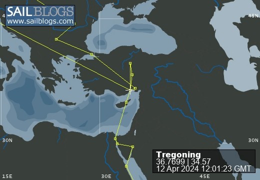
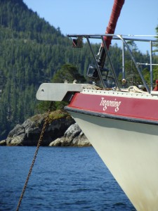
Tregoning
12 April 2024 | We are back aboard Tregoning in Mersin Marina, Mersin, Türkiye
02 April 2024 | We are in Toronto Airport, Canada: Tregoning is in Mersin Marina, Mersin, Türkiye
25 February 2024 | We are back in Gainesville, FL: Tregoning is in Mersin Marina, Mersin, Türkiye
18 February 2024 | We are in Glenwood, New Mexico: Tregoning is in Mersin Marina, Mersin, Türkiye
12 February 2024 | We are in Morro Bay, California: Tregoning is in Mersin Marina, Mersin, Türkiye
19 January 2024 | We are in Vancouver, BC Canada: Tregoning is in Mersin Marina, Mersin, Türkiye
01 January 2024 | We are in Washington State: Tregoning is in Mersin Marina, Mersin, Türkiye
15 December 2023 | We are in Minnesota: Tregoning is in Mersin Marina, Mersin, Türkiye
18 November 2023 | We are in Florida: Tregoning is in Mersin Marina, Mersin, Türkiye
29 October 2023 | We're in Florida - Tregoning is at B-dock, Mersin Marina, Mersin, Türkiye
21 October 2023 | 7 Oda Kapadokya Cave Hotel, Ürgüp, Türkiye
14 October 2023 | Hotel Aşikoğlu, Boğazkale, Türkiye
07 October 2023 | B-dock, Mersin Marina, Mersin, Türkiye
19 September 2023 | “Chez Jon & Angela”, Near Otterton, Devon, UK
14 September 2023 | Airbnb in Fortuneswell on the Isle of Portland, Dorset, UK
11 September 2023 | With Mike, Grange-over-Sands, Cumbria, UK
03 September 2023 | Ardington House, Ardington, Oxfordshire, UK
24 August 2023 | Near "Chez Joan and Peter", College of Roseisle, Moray, Scotland
11 August 2023 | Andrew's house (not exactly), Lichfield, UK
22 July 2023 | Chez Gail, near the New York Café, Budapest, Hungary
The Barrier Islands
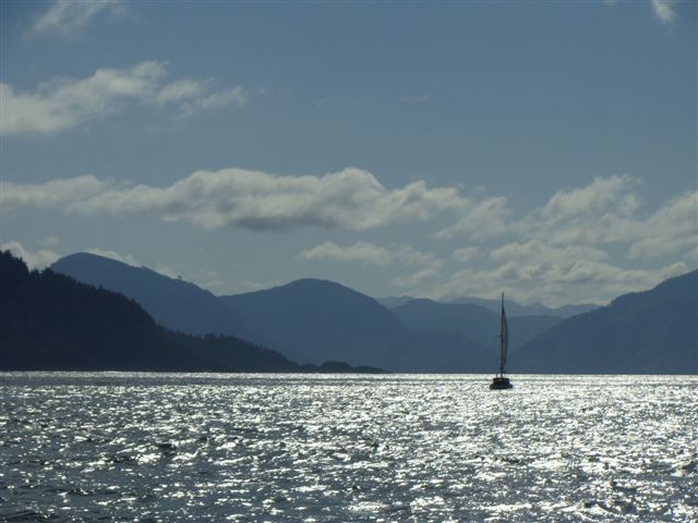
07 March 2017 | Akapoua Bay of Port Fitzroy on Great Barrier Island, New Zealand
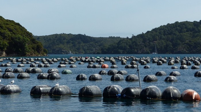
Photo: Floats of a shellfish farm in Port Fitzroy Harbour
Great Barrier Island was so named by Captain Cook because of its protective position on the northeastern edge of the Hauraki Gulf, the large bay in which Auckland sits. The Māori called this island, Aotea, meaning Cloud, distinctive from New Zealand's Māori name of Aotearoa or Land of the Long White Cloud. At 285 sq km (111 sq miles), Aotea is the nation's fourth largest island after the South, North, and Stewart Islands, and of its many rugged peaks and ridges, the highest point is Mount Hobson, or Hirakimata, at 627 m (2,027 feet). Two thirds of the island is publically owned and managed by the New Zealand Department of Conservation and the other third supports a permanent population of only 860. Being within 90 km of Auckland (56 miles) and served by both ferries and airlines, Aotea is a very popular tourist- and weekend-destination with many hiking tracks, mountain bike routes, and water-sport opportunities.
Aotea is also a very attractive to boaters because there are several large bays on the west coast that are suitable for anchoring and which are relatively protected from ocean swells. While the exposed east coast is less hospitable, the most sheltered anchorages are within an almost landlocked bay, Port Fitzroy Harbour. On the west coast of the island, this waterbody is protected from ocean swells by the small island Motu Kiakoura so that there are only two relatively narrow channels, north and south of this island, into Port Fitzroy Harbour. At the north end of the Harbour, is a narrow bay with the "village" of Port Fitzroy which boasts a fuel dock, boat ramp, shop and post office, information center, health clinic, public bathrooms, campground, restaurant/boat club, bed and breakfast, a few houses, and not much else.
We had aimed for Aotea because it was greatly praised by Kiwis and cruisers as a relatively remote-feeling yet convenient place to cruise, hike, and generally explore. The weather forecast was also calling for several days of rain and gale-force winds (34 to 40 knots), mostly from the north and east so we were keen to find an anchorage with little wind-fetch from those directions in which we could hunker-down (a good US expression) for a few days.
When we left Urquhart Bay on Sunday morning (March 5th), it was rather cloudy and the wind was not as strong as it had been the previous day, so we had to motor-sail for a few hours before we could unfurl the jib and turn off the engine. This was actually all right for us because Randall had carefully un-pickled the water-maker earlier that morning so we were able to run it and make water for several hours without having to worry about using up too much battery power.
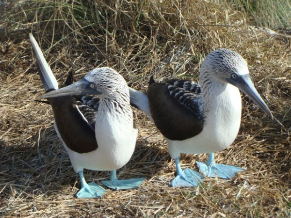
On the way to Aotea, Randall periodically spotted a shark's white dorsal fin at the water surface only to be surprised by the arrival of a black one nearby. In fact, it was the two wingtips of a huge manta ray (black on top, white underneath) just under the water's surface. We also saw various seabirds, which included the diminutive diving petrel (similar to the North American murrelets), and other larger petrels and/or shearwaters. Unfortunately for me, our New Zealand bird book lists 41 petrel-like species, 17 shearwater species, 16 albatrosses and mollymawks, and 6 storm petrels, so identification of these swiftly moving, black, white, and grey birds is not easy. Although not many of these species were likely to be in our area it will be quite a while before I can identify many of them with confidence. For example, I had a good look at a couple of individuals of a totally dark-plumed species but I just could not be sure whether they were both flesh-footed shearwaters (common) or both black petrels (an uncommon endemic that breeds on Little and Great Barrier Islands), or one of each.
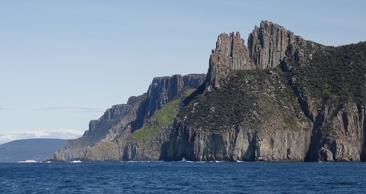
On our way, we passed by Hauturu or Little Barrier Island, which must only be "littler" based on area. With a 722 m peak (2,369 feet) and mostly sheer cliffs around its coasts, it looks pretty big from a sailboat. This island is a pest-free, Nature Reserve which cannot be visited without a permit, and is home to several species of rare endemic birds and the "living fossil", the endemic tuatara. The only remaining species of a group of reptiles that roamed the earth at the same time as the dinosaurs, we had seen one of these crested iguana-like creatures at the Kiwi North exhibit in Whangarei. With a global population between 50,000 and 100,000, these 30 - 75 cm long reptiles (12 - 30 inches), are only found in predator-free sanctuaries, within fenced boundaries of the mainland or off-shore islands of New Zealand.
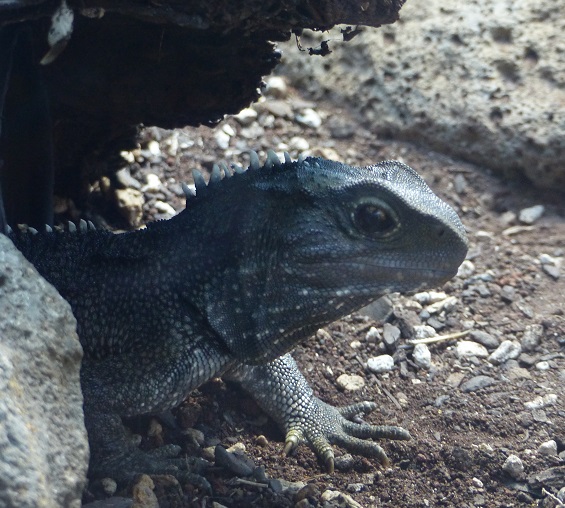
A tuarara in captivity at Kiwi North, Whangarei
Mindful of the forecast for northerly and easterly winds, on arrival at Aotea we headed into Port Fitzroy Harbour and looked for a suitable spot to anchor in Akapoua Bay, near the Department of Conservation's Forestry headquarters. With the small Quoin (or Graves) Island to our west and the coast of Aotea north, east, and south of us, we found ourselves sharing the bay with a varying cast of about a dozen other boats for several days. We were glad that the anchor set well in the sand/mud bottom.
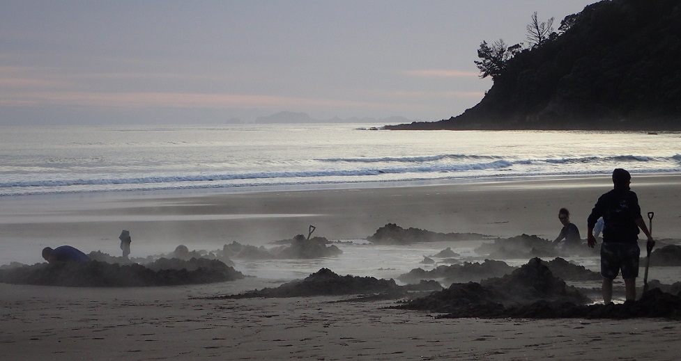
Expecting weather good enough for sightseeing only on Monday and Tuesday, our first job on Monday morning was to launch the dinghy and see if the outboard, which (to continue the familiar refrain) had not been used in almost 18 months, was going to work. It took quite a few pulls on the starter cord but soon we were enjoying sunshine and calm waters on our way to Kaiaraara Bay, the cove just to the south of ours. Here we found Marissa and Bavo on Devocean who had crossed from Urquhart Bay at the same time as us, and a large number of floats for a shellfish farm (green mussels, we think).
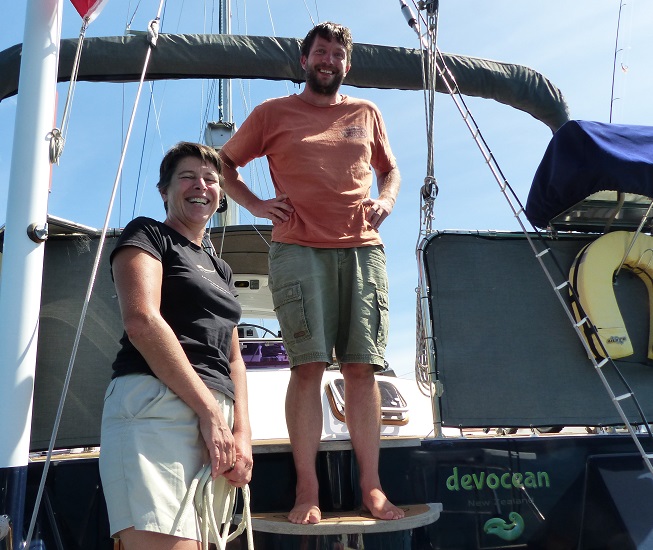
Marissa and Bavo on the stern of Devocean
We also explored Port Fitzroy Village, where I supported the local economy by having an expensive but tasty ice-cream. Cruising along the shore of our bay we noticed a lone female duck which we were excited to find was a brown teal (a.k.a pateke), a rare endemic duck. Aotea is one of the few locations where some of the 2,000 to 2,500 remaining individuals of this species occur.
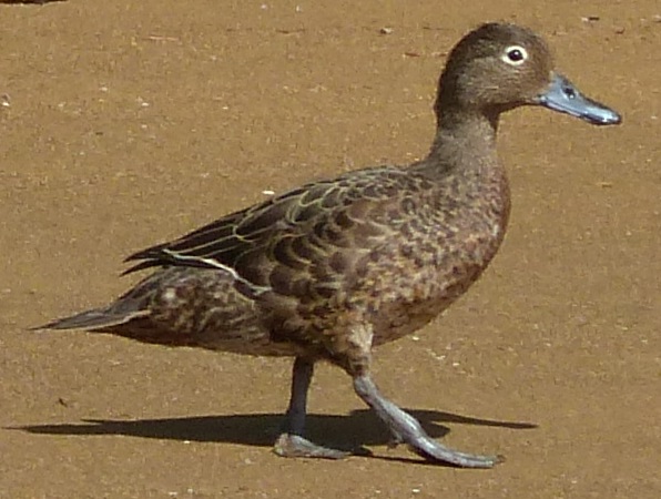
A brown teal (pateke) strides down the shore in Port Fitzroy Harbour
While in Kaiaraara Bay, we had visited a small sandy beach at the start of Bush's Beach Track which, cruisers just returning from a long hike told us, leads to the top of Hirakimata. It was tempting to consider that hike for the following day but with winds predicted to start rising in the afternoon, we did not want to be away from Tregoning for too long. As it turned out, this was just as well...
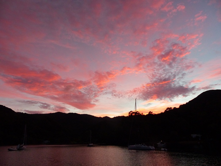
Red sky on Tuesday morning, these sailors take warning... Akapoua Bay, Aotea
Aotea is also a very attractive to boaters because there are several large bays on the west coast that are suitable for anchoring and which are relatively protected from ocean swells. While the exposed east coast is less hospitable, the most sheltered anchorages are within an almost landlocked bay, Port Fitzroy Harbour. On the west coast of the island, this waterbody is protected from ocean swells by the small island Motu Kiakoura so that there are only two relatively narrow channels, north and south of this island, into Port Fitzroy Harbour. At the north end of the Harbour, is a narrow bay with the "village" of Port Fitzroy which boasts a fuel dock, boat ramp, shop and post office, information center, health clinic, public bathrooms, campground, restaurant/boat club, bed and breakfast, a few houses, and not much else.
We had aimed for Aotea because it was greatly praised by Kiwis and cruisers as a relatively remote-feeling yet convenient place to cruise, hike, and generally explore. The weather forecast was also calling for several days of rain and gale-force winds (34 to 40 knots), mostly from the north and east so we were keen to find an anchorage with little wind-fetch from those directions in which we could hunker-down (a good US expression) for a few days.
When we left Urquhart Bay on Sunday morning (March 5th), it was rather cloudy and the wind was not as strong as it had been the previous day, so we had to motor-sail for a few hours before we could unfurl the jib and turn off the engine. This was actually all right for us because Randall had carefully un-pickled the water-maker earlier that morning so we were able to run it and make water for several hours without having to worry about using up too much battery power.
On the way to Aotea, Randall periodically spotted a shark's white dorsal fin at the water surface only to be surprised by the arrival of a black one nearby. In fact, it was the two wingtips of a huge manta ray (black on top, white underneath) just under the water's surface. We also saw various seabirds, which included the diminutive diving petrel (similar to the North American murrelets), and other larger petrels and/or shearwaters. Unfortunately for me, our New Zealand bird book lists 41 petrel-like species, 17 shearwater species, 16 albatrosses and mollymawks, and 6 storm petrels, so identification of these swiftly moving, black, white, and grey birds is not easy. Although not many of these species were likely to be in our area it will be quite a while before I can identify many of them with confidence. For example, I had a good look at a couple of individuals of a totally dark-plumed species but I just could not be sure whether they were both flesh-footed shearwaters (common) or both black petrels (an uncommon endemic that breeds on Little and Great Barrier Islands), or one of each.
On our way, we passed by Hauturu or Little Barrier Island, which must only be "littler" based on area. With a 722 m peak (2,369 feet) and mostly sheer cliffs around its coasts, it looks pretty big from a sailboat. This island is a pest-free, Nature Reserve which cannot be visited without a permit, and is home to several species of rare endemic birds and the "living fossil", the endemic tuatara. The only remaining species of a group of reptiles that roamed the earth at the same time as the dinosaurs, we had seen one of these crested iguana-like creatures at the Kiwi North exhibit in Whangarei. With a global population between 50,000 and 100,000, these 30 - 75 cm long reptiles (12 - 30 inches), are only found in predator-free sanctuaries, within fenced boundaries of the mainland or off-shore islands of New Zealand.
A tuarara in captivity at Kiwi North, Whangarei
Mindful of the forecast for northerly and easterly winds, on arrival at Aotea we headed into Port Fitzroy Harbour and looked for a suitable spot to anchor in Akapoua Bay, near the Department of Conservation's Forestry headquarters. With the small Quoin (or Graves) Island to our west and the coast of Aotea north, east, and south of us, we found ourselves sharing the bay with a varying cast of about a dozen other boats for several days. We were glad that the anchor set well in the sand/mud bottom.
Expecting weather good enough for sightseeing only on Monday and Tuesday, our first job on Monday morning was to launch the dinghy and see if the outboard, which (to continue the familiar refrain) had not been used in almost 18 months, was going to work. It took quite a few pulls on the starter cord but soon we were enjoying sunshine and calm waters on our way to Kaiaraara Bay, the cove just to the south of ours. Here we found Marissa and Bavo on Devocean who had crossed from Urquhart Bay at the same time as us, and a large number of floats for a shellfish farm (green mussels, we think).
Marissa and Bavo on the stern of Devocean
We also explored Port Fitzroy Village, where I supported the local economy by having an expensive but tasty ice-cream. Cruising along the shore of our bay we noticed a lone female duck which we were excited to find was a brown teal (a.k.a pateke), a rare endemic duck. Aotea is one of the few locations where some of the 2,000 to 2,500 remaining individuals of this species occur.
A brown teal (pateke) strides down the shore in Port Fitzroy Harbour
While in Kaiaraara Bay, we had visited a small sandy beach at the start of Bush's Beach Track which, cruisers just returning from a long hike told us, leads to the top of Hirakimata. It was tempting to consider that hike for the following day but with winds predicted to start rising in the afternoon, we did not want to be away from Tregoning for too long. As it turned out, this was just as well...
Red sky on Tuesday morning, these sailors take warning... Akapoua Bay, Aotea
Comments
| Vessel Name: | Tregoning |
| Vessel Make/Model: | Morgan Classic 41 |
| Hailing Port: | Gainesville, FL |
| Crew: | Alison and Randall |
| About: | We cast-off from Fernandina Beach in north Florida on 1st June 2008 and we have been cruising on Tregoning ever since. Before buying Tregoning, both of us had been sailing on smaller boats for many years and had worked around boats and water throughout our careers. |
| Extra: | “Tregoning” (rhymes with “belonging”) and is a Cornish word (meaning “homestead of Cohnan” or “farm by the ash trees”) and was Alison's mother’s middle name. Cornwall is in southwest England and is where Alison grew-up. |
Tregoning's Photos - Main
 |
 |
 |
 |
 |
 |
 |
 |
 |
 |
 |
The Sailblogs Prequel: Adding old posts from expired blog
166 Photos
Created 26 May 2020
|
 |
 |
 |
 |
 |
 |
 |
 |
 |
 |
 |
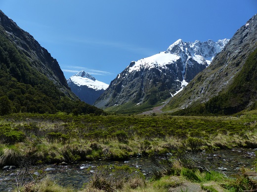 |
Extra photographs from our three-week campervan tour of the South Island from November 15th to December 5th 2015
217 Photos
Created 4 January 2016
|
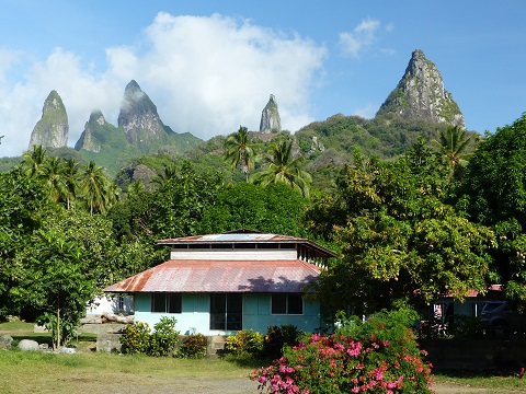 |
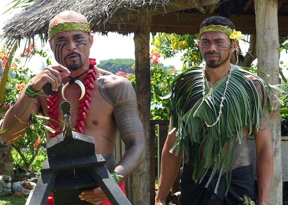
Random pictures from our month spent on the islands of Hiva Oa, Tahuata, Ua Pou, and Nuku Hiva
45 Photos
Created 18 July 2015
|
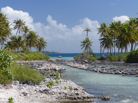 |
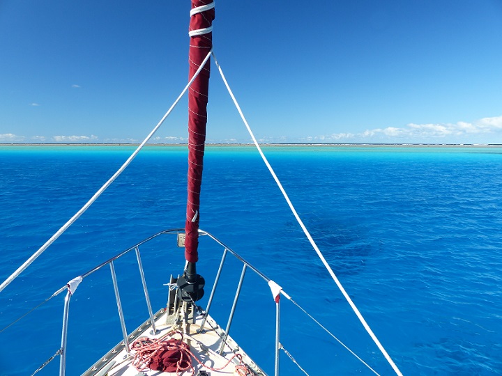
Random pictures from our month spent in 4 Tuamotu Atolls; Ahe, Fakarava, Tahanea, and Toau
32 Photos
Created 1 July 2015
|
 |
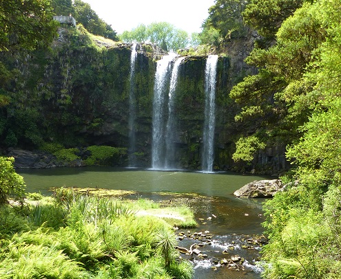
Some of the birds, fish, reptiles, and mammals (and others) that we have seen in Mexico
74 Photos
Created 5 May 2014
|
 |
Tregoning
Who: Alison and Randall
Port: Gainesville, FL
Gallery