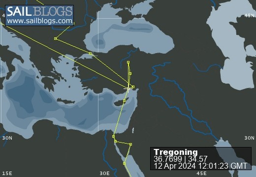
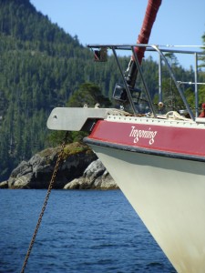
Tregoning
12 April 2024 | We are back aboard Tregoning in Mersin Marina, Mersin, Türkiye
02 April 2024 | We are in Toronto Airport, Canada: Tregoning is in Mersin Marina, Mersin, Türkiye
25 February 2024 | We are back in Gainesville, FL: Tregoning is in Mersin Marina, Mersin, Türkiye
18 February 2024 | We are in Glenwood, New Mexico: Tregoning is in Mersin Marina, Mersin, Türkiye
12 February 2024 | We are in Morro Bay, California: Tregoning is in Mersin Marina, Mersin, Türkiye
19 January 2024 | We are in Vancouver, BC Canada: Tregoning is in Mersin Marina, Mersin, Türkiye
01 January 2024 | We are in Washington State: Tregoning is in Mersin Marina, Mersin, Türkiye
15 December 2023 | We are in Minnesota: Tregoning is in Mersin Marina, Mersin, Türkiye
18 November 2023 | We are in Florida: Tregoning is in Mersin Marina, Mersin, Türkiye
29 October 2023 | We're in Florida - Tregoning is at B-dock, Mersin Marina, Mersin, Türkiye
21 October 2023 | 7 Oda Kapadokya Cave Hotel, Ürgüp, Türkiye
14 October 2023 | Hotel Aşikoğlu, Boğazkale, Türkiye
07 October 2023 | B-dock, Mersin Marina, Mersin, Türkiye
19 September 2023 | “Chez Jon & Angela”, Near Otterton, Devon, UK
14 September 2023 | Airbnb in Fortuneswell on the Isle of Portland, Dorset, UK
11 September 2023 | With Mike, Grange-over-Sands, Cumbria, UK
03 September 2023 | Ardington House, Ardington, Oxfordshire, UK
24 August 2023 | Near "Chez Joan and Peter", College of Roseisle, Moray, Scotland
11 August 2023 | Andrew's house (not exactly), Lichfield, UK
22 July 2023 | Chez Gail, near the New York Café, Budapest, Hungary
Mount Rushmore and the South Dakota Badlands
22 September 2016 | Tregoning is in Whangarei Town Basin Marina, Whangarei, New Zealand but we are in Wall, SD
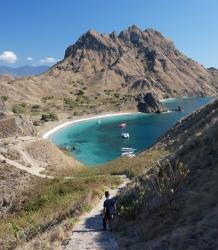
Photo: Randall carefully approaches the end of path on top of the Badland hills in South Dakota
Leaving Lake Tahoe, we passed through Carson City and then rather than aim north for Interstate 80, we continued east and had a beautiful drive in bright sunshine across Nevada on Highway 50. This mostly two-lane road is called "The Loneliest Road in America" and it did not take us long to see why. The towns were few and far between and ranches or other homes were widely scattered across the several large desert valleys separated by numerous mountain ranges towering over the valley floors. This is the heart of the Great Basin which lies between the Sierra and Rocky Mountains.
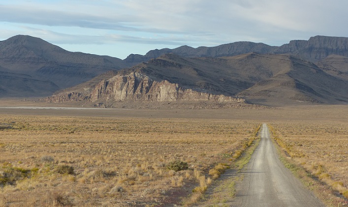
A lonely deserted side road off Highway 50 in Utah
After spending the night in Ely, NV, the second day on Highway 50 took us deep into Utah before joining Interstate 70. We had a brief pause before crossing the Green River to look over the northern edge of the San Rafael Swell, which is part of the Colorado Plateau where infrequent but powerful flash floods have eroded the sedimentary rocks into numerous valleys, canyons, gorges, mesas and buttes. With the "Little Grand Canyon" on the San Rafael River, Goblin Valley State Park, Capitol Reef National Park, Canyonlands National Park, and Arches National Park within easy driving distance off I70, this is obviously an area that we must revisit when we have more time to linger and enjoy the spectacular geological formations.
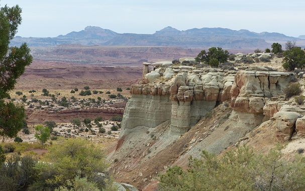
Part of the San Rafael Swell seen from I70
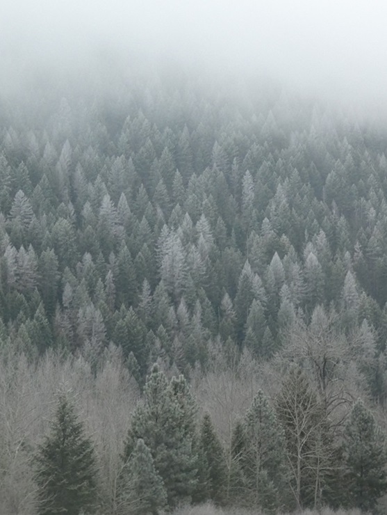
I was more familiar with I70 once it entered Colorado, having driven from Denver to Grand Junction before, but this did not diminish the magnificence of the scenery. It was especially impressive to see the autumnal colors of the aspen trees which grade from green to bright yellow, gold, and red. They particularly stood-out from the dark green of the neighboring conifers.
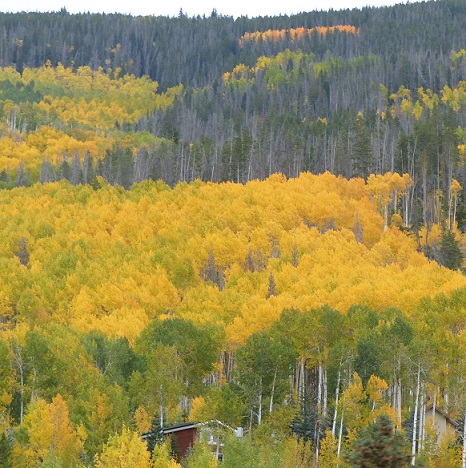
Yellow aspens in Colorado
We followed the Colorado River through the hot-springs, resort-town of Glenwood Springs, then the Eagle River and Gore Creek through Vail. We also passed Copper Mountain and in the Loveland Ski Area we crossed the Continental Divide through the Eisenhower Tunnel. This was followed by the rapid descent towards Denver along the path of Clear Creek and through many old mining towns. This Rocky Mountains part of I70 may be one my most favorite interstate/motorway-sized roads in the world.
It was wonderful to see Heather, Kaeden, and Atleigh again but our two-night stay was, of course, too brief. At least we knew that we would be back again for a longer visit just before we returned to New Zealand in November. Thus, after a day of rest (well, internet projects and an oil-change for the Pruis), we set-off towards our next destination of Duluth, Minnesota. But before reaching our other daughter, Shevaun, we had a couple of places to see in South Dakota.
After driving north on Interstate 25, we eventually turned on to Highway 18 and entered the Black Hills National Forest. I was expecting to see hills with a strange black soil or rocks but the hills were so-named because of their dark appearance from a distance, the result of being covered with trees. Eventually, we rounded one of many bends in the twisty road and found ourselves at the entrance to Mount Rushmore National Memorial, an iconic national monument that neither of us had visited before.
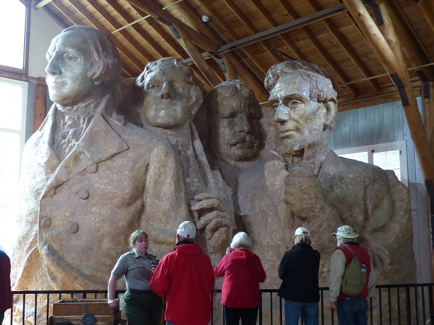
Mount Rushmore features 60-foot (18 m) sculptures of the heads of four United States presidents: from left to right they are George Washington (born 1732- died 1799), Thomas Jefferson (1743-1826), Theodore Roosevelt (1858-1919), and Abraham Lincoln (1809-1865). The original plan, suggested in 1923 by state historian Doane Robinson, was to locate the carvings in granite pillars known as the Needles. However, the Danish-American sculptor who was commissioned to work on the project, Gutzon Borglum, realized that the eroded Needles were too thin to support sculpting. He chose Mount Rushmore (5,725 feet tall or 1,745 m), a grander location, partly because it faced southeast and enjoyed maximum exposure to the sun.
Congress had authorized the Mount Rushmore National Memorial Commission on March 3, 1925 and President Coolidge insisted that, along with George Washington, two Republicans and one Democrat be portrayed. Thus, Borglum selected Jefferson, Roosevelt, and Lincoln to represent the first 130 years of American history because of their roles in preserving the Republic and expanding its territory. The four colossal carvings were sculpted by Borglum and about 400 workers between October 1927 and October 1941.
Borglum had trained with Auguste Rodin in Paris so he was skilled at portraiture and started with plaster models which were always on display on the mountain as guides for the workers although many changes were made in the final carvings. The models were scaled at a ratio of 1:12 so one inch on the model was transposed to one foot on the mountain. A pointing process was used where a metal pole was placed upright at the central point on the top of the head. A protractor at the base of this vertical pole showed the measured angle from the central axis at which a horizontal rule bar (attached to the base of the vertical pole) could be pivoted. A weighted plumb line hung from the horizontal bar and this line could be slid back and forth away from or toward the rock (a measured distance from the vertical pole) and the weight could be raised or lowered (a measured distance from the base of the vertical pole at the top of the head). Thus, two distances and one angle could define any point on the face, and measurements (made with a similar but smaller pointing device) from the plaster models could be transferred to the rock by simply multiplying the distances by 12 (angles remained the same). To give an idea of the scale of the faces, the dimensions of George Washington's head are: forehead to chin - 60 feet (18 m); width of an eye - 11 feet (3.3 m); length of nose - 20 feet (6 m); and width of mouth - 18 feet (5.5 m). If his whole body were carved in proportion to the head, the full figure would be 465 feet (142 m) tall.
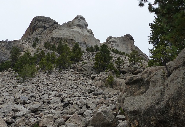
Looking across the rubble field to the base of the monument
The carving of Mount Rushmore could only be shaped by removing stone, nothing could be added, and Borglum soon realized that it had to involve the use of dynamite to produce an egg-shaped volume of rock. This was followed by the process of "honeycombing", a procedure where workers used pneumatic drills to produce holes close together at nearly the depth of the final surface, allowing small pieces to be removed by hand and using pneumatic hammers to create a smooth white surface. Working on the hard granite rock, hundreds of drill bits had to be sharpened by a blacksmith every day. In total, about 450,000 tons (410,000 tonnes) of rock were blasted off the mountainside. The image of Thomas Jefferson was originally intended to appear in the area at Washington's right, but after the work there was begun, the rock was found to be unsuitable, so the work on the Jefferson figure was dynamited, and a new figure was sculpted to Washington's left.
Borglum's attention to detail, such as smoothing the surface of the rock and the delicate carving of Roosevelt's spectacles, was what gave the sculptures their humanity. When seen closely, the pupils of the eyes appear quite strange with dark shallow recessions from which project light-colored, square shafts of granite. However, from a distance, this unlikely shape provides sparkle to the eyes, bringing the faces to life.
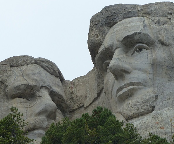
Detail of the faces of Theodore Roosevelt and Abraham Lincoln
Washington's face was completed and dedicated in 1930, while the faces of Thomas Jefferson and Abraham Lincoln were dedicated in 1936 and 1937, respectively. In 1937, a bill was introduced in Congress to add the head of civil-rights leader Susan B. Anthony, but a rider was passed on an appropriations bill requiring federal funds be used to finish only those heads that had already been started at that time. In 1939, the face of Theodore Roosevelt was dedicated. Borglum died in March 1941 so his son Lincoln supervised the completion of the heads, but work stopped in October 1941 on the eve of the entrance of the US into WWII.
Work in the Mount Rushmore National Memorial Park is ongoing, both in enhancing the supporting infrastructure of observation decks, pathways, museum, interpretive signs, etc. but also in trying to prolong the lifespan of these remarkable sculptures. Current conservation techniques include replacing sealant with waterproof silicone sealer and scanning the faces with lasers to detect minute changes in any of the dimensions.
Mount Rushmore is controversial among Native Americans because the United States seized the area from the Lakota tribe after the Great Sioux War of 1876. The Treaty of Fort Laramie from 1868 had previously granted the Black Hills to the Lakota in perpetuity. Members of the American Indian Movement led an occupation of the monument in 1971, naming it "Mount Crazy Horse". By 2004, Gerard Baker was appointed as the first Native American superintendent of the park. Baker stated that he will open up more "avenues of interpretation", and that the four presidents are "only one avenue and only one focus."
A memorial to Chief Crazy Horse is being constructed elsewhere in the Black Hills to commemorate the famous Native American leader as a response to Mount Rushmore. It is intended to be larger than Mount Rushmore and has the support of Lakota chiefs. The Crazy Horse Memorial Foundation has rejected offers of federal funds, however, this memorial is likewise the subject of controversy, even within the Native American community.
After watching an informative film about the Memorial, we walked around the loop trail that passes below the carvings and across the field of large granite rubble that was blasted off the mountainside. Passing through an exhibit about how the monument was built, it was interesting to see how much more of the upper torsos were included in the 1936 scale model that was used as the basis for the pointing process. However, variations in the rock formation did not allow the lower portions of the model to be translated to the mountainside.
The1936 scale model (1 inch to 1 foot) of the Mount Rushmore Memorial
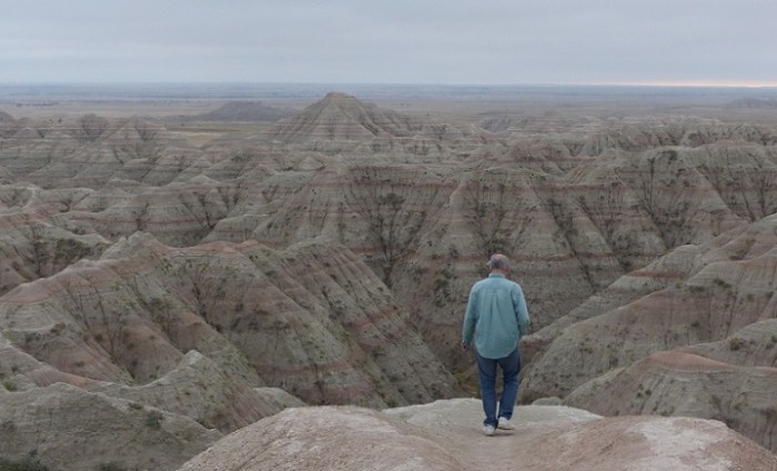
Once we could finally drag ourselves away from the captivating monument and fascinating exhibits, we headed a little further east to drive through the Badlands National Park. It was getting late in the day and with low clouds and drizzle moving in, we had to cut our visit rather short. However, we did get some sense of the sharply eroded buttes, pinnacles, and spires that characterize the Badlands, which are a type of dry terrain where softer sedimentary rocks and clay-rich soils have been extensively eroded by wind and water.
Although the Badlands typically have steep slopes and minimal vegetation, this particular example is surrounded in the Badlands National Park with the largest undisturbed mixed grass prairie in the United States. Large parts of the Park are designated as wilderness area and this is the site of the reintroduction of the black-footed ferret, the most endangered land mammal in North America. Needless to say, we did not see one.
The formation of badlands is a result of two processes: deposition and erosion. The process of deposition describes the accumulation, over time, of layers of mineral material composed of tiny grains of sediments. Different environments such as seas, rivers, or tropical zones, deposited different sorts of clays, silts, and sand at different times. The formations in the Badlands National Park, underwent a 47-million year period of deposition, resulting in clear, distinct layers of sediment with the oldest formations at the bottom and the youngest are at the top.
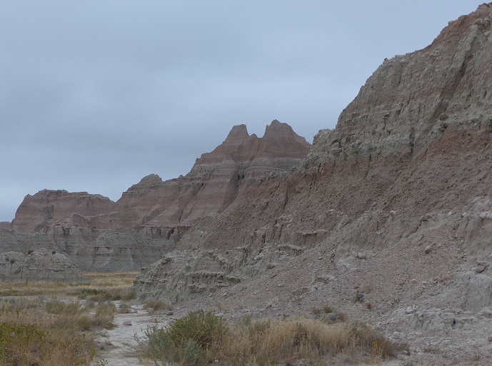
Eroding slopes in the South Dakota Badlands National Park
Before 500,000 years ago, streams and rivers carried sediments from the Black Hills into the Badlands area, building the rock layers we see today. Erosion began after that time, when the Cheyenne River captured streams and rivers flowing from the Black Hills into the Badlands region, causing erosion to dominate over deposition. Modern rivers cut down through the rock layers, carving fantastic shapes into what had once been a flat floodplain. The Badlands erode at the rapid rate of about one inch per year, although there is great variation around this average. Evidence suggests that they will erode completely away in another 500,000 years, giving them a life span of just one million years. Not a long period of time from a geologic perspective.
A lonely deserted side road off Highway 50 in Utah
After spending the night in Ely, NV, the second day on Highway 50 took us deep into Utah before joining Interstate 70. We had a brief pause before crossing the Green River to look over the northern edge of the San Rafael Swell, which is part of the Colorado Plateau where infrequent but powerful flash floods have eroded the sedimentary rocks into numerous valleys, canyons, gorges, mesas and buttes. With the "Little Grand Canyon" on the San Rafael River, Goblin Valley State Park, Capitol Reef National Park, Canyonlands National Park, and Arches National Park within easy driving distance off I70, this is obviously an area that we must revisit when we have more time to linger and enjoy the spectacular geological formations.
Part of the San Rafael Swell seen from I70
I was more familiar with I70 once it entered Colorado, having driven from Denver to Grand Junction before, but this did not diminish the magnificence of the scenery. It was especially impressive to see the autumnal colors of the aspen trees which grade from green to bright yellow, gold, and red. They particularly stood-out from the dark green of the neighboring conifers.
Yellow aspens in Colorado
We followed the Colorado River through the hot-springs, resort-town of Glenwood Springs, then the Eagle River and Gore Creek through Vail. We also passed Copper Mountain and in the Loveland Ski Area we crossed the Continental Divide through the Eisenhower Tunnel. This was followed by the rapid descent towards Denver along the path of Clear Creek and through many old mining towns. This Rocky Mountains part of I70 may be one my most favorite interstate/motorway-sized roads in the world.
It was wonderful to see Heather, Kaeden, and Atleigh again but our two-night stay was, of course, too brief. At least we knew that we would be back again for a longer visit just before we returned to New Zealand in November. Thus, after a day of rest (well, internet projects and an oil-change for the Pruis), we set-off towards our next destination of Duluth, Minnesota. But before reaching our other daughter, Shevaun, we had a couple of places to see in South Dakota.
After driving north on Interstate 25, we eventually turned on to Highway 18 and entered the Black Hills National Forest. I was expecting to see hills with a strange black soil or rocks but the hills were so-named because of their dark appearance from a distance, the result of being covered with trees. Eventually, we rounded one of many bends in the twisty road and found ourselves at the entrance to Mount Rushmore National Memorial, an iconic national monument that neither of us had visited before.
Mount Rushmore features 60-foot (18 m) sculptures of the heads of four United States presidents: from left to right they are George Washington (born 1732- died 1799), Thomas Jefferson (1743-1826), Theodore Roosevelt (1858-1919), and Abraham Lincoln (1809-1865). The original plan, suggested in 1923 by state historian Doane Robinson, was to locate the carvings in granite pillars known as the Needles. However, the Danish-American sculptor who was commissioned to work on the project, Gutzon Borglum, realized that the eroded Needles were too thin to support sculpting. He chose Mount Rushmore (5,725 feet tall or 1,745 m), a grander location, partly because it faced southeast and enjoyed maximum exposure to the sun.
Congress had authorized the Mount Rushmore National Memorial Commission on March 3, 1925 and President Coolidge insisted that, along with George Washington, two Republicans and one Democrat be portrayed. Thus, Borglum selected Jefferson, Roosevelt, and Lincoln to represent the first 130 years of American history because of their roles in preserving the Republic and expanding its territory. The four colossal carvings were sculpted by Borglum and about 400 workers between October 1927 and October 1941.
Borglum had trained with Auguste Rodin in Paris so he was skilled at portraiture and started with plaster models which were always on display on the mountain as guides for the workers although many changes were made in the final carvings. The models were scaled at a ratio of 1:12 so one inch on the model was transposed to one foot on the mountain. A pointing process was used where a metal pole was placed upright at the central point on the top of the head. A protractor at the base of this vertical pole showed the measured angle from the central axis at which a horizontal rule bar (attached to the base of the vertical pole) could be pivoted. A weighted plumb line hung from the horizontal bar and this line could be slid back and forth away from or toward the rock (a measured distance from the vertical pole) and the weight could be raised or lowered (a measured distance from the base of the vertical pole at the top of the head). Thus, two distances and one angle could define any point on the face, and measurements (made with a similar but smaller pointing device) from the plaster models could be transferred to the rock by simply multiplying the distances by 12 (angles remained the same). To give an idea of the scale of the faces, the dimensions of George Washington's head are: forehead to chin - 60 feet (18 m); width of an eye - 11 feet (3.3 m); length of nose - 20 feet (6 m); and width of mouth - 18 feet (5.5 m). If his whole body were carved in proportion to the head, the full figure would be 465 feet (142 m) tall.
Looking across the rubble field to the base of the monument
The carving of Mount Rushmore could only be shaped by removing stone, nothing could be added, and Borglum soon realized that it had to involve the use of dynamite to produce an egg-shaped volume of rock. This was followed by the process of "honeycombing", a procedure where workers used pneumatic drills to produce holes close together at nearly the depth of the final surface, allowing small pieces to be removed by hand and using pneumatic hammers to create a smooth white surface. Working on the hard granite rock, hundreds of drill bits had to be sharpened by a blacksmith every day. In total, about 450,000 tons (410,000 tonnes) of rock were blasted off the mountainside. The image of Thomas Jefferson was originally intended to appear in the area at Washington's right, but after the work there was begun, the rock was found to be unsuitable, so the work on the Jefferson figure was dynamited, and a new figure was sculpted to Washington's left.
Borglum's attention to detail, such as smoothing the surface of the rock and the delicate carving of Roosevelt's spectacles, was what gave the sculptures their humanity. When seen closely, the pupils of the eyes appear quite strange with dark shallow recessions from which project light-colored, square shafts of granite. However, from a distance, this unlikely shape provides sparkle to the eyes, bringing the faces to life.
Detail of the faces of Theodore Roosevelt and Abraham Lincoln
Washington's face was completed and dedicated in 1930, while the faces of Thomas Jefferson and Abraham Lincoln were dedicated in 1936 and 1937, respectively. In 1937, a bill was introduced in Congress to add the head of civil-rights leader Susan B. Anthony, but a rider was passed on an appropriations bill requiring federal funds be used to finish only those heads that had already been started at that time. In 1939, the face of Theodore Roosevelt was dedicated. Borglum died in March 1941 so his son Lincoln supervised the completion of the heads, but work stopped in October 1941 on the eve of the entrance of the US into WWII.
Work in the Mount Rushmore National Memorial Park is ongoing, both in enhancing the supporting infrastructure of observation decks, pathways, museum, interpretive signs, etc. but also in trying to prolong the lifespan of these remarkable sculptures. Current conservation techniques include replacing sealant with waterproof silicone sealer and scanning the faces with lasers to detect minute changes in any of the dimensions.
Mount Rushmore is controversial among Native Americans because the United States seized the area from the Lakota tribe after the Great Sioux War of 1876. The Treaty of Fort Laramie from 1868 had previously granted the Black Hills to the Lakota in perpetuity. Members of the American Indian Movement led an occupation of the monument in 1971, naming it "Mount Crazy Horse". By 2004, Gerard Baker was appointed as the first Native American superintendent of the park. Baker stated that he will open up more "avenues of interpretation", and that the four presidents are "only one avenue and only one focus."
A memorial to Chief Crazy Horse is being constructed elsewhere in the Black Hills to commemorate the famous Native American leader as a response to Mount Rushmore. It is intended to be larger than Mount Rushmore and has the support of Lakota chiefs. The Crazy Horse Memorial Foundation has rejected offers of federal funds, however, this memorial is likewise the subject of controversy, even within the Native American community.
After watching an informative film about the Memorial, we walked around the loop trail that passes below the carvings and across the field of large granite rubble that was blasted off the mountainside. Passing through an exhibit about how the monument was built, it was interesting to see how much more of the upper torsos were included in the 1936 scale model that was used as the basis for the pointing process. However, variations in the rock formation did not allow the lower portions of the model to be translated to the mountainside.
The1936 scale model (1 inch to 1 foot) of the Mount Rushmore Memorial
Once we could finally drag ourselves away from the captivating monument and fascinating exhibits, we headed a little further east to drive through the Badlands National Park. It was getting late in the day and with low clouds and drizzle moving in, we had to cut our visit rather short. However, we did get some sense of the sharply eroded buttes, pinnacles, and spires that characterize the Badlands, which are a type of dry terrain where softer sedimentary rocks and clay-rich soils have been extensively eroded by wind and water.
Although the Badlands typically have steep slopes and minimal vegetation, this particular example is surrounded in the Badlands National Park with the largest undisturbed mixed grass prairie in the United States. Large parts of the Park are designated as wilderness area and this is the site of the reintroduction of the black-footed ferret, the most endangered land mammal in North America. Needless to say, we did not see one.
The formation of badlands is a result of two processes: deposition and erosion. The process of deposition describes the accumulation, over time, of layers of mineral material composed of tiny grains of sediments. Different environments such as seas, rivers, or tropical zones, deposited different sorts of clays, silts, and sand at different times. The formations in the Badlands National Park, underwent a 47-million year period of deposition, resulting in clear, distinct layers of sediment with the oldest formations at the bottom and the youngest are at the top.
Eroding slopes in the South Dakota Badlands National Park
Before 500,000 years ago, streams and rivers carried sediments from the Black Hills into the Badlands area, building the rock layers we see today. Erosion began after that time, when the Cheyenne River captured streams and rivers flowing from the Black Hills into the Badlands region, causing erosion to dominate over deposition. Modern rivers cut down through the rock layers, carving fantastic shapes into what had once been a flat floodplain. The Badlands erode at the rapid rate of about one inch per year, although there is great variation around this average. Evidence suggests that they will erode completely away in another 500,000 years, giving them a life span of just one million years. Not a long period of time from a geologic perspective.
Comments
| Vessel Name: | Tregoning |
| Vessel Make/Model: | Morgan Classic 41 |
| Hailing Port: | Gainesville, FL |
| Crew: | Alison and Randall |
| About: | We cast-off from Fernandina Beach in north Florida on 1st June 2008 and we have been cruising on Tregoning ever since. Before buying Tregoning, both of us had been sailing on smaller boats for many years and had worked around boats and water throughout our careers. |
| Extra: | “Tregoning” (rhymes with “belonging”) and is a Cornish word (meaning “homestead of Cohnan” or “farm by the ash trees”) and was Alison's mother’s middle name. Cornwall is in southwest England and is where Alison grew-up. |
Tregoning's Photos - Main
 |
 |
 |
 |
 |
 |
 |
 |
 |
 |
 |
The Sailblogs Prequel: Adding old posts from expired blog
166 Photos
Created 26 May 2020
|
 |
 |
 |
 |
 |
 |
 |
 |
 |
 |
 |
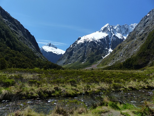 |
Extra photographs from our three-week campervan tour of the South Island from November 15th to December 5th 2015
217 Photos
Created 4 January 2016
|
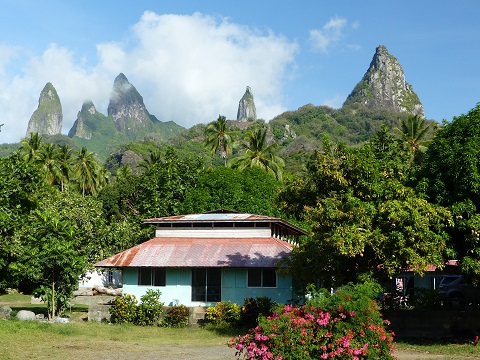 |
Random pictures from our month spent on the islands of Hiva Oa, Tahuata, Ua Pou, and Nuku Hiva
45 Photos
Created 18 July 2015
|
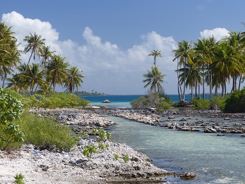 |
Random pictures from our month spent in 4 Tuamotu Atolls; Ahe, Fakarava, Tahanea, and Toau
32 Photos
Created 1 July 2015
|
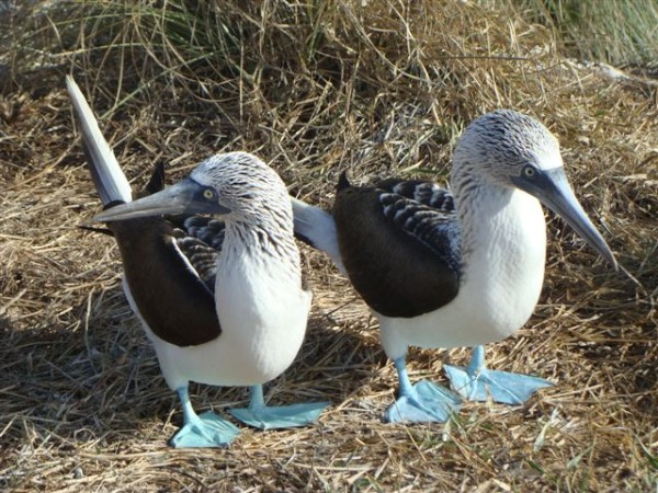 |
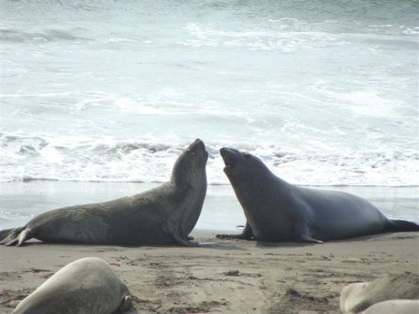
Some of the birds, fish, reptiles, and mammals (and others) that we have seen in Mexico
74 Photos
Created 5 May 2014
|
 |
Tregoning
Who: Alison and Randall
Port: Gainesville, FL
Gallery