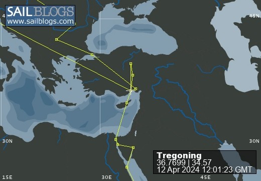
Tregoning
12 April 2024 | We are back aboard Tregoning in Mersin Marina, Mersin, Türkiye
02 April 2024 | We are in Toronto Airport, Canada: Tregoning is in Mersin Marina, Mersin, Türkiye
25 February 2024 | We are back in Gainesville, FL: Tregoning is in Mersin Marina, Mersin, Türkiye
18 February 2024 | We are in Glenwood, New Mexico: Tregoning is in Mersin Marina, Mersin, Türkiye
12 February 2024 | We are in Morro Bay, California: Tregoning is in Mersin Marina, Mersin, Türkiye
19 January 2024 | We are in Vancouver, BC Canada: Tregoning is in Mersin Marina, Mersin, Türkiye
01 January 2024 | We are in Washington State: Tregoning is in Mersin Marina, Mersin, Türkiye
15 December 2023 | We are in Minnesota: Tregoning is in Mersin Marina, Mersin, Türkiye
18 November 2023 | We are in Florida: Tregoning is in Mersin Marina, Mersin, Türkiye
29 October 2023 | We're in Florida - Tregoning is at B-dock, Mersin Marina, Mersin, Türkiye
21 October 2023 | 7 Oda Kapadokya Cave Hotel, Ürgüp, Türkiye
14 October 2023 | Hotel Aşikoğlu, Boğazkale, Türkiye
07 October 2023 | B-dock, Mersin Marina, Mersin, Türkiye
19 September 2023 | “Chez Jon & Angela”, Near Otterton, Devon, UK
14 September 2023 | Airbnb in Fortuneswell on the Isle of Portland, Dorset, UK
11 September 2023 | With Mike, Grange-over-Sands, Cumbria, UK
03 September 2023 | Ardington House, Ardington, Oxfordshire, UK
24 August 2023 | Near "Chez Joan and Peter", College of Roseisle, Moray, Scotland
11 August 2023 | Andrew's house (not exactly), Lichfield, UK
22 July 2023 | Chez Gail, near the New York Café, Budapest, Hungary
Blowholes, caves, and a multi-headed coconut tree
29 June 2017 | Anchorage off Big Mama’s Yacht Club, Pangaimotu, near Tongatapu, Tonga
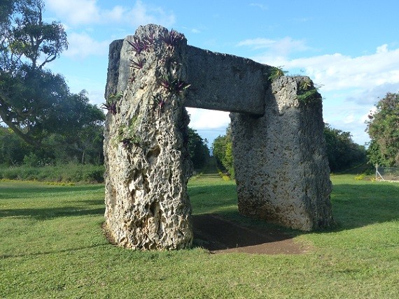
Photo: The trilithon Ha’amonga ‘a Maui with the radiating paths beyond
Having become somewhat familiar with Nuku'alofa, it was time to explore at little further afield on the island of Tongatapu. So Marisa and I paid our T$40 (US$18) each to get a tourist's driver's license (good for 3 months) and the four of us rented a car for T$40 for the day (or T$80 for 24 hours). Armed with the Lonely Planet guidebook and the Tongan tourist map, we set off to find most of the tourist attractions that are listed outside Nuku'alofa.
Remembering that Tongatapu is a relatively flat, coralline island that is triangular in shape and only about 30 km from east to west and less than 15 km north to south (18 by 9 miles), it did not seem overly ambitious to drive around the whole island in one day. A large lagoon that opens on the north coast and is in the shape of an upside-down Y, fills most of the central portion of the island, reducing the land area and interrupting the road that runs along the north coast. This is the biggest and best maintained road on the island and it detours around the edge of the lagoon and through Nuku'alofa.
On the map, there are two other east-west roads that look of similar size, one across the middle of the island and the other around the south coast. In fact, while these are sealed roads (macadam) they are much less busy, narrower, and in places not maintained at all. Many of the lateral roads (running north and south) are either dirt roads or might as well be as the macadam is well-potholed and covered with mud tracks. Most of the villages on Tongatapu are spread around the coastline or lagoon, and the interior land is mainly coconut groves and other agricultural fields or plantations. Tongatapu has a total population of around 75,000 (more than 65% of the Kingdom's population), with about a third of those people living in Nuku'alofa and the rest being scattered throughout the many, smaller villages.
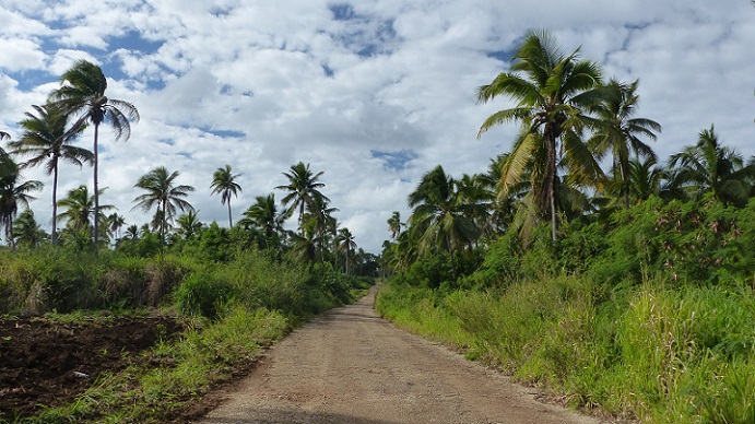
In an agricultural area, part of the middle main-road going east-west on Tongatapu
So in an area as small as this, and with so few roads, surely navigation to the half-dozen or so sites that we all wanted to visit would be easy? Well, we had been pre-warned by the crew from SV Tintin that few of the sites were signposted and they had been unable to find several of them...and this a crew that had managed to navigate all the way here from the UK. Part of the problem was that many roads were not named, either on our map or on the ground. The other issue was that without signposts announcing the attraction, it was surprisingly easy to drive past and miss the intended target completely.
Our first goal was a good example. Marisa and Bavo were particularly keen to see the multi-headed coconut tree. Curiously, some guidebooks suggest that it is a two-headed tree and others that there are three-heads. These seem an unlikely pair of numbers to find confusing, which adds to part of the tree's mystique. Most coconut trees have an unbranched trunk with a single head of palm fronds and coconuts but very rarely, perhaps due to damage of the growing tip, a trunk with have a single fork. To have two forks to make a three-headed tree is particularly unusual (likely the only one in Tonga and maybe in the whole South Pacific) so between the ambiguity of the guidebooks, the rareness of a three-headed tree, and the fact that this site was on the way to the Blow Holes on the southwest coast, made this stop a no-brainer.
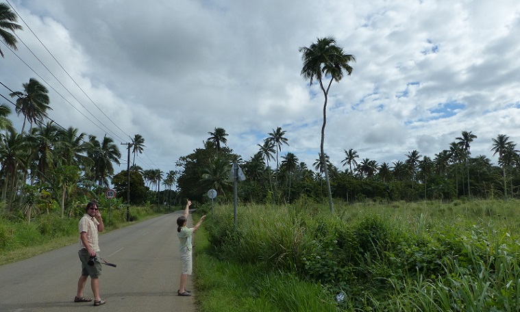
Bavo and Alison show that we have finally found the...um...two-headed coconut tree?
Except it took us about 30 minutes to find the darn tree. In the end we had to turn on our phone and use GoogleMaps to find the right road (having mistaken the main mid-island east-west road for a farm track). Then having unknowingly driven past the tree because it was on the opposite side of the road from what was marked on the tourist map, we then had to ask for directions from some locals, who pointed us back the way we had come. When we eventually did spot the tree, standing alone at the edge of a roadside field, Marisa was driven to near-hysterical laughter because after all of our effort to find it, it turned out to be tall and spindly and appeared to have only two heads. Getting out of the car and inspecting the tree from the side, however, we did see that one of the branches did branch again so that there really were three heads but there definitely were no signs to show that this was the tree, much less to explain why it was unusual.
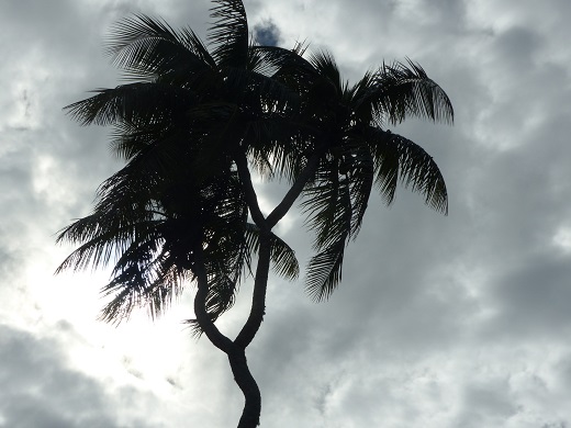
With two branches there are indeed three heads to this famous coconut tree
So why was a tree that is mentioned in every tourist book, brochure, and map so hard to find? The cynic might suggest that the taxi-drivers and other tour-guides prefer to make it difficult to explore the sights of Tongatapu without their services and local knowledge. But perhaps is it more a reflection of the Tongan's attitude to tourism in general. The Information Center produces many nice brochures and maps and there are certainly plenty of places to stay and tour-guides to serve the tourists, but one distinctly gets the impression that Tongans are slightly reluctant hosts. It is not that they are not pleased to greet you or to accept the income from tourism, but in general, Tongans give the impression that they are just not that bothered about tourists one way or the other.
There are plenty of small hotels and resorts throughout Tonga, and many may be owned by foreigners, but the big hotel chains are noticeably absent. So visitors really have to want to visit Tonga for its own sake and not simply as another tropical island nation that happens to surround the Hilton, Sofitel, or Intercontinental that is their hotel-selection for this year's winter get-away.
The exception to this is that near the Royal Palace is the Vuna cruise-ship wharf, and 14 ships are due to visit Nuku'alofa during 2017. However, none will be here during our stay so we will not get to see what the sudden addition of thousands of tourists does to Tongatapu. We assume that most people would go on bus tours of the island and we have seen several new-looking, mid-size buses funded by the Chinese, parked close to the visitors' center.
After the effort it took to find it, the coconut tree was sufficiently underwhelming to become quite the joke for us. However, our next stop at the Mapu 'a Vaea Blowholes completely exceeded expectations. Again, we had to rely on GoogleMaps to select the correct road in the village of Houma to get down to the coast. However, there was no doubt that we arrived at the best site, based on the presence of two viewing platforms, a couple of tables of souvenirs and jewelry for sale, and the steady stream of tours that stopped during our visit.

One of the viewing platforms at the blowholes with the coral ledge visible right and waves crashing all along the coastline
We were there at mid- to high-tide and in general the waves were not massive nor the wind particularly strong, but conditions were quite sufficient to put on a good show. About 30 m (100 feet) from the shoreline is a flat coralline ledge which then drops straight into the sea. The crashing of waves into this wall is in itself quite impressive, creating tall, spectacular screens of white spray. But even more intriguing are the taller, narrow spouts of spray that are forced up through narrow vents, the blowholes, in the coralline rock. The Tongan name of Mapu 'a Vaea means Chief's Whistles and it was easy to see why a chief might have spent hours in meditation at this site, mesmerized by the sight of the powerful sea and the whistling sound of the blowholes. We also saw a couple of whales cruising along the coast and we idly speculated whether they thought that the rock blowholes might be other spouting whales.
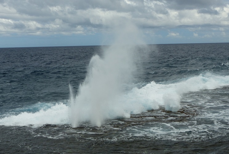
Water spouts through vents in the coral ledge at Mapu 'a Vaea
The blowholes right in front of the viewing platform are impressive enough, especially since the spouts tend to flare-up both before the main impact of a wave, and often again as the wave recedes. However, the most extraordinary aspect of this site is that blowholes and wave-spray, can be seen for 5 km along the coastline, particularly to the northwest. One or two blowholes are not that unusual (we have seen them in the Bahamas, San Andreas, and on Oahu, for example), but we had never seen a whole coastline erupting like this. It was truly awesome.

Marisa and Bavo with waves crashing on the coral ledge behind them
With such a spectacular view along the coast, it was a bit surprising that there were no resorts taking advantage of this natural show. However, in stormy conditions the coral ledge is not enough to protect structures close to the shore, and as we continued west, we stopped at the site of a former resort that had been destroyed in a storm. Resorts had survived further along the coast, where the western tip of the island bends northwards, and we stopped to look at a couple of these, including a quick visit to the charming Blue Banana Studios and Beach House accommodation.

Waves crash on the coral ledge beyond this beautiful site of a former resort
We turned around at the plaque marking the landing site of Abel Tasman in 1643. The first European to visit Tongatapu (two other Dutch explorers - Willen Schouten and Jacob Le Maire - visited the northern Niua Islands in 1616), Tasman spent a few days trading with the islanders before heading off to the Ha'apai Islands. Showing a lack of originality typical of the period and profession, Tasman named Tongatapu, "Amsterdam". Cook was the next European to visit in 1773 and he became good friends with the 30th Tu'i Tonga. He was so impressed with the welcome that he received, that he called Tonga "The Friendly Islands", a moniker with which we would not disagree. Tregoning was sitting not far from where Cook anchored but we did not stop at the plaque marking his landing place inside the lagoon.
We also skipped the Christianity Landing Place (shown on the map but we are not sure exactly who landed there but we presume the first missionaries) and the flying fox roost at Kolovai. While it is unusual for us to miss wildlife-viewing opportunities, we had seen roosts elsewhere (in American Samoa for us and Australia for Marisa and Bavo) and we saw some fruit bats flying around almost every day. Also it was time to find lunch.
Two of the royal terraced tombs or langi at Mu'a
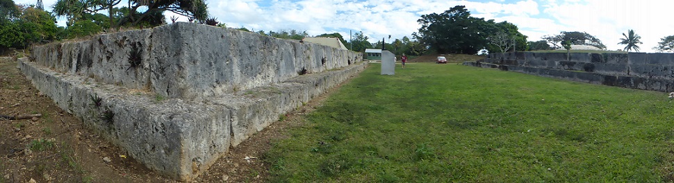
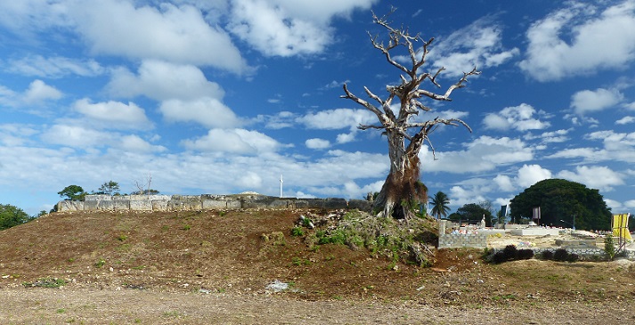
After eating in Nuku'alofa, we set off for the eastern side of Tongatapu starting with the Mu'a / Lapaha archeological site. We were sure that there would be signposts and interpretive signs at this, "the richest concentration of archeological remnants in Tonga". But we were wrong. More by luck than good directions, we turned on side roads that took us to several of the 28 royal stone tombs (langi) in the area. Built as low earthen pyramids contained within three or four levels of walls made from huge limestone/coralline slabs, these date from 1200 AD when the 11th Tu'i Tonga moved the royal capital to this area.
A terraced tomb atop an earthen mound with a modern cemetery to the right
These terraced tombs vary in size up to 50 m across and 10 m tall (165 by 33 feet) and are really quite impressive. However, not only does the site lack any interpretation but houses have been built right up to the edges of the tombs and apparently new burials have been made on the tops and around the bases of the pyramids. The new-looking graves are like those in small cemeteries all over the island, with rounded mounds of soil covered with brightly colored plastic and fabric flowers, solar-powered garden-path lights, and elaborately decorated quilts or billboards. Masonry headstones are not quite as common but when they are used, they are often quite ornate.
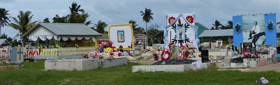
Colorful fabric flowers and banners at a cemetery on the waterfront in Nuku'alofa
Continuing along the coastal road around the northeast part of Tongatapu, we saw some of the island's infamous fishing pigs. These are no different from the pigs wandering through any other Tongan village but they specifically feed on seafood at low tide and, apparently, taste saltier than land-based pigs. Pigs generally seemed to be kept in enclosures within the town of Nuku'alofa itself although grazing in a cemetery is apparently quite acceptable.
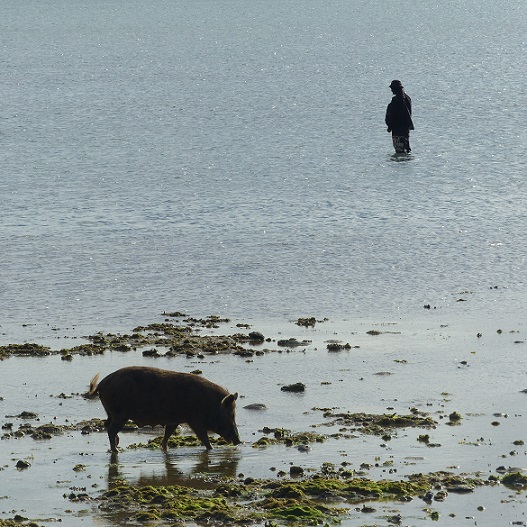
A fishing pig and a fisherman with a hand-line
Approaching the northeastern tip of Tongatapu, we watched diligently on both sides of the road to avoid missing the Ha'amonga 'a Maui, a large trilithon, but we need not have bothered. As a National Park protected area, this archeological site was actually signposted and had a parking area and toilets in addition to the tables of jewelry and souvenirs for sale. More amazingly, there were even interpretive signs to explain the history of the two huge stone structures in the area.
The Trilithon itself is called "the South Pacific's equivalent of Stonehenge" although "a part of Stonehenge" would be more accurate as there is just a single trilithic gate consisting of three massive rectangular blocks of coralline rock. The two upright stones are 5 m tall (16 feet) and each weigh about 40 tonnes (44 tons). The trilithon was erected for the prosperous and powerful 11th Tu'i Tonga, around 1200 AD, possibly as a gateway to a royal compound. In 1967, however, King Tupou IV suggested that the notch carved on the top lintel may have had significance in the lunar calendar and possibly established the beginning of a New Year. Subsequent surveys showed that two marks on the lintel line-up with the positions of the rising sun on the longest and shortest days of the year.
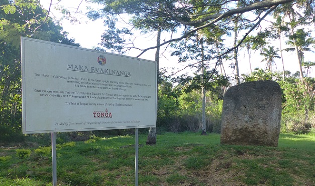
A rare interpretive sign and the Maka Fa'akinanga backrest stone
Three avenues radiating out from the trilithon have been mown and lined with border plants. It is not clear whether these mark the lines to the rising sun at the solstices and equinoxes but at the end of one of them is another large stone and sign. This is the Maka Fa'akinanga or leaning rock, which is a large upright standing-stone made from the same rock as the trilithon. Markings on one side of the slab resemble the indentations of a large head, shoulders, and back, and oral tradition suggests that to prevent assassination the 11th Tu'i Tonga sat against the stone to protect his back while using a staff to keep people a safe distance away from his front. Such chiefly backrests occur throughout Polynesia.
Continuing south along the eastern coastline of the island, we arrived (thanks to GoogleMaps) at 'Anahulu Cave. After paying T$15 each (US $7), we were assigned a guide who led us a short distance down some stairs towards the beach. Before reaching the sand, we turned inland and entered the mouth of the cave which is well-lit and traversed by a concrete path. The cave is full of stalactites and stalagmites of a bewildering array of shapes and sizes.
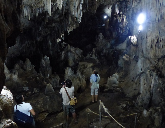
Marisa, Bavo, and Alison stare at the rock formations and swiftlets in 'Anahulu Cave
Dark creatures flitted about near the ceiling and we could hear their squeaks of echolocation so we assumed that they were small bats, but on closer inspection with our flashlights, we realized that they were white-rumped swiftlets. The only time that these birds land is to roost on their nests, which are cups of mud and plant fibers attached to the cave's walls and ceiling. Nests are usually in total darkness and the swiftlets may leave before dawn or return after dark, thanks to their ability to echolocate. This species is related to the swiftlets whose nests are plundered to make bird's nest soup, but the nests of the white-rumped swiftlet are too fibrous for such use.
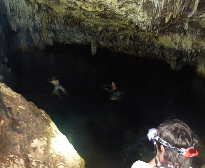
Bavo watches Alison and Marisa swim in the freshwater pool in 'Anahulu Cave
Our guide asked where we were from but his only other comment was to point-out that the freshwater pool at the end of the 100-m long path was where we could swim if so desired. He then abruptly left. We wondered if we had asked about the cave formations whether he would have been able to tell us anything more. Anyway, since this cave contains the only freshwater pools on Tongatapu, Marisa and I were not going to miss this opportunity for a swim. The water was cool and clear and with Marisa's bright headlamp, we could see to swim the length of the pool (maybe 20 m or 65 feet) while Randall and Bavo bravely stayed on the path and took photos.
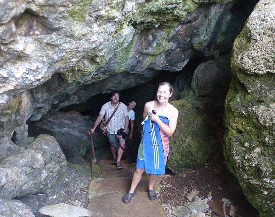
Bavo, Marisa, and Alison (with the Gator towel) leaving 'Anahulu Cave
Having arrived relatively late in the day (around 4 pm although they stay open until 7 pm), we had the place to ourselves which was rather nice but, sadly, trash stuffed in holes in the rocks just above the water surface marred any sense we might have had of swimming in a pristine pool. Apparently, the place can get pretty crowded around midday which we were quite thankful not to witness.
With the sun dipping close to the horizon, we had one last site to find, the natural land bridge or Hufangalupe Archway. So we continued southeastern along the coast road past the entrance to one of the Royal Residences and, with the aid of GoogelMaps, we found the (unmarked) dirt road (with grass down the middle) that should take us to the site. We were not exactly sure what to expect but a natural arch of some sort.
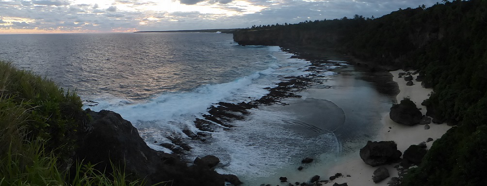
View northwest along the coast near the Hufangalupe Arch
After parking the car, we found a good view northwest along the coast, then walked to the end of vehicle tracks. Of course, nothing was signposted and we saw nothing that looked like an arch reaching out from the 20-m high cliffs (65 feet) but various caves had been eroded into the cliff beneath us. As it was getting dark and we headed back towards car, I walked down a side track and then realized that there was a big sinkhole inland of me. The roof of a sea cave worn into the cliff had collapsed and, without realizing it, I had walked onto the remaining land bridge between the sinkhole and the cliffs. At the same time, Bavo and Randall noticed the big hole to seaward of where they were standing, and they could see the sea under the arch upon which I was standing. It would have been even more interesting in the daylight but we were very pleased that we had eventually found the Hufangalupe Archway and had not just walked right past it.

The mouth of an intact sea cave in the cliffs near Hufangalupe Arch
Slumped patches of earth and vegetation at the edges of the sinkhole showed that it was not necessarily very stable so we did not step too close. I was glad that Marisa and I walked over the archway when the ground was stable. A few days earlier (early on June 26th) there had been an earthquake measuring 6.2 on the Richter scale centered just 120 nm northwest of Tongatapu. Luckily for us it do not generate a tsunami and on the boats we did not know about it until we heard it mentioned on the Gulf Harbour Radio weather report. We were concerned that there may have been damage ashore but when we visited Nuku'alofa, nobody that we asked knew anything about it. The quake was probably centered in the active volcanic area in the western Ha'apai Group of Tonga, where small islands can appear and disappear as volcanic cones rise and subside or erode, a phenomenon that makes sailing in the area somewhat hazardous. When we head north, we will probably avoid that belt and stick to the Ha'apai Islands that have been around of a while.
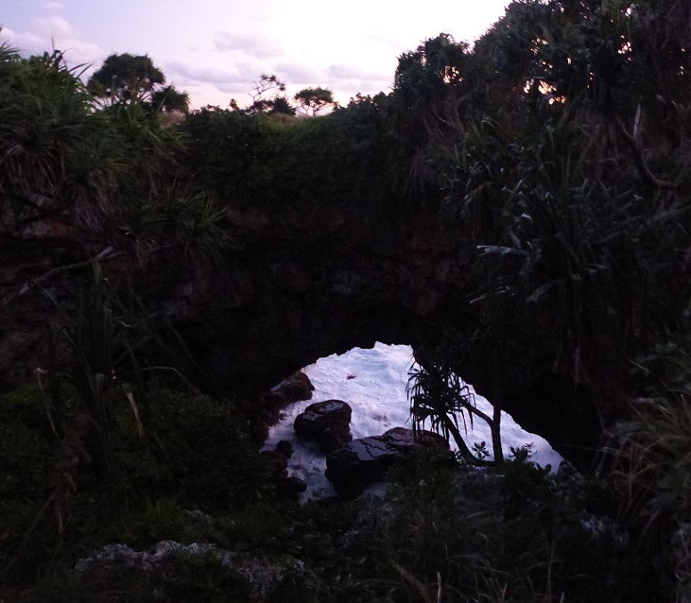
Looking seaward, waves enter the mouth of a former cave, the roof of which has fallen in and left a "natural land bridge" between the sinkhole and the outside of the cliffs
By the time we refueled the car, returned it, and rode our dinghies home, it was 8 pm, so it had been a long day. We ran out of time to buy some cases of the local Outrigger beer for Marisa and Bavo but, other than that, we had achieved everything that we wanted. The other potential sites of interest to us on Tongatapu are a small nature reserve on the far northeast corner of the island and another cave system. Since we have our driver's licenses, the rental is cheap, and we can pick-up the beer, why not plan another day of driving on Tongatapu?
Remembering that Tongatapu is a relatively flat, coralline island that is triangular in shape and only about 30 km from east to west and less than 15 km north to south (18 by 9 miles), it did not seem overly ambitious to drive around the whole island in one day. A large lagoon that opens on the north coast and is in the shape of an upside-down Y, fills most of the central portion of the island, reducing the land area and interrupting the road that runs along the north coast. This is the biggest and best maintained road on the island and it detours around the edge of the lagoon and through Nuku'alofa.
On the map, there are two other east-west roads that look of similar size, one across the middle of the island and the other around the south coast. In fact, while these are sealed roads (macadam) they are much less busy, narrower, and in places not maintained at all. Many of the lateral roads (running north and south) are either dirt roads or might as well be as the macadam is well-potholed and covered with mud tracks. Most of the villages on Tongatapu are spread around the coastline or lagoon, and the interior land is mainly coconut groves and other agricultural fields or plantations. Tongatapu has a total population of around 75,000 (more than 65% of the Kingdom's population), with about a third of those people living in Nuku'alofa and the rest being scattered throughout the many, smaller villages.
In an agricultural area, part of the middle main-road going east-west on Tongatapu
So in an area as small as this, and with so few roads, surely navigation to the half-dozen or so sites that we all wanted to visit would be easy? Well, we had been pre-warned by the crew from SV Tintin that few of the sites were signposted and they had been unable to find several of them...and this a crew that had managed to navigate all the way here from the UK. Part of the problem was that many roads were not named, either on our map or on the ground. The other issue was that without signposts announcing the attraction, it was surprisingly easy to drive past and miss the intended target completely.
Our first goal was a good example. Marisa and Bavo were particularly keen to see the multi-headed coconut tree. Curiously, some guidebooks suggest that it is a two-headed tree and others that there are three-heads. These seem an unlikely pair of numbers to find confusing, which adds to part of the tree's mystique. Most coconut trees have an unbranched trunk with a single head of palm fronds and coconuts but very rarely, perhaps due to damage of the growing tip, a trunk with have a single fork. To have two forks to make a three-headed tree is particularly unusual (likely the only one in Tonga and maybe in the whole South Pacific) so between the ambiguity of the guidebooks, the rareness of a three-headed tree, and the fact that this site was on the way to the Blow Holes on the southwest coast, made this stop a no-brainer.
Bavo and Alison show that we have finally found the...um...two-headed coconut tree?
Except it took us about 30 minutes to find the darn tree. In the end we had to turn on our phone and use GoogleMaps to find the right road (having mistaken the main mid-island east-west road for a farm track). Then having unknowingly driven past the tree because it was on the opposite side of the road from what was marked on the tourist map, we then had to ask for directions from some locals, who pointed us back the way we had come. When we eventually did spot the tree, standing alone at the edge of a roadside field, Marisa was driven to near-hysterical laughter because after all of our effort to find it, it turned out to be tall and spindly and appeared to have only two heads. Getting out of the car and inspecting the tree from the side, however, we did see that one of the branches did branch again so that there really were three heads but there definitely were no signs to show that this was the tree, much less to explain why it was unusual.
With two branches there are indeed three heads to this famous coconut tree
So why was a tree that is mentioned in every tourist book, brochure, and map so hard to find? The cynic might suggest that the taxi-drivers and other tour-guides prefer to make it difficult to explore the sights of Tongatapu without their services and local knowledge. But perhaps is it more a reflection of the Tongan's attitude to tourism in general. The Information Center produces many nice brochures and maps and there are certainly plenty of places to stay and tour-guides to serve the tourists, but one distinctly gets the impression that Tongans are slightly reluctant hosts. It is not that they are not pleased to greet you or to accept the income from tourism, but in general, Tongans give the impression that they are just not that bothered about tourists one way or the other.
There are plenty of small hotels and resorts throughout Tonga, and many may be owned by foreigners, but the big hotel chains are noticeably absent. So visitors really have to want to visit Tonga for its own sake and not simply as another tropical island nation that happens to surround the Hilton, Sofitel, or Intercontinental that is their hotel-selection for this year's winter get-away.
The exception to this is that near the Royal Palace is the Vuna cruise-ship wharf, and 14 ships are due to visit Nuku'alofa during 2017. However, none will be here during our stay so we will not get to see what the sudden addition of thousands of tourists does to Tongatapu. We assume that most people would go on bus tours of the island and we have seen several new-looking, mid-size buses funded by the Chinese, parked close to the visitors' center.
After the effort it took to find it, the coconut tree was sufficiently underwhelming to become quite the joke for us. However, our next stop at the Mapu 'a Vaea Blowholes completely exceeded expectations. Again, we had to rely on GoogleMaps to select the correct road in the village of Houma to get down to the coast. However, there was no doubt that we arrived at the best site, based on the presence of two viewing platforms, a couple of tables of souvenirs and jewelry for sale, and the steady stream of tours that stopped during our visit.
One of the viewing platforms at the blowholes with the coral ledge visible right and waves crashing all along the coastline
We were there at mid- to high-tide and in general the waves were not massive nor the wind particularly strong, but conditions were quite sufficient to put on a good show. About 30 m (100 feet) from the shoreline is a flat coralline ledge which then drops straight into the sea. The crashing of waves into this wall is in itself quite impressive, creating tall, spectacular screens of white spray. But even more intriguing are the taller, narrow spouts of spray that are forced up through narrow vents, the blowholes, in the coralline rock. The Tongan name of Mapu 'a Vaea means Chief's Whistles and it was easy to see why a chief might have spent hours in meditation at this site, mesmerized by the sight of the powerful sea and the whistling sound of the blowholes. We also saw a couple of whales cruising along the coast and we idly speculated whether they thought that the rock blowholes might be other spouting whales.
Water spouts through vents in the coral ledge at Mapu 'a Vaea
The blowholes right in front of the viewing platform are impressive enough, especially since the spouts tend to flare-up both before the main impact of a wave, and often again as the wave recedes. However, the most extraordinary aspect of this site is that blowholes and wave-spray, can be seen for 5 km along the coastline, particularly to the northwest. One or two blowholes are not that unusual (we have seen them in the Bahamas, San Andreas, and on Oahu, for example), but we had never seen a whole coastline erupting like this. It was truly awesome.
Marisa and Bavo with waves crashing on the coral ledge behind them
With such a spectacular view along the coast, it was a bit surprising that there were no resorts taking advantage of this natural show. However, in stormy conditions the coral ledge is not enough to protect structures close to the shore, and as we continued west, we stopped at the site of a former resort that had been destroyed in a storm. Resorts had survived further along the coast, where the western tip of the island bends northwards, and we stopped to look at a couple of these, including a quick visit to the charming Blue Banana Studios and Beach House accommodation.
Waves crash on the coral ledge beyond this beautiful site of a former resort
We turned around at the plaque marking the landing site of Abel Tasman in 1643. The first European to visit Tongatapu (two other Dutch explorers - Willen Schouten and Jacob Le Maire - visited the northern Niua Islands in 1616), Tasman spent a few days trading with the islanders before heading off to the Ha'apai Islands. Showing a lack of originality typical of the period and profession, Tasman named Tongatapu, "Amsterdam". Cook was the next European to visit in 1773 and he became good friends with the 30th Tu'i Tonga. He was so impressed with the welcome that he received, that he called Tonga "The Friendly Islands", a moniker with which we would not disagree. Tregoning was sitting not far from where Cook anchored but we did not stop at the plaque marking his landing place inside the lagoon.
We also skipped the Christianity Landing Place (shown on the map but we are not sure exactly who landed there but we presume the first missionaries) and the flying fox roost at Kolovai. While it is unusual for us to miss wildlife-viewing opportunities, we had seen roosts elsewhere (in American Samoa for us and Australia for Marisa and Bavo) and we saw some fruit bats flying around almost every day. Also it was time to find lunch.
Two of the royal terraced tombs or langi at Mu'a
After eating in Nuku'alofa, we set off for the eastern side of Tongatapu starting with the Mu'a / Lapaha archeological site. We were sure that there would be signposts and interpretive signs at this, "the richest concentration of archeological remnants in Tonga". But we were wrong. More by luck than good directions, we turned on side roads that took us to several of the 28 royal stone tombs (langi) in the area. Built as low earthen pyramids contained within three or four levels of walls made from huge limestone/coralline slabs, these date from 1200 AD when the 11th Tu'i Tonga moved the royal capital to this area.
A terraced tomb atop an earthen mound with a modern cemetery to the right
These terraced tombs vary in size up to 50 m across and 10 m tall (165 by 33 feet) and are really quite impressive. However, not only does the site lack any interpretation but houses have been built right up to the edges of the tombs and apparently new burials have been made on the tops and around the bases of the pyramids. The new-looking graves are like those in small cemeteries all over the island, with rounded mounds of soil covered with brightly colored plastic and fabric flowers, solar-powered garden-path lights, and elaborately decorated quilts or billboards. Masonry headstones are not quite as common but when they are used, they are often quite ornate.
Colorful fabric flowers and banners at a cemetery on the waterfront in Nuku'alofa
Continuing along the coastal road around the northeast part of Tongatapu, we saw some of the island's infamous fishing pigs. These are no different from the pigs wandering through any other Tongan village but they specifically feed on seafood at low tide and, apparently, taste saltier than land-based pigs. Pigs generally seemed to be kept in enclosures within the town of Nuku'alofa itself although grazing in a cemetery is apparently quite acceptable.
A fishing pig and a fisherman with a hand-line
Approaching the northeastern tip of Tongatapu, we watched diligently on both sides of the road to avoid missing the Ha'amonga 'a Maui, a large trilithon, but we need not have bothered. As a National Park protected area, this archeological site was actually signposted and had a parking area and toilets in addition to the tables of jewelry and souvenirs for sale. More amazingly, there were even interpretive signs to explain the history of the two huge stone structures in the area.
The Trilithon itself is called "the South Pacific's equivalent of Stonehenge" although "a part of Stonehenge" would be more accurate as there is just a single trilithic gate consisting of three massive rectangular blocks of coralline rock. The two upright stones are 5 m tall (16 feet) and each weigh about 40 tonnes (44 tons). The trilithon was erected for the prosperous and powerful 11th Tu'i Tonga, around 1200 AD, possibly as a gateway to a royal compound. In 1967, however, King Tupou IV suggested that the notch carved on the top lintel may have had significance in the lunar calendar and possibly established the beginning of a New Year. Subsequent surveys showed that two marks on the lintel line-up with the positions of the rising sun on the longest and shortest days of the year.
A rare interpretive sign and the Maka Fa'akinanga backrest stone
Three avenues radiating out from the trilithon have been mown and lined with border plants. It is not clear whether these mark the lines to the rising sun at the solstices and equinoxes but at the end of one of them is another large stone and sign. This is the Maka Fa'akinanga or leaning rock, which is a large upright standing-stone made from the same rock as the trilithon. Markings on one side of the slab resemble the indentations of a large head, shoulders, and back, and oral tradition suggests that to prevent assassination the 11th Tu'i Tonga sat against the stone to protect his back while using a staff to keep people a safe distance away from his front. Such chiefly backrests occur throughout Polynesia.
Continuing south along the eastern coastline of the island, we arrived (thanks to GoogleMaps) at 'Anahulu Cave. After paying T$15 each (US $7), we were assigned a guide who led us a short distance down some stairs towards the beach. Before reaching the sand, we turned inland and entered the mouth of the cave which is well-lit and traversed by a concrete path. The cave is full of stalactites and stalagmites of a bewildering array of shapes and sizes.
Marisa, Bavo, and Alison stare at the rock formations and swiftlets in 'Anahulu Cave
Dark creatures flitted about near the ceiling and we could hear their squeaks of echolocation so we assumed that they were small bats, but on closer inspection with our flashlights, we realized that they were white-rumped swiftlets. The only time that these birds land is to roost on their nests, which are cups of mud and plant fibers attached to the cave's walls and ceiling. Nests are usually in total darkness and the swiftlets may leave before dawn or return after dark, thanks to their ability to echolocate. This species is related to the swiftlets whose nests are plundered to make bird's nest soup, but the nests of the white-rumped swiftlet are too fibrous for such use.
Bavo watches Alison and Marisa swim in the freshwater pool in 'Anahulu Cave
Our guide asked where we were from but his only other comment was to point-out that the freshwater pool at the end of the 100-m long path was where we could swim if so desired. He then abruptly left. We wondered if we had asked about the cave formations whether he would have been able to tell us anything more. Anyway, since this cave contains the only freshwater pools on Tongatapu, Marisa and I were not going to miss this opportunity for a swim. The water was cool and clear and with Marisa's bright headlamp, we could see to swim the length of the pool (maybe 20 m or 65 feet) while Randall and Bavo bravely stayed on the path and took photos.
Bavo, Marisa, and Alison (with the Gator towel) leaving 'Anahulu Cave
Having arrived relatively late in the day (around 4 pm although they stay open until 7 pm), we had the place to ourselves which was rather nice but, sadly, trash stuffed in holes in the rocks just above the water surface marred any sense we might have had of swimming in a pristine pool. Apparently, the place can get pretty crowded around midday which we were quite thankful not to witness.
With the sun dipping close to the horizon, we had one last site to find, the natural land bridge or Hufangalupe Archway. So we continued southeastern along the coast road past the entrance to one of the Royal Residences and, with the aid of GoogelMaps, we found the (unmarked) dirt road (with grass down the middle) that should take us to the site. We were not exactly sure what to expect but a natural arch of some sort.
View northwest along the coast near the Hufangalupe Arch
After parking the car, we found a good view northwest along the coast, then walked to the end of vehicle tracks. Of course, nothing was signposted and we saw nothing that looked like an arch reaching out from the 20-m high cliffs (65 feet) but various caves had been eroded into the cliff beneath us. As it was getting dark and we headed back towards car, I walked down a side track and then realized that there was a big sinkhole inland of me. The roof of a sea cave worn into the cliff had collapsed and, without realizing it, I had walked onto the remaining land bridge between the sinkhole and the cliffs. At the same time, Bavo and Randall noticed the big hole to seaward of where they were standing, and they could see the sea under the arch upon which I was standing. It would have been even more interesting in the daylight but we were very pleased that we had eventually found the Hufangalupe Archway and had not just walked right past it.
The mouth of an intact sea cave in the cliffs near Hufangalupe Arch
Slumped patches of earth and vegetation at the edges of the sinkhole showed that it was not necessarily very stable so we did not step too close. I was glad that Marisa and I walked over the archway when the ground was stable. A few days earlier (early on June 26th) there had been an earthquake measuring 6.2 on the Richter scale centered just 120 nm northwest of Tongatapu. Luckily for us it do not generate a tsunami and on the boats we did not know about it until we heard it mentioned on the Gulf Harbour Radio weather report. We were concerned that there may have been damage ashore but when we visited Nuku'alofa, nobody that we asked knew anything about it. The quake was probably centered in the active volcanic area in the western Ha'apai Group of Tonga, where small islands can appear and disappear as volcanic cones rise and subside or erode, a phenomenon that makes sailing in the area somewhat hazardous. When we head north, we will probably avoid that belt and stick to the Ha'apai Islands that have been around of a while.
Looking seaward, waves enter the mouth of a former cave, the roof of which has fallen in and left a "natural land bridge" between the sinkhole and the outside of the cliffs
By the time we refueled the car, returned it, and rode our dinghies home, it was 8 pm, so it had been a long day. We ran out of time to buy some cases of the local Outrigger beer for Marisa and Bavo but, other than that, we had achieved everything that we wanted. The other potential sites of interest to us on Tongatapu are a small nature reserve on the far northeast corner of the island and another cave system. Since we have our driver's licenses, the rental is cheap, and we can pick-up the beer, why not plan another day of driving on Tongatapu?
Comments
| Vessel Name: | Tregoning |
| Vessel Make/Model: | Morgan Classic 41 |
| Hailing Port: | Gainesville, FL |
| Crew: | Alison and Randall |
| About: | We cast-off from Fernandina Beach in north Florida on 1st June 2008 and we have been cruising on Tregoning ever since. Before buying Tregoning, both of us had been sailing on smaller boats for many years and had worked around boats and water throughout our careers. |
| Extra: | “Tregoning” (rhymes with “belonging”) and is a Cornish word (meaning “homestead of Cohnan” or “farm by the ash trees”) and was Alison's mother’s middle name. Cornwall is in southwest England and is where Alison grew-up. |
Tregoning's Photos - Main
 |
 |
 |
 |
 |
 |
 |
 |
 |
 |
 |
The Sailblogs Prequel: Adding old posts from expired blog
166 Photos
Created 26 May 2020
|
 |
 |
 |
 |
 |
 |
 |
 |
 |
 |
 |
 |
Extra photographs from our three-week campervan tour of the South Island from November 15th to December 5th 2015
217 Photos
Created 4 January 2016
|
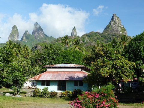 |
Random pictures from our month spent on the islands of Hiva Oa, Tahuata, Ua Pou, and Nuku Hiva
45 Photos
Created 18 July 2015
|
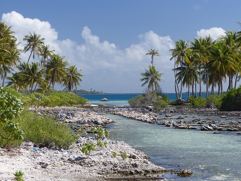 |
Random pictures from our month spent in 4 Tuamotu Atolls; Ahe, Fakarava, Tahanea, and Toau
32 Photos
Created 1 July 2015
|
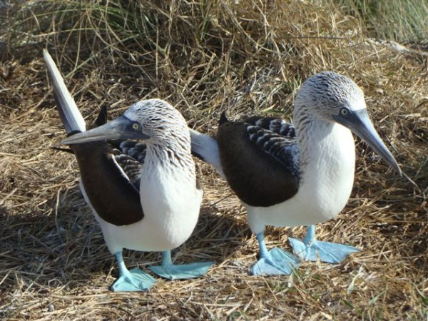 |
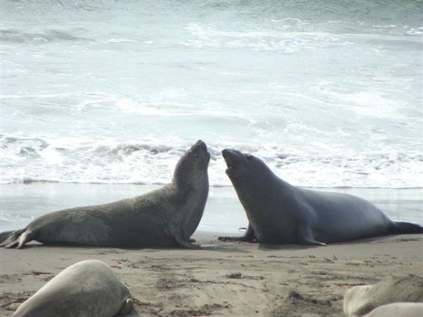
Some of the birds, fish, reptiles, and mammals (and others) that we have seen in Mexico
74 Photos
Created 5 May 2014
|
 |
Tregoning
Who: Alison and Randall
Port: Gainesville, FL
Gallery