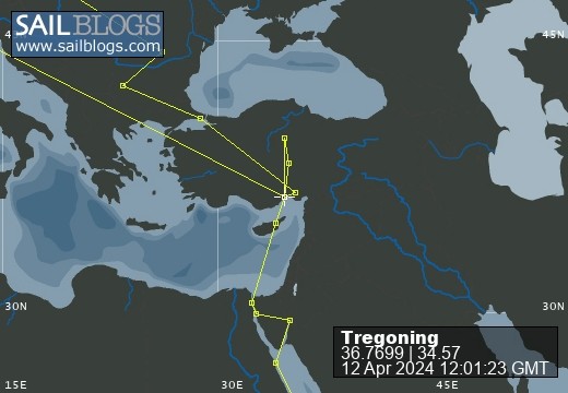
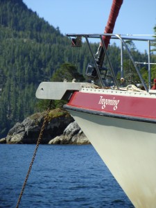
Tregoning
12 April 2024 | We are back aboard Tregoning in Mersin Marina, Mersin, Türkiye
02 April 2024 | We are in Toronto Airport, Canada: Tregoning is in Mersin Marina, Mersin, Türkiye
25 February 2024 | We are back in Gainesville, FL: Tregoning is in Mersin Marina, Mersin, Türkiye
18 February 2024 | We are in Glenwood, New Mexico: Tregoning is in Mersin Marina, Mersin, Türkiye
12 February 2024 | We are in Morro Bay, California: Tregoning is in Mersin Marina, Mersin, Türkiye
19 January 2024 | We are in Vancouver, BC Canada: Tregoning is in Mersin Marina, Mersin, Türkiye
01 January 2024 | We are in Washington State: Tregoning is in Mersin Marina, Mersin, Türkiye
15 December 2023 | We are in Minnesota: Tregoning is in Mersin Marina, Mersin, Türkiye
18 November 2023 | We are in Florida: Tregoning is in Mersin Marina, Mersin, Türkiye
29 October 2023 | We're in Florida - Tregoning is at B-dock, Mersin Marina, Mersin, Türkiye
21 October 2023 | 7 Oda Kapadokya Cave Hotel, Ürgüp, Türkiye
14 October 2023 | Hotel Aşikoğlu, Boğazkale, Türkiye
07 October 2023 | B-dock, Mersin Marina, Mersin, Türkiye
19 September 2023 | “Chez Jon & Angela”, Near Otterton, Devon, UK
14 September 2023 | Airbnb in Fortuneswell on the Isle of Portland, Dorset, UK
11 September 2023 | With Mike, Grange-over-Sands, Cumbria, UK
03 September 2023 | Ardington House, Ardington, Oxfordshire, UK
24 August 2023 | Near "Chez Joan and Peter", College of Roseisle, Moray, Scotland
11 August 2023 | Andrew's house (not exactly), Lichfield, UK
22 July 2023 | Chez Gail, near the New York Café, Budapest, Hungary
Finding a place to hide
17 August 2017 | South of Ofolanga Island, Ha’apai Group, Tonga
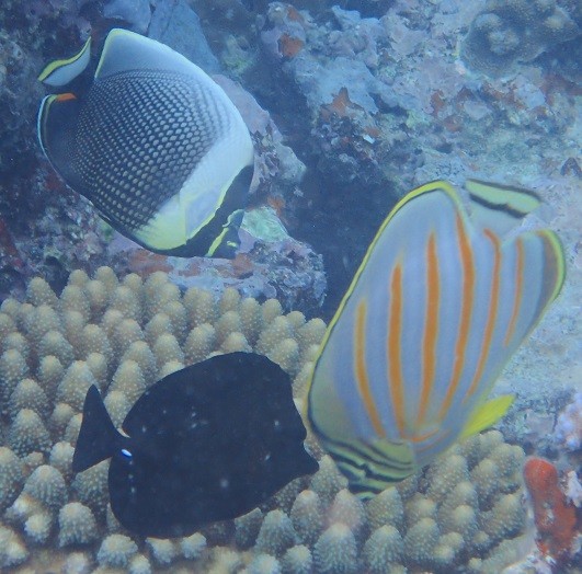
Photo: Calm underwater before the blow. Top to bottom: reticulated butterflyfish, ornate butterflyfish, and longnose tang
After much mulling over the weather forecasts, cruising guides, and charts, on Tuesday (August 15th) we left the anchorage off Pangai Village. While Kalliope and Devocean headed south to find suitable anchorages further along the Lifuka-Island-chain, we took the north-channel out from the lagoon on the west side of the long, narrow, north-south oriented Lifuka Island.
In the process, we met another boat coming in to anchor just south of the airport which runs diagonally across the north end of Lifuka Island and to the west of which a large area of shoreline-reef bulges to the west. This would make the anchorage fairly well protected from northerly waves but would put the boat on a lee-shore (wind blowing towards the shore) when the winds continued to back from northeast to northwest to west to southwest. In the forecasts, the winds were to be strongest from northeast and north during Wednesday, with possible gusts up to 35 knots, and would weaken to 15 - 25 knots during their anticlockwise swing on Wednesday night and Thursday.
We had considered this airport anchorage but instead unfurled the jib and sailed northwest to the uninhabited Ofolanga Island which is about 12 nm from Pangai. This island is much smaller than Lifuka and almost rectangular in shape with a slightly longer north-south dimension than east-west. Protection from the north is increased by fringing reefs that fan out on the east and west sides of the island. However, on the south side only a narrow line of reef separates the beach from a large area of coral-less, gently sloping sand. Randall had studied Google-Earth views of this sandy area as well as the charts and we had chosen it for several reasons.
1. The pure sand bottom (no plants, no coral-heads, no coral rubble) provides very good holding for our anchor.
2. When strong winds are coming, we (especially me) like to know that we have plenty of room in case of problems. Thus, if the anchor does start to drag in this site, we do not have to worry about a lee-shore or reef behind us (until winds turn southerly on Thursday in which case it will be time to move) nor are there coral-heads on which the anchor or chain will snag.
3. If we had to leave in the middle of the night for some reason, the entrance and exit is wide and very simple (no narrow channels between reefs).
4. The reefs to the east and west of the island will provide protection from waves from northeast to northwest.
5. Even when the wind becomes westerly, we may lose wave-protection but there will be plenty of swinging room. The lee-shore will not be too close so we can leave when we want to, not because we have to.
6. When the winds swing westerly, we can easily sail downwind back to somewhere on the Lifuka-Island-chain that will provide adequate protection from the south, possibly back to Pangai Village.
7. The southern anchorage at Ofolanga is not discussed much in the cruising-guides (it would not be comfortable in the southeasterly trade-winds) so we might have the place to ourselves which adds to the security of not having to worry about hitting, or being hit by, another boat.
The main potential downsides of this anchorage are exposure to northerly swells wrapping around the reefs or to any residual swells from the south, and the need to move once the winds become westerly to southerly. These are issues in most of the anchorages in Ha'apai, very few of which have any westerly protection, but the winds should be reduced and only last for a few hours from that direction. The Pangai Village anchorage had been blessedly free from residual swells (the long north-south chain of islands providing good protection from 0 to 180 degrees, i.e., the eastern half of the compass) so we were fully prepared to find that some swell would roll us a bit at anchor at Ofolanga.
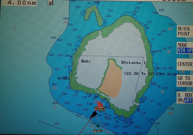
Chart of Ofolanga Island (central orange) surrounded by reef (green) and Tregoning's anchorage (red blog from which the black boat icon is moving away)
We arrived to find the place to ourselves, a luxury that allowed us to circle around several times to find the best balance of water depth and distance from the reef. As the Google-Earth images had shown, the bottom was sand with no coral-heads so we dropped the anchor in 42 feet (13 m). Soon afterwards, I snorkeled over the anchor and was very happy to see that it was deeply set in the unobstructed sand.
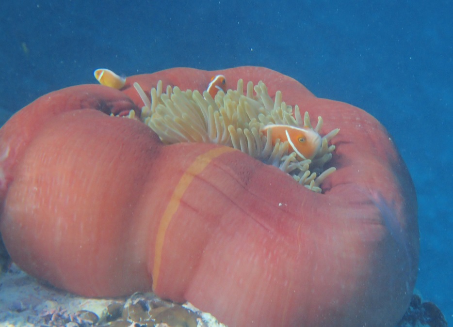
While I was in the water, I swam over to the edge of the reef that lined the southern shoreline of the island. With northeasterly waves flushing through the reef upwind of me, the water was not perfectly clear but along the sheer edge between the reef and the sandy bottom at a depth of 30-feet (9 m), there were quite a few larger fish such as emperors, parrotfish, and yellowfin surgeonfish. I enjoyed exploring the reef edge and was excited near the end to see a harem (dominant male with several females and a few lesser males) of scalefin anthias. This was my first sighting of any member of the seabass subfamily of anthias, which are small (all less than 20 cm or 8 inches and most around 11 cm or 4 inches), often brightly colored species. My tropical Pacific book lists 33 anthia species, many of which form plankton-feeding aggregations over quite deep reef slopes (often below 10 m or 33 feet deep so difficult to identify when snorkeling).
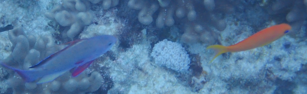
Male (left) and female scalefin anthias
One slightly odd aspect of my snorkeling venture was that despite frequently diving into deeper water than usual, I did not get particularly cold. One of our cruising guides (Ken's) had made a passing comment about the water seeming warmer at this island which he assumed was due to it being a sunny day. My snorkel was under overcast skies so this explanation did not seem to apply to me, but reading another guide (Sailingbird's) revealed that there was a volcanic vent releasing detectable heat into the sea by the Buhi Rocks which we could see on the edge of Ofolanga's western reef. It seemed surprising that I could detect it where I was on the south side of the island, but I had noted the warmer conditions before I read the guides. This information made snorkeling on the west side of the island seem rather appealing but that would only be tenable in calm conditions which were not predicted for the foreseeable future.
Amazingly, the anchorage was sufficiently protected by the eastern reef, even at high tide, so that there was very little swell when we arrived. This convinced us that, at least until the winds backed to the southwest, this would be a good place to sit-out the blow. In the evening, one of the boats that we have left at Pangai showed-up but there was plenty of room for them to the west of us. It was an Oyster so we predicted, correctly, that once the wind did come from the west, they would take-off in the direction of Vava'u. We assumed that most other cruisers in the area had gone looking for anchorages that were shallower, provided protection from more directions, and/or were closer to Pangai.
After a comfortable night, Wednesday dawned with overcast skies and a steady rain which lasted all morning. The northeasterly wind started to increase into the mid-20 knots around 10 am and did not dip below that speed for 12 hours. Remembering that we do not have a recording anemometer but have to be in the cockpit looking at the gauge to see the current wind-speed, the highest gusts that we noted were 32 knots at noon, 37.6 knots by 3 pm, and 35.9 knots by 4:30 pm. Steady winds from the northeast to north of around 30 knots must have lasted for about five hours (2 pm to 7 pm) during which time I was able to immerse myself in projects but got rather anxious when distracted by particularly strong gusts.
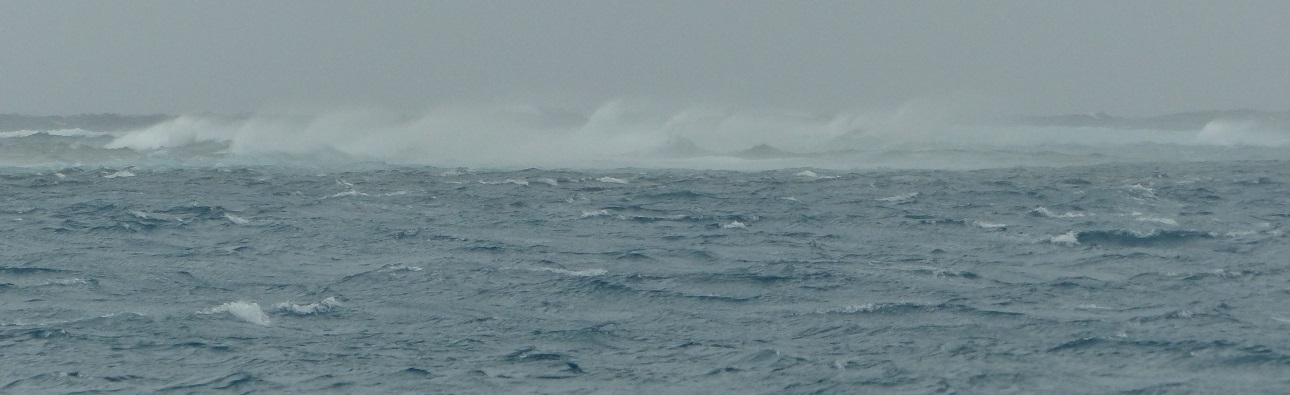
30 knots winds whip spray from waves on the sheltered side of the reef at Ofolanga Island
The wind finally eased during the evening while we were watching a movie, returning to the mid-20 knots by 9 pm. Having the anchor-alarm set on Randall's laptop was very reassuring and allowed us to check Tregoning's position on the chart and relative to the anchor at any time without leaving the cabin. It was also a refreshing change for the strongest winds to occur during daylight.
With the anchor-alarm set for the night, we did not need to take turns at anchor-watches but Randall checked the laptop at midnight and 3 am to see where Tregoning lay in relation to her anchor, thus, indicating the changing wind direction. Sure enough, by 3 am the wind was coming from the west but we still had a little protection from the waves due to the western reef.
By 5:30 am, however, sleeping was no longer an option because the swell and wind-waves from the southwest were bouncing Tregoning around quite merrily. As anticipated, we looked out to see our neighbors heading northward around the east side of Ofolanga and as it became light, we could finally see the 6 feet (2 m) swells rolling in from the southwest. Although these waves crashed rather spectacularly on the reef that was now behind Tregoning, we were a sufficient distance away that it was bouncy but not too alarming.
Still, it was not going to be tenable as an anchorage any longer. We had considered moving to outside the island's eastern reef but the Google-Earth images had shown that there was not much sand between the large ridges of coral in which to anchor. Even if that had been acceptable, once we raised the anchor and moved south and away from the shelter of the eastern reef, we found that there was still a considerable northeastern swell which would have been very uncomfortable in the southwesterly wind. So we unfurled the jib and in 15 knot winds, we gently glided over opposing northeasterly and southwesterly swells, and set-off in a southeasterly direction looking for our next place to anchor.
In the process, we met another boat coming in to anchor just south of the airport which runs diagonally across the north end of Lifuka Island and to the west of which a large area of shoreline-reef bulges to the west. This would make the anchorage fairly well protected from northerly waves but would put the boat on a lee-shore (wind blowing towards the shore) when the winds continued to back from northeast to northwest to west to southwest. In the forecasts, the winds were to be strongest from northeast and north during Wednesday, with possible gusts up to 35 knots, and would weaken to 15 - 25 knots during their anticlockwise swing on Wednesday night and Thursday.
We had considered this airport anchorage but instead unfurled the jib and sailed northwest to the uninhabited Ofolanga Island which is about 12 nm from Pangai. This island is much smaller than Lifuka and almost rectangular in shape with a slightly longer north-south dimension than east-west. Protection from the north is increased by fringing reefs that fan out on the east and west sides of the island. However, on the south side only a narrow line of reef separates the beach from a large area of coral-less, gently sloping sand. Randall had studied Google-Earth views of this sandy area as well as the charts and we had chosen it for several reasons.
1. The pure sand bottom (no plants, no coral-heads, no coral rubble) provides very good holding for our anchor.
2. When strong winds are coming, we (especially me) like to know that we have plenty of room in case of problems. Thus, if the anchor does start to drag in this site, we do not have to worry about a lee-shore or reef behind us (until winds turn southerly on Thursday in which case it will be time to move) nor are there coral-heads on which the anchor or chain will snag.
3. If we had to leave in the middle of the night for some reason, the entrance and exit is wide and very simple (no narrow channels between reefs).
4. The reefs to the east and west of the island will provide protection from waves from northeast to northwest.
5. Even when the wind becomes westerly, we may lose wave-protection but there will be plenty of swinging room. The lee-shore will not be too close so we can leave when we want to, not because we have to.
6. When the winds swing westerly, we can easily sail downwind back to somewhere on the Lifuka-Island-chain that will provide adequate protection from the south, possibly back to Pangai Village.
7. The southern anchorage at Ofolanga is not discussed much in the cruising-guides (it would not be comfortable in the southeasterly trade-winds) so we might have the place to ourselves which adds to the security of not having to worry about hitting, or being hit by, another boat.
The main potential downsides of this anchorage are exposure to northerly swells wrapping around the reefs or to any residual swells from the south, and the need to move once the winds become westerly to southerly. These are issues in most of the anchorages in Ha'apai, very few of which have any westerly protection, but the winds should be reduced and only last for a few hours from that direction. The Pangai Village anchorage had been blessedly free from residual swells (the long north-south chain of islands providing good protection from 0 to 180 degrees, i.e., the eastern half of the compass) so we were fully prepared to find that some swell would roll us a bit at anchor at Ofolanga.
Chart of Ofolanga Island (central orange) surrounded by reef (green) and Tregoning's anchorage (red blog from which the black boat icon is moving away)
We arrived to find the place to ourselves, a luxury that allowed us to circle around several times to find the best balance of water depth and distance from the reef. As the Google-Earth images had shown, the bottom was sand with no coral-heads so we dropped the anchor in 42 feet (13 m). Soon afterwards, I snorkeled over the anchor and was very happy to see that it was deeply set in the unobstructed sand.
While I was in the water, I swam over to the edge of the reef that lined the southern shoreline of the island. With northeasterly waves flushing through the reef upwind of me, the water was not perfectly clear but along the sheer edge between the reef and the sandy bottom at a depth of 30-feet (9 m), there were quite a few larger fish such as emperors, parrotfish, and yellowfin surgeonfish. I enjoyed exploring the reef edge and was excited near the end to see a harem (dominant male with several females and a few lesser males) of scalefin anthias. This was my first sighting of any member of the seabass subfamily of anthias, which are small (all less than 20 cm or 8 inches and most around 11 cm or 4 inches), often brightly colored species. My tropical Pacific book lists 33 anthia species, many of which form plankton-feeding aggregations over quite deep reef slopes (often below 10 m or 33 feet deep so difficult to identify when snorkeling).
Male (left) and female scalefin anthias
One slightly odd aspect of my snorkeling venture was that despite frequently diving into deeper water than usual, I did not get particularly cold. One of our cruising guides (Ken's) had made a passing comment about the water seeming warmer at this island which he assumed was due to it being a sunny day. My snorkel was under overcast skies so this explanation did not seem to apply to me, but reading another guide (Sailingbird's) revealed that there was a volcanic vent releasing detectable heat into the sea by the Buhi Rocks which we could see on the edge of Ofolanga's western reef. It seemed surprising that I could detect it where I was on the south side of the island, but I had noted the warmer conditions before I read the guides. This information made snorkeling on the west side of the island seem rather appealing but that would only be tenable in calm conditions which were not predicted for the foreseeable future.
Amazingly, the anchorage was sufficiently protected by the eastern reef, even at high tide, so that there was very little swell when we arrived. This convinced us that, at least until the winds backed to the southwest, this would be a good place to sit-out the blow. In the evening, one of the boats that we have left at Pangai showed-up but there was plenty of room for them to the west of us. It was an Oyster so we predicted, correctly, that once the wind did come from the west, they would take-off in the direction of Vava'u. We assumed that most other cruisers in the area had gone looking for anchorages that were shallower, provided protection from more directions, and/or were closer to Pangai.
After a comfortable night, Wednesday dawned with overcast skies and a steady rain which lasted all morning. The northeasterly wind started to increase into the mid-20 knots around 10 am and did not dip below that speed for 12 hours. Remembering that we do not have a recording anemometer but have to be in the cockpit looking at the gauge to see the current wind-speed, the highest gusts that we noted were 32 knots at noon, 37.6 knots by 3 pm, and 35.9 knots by 4:30 pm. Steady winds from the northeast to north of around 30 knots must have lasted for about five hours (2 pm to 7 pm) during which time I was able to immerse myself in projects but got rather anxious when distracted by particularly strong gusts.
30 knots winds whip spray from waves on the sheltered side of the reef at Ofolanga Island
The wind finally eased during the evening while we were watching a movie, returning to the mid-20 knots by 9 pm. Having the anchor-alarm set on Randall's laptop was very reassuring and allowed us to check Tregoning's position on the chart and relative to the anchor at any time without leaving the cabin. It was also a refreshing change for the strongest winds to occur during daylight.
With the anchor-alarm set for the night, we did not need to take turns at anchor-watches but Randall checked the laptop at midnight and 3 am to see where Tregoning lay in relation to her anchor, thus, indicating the changing wind direction. Sure enough, by 3 am the wind was coming from the west but we still had a little protection from the waves due to the western reef.
By 5:30 am, however, sleeping was no longer an option because the swell and wind-waves from the southwest were bouncing Tregoning around quite merrily. As anticipated, we looked out to see our neighbors heading northward around the east side of Ofolanga and as it became light, we could finally see the 6 feet (2 m) swells rolling in from the southwest. Although these waves crashed rather spectacularly on the reef that was now behind Tregoning, we were a sufficient distance away that it was bouncy but not too alarming.
Still, it was not going to be tenable as an anchorage any longer. We had considered moving to outside the island's eastern reef but the Google-Earth images had shown that there was not much sand between the large ridges of coral in which to anchor. Even if that had been acceptable, once we raised the anchor and moved south and away from the shelter of the eastern reef, we found that there was still a considerable northeastern swell which would have been very uncomfortable in the southwesterly wind. So we unfurled the jib and in 15 knot winds, we gently glided over opposing northeasterly and southwesterly swells, and set-off in a southeasterly direction looking for our next place to anchor.
Comments
| Vessel Name: | Tregoning |
| Vessel Make/Model: | Morgan Classic 41 |
| Hailing Port: | Gainesville, FL |
| Crew: | Alison and Randall |
| About: | We cast-off from Fernandina Beach in north Florida on 1st June 2008 and we have been cruising on Tregoning ever since. Before buying Tregoning, both of us had been sailing on smaller boats for many years and had worked around boats and water throughout our careers. |
| Extra: | “Tregoning” (rhymes with “belonging”) and is a Cornish word (meaning “homestead of Cohnan” or “farm by the ash trees”) and was Alison's mother’s middle name. Cornwall is in southwest England and is where Alison grew-up. |
Tregoning's Photos - Main
 |
 |
 |
 |
 |
 |
 |
 |
 |
 |
 |
The Sailblogs Prequel: Adding old posts from expired blog
166 Photos
Created 26 May 2020
|
 |
 |
 |
 |
 |
 |
 |
 |
 |
 |
 |
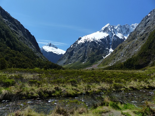 |
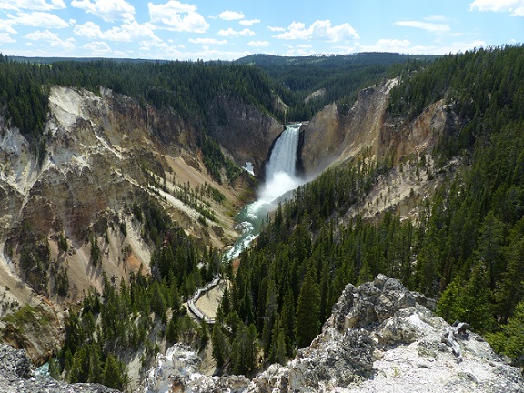
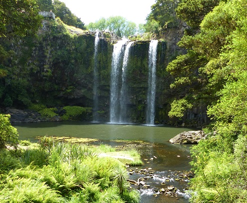
Extra photographs from our three-week campervan tour of the South Island from November 15th to December 5th 2015
217 Photos
Created 4 January 2016
|
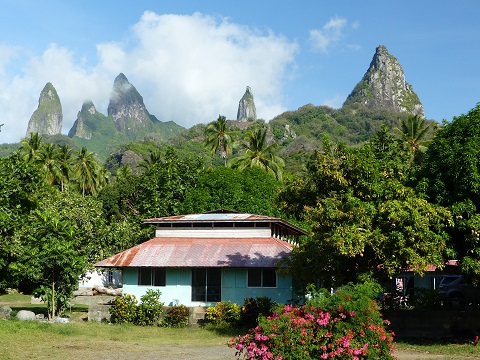 |
Random pictures from our month spent on the islands of Hiva Oa, Tahuata, Ua Pou, and Nuku Hiva
45 Photos
Created 18 July 2015
|
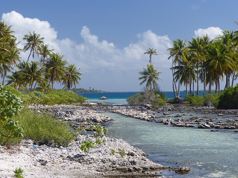 |
Random pictures from our month spent in 4 Tuamotu Atolls; Ahe, Fakarava, Tahanea, and Toau
32 Photos
Created 1 July 2015
|
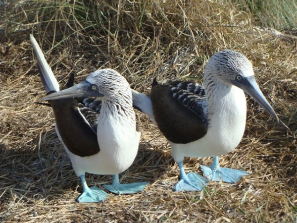 |
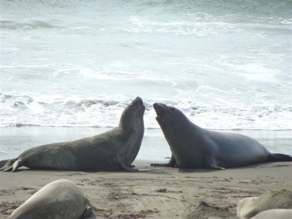
Some of the birds, fish, reptiles, and mammals (and others) that we have seen in Mexico
74 Photos
Created 5 May 2014
|
 |
Tregoning
Who: Alison and Randall
Port: Gainesville, FL
Gallery