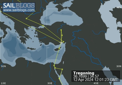
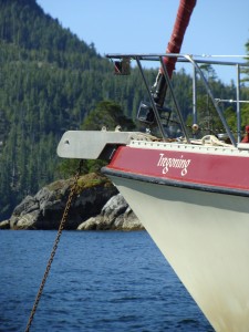
Tregoning
12 April 2024 | We are back aboard Tregoning in Mersin Marina, Mersin, Türkiye
02 April 2024 | We are in Toronto Airport, Canada: Tregoning is in Mersin Marina, Mersin, Türkiye
25 February 2024 | We are back in Gainesville, FL: Tregoning is in Mersin Marina, Mersin, Türkiye
18 February 2024 | We are in Glenwood, New Mexico: Tregoning is in Mersin Marina, Mersin, Türkiye
12 February 2024 | We are in Morro Bay, California: Tregoning is in Mersin Marina, Mersin, Türkiye
19 January 2024 | We are in Vancouver, BC Canada: Tregoning is in Mersin Marina, Mersin, Türkiye
01 January 2024 | We are in Washington State: Tregoning is in Mersin Marina, Mersin, Türkiye
15 December 2023 | We are in Minnesota: Tregoning is in Mersin Marina, Mersin, Türkiye
18 November 2023 | We are in Florida: Tregoning is in Mersin Marina, Mersin, Türkiye
29 October 2023 | We're in Florida - Tregoning is at B-dock, Mersin Marina, Mersin, Türkiye
21 October 2023 | 7 Oda Kapadokya Cave Hotel, Ürgüp, Türkiye
14 October 2023 | Hotel Aşikoğlu, Boğazkale, Türkiye
07 October 2023 | B-dock, Mersin Marina, Mersin, Türkiye
19 September 2023 | “Chez Jon & Angela”, Near Otterton, Devon, UK
14 September 2023 | Airbnb in Fortuneswell on the Isle of Portland, Dorset, UK
11 September 2023 | With Mike, Grange-over-Sands, Cumbria, UK
03 September 2023 | Ardington House, Ardington, Oxfordshire, UK
24 August 2023 | Near "Chez Joan and Peter", College of Roseisle, Moray, Scotland
11 August 2023 | Andrew's house (not exactly), Lichfield, UK
22 July 2023 | Chez Gail, near the New York Café, Budapest, Hungary
Exploring the Other Island: Savai´i
21 October 2017 | Apia Marina, `Upolu Island, Samoa
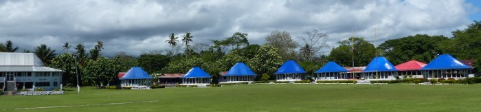
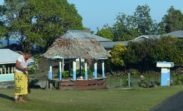
Photo: Blue-roofed fales, an iconic Samoan building, take the place of grandstands around a rugby field
Of Samoa's two major islands, although ´Upolu has a much larger population than Savai´i, 136,000 and 43,100 respectively, the latter is actually the larger landmass with an area of 1,700 sq km (663 sq miles) compared to ´Upolu's 1,115 sq km (435 sq miles). Savai´i has villages scattered all around the coastal road but no major towns. There are a few specialist stores in Salelologa, the small town where the ferry from ´Upolu arrives, but elsewhere on the island, there only appear to be small grocery stores/bakeries.
During the day, car ferries run every two hours between the main islands and on ´Upolu there is a steady stream of passengers arriving and leaving the Mulifanua Wharf on the fleet of buses that run the 30 km (18 mile) route back and forth to Apia. Many of these buses just have hard wooden seats and little suspension, so the trip can be tiring on your back but the atmosphere aboard is colorful and cheerful. Drivers usually wait until the bus is full before leaving (there are no timetables) but the ferries depart exactly on schedule so it pays to leave plenty of time to get to the wharf by bus. We left Apia so early for the 2 pm ferry departure that we actually arrived at the wharf just in time for the noon sailing, which was perhaps fortunate because the Lady Samoa III is the largest and most comfortable of the interisland ferries. We also, by complete coincidence, found ourselves sitting near Faye and Pafelio (the New Zealand/Samoan couple we met at the Taufua Beach Fales). Samoa is a small world...
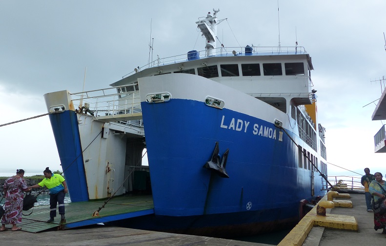
The largest of the car ferries that runs between ´Upolu and Savai´i
Savai´i bears a slight resemblance to the Big Island of Hawai´i in more than just the name. Both islands have the shape of a convex dome, virtue of their central shield volcanos, the dormant Mauna Kea on Hawai´i and the active Mount Silisili on Savai´i. The 450 volcanic cones scattered all over Savai´i (the most recent of which erupted about 110 years ago) create an interesting topography on top of this general dome-shape that is quite different from the narrow ridges and steep-sided valleys of ´Upolu, which bears more similarity to the Hawaiian islands of Kaua´i or Oahu.
After spending a pleasant night at The Savaiian Hotel (about 5 km or 2 miles north of Salelologa), we drove our rental car south to the Tafua Peninsula. This otherwise flat projection of land has a central volcanic cone, Mount Tafua Savai´i, which encloses a deep, circular crater. The cone had been clearly visible from the ferry and my bird-book for the area recommended walking through the rainforest around the crater rim as a good place to see some of Samoa's rarer endemic species.
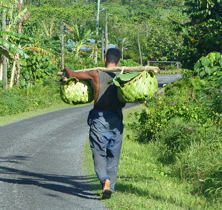
A young man carries his crop in palm-frond baskets towards the locked gate at Mount Tafua Savai´i
Following directions from our Lonely Planet Guide and from the small Visitor Information Center in Salelologa, we drove to the base of the cone where we saw a locked gate on a side road. We kept going through Tafua-tai Village and found that our road curved back through banana plantations, around the base of the cone, to bring us to the far side of the locked gate. A woman appeared from a house across the street to explain that there was no key. I assured her that we did not need a key (we could drive back the way we came) but that we were looking for the trail to the crater rim. For a 5 tala fee each, she happily gave me the directions, back up the road to the first big tree on the left, park, and follow the trail on the right.
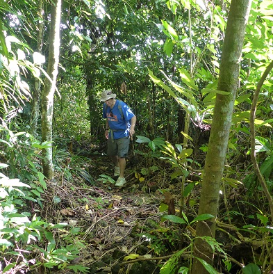
A not-so-young man (Randall) following the narrow to the crater rim
The trail was rough, narrow, and in places quite steep but it was clearly defined and soon brought us to the crater rim. The sheer far walls almost looked as though they were made of brick with a lush green mantle of vegetation starting to pour over the edge and a few large trees teetering on the rim. The bottom of the crater was full of trees and other vine-covered vegetation with no sign of human impact and no easy access down. Even though it was only mid-morning, it was hot and very humid, with the typical, slightly fermented, and peaty smell of damp tropical vegetation. We heard several different cooing calls of doves and pigeons but only got a fleeting glimpse of the large, common Pacific pigeon. Nothing looked or sounded like the rare, endemic tooth-billed pigeon that is supposed to occur here, but we did see several fruit bats flapping their way across the crater.
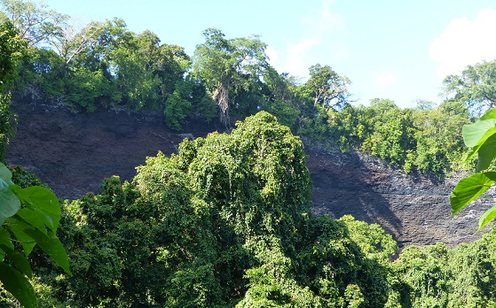
Looking across the Tafua Savai´i crater to the sheer walls on the south side
It seemed as though the trail might make the complete loop around the crater rim but it fizzled-out about two-thirds of the way around so we had to retrace our steps. It was still worth going to the higher south rim, however, because we had a good view north to the interior of Savai'i and along the eastern coast. Just before leaving the rim, we met a couple that we had seen at our hotel and who had ridden there on bicycles. They too were hoping to see the endemic birds and we compared our observations on some Samoan whistlers that had been hopping around the path, and they showed us lovely photos of Samoan broadbills (a type of flycatcher) that they had seen from their bikes. While I admired the sustainable virtues of the other couple using bicycles, on returning very hot and sweaty to our car, it was rather nice to turn on the air-conditioning.
A further opportunity to cool-down soon presented itself as we headed west along the coastal road. Up a short side-road, the Afu Aau waterfalls (a.k.a. Afu-A-Au or Olemoe falls) were a wonderfully secluded spot for a refreshing dip in crystal clear spring-water.
Having paid the modest entrance fee, we passed a couple of cascade falls before reaching the large pool and the 8-m (26-feet) high drop of the top waterfall.
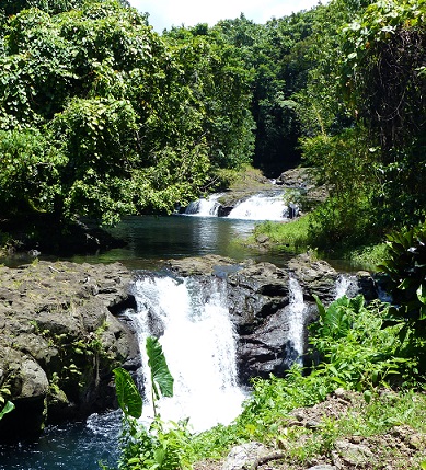
The two lower cascades of Afu Aau waterfalls
In addition to the main stream, water was flowing from small springs down parts of the driveway and in small cascades all around the edge of the main pool. The island of Savai´i is principally composed of volcanic rock that is very porous. Because of this, little of the high annual rainfall accumulates in rivers that reach the sea. Instead most rainfall permeates through the rock to form a freshwater aquifer that saturates the rocks just below sea-level and which sits atop seawater-saturated rock. Pressure from additional rain above and the seawater below, squeezes this freshwater lens, and causes freshwater to be discharged in springs all around the island's shoreline and any other low-lying areas.
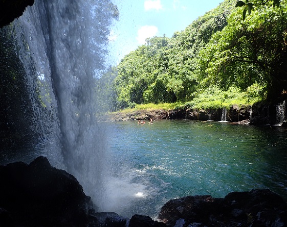
A distant group of swimmers enjoy the largest Afu Aau pool as seen from behind the highest waterfall
Along with a dozen or so other visitors, we enjoyed cavorting in the main pool although the current was strong enough to require caution near the outflow and under the main waterfall. With my mask and snorkel I was able to observe several species of small, bottom-dwelling fish and a few of the freshwater shrimp that reached a respectable 10 cm (4 inches) in length.
Another aspect of the porous nature of the volcanic rock became apparent later in the afternoon when we visited the southwest corner of Savai´i. After paying the inevitable 5 or 10 tala entrance fee, we drove along a very bumpy road just inland of a shoreline-shelf of black, volcanic rock. Having waited for high tide on a day that had a reasonable 1 to 2 m (3 to 7 feet) swell, we were treated to a pretty good show at the Alofa´aga Blowholes.
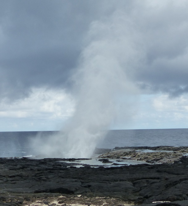
One of the Alofa´aga blowholes
The viewing platform was set further back from the blowholes than at Mapu´a Vaea on Tongatapu so that the thunderous sound and spray seemed a little less immediate, but the actual waterspouts at Alofa´aga were just as impressive and, apparently, can reach up to 40 m (130 feet) in height. They were also more diverse with water spouting in slightly different directions depending upon the wave angles and the shape of the blowholes. Although the Alofa´aga blowholes did not extend as far along the coast as they did in Tonga, the views were still striking.
Looking west from the Alofa´aga blowholes
The real disadvantage of this explosive exhibition was that the background sky was grey with rainclouds, against which the waterspouts were not as easily seen as against a clear-blue sky. While we were there, it seemed to us that there was far more rain on the southwestern, downwind side of Savai´i than on the northeastern, upwind side. Rather than being in a rain shadow, the clouds were forming on the central peak and depositing showers, of sometimes heavy rain, all along the southwestern coast.
Although it seemed a bit unfortunate that we had chosen this rainy night and location to stay in a genuine beach fale, the palm-thatch roof with its corrugated-tin covering along the apex, and woven palm louvres down the sides (overlapping panels that can be raised and lowered), was actually very dry and comfortable. Including dinner and breakfast, at 75 tala (US$30) per person, a night's accommodation at Satuiatua Beach Fales was an excellent deal and a genuine Samoan experience.
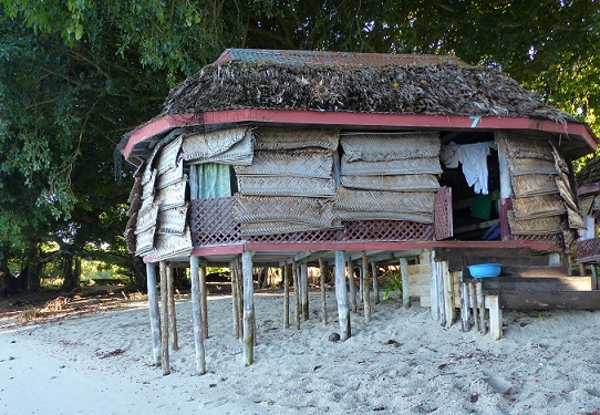
Our beach fale, with the louvres down, shaded by large fig trees at the edge of the high-tide mark
Small fales, Samoa's iconic form of beach accommodation, are available in many places and can be as basic as a wooden platform on stilts with poles supporting a thatched roof. With no walls and no beds these are suitable for day-use or at night in fine weather. Fales like ours have palm louvres (or plastic sheeting) to provide some privacy and keep out the rain, simple beds with thin mattresses, mosquito netting, and lanterns or electric lights. Communal bathrooms are situated nearby. The most expensive beach fales have wooden walls with windows (with or without glass), overhead-fans, and all of the facilities of a typical hotel room, which may include en-suite bathrooms.
Randall demonstrates how comfortable it is inside our beach fale
Fales of various sizes, complexity, and purpose are found throughout Polynesia although the name may vary, such as "fare" in French Polynesia. The basic concept is of an oval to rectangular wooden platform with a roof raised on poles. Roof materials range from palm thatch, usually with a waterproof (plastic or metal) sheet over the apex ridge, to wooden shingles, tiles, corrugated metal, and even copper sheeting, and the shapes vary from simple, low-rise, flat-surface with straight-angled designs to stylish high-domed, fully curved structures.
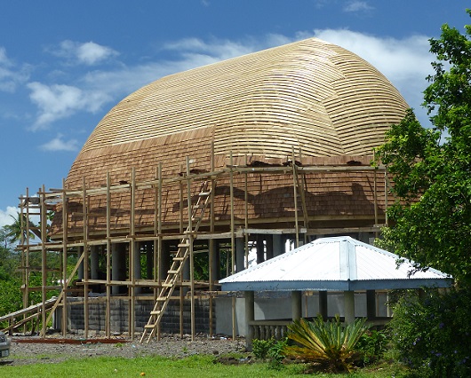
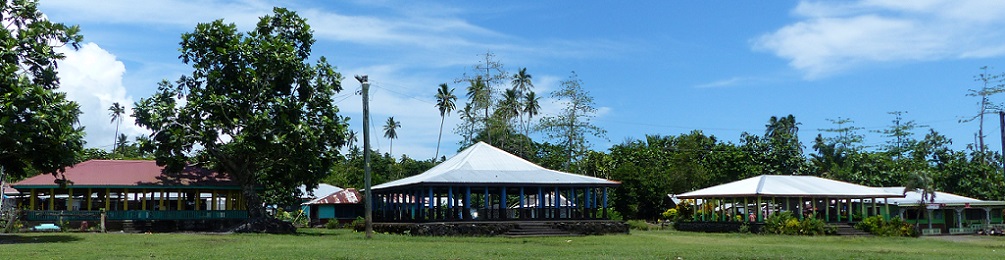
Contrasting styles of fale roof design
In addition to beach accommodation, the purposes of fales vary from simple bus shelters, to grandstands for sporting events. They may also be detached or attached living-rooms of private homes (often with no furniture but sometimes with a few chairs, etc.) or complete homes including bedding behind partitions and kitchens complete with refrigerators, etc. Bigger structures called fale fono serve a communal purpose as village meeting-houses and parliament buildings.
A small fale bus shelter (the concrete stand on the right is for rubbish)
Fales as living or communal areas associated with private homes

A small village fale fono
The Satuiatua Beach Fales were located in the shade of several large Ficus trees which not only provided important shade but also reduced the impact of the pouring rain. The small resort had a pleasant view along the beach, an attractive dining room/bar, a raised viewing platform up in a large tree, and a convenient shallow reef on which to snorkel, from which fishing was excluded. The coral was mostly a type of stags' horn and was thick and healthy. There were plenty of small fish, including quite a variety of butterflyfish. The southward flowing current was not difficult to swim against but provided an additional level of much-needed exercise.
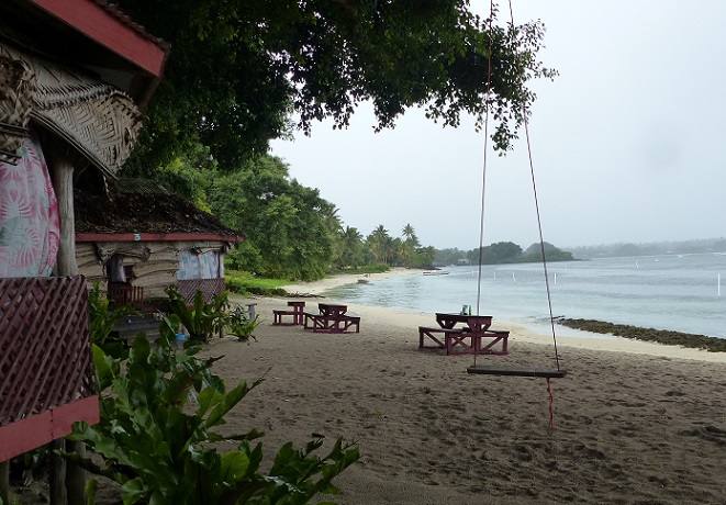
View along the beach at Satuiatua Beach Fales with white poles to right designating the protected area of reef
After breakfast in the company of a group of medical professionals from Apia who were operating a mobile family-planning clinic, we continued our clockwise, coastal drive around Savai´i. This took us past Lover's Leap which had a sign advising us that the spot was "Good for take photos and sight seen". The carefully hand-painted writing of the site's legend had unfortunately faded so all that I could decipher was that two people had leapt into sea from this high, sheer cliff and one had turned into a shark and the other into a turtle, both of which are frequently seen in the area.
We continued driving northwest to the Falealupo Peninsula where we turned left off the main road to follow a loop road to Cape Vaitoloa. Our first stop was at the Falealupo Rainforest Preserve where we each paid 20 tala to walk a short distance through the forest to the foot of a 9-m (30-feet) high metal tower. Climbing to the top, we were confronted by a narrow, 24-m (80-feet) long, suspended bridge over to a huge, 230-year old banyan tree. The base of this canopy walkway consisted of several aluminum ladders joined end to end and topped by single planks of wood. I merrily skipped across the walkway, enjoying the view down onto the tops of smaller trees, while Randall followed at a more tentative pace. He was not very impressed by the thin, flexible handrails and general wobbliness of the bridge.

Alison starts-out along the canopy walkway, heading towards the large banyan tree
On reaching the banyan tree, Randall was happy to descend immediately to the motionless forest floor while I continued climbing a series of sturdy wooden ladders that weaved through the tree's multiple trunks. This brought me to a large platform from which it was possible to see over all of the forest canopy, far inland towards Mount Silisili and out over the ocean.
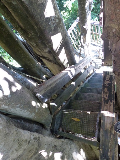
Looking down part of the stairway within the multiple trunks of the banyan tree
As at Tafua Crater, I could hear plenty of pigeons and doves but, above the canopy, I only saw the occasional Pacific pigeon, wattled honeyeaters, and Polynesian trillers. However, as we walked back to the car, we saw the vermillion flash of a cardinal myzomela, the fluttering feathers of a Samoan fantail, and, finally, high in the top of a tall tree we spotted a group of the aptly named, many-colored fruit-doves and a couple of crimson-crowned fruit-doves. The other interesting bird that we saw nearby was the endemic, flat-billed kingfisher.
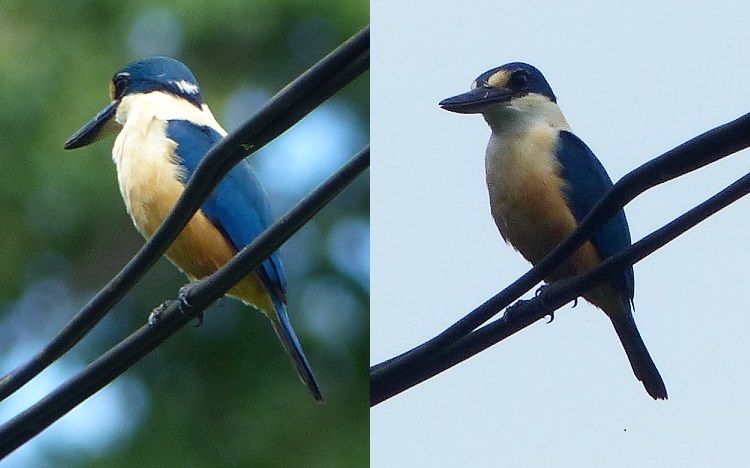
Found only in Samoa, the flat-billed kingfisher
Having been on several canopy walkways around the Pacific, it was tempting to question whether this one was worth the 20 tala (US8) entrance fee per person. However, on the assumption that someone does check the state of the stairs, tower, and walkway every so often, the fee seemed a bit more reasonable. We also regarded these fees as our way to support the local economy and in this case the support seemed particularly worthwhile.
In 1989, the Falealupo villagers had reluctantly signed a contract with a Japanese logging company in order to pay for the construction of a new primary school. An American ethnobotanist, Dr. Paul Alan Cox, who had been working with traditional healers in the area, was so moved by the weeping of the villagers at the prospect of losing of their scared rainforest, that he personally guaranteed the funding for the school. The village chief then ran 9 km (5.6 miles) through the rainforest to stop the bulldozers and the Rainforest Preserve became the first village-owed conservation area in Samoa. The construction of the canopy walkway was subsequently conceived as a sustainable source of tourist-income for the village.
Included in the Canopy Walkway ticket, was the entrance fee for a stop at Moso's Footprint. This rather underwhelming depression in the volcanic rock was supposed to have been left by the giant Moso when he stepped from Fiji to Samoa. However, the most cursory analysis of the direction and size of the print made this interpretation of past events seem just a little suspect.
The "print" of the giant's right-foot is mostly in sun to the right with the big-toe pointing to us
Continuing the loop-road around Cape Vaitoloa provided several other opportunities to support the local economy. However, we decided not to stop at the Rock House (ruins of a partially collapsed lava tube), the "blood well" (where an ancient warrior threw his enemies' severed heads), the prehistoric star mound (as found around the Samoan island and thought to be part of a pigeon-snaring sport of chiefs although possibly also sites for more complex rituals), the sacred cave that provided the gateway for souls to the next world, or the haunting ruins of the Falealupo Catholic Church. We drove past the latter site in the middle of the ruins of the original, coastal Falealupo Village which was destroyed by, and abandoned after, cyclones Ofa and Val in 1990 and 1991. The new village was built on the inland edge of the peninsula by the main, round-the-island road. The headland site is so beautiful, however, that a few families have built new houses in the old village and there are even some beach fales for those who seek some truly isolated accommodation.
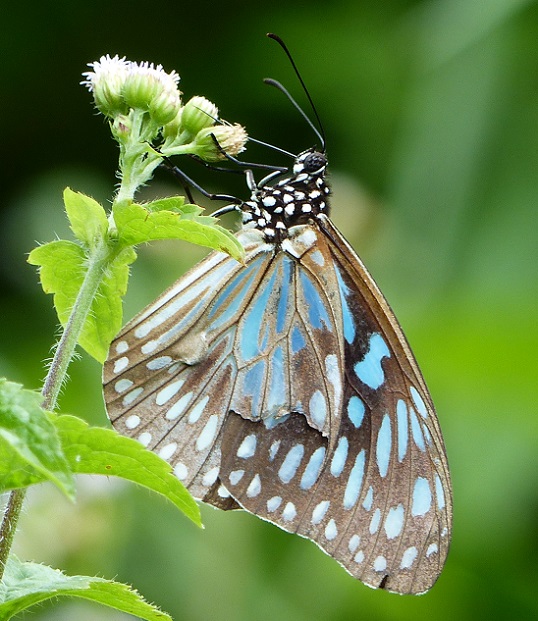
A blue tiger butterfly seen along one of the few inland roads of Savai´i
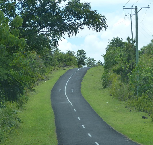
Back on the main road, we headed east along the shorelines of Vaisala and Asua Bays before the road turned southeast and inland. There are very few roads that penetrate inland on Savai´i so most of the island's montane and lowland rainforests are relatively undisturbed. Savai´i's interior includes one of the largest intact regions of tropical rainforest in Polynesia, covering more than 700 sq km (270 sq miles). The road leaves the coastline for about 25 km (16 miles), to detour around a large lava field, which makes a pleasant change of scenery.
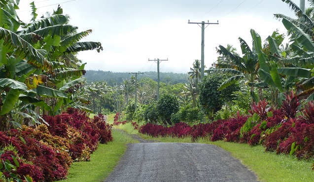
Roadside beautification including large coleus plants on one of the few inland roads of Savai´i
In, or near, most villages on Savai´i, the same attention had been paid to roadside beautification as we had seen on ´Upolu, with attractive borders of vegetation that would be recognized as common house-plants in temperate climates. Even on the more remote parts of the road, the grass verges were neatly mowed. As far as we could tell, this was not accomplished by tractor-mowers but by teams of young men wielding weed-wackers (a.k.a. string-trimmers or strimmers) for mile after mile. Since we rarely saw tall grass, in this wet, tropical climate, this labor-intensive mowing must have been repeated quite frequently.
Neatly mowed grass verges and directional arrows painted on the road in northern Savai´i
Other noticeable features along the Samoan roads were elevated stands on which garbage bags were placed. These might be made of wood, concrete, or metal and were either highly individual or painted in a uniform theme throughout a village. We were told that they were required by the Ministry of Tourism as part of an effort to reduce litter, by keeping garbage out of the reach of any roaming dogs. On the whole, Samoa did seem to be less litter-strewn than Tonga.
On the other hand, speed-limit signs were very infrequent; we counted about a dozen in the whole country. This is presumably because the rules are pretty simple. Within Apia and the villages, the speed-limit is 40 kph (25 mph) and elsewhere it is only 55 kph (35 mph). Obviously, some people exceed these limits but this was surprisingly rare in inhabited areas, and taxis in Apia had alarms warning them when they were going too fast.
Apia had many, many taxis trolling for fares especially as there were relatively few tourists at this time of year but the locals use taxis quite commonly. They are very cheap but it is important to ask the price before starting as there are no meters. Taxi stands were scattered among villages around both islands and almost all taxis were immaculate white cars or vans. Apparently, rather than going through a dealership, most new taxis are now ordered online for direct delivery from Japan. However, cheaper secondhand cars can also be bought from New Zealand and it was supposedly to accommodate these imports that in 2009 driving in Samoa was changed from the right-side of the road to the left. We assumed that it was to remind locals as well as tourist of this directionality that arrows are painted at very frequent intervals along the main Samoan roads.
The other common sight along the roads were signs in Samoan or English saying "Keep left of center line". At first we thought that these were intended to reinforce the painted arrows but we soon decided that this was actually to discourage people from driving with their right-hand wheels astride the centerline. This conspicuously common practice led to more than a few games of "chicken" with oncoming vehicles but always seems to be resolved safely in the end. Whether this drifting to the center of the road was a response to narrow lanes or poorer road conditions at the edges, we could not tell, but it was generally absent on the busier roads of Apia.
In addition to changing the road directions to match New Zealand, in 2011 Samoa changed time zones from the east to the west side of the International Date Line so that it would be on the same day as New Zealand (but one hour ahead). Samoa has maintained close ties to New Zealand since the outset of World War I. At that time, the British government persuaded the New Zealand government to seize German Samoa, in large part because of a big radio station there that enabled the Germans to communicate across the Pacific. Preoccupied in Europe, Germany had few resources to resist.
The subsequent administration of Western Samoa by New Zealand was not without problems, including a devastating (and preventable) influenza epidemic in 1919 which killed more than 7,000 people, one-fifth of the population. Calls for independence by the Mau Movement were clumsily suppressed, sometimes with violent results such as when a crowd of demonstrators were shot at in Apia in 1929. After World War II, Western Samoa became a UN Trust Territory that was administered by New Zealand but by the mid-1950s, the beginning of the end of the colonial-age in the Pacific was in sight. In 1962, Western Samoa was the first Pacific nation to achieve independence and in doing so the country's name was changed to Samoa.
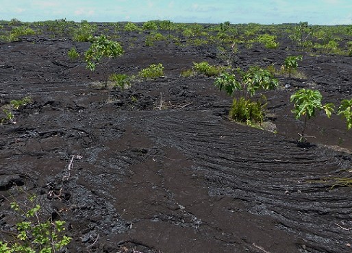
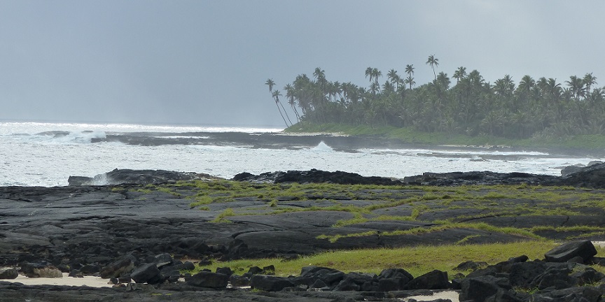
Sparsely vegetated pahoehoe lava in northeastern Savai´i
Continuing eastward, we did not stop to look at the Pe´ape´a lava tube and its population of white-rumped swiftlets, at the muddy Dwarf's Cave lava tube, or detour inland to the Mount Matavanu crater. Instead, we scurried through the popular coastal tourist-destination of Manase and crossed the moonscape of the lava field created when Mount Matavanu spewed a 10-m to 150-m (33 to 500 feet) deep flow of lava over the plantations and villages of northeastern Savai´i between 1905 and 1911.
On our final, southward drive to complete our circumnavigation, we paused for a late lunch at the upscale Amoa Resort. It was very tasty and we enjoyed our brief view of life at the opposite end of the accommodation range from basic beach fales. Our own accommodation that night was in Salelologa at Lusia's Lagoon chalets where we had a very pleasant chalet among the trees. I tried swimming in the lagoon but under a thin, cold, clear layer of spring-water, the seawater was much too milky for a snorkel to be enjoyable. However, at the dock I met a group of Peace Corps volunteers, one of whom was FaceBook friends with Peggy, whom we had met in Vava'u, Tonga. A small world indeed...
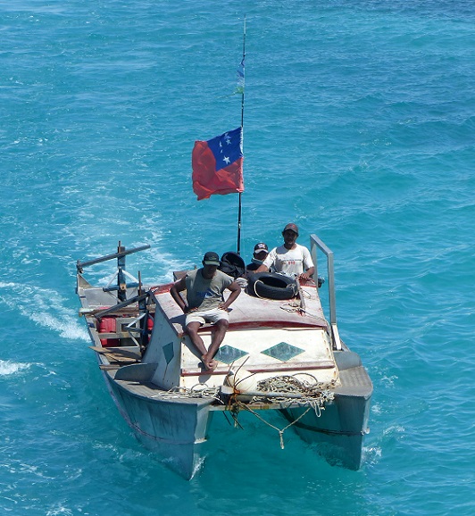
A small Samoan fishing boat following the ferry into Mulifanua Wharf
Our ferry- and bus-rides back to Apia the following day were uneventful. We returned to the marina to find that, as expected, Pied-a-Mer III and Armagh had left for American Samoa. All was well with Tregoning except that our inverter (converts 12-volt DC power 110-volt AC) was not working. Since we use this system to run the DVD player, and to charge our laptops, rechargeable batteries, and assorted tools, this was a bit frustrating. Being unable to recharge the laptops could become a real problem for downloading weather forecasts from the SSB radio at sea. Not only would we have to wait until returning to New Zealand to look at the options for repair or replacement of the inverter but, given the use of 220-volt AC there, we are likely to have to ship the equipment back and forth from the US. Luckily, however, we still have the small inverter (made for use in a car) that we bought in Jamaica and, after a bit of cleaning, we found that it still worked just fine. Thank goodness!
During the day, car ferries run every two hours between the main islands and on ´Upolu there is a steady stream of passengers arriving and leaving the Mulifanua Wharf on the fleet of buses that run the 30 km (18 mile) route back and forth to Apia. Many of these buses just have hard wooden seats and little suspension, so the trip can be tiring on your back but the atmosphere aboard is colorful and cheerful. Drivers usually wait until the bus is full before leaving (there are no timetables) but the ferries depart exactly on schedule so it pays to leave plenty of time to get to the wharf by bus. We left Apia so early for the 2 pm ferry departure that we actually arrived at the wharf just in time for the noon sailing, which was perhaps fortunate because the Lady Samoa III is the largest and most comfortable of the interisland ferries. We also, by complete coincidence, found ourselves sitting near Faye and Pafelio (the New Zealand/Samoan couple we met at the Taufua Beach Fales). Samoa is a small world...
The largest of the car ferries that runs between ´Upolu and Savai´i
Savai´i bears a slight resemblance to the Big Island of Hawai´i in more than just the name. Both islands have the shape of a convex dome, virtue of their central shield volcanos, the dormant Mauna Kea on Hawai´i and the active Mount Silisili on Savai´i. The 450 volcanic cones scattered all over Savai´i (the most recent of which erupted about 110 years ago) create an interesting topography on top of this general dome-shape that is quite different from the narrow ridges and steep-sided valleys of ´Upolu, which bears more similarity to the Hawaiian islands of Kaua´i or Oahu.
After spending a pleasant night at The Savaiian Hotel (about 5 km or 2 miles north of Salelologa), we drove our rental car south to the Tafua Peninsula. This otherwise flat projection of land has a central volcanic cone, Mount Tafua Savai´i, which encloses a deep, circular crater. The cone had been clearly visible from the ferry and my bird-book for the area recommended walking through the rainforest around the crater rim as a good place to see some of Samoa's rarer endemic species.
A young man carries his crop in palm-frond baskets towards the locked gate at Mount Tafua Savai´i
Following directions from our Lonely Planet Guide and from the small Visitor Information Center in Salelologa, we drove to the base of the cone where we saw a locked gate on a side road. We kept going through Tafua-tai Village and found that our road curved back through banana plantations, around the base of the cone, to bring us to the far side of the locked gate. A woman appeared from a house across the street to explain that there was no key. I assured her that we did not need a key (we could drive back the way we came) but that we were looking for the trail to the crater rim. For a 5 tala fee each, she happily gave me the directions, back up the road to the first big tree on the left, park, and follow the trail on the right.
A not-so-young man (Randall) following the narrow to the crater rim
The trail was rough, narrow, and in places quite steep but it was clearly defined and soon brought us to the crater rim. The sheer far walls almost looked as though they were made of brick with a lush green mantle of vegetation starting to pour over the edge and a few large trees teetering on the rim. The bottom of the crater was full of trees and other vine-covered vegetation with no sign of human impact and no easy access down. Even though it was only mid-morning, it was hot and very humid, with the typical, slightly fermented, and peaty smell of damp tropical vegetation. We heard several different cooing calls of doves and pigeons but only got a fleeting glimpse of the large, common Pacific pigeon. Nothing looked or sounded like the rare, endemic tooth-billed pigeon that is supposed to occur here, but we did see several fruit bats flapping their way across the crater.
Looking across the Tafua Savai´i crater to the sheer walls on the south side
It seemed as though the trail might make the complete loop around the crater rim but it fizzled-out about two-thirds of the way around so we had to retrace our steps. It was still worth going to the higher south rim, however, because we had a good view north to the interior of Savai'i and along the eastern coast. Just before leaving the rim, we met a couple that we had seen at our hotel and who had ridden there on bicycles. They too were hoping to see the endemic birds and we compared our observations on some Samoan whistlers that had been hopping around the path, and they showed us lovely photos of Samoan broadbills (a type of flycatcher) that they had seen from their bikes. While I admired the sustainable virtues of the other couple using bicycles, on returning very hot and sweaty to our car, it was rather nice to turn on the air-conditioning.
A further opportunity to cool-down soon presented itself as we headed west along the coastal road. Up a short side-road, the Afu Aau waterfalls (a.k.a. Afu-A-Au or Olemoe falls) were a wonderfully secluded spot for a refreshing dip in crystal clear spring-water.
Having paid the modest entrance fee, we passed a couple of cascade falls before reaching the large pool and the 8-m (26-feet) high drop of the top waterfall.
The two lower cascades of Afu Aau waterfalls
In addition to the main stream, water was flowing from small springs down parts of the driveway and in small cascades all around the edge of the main pool. The island of Savai´i is principally composed of volcanic rock that is very porous. Because of this, little of the high annual rainfall accumulates in rivers that reach the sea. Instead most rainfall permeates through the rock to form a freshwater aquifer that saturates the rocks just below sea-level and which sits atop seawater-saturated rock. Pressure from additional rain above and the seawater below, squeezes this freshwater lens, and causes freshwater to be discharged in springs all around the island's shoreline and any other low-lying areas.
A distant group of swimmers enjoy the largest Afu Aau pool as seen from behind the highest waterfall
Along with a dozen or so other visitors, we enjoyed cavorting in the main pool although the current was strong enough to require caution near the outflow and under the main waterfall. With my mask and snorkel I was able to observe several species of small, bottom-dwelling fish and a few of the freshwater shrimp that reached a respectable 10 cm (4 inches) in length.
Another aspect of the porous nature of the volcanic rock became apparent later in the afternoon when we visited the southwest corner of Savai´i. After paying the inevitable 5 or 10 tala entrance fee, we drove along a very bumpy road just inland of a shoreline-shelf of black, volcanic rock. Having waited for high tide on a day that had a reasonable 1 to 2 m (3 to 7 feet) swell, we were treated to a pretty good show at the Alofa´aga Blowholes.
One of the Alofa´aga blowholes
The viewing platform was set further back from the blowholes than at Mapu´a Vaea on Tongatapu so that the thunderous sound and spray seemed a little less immediate, but the actual waterspouts at Alofa´aga were just as impressive and, apparently, can reach up to 40 m (130 feet) in height. They were also more diverse with water spouting in slightly different directions depending upon the wave angles and the shape of the blowholes. Although the Alofa´aga blowholes did not extend as far along the coast as they did in Tonga, the views were still striking.
Looking west from the Alofa´aga blowholes
The real disadvantage of this explosive exhibition was that the background sky was grey with rainclouds, against which the waterspouts were not as easily seen as against a clear-blue sky. While we were there, it seemed to us that there was far more rain on the southwestern, downwind side of Savai´i than on the northeastern, upwind side. Rather than being in a rain shadow, the clouds were forming on the central peak and depositing showers, of sometimes heavy rain, all along the southwestern coast.
Although it seemed a bit unfortunate that we had chosen this rainy night and location to stay in a genuine beach fale, the palm-thatch roof with its corrugated-tin covering along the apex, and woven palm louvres down the sides (overlapping panels that can be raised and lowered), was actually very dry and comfortable. Including dinner and breakfast, at 75 tala (US$30) per person, a night's accommodation at Satuiatua Beach Fales was an excellent deal and a genuine Samoan experience.
Our beach fale, with the louvres down, shaded by large fig trees at the edge of the high-tide mark
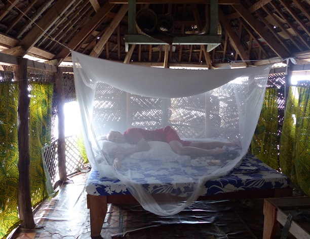
Small fales, Samoa's iconic form of beach accommodation, are available in many places and can be as basic as a wooden platform on stilts with poles supporting a thatched roof. With no walls and no beds these are suitable for day-use or at night in fine weather. Fales like ours have palm louvres (or plastic sheeting) to provide some privacy and keep out the rain, simple beds with thin mattresses, mosquito netting, and lanterns or electric lights. Communal bathrooms are situated nearby. The most expensive beach fales have wooden walls with windows (with or without glass), overhead-fans, and all of the facilities of a typical hotel room, which may include en-suite bathrooms.
Randall demonstrates how comfortable it is inside our beach fale
Fales of various sizes, complexity, and purpose are found throughout Polynesia although the name may vary, such as "fare" in French Polynesia. The basic concept is of an oval to rectangular wooden platform with a roof raised on poles. Roof materials range from palm thatch, usually with a waterproof (plastic or metal) sheet over the apex ridge, to wooden shingles, tiles, corrugated metal, and even copper sheeting, and the shapes vary from simple, low-rise, flat-surface with straight-angled designs to stylish high-domed, fully curved structures.
Contrasting styles of fale roof design
In addition to beach accommodation, the purposes of fales vary from simple bus shelters, to grandstands for sporting events. They may also be detached or attached living-rooms of private homes (often with no furniture but sometimes with a few chairs, etc.) or complete homes including bedding behind partitions and kitchens complete with refrigerators, etc. Bigger structures called fale fono serve a communal purpose as village meeting-houses and parliament buildings.
A small fale bus shelter (the concrete stand on the right is for rubbish)
Fales as living or communal areas associated with private homes
A small village fale fono
The Satuiatua Beach Fales were located in the shade of several large Ficus trees which not only provided important shade but also reduced the impact of the pouring rain. The small resort had a pleasant view along the beach, an attractive dining room/bar, a raised viewing platform up in a large tree, and a convenient shallow reef on which to snorkel, from which fishing was excluded. The coral was mostly a type of stags' horn and was thick and healthy. There were plenty of small fish, including quite a variety of butterflyfish. The southward flowing current was not difficult to swim against but provided an additional level of much-needed exercise.
View along the beach at Satuiatua Beach Fales with white poles to right designating the protected area of reef
After breakfast in the company of a group of medical professionals from Apia who were operating a mobile family-planning clinic, we continued our clockwise, coastal drive around Savai´i. This took us past Lover's Leap which had a sign advising us that the spot was "Good for take photos and sight seen". The carefully hand-painted writing of the site's legend had unfortunately faded so all that I could decipher was that two people had leapt into sea from this high, sheer cliff and one had turned into a shark and the other into a turtle, both of which are frequently seen in the area.
We continued driving northwest to the Falealupo Peninsula where we turned left off the main road to follow a loop road to Cape Vaitoloa. Our first stop was at the Falealupo Rainforest Preserve where we each paid 20 tala to walk a short distance through the forest to the foot of a 9-m (30-feet) high metal tower. Climbing to the top, we were confronted by a narrow, 24-m (80-feet) long, suspended bridge over to a huge, 230-year old banyan tree. The base of this canopy walkway consisted of several aluminum ladders joined end to end and topped by single planks of wood. I merrily skipped across the walkway, enjoying the view down onto the tops of smaller trees, while Randall followed at a more tentative pace. He was not very impressed by the thin, flexible handrails and general wobbliness of the bridge.
Alison starts-out along the canopy walkway, heading towards the large banyan tree
On reaching the banyan tree, Randall was happy to descend immediately to the motionless forest floor while I continued climbing a series of sturdy wooden ladders that weaved through the tree's multiple trunks. This brought me to a large platform from which it was possible to see over all of the forest canopy, far inland towards Mount Silisili and out over the ocean.
Looking down part of the stairway within the multiple trunks of the banyan tree
As at Tafua Crater, I could hear plenty of pigeons and doves but, above the canopy, I only saw the occasional Pacific pigeon, wattled honeyeaters, and Polynesian trillers. However, as we walked back to the car, we saw the vermillion flash of a cardinal myzomela, the fluttering feathers of a Samoan fantail, and, finally, high in the top of a tall tree we spotted a group of the aptly named, many-colored fruit-doves and a couple of crimson-crowned fruit-doves. The other interesting bird that we saw nearby was the endemic, flat-billed kingfisher.
Found only in Samoa, the flat-billed kingfisher
Having been on several canopy walkways around the Pacific, it was tempting to question whether this one was worth the 20 tala (US8) entrance fee per person. However, on the assumption that someone does check the state of the stairs, tower, and walkway every so often, the fee seemed a bit more reasonable. We also regarded these fees as our way to support the local economy and in this case the support seemed particularly worthwhile.
In 1989, the Falealupo villagers had reluctantly signed a contract with a Japanese logging company in order to pay for the construction of a new primary school. An American ethnobotanist, Dr. Paul Alan Cox, who had been working with traditional healers in the area, was so moved by the weeping of the villagers at the prospect of losing of their scared rainforest, that he personally guaranteed the funding for the school. The village chief then ran 9 km (5.6 miles) through the rainforest to stop the bulldozers and the Rainforest Preserve became the first village-owed conservation area in Samoa. The construction of the canopy walkway was subsequently conceived as a sustainable source of tourist-income for the village.
Included in the Canopy Walkway ticket, was the entrance fee for a stop at Moso's Footprint. This rather underwhelming depression in the volcanic rock was supposed to have been left by the giant Moso when he stepped from Fiji to Samoa. However, the most cursory analysis of the direction and size of the print made this interpretation of past events seem just a little suspect.
The "print" of the giant's right-foot is mostly in sun to the right with the big-toe pointing to us
Continuing the loop-road around Cape Vaitoloa provided several other opportunities to support the local economy. However, we decided not to stop at the Rock House (ruins of a partially collapsed lava tube), the "blood well" (where an ancient warrior threw his enemies' severed heads), the prehistoric star mound (as found around the Samoan island and thought to be part of a pigeon-snaring sport of chiefs although possibly also sites for more complex rituals), the sacred cave that provided the gateway for souls to the next world, or the haunting ruins of the Falealupo Catholic Church. We drove past the latter site in the middle of the ruins of the original, coastal Falealupo Village which was destroyed by, and abandoned after, cyclones Ofa and Val in 1990 and 1991. The new village was built on the inland edge of the peninsula by the main, round-the-island road. The headland site is so beautiful, however, that a few families have built new houses in the old village and there are even some beach fales for those who seek some truly isolated accommodation.
A blue tiger butterfly seen along one of the few inland roads of Savai´i
Back on the main road, we headed east along the shorelines of Vaisala and Asua Bays before the road turned southeast and inland. There are very few roads that penetrate inland on Savai´i so most of the island's montane and lowland rainforests are relatively undisturbed. Savai´i's interior includes one of the largest intact regions of tropical rainforest in Polynesia, covering more than 700 sq km (270 sq miles). The road leaves the coastline for about 25 km (16 miles), to detour around a large lava field, which makes a pleasant change of scenery.
Roadside beautification including large coleus plants on one of the few inland roads of Savai´i
In, or near, most villages on Savai´i, the same attention had been paid to roadside beautification as we had seen on ´Upolu, with attractive borders of vegetation that would be recognized as common house-plants in temperate climates. Even on the more remote parts of the road, the grass verges were neatly mowed. As far as we could tell, this was not accomplished by tractor-mowers but by teams of young men wielding weed-wackers (a.k.a. string-trimmers or strimmers) for mile after mile. Since we rarely saw tall grass, in this wet, tropical climate, this labor-intensive mowing must have been repeated quite frequently.
Neatly mowed grass verges and directional arrows painted on the road in northern Savai´i
Other noticeable features along the Samoan roads were elevated stands on which garbage bags were placed. These might be made of wood, concrete, or metal and were either highly individual or painted in a uniform theme throughout a village. We were told that they were required by the Ministry of Tourism as part of an effort to reduce litter, by keeping garbage out of the reach of any roaming dogs. On the whole, Samoa did seem to be less litter-strewn than Tonga.
On the other hand, speed-limit signs were very infrequent; we counted about a dozen in the whole country. This is presumably because the rules are pretty simple. Within Apia and the villages, the speed-limit is 40 kph (25 mph) and elsewhere it is only 55 kph (35 mph). Obviously, some people exceed these limits but this was surprisingly rare in inhabited areas, and taxis in Apia had alarms warning them when they were going too fast.
Apia had many, many taxis trolling for fares especially as there were relatively few tourists at this time of year but the locals use taxis quite commonly. They are very cheap but it is important to ask the price before starting as there are no meters. Taxi stands were scattered among villages around both islands and almost all taxis were immaculate white cars or vans. Apparently, rather than going through a dealership, most new taxis are now ordered online for direct delivery from Japan. However, cheaper secondhand cars can also be bought from New Zealand and it was supposedly to accommodate these imports that in 2009 driving in Samoa was changed from the right-side of the road to the left. We assumed that it was to remind locals as well as tourist of this directionality that arrows are painted at very frequent intervals along the main Samoan roads.
The other common sight along the roads were signs in Samoan or English saying "Keep left of center line". At first we thought that these were intended to reinforce the painted arrows but we soon decided that this was actually to discourage people from driving with their right-hand wheels astride the centerline. This conspicuously common practice led to more than a few games of "chicken" with oncoming vehicles but always seems to be resolved safely in the end. Whether this drifting to the center of the road was a response to narrow lanes or poorer road conditions at the edges, we could not tell, but it was generally absent on the busier roads of Apia.
In addition to changing the road directions to match New Zealand, in 2011 Samoa changed time zones from the east to the west side of the International Date Line so that it would be on the same day as New Zealand (but one hour ahead). Samoa has maintained close ties to New Zealand since the outset of World War I. At that time, the British government persuaded the New Zealand government to seize German Samoa, in large part because of a big radio station there that enabled the Germans to communicate across the Pacific. Preoccupied in Europe, Germany had few resources to resist.
The subsequent administration of Western Samoa by New Zealand was not without problems, including a devastating (and preventable) influenza epidemic in 1919 which killed more than 7,000 people, one-fifth of the population. Calls for independence by the Mau Movement were clumsily suppressed, sometimes with violent results such as when a crowd of demonstrators were shot at in Apia in 1929. After World War II, Western Samoa became a UN Trust Territory that was administered by New Zealand but by the mid-1950s, the beginning of the end of the colonial-age in the Pacific was in sight. In 1962, Western Samoa was the first Pacific nation to achieve independence and in doing so the country's name was changed to Samoa.
Sparsely vegetated pahoehoe lava in northeastern Savai´i
Continuing eastward, we did not stop to look at the Pe´ape´a lava tube and its population of white-rumped swiftlets, at the muddy Dwarf's Cave lava tube, or detour inland to the Mount Matavanu crater. Instead, we scurried through the popular coastal tourist-destination of Manase and crossed the moonscape of the lava field created when Mount Matavanu spewed a 10-m to 150-m (33 to 500 feet) deep flow of lava over the plantations and villages of northeastern Savai´i between 1905 and 1911.
On our final, southward drive to complete our circumnavigation, we paused for a late lunch at the upscale Amoa Resort. It was very tasty and we enjoyed our brief view of life at the opposite end of the accommodation range from basic beach fales. Our own accommodation that night was in Salelologa at Lusia's Lagoon chalets where we had a very pleasant chalet among the trees. I tried swimming in the lagoon but under a thin, cold, clear layer of spring-water, the seawater was much too milky for a snorkel to be enjoyable. However, at the dock I met a group of Peace Corps volunteers, one of whom was FaceBook friends with Peggy, whom we had met in Vava'u, Tonga. A small world indeed...
A small Samoan fishing boat following the ferry into Mulifanua Wharf
Our ferry- and bus-rides back to Apia the following day were uneventful. We returned to the marina to find that, as expected, Pied-a-Mer III and Armagh had left for American Samoa. All was well with Tregoning except that our inverter (converts 12-volt DC power 110-volt AC) was not working. Since we use this system to run the DVD player, and to charge our laptops, rechargeable batteries, and assorted tools, this was a bit frustrating. Being unable to recharge the laptops could become a real problem for downloading weather forecasts from the SSB radio at sea. Not only would we have to wait until returning to New Zealand to look at the options for repair or replacement of the inverter but, given the use of 220-volt AC there, we are likely to have to ship the equipment back and forth from the US. Luckily, however, we still have the small inverter (made for use in a car) that we bought in Jamaica and, after a bit of cleaning, we found that it still worked just fine. Thank goodness!
Comments
| Vessel Name: | Tregoning |
| Vessel Make/Model: | Morgan Classic 41 |
| Hailing Port: | Gainesville, FL |
| Crew: | Alison and Randall |
| About: | We cast-off from Fernandina Beach in north Florida on 1st June 2008 and we have been cruising on Tregoning ever since. Before buying Tregoning, both of us had been sailing on smaller boats for many years and had worked around boats and water throughout our careers. |
| Extra: | “Tregoning” (rhymes with “belonging”) and is a Cornish word (meaning “homestead of Cohnan” or “farm by the ash trees”) and was Alison's mother’s middle name. Cornwall is in southwest England and is where Alison grew-up. |
Tregoning's Photos - Main
 |
 |
 |
 |
 |
 |
 |
 |
 |
 |
 |
The Sailblogs Prequel: Adding old posts from expired blog
166 Photos
Created 26 May 2020
|
 |
 |
 |
 |
 |
 |
 |
 |
 |
 |
 |
 |
Extra photographs from our three-week campervan tour of the South Island from November 15th to December 5th 2015
217 Photos
Created 4 January 2016
|
 |
Random pictures from our month spent on the islands of Hiva Oa, Tahuata, Ua Pou, and Nuku Hiva
45 Photos
Created 18 July 2015
|
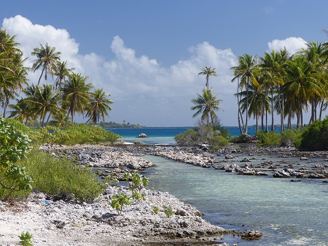 |
Random pictures from our month spent in 4 Tuamotu Atolls; Ahe, Fakarava, Tahanea, and Toau
32 Photos
Created 1 July 2015
|
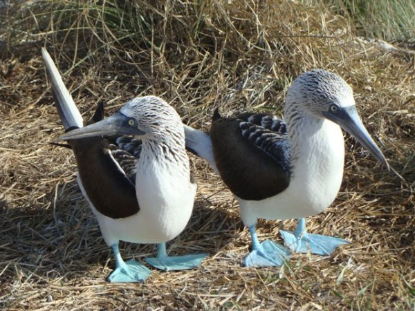 |
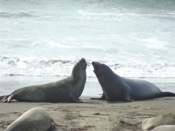
Some of the birds, fish, reptiles, and mammals (and others) that we have seen in Mexico
74 Photos
Created 5 May 2014
|
 |
Tregoning
Who: Alison and Randall
Port: Gainesville, FL
Gallery