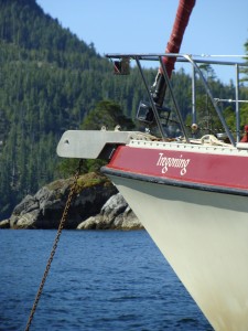
Tregoning
12 April 2024 | We are back aboard Tregoning in Mersin Marina, Mersin, Türkiye
02 April 2024 | We are in Toronto Airport, Canada: Tregoning is in Mersin Marina, Mersin, Türkiye
25 February 2024 | We are back in Gainesville, FL: Tregoning is in Mersin Marina, Mersin, Türkiye
18 February 2024 | We are in Glenwood, New Mexico: Tregoning is in Mersin Marina, Mersin, Türkiye
12 February 2024 | We are in Morro Bay, California: Tregoning is in Mersin Marina, Mersin, Türkiye
19 January 2024 | We are in Vancouver, BC Canada: Tregoning is in Mersin Marina, Mersin, Türkiye
01 January 2024 | We are in Washington State: Tregoning is in Mersin Marina, Mersin, Türkiye
15 December 2023 | We are in Minnesota: Tregoning is in Mersin Marina, Mersin, Türkiye
18 November 2023 | We are in Florida: Tregoning is in Mersin Marina, Mersin, Türkiye
29 October 2023 | We're in Florida - Tregoning is at B-dock, Mersin Marina, Mersin, Türkiye
21 October 2023 | 7 Oda Kapadokya Cave Hotel, Ürgüp, Türkiye
14 October 2023 | Hotel Aşikoğlu, Boğazkale, Türkiye
07 October 2023 | B-dock, Mersin Marina, Mersin, Türkiye
19 September 2023 | “Chez Jon & Angela”, Near Otterton, Devon, UK
14 September 2023 | Airbnb in Fortuneswell on the Isle of Portland, Dorset, UK
11 September 2023 | With Mike, Grange-over-Sands, Cumbria, UK
03 September 2023 | Ardington House, Ardington, Oxfordshire, UK
24 August 2023 | Near "Chez Joan and Peter", College of Roseisle, Moray, Scotland
11 August 2023 | Andrew's house (not exactly), Lichfield, UK
22 July 2023 | Chez Gail, near the New York Café, Budapest, Hungary
The riches of the Poor Knights
25 January 2018 | Maroro Bay, Off Aorangi Island, The Poor Knights, New Zealand
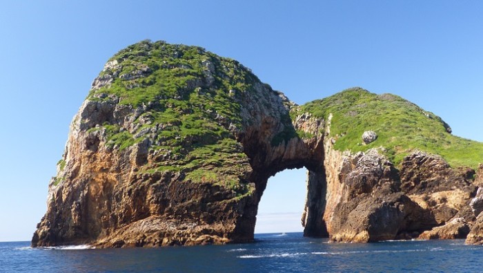
Photo: A small boat has passed through the huge arch on Archway Island in the Poor Knights
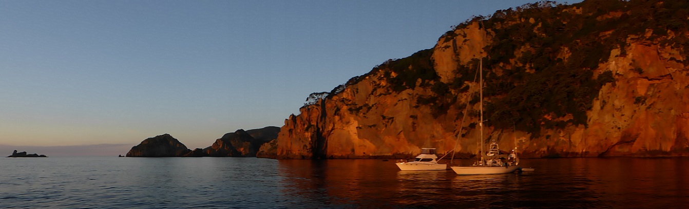
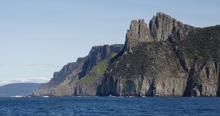
The Poor Knights are a series of small islands and rocky pinnacles about 10 nm offshore, and about halfway between Bream Head and Cape Brett, the latter being the at the southern edge of the Bay of Islands. As we motored towards them in virtually no wind and fairly calm seas on Wednesday (January 24th), we realized that we were cutting our possible stay in the Bay of Islands even shorter, but everyone we had spoken with had suggested that the small archipelago should not be missed if the weather was calm.
In the middle of the day, the first isolated pinnacles that we passed, Sugarloaf Rock and High Peak Rock, had few birds on them but the white guano revealed that they were popular roosts at night. Seeing arches and caves as we passed the southern islets and the high cliffs (perhaps 50 m or 165 feet tall) along the southwest side of Aorangi Island, it was immediately obvious that these islands were something special.
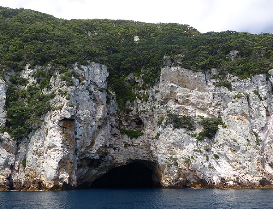
The mouth of Rikoriko Cave on Aorangi Island
Elongated and aligned in a north/south direction, the two main islands are Aorangi (to the south) and Tawhiti Rahi. We had been advised by Dean and Gail to anchor in the large Maroro Bay on the west side of Aorangi and, as expected, we arrived to find a large tour-boat and several smaller powerboats anchored in the best, shallowest spots. With numerous people swimming, snorkeling, kayaking, paddle-boarding, and simply floating near these boats, we dropped our anchor, with a trip-line and float, at a safe distance, in water that was 95 feet (29 m) deep.
This was not ideal, especially as we did not want to set the anchor in the rocky bottom but the wind was mostly light and the swell negligible. Dean had suggested that we move closer to shore when the day-tripper boats left but other sailboats came in at that time, and we felt pretty comfortable after a few gusts of stronger wind spun us around but did not seem to move the anchor. Our sensitivity about anchoring is especially heightened when there is a rocky shoreline that seems rather close. The high cliffs of the shoreline made the rocks at their base seem closer than they actually were (for example, as seen from a distance in the dinghy) but fortunately it was a beautifully calm night.
Twilight in the Maroro Bay anchorage
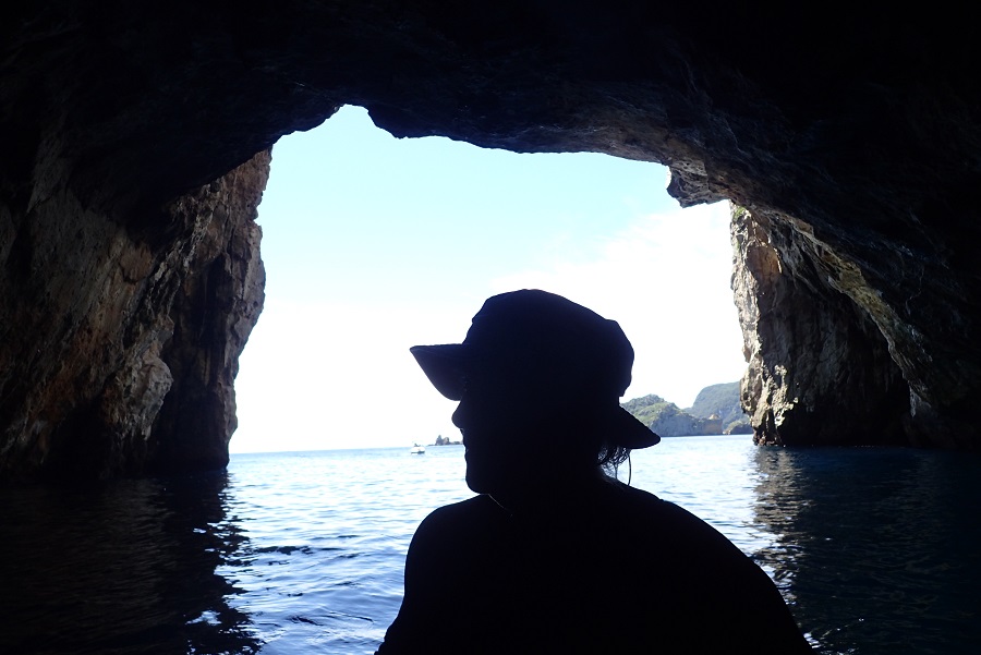
Intending to only stay for one night, we had plenty to see so we quickly launched the dinghy and started rowing towards the nearby Rikoriko Cave. We were quickly swallowed-up by this huge cavern and it was not difficult to imagine the orchestral concert that was once held there (we assume on a boat as there was no emergent beach or rocky shelf) taking advantage of the marvelous acoustics. A small sport-fishing boat followed us into the cave and later we watched as a large tour-boat entered, sounded its horn, and eventually left.
A large tour-boat exits the mouth of Rikiriko Cave
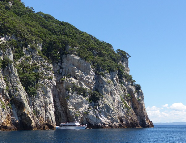
While anchoring and diving are allowed at the Poor Knights, no fishing has been allowed there since 1981 when the area was designated as a marine reserve. With sheer walls dropping 40 to 60 m underwater (130 to 200 feet), clear water, and a labyrinth of caves, arches, and tunnels both above and below the water, this is rated as one of the world's top ten diving destinations. Bathed in a subtropical current from the Coral Sea, the islands are home to colorful sponges, and tropical and subtropical species of fish not seen elsewhere in New Zealand.
Randall inside Rikoriko Cave
So on leaving the cave, we rowed across the bay to a small inlet that is called Nursery Cove because of the variety of underwater life. With Randall resplendent in his "new" wetsuit (bought second-hand from SV Astarté...now, sadly, sold and Michael and Barbara have returned to land-living), we rolled into the clear water and towed the dinghy around the cove and part of the way back to Tregoning.
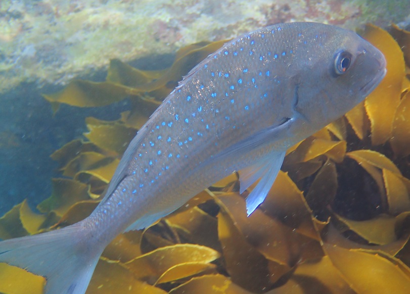
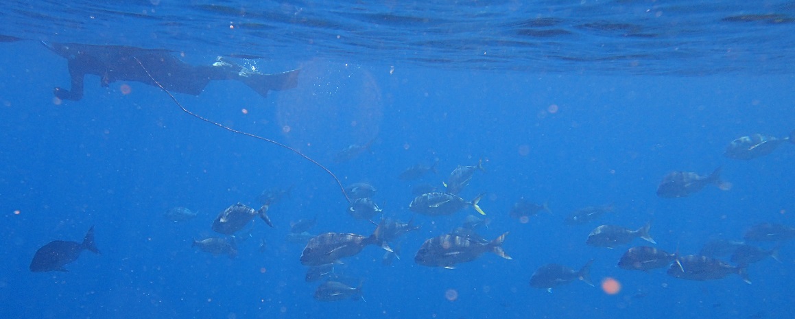
Snapper
Since we have not snorkeled much in New Zealand (brrr...), I have not invested in a good fish-identification book. We did get one for identifying common fish that we might catch so that helped, but I need to compare our photos to pictures online to be sure of what we saw. However, the main, unmistakable impression that we got was there were many fish at the Poor Knights that were not only relatively unafraid of snorkelers and divers but that were downright nosy.
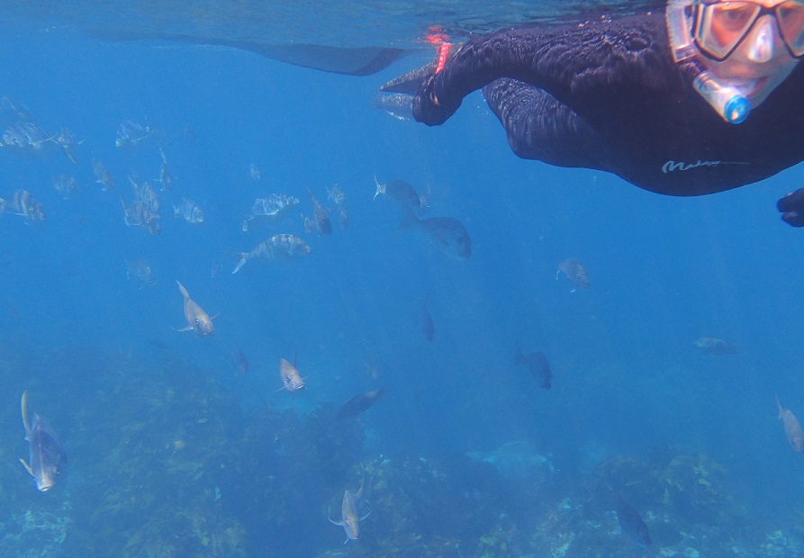
Randall appears to be leading a procession of fish
Unafraid of the trailing dinghy line, fish happily follow Randall, the underwater Pied Piper of the Poor Knights
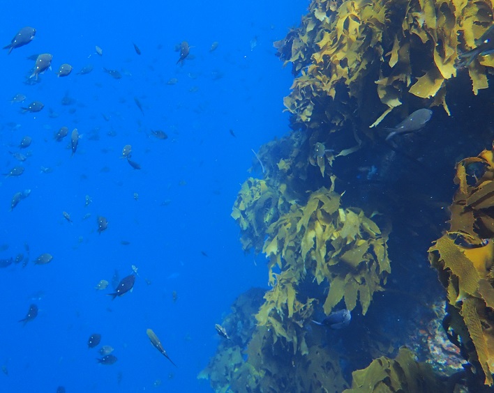
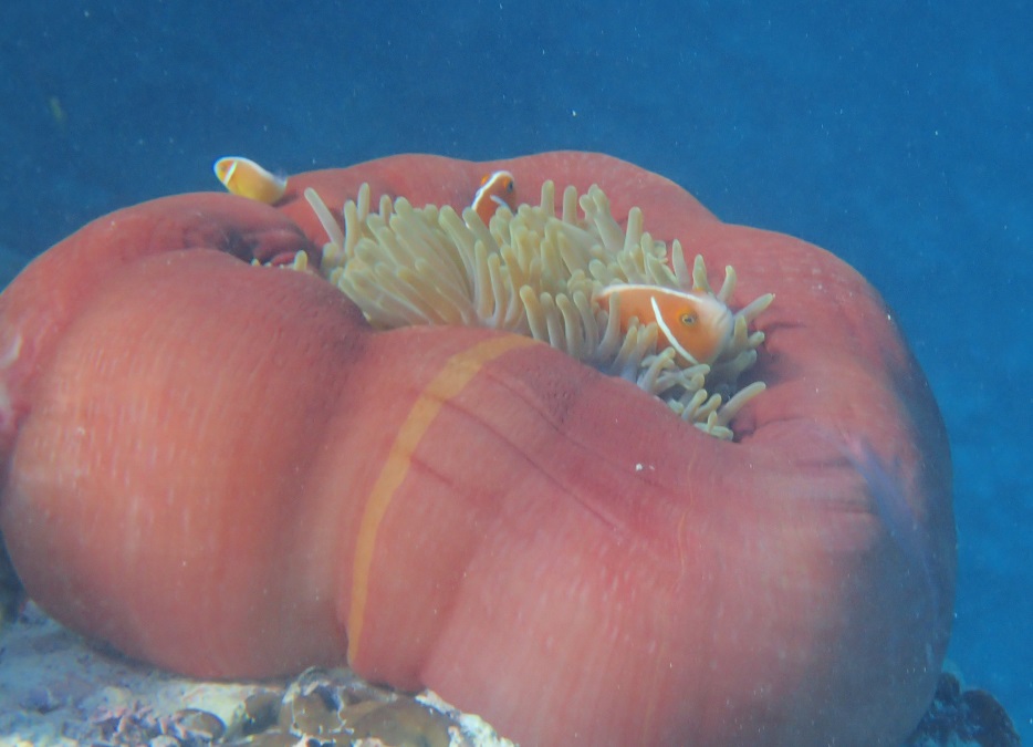
Looking back at Randall towing the dinghy, I was mightily tickled to see that he was being followed by a procession of good-sized fish, like an underwater Pied Piper of Hamlin. These followers were mostly (to use their NZ names) snapper, parore, and trevally but occasionally a few of the large and more aloof kingfish would cruise by. Colorful sandager's wrasse positively begged to have their photographs taken and it was surprisingly easy to get fairly close to several other species of fish that I have yet to identify, including a red-eyed scorpionfish making little effort to conceal itself on the sandy and rocky bottom.
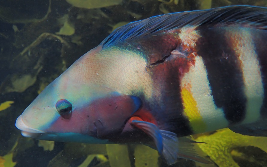
A colorful sandager's wrasse that appears to have a healing wound on its back
Despite having few places between the sheer cliffs where boats could safely land, the main islands had been home to the Ngai Wai tribe. However, after a raiding-party massacre in 1825, they became tapu (forbidden) to the Maori people. This tradition has now been continued by the Department of Conservation to protect the pristine environment, which includes habitats for the large tuatara lizards, nesting sites for Buller's shearwater (a common New Zealand endemic seabird), and endemic plants such as the Poor Knight's lily. As night both descended and disappeared, it was trilling to hear and dimly see the large Buller's shearwaters (46-cm or 18-inches long) circling overhead on their way to, or from, the islands.
The following morning, the anchor came up surprisingly easily (perhaps it was on a sand patch rather than caught on rocks) and we motored back to the south end of Aorangi and around Archway Island. Although we had somehow missed it the previous day, this island has a huge arch which extends 45 m (148 feet) below water and an impressive 27 m (89 feet) above. We watched small sport-fishing boats pass easily in both directions through this arch and it was really tempting to take Tregoning through.
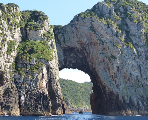
A sport-fishing boat inside the arch of Archway Island
With a mast height of just over 18 m (about 60 feet), we would probably not have had any problems and we would not have hesitated if we could watch another sailboat go through first. But the arch had a slight lean to it, so we would have to be careful about staying in the tallest area. Not knowing what the currents were like in the archway we decided not to tempt fate and satisfied ourselves with passing around the south side of Archway Island to admire the arch from both sides.
Returning past our anchorage, we continued north along the western shoreline of Tawhiti Rahi until we reached its middle arch in Maratea Point. With dive-boats already occupying what little suitable area there was for anchoring nearby, Randall kindly offered to stay aboard while I snorkeled through the arch. It was a pleasant snorkel, often through the columns of bubbles from classes of divers (the Poor Knights are a popular place for check-out dives for local novice divers). I saw several interesting fish that were new to me, including the boldly barred red moki, the leatherjacket (a species of filefish), blue maomao, and banded wrasse. I did not see any sharks but, both after this snorkel and during the previous evening, we had seen the distinctive dorsal fin of a medium-sized shark cruising around near the water surface. As clear as the water was, we were never quite close enough to see the rest of the creature, so its exact identity remains a mystery.
Fish and seaweed on a wall in the clear water near the middle arch of Tawhiti Rahi Island
By the late morning, we finally took our leave of the Poor Knights and aimed northwest back towards the mainland. We could not find a satisfactory explanation of why Captain Cook named these the Poor Knights Islands. There are the Three Kings Islands to the northwest of Cape Reinga and North Cape but even if these were the Knights associated with those Kings, why were they considered Poor? Perhaps people stranded there had found the islands inhospitable but we had enjoyed a marvelously rich experience there. Perhaps things were different when the islands were named but, now, the marine life that is associated with these protected sanctuaries is anything but poor.
In the middle of the day, the first isolated pinnacles that we passed, Sugarloaf Rock and High Peak Rock, had few birds on them but the white guano revealed that they were popular roosts at night. Seeing arches and caves as we passed the southern islets and the high cliffs (perhaps 50 m or 165 feet tall) along the southwest side of Aorangi Island, it was immediately obvious that these islands were something special.
The mouth of Rikoriko Cave on Aorangi Island
Elongated and aligned in a north/south direction, the two main islands are Aorangi (to the south) and Tawhiti Rahi. We had been advised by Dean and Gail to anchor in the large Maroro Bay on the west side of Aorangi and, as expected, we arrived to find a large tour-boat and several smaller powerboats anchored in the best, shallowest spots. With numerous people swimming, snorkeling, kayaking, paddle-boarding, and simply floating near these boats, we dropped our anchor, with a trip-line and float, at a safe distance, in water that was 95 feet (29 m) deep.
This was not ideal, especially as we did not want to set the anchor in the rocky bottom but the wind was mostly light and the swell negligible. Dean had suggested that we move closer to shore when the day-tripper boats left but other sailboats came in at that time, and we felt pretty comfortable after a few gusts of stronger wind spun us around but did not seem to move the anchor. Our sensitivity about anchoring is especially heightened when there is a rocky shoreline that seems rather close. The high cliffs of the shoreline made the rocks at their base seem closer than they actually were (for example, as seen from a distance in the dinghy) but fortunately it was a beautifully calm night.
Twilight in the Maroro Bay anchorage
Intending to only stay for one night, we had plenty to see so we quickly launched the dinghy and started rowing towards the nearby Rikoriko Cave. We were quickly swallowed-up by this huge cavern and it was not difficult to imagine the orchestral concert that was once held there (we assume on a boat as there was no emergent beach or rocky shelf) taking advantage of the marvelous acoustics. A small sport-fishing boat followed us into the cave and later we watched as a large tour-boat entered, sounded its horn, and eventually left.
A large tour-boat exits the mouth of Rikiriko Cave
While anchoring and diving are allowed at the Poor Knights, no fishing has been allowed there since 1981 when the area was designated as a marine reserve. With sheer walls dropping 40 to 60 m underwater (130 to 200 feet), clear water, and a labyrinth of caves, arches, and tunnels both above and below the water, this is rated as one of the world's top ten diving destinations. Bathed in a subtropical current from the Coral Sea, the islands are home to colorful sponges, and tropical and subtropical species of fish not seen elsewhere in New Zealand.
Randall inside Rikoriko Cave
So on leaving the cave, we rowed across the bay to a small inlet that is called Nursery Cove because of the variety of underwater life. With Randall resplendent in his "new" wetsuit (bought second-hand from SV Astarté...now, sadly, sold and Michael and Barbara have returned to land-living), we rolled into the clear water and towed the dinghy around the cove and part of the way back to Tregoning.
Snapper
Since we have not snorkeled much in New Zealand (brrr...), I have not invested in a good fish-identification book. We did get one for identifying common fish that we might catch so that helped, but I need to compare our photos to pictures online to be sure of what we saw. However, the main, unmistakable impression that we got was there were many fish at the Poor Knights that were not only relatively unafraid of snorkelers and divers but that were downright nosy.
Randall appears to be leading a procession of fish
Unafraid of the trailing dinghy line, fish happily follow Randall, the underwater Pied Piper of the Poor Knights
Looking back at Randall towing the dinghy, I was mightily tickled to see that he was being followed by a procession of good-sized fish, like an underwater Pied Piper of Hamlin. These followers were mostly (to use their NZ names) snapper, parore, and trevally but occasionally a few of the large and more aloof kingfish would cruise by. Colorful sandager's wrasse positively begged to have their photographs taken and it was surprisingly easy to get fairly close to several other species of fish that I have yet to identify, including a red-eyed scorpionfish making little effort to conceal itself on the sandy and rocky bottom.
A colorful sandager's wrasse that appears to have a healing wound on its back
Despite having few places between the sheer cliffs where boats could safely land, the main islands had been home to the Ngai Wai tribe. However, after a raiding-party massacre in 1825, they became tapu (forbidden) to the Maori people. This tradition has now been continued by the Department of Conservation to protect the pristine environment, which includes habitats for the large tuatara lizards, nesting sites for Buller's shearwater (a common New Zealand endemic seabird), and endemic plants such as the Poor Knight's lily. As night both descended and disappeared, it was trilling to hear and dimly see the large Buller's shearwaters (46-cm or 18-inches long) circling overhead on their way to, or from, the islands.
The following morning, the anchor came up surprisingly easily (perhaps it was on a sand patch rather than caught on rocks) and we motored back to the south end of Aorangi and around Archway Island. Although we had somehow missed it the previous day, this island has a huge arch which extends 45 m (148 feet) below water and an impressive 27 m (89 feet) above. We watched small sport-fishing boats pass easily in both directions through this arch and it was really tempting to take Tregoning through.
A sport-fishing boat inside the arch of Archway Island
With a mast height of just over 18 m (about 60 feet), we would probably not have had any problems and we would not have hesitated if we could watch another sailboat go through first. But the arch had a slight lean to it, so we would have to be careful about staying in the tallest area. Not knowing what the currents were like in the archway we decided not to tempt fate and satisfied ourselves with passing around the south side of Archway Island to admire the arch from both sides.
Returning past our anchorage, we continued north along the western shoreline of Tawhiti Rahi until we reached its middle arch in Maratea Point. With dive-boats already occupying what little suitable area there was for anchoring nearby, Randall kindly offered to stay aboard while I snorkeled through the arch. It was a pleasant snorkel, often through the columns of bubbles from classes of divers (the Poor Knights are a popular place for check-out dives for local novice divers). I saw several interesting fish that were new to me, including the boldly barred red moki, the leatherjacket (a species of filefish), blue maomao, and banded wrasse. I did not see any sharks but, both after this snorkel and during the previous evening, we had seen the distinctive dorsal fin of a medium-sized shark cruising around near the water surface. As clear as the water was, we were never quite close enough to see the rest of the creature, so its exact identity remains a mystery.
Fish and seaweed on a wall in the clear water near the middle arch of Tawhiti Rahi Island
By the late morning, we finally took our leave of the Poor Knights and aimed northwest back towards the mainland. We could not find a satisfactory explanation of why Captain Cook named these the Poor Knights Islands. There are the Three Kings Islands to the northwest of Cape Reinga and North Cape but even if these were the Knights associated with those Kings, why were they considered Poor? Perhaps people stranded there had found the islands inhospitable but we had enjoyed a marvelously rich experience there. Perhaps things were different when the islands were named but, now, the marine life that is associated with these protected sanctuaries is anything but poor.
Comments
| Vessel Name: | Tregoning |
| Vessel Make/Model: | Morgan Classic 41 |
| Hailing Port: | Gainesville, FL |
| Crew: | Alison and Randall |
| About: | We cast-off from Fernandina Beach in north Florida on 1st June 2008 and we have been cruising on Tregoning ever since. Before buying Tregoning, both of us had been sailing on smaller boats for many years and had worked around boats and water throughout our careers. |
| Extra: | “Tregoning” (rhymes with “belonging”) and is a Cornish word (meaning “homestead of Cohnan” or “farm by the ash trees”) and was Alison's mother’s middle name. Cornwall is in southwest England and is where Alison grew-up. |
Tregoning's Photos - Main
 |
 |
 |
 |
 |
 |
 |
 |
 |
 |
 |
The Sailblogs Prequel: Adding old posts from expired blog
166 Photos
Created 26 May 2020
|
 |
 |
 |
 |
 |
 |
 |
 |
 |
 |
 |
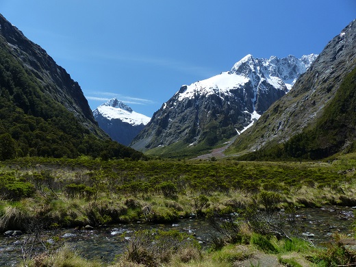 |
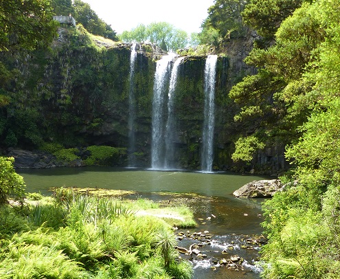
Extra photographs from our three-week campervan tour of the South Island from November 15th to December 5th 2015
217 Photos
Created 4 January 2016
|
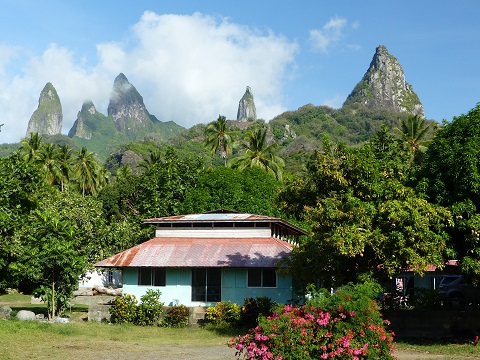 |
Random pictures from our month spent on the islands of Hiva Oa, Tahuata, Ua Pou, and Nuku Hiva
45 Photos
Created 18 July 2015
|
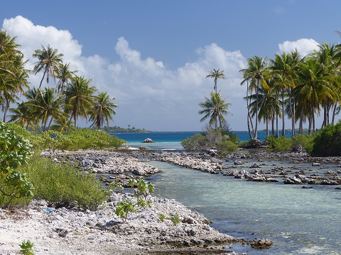 |
Random pictures from our month spent in 4 Tuamotu Atolls; Ahe, Fakarava, Tahanea, and Toau
32 Photos
Created 1 July 2015
|
 |
Some of the birds, fish, reptiles, and mammals (and others) that we have seen in Mexico
74 Photos
Created 5 May 2014
|
 |
Tregoning
Who: Alison and Randall
Port: Gainesville, FL
Gallery