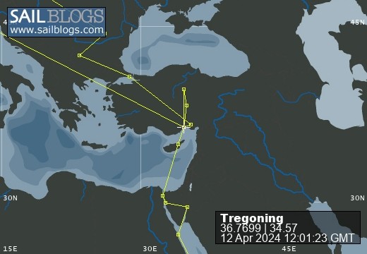
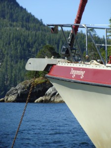
Tregoning
12 April 2024 | We are back aboard Tregoning in Mersin Marina, Mersin, Türkiye
02 April 2024 | We are in Toronto Airport, Canada: Tregoning is in Mersin Marina, Mersin, Türkiye
25 February 2024 | We are back in Gainesville, FL: Tregoning is in Mersin Marina, Mersin, Türkiye
18 February 2024 | We are in Glenwood, New Mexico: Tregoning is in Mersin Marina, Mersin, Türkiye
12 February 2024 | We are in Morro Bay, California: Tregoning is in Mersin Marina, Mersin, Türkiye
19 January 2024 | We are in Vancouver, BC Canada: Tregoning is in Mersin Marina, Mersin, Türkiye
01 January 2024 | We are in Washington State: Tregoning is in Mersin Marina, Mersin, Türkiye
15 December 2023 | We are in Minnesota: Tregoning is in Mersin Marina, Mersin, Türkiye
18 November 2023 | We are in Florida: Tregoning is in Mersin Marina, Mersin, Türkiye
29 October 2023 | We're in Florida - Tregoning is at B-dock, Mersin Marina, Mersin, Türkiye
21 October 2023 | 7 Oda Kapadokya Cave Hotel, Ürgüp, Türkiye
14 October 2023 | Hotel Aşikoğlu, Boğazkale, Türkiye
07 October 2023 | B-dock, Mersin Marina, Mersin, Türkiye
19 September 2023 | “Chez Jon & Angela”, Near Otterton, Devon, UK
14 September 2023 | Airbnb in Fortuneswell on the Isle of Portland, Dorset, UK
11 September 2023 | With Mike, Grange-over-Sands, Cumbria, UK
03 September 2023 | Ardington House, Ardington, Oxfordshire, UK
24 August 2023 | Near "Chez Joan and Peter", College of Roseisle, Moray, Scotland
11 August 2023 | Andrew's house (not exactly), Lichfield, UK
22 July 2023 | Chez Gail, near the New York Café, Budapest, Hungary
A reminder of the days of whaling
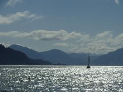
26 January 2018 | Whangamumu Harbour, North Island, New Zealand
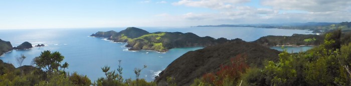
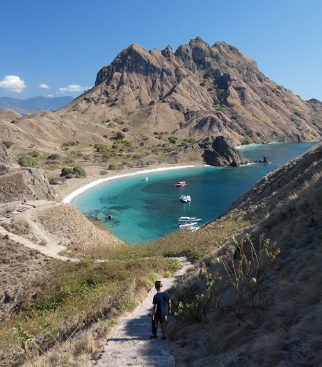
Photo: Looking southeast over Whangamumu Peninsular (glimpse of the Harbour to the right) towards Home Point on the horizon
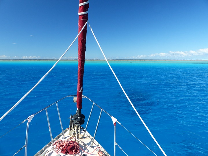
On taking our leave from the treasures of the Poor Knights, we were determined to enjoy the gloriously sunny weather and light breezes while actually sailing. So we hauled the asymmetrical spinnaker (a.k.a. APC) out of the forward cabin and started to attach the appropriate lines at its top (on a halyard raised to the top of the mast) and bottom (at the bow). We then threaded the downwind sheet (control line) to the appropriate winch in the cockpit, so that when we raised the protective sock off the APC, the lightweight sail would billow out on the downwind side of Tregoning’s bow but could be controlled by the sheet. We did not expect to change directions relative to the wind during our short crossing to the mainland, so we did not bother to thread the upwind sheet to its winch…this might have been a mistake.
When the sock was hauled-up and the bright blue sail billowed forth, we indeed were able to control it with the downwind sheet but, to our horror, we also found that the upwind sheet had been swept under the boat and was now impossible to pull back out of the water. It did not take us long to realize that the line had passed all the way under the keel and was now entangled with the propeller. Luckily, even though the engine was still running, we had put it in neutral gear so the propeller was not being turned by the engine (in which case the line would have snapped tight and broken itself or its attachment to the sail and possibly bent the propeller shaft). Unluckily, we were sailing along at a few knots and in neutral gear the propeller is free to spin with the water motion around it. Hence, the line had become intransigently entangled.
We quickly doused the APC with its sock and turned off the engine so that I could safely work on releasing the line from the propeller. However, given Tregoning’s high freeboard (deck height above the water) and extensive Bimini and associated cockpit windows, the 10-knot breeze was quite sufficient to keep her moving through the water at a couple of knots. Thus, when I slipped into the water from the swim ladder (which we first had to retrieve from the forward cabin and bolt into place), it took much of my finning effort (with my nice, big, new fins) to keep up with the boat.
It took several minutes for me to loop the trailing sheet back around the propeller (which is protected by the hull above, the rudder behind, and the skeg forward and below). All of the time, I kept a death-grip on end of the sheet that Randall was holding up on the deck so that I did not get left behind and have to fin hard to catch-up as Tregoning (with no motoring capability) blithely continued sailing away. It was exhausting work as it was hard to hold my breath for long while struggling with the current and the long, loosely coiled line but, at least, in the clear blue ocean water it was easy to see what I was doing. I tried not the think too much about the sharks’ fins that we had seen earlier or what a long swim to shore it would be if I lost my grip and was left behind.
We did finally get it all sorted-out and, after carefully managing the upwind sheet, we were able to sail using the APC for about an hour before the wind faded away. Having safely stowed the APC, we motored towards our destination of Whangamumu Harbour.
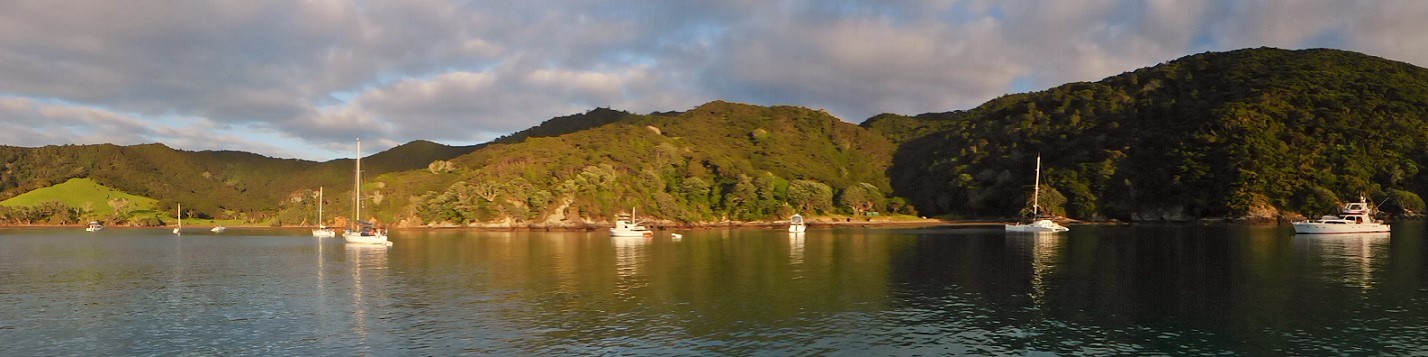
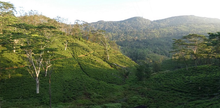
It did not take us long to see why this anchorage had been so highly recommended and was already home to about 30 boats, although there was room for plenty more. On the north side of the Whangamumu Peninsula, the harbour is protected from swell from all directions except the northeast. Needless to say, that was the direction of what little swell remained but with a moderately narrow entrance to a large bay that had a smooth, very gradually sloping bottom, it was a wonderfully protected and beautiful anchorage surrounded by low hills covered in forest and pastureland. We enjoyed another calm night and both slept better having firmly set the anchor in the sandy bottom and without the sound of waves lapping at the base of nearby rocky cliffs.
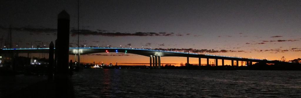
Looking towards the whaling station site (just left of the shaded hillside) in Whangamumu Harbour near sunset
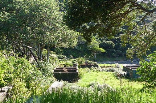
On Friday morning (January 26th), we rowed to shore at the site of an old whaling station that was abandoned in the 1930s. There were assorted ruins that were dominated by a large, rusting steel boiler and square, concrete vats in which the meat and bones were cooked and the rendered oil was stored. Now overgrown with trees and shrubs, it was difficult to visualize the station as a stark and busy factory for processing whale carcasses.
Concrete vats from the old whaling station at Whangamumu
Whaling at Whangamumu was conducted with the unique method of herding whales into steel nets suspended across the harbour’s narrow entrance. The catch-rate using hand-harpoons to kill the trapped whales had been about 10 whales per season until 1910, when the steam-powered whaling ship, Hananui II was purchased. With a specially fitted harpoon gun on the ship, the catch-rate increased to 50 whales per season, a rate of destruction that seems particularly horrendous to many of us now. The old photographs on some of the interpretive signs gave us a glimpse of how industrial the station must have been but the grassy area has a quiet dignity, now that it is managed by the Department of Conservation. Some of the signs (especially the map of the station that would have been most informative) were in poor repair and in need replacement.
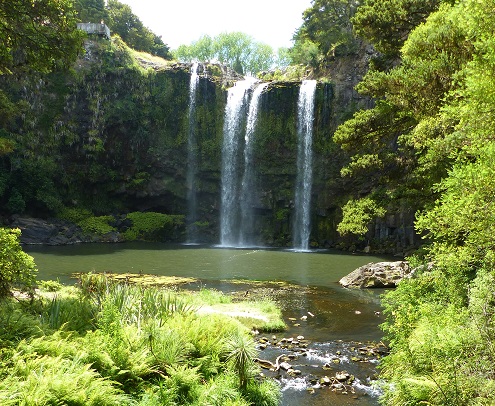
Behind the station is a small stream and a trail leads to a trickling cascade of water. Scrambling up the rocks further upstream leads to a bigger waterfall and a small pool that could provide a pleasant freshwater bath. While Randall examined the station and stream at his leisure, I followed the well-signposted track up the valley. It ascended quite steeply and crossed the stream before finally emerging high above Whangamumu Harbour. To the north the view was bounded by the long peninsula north of Te Roa Bay, while the view to the south, over the Whangamumu Peninsula, extended in a sweeping curve about 5 nm south to Home Point.
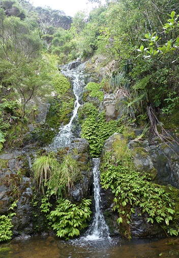
The small waterfalls above the Whangamumu Whaling Station
The trail continued north, ultimately joining the track that overlooks the Bay of Islands and reaches east to Cape Brett. While it was tempting to follow the trail for a sneak-preview of the Cape and Bay, instead, I hurried back to join Randall so that we could return to Tregoning and, finally, finish our long-awaited passage to the fine cruising grounds that the Maori had known as Pewhairangi.
When the sock was hauled-up and the bright blue sail billowed forth, we indeed were able to control it with the downwind sheet but, to our horror, we also found that the upwind sheet had been swept under the boat and was now impossible to pull back out of the water. It did not take us long to realize that the line had passed all the way under the keel and was now entangled with the propeller. Luckily, even though the engine was still running, we had put it in neutral gear so the propeller was not being turned by the engine (in which case the line would have snapped tight and broken itself or its attachment to the sail and possibly bent the propeller shaft). Unluckily, we were sailing along at a few knots and in neutral gear the propeller is free to spin with the water motion around it. Hence, the line had become intransigently entangled.
We quickly doused the APC with its sock and turned off the engine so that I could safely work on releasing the line from the propeller. However, given Tregoning’s high freeboard (deck height above the water) and extensive Bimini and associated cockpit windows, the 10-knot breeze was quite sufficient to keep her moving through the water at a couple of knots. Thus, when I slipped into the water from the swim ladder (which we first had to retrieve from the forward cabin and bolt into place), it took much of my finning effort (with my nice, big, new fins) to keep up with the boat.
It took several minutes for me to loop the trailing sheet back around the propeller (which is protected by the hull above, the rudder behind, and the skeg forward and below). All of the time, I kept a death-grip on end of the sheet that Randall was holding up on the deck so that I did not get left behind and have to fin hard to catch-up as Tregoning (with no motoring capability) blithely continued sailing away. It was exhausting work as it was hard to hold my breath for long while struggling with the current and the long, loosely coiled line but, at least, in the clear blue ocean water it was easy to see what I was doing. I tried not the think too much about the sharks’ fins that we had seen earlier or what a long swim to shore it would be if I lost my grip and was left behind.
We did finally get it all sorted-out and, after carefully managing the upwind sheet, we were able to sail using the APC for about an hour before the wind faded away. Having safely stowed the APC, we motored towards our destination of Whangamumu Harbour.
It did not take us long to see why this anchorage had been so highly recommended and was already home to about 30 boats, although there was room for plenty more. On the north side of the Whangamumu Peninsula, the harbour is protected from swell from all directions except the northeast. Needless to say, that was the direction of what little swell remained but with a moderately narrow entrance to a large bay that had a smooth, very gradually sloping bottom, it was a wonderfully protected and beautiful anchorage surrounded by low hills covered in forest and pastureland. We enjoyed another calm night and both slept better having firmly set the anchor in the sandy bottom and without the sound of waves lapping at the base of nearby rocky cliffs.
Looking towards the whaling station site (just left of the shaded hillside) in Whangamumu Harbour near sunset
On Friday morning (January 26th), we rowed to shore at the site of an old whaling station that was abandoned in the 1930s. There were assorted ruins that were dominated by a large, rusting steel boiler and square, concrete vats in which the meat and bones were cooked and the rendered oil was stored. Now overgrown with trees and shrubs, it was difficult to visualize the station as a stark and busy factory for processing whale carcasses.
Concrete vats from the old whaling station at Whangamumu
Whaling at Whangamumu was conducted with the unique method of herding whales into steel nets suspended across the harbour’s narrow entrance. The catch-rate using hand-harpoons to kill the trapped whales had been about 10 whales per season until 1910, when the steam-powered whaling ship, Hananui II was purchased. With a specially fitted harpoon gun on the ship, the catch-rate increased to 50 whales per season, a rate of destruction that seems particularly horrendous to many of us now. The old photographs on some of the interpretive signs gave us a glimpse of how industrial the station must have been but the grassy area has a quiet dignity, now that it is managed by the Department of Conservation. Some of the signs (especially the map of the station that would have been most informative) were in poor repair and in need replacement.
Behind the station is a small stream and a trail leads to a trickling cascade of water. Scrambling up the rocks further upstream leads to a bigger waterfall and a small pool that could provide a pleasant freshwater bath. While Randall examined the station and stream at his leisure, I followed the well-signposted track up the valley. It ascended quite steeply and crossed the stream before finally emerging high above Whangamumu Harbour. To the north the view was bounded by the long peninsula north of Te Roa Bay, while the view to the south, over the Whangamumu Peninsula, extended in a sweeping curve about 5 nm south to Home Point.
The small waterfalls above the Whangamumu Whaling Station
The trail continued north, ultimately joining the track that overlooks the Bay of Islands and reaches east to Cape Brett. While it was tempting to follow the trail for a sneak-preview of the Cape and Bay, instead, I hurried back to join Randall so that we could return to Tregoning and, finally, finish our long-awaited passage to the fine cruising grounds that the Maori had known as Pewhairangi.
Comments
| Vessel Name: | Tregoning |
| Vessel Make/Model: | Morgan Classic 41 |
| Hailing Port: | Gainesville, FL |
| Crew: | Alison and Randall |
| About: | We cast-off from Fernandina Beach in north Florida on 1st June 2008 and we have been cruising on Tregoning ever since. Before buying Tregoning, both of us had been sailing on smaller boats for many years and had worked around boats and water throughout our careers. |
| Extra: | “Tregoning” (rhymes with “belonging”) and is a Cornish word (meaning “homestead of Cohnan” or “farm by the ash trees”) and was Alison's mother’s middle name. Cornwall is in southwest England and is where Alison grew-up. |
Tregoning's Photos - Main
 |
 |
 |
 |
 |
 |
 |
 |
 |
 |
 |
The Sailblogs Prequel: Adding old posts from expired blog
166 Photos
Created 26 May 2020
|
 |
 |
 |
 |
 |
 |
 |
 |
 |
 |
 |
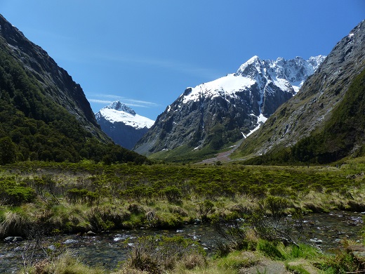 |
Extra photographs from our three-week campervan tour of the South Island from November 15th to December 5th 2015
217 Photos
Created 4 January 2016
|
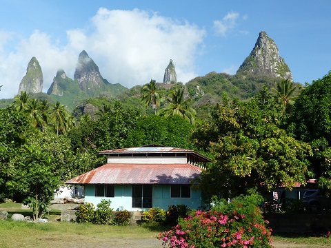 |
Random pictures from our month spent on the islands of Hiva Oa, Tahuata, Ua Pou, and Nuku Hiva
45 Photos
Created 18 July 2015
|
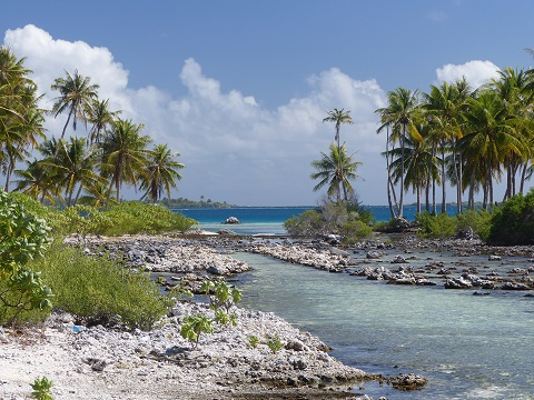 |
Random pictures from our month spent in 4 Tuamotu Atolls; Ahe, Fakarava, Tahanea, and Toau
32 Photos
Created 1 July 2015
|
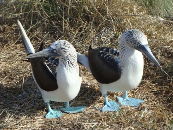 |
Some of the birds, fish, reptiles, and mammals (and others) that we have seen in Mexico
74 Photos
Created 5 May 2014
|
 |
Tregoning
Who: Alison and Randall
Port: Gainesville, FL
Gallery