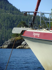
Tregoning
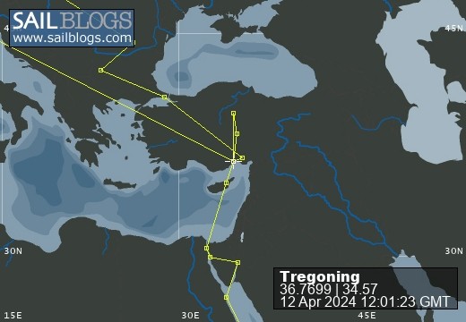
12 April 2024 | We are back aboard Tregoning in Mersin Marina, Mersin, Türkiye
02 April 2024 | We are in Toronto Airport, Canada: Tregoning is in Mersin Marina, Mersin, Türkiye
25 February 2024 | We are back in Gainesville, FL: Tregoning is in Mersin Marina, Mersin, Türkiye
18 February 2024 | We are in Glenwood, New Mexico: Tregoning is in Mersin Marina, Mersin, Türkiye
12 February 2024 | We are in Morro Bay, California: Tregoning is in Mersin Marina, Mersin, Türkiye
19 January 2024 | We are in Vancouver, BC Canada: Tregoning is in Mersin Marina, Mersin, Türkiye
01 January 2024 | We are in Washington State: Tregoning is in Mersin Marina, Mersin, Türkiye
15 December 2023 | We are in Minnesota: Tregoning is in Mersin Marina, Mersin, Türkiye
18 November 2023 | We are in Florida: Tregoning is in Mersin Marina, Mersin, Türkiye
29 October 2023 | We're in Florida - Tregoning is at B-dock, Mersin Marina, Mersin, Türkiye
21 October 2023 | 7 Oda Kapadokya Cave Hotel, Ürgüp, Türkiye
14 October 2023 | Hotel Aşikoğlu, Boğazkale, Türkiye
07 October 2023 | B-dock, Mersin Marina, Mersin, Türkiye
19 September 2023 | “Chez Jon & Angela”, Near Otterton, Devon, UK
14 September 2023 | Airbnb in Fortuneswell on the Isle of Portland, Dorset, UK
11 September 2023 | With Mike, Grange-over-Sands, Cumbria, UK
03 September 2023 | Ardington House, Ardington, Oxfordshire, UK
24 August 2023 | Near "Chez Joan and Peter", College of Roseisle, Moray, Scotland
11 August 2023 | Andrew's house (not exactly), Lichfield, UK
22 July 2023 | Chez Gail, near the New York Café, Budapest, Hungary
Around an island: in sight and sound
29 January 2018 | Mangahawea Bay, Moturua Island, Bay of Islands, New Zealand
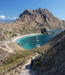
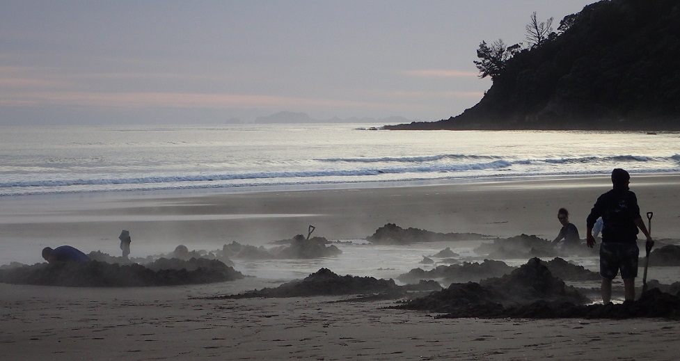
Photo: Mangahawea Bay on Moturua Island: Tregoning is the 3rd sailboat from the right

Although there are many good anchorages in the Bay of Islands, only some of them are suitable when the wind is blowing from a given direction. We had enjoyed calm conditions at Otaio Bay but the wind was soon forecast to increase from the east and southeast. Thus, on Saturday (January 27th), after I had returned from my exploration of Urupukapuka Island and we had raised the anchor, we set-off for the neighboring Moturua Island in search of a cove that would be well-protected from both the predicted wind direction and from any swell that might wrap around from the open ocean.
We arrived at Mangahawea Bay on the northwest corner of Moturua Island to find quite a few other boats at anchor. Luckily, Randall noticed that we could squeeze in close to shore at the north end near the rocky islets and pinnacles that gave some protection from swell creeping around the north end of the main island. For once, we were not on the outside edge of the fleet. Many of the boats left in the afternoon and we shared the anchorage with only three other boats on our first night and just one other on the second night.
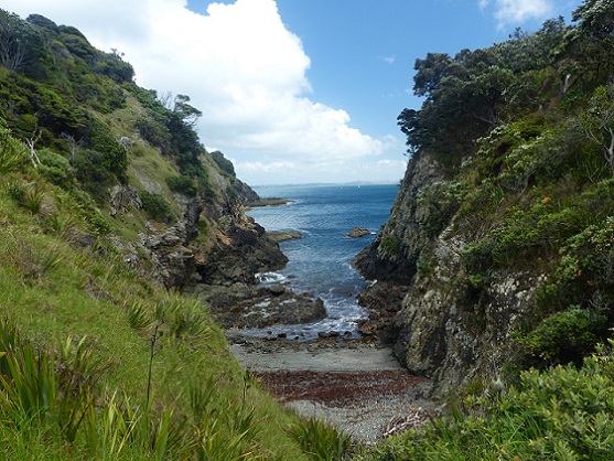
A steep gully seen from the around-the-island trail
In the Bay of Islands, Moturua Island is second in size only to Urupukapuka Island. While the latter island has plenty of grassland and active pastures in addition to some protected bush and the many trails, Moturua is completely managed by the Department of Conservation and has a single loop trail around all but the southernmost part of the island. In 1772, the island was used as a hospital camp and refitting base by the French navigator, Marion de Fresne.
In addition to the trail, the island had appealed to us because one of our cruising guides had suggested that there was good snorkeling around the rocky islets to our north. Needless to say, I jumped into the water that afternoon and was glad that it was not a long swim to the islets from our location in the anchorage. Of course, the water was not as clear as at the isolated Poor Knights and it was much shallower, but it was definitely worth exploring. I came across several large longtailed stingrays, some of the fish that are quaintly named spotty, pipers (a type of halfbeak), kelpfish, some reddish-colored goatfish, and some of the same species that we had seen at Poor Knights. Randall joined me for another snorkel the following afternoon.

Mangahawea Bay with the northern islets just beyond Tregoning (3rd from the right)
That morning, we had both rowed ashore to walk on Moturua's trail. Randall wanted to avoid stairs and walk slowly so as not to risk aggravating his tender knee, so I set-off for the circumambulation while he went about a third of the way and then turned back. It was a rather up-and-down trail that crossed four of the island's several beaches and despite having never been there before, I felt as though I already knew the route.
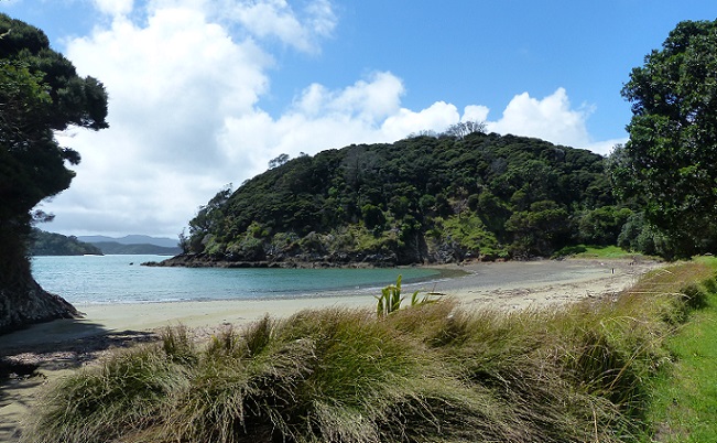
A small beach on the eastern side of Moturua Island
This was because as a charming Christmas gift, Gail and Dean had given us a CD with a recording of Gail walking this same trail at 5:30 am one morning, when the dawn chorus was in full swing. As recommended, I had read Gail's written description while I listened to the 75-minute recording with headphones. She had undertaken the journey in bare feet to minimize the pounding of her hiking boots and I was well-impressed that she could walk so fast in some places where the trail was pretty rough underfoot.
The bird songs had been fabulous on her recording but they were rather more subdued by the mid-morning time that we were out. Still, I saw some tuis, saddlebacks, North Island robins, and squawking pukekos. What I did not see that Gail was incredibly lucky to observe was a brown kiwi. Presumably heading back to its burrow after a busy night of feeding, this rare nocturnal bird shuffled across the path apparently unaware that it almost had to step over Gail's bare feet. How thrilling!
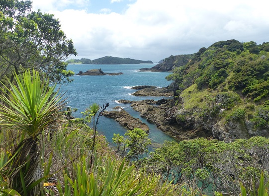
A view northeast from Moturua Island
Gail had started from Waipao Bay, the next bay south from us, but otherwise I followed her route in an anticlockwise direction. I could now see what I had only heard before, especially where she had walked across sandy or pebbly beaches, squelched through muddy bits, or been panting as she climbed the steeper slopes. It really was rather fascinating to add the visual component to an auditory experience.
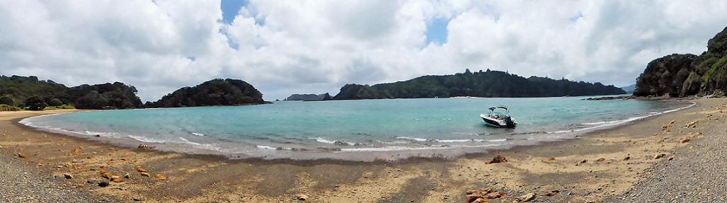
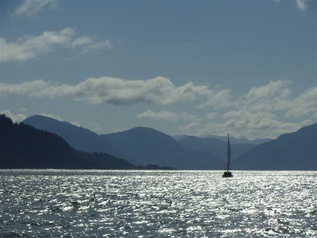
A lone boat anchored in Waiwhapuku Bay
When I took the short detour to look at a Pa site on the northeast corner of the island above Waiwhapuku Bay, I saw that there was heavy rain over Cape Brett. With the wind blowing from that direction, I decided to scurry along the rest of the trail to try to beat the rain back to Tregoning. As it transpired, the rain just stayed north of us but as I trotted down to meet Randall in Mangahawea Bay, I realized that despite several stops to take photographs, with the accelerated ending I had almost exactly matched the time of Gail's audio-trail. That made me feel pretty good about my rate of walking but, of course, I had not been delayed by a kiwi passing within a few centimeters of my toes!
We arrived at Mangahawea Bay on the northwest corner of Moturua Island to find quite a few other boats at anchor. Luckily, Randall noticed that we could squeeze in close to shore at the north end near the rocky islets and pinnacles that gave some protection from swell creeping around the north end of the main island. For once, we were not on the outside edge of the fleet. Many of the boats left in the afternoon and we shared the anchorage with only three other boats on our first night and just one other on the second night.
A steep gully seen from the around-the-island trail
In the Bay of Islands, Moturua Island is second in size only to Urupukapuka Island. While the latter island has plenty of grassland and active pastures in addition to some protected bush and the many trails, Moturua is completely managed by the Department of Conservation and has a single loop trail around all but the southernmost part of the island. In 1772, the island was used as a hospital camp and refitting base by the French navigator, Marion de Fresne.
In addition to the trail, the island had appealed to us because one of our cruising guides had suggested that there was good snorkeling around the rocky islets to our north. Needless to say, I jumped into the water that afternoon and was glad that it was not a long swim to the islets from our location in the anchorage. Of course, the water was not as clear as at the isolated Poor Knights and it was much shallower, but it was definitely worth exploring. I came across several large longtailed stingrays, some of the fish that are quaintly named spotty, pipers (a type of halfbeak), kelpfish, some reddish-colored goatfish, and some of the same species that we had seen at Poor Knights. Randall joined me for another snorkel the following afternoon.
Mangahawea Bay with the northern islets just beyond Tregoning (3rd from the right)
That morning, we had both rowed ashore to walk on Moturua's trail. Randall wanted to avoid stairs and walk slowly so as not to risk aggravating his tender knee, so I set-off for the circumambulation while he went about a third of the way and then turned back. It was a rather up-and-down trail that crossed four of the island's several beaches and despite having never been there before, I felt as though I already knew the route.
A small beach on the eastern side of Moturua Island
This was because as a charming Christmas gift, Gail and Dean had given us a CD with a recording of Gail walking this same trail at 5:30 am one morning, when the dawn chorus was in full swing. As recommended, I had read Gail's written description while I listened to the 75-minute recording with headphones. She had undertaken the journey in bare feet to minimize the pounding of her hiking boots and I was well-impressed that she could walk so fast in some places where the trail was pretty rough underfoot.
The bird songs had been fabulous on her recording but they were rather more subdued by the mid-morning time that we were out. Still, I saw some tuis, saddlebacks, North Island robins, and squawking pukekos. What I did not see that Gail was incredibly lucky to observe was a brown kiwi. Presumably heading back to its burrow after a busy night of feeding, this rare nocturnal bird shuffled across the path apparently unaware that it almost had to step over Gail's bare feet. How thrilling!
A view northeast from Moturua Island
Gail had started from Waipao Bay, the next bay south from us, but otherwise I followed her route in an anticlockwise direction. I could now see what I had only heard before, especially where she had walked across sandy or pebbly beaches, squelched through muddy bits, or been panting as she climbed the steeper slopes. It really was rather fascinating to add the visual component to an auditory experience.
A lone boat anchored in Waiwhapuku Bay
When I took the short detour to look at a Pa site on the northeast corner of the island above Waiwhapuku Bay, I saw that there was heavy rain over Cape Brett. With the wind blowing from that direction, I decided to scurry along the rest of the trail to try to beat the rain back to Tregoning. As it transpired, the rain just stayed north of us but as I trotted down to meet Randall in Mangahawea Bay, I realized that despite several stops to take photographs, with the accelerated ending I had almost exactly matched the time of Gail's audio-trail. That made me feel pretty good about my rate of walking but, of course, I had not been delayed by a kiwi passing within a few centimeters of my toes!
Comments
| Vessel Name: | Tregoning |
| Vessel Make/Model: | Morgan Classic 41 |
| Hailing Port: | Gainesville, FL |
| Crew: | Alison and Randall |
| About: | We cast-off from Fernandina Beach in north Florida on 1st June 2008 and we have been cruising on Tregoning ever since. Before buying Tregoning, both of us had been sailing on smaller boats for many years and had worked around boats and water throughout our careers. |
| Extra: | “Tregoning” (rhymes with “belonging”) and is a Cornish word (meaning “homestead of Cohnan” or “farm by the ash trees”) and was Alison's mother’s middle name. Cornwall is in southwest England and is where Alison grew-up. |
Tregoning's Photos - Main
 |
 |
 |
 |
 |
 |
 |
 |
 |
 |
 |
The Sailblogs Prequel: Adding old posts from expired blog
166 Photos
Created 26 May 2020
|
 |
 |
 |
 |
 |
 |
 |
 |
 |
 |
 |
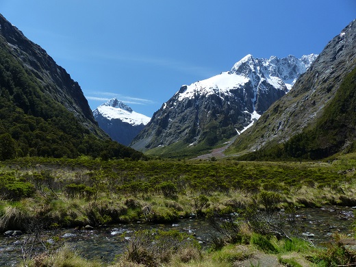 |
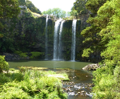
Extra photographs from our three-week campervan tour of the South Island from November 15th to December 5th 2015
217 Photos
Created 4 January 2016
|
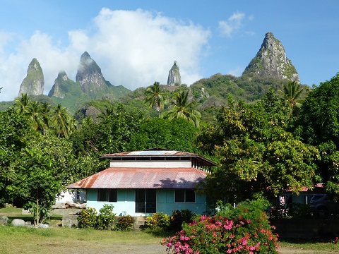 |
Random pictures from our month spent on the islands of Hiva Oa, Tahuata, Ua Pou, and Nuku Hiva
45 Photos
Created 18 July 2015
|
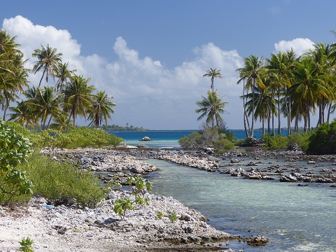 |
Random pictures from our month spent in 4 Tuamotu Atolls; Ahe, Fakarava, Tahanea, and Toau
32 Photos
Created 1 July 2015
|
 |
Some of the birds, fish, reptiles, and mammals (and others) that we have seen in Mexico
74 Photos
Created 5 May 2014
|
 |
Tregoning
Who: Alison and Randall
Port: Gainesville, FL
Gallery