WELCOME ABOARD VOYAGEUR
11 July 2016
01 April 2016
28 November 2012
27 November 2012
26 November 2012
30 September 2011
28 August 2011
02 May 2011
16 April 2011
08 January 2011
12 November 2010
27 October 2010
24 September 2010
31 August 2010
18 May 2010
20 April 2010
27 August 2008 | Litchfield, CT
29 December 2007 | Litchfield, CT
Cocktails and Fog
30 September 2011
Dear Friends and Family ~
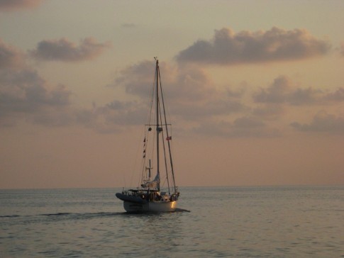
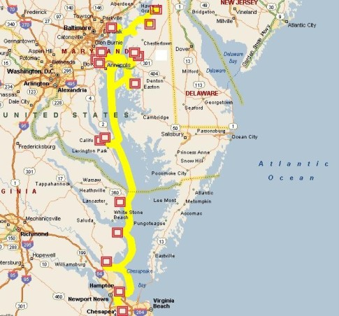
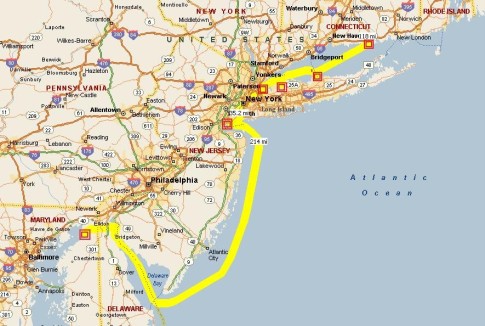
Cocktails (Bob's Passage Notes): The summer of 2011 is over. Officially, it ended a week ago when we were still in Connecticut. And it was a wonderful summer. But for us, unofficially, the summer ended Tuesday night, September 27, at 11:00 PM. That's when we tied up to Chesapeake City's town dock after a 36 hour passage from Port Washington, NY, which took us down the East River and out New York Harbor with the tide pushing us to speeds we do not often attain, along the darkened, fog bound Jersey coast and up Delaware Bay surfing 3 to 5 foot rollers with a 25 kt following breeze. It was the usual long boring semi-annual passage but it was the first time we bypassed a harbor of refuge called Great Kill.
Like the latch on a diamond necklace, Staten Island's Great Kill Harbor connects two parts of a precious circle for us, the circle that includes our southern and northern cruising grounds. Usually, when headed north or south, we stop there to pick up a mooring for a day or two in order to recover from or to prepare for the passage between Long Island Sound and Chesapeake Bay. And while neither of us particularly enjoys the passage, we must make it twice a year in order to accommodate the seasonal modalities of the way of life we have chosen. The fact that wonderful new cruising experiences await at both ends of the passage is a motivating bonus.
Jane and I, in the company of some of the best friends we'll ever enjoy, have been visiting Chesapeake City, MD, for over twenty years. And we always visit The Tap Room when we're there for a great meal in casual surroundings. This visit was no exception to the Tap Room rule. And to make the occasion even more special we were visiting Chesapeake City aboard Voyageur for the first time. After we made ourselves fast to the darkened, empty town dock, we hauled lines for Centime, a Shearwater 39 with Dennis and Heidi aboard who had joined us half way up Delaware Bay. Shortly thereafter we sank into a long, deep sleep that ended late the next morning.
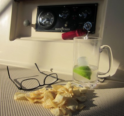
Today, refreshed by our Tap Room feast and hours of deep, restful slumber we motor-sailed twenty miles down Chesapeake Bay to a peaceful, sheltered Sassafras River anchorage. There we watched the sun set over the bow and enjoyed cocktails while Voyageur's anchor settled back into the mud from which we had raised it four months before. Tomorrow we'll move a short distance up the Sassafras to Georgetown and a berth at the Georgetown Yacht Basin where we'll meet with friends Len, Patti, Ron and Carol over the weekend.
Who knows . . . maybe we'll stay the week to properly celebrate the end of summer as we undertake our ceremonial, seasonal switch from Rockporters to Margaritas.
Care to join us ?
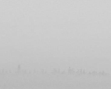
Fog (Jane's Passage Notes): Fog . . . Bob mentioned fog along the New Jersey coast. This was my first "in depth" experience with fog. I know, I know . . . all you New England boaters have lots of experience with fog. But I've never been out in it like we were on this trip.
Coming out of Upper New York Harbor and passing under the Verrazano Narrows Bridge at mid-day we decided to press on for Chesapeake City, MD, in spite of patchy fog on the water. We could see Staten Island but Sandy Hook and Coney Island were hidden from view. So with our vision limited, we turned our attention to the radar overlay on our chart plotter which portrays solid objects (and rain) all around Voyageur out to a distance of 36 miles. Beneath the radar image, the GPS chart plotter displays a map, like the one in your car, but with depths, buoys and hazards and such. In addition, it displays all sorts of other things like distances to waypoints (points on the map you put in), temperatures, both sea and air, barometric pressure, depth, speed through the water and speed over the ground, wind speed and direction (true and apparent) and our latitude and longitude. As Voyageur moves along, the small boat shaped icon in the middle of the chart plotter's screen shows us where we are and where we are going. A dotted line strung out behind the boat symbol even shows us where we've been for the last hundred miles or so.
After a short while, I began to gain confidence in our instruments and what I could deduce from them. As it turned out, they provided all the information we would need to safely navigate the entire fog bound Jersey coast, showing boat traffic and navigational aids moving relative to us or into our path as well as other hazards on and below the surface of the sea. Given the thickness of the fog, it was a bit like closing my eyes for 16 hours and listening to a computer whispering in my ear. I just needed to ask the computer the right questions.
In this regard, a helpful sole recommended to me last year that we travel with our radar on in good weather as well as in bad, even in excellent visibility conditions. That way we could learn how objects such as boats and buoys appear and move on radar and practice using that information. We did so on our trip north this spring, off-shore from St. Augustine to Charleston, on the ICW and around New Jersey and in Long Island Sound. It really was an education and it went a long way toward preparing me for the fog off New Jersey.
Now, when I absolutely needed the radar to be my eyes, I was comfortable interpreting what it was displaying. Though we mingled with quite a few other vessels on the trip, some with better radar images than others, our radar "painted" every one and, even if the vessel was ten or more miles away, we were confident that we knew what direction it was going and at what speed.
Throughout the day and night the fog lifted briefly from time to time but then returned. We always stayed at least five miles off the Jersey coast and, during the night, its lights occasionally came into view such as when the first few floors of Atlantic City's towers appeared, the tops of the buildings being hidden in fog. But a few hours later, when we rounded Cape May only a mile or so off shore, we confidently dodged dangerous shoals by following the bottom contours depicted on our chart plotter and confirmed by our depth sounder. Last spring, with perfect visibility, I was VERY uncomfortable being so close to shore for the rounding. But this time, in spite of hearing the invisible surf, I wasn't (very) concerned.
The day and night we spent in the fog off New Jersey was tiring and occasionally a bit tense. But in the future I'll feel confident traveling, as we hope to, through Block Island Sound, Buzzard's Bay and Maine's Casco and Penobscot Bays . . . all known for fog. On the other hand, there were no lobster pots off New Jersey to worry about. Guess we'll have to wait until next summer to experience that maritime magic.
Bob & Jane Fulton
Sep 2011
Cocktails (Bob's Passage Notes): The summer of 2011 is over. Officially, it ended a week ago when we were still in Connecticut. And it was a wonderful summer. But for us, unofficially, the summer ended Tuesday night, September 27, at 11:00 PM. That's when we tied up to Chesapeake City's town dock after a 36 hour passage from Port Washington, NY, which took us down the East River and out New York Harbor with the tide pushing us to speeds we do not often attain, along the darkened, fog bound Jersey coast and up Delaware Bay surfing 3 to 5 foot rollers with a 25 kt following breeze. It was the usual long boring semi-annual passage but it was the first time we bypassed a harbor of refuge called Great Kill.
Like the latch on a diamond necklace, Staten Island's Great Kill Harbor connects two parts of a precious circle for us, the circle that includes our southern and northern cruising grounds. Usually, when headed north or south, we stop there to pick up a mooring for a day or two in order to recover from or to prepare for the passage between Long Island Sound and Chesapeake Bay. And while neither of us particularly enjoys the passage, we must make it twice a year in order to accommodate the seasonal modalities of the way of life we have chosen. The fact that wonderful new cruising experiences await at both ends of the passage is a motivating bonus.
Jane and I, in the company of some of the best friends we'll ever enjoy, have been visiting Chesapeake City, MD, for over twenty years. And we always visit The Tap Room when we're there for a great meal in casual surroundings. This visit was no exception to the Tap Room rule. And to make the occasion even more special we were visiting Chesapeake City aboard Voyageur for the first time. After we made ourselves fast to the darkened, empty town dock, we hauled lines for Centime, a Shearwater 39 with Dennis and Heidi aboard who had joined us half way up Delaware Bay. Shortly thereafter we sank into a long, deep sleep that ended late the next morning.
Today, refreshed by our Tap Room feast and hours of deep, restful slumber we motor-sailed twenty miles down Chesapeake Bay to a peaceful, sheltered Sassafras River anchorage. There we watched the sun set over the bow and enjoyed cocktails while Voyageur's anchor settled back into the mud from which we had raised it four months before. Tomorrow we'll move a short distance up the Sassafras to Georgetown and a berth at the Georgetown Yacht Basin where we'll meet with friends Len, Patti, Ron and Carol over the weekend.
Who knows . . . maybe we'll stay the week to properly celebrate the end of summer as we undertake our ceremonial, seasonal switch from Rockporters to Margaritas.
Care to join us ?
Fog (Jane's Passage Notes): Fog . . . Bob mentioned fog along the New Jersey coast. This was my first "in depth" experience with fog. I know, I know . . . all you New England boaters have lots of experience with fog. But I've never been out in it like we were on this trip.
Coming out of Upper New York Harbor and passing under the Verrazano Narrows Bridge at mid-day we decided to press on for Chesapeake City, MD, in spite of patchy fog on the water. We could see Staten Island but Sandy Hook and Coney Island were hidden from view. So with our vision limited, we turned our attention to the radar overlay on our chart plotter which portrays solid objects (and rain) all around Voyageur out to a distance of 36 miles. Beneath the radar image, the GPS chart plotter displays a map, like the one in your car, but with depths, buoys and hazards and such. In addition, it displays all sorts of other things like distances to waypoints (points on the map you put in), temperatures, both sea and air, barometric pressure, depth, speed through the water and speed over the ground, wind speed and direction (true and apparent) and our latitude and longitude. As Voyageur moves along, the small boat shaped icon in the middle of the chart plotter's screen shows us where we are and where we are going. A dotted line strung out behind the boat symbol even shows us where we've been for the last hundred miles or so.
After a short while, I began to gain confidence in our instruments and what I could deduce from them. As it turned out, they provided all the information we would need to safely navigate the entire fog bound Jersey coast, showing boat traffic and navigational aids moving relative to us or into our path as well as other hazards on and below the surface of the sea. Given the thickness of the fog, it was a bit like closing my eyes for 16 hours and listening to a computer whispering in my ear. I just needed to ask the computer the right questions.
In this regard, a helpful sole recommended to me last year that we travel with our radar on in good weather as well as in bad, even in excellent visibility conditions. That way we could learn how objects such as boats and buoys appear and move on radar and practice using that information. We did so on our trip north this spring, off-shore from St. Augustine to Charleston, on the ICW and around New Jersey and in Long Island Sound. It really was an education and it went a long way toward preparing me for the fog off New Jersey.
Now, when I absolutely needed the radar to be my eyes, I was comfortable interpreting what it was displaying. Though we mingled with quite a few other vessels on the trip, some with better radar images than others, our radar "painted" every one and, even if the vessel was ten or more miles away, we were confident that we knew what direction it was going and at what speed.
Throughout the day and night the fog lifted briefly from time to time but then returned. We always stayed at least five miles off the Jersey coast and, during the night, its lights occasionally came into view such as when the first few floors of Atlantic City's towers appeared, the tops of the buildings being hidden in fog. But a few hours later, when we rounded Cape May only a mile or so off shore, we confidently dodged dangerous shoals by following the bottom contours depicted on our chart plotter and confirmed by our depth sounder. Last spring, with perfect visibility, I was VERY uncomfortable being so close to shore for the rounding. But this time, in spite of hearing the invisible surf, I wasn't (very) concerned.
The day and night we spent in the fog off New Jersey was tiring and occasionally a bit tense. But in the future I'll feel confident traveling, as we hope to, through Block Island Sound, Buzzard's Bay and Maine's Casco and Penobscot Bays . . . all known for fog. On the other hand, there were no lobster pots off New Jersey to worry about. Guess we'll have to wait until next summer to experience that maritime magic.
Bob & Jane Fulton
Sep 2011
Comments
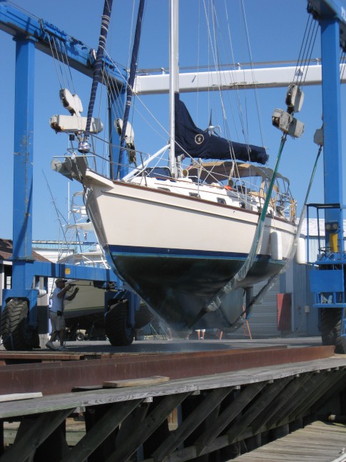
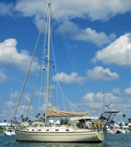
| Vessel Name: | Voyageur |
| Vessel Make/Model: | Island Packet 40 |
| Hailing Port: | Portsmouth, RI |
| Crew: | Bob & Jane Fulton |
| About: | First sail . . . Oshkosh Yacht Club, Lake Winnebago, in 1953 on an M16. First sail together . . . Lake Texoma in 1994 on an ODay 322. We're now full time cruisers aboard our Island Packet 40 cutter Voyageur with cruising friends from Nova Scotia to the Bahamas. It's what cruising is all about. |
| Extra: | DAS BOAT ~ LOA - 41'6" Beam - 12'11'' Displ - 22,800lb Sail Area - 907 sq ft 2 Staterooms; 2 Heads |
Voyageur's Photos - Main
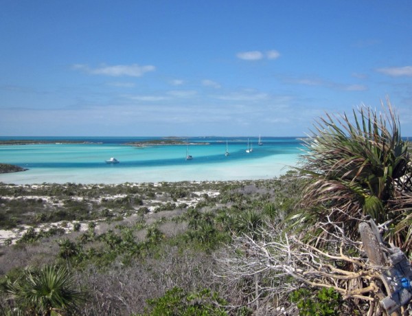 |
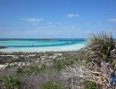
At midnight on January 2, 2013, we headed through Little Harbor Reef and left the Abacos for a two month trip down and back up the incredibly beautiful Exumas island chain.
38 Photos
Created 6 April 2013
|
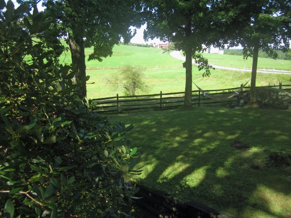 |
On July 26, 2012, we left Voyageur in Man-O-War Cay and flew from Marsh Harbour to Miami. Then we picked up our old Honda in St. Augustine and set off on three and a half months of visits with family and friends.
The trip which we dubbed "The Great Sofa Tour of 2012" would take us from the Bahamas to Florida, Connecticut, Nova Scotia, Maine, Massachusetts, Pennsylvania, Ohio, Wisconsin, Indiana, Maryland, Virginia and North Carolina. And to all who opened their hearts and homes to us, we offer our thanks for making this trip of a life time possible ! This is your story too.
28 Photos
Created 1 December 2012
|
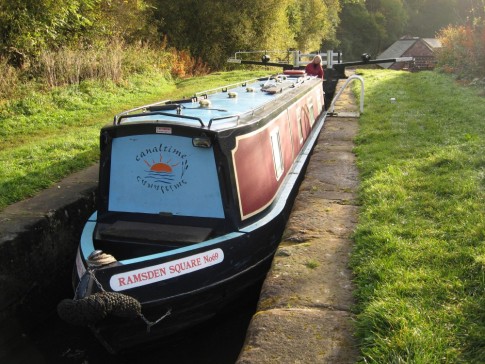 |
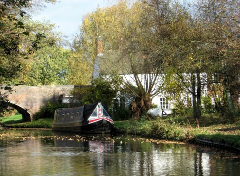
We leave Voyageur in St. Augustine and return to the canals and locks of the United Kingdom for our third narrowboat cruise.
56 Photos
Created 24 November 2009
|
 |
Back in St. Augustine from the Abacos.
7 Photos
Created 15 July 2009
|
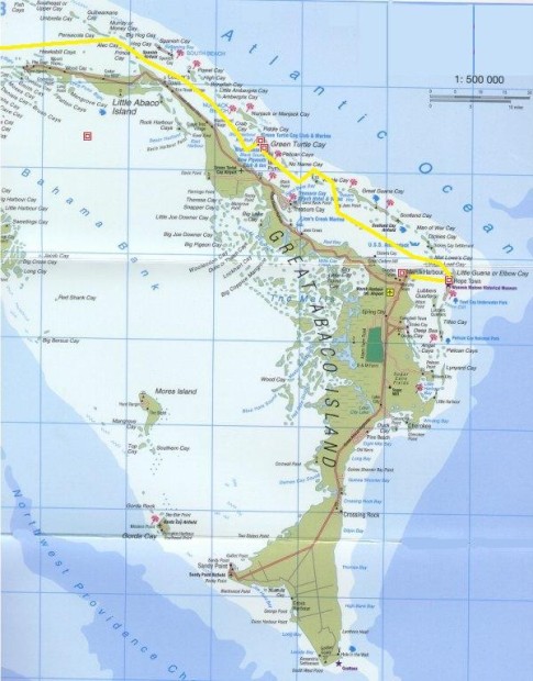 |
The Abacos are the islands and cays that comprise the Northern Bahamas.
46 Photos
Created 23 April 2009
|
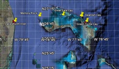 |
From Lake Worth (West palm Beach), we set out across the Gulf Stream bound for the Little Bahama Bank and Great Sale Cay on our way to the Abacos.
16 Photos
Created 23 April 2009
|
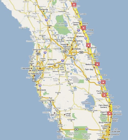 |
From St. Augustine, we head further South for Lake Worth, near West Palm Beach, a popular jumping off point for the Bahamas . . . Mile 776 to Mile 1014
45 Photos
Created 10 March 2009
|
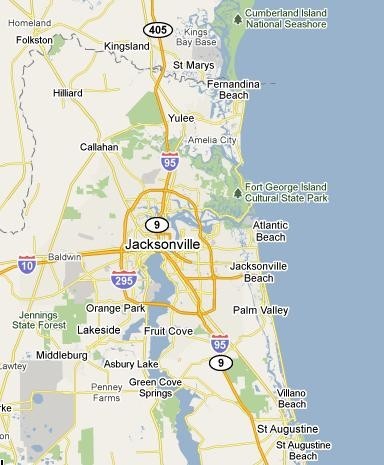 |
After a 9 degree wind chill and frost on the deck in Fernandina Beach, we finally find warm weather in Florida and some good ol' friends too . . . Mile 716 to Mile 776
30 Photos
Created 24 February 2009
|
 |
Joined by Bobby and Starr, we point the bow South once again in search of warm breezes and Florida sunshine . . . Mile 563 to Mile 716
22 Photos
Created 20 February 2009
|
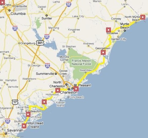 |
In this leg, we're bound from Calabash Creek to Shelter Cove Marina on Hilton Head Island where we'll leave the boat for a month of holiday visiting in the Northeast . . . Mile 342 to Mile 563
54 Photos
Created 20 February 2009
|
 |
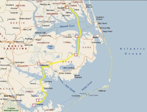
We left Oriental on Dec 3. In this part of our journey we were introduced to the Carolina low country, anchored with the Marines at Camp Lejeune, experienced the most unusual bridge opening of the entire waterway and saw our first Dolphins . . . Mile 181 to Mile 342
24 Photos
Created 20 February 2009
|
 |
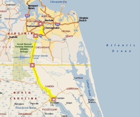
On November 17 we begin following rivers and crossing sounds on our way South to Oriental, NC . . . Mile 51 to Mile 181
11 Photos
Created 19 February 2009
|
 |
Our first "official" leg on the Intracoastal Waterway . . . Mile 0 to Mile 51
25 Photos
Created 18 February 2009
|
 |
While we spent the month of October on this magnificent body of water , winter caught up to us.
19 Photos
Created 13 February 2009
|
 |
 |
Getting ready to cast off, we sell most of our land life things and move aboard.
8 Photos
Created 27 September 2008
|
 |
Exploring the canal and lock system in England and Wales with friends Bobby & Starr, we discuss our cruising dreams.
8 Photos
Created 5 July 2008
|
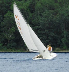 |
These boats taught me to sail and readied me for cruising.
8 Photos
Created 4 July 2008
|
Welcome Aboard Voyageur
Who: Bob & Jane Fulton
Port: Portsmouth, RI
Gallery