Anna Marie
Crealock 37
10 September 2018
24 August 2018
18 August 2018 | Eureka, Humboldt Bay, California
05 August 2018 | Half Moon Bay
30 July 2018 | Monterey, California
19 July 2018 | Port San Luis
14 July 2018
10 July 2018
08 July 2018
01 July 2018 | Ensenada
23 June 2018
22 June 2018 | Cabo San Lucas
14 June 2018 | La Paz, BCS, Mexico
11 June 2018 | Marina de La Paz, BCS, Mexico
04 June 2018 | Puerto Balandra
11 May 2018 | Marina Mazatlan
02 May 2018 | La Cruz
14 April 2018 | La Cruz de Huanacaxtle Anchorage
02 April 2018
The Return Trip - Astoria, Rainier, Portland
10 September 2018
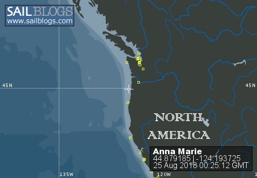
Our 190 nm leg from Coos Bay to Astoria was uneventful and we made good enough time that we had to consciously keep slowing our progress so that we would arrive at the Columbia River Bar at slack water before the flood tide. As it was, we arrived somewhat early on Saturday morning, August 25, and entered on the last of the ebb current. Winds were calm and the swells quite manageable, but we entered slowly regardless. We encountered dredging vessels, an inbound tanker, and literally hundreds of swarming recreational fishing boats. The latter was the most disturbing and disruptive due to the chaotic and undisciplined nature of the recreational fishery. These boats were all over the channel going every direction but down or up. Most were crowded near Buoy 10.
We arrived at our assigned slip in the West Basin in Astoria at 1137, 190 nm after departing Coos Bay. We took care of Anna Marie, showered, and waited for my daughter Genevieve to arrive. She had been out to Tillamook for an outing with friends and had offered to take Tom back to Portland. After Genevieve arrived, we walked up to a local pub and had typically good and greasy pub food and some good beer before they both departed for Portland around 1400 hours.
The following day, Sunday, I spent several hours cleaning and rearranging gear. Since I normally use the quarter berth for storage of gear, I had moved all of it out to the starboard settee during Tom's tenure aboard (he slept in the quarter berth). So all of that gear went back onto the quarter berth.
Late in the day, I walked into Astoria's downtown to meet my friend Leann, who had bused out of Portland to accompany me up river to Portland. And of course, the rain that had been predicted and threatening all day, burst forth for our walk back to the marina. Absolutely the wettest I've been in many years. Welcome back to the PNW!
After refueling on the morning of August 27, Monday, we departed Astoria at 1007 and began our 81.6 nm trip up the Columbia River to our assigned slip at Tomahawk Bay Marina. We took two days getting there. We stopped at the public docks at the Oregon town of Rainier at 1730 hours on Monday after a rapid 47.3 nm jaunt. The current was still running at nearly 2 knots, upstream, when we arrived, and years away from the excitement of docking on the Columbia River left us in somewhat of a pickle, as Leann stepped off to secure the amidships line but I stupidly allowed the bow to catch the current and swing out away from the dock. So here we were with the stern securely tied to the dock, the amidships line secured but less securely so. A 50 foot bowline quickly replaced our 25 foot line and I was able to pull the bow back in. Current! I guess I better get reacquainted with it. We had dinner ashore in a tavern up on Rainier's main drag,and settled in early so as to ready for an early departure on Tuesday.
Well, we didn't leave quite so early, but cast off and let the ebb tide and river current carry us away from the dock at 0837. We fought the current all the way to Portland, arriving at Tomahawk Bay Marina at 1600, some 34 nm upstream from Rainier. So here we are, on Tuesday, August 28, 2018, 2,585 nm from my departure point at La Cruz de Huanacaxtle, Mexico, and 10,549 nm since my departure from this very spot five years ago.
I am currently in the process of unloading all the personal gear that I have been hauling around for the past five years, so that I can properly clean Anna Marie and begin assessing her for needed regular and deferred maintenance. I will be moored at slip F-10 in Tomahawk Bay Marina for the immediate future.
I do believe that this will wrap up this particular blog! I will start a new one for future trips. Adios!
The Return Trip - Coos Bay
24 August 2018
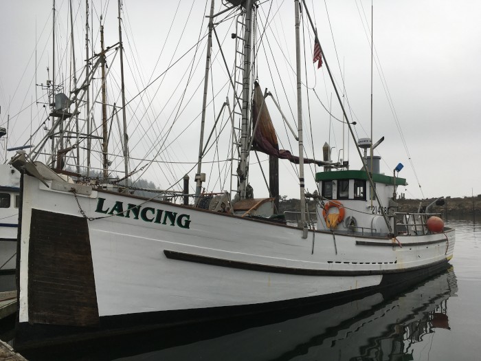
We stopped at Charleston Harbor in Coos Bay following our departure from Humboldt Bay. About 170 nautical miles, taking us about 30 hours. Getting some rest and waiting for a weather window, we caught a bus into the town of Coos Bay and visited the art museum. They had an interesting maritime display.
The photo of the old fishing boat is representative of the fine old fishing boats moored in Charleston.
We decided to depart Coos Bay at about 2345 on Thursday, August 23 and are currently 96 nm out, 77 nm to the outer approaches to the Columbia River bar. Should be there about 0930 on Saturday morning.
The Return Trip - Half Moon Bay to Humboldt Bay
18 August 2018 | Eureka, Humboldt Bay, California
After spending way too much time at the Pillar Point Marina in Half Moon Bay (12 days), Anna Marie, Tom, and I finally departed on Monday, August 13 and set a course to cross the San Francisco shipping lanes towards Drake's Bay. We left HMB a little after 0900 and arrived at anchorage in Drake's Bay at 1650.
Based on information obtained from ActiveCaptain, we decided to try anchoring in closer to the shore and not too far off of the old pier in about 15 feet of water rather than the recommended 4-6 fathoms listed in the US Coast Pilot. After sitting there for a couple hours I decided that we would be better further up the bay to the NW assuming that it would get windy later in the evening. So I hauled in the anchor (Anna Marie has an old manual Muir Hercules windlass that definitely needs an overhaul) and we moved a half mile or more up the bay and into slightly deeper water at 20 feet. We set the hook and she held properly when backing down on it to about 1500 RPM.
Later that night I got up around 2300 to go on deck and check the ground tackle. Everything looked ok although by this time it was blowing out of the NW at about 18-19 knots. Once I was reasonably assured we were holding well, I went back to bed. Not more than 15 minutes later I heard a loud unidentified noise and Anna Marie seemed to be riding the waves differently. I got up noting that the bow was pointing to the SW rather than NW, and looking out of the starboad port above the galley I noticed with shock that there was another sailboat not more than 100 feet off our side. By the time I made it onto deck it was obvious that we were dragging and dragging rapidly. The wind was up to 22-24 knots by this time. I started the engine and once Tom was on deck I went forward and started bringing in the anchor. It was obviously just skipping along on the bottom. There was plenty of weed wrapped around the chain, but none on the anchor. The whole chore of raising the anchor and the chain was reasonably difficult at best. In ten years of anchoring Anna Marie, this was the the second time my seemingly well set anchor has dragged.
With difficulty maneuvering the boat in the strong winds, we found in the windy and dark night what seemed a good alternative in about 25 feet and dropped the hook, but could not get a set. I had put out about 150 feet of chain in both these attempts, which should have held us in much stronger winds. Raising the anchor this time was much more difficult and when I finally had the anchor out of the water I could see that it was heavily laden with weed and mud. It took me at least 15 minutes to clear it off as Tom kept us hovering in more or less the same location. It was after 0200 by this time and we noticed several anchor lights and radar targets within the bay that has not been there when we anchored for the second time earlier in the evening. Seems we had many neighbors and all were anchored in what we assumed to be 35 feet or greater in depth. We figured that there was a weed line along that depth contour someplace so we went out to about 36 feet and upon setting the anchor we seemed to get a good hold (noting apprehensively that we seemed to have had a good set earlier as well!). Thirty minutes later or so I was reasonably assured we had a good set and was thus able to get a couple hours of sleep that night.
We departed Drake's Bay around 0700 still somewhat in shock from the night's misadventures, and set course to round Point Reyes and make it into Bodega Harbor, destination Spud Point Marina.
We arrived at the marina around 1230 on Tuesday, August 14, filled the fuel tank with diesel and found our assigned slip, B-27. After showers and a late lunch at a local sea food cafe we settled in for the day as we were anticipating an early start on Wednesday, destination Eureka in Humboldt Bay.
We departed Spud Point Marina around 0300 on August 15, inching our way through the dark out the long narrow channel that would return us to the Pacific Ocean. Once free of the jetty we had to avoid Bodega Rock and round Bodega Head before we could turn to the NW and head toward Cape Mendocino. The winds were light and variable for the first part of the trip but later 14-20 knots off and on until we rounded the cape in the wee hours of August 16, Thursday. We arrived at the fuel dock at Englund Marine by 1130, added 22 gallons of diesel, and made our way to the Eureka Public Marina nearby. At this point in time, we were planning to stop for a few hours and then catch the next slack tide to clear the bar and travel overnight to Crescent City. Upon securing a space on the outer linear dock at the marina we both tried to catch a little sleep before out planned departure at around 1530. Once up and ready to go, a revisit to the marine forecast convinced us that the steep seas expected on Friday sometime were in fact now forecast to hit the area soon after midnight. Being quite tired from lack of sleep, we did not relish the idea of pounding into 5-6 foot closely spaced waves, so we postponed our departure until some unknown date in the future.
Eureka is in the middle of an art festival so we have found much to keep us busy between wandering Old Town, provisioning, and doing boat maintenance, including a fuel filter change.
The Return Trip - Santa Cruz and Half Moon Bay
05 August 2018 | Half Moon Bay
I managed to depart my slip at the Monterey marina at about 0830 on Tuesday, July 31, pulling out into Monterey Bay in fairly foggy conditions. I initially set the mains'l and the genoa with the hope the wind angle would allow me to sail in a northerly direction across the bay to Santa Cruz. This proved to be a false hope as once I'd properly set my course the wind was coming across the port bow at about 30 degrees and the jib would not function properly. So there I am fueling the jib again within minutes of deploying it. As I was fiddling with sails, moorage lines, fenders and the new chart plotter, I failed to notice I had sailed into a pod of humpback whales. When one of the large creatures surfaced not more than a dozen feet off my starboard beam, I was quite shocked. So I quit fiddling and paid attention to my surroundings. In the next several minutes I noticed at least four humpback whales in the immediate vicinity. Once I was clear of the whales, I set my course and motorsailed across the bay in fairly light winds. I only had about 23 nautical miles to go to get to the anchorage near the Santa Cruz wharf, and when I was about an hour out I noticed what appeared to be breakers off my portside. As these "breakers" got closer I determined that there was a strong westerly wind bearing down on me. I decided to douse the main right then and there as I was close enough to my destination not to be interested in dealing with a wind on my full main with a wind that was creating that impressive line of breaking seas bearing down on me. And hit me it did, about 30 minutes out of the Santa Cruz anchorage. 15-20 knots off my port beam. It would have made for a good afternoon of sailing had that been my objective!
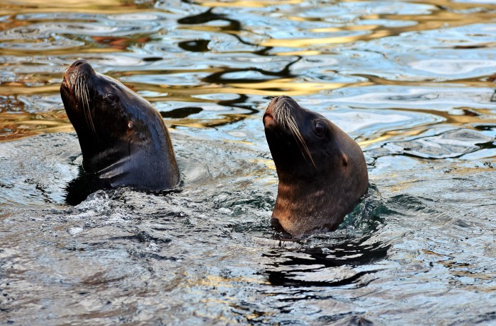
I anchored fairly close in to the western side of the wharf, well protected from the wind by the headland protecting the Santa Cruz harbor, at 1315 in the early afternoon. Twenty two and seven tenths nm from my slip in Monterey, in 29' of water with 120' of chain out. I was able to spend a leisurely afternoon observing the sea lions and sea birds. In fact, I had a pair of sea lions surface next to the boat carrying on together with what quite appeared to be amorous kissing!
I was up early the next morning, Wednesday August 1, and underway by 0200. With the weather report calling for small craft advisory winds to 25 knots, I thought I would try to beat the worst of them in the normally calmer morning. Yeah, for the first hour or so. But I was soon motorsailing into steep chop and 18-19 knots of apparent wind just off my port bow. This stayed with me most of the fifty plus miles up to Pillar Pont Harbor, tucked inside Half Moon Bay. I saw apparent winds as strong as 24 knots and as mild as 14 knots, but the seas remained rough so I was glad to reach my anchoring point inside the outer breakwater around noon. I had attempted to get a slip since I intended to collect my crew here, but there was nothing available according to the young, indifferent female voice I connected to via my cell phone. Which was fine, as it is actually easier to anchor than to prepare Anna Marie for docking, and I was pretty tired.
Tom Wordell had flown in to San Francisco on July 31 and planning to spend a couple days visiting with his step brother and family and would not be ready to board until around 1000 on Thursday August 2. So I arranged to pick him up at the fuel dock the following morning. Before I raised the anchor, though, I called the harbor office and was able to secure a slip for the next night. I still went to the fuel dock, however, picked up Tom, met his brother's wife Allison and daughter Francis, put on 12.8 gallons of diesel in the main tank and filled a third deck stored 5 gallon Jerry can. We then moved a few hundred feet to our assigned slip, C-28.
I am paying about $30 a night for a slip here. Since the winds are still howling outside the harbor at around 20 knots, with the forecast predicting gusts to 30 knots, here we yet sit on Sunday August 5. Neither one of us are too interested in bashing into to 20-30 knots of wind, with seas running who knows how chaotically.
We are poised, however, to make a run for the coast north of here the moment we believe the conditions will allow it. The long range grib files indicate we may have an opening mid week.
The Return Trip - San Simeon and Monterey
30 July 2018 | Monterey, California
I departed Port San Luis around 0700 on Friday, July 20. It took me about 7 hours to travel the 40 nautical miles up the coast to the anchorage off San Simeon. The wind and sea were light and manageable. A pair of humpback whales passed close off the starboard beam. I anchored Anna Marie in 25 feet of water with about 100 feet of chain out. A quiet anchorage with little wind. I could just see the renown Hearst Castle up in the hills over some tall trees lining the shore.
In a thick fog on the very dark morning of Saturday, July 21, I departed the San Simeon anchorage very slowly at about a quarter past midnight. With zero visibility, using radar and my entry track on the chart plotter, I was able to leave the shoreline and thick kelp patches behind without tangling the prop.
For the first time since leaving Cabo San Lucas, I left the mains'l furled as there was but a breath of wind off the stern, not enough to help, not enough to prevent sail flogging with the boat's motion. Unfortunately, the seas were confused for most of the day and the sail, with some slight wind, would have steadied the ride.
Sighted more whales, lots of seals and dolphins, and sea otters as I approached Monterey. Also slowed down so a pair of grey whales could pass forward of Anna Marie. They sounded, however, figuring I was a danger to them.
I arrived at my assigned slip in the Monterey marina, A-60, at 1430. It took over 14 hours to travel the 87 nautical miles from San Simeon to the Monterey harbor. This time included a stop at the Monterey fuel dock to refuel. I added 24.3 gallons of diesel to the tank, which calculates to using 0.616 gallons per hour since my last refueling in Santa Barbara.
As of today, Monday July 30, I have been here for 10 days. I have spent that time reprovisioning, installing the new chartplotter, exploring historical Monterey, rebuilding the head, and performing many small and not-so-small tasks aboard Anna Marie.
My plan is to leave for Santa Cruz in the morning, then on to Half Moon Bay on Wednesday where I will pick up my friend Tom Wordell (sv Eagle) who will crew for me up the coast as far as Portland.
The Return Trip - Cojo Anchorage and Port San Luis
19 July 2018 | Port San Luis
I spent five nights in Santa Barbara. The first three days in the marina were spent doing tasks such as reprovisioning, putting on water, laundry, bottom cleaning and zinc anode replacement (Salty Dog Divers), cell phone repair, and oil and oil filter change. Finally, on Tuesday, the day before my departure, I did a little sightseeing. I walked up (and back) to the Mission Santa Barbara and took the self-guided tour.
I departed Santa Barbara on Wednesday, July 18, at 0600 and made my way in a westerly direction to Cojo Anchorage, arriving early in the afternoon at 1340. That is a 41 nm hop up the coast. This is essentially an open roadstead tucked in behind Government Point (just east of Concepcion Point). One has to weave in through the kelp beds to find suitable anchorage off a culvert protruding from under the railroad tracks in about 5 fathoms over hard sand (according to the Coast Pilot).
At one point, soon after leaving Santa Barbara, I went through a massive oil slick. The oil was thick on the water and had a rainbow sheen to it. It had a very strong odor, as well.
I was up early on Thursday, July 19, and had my anchor raised and was under way by 0530. Although the weather forecast called for reasonably mild conditions off Point Concepcion and Point Arguella, I wanted to hedge my bets by getting an early start. It certainly wasn't glass like out there, but for the 20 odd nm it took to round both points, the wind waves and ocean swell were steep and close together, although wind velocity seldom reached 14 knots apparent (wind out of the west and right on my bow). As with most of my traveling up the Mexican and US coasts, I motor sailed with the full main and tacked off 20-30 degrees when necessary to use the wind to help accelerate the boat. The day was actually fairly easy and I saw many dolphins and seals and a few whale.
I arrived in Port San Luis around 1430 and attempted (three times) to secure Anna Marie to one of the port's mooring buoys, but failed miserably due to the 15 knot wind blowing through the mooring field and the slick nature of the mooring cables. I would get ahold of the cable, or hawse, and Anna Marie's bow would veer off in the wind and I would be forced to let go of the slimy thing. Finally in disgust I headed over to the anchorage and set my hook in about 30 feet of water. Should have just done that first, but I had thought I was saving myself some effort to secure to a mooring ball. The anchorage is in between the Cal Poly wharf and the county wharf, off a public swimming beach.
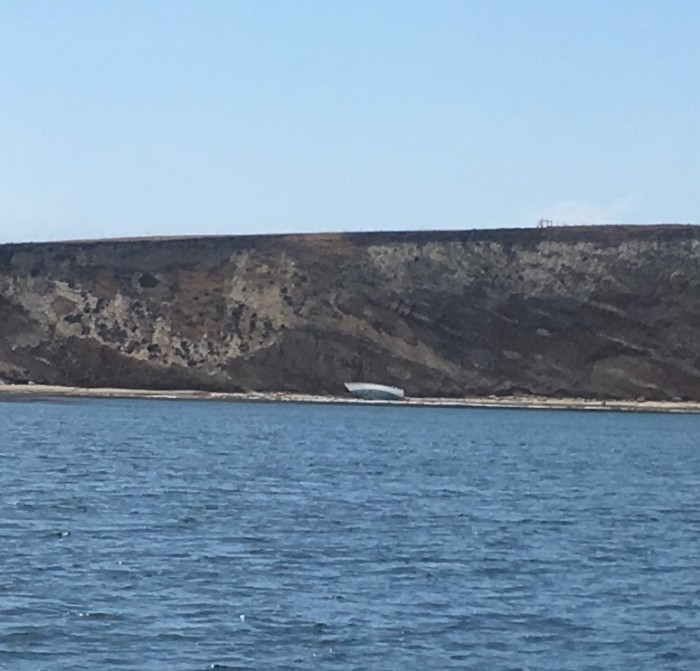
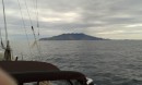
The photo shows what is left of a small sailboat on the beach at Cojo Anchorage. Somebody evidently had some troubles.
I departed Santa Barbara on Wednesday, July 18, at 0600 and made my way in a westerly direction to Cojo Anchorage, arriving early in the afternoon at 1340. That is a 41 nm hop up the coast. This is essentially an open roadstead tucked in behind Government Point (just east of Concepcion Point). One has to weave in through the kelp beds to find suitable anchorage off a culvert protruding from under the railroad tracks in about 5 fathoms over hard sand (according to the Coast Pilot).
At one point, soon after leaving Santa Barbara, I went through a massive oil slick. The oil was thick on the water and had a rainbow sheen to it. It had a very strong odor, as well.
I was up early on Thursday, July 19, and had my anchor raised and was under way by 0530. Although the weather forecast called for reasonably mild conditions off Point Concepcion and Point Arguella, I wanted to hedge my bets by getting an early start. It certainly wasn't glass like out there, but for the 20 odd nm it took to round both points, the wind waves and ocean swell were steep and close together, although wind velocity seldom reached 14 knots apparent (wind out of the west and right on my bow). As with most of my traveling up the Mexican and US coasts, I motor sailed with the full main and tacked off 20-30 degrees when necessary to use the wind to help accelerate the boat. The day was actually fairly easy and I saw many dolphins and seals and a few whale.
I arrived in Port San Luis around 1430 and attempted (three times) to secure Anna Marie to one of the port's mooring buoys, but failed miserably due to the 15 knot wind blowing through the mooring field and the slick nature of the mooring cables. I would get ahold of the cable, or hawse, and Anna Marie's bow would veer off in the wind and I would be forced to let go of the slimy thing. Finally in disgust I headed over to the anchorage and set my hook in about 30 feet of water. Should have just done that first, but I had thought I was saving myself some effort to secure to a mooring ball. The anchorage is in between the Cal Poly wharf and the county wharf, off a public swimming beach.
The photo shows what is left of a small sailboat on the beach at Cojo Anchorage. Somebody evidently had some troubles.
| Vessel Name: | Anna Marie |
| Vessel Make/Model: | Pacific Seacraft (Crealock 37) |
| Hailing Port: | Portland, Oregon |
| Crew: | Robert Curry |
Anna Marie's Photos - La Cruz de Huanacaxtle to Bahia Santiago


.jpeg "Anna Marie : Taken from sv Eagle on a jaunt up the Costelegro (Spanish for Happy Coast)")


.jpeg "Booby Investigates our Sails: A young Booby investigation my sails. It circled around several times, getting right up to the sails to have a good look.")
.jpeg "The Manzanillo coal fired power generating plant.: A massive polluting plant. It was smokey most of the time we were here.")


.jpeg "Cap and his Conch Shell: Jessica bought me this shell from a vendor on the Santiago beach. I have been learning how to \"play\" it.")


Anna Marie
Who: Robert Curry
Port: Portland, Oregon
Gallery
.jpeg)
.jpg)
Favorites
SailBlogs Friends

