
Audrey's journey
20 July 2012 | Beaufort, NC
13 April 2012 | 34.72N 76.66W
01 March 2012 | Beaufort NC
03 January 2012 | 1603 Ann St
23 December 2010 | Beaufort NC
25 February 2010 | 34 42.5N
22 January 2010 | Towne Creek Marine
02 November 2009 | 34 43.5'N: 76 39.8'W
11 March 2009 | Shakleford Banks NC
26 February 2009 | Beaufort NC
22 February 2009 | beaufort or Blowfort!
22 February 2009 | Town Creek Marina
15 February 2009 | Port City Java NC
08 February 2009 | Oriental
05 February 2009 | Oriental
29 January 2009 | Cape Fear NC
21 January 2009 | Beaufort, NC
18 January 2009 | Still in Minnesott
12 January 2009 | Minessott Beach, NC
28 December 2008 | The Cabin
Detour to Cape Fear
29 January 2009 | Cape Fear NC
Jon - now ok!
Well, here's the latest, warts-n-all.
We left Beaufort, NC last Saturday around 11 am and headed out the long channel to the Atlantic. The forecast was for 2-4 ft seas with 15-20kts winds from the Northwest, then North then Northeast, all good for a nice downwind sail down the cost.
When we hit the Atlantic, the seas were more like 4-6 ft, but very close together, so it was a pretty bumpy ride. We put the main up with one reef in and then motorsailed as the wind was mostly light and variable, and what there was, was right on the nose (southwest). We continued on, the motor running flawlessly at 2000 pm making about 6 knots, hoping for more wind - all good really. Michelle went down below for a nap, and then I went below around 4pm to get some rest before the night.
In the middle of that rest, Michelle called me as the wind had suddenly to the north and was blowing 20-25 kts, so with the main up, the motor running, we were flying along - too fast. So we shut the motor off and were still doing 7 and sometimes 8 knots, but now the seas had picked up to maybe 6-8 ft and were starting to come from a couple of different directions, so at that speed, the windvane steering system, which to that point had worked flawlessly, was being overpowered. We were in the process of discussing how to take the main down with a thought to unfurl a small amount of jib to control the speed, when RRRRRIP- the mainsail tore fore and aft about a 1/3 of the way up the mast.
The main was now plastered against the spreaders and mast, and the boat now had more windage, so we were now doing 8-9 knots and the helm was REALLY hard work, so I had to steer as Michelle didn't have the strength to keep the boat straight. So, Michelle went up on deck to try to pull down the ripped main, in now building seas, and winds starting to hit 30kts - she got banged around pretty good, and managed to loosen the halyard, but there was no way the main was coming down.
Its now around 6:30pm. After a lot of thought, we decided that on the course we had to run (downwind) we could make the Cape Fear shoal light by daybreak (around 6:30am) and the boat was just about controllable, within 30-40 degrees. So, handsteering through the night, trying to avoid broaching on the now really confused and breaking seas (which in the dark we couldn't see, but could certainly hear and feel), the main eventually fell down on its own when the boat swung away from the winf on a couple of occasions, so that helped. With the wind increasing to 35kts gusting 40, we still had some residual main stuck to the mast, so enough windage to propel the boat at 7-8 knots, but just about manageable. All through the night we encountered little mini-squalls and rainstorms.
So, we're approaching the Cape Fear light just as dawn is breaking, and now we can see the seas - scary! Swell in three directions, waves breaking everywhere, and estimated seas of 12-15ft with the wind a constant 35kts with frequent gusts around 40kts. So, we decided now we'd need the motor to go negotiate the narrow and twisting 35 mile channel to Cape Fear between a bunch of very shallow shoals (1-5ft). The motor would not start! It looked like we'd lost electrical power, so the starter motor would not turn over. We tried combining house and start batteries, but still nothing. At this point, I had to stay at the helm as it was really difficult to steer. We did our best to trouble shoot the problem, but concluded we were without engine. So we were adrift, with no real sail plan, and no motor and what looked like failing electrics (meaning no navigation). We had no choice but to call the coastguard. We couldn't raise them on the VHF radio due to low battery, and the handheld back-up didn't have the range (we were about 40miles from shore and the normal range is 10nnm). We then activated the EPIRB (emergency beacon) which sends the emergency signal and coordinates to the coastguard.
About 3 hours later, after drifting at about 3-4 kts in huge seas, we spotted a helicopter and managed to raise them on the handheld VHF. We directed them to us as they couldn't see us amongst all the white caps and breaking waves; turns out they weren't looking for us but for another boat in distress. They stayed with us until the helicopter that was looking for us cam on station - they wanted to know if we wanted to abandon ship. I requested a tow. So, after about another hour, two 42ft coast guard boats came along. They wanted us to come aboard their boat, but the seas were far to big and rough for them to get close enough to get alongside; they tried once, but just ended up smashing into the side of the boat. So they then set about hooking us up for a tow; Michelle drew the short straw of going to the bow to catch the lines as I had to continue steering. She got well and truly bashed around, and had to struggle to grab the ball and small line they threw, then pull in two big, heavy tow lines and secure them to the bow. She got all that done, and collected many, many bruises in the process.
The various coastguard radio chatter, plus some reports from other ships confirmed the 12-15ft seas and 35-40 knot winds! Apparently, non-one was expecting these conditions given the forecast.
Our instructions were to follow exactly in the wake of the tow boat, wherever they went. Off we set at 7 knots! This started a 5 hour extreme roller coaster ride smashing through waves and ridiculous angles and getting pummeled by spray every minute or so. By the time we arrived at Cape Fear, we were both, freezing, soaked and sore. Then Michelle had to go to the bow again to release the tow lines, and set two more from a different coastguard cutter that would take us into port - still in big wind and big seas - but by now, she's an expert.
Anyway, we got to port, underwent a coastguard inspection of the vessel to make sure we had all required safety gear, etc., which we did. Then we checked into a hotel and slept for 12 hours after two showers to warm up.
Sounds a little more boring than it really was, but it is hard to put in words. Needless to say our plans have changed and we are going to stay in NC to do necessary repairs and iron out the electrical and engine glitches.
Jon & Michelle
Ps. The coastguard were terrific - professional, understanding, the helicopter stayed on scene until the boats got there (about an hour) even though that was right at the limit of their fuel reserve.
Here is the official US CG release about our incident:
News Release
Date: January 25, 2009
Contact: Fifth District Public Affairs
(757) 398-6274
Coast Guard rescues 2 near Cape Fear, N.C.
Frying Pan Shoals, N.C. - The Coast Guard rescued two people Sunday aboard a disabled sailboat 37 miles southeast of Cape Fear, N.C.
The Coast Guard received a mayday call at 6:01 a.m. from a crew member aboard the Audrey and received an electronic positioning indication radio beacon signal.
Coast Guard rescue helicopter crews from Air Station Elizabeth City and Air Facility Charleston, S.C., arrived on scene and established communication with the crew of the Audrey, who reported they had lost power and had torn sails.
A boat crew from Coast Guard Station Wrightsville Beach arrived on scene and towed the Audrey and crew up the Cape Fear River and transferred the tow to a boat crew from Coast Guard Station Oak Island, who is towing them to a local marina.
The Coast Guard urges boaters to be equipped with a 406 MHz EPIRB whenever they are on the water. The EPIRB provides information such as location, owner of the vessel and contact information which can assist rescuers if the vessel is in distress.
The triangulated position of the mayday call provided a search area that was approximately 40 miles different than the actual position, according to Petty Officer 1st Class Richard Hynson, a watchstander at the Fifth Coast Guard District command center.
"If it weren't for the EPIRB, we would have been looking in a totally different area for them," said Hynson.
Also, boaters should try to provide as much information about their boat, situation, and position as they can while making a mayday call, in order to reduce search areas and response times.
###
ShareThis
Saving Lives and Guarding the Coast Since 1790.
The United States Coast Guard -- Proud History. Powerful Future.
Comments
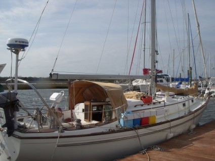
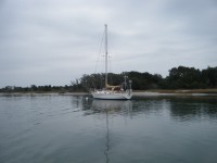
| Vessel Name: | Audrey |
| Vessel Make/Model: | Pearson 367 Cutter |
| Hailing Port: | Beaufort NC |
| Crew: | Jon & Michelle Groom |
| About: | Jon & Michelle have been sailing since 2007, starting in Monterey Bay in California with a Pearson 30, then upgrading to a Hunter 44DS which we lived aboard for a year, before moving back to the east cost and to their newest boat, Audrey, a 1981 Pearson 367 Cutter. |
| Extra: | Having lived aboard during 2007 in California, Jon & Michelle moved to a cabin in the Catskills in NY, and spent two winters in Beaufort, NC, where we moved permanently in April 2010, so now we have a cottage and our boat in Beaufort. |
| Home Page: | www.audreysails.com |
Gallery not available
About the crew
Who: Jon & Michelle Groom
Port: Beaufort NC