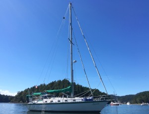
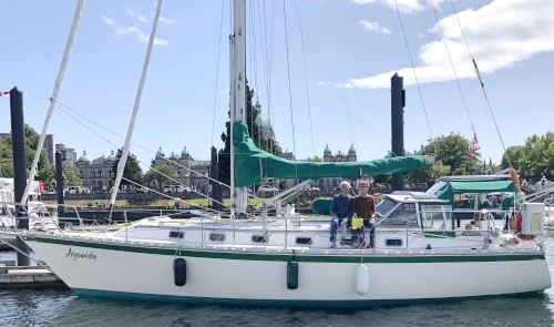
sv Ayomide Explorations
| Vessel Name: | Ayomide |
| Vessel Make/Model: | Caliber 38 |
| Hailing Port: | Victoria, BC, Canada |
| Crew: | Ken & Joan Newman |
| About: |
15 April 2023
Discovering the North End of Vancouver Island
During the past two cruising seasons (2021 and 2022) we have been exploring the waters and destinations at the north end of Vancouver Island. It takes time and careful planning to reach there as the island is 460 km long and the waters get more challenging the further north you go. At the top of the [...]
08 September 2019
Cruising Local waters
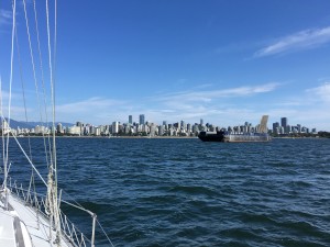
Our new direction has been leading us to quiet coves and country walks in our local islands as well as to the vibrant waterfront activity of Vancouver’s False Creek and Granville Island, where we had a berth right next to the Granville Street Bridge. While there, we had an added treat of a dinner at the historic Sylvia Hotel, where Joan and her brother Terry had been treated to dinner 60 years earlier. We’ve added a few more photos to show the diversity of experiences.
31 August 2019
A Sailor's Plans Are Always Changing
After 4 years of preparation and only days from leaving, we have done a 180° turn in our course direction. This is a perfect example of the saying, “A sailor’s plans are written in sand at low tide”. We expect that you may be shocked—and so are we!
21 August 2019
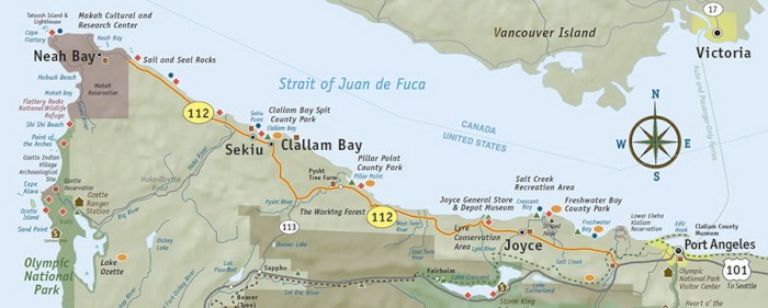
Choosing the Route South
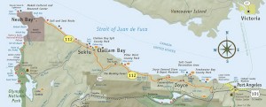
The challenging section for those leaving from our area, after traveling down the Strait of Juan de Fuca, is the 400 nautical mile stretch along the coasts of Washington and Oregon. Their coastlines are wide open to the vast Pacific Ocean, and the only sheltered harbours are at the mouths of rivers that [...]

01 August 2019 | Vancouver Island Southwest Coast
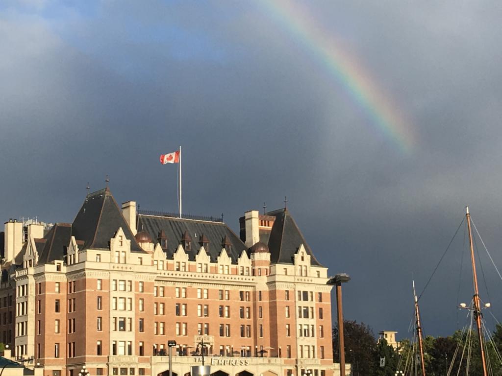
Successful Offshore Training Cruise
Our shakedown cruise, in which we ventured offshore of the west coast of Vancouver Island, went well. It started with a good sign--a rainbow over The Empress hotel in Victoria's Inner Harbour.
Discovering the North End of Vancouver Island
Cruising Local waters

A Sailor's Plans Are Always Changing
While we’ve been pushing forward, we’ve started re-evaluating what we can realistically achieve, given our late start in life on this project and what is important to both of us. As the departure date grew closer, we knew that the decision had to be made quickly, as there was no turning back once we started. Our resources of time and energy have been stretched to the max, and our needs have been growing stronger for re-connection with friends and family and visiting other parts of the world in a less all-encompassing way. The endless hours of dedication to the task haven’t been conducive to healthful habits, and we’d like to give fun a kick-start in this next phase of our lives.
And so we are putting the brakes on and choosing a new direction. We will take this next month to spend time in the beautiful waters and harbours around us and to reconnect with family and friends here, then we will do a road trip to Alberta for more re-connections before choosing new destinations to travel to by air and land.
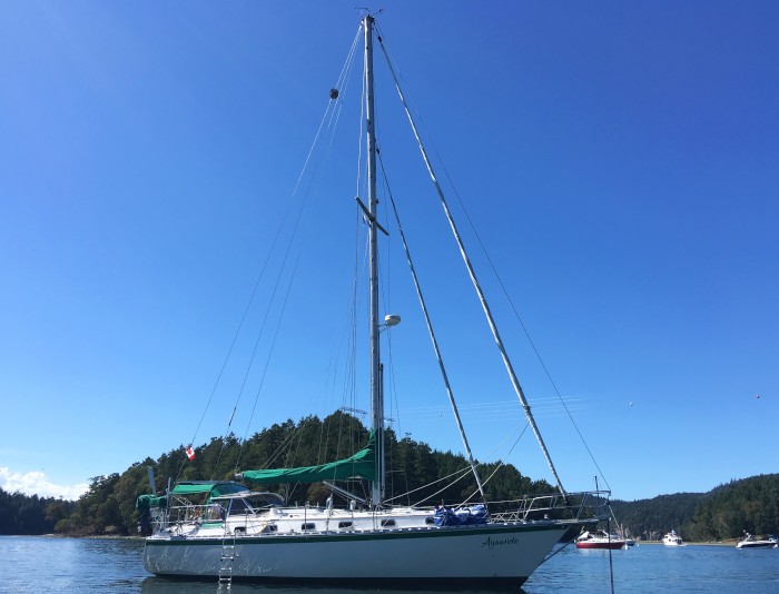
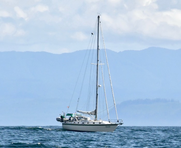
Ayomide is in far better shape now than when we took ownership 4 years ago, thanks to Ken’s dedication and fastidious attention to detail, and Ken will be proud to turn the keys over to new owners, knowing that the boat is in great shape to carry them to distant shores. And Joan is content with the knowledge, after the successful offshore training run, that she CAN do offshore sailing.
We thank you for your patience, understanding, and support these past few years, and we look forward to reconnecting with you in person.
We’re adding some photos of our past explorations to the gallery, and we’ll probably add a few more from the local cruising that we’ll be doing this fall. Hope you enjoy them!
Choosing the Route South
Along the long shoreline there are thousands of crap pots. Each crab pot has a small float on the water (often barely visible) with a long line attached to the trap on the ocean floor. The line can get caught in your prop, spin around your prop shaft, and become a molten blob of plastic in the "stuffing box," stalling the engine. Tugboats use a crab-pot-free tow zone 5-15 miles off shore.
There are two main choices for moving down that stretch of coastline.
Harbour Hopping. This is closer to shore and can take weeks, depending on how many stops are made and how long the stopovers are. Bad weather can force a boat to stay a week longer. You can choose to stop in every port so that all or most of your travel is in daylight, or travel further from shore and make stops at selective ports with just a few one or two-night passages.
Advantages: The comfort of being closer to help if needed and possibly avoiding the big swells and winds of the deep ocean. Disadvantages: Bar crossings, crab pots, marine traffic, fog.
Offshore ("Bluewater") route. This takes 7-10 days of continuous sailing/motoring and round-the-clock watches. It can be very tiring, and having experienced offshore crew is a "must" in our books. This could be anywhere from 60 to 200 nautical miles offshore. At a boat speed of 5 knots, the boat would be 12 hours to 40 hours away from shore.
Advantages: Avoiding bar crossings, crap pots and most marine traffic. Disadvantages: Bigger weather conditions--winds and swells. Being further from help. No cell phone connections. (We will not be carrying a satellite phone and will do our communications by boat radio.)
We had been planning to harbour hop our way down the coast, but Agathe has agreed to accompany us, so we will be traveling the offshore route to fit with her schedule. We will slip off the dock sometime during the week of August 26, and will make two stops on the northern edge of Washington state--Port Angeles and Neah Bay--before turning the corner to head south at Cape Flattery, just past Neah Bay.
It will be approximately 1100 nautical miles to San Francisco, and our average boat speed is 5 knots.
The boat tracker is not yet linked to the blog, and I hope to get this worked out for our departure.
Fingers crossed for fair winds and following seas!
Successful Offshore Training Cruise
I (Joan) didn't mind losing sight of land--but it could be easy to lose sight of your location if you didn't have instruments working for you! The seas were easy on us, so no seasickness, thankfully! I got the sense of what it's like to be tossed around inside the cabin and head (bathroom) and to do the watch routine--ugh, but do-able. We did 3-hour watches at night with 4-hour watches during the day. During one long night of dense fog, Bud and I took turns sleeping on deck during each other's watches. (We've now added an extra sleeping bag for the wet nights on deck.) Our coach, Agathe, was a great support to both of us, particularly this rookie--it was a real comfort having her on board. And it was good to hear from Agathe, who has provisioned for numerous lengthy offshore trips, that the boat was well provisioned with food and snacks.
We didn't get the big winds we had hoped to experience, but we did experience 12 hours of fog with our radar not working properly--it was like going blindly into darkness. A new challenge presented itself when we were hailed on the radio by a trawler who said we were headed into his nets and another commercial fisher's lines, which extended a mile! We couldn't pick them up on either our radar or the AIS (Automatic Identification System) system, so were shooting in the dark and just followed their instruction to head south while trying to avoid the shipping lane. The fog was so dense we couldn't see the freighters that were passing a short distance away, and we never did see the fishing boats.
The encounters with nature were the best part--Dahl's porpoises would appear every so often, and we were surrounded by a pod of humpback whales who were busily hunting for food. We stopped and watched them for about an hour! We also saw some beautiful sunrises and sunsets. The moon rise was particularly surprising as it rose with an intense orange glow above the horizon. The sunrises and sunsets were easy to photograph, but the whales and porpoises wouldn't stop to pose!

So now we're back in our home port preparing for the "real" cruise south down the coast. The next blog entry will talk about the decision process for the route to take.
Additional photos from the cruise are in the blog's photo gallery.
 |
|
 |
|
About & Links
|
15 April 2023
1 Photo
|
|
08 September 2019
12 Photos
|