Bacon Good, Work Bad
Follow the adventures of Bacon and James as they travel the Great Lakes, Intracoastal Waterway, Florida, and the Bahamas. Stay in touch, follow along, or join me aboard!
About Me...
Who: James Burbidge
Port: Midland (Doral)
Links
18 January 2011
18 January 2011 | Atlantis (Nassau)
02 January 2011 | Northwest Shoal
01 January 2011 | Bimini
30 December 2010 | Bimini
29 December 2010 | Bimini
28 December 2010 | Miami Beach
18 December 2010 | North Palm Beach
17 December 2010 | Peck Lake
16 December 2010 | Wabasso
15 December 2010 | Port Canaveral
13 December 2010 | Jacksonville
09 December 2010 | Jacksonville
06 December 2010 | Grande Dunes (Myrtle Beach)
05 December 2010 | St. James
04 December 2010 | Wrightsville Beach
03 December 2010 | Swansboro
01 December 2010 | Oriental
23 November 2010 | Oriental
22 November 2010 | Oriental
Bacon: 1, Treacherous North Carolina Water: 0
05 December 2010 | St. James
33 statute miles, 5 hours
Navigating the tidal inland waters of North Carolina in a deep-draft boat with a small engine is a bit like a game of chess. There is a significant amount of strategy and forethought required to make the passage quickly, efficiently, and safely. The ocean tide rises and falls in a regular, predictable manner, much like a sleeping giant breathing peacefully. However, all that water needs to find its way into and out of the inland waterway, which it does by surging through the inlets, small gaps in the outer banks. This causes tremendous currents though those inlets and adjoining waterways. This current reverses every six hours and repeats every twelve hours in sync with (but not at the same time as) the rise and fall of the ocean tide. Of course the inland water rises and falls as well, although with varying degrees of magnitude and delay, depending on how far one is from an inlet. Since the waterway is parallel to the ocean and the inlets intersect perpendicularly, the incoming (and outgoing) water splits as it enters (and exits) the waterway. This causes a reversal of current as one travels past an inlet. So when travelling the waterway, the current either helps you, or opposes you depending on when AND where you are. It also pushes (and pulls) you sideways when passing an inlet. It gets very complicated and is not easy to predict which way or how strong the current will be at all the locations and times that one will traverse in a day. Furthermore, since the whole world here is made of sand, all that in and out continually changes the landscape. Uncharted, unmarked shoals appear regularly and randomly, especially near the inlets. To further complicate matters, the height of the tides gets higher and higher as one heads south. It's about six feet around here. And then there is the wind. The wind has a direct effect by blowing you around, but it also causes tides and currents of its own, which add to or subtract from the lunar tides. If the wind opposes the current it creates steep chop which can almost stop the boat. So those are the rules of the game. The object of the game is to get your boat from Point A to Point B with the current and wind at your back as much as possible, with as much water under the boat as possible when passing through the shoally bits. All that said, I was little apprehensive about today. My ambitious plan was to put about 60 miles of waterway behind me. Those miles would include three notorious inlets and the aptly named Cape Fear River. The only thing you can really control is when you leave and when you stop. So, the plan was to get up early, hit the Carolina Beach Inlet at high slack, and see how it goes from there. To further enhance my anxiety was the fact that the wind howled all night, the rain poured, and the temperature dropped below freezing, creating a grey, icy morning to head out into in the pre-dawn darkness. This could turn into one of those brutal days - stranded on a shoal, tide falling, strong wind and current preventing rescue, all the while being hammered by cold wind or possibly snow. As it turns out, the day went pretty good. My timing was great all morning. The current wasn't much of a factor as I passed Carolina Beach Inlet in the deepest possible water. Even at slack tide, the current was several knots, but in my favour. Cape Fear River can be insurmountable if the current and tides go against you. For me, the wind blew (with 35 mph gusts) directly from behind, and I hit the river at maximum ebb, which shot me through the 13-mile passage at speeds almost double what the motor can do. Even the sun cooperated, coming out just after dawn and warming me up in my little canvas cockpit shelter. I had covered the thirty miles to Southport by 11 am! Then the game changed. As I rounded the turn out of the Cape Fear River, the wind turned onto my nose and the current that had been so helpful came on against me. The boat speed dropped from 9½ mph down to 3½ mph. Furthermore, the timing of my travel would take me to Lockwood's Folly Inlet right at low tide. Certain grounding was in the cards. So I pulled into a marina in Southport to fuel up, have lunch, wait for the current turn, and devise my strategy for the next two inlets, both notorious for shoaling. Everything I've read advises to ask the locals for navigating advice, so I figured I could do that too. Didn't get any advice except "don't go there now" so I guess stopping was a good idea. Besides, with my fill up I got to use the showers and the wifi. The pub there had good beer and the cream of crab soup was the best thing I've ever tasted. I went back to the boat and pored over the charts, the books, the tide tables and my watch. Eventually I determined that there was no possible way to negotiate the next two inlets and get to an anchorage today. So, I moved on to another marina a little further down the way to spend the night. It made for a short day, but I think it was a good decision. Now I am poised to hit the inlets in deep water and low current first thing in the morning. Also, it might be nice to be plugged in tonight - it's supposed to go down to 27 °F (that's about -3 °). It's weird to see palm trees blowing in wind that feels like it's about to snow.
Comments
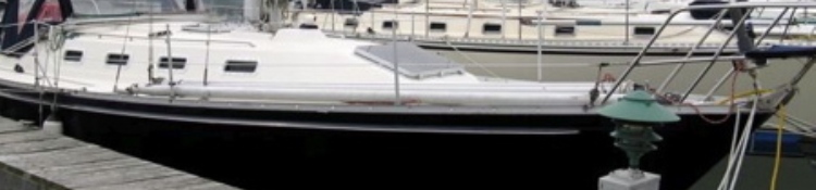
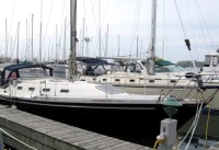
| Vessel Name: | Bacon (nee Rapture) |
| Vessel Make/Model: | CS 36 Traditional |
| Hailing Port: | Midland (Doral) |
| Crew: | James Burbidge |
| About: |
Gallery not available
About Me...
Who: James Burbidge
Port: Midland (Doral)