BANGORANG!
15 September 2017 | Tacoma
13 July 2017
12 July 2017
26 June 2017 | West Vancouver Island
24 June 2017 | North Vancouver Island
23 June 2017 | North Vancouver Island
22 June 2017 | North Vancouver Island, BC
21 June 2017 | East Thurlow Island
20 June 2017 | Quadra Island
17 June 2017 | Vancouver Island
15 June 2017 | Comox, BC
12 June 2017 | Nanimo, BC
10 June 2017 | Saltspring Island, BC
09 June 2017 | Victoria, BC
04 June 2017 | Port Townsend
04 June 2017 | Blake Island
03 June 2017 | Tacoma
29 July 2016 | Neah Bay, WA
29 July 2016 | Neah Bay
Beware Navionics Charts ARE Accurate, but your GPS may not be…
17 July 2017
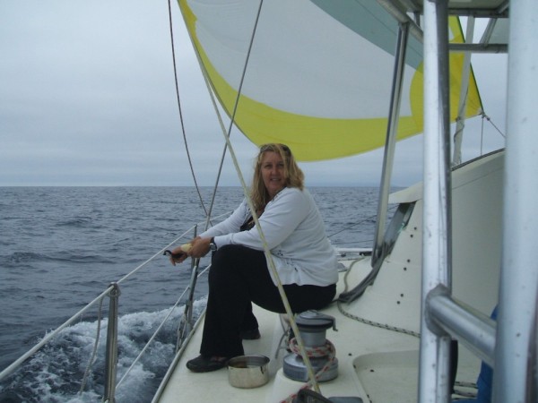
Colin
Every so often someone hits a reef, or a rock or the beach and the first thing I read is that the Navionics Charting software was somehow at fault. Usually, the chartplotter showed the boat in open water right before hitting bottom. Alternatively, I've seen claims that Navionics software placed the boat miles inland while safely anchored in a cove somewhere. I suggest that it may not be the Navionics charting, but rather the GPS input that is off course.
In our Pacific Circuit cruise we sailed nearly 30k miles There and Back Again using Navionics charting software on a pair of networked Raymarine chartplotters (e7d and e125 series) with an external pole mount GPS antenna. We have crisscrossed the largest ocean on the planet and frequently navigated through scattered reefs, narrow channels and passages so tight we had little more than a boat length on either side. Wherever we went we'd load the regional Navionics charts and over 5 yrs they have ALWAYS plotted our position exactly as we saw it to be... until one time last summer...
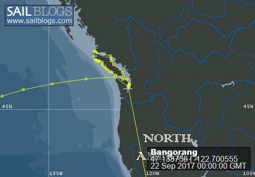
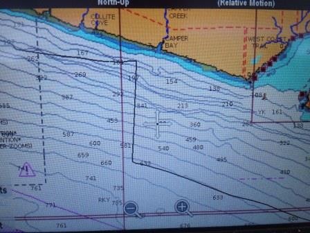
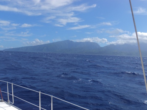
We were motorsailing SE along the south end of Vancouver Island, BC finishing a circumnavigation of the island. The weather was clear, winds light and current favorable. While closer to Vancouver Island, we could easily see across the Strait of Juan de Fuca to the WA side. Over a couple of hrs our chart plotter showed us slowly veering north as I made course corrections to the south. Eventually, the plotter had us 0.5 mile off and heading for the beach, when in fact we were miles from shore and headed for Port Angeles, WA. I tried rebooting the chartplotter a couple of times, but always it returned to the northerly course for the beach. Finally, I switched the chartplotter off the external GPS antenna and switched on the redundant internal GPS antenna. Instantly our position jumped 3 miles to the south and our new course now matched the boat heading (see photo). I was able to reproduce the faulty GPS coordinates and track just by switching back to the external GPS antenna. Anyway, we finished the cruise on the internal GPS antenna and back in Tacoma I replaced the external antenna. Once again, the Navionics charts were spot on! Although it failed, the old GPS antenna had performed admirably throughout our cruise, sometimes running 3 weeks straight and was retired with honor.
While I still love the GPS/chartplotter technology, I've once again learned to get my head out of the boat and look around. Also, embracing a belts and suspenders approach to redundant technology could prove a game saver.
In our Pacific Circuit cruise we sailed nearly 30k miles There and Back Again using Navionics charting software on a pair of networked Raymarine chartplotters (e7d and e125 series) with an external pole mount GPS antenna. We have crisscrossed the largest ocean on the planet and frequently navigated through scattered reefs, narrow channels and passages so tight we had little more than a boat length on either side. Wherever we went we'd load the regional Navionics charts and over 5 yrs they have ALWAYS plotted our position exactly as we saw it to be... until one time last summer...
We were motorsailing SE along the south end of Vancouver Island, BC finishing a circumnavigation of the island. The weather was clear, winds light and current favorable. While closer to Vancouver Island, we could easily see across the Strait of Juan de Fuca to the WA side. Over a couple of hrs our chart plotter showed us slowly veering north as I made course corrections to the south. Eventually, the plotter had us 0.5 mile off and heading for the beach, when in fact we were miles from shore and headed for Port Angeles, WA. I tried rebooting the chartplotter a couple of times, but always it returned to the northerly course for the beach. Finally, I switched the chartplotter off the external GPS antenna and switched on the redundant internal GPS antenna. Instantly our position jumped 3 miles to the south and our new course now matched the boat heading (see photo). I was able to reproduce the faulty GPS coordinates and track just by switching back to the external GPS antenna. Anyway, we finished the cruise on the internal GPS antenna and back in Tacoma I replaced the external antenna. Once again, the Navionics charts were spot on! Although it failed, the old GPS antenna had performed admirably throughout our cruise, sometimes running 3 weeks straight and was retired with honor.
While I still love the GPS/chartplotter technology, I've once again learned to get my head out of the boat and look around. Also, embracing a belts and suspenders approach to redundant technology could prove a game saver.
Comments
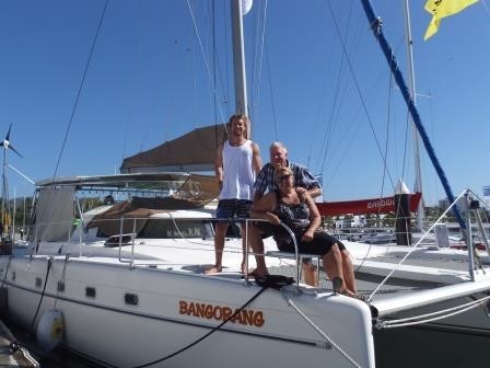
| Vessel Name: | Bangorang |
| Hailing Port: | Ventura, CA |
| Crew: | Colin, Wendy and Skid |
| Extra: | Urban Dictionary: Bangorang - The word from the film "Hook" meaning, basically, awesome! |
Bangorang's Photos - Main
 |
 |
 |
 |
 |
 |
 |
 |
 |
 |
 |
 |
 |
 |
 |
A 2 week road trip to Seattle and back on the PCH
18 Photos
Created 5 October 2013
|
 |
 |
 |
 |
 |
 |
 |
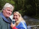
Who: Colin, Wendy and Skid
Port: Ventura, CA
Gallery