
Where WAS Brick House...The First Eight Years
Please visit our NEW WEB SITE: http://WhereIsBrickHouse.com


20 April 2016
05 October 2015 | Malaysia, island of Borneo
19 September 2015 | Kuching/Santubong
30 July 2015
01 July 2015 | Bali, Indonesia
23 May 2015 | Bali, Indonesia
17 April 2015 | Venu Island
01 April 2015
12 March 2015 | Tioman
01 March 2015 | Papua, Indonesia
26 February 2015 | West Shore of Papua Indonesia
21 January 2015 | Raja Ampat, Indonesia
05 January 2015 | Gam and Waigeo, Raja Ampat
31 December 2014 | Misool, Indonesia
31 December 2014 | Masool, Indonesia
24 December 2014 | Indonesia
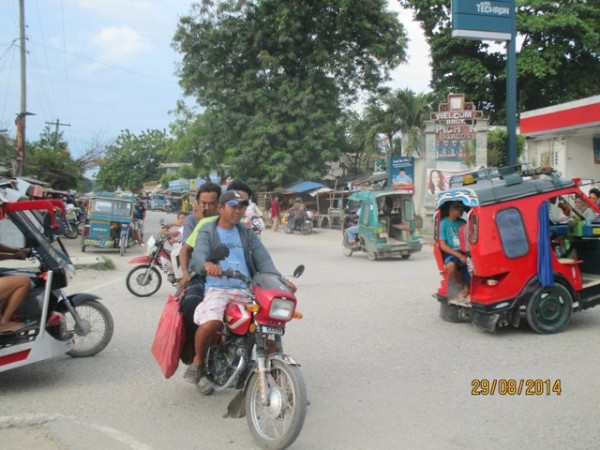
21 October 2014 | Philippines
04 June 2014 | Davao
17 April 2014 | Pacific
03 March 2014 | Pacific
World War 2
17 April 2014 | Pacific
Patrick
Command Center
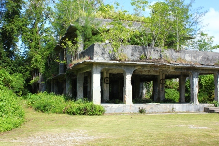
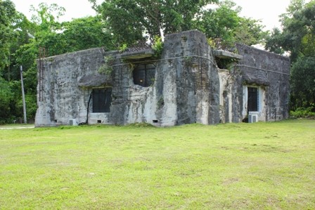
There was once a TV game show called "Camouflage". The contestant looked at a large picture then, with a pointer, tried to trace out a hidden pattern as layers of obscura were peeled away with each round. This picture of a building you have probably seen before but it is not easily recognized as it is obscured by 70 years of vegetation minus some removing of overgrowth so tourists can have access.
The big clue is, this is a World War 2 era, Japanese construction in the Pacific. If you watched the mini series, The Pacific, the Hanks/Speilberg production, this is the bombed out Japanese Command Center which the U.S. Marines had to fight their way past after crossing the runway. In the movie scene, Japanese were on both levels laying down heavy fire at the oncoming Americans. In reality, the building is well on the same side of the runway as the approaching Marines and there was no need to cross the runway, but this is a minor point.
There were other heavily fortified block houses and bunkers which the Marines had to subdue before reaching the Command Center on their way to the airport. Rounds from American tanks merely bounced off the thick concrete. In some cases it took the large projectiles from U.S. battle ships, cruising well offshore, to be called in to knock a hole in the thick fortifications. In other cases heavy smoke was used to obscure the battlefield so infantry could move up to the fortification and toss in hand grenades and hopefully, at the same time, not have their hand shot off by the enemy or have a grenade thrown out to them. There is one scene where on top of a bunker, a U.S. Marine easily tips over the coned top of an air vent and drops in a hand grenade. Those cones are welded on and not easily removed. If a grenade can be dropped down an air vent, the bottom of the vent is blocked with a very thick round piece of steel with about 6 round holes to allow air flow and stop a hand grenade. After blasting away the steel grate, it would take a second grenade to do some real damage, that is, if there were not a concrete pillar just below the vent reaching to about 2 feet of the ceiling to act as a blast deflector. Certainly, the ears of the defenders would be left ringing as well as pain in their eyes and brains.
The battle for Peleliu was even more horrendous than the earlier battle at Tarawa and no matter how graphic a TV show is, it cannot depict the reality of the carnage and difficulty of displacing Japanese who do not have the word " surrender" in their vocabulary. The Japanese were there to die and kill as many Americans as possible in the process.
The movie crew did a very good job of building a set to faithfully recreate the Japanese Command Center building. During World War 2, the view from the Command Center, all the bunkers and caves in other areas of the island, were clear to the ocean. Now, there are no long views from any fortification as all is obscured by tall vegetation. At the airport, even two of the smaller adjoining runways forming the top of the 4 shape, are overgrown leaving only the very long and wide main runway. But it is curious why the main runway is kept clear for such a great width and length when only a very rare private or small commuter plane lands there. I suspect, like the U.S. financed lengthening of the already very long runway in Majuro, Marshall Islands, and the mowing of the equally long runway at desolate Bikini Atoll, this runway on Peleliu is, for now, an emergency runway for large jets or possible use by the U.S. now that there is a military build up in the Pacific to counter the growing Chinese arsenal. After 70 years, suddenly, there is now an extensive effort to clear unexploded ordinance from areas around the airport in Peleliu. There is a token U.S. Army presence of 13 infrastructure troops, ie electricians, carpenters, stationed at a small base near the commercial airport several islands north of Peleliu. They are there to do good will work around Palau. But their presence is a toe hold, history could very well repeat itself.
Trekking into the mountains called Bloody Nose Ridge, tourist trails are marked and cleared of live ordinance. This gave us the chance to walk and crawl into the caves fortified by the Japanese. Looking out, to what would have been a wide open vista, it was easy to see how the Japanese could comfortably shoot large cannons and smaller mortar rounds with little worry of returned rounds being a direct hit on them. Even outside of caves, circular stacks of coral rocks backing up to a solid rock wall formed mortar and machine gun nests. The walking was not always easy on sharp coral slicing at our shoes.
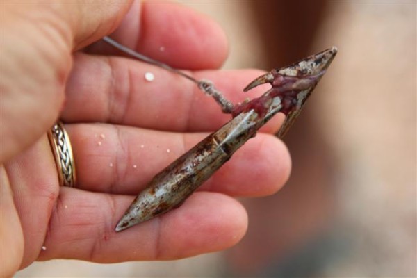
One day I returned alone to Bloody Nose Ridge to explore off the beaten path. One ridge over from the tourist trail, I found areas inside large depressions, like sink holes, which the Japanese had used for outdoor living. Stacks of bottles in good condition were under a small overhang, live mortars were stacked and a hand grenade minus the igniting pin, was resting prominently on a rock. I worked my way back to the tourist trail to explore more caves. There were once hundreds of fortified caves and adjoining corridors but many of the openings were sealed by the Marines to keep the Japanese from coming from other areas to reman the areas the Marines had spent so much effort clearing.
This day there was no one else on the marked trail till I neared its end. That is where I met two American WW2 buffs, Bruce and Rick. This is their fifth trip to Peleliu. They had a synergy and interest of which I was fortunate to latch onto. Together we trekked past the cleared trail into higher elevations of the ravine and into denser brush. We made our own trail the tangle of vegetation. They were looking for hill 140, a historic ridge in the area where the well liked U.S. captain Andrew Halbane was killed. The bushwhacking and wabbling over the sharp coral was very difficult. But it was worth the effort. We were careful to watch our step when we found old mortar fortifications. The arms are no longer there but the live projectiles lay scattered on the ground. Trekking deeper into the serpentine ridges we found caves which had not been visited for a very long time. Old helmets, blue rice bowls with the Japanese anchor printed on the bottom and clips of 5 rounds of rifle bullets were easy to find. In one very difficult to reach cave we found a very rusty sward amongst the artifacts. Those things are still there for someone else to find. In the same area we found what was left of an airplane wing. It was totally perforated with bullet holes. Another decimated part of an airplane wing was not far away. That pilot held his approach to drop his bomb and was disintegrated in the process. Trekking off the marked trails gave us a great appreciation for the rugged and jagged geology of the area where there is often a vertical 100 foot drop into a labyrinth of shorter, yet vertical, coral walls.
Palau is one of the nicest island nations we have visited. The roads are well paved and maintained. There is no trash along the roads and sidewalks. Taxi cabs are hard to find as so many people own their own cars. The people of Palau are friendly and respectful. As a tourist, crime is not a consideration. Besides the many millions of free money the U.S. hands to the government of Palau for the privilege of being their protectorate, tourism in Palau is big business. It appears Japanese tourists outnumber any other nationality for bringing in tourist dollars. Because of the expensive economy in Japan, Palau is an affordable tourist destination which it is far cheaper than visiting Hawaii.
While Rick, Bruce and I were ripping the skin on our legs and arms through tangles of overgrowth, Rebecca was biking more roadways looking for the colorful and some unique species of birds in the tree branches. She spotted King Fishers, Noddy Terns and an assortment of doves and parrots.
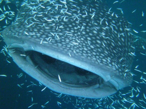
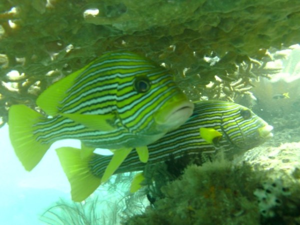
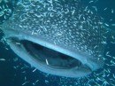
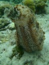
Palau is noted as being one of the top 10 SCUBA dive destinations in the world. Rebecca and I have not been impressed with the scattered snorkeling spots inside the barrier reef. Snorkeling on the outside of the reef is quite another story. Beautiful coral, loads of sizable fish and massive schools of reef fish which seem to be determined to get somewhere on a schedule. In deeper water, I hear there are schools of jacks and a species I never before heard of as well as the ubiquitous gray reef sharks and pelagic sharks. But there is a catch. The government thinks up tourist fees for everything. If you want to snorkel or SCUBA there is a "park fee" of $50 good for ten days. To take our sailboat to Pelileu, it cost us $125 for the boat. If we wandered off the roads to view something of interest, there is a $10 per person charge good for ten days. There are so many fees that I won't mention all of them here. But to some degree, these extra charges are worth while as they allow the government to maintain the tourist sites which is not done in the Marshall Islands or the Federated States of Micronesia, which includes Pohnpei. In Pohnpei no one clears the strangling vegetation from the World Heritage site of Nan Mandel.
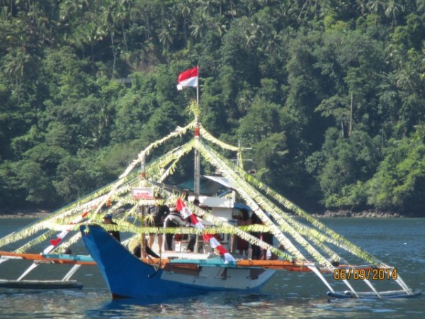
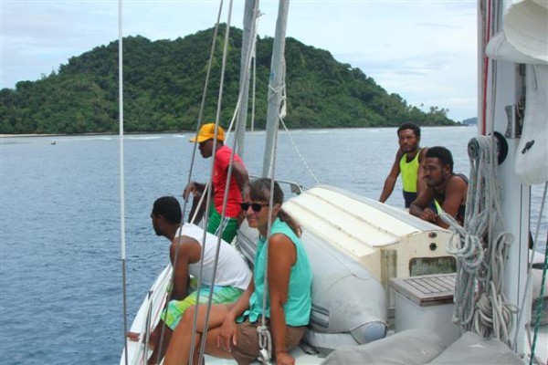
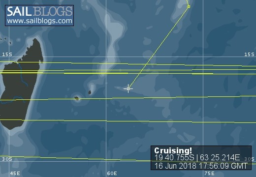
Palau is not a cruising boat friendly place because of the excessive "fees". Each island or state in Palau has their own yachting fees. The island of Angar wants $100 per day for a yacht to visit. Other islands have their own odd fees as though they have something special to offer. Waterfront hotels do not want sailboats to anchor off their shore and dingy to their beach. Most cruisers will anchor in the cove at Sam's Tours without cruising any other islands of Palau, then move on to the cheaper Philippines. And this is what we will soon do, as soon as the wind shifts out of the south west.
There are more images in the Photo Album to the right.
There was once a TV game show called "Camouflage". The contestant looked at a large picture then, with a pointer, tried to trace out a hidden pattern as layers of obscura were peeled away with each round. This picture of a building you have probably seen before but it is not easily recognized as it is obscured by 70 years of vegetation minus some removing of overgrowth so tourists can have access.
The big clue is, this is a World War 2 era, Japanese construction in the Pacific. If you watched the mini series, The Pacific, the Hanks/Speilberg production, this is the bombed out Japanese Command Center which the U.S. Marines had to fight their way past after crossing the runway. In the movie scene, Japanese were on both levels laying down heavy fire at the oncoming Americans. In reality, the building is well on the same side of the runway as the approaching Marines and there was no need to cross the runway, but this is a minor point.
There were other heavily fortified block houses and bunkers which the Marines had to subdue before reaching the Command Center on their way to the airport. Rounds from American tanks merely bounced off the thick concrete. In some cases it took the large projectiles from U.S. battle ships, cruising well offshore, to be called in to knock a hole in the thick fortifications. In other cases heavy smoke was used to obscure the battlefield so infantry could move up to the fortification and toss in hand grenades and hopefully, at the same time, not have their hand shot off by the enemy or have a grenade thrown out to them. There is one scene where on top of a bunker, a U.S. Marine easily tips over the coned top of an air vent and drops in a hand grenade. Those cones are welded on and not easily removed. If a grenade can be dropped down an air vent, the bottom of the vent is blocked with a very thick round piece of steel with about 6 round holes to allow air flow and stop a hand grenade. After blasting away the steel grate, it would take a second grenade to do some real damage, that is, if there were not a concrete pillar just below the vent reaching to about 2 feet of the ceiling to act as a blast deflector. Certainly, the ears of the defenders would be left ringing as well as pain in their eyes and brains.
The battle for Peleliu was even more horrendous than the earlier battle at Tarawa and no matter how graphic a TV show is, it cannot depict the reality of the carnage and difficulty of displacing Japanese who do not have the word " surrender" in their vocabulary. The Japanese were there to die and kill as many Americans as possible in the process.
The movie crew did a very good job of building a set to faithfully recreate the Japanese Command Center building. During World War 2, the view from the Command Center, all the bunkers and caves in other areas of the island, were clear to the ocean. Now, there are no long views from any fortification as all is obscured by tall vegetation. At the airport, even two of the smaller adjoining runways forming the top of the 4 shape, are overgrown leaving only the very long and wide main runway. But it is curious why the main runway is kept clear for such a great width and length when only a very rare private or small commuter plane lands there. I suspect, like the U.S. financed lengthening of the already very long runway in Majuro, Marshall Islands, and the mowing of the equally long runway at desolate Bikini Atoll, this runway on Peleliu is, for now, an emergency runway for large jets or possible use by the U.S. now that there is a military build up in the Pacific to counter the growing Chinese arsenal. After 70 years, suddenly, there is now an extensive effort to clear unexploded ordinance from areas around the airport in Peleliu. There is a token U.S. Army presence of 13 infrastructure troops, ie electricians, carpenters, stationed at a small base near the commercial airport several islands north of Peleliu. They are there to do good will work around Palau. But their presence is a toe hold, history could very well repeat itself.
Trekking into the mountains called Bloody Nose Ridge, tourist trails are marked and cleared of live ordinance. This gave us the chance to walk and crawl into the caves fortified by the Japanese. Looking out, to what would have been a wide open vista, it was easy to see how the Japanese could comfortably shoot large cannons and smaller mortar rounds with little worry of returned rounds being a direct hit on them. Even outside of caves, circular stacks of coral rocks backing up to a solid rock wall formed mortar and machine gun nests. The walking was not always easy on sharp coral slicing at our shoes.
One day I returned alone to Bloody Nose Ridge to explore off the beaten path. One ridge over from the tourist trail, I found areas inside large depressions, like sink holes, which the Japanese had used for outdoor living. Stacks of bottles in good condition were under a small overhang, live mortars were stacked and a hand grenade minus the igniting pin, was resting prominently on a rock. I worked my way back to the tourist trail to explore more caves. There were once hundreds of fortified caves and adjoining corridors but many of the openings were sealed by the Marines to keep the Japanese from coming from other areas to reman the areas the Marines had spent so much effort clearing.
This day there was no one else on the marked trail till I neared its end. That is where I met two American WW2 buffs, Bruce and Rick. This is their fifth trip to Peleliu. They had a synergy and interest of which I was fortunate to latch onto. Together we trekked past the cleared trail into higher elevations of the ravine and into denser brush. We made our own trail the tangle of vegetation. They were looking for hill 140, a historic ridge in the area where the well liked U.S. captain Andrew Halbane was killed. The bushwhacking and wabbling over the sharp coral was very difficult. But it was worth the effort. We were careful to watch our step when we found old mortar fortifications. The arms are no longer there but the live projectiles lay scattered on the ground. Trekking deeper into the serpentine ridges we found caves which had not been visited for a very long time. Old helmets, blue rice bowls with the Japanese anchor printed on the bottom and clips of 5 rounds of rifle bullets were easy to find. In one very difficult to reach cave we found a very rusty sward amongst the artifacts. Those things are still there for someone else to find. In the same area we found what was left of an airplane wing. It was totally perforated with bullet holes. Another decimated part of an airplane wing was not far away. That pilot held his approach to drop his bomb and was disintegrated in the process. Trekking off the marked trails gave us a great appreciation for the rugged and jagged geology of the area where there is often a vertical 100 foot drop into a labyrinth of shorter, yet vertical, coral walls.
Palau is one of the nicest island nations we have visited. The roads are well paved and maintained. There is no trash along the roads and sidewalks. Taxi cabs are hard to find as so many people own their own cars. The people of Palau are friendly and respectful. As a tourist, crime is not a consideration. Besides the many millions of free money the U.S. hands to the government of Palau for the privilege of being their protectorate, tourism in Palau is big business. It appears Japanese tourists outnumber any other nationality for bringing in tourist dollars. Because of the expensive economy in Japan, Palau is an affordable tourist destination which it is far cheaper than visiting Hawaii.
While Rick, Bruce and I were ripping the skin on our legs and arms through tangles of overgrowth, Rebecca was biking more roadways looking for the colorful and some unique species of birds in the tree branches. She spotted King Fishers, Noddy Terns and an assortment of doves and parrots.
Palau is noted as being one of the top 10 SCUBA dive destinations in the world. Rebecca and I have not been impressed with the scattered snorkeling spots inside the barrier reef. Snorkeling on the outside of the reef is quite another story. Beautiful coral, loads of sizable fish and massive schools of reef fish which seem to be determined to get somewhere on a schedule. In deeper water, I hear there are schools of jacks and a species I never before heard of as well as the ubiquitous gray reef sharks and pelagic sharks. But there is a catch. The government thinks up tourist fees for everything. If you want to snorkel or SCUBA there is a "park fee" of $50 good for ten days. To take our sailboat to Pelileu, it cost us $125 for the boat. If we wandered off the roads to view something of interest, there is a $10 per person charge good for ten days. There are so many fees that I won't mention all of them here. But to some degree, these extra charges are worth while as they allow the government to maintain the tourist sites which is not done in the Marshall Islands or the Federated States of Micronesia, which includes Pohnpei. In Pohnpei no one clears the strangling vegetation from the World Heritage site of Nan Mandel.
Palau is not a cruising boat friendly place because of the excessive "fees". Each island or state in Palau has their own yachting fees. The island of Angar wants $100 per day for a yacht to visit. Other islands have their own odd fees as though they have something special to offer. Waterfront hotels do not want sailboats to anchor off their shore and dingy to their beach. Most cruisers will anchor in the cove at Sam's Tours without cruising any other islands of Palau, then move on to the cheaper Philippines. And this is what we will soon do, as soon as the wind shifts out of the south west.
There are more images in the Photo Album to the right.
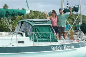
| Vessel Name: | Brick House |
| Vessel Make/Model: | Valiant 40 #134 |
| Hailing Port: | Middletown, RI USA |
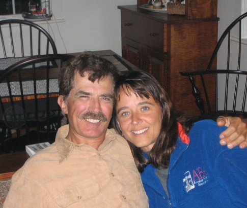
| Crew: | Patrick and Rebecca Childress |
| Extra: | |
| Home Page: | http://www.whereisbrickhouse.com |
| Social: |
|
Brick House 's Photos - (Main)
 |
|
All sorts of tropical animals and insects
No Photos
Created 5 October 2015
|
.JPG) |
 |
 |
 |
 |
 |
 |
 |
 |
 |
 |
We decided to take the slow route, down the sidewalk..ie the Intracoastal Waterway, the ICW. We went slowly, and smelled the flowers along the way. We are with old friends of Patricks, new friends of mine...Art and Grace Ormaniec, in Manteo, North Carolina.
2 Photos
Created 26 October 2007
|
 |
 |
Brick House Crew
Who: Patrick and Rebecca Childress
Port: Middletown, RI USA
Gallery
.JPG)

What Brick House Chose
- Citimarine Store
- WHAT BRICK HOUSE CHOSE
- Where Is Brick House now? (Link to Current Web Site)
- Alpenglow LED lights
- Mantus Anchor Hook
- Mantus Anchor Swivel
- SeaBreathe - Snorkelling/Boat Bottom Cleaning
- Sealife Cameras -DC1400 and Mini II
- Mack Sails for our new Genoa and Staysail
- Allied Titanium for our new Chainplates and more
- Ballenger Spars:Our new mast and rigging
- TackTick Wireless Instruments ( now Raymarine)
- Sewing Machine: Barracuda 2000U-33
- Tides Marine (STRONG) Track System
- Dry Bags- Seattle Sport Co.
- Barracuda Sewing Machine
- Sailrite for Accessories etc for most sewing machines
- ACR Electronics
- Brick House Articles Now Available
- Feathering Kiwiprop
- Our favorite Chandlery
- ProFurl Roller Furlers
- Personal AIS Transponder - Kannad Marine Safelink R10 SRS
- Vespermarine AISWatchmate
- Calibre Sails New Mainsail etc
- Edson High Capacity Pump
- Lofrans/Imtra Tigres Windlass
- RayMarine Autopilot, Chartplotter and Radar
- Navionics Charts for laptop and Chartplotter
- SHADETREE awnings
- Monitor Windvane
- Seafrost Freezer/Fridge
- Follow Our Track on Winlink
- Brick House Theme Song
- Secure WiFi Connections
- Seven Seas Cruising Organization
- Bluewater Sailing Magazine
- SAIL Magazine
- Want to Crew?