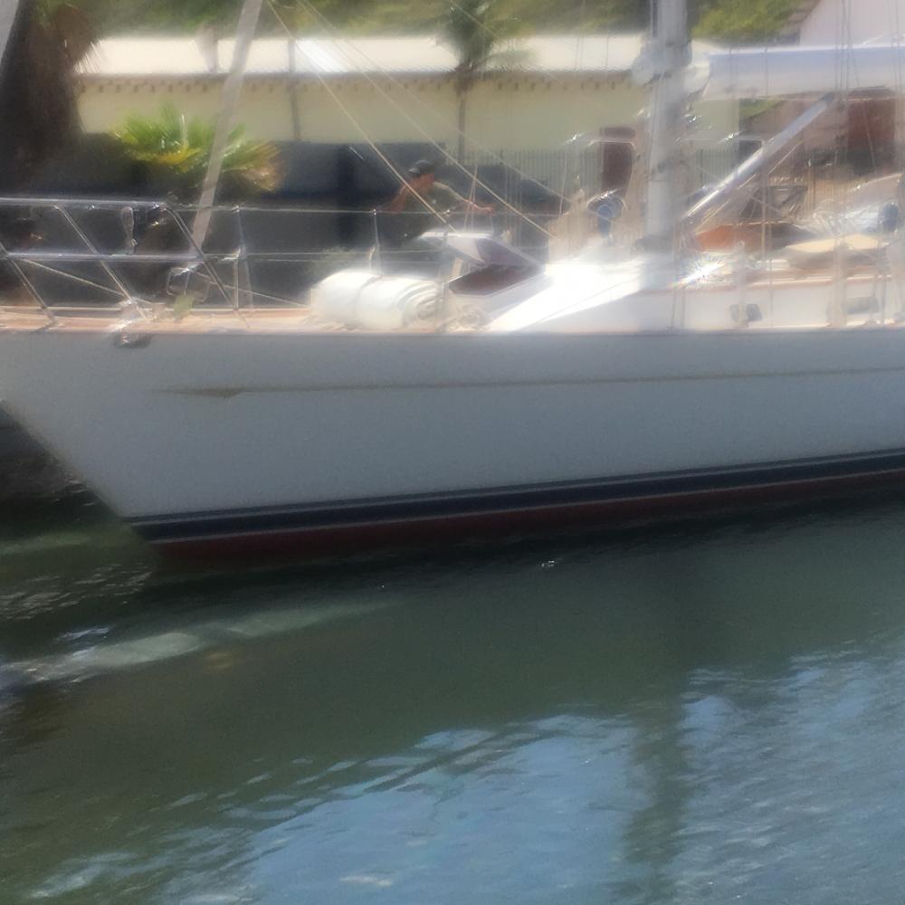
Cailin Lomhara
Some stories of our life wandering the oceans, along with some random thoughts on matters either important or trivial. Through words and pictures it is our way to share our life a bit, perhaps even what we learn along the way.

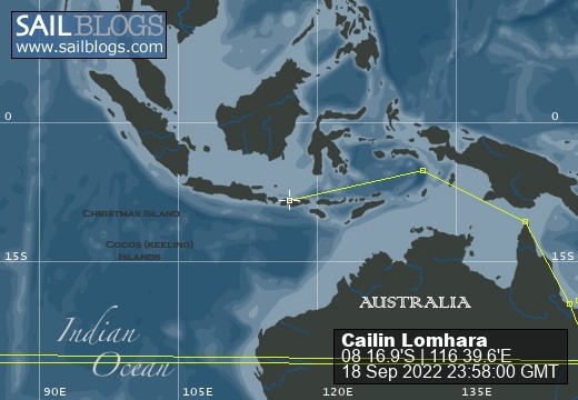
18 September 2022 | 08 16.9'S:116 39.6'E, Bali Sea
22 July 2022 | 05 05.0'S:131 02.6'E, Banda Sea
08 July 2022 | 10 34.2'S:142 03.3'E, Torres Strait, Arafura Sea
01 June 2022 | Coral Sea, East Coast Australia
11 April 2022 | 32 14.9'S:152 41.2'E, Tasman Sea, East Coast Australia
10 April 2022 | Newcastle, Australia Tasman Sea
24 December 2020 | Royal Prince Alfred Yacht Club, Newport, NSW, Austrailia
05 June 2020 | Ku-Ring-Gai-Chase National Park, NSW, Australia
21 March 2020 | Sydney Harbour
15 March 2020 | Tasman Sea
15 March 2020 | Port Arthur, Tasmania
12 March 2020 | Port Arthur, Tasmania
10 January 2020 | Prince of Wales Bay
31 December 2019 | 42 53.0'S:147 20.15'E, Hobart, Tasmania
29 December 2019 | 41 06.6'S:149 49.8'E, Tasman Sea
28 December 2019 | 39 42.26'S:149 58.0'E, South of Bass Strait, Tasman Sea
27 December 2019 | 36 59.9'S:151 04.4'E, Southbound Off the Coast of Australia
26 December 2019 | 35 17.3'S:151 23.5'E, Southbound Off the Coast of Australia
25 December 2019 | Cruising Yacht Club of Australia, Sydney
17 December 2019 | Cruising Yacht Club of Australia, Sydney
Where to start.............
22 July 2019 | Port Mackay, Great Barrier Reef
Larry Green | warmer
This was written 3 days ago, technical difficulties prevented me from posting it. Near as I could tell our "tracker"on Predictwind was working pretty well so there was little concern that a few days without a blog post would be an issue.
Today was another day moving the boat northward towards the Whitsunday Islands, apparently the holy grail we are seeking. The Great Barrier Reef is some 1200 miles long, the Whitsunday Islands are but one small group about 400 miles north of Bundaberg, and they stretch close to 100 miles further north. Their allure is the crystal clear water, warm temperatures, beautiful scenery extraordinary diving and snorkeling. As a tourist destination they also have a fair share of decent dining establishments.
In our quest to get there we have sailed about 275 miles in a week, the relatively short distance is due to the need to be anchored before sunset. We have 100 or so miles to go before we arrive in Mckay, the southern part of the Whitsunday group. I expect we will be there Monday (Sunday to those living in the other half of the world) Somehow, perhaps by magic, we expect it will be much warmer. An example will illustrate my point. At night where we are it gets into the high 50s or low 60s. During the day it is perhaps 10 degrees warmer. Don't get me wrong, the sun is very hot, but the air is very cool as is the water. Thus, it feels chilly virtually all the time except when sitting still in the sunlight. A sweater and jeans is routine daytime dress.
Personally, I doubt it will be much warmer when we get to the promised land. We are currently at 22 degrees South Latitude, Hamilton Island, the "center" of the Whitsundays is a bit north of 20 degrees south or 120 miles closer to the warm weather. We shall see how warm it gets.
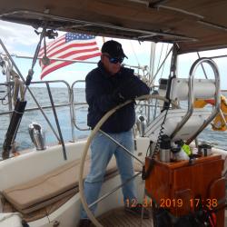
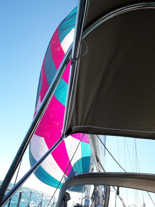
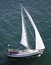
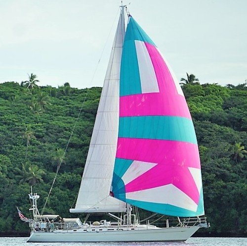
We were going downwind most of the day so had a chance to use the spinnaker. The blog has a picture of the boat sailing with the spinnaker, however I thought it might be of interest to some to see the view from the helm of the spinnaker. Thus, the picture at the top of this post.
Today we also passed through an area that was originally closed to all civilian craft due to joint military exercises with the Australian, New Zealand, American and Japanese Navy and Marines (or their equivalent) Apparently the lengthy detour around this area received enough political attention to allow the authorities to open the area for most days this month except the specific days where live fire exercises would take place. So, throughout the day our VHF radio would broadcast items like "this is Australian Warship #1234 to the fishing vessel on my port bow, please be advised you are hampering our maneuvers and are required to maintain a 2 mile separation at all times". The poor bloke on the fishing vessel would usually ask something like "tell me your course and speed" and I will keep out of your way. For the most part the response was polite but uninformative.
We encountered two US Warships. The first we had a direct radio communication with. On our third attempt to call them to ask their intentions, course and speed they finally answered. Very politely they provided their course and speed, but not their intentions. Previously, they had changed course a couple of times and were heading directly in our path, which is why I wanted to know their intention. Ultimately, I advised them that my intention was to alter course to Port, pass a safe distance then resume my course by passing astern of them. They seemed to agree, so that is what we did. The next encounter was pretty funny. A different US Warship was steaming about 2.5 miles away on a reciprocal course when they announced "Securitie, Securitie, Securitie, all ships be aware that US Warship #3456 is commencing continuous turns to port and all ships stay clear. We were the only other vessel in visual range; the Warship continued steaming straight and true until out of sight. We also heard a Japanese Warship on the radio, but had a hard time understanding and they were too far away to be of any concern to us.
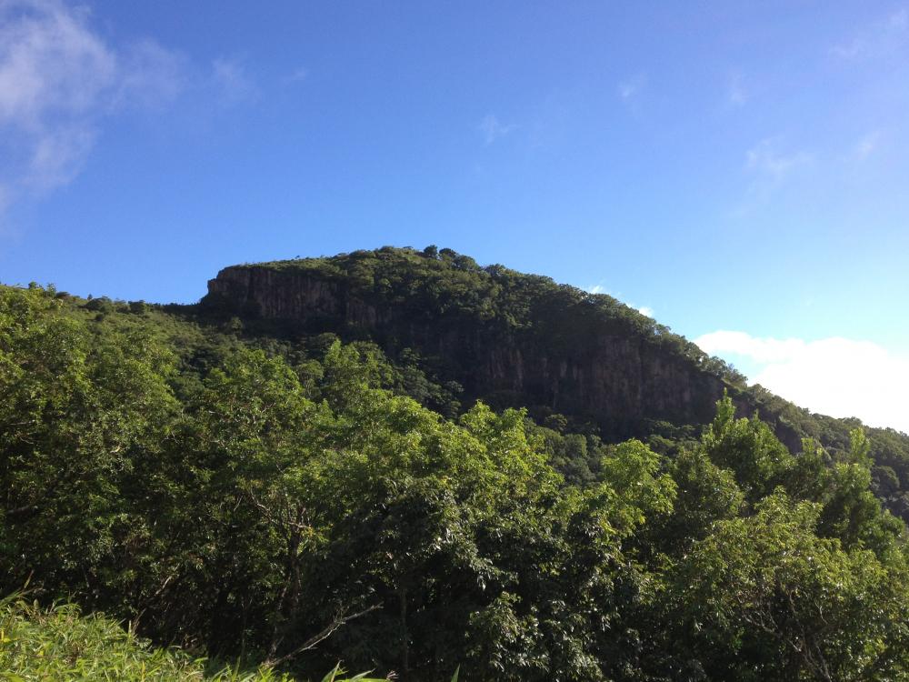
Now that I have griped about the weather, and the Warships of several nations I should let you in on something special. There are many Australian sights and sounds that are unique. Some of the animals here live no where else on earth, the country is geographically as large as the US, yet has a population of only 27 million, 90% of whom live on a narrow band of land on the south east coast. Much of the interior land is desert. I often thought of Australia as it was originally, a British prison colony, yet it has a rich heritage from trading with other nations in this area from well before the British sent their first boatload of convicts. The special something has to do with the stark beauty of this country. As noted, we have sailed about 275 miles in the Great Barrier Reef, and I have seen more raw, natural beauty here than any place I have been. Maybe it will turn ugly, but I doubt it.
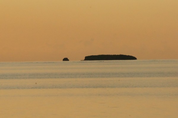
The Great Barrier Reef is actually a series of reefs strung along the continental shelf of eastern Australia. When I think about sailing in a reef, I think shallow water, lots of coral heads ready to catch your keel and the occasional island. Not so here. It is generally fairly deep, up to about 200 feet from what I have seen so far. Yes, as you approach an island or atoll you must be vigilant for those coral heads or "Boomies" as they are referred to locally. However, for the most part you are sailing in fairly open water with magnificent islands or just huge rocks sticking up out of the sea. For example, tonight we are anchored at Hexam Island, which is really a large rock with a beach on one side and some stone outcrops that look a bit like Lions guarding a sacred place in a different part of the world. There are two other sailboats here, and nothing else.
The moon is full and bright, the sea is calm, the surroundings are better than any postcard...........so More later
Today was another day moving the boat northward towards the Whitsunday Islands, apparently the holy grail we are seeking. The Great Barrier Reef is some 1200 miles long, the Whitsunday Islands are but one small group about 400 miles north of Bundaberg, and they stretch close to 100 miles further north. Their allure is the crystal clear water, warm temperatures, beautiful scenery extraordinary diving and snorkeling. As a tourist destination they also have a fair share of decent dining establishments.
In our quest to get there we have sailed about 275 miles in a week, the relatively short distance is due to the need to be anchored before sunset. We have 100 or so miles to go before we arrive in Mckay, the southern part of the Whitsunday group. I expect we will be there Monday (Sunday to those living in the other half of the world) Somehow, perhaps by magic, we expect it will be much warmer. An example will illustrate my point. At night where we are it gets into the high 50s or low 60s. During the day it is perhaps 10 degrees warmer. Don't get me wrong, the sun is very hot, but the air is very cool as is the water. Thus, it feels chilly virtually all the time except when sitting still in the sunlight. A sweater and jeans is routine daytime dress.
Personally, I doubt it will be much warmer when we get to the promised land. We are currently at 22 degrees South Latitude, Hamilton Island, the "center" of the Whitsundays is a bit north of 20 degrees south or 120 miles closer to the warm weather. We shall see how warm it gets.
We were going downwind most of the day so had a chance to use the spinnaker. The blog has a picture of the boat sailing with the spinnaker, however I thought it might be of interest to some to see the view from the helm of the spinnaker. Thus, the picture at the top of this post.
Today we also passed through an area that was originally closed to all civilian craft due to joint military exercises with the Australian, New Zealand, American and Japanese Navy and Marines (or their equivalent) Apparently the lengthy detour around this area received enough political attention to allow the authorities to open the area for most days this month except the specific days where live fire exercises would take place. So, throughout the day our VHF radio would broadcast items like "this is Australian Warship #1234 to the fishing vessel on my port bow, please be advised you are hampering our maneuvers and are required to maintain a 2 mile separation at all times". The poor bloke on the fishing vessel would usually ask something like "tell me your course and speed" and I will keep out of your way. For the most part the response was polite but uninformative.
We encountered two US Warships. The first we had a direct radio communication with. On our third attempt to call them to ask their intentions, course and speed they finally answered. Very politely they provided their course and speed, but not their intentions. Previously, they had changed course a couple of times and were heading directly in our path, which is why I wanted to know their intention. Ultimately, I advised them that my intention was to alter course to Port, pass a safe distance then resume my course by passing astern of them. They seemed to agree, so that is what we did. The next encounter was pretty funny. A different US Warship was steaming about 2.5 miles away on a reciprocal course when they announced "Securitie, Securitie, Securitie, all ships be aware that US Warship #3456 is commencing continuous turns to port and all ships stay clear. We were the only other vessel in visual range; the Warship continued steaming straight and true until out of sight. We also heard a Japanese Warship on the radio, but had a hard time understanding and they were too far away to be of any concern to us.
Now that I have griped about the weather, and the Warships of several nations I should let you in on something special. There are many Australian sights and sounds that are unique. Some of the animals here live no where else on earth, the country is geographically as large as the US, yet has a population of only 27 million, 90% of whom live on a narrow band of land on the south east coast. Much of the interior land is desert. I often thought of Australia as it was originally, a British prison colony, yet it has a rich heritage from trading with other nations in this area from well before the British sent their first boatload of convicts. The special something has to do with the stark beauty of this country. As noted, we have sailed about 275 miles in the Great Barrier Reef, and I have seen more raw, natural beauty here than any place I have been. Maybe it will turn ugly, but I doubt it.
The Great Barrier Reef is actually a series of reefs strung along the continental shelf of eastern Australia. When I think about sailing in a reef, I think shallow water, lots of coral heads ready to catch your keel and the occasional island. Not so here. It is generally fairly deep, up to about 200 feet from what I have seen so far. Yes, as you approach an island or atoll you must be vigilant for those coral heads or "Boomies" as they are referred to locally. However, for the most part you are sailing in fairly open water with magnificent islands or just huge rocks sticking up out of the sea. For example, tonight we are anchored at Hexam Island, which is really a large rock with a beach on one side and some stone outcrops that look a bit like Lions guarding a sacred place in a different part of the world. There are two other sailboats here, and nothing else.
The moon is full and bright, the sea is calm, the surroundings are better than any postcard...........so More later
Comments
| Vessel Name: | Cailin Lomhara |
| Vessel Make/Model: | Tayana 52 |
| Hailing Port: | Anna Maria Island, FL |
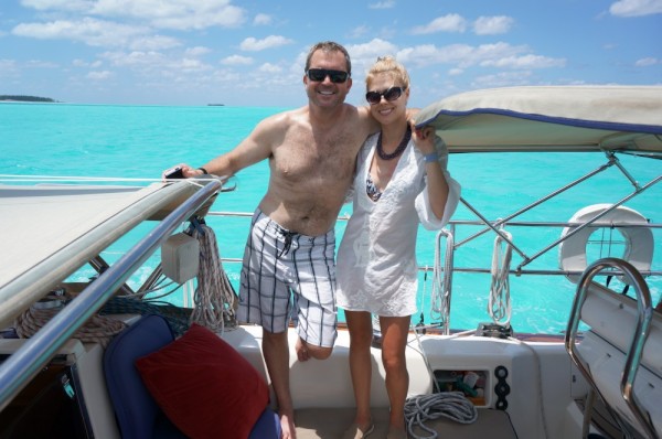
| Crew: | Charlene Green & Larry Green |
| About: | |
| Extra: | |
| Home Page: | www.predictwind.com/forecasts/display/CailinLomhara |
| Social: |
|
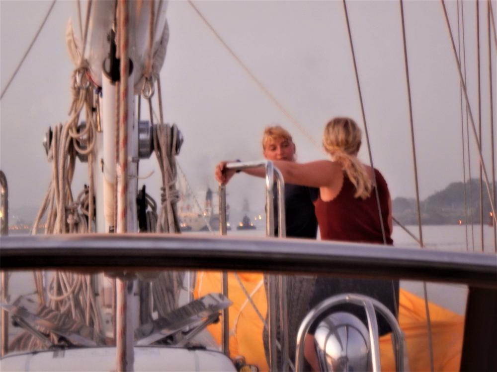
Cailin Lomhara's Photos - Main
 |
Pictures of our a bit of our preperation, pictures of the race start, our boat underway, the crew, and a bit in Hobart.
58 Photos
Created 5 January 2020
|
 |
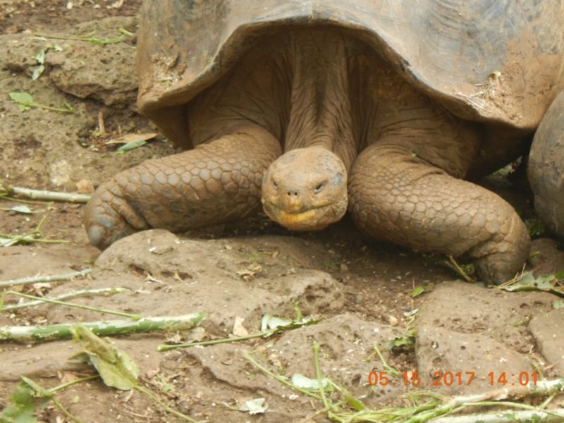
Some scenes from Tonga June through August 9th 2018, mostly the Refuge Yacht Race
10 Photos
Created 10 August 2018
|
 |
Pictures from the passage to this part of the South Pacific along with pictures we will add of what we see while we are here.
22 Photos
Created 15 May 2017
|
 |
At 0430 Friday our Pilot/Advisor came aboard and 30 minutes later we were underway headed for a single day transit. Some of the photos are taken inside the lock(s) others of the scenery along the way.
40 Photos
Created 30 April 2017
|
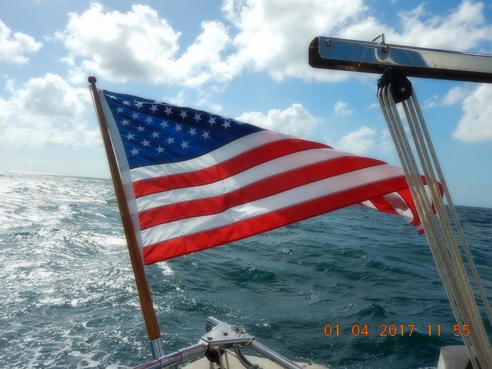 |
Our passage to Columbia. Lots of wind, mostly from abaft the beam.
6 Photos
Created 13 January 2017
|
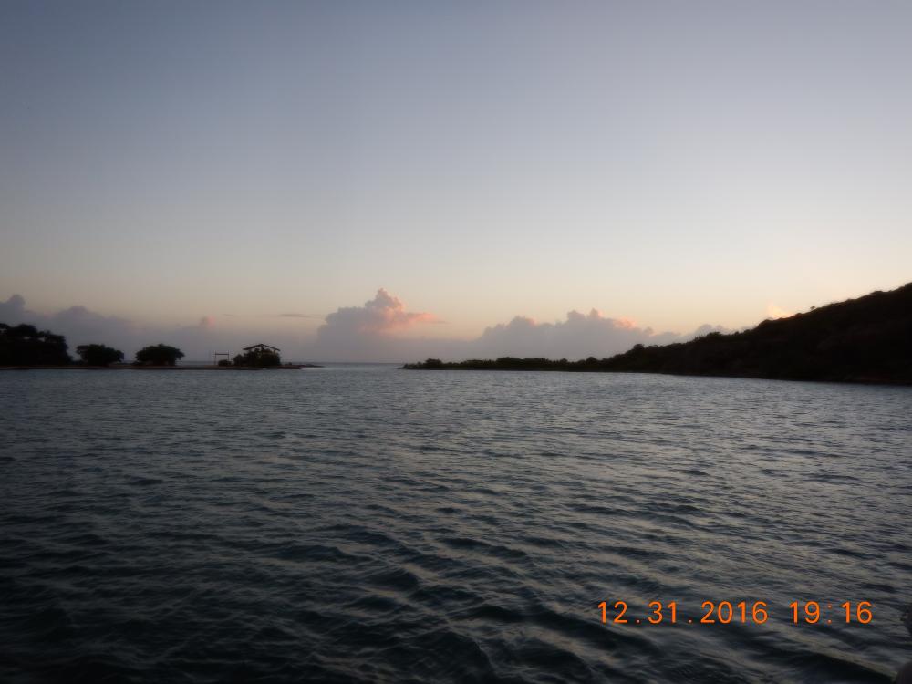 |
A beautiful, pretty much uninhabited spot to welcome the new year with it's possibilities
9 Photos
Created 1 January 2017
|
 |
When all your worldly possessions are aboard your boat/home it rides a little lower than designed. We finally raised the waterline in Curacao
4 Photos
Created 28 December 2016
|
 |
One of the most unusual islands in it's beauty and charming people. Most of these photos were taken when we were touring the island with Hubert Winston as our guide. There are no marinas and only two viable anchorages, one in Portsmouth, the other to the north in Roseau. We were there through Christmas 2015.
7 Photos
Created 11 January 2016
|
 |
Some of us, family, friends and folks we have met
22 Photos
Created 3 September 2014
|
 |
 |
Views of places and people we have met along the path.
26 Photos
Created 3 September 2014
|
 |
Cailin Lomhara
Who: Charlene Green & Larry Green
Port: Anna Maria Island, FL
Gallery