Commotion on Comocean
25 March 2020 | Ft. Pierce, FL
25 March 2020 | Ft. Pierce, FL
23 March 2020 | Chubb Cay, Bahamas
23 March 2020 | Chubb Cay, Bahamas
22 January 2020 | Grand Bahama Yacht Club
19 January 2020 | Ft. Pierce to West End, Baahamas
29 December 2019 | Coral Harbor, Naassau
27 December 2019 | Chubb Cay
29 August 2019 | Vero Beach, FL
17 March 2019
02 March 2019
01 March 2019
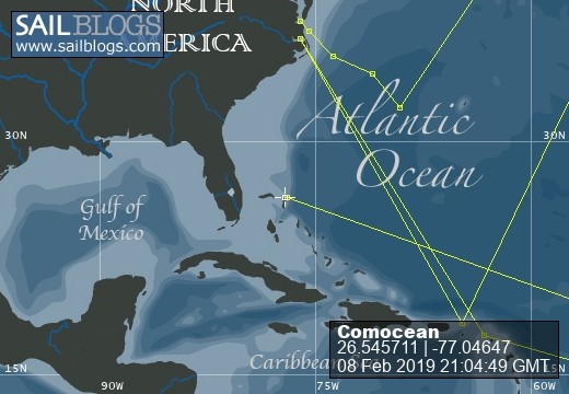
08 February 2019
06 February 2019
28 January 2019 | Hope Town Lodge
23 January 2019 | Hope Town Inn and Marina
21 January 2019 | Hope Town
18 January 2019 | Tillo Cay, Bahamas
10 January 2019 | Green Turtle Cay. Lanyard Dock
10 January 2019 | Green Turtle Cay. Lanyard Dock
Weather becoming a Question
12 May 2015 | Bermuda Triangle
Toby Hynes
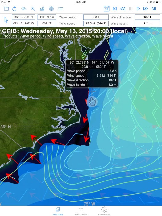
Hi Dad - the weather model has updated. Either you are moving faster than 6 knots SOG or the storm system is moving slower than predicted - and the wind on Thursday will now be more pfrom the NW (not North). This means two things for Comocean:
1) You are going too fast. At this rate you will catch up to the storm on Wednesday night and see 25 knots from the SSW on your stern before dying and then clocking around to the NW at a fresh 25 knots by 9am UTC Thursday. With your boat speed, this will be 30-35 knots apparent wind. If you slow down and essentially stall for 12 hours you'll be below the strongest winds and see no more than 15-20 knots from the SSW and NW.
And 2) the new NW direction of the wind on Thursday essentially eliminates any landfall option after Hatteras as you will have 20 knots on the nose all the way to shore. If you want to pull in, you'll need to do it before Hatteras.
My recommendation is that you slow down significantly tomorrow and crawl at 2-3 knots toward Hatteras. This will prove difficult when the SW winds pick up when combined with the 2-3 knot Gulfstream current. But try to stall 12 hours so you only see 20 knots on the stern Wednesday and only 20 knots from the NW (instead of 25) on Thursday & Friday. You should also try to stay west of your rhumb line as you will need to head easterly (Northeast probably) when the 20 knot NW winds hit at 8am UTC Thursday. Being west would also be ideal to get you out of the Gulfstream current when that wind hits as it will be opposing the current and make things a bit uncomfortable.
I would stay out there. Nothing here is dangerous, but it might get very uncomfortable on board. If you slow things down seriously tomorrow you will make it more pleasant for the next three days. If you make landfall you probably can't get started again until the 15th. But if you keep your current speed you will get home without stopping, but you might have a few sea sick sailors on board. Let's talk tomorrow am before 9am PST!
Good luck!
Seth
Dad Response:
Seth, I am concerned about a new low forming around New England on Sunday. It looks like we are at current speed able to get at or around Hatteras tonight. The winds then shift NW at 20 knots. There appears to be little squall activity likely which is my greatest concern. Also, every grib shows that the closer to shore, the lower the wave heights. We would point high to keep speed down and reduce pounding. By Thursday, the seas would start to abate closest to shore first. That's current thinking. Not optimal but a plan. I could just slow down once through the Gulf Stream by going hove to.
Norfolk would be our out. If we go to Beaufort we can't make it by day light and won't then be able to leave until Friday as it will take that long for the north winds to abate. We will get past the Gulf Stream by nightfall today and still have south winds.
Call you at 11:30 your time if I have a satellite.
Comments
| Vessel Name: | Comocean |
| Vessel Make/Model: | Sabre 426 |
| Hailing Port: | Osterville, Ma |
| Crew: | JoAnne and Toby Hynes |
| About: | |
| Home Page: | http://www.sailblogs.com/member/comoceanadventure/ |
Comocean's Photos - Main
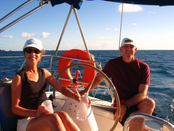 |
Here are a few shots from the past of the Hynes family enjoying their boats.
22 Photos
Created 6 November 2011
|
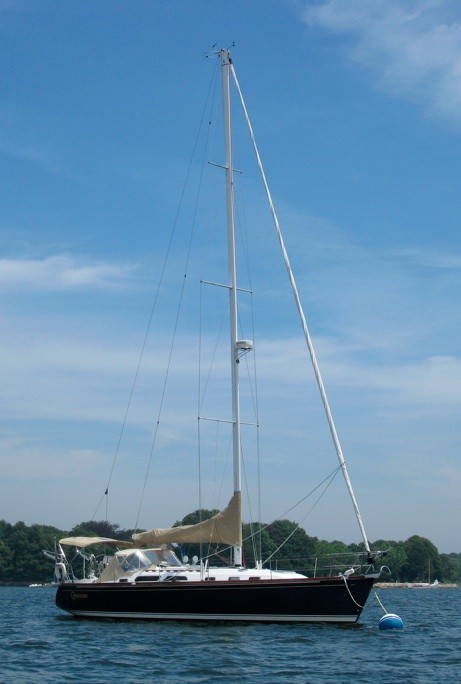 |
Here are some of the first pictures of Toby and JoAnne on their new boat, Comocean. Seth, Elizabeth and Hale joined them!
7 Photos
Created 6 November 2011
|
Commotion on Comocean
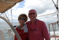
Who: JoAnne and Toby Hynes
Port: Osterville, Ma