Doing the Loop in GH 3
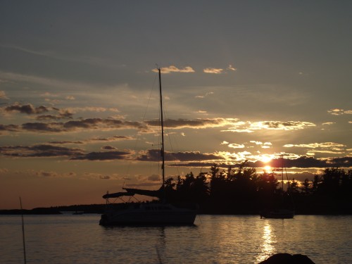
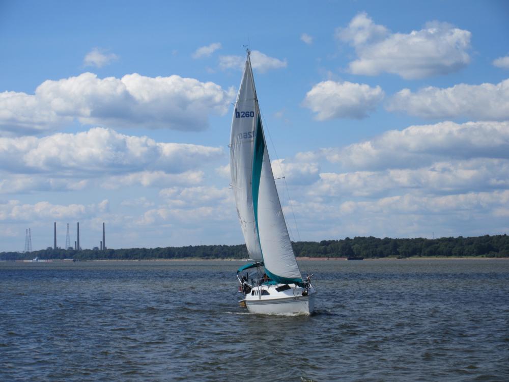
A retired couple from the midwest set off sailing the Loop in June 2016. They travel about 2400 miles on a 1999 Hunter 260 sailboat, "GH3". Beginning Jan. 2017, they continue the journey on their newly purchased 2008 Catalina 320 MK II sailboat.
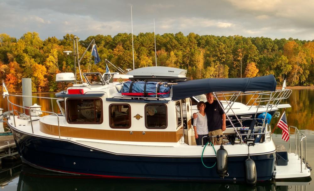
| Vessel Name: | Bucket List |
| Vessel Make/Model: | Catalina 320 MK II |
| Hailing Port: | St. Louis, Missouri |
| Crew: | |
| About: |
22 November 2017 | MacKinaw City Marina
13 July 2017 | Port Severn, Ontario
11 July 2017 | Hyde Park, New York
30 June 2017 | Waterford, New York
28 June 2017 | Oswago, New York
01 June 2017 | Statue of Liberty, New York Harbor
14 May 2017 | Waterside Marina - Norfork, VA
23 April 2017 | Morehead City, North Carolina ... Mile Marker 203.6
07 April 2017 | Beaufort, South Carolina
27 March 2017 | Jekyll Island, Georgia
18 March 2017 | Anchorage on ICW adjacent to Cape Canaveral
13 March 2017 | Ft. Pierce City Marina
04 March 2017 | Old Bahama Bay
16 February 2017 | Lighthouse Point, Florida
13 February 2017 | 30 Miles East of Marathon
19 January 2017 | Cape Coral, Florida
17 January 2017 | Dunedin Municipal Marina, Dunedin, Florida
31 December 2016 | Dunedin Municipal Marina, Dunedin, Florida
06 December 2016 | Carrabelle, Florida
29 November 2016 | St. Andrews Marina, Panama City, Florida
Recent Blog Posts
13 July 2017 | Port Severn, Ontario
Tales from the Trent Severn Waterway
"Roses are Red, Violets are Blue. We finished the Trent Severn Waterway; only 356 miles yet to Do!!!" T. Grass

30 June 2017 | Waterford, New York
Kids in the Cockpit
"Grandparent doesn't mean that you have gray hair and stay home cooking cakes for your grandchildren." Carine Roitfeld
28 June 2017 | Oswago, New York
NY State Canals
"Fifteen Miles on the Erie Canal" from Erie Canal Song
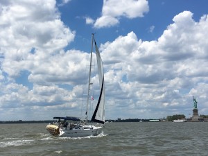
01 June 2017 | Statue of Liberty, New York Harbor
Our Slice of the BIG APPLE
"I say goodbye to all my sorrows And by tomorrow I'll be on my way. I guess the Lord must be in New York City." Lyrics to The Lord must live in New York City, Harry Nilsson
Tales from the Trent Severn Waterway
13 July 2017 | Port Severn, Ontario
"Roses are Red, Violets are Blue. We finished the Trent Severn Waterway; only 356 miles yet to Do!!!" T. Grass
We never heard of the Trent Severn Waterway (TSW) until we started researching America's Great Loop 11 years ago.
Entrance to the Trent Severn -
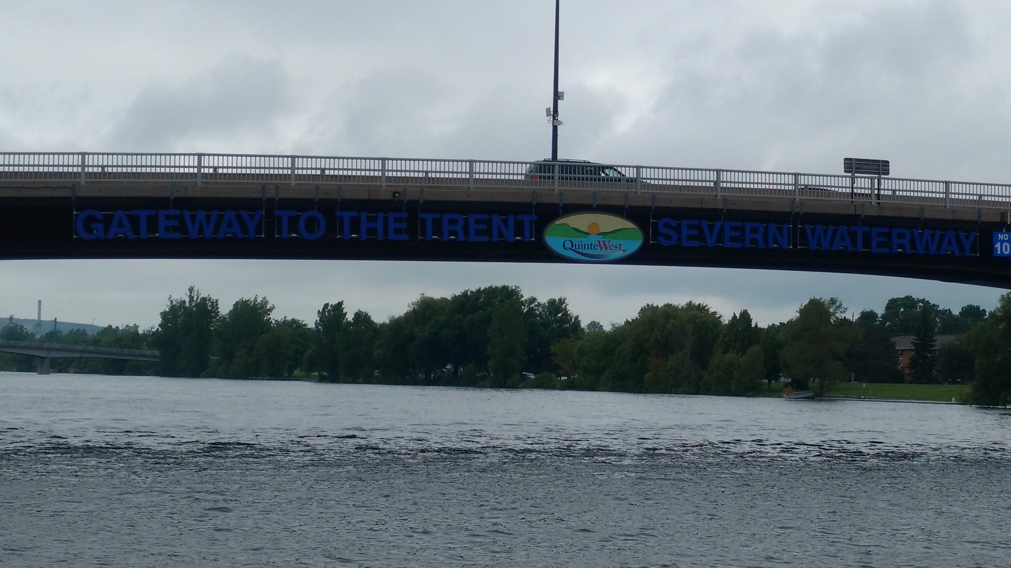
Geographically speaking, it is a series of natural rivers and lakes connected by man-made locks and canals, stretching from Trenton, Ontario on the edge of Lake Ontario to Port Severn on the edge of Lake Huron. Mathematically speaking, it is 240 statute miles of waterway which includes 35 locks going upward and 9 locks going downward. It begins at an elevation of 243 feet above sea level at Trenton and peaks at an elevation of 840 feet above sea level at Balsam Lake and ends at an elevation of 576 feet above sea level. Artistically speaking, the TSW includes incredible natural beauty and manmade marvels, such as the Peterborough Lift Lock, The Kirkfield Lift Lock and The Big Chute Marine Railway Personally speaking, the people on the TSW are amazingly generous, helpful, and outgoing. This includes citizens of towns, boaters and employees of Parks Canada. But this does not tell the whole story of the TSW. Emotionally speaking, it includes enough skinny water, raging currents, and narrow rock-lined channels to turn Tracy's knuckles white and cause Tom to nearly grind his teeth.
******************************************************
CANAL LAKE
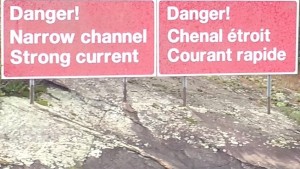
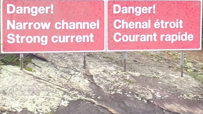
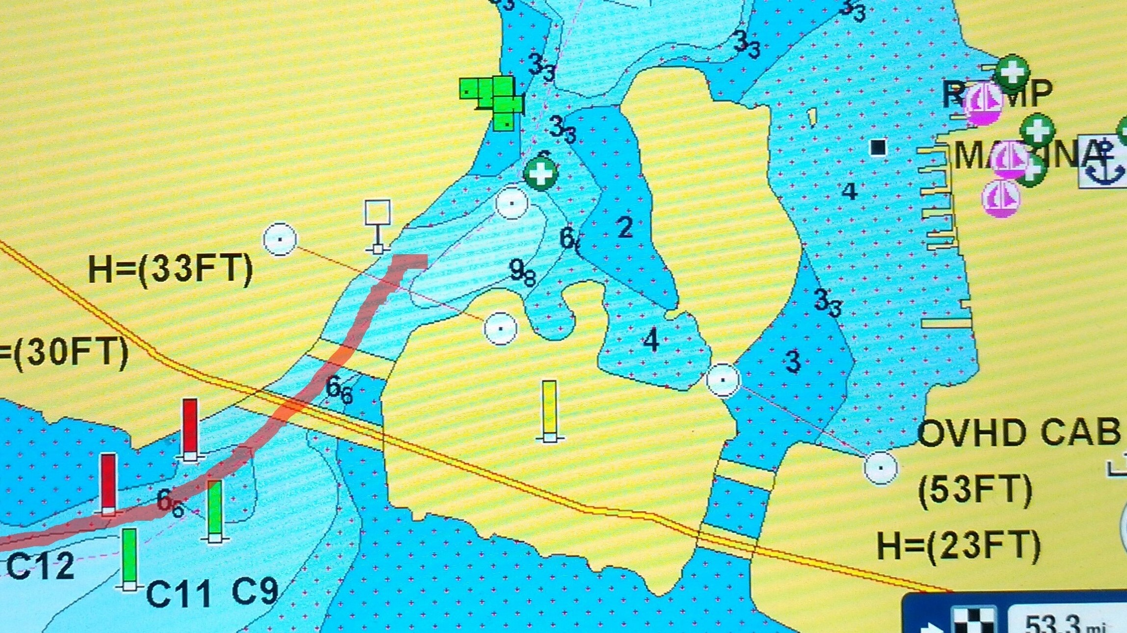
Canal Lake is a small man-made body of water near the Port Severn end of the TSW. It is about 5 miles long and one mile wide. Boaters have reported significant difficulty transiting Canal Lake. It is a part of the TSW that cannot be avoided. There are no other options, no detours available. We actually lost sleep thinking about transiting Canal Lake.
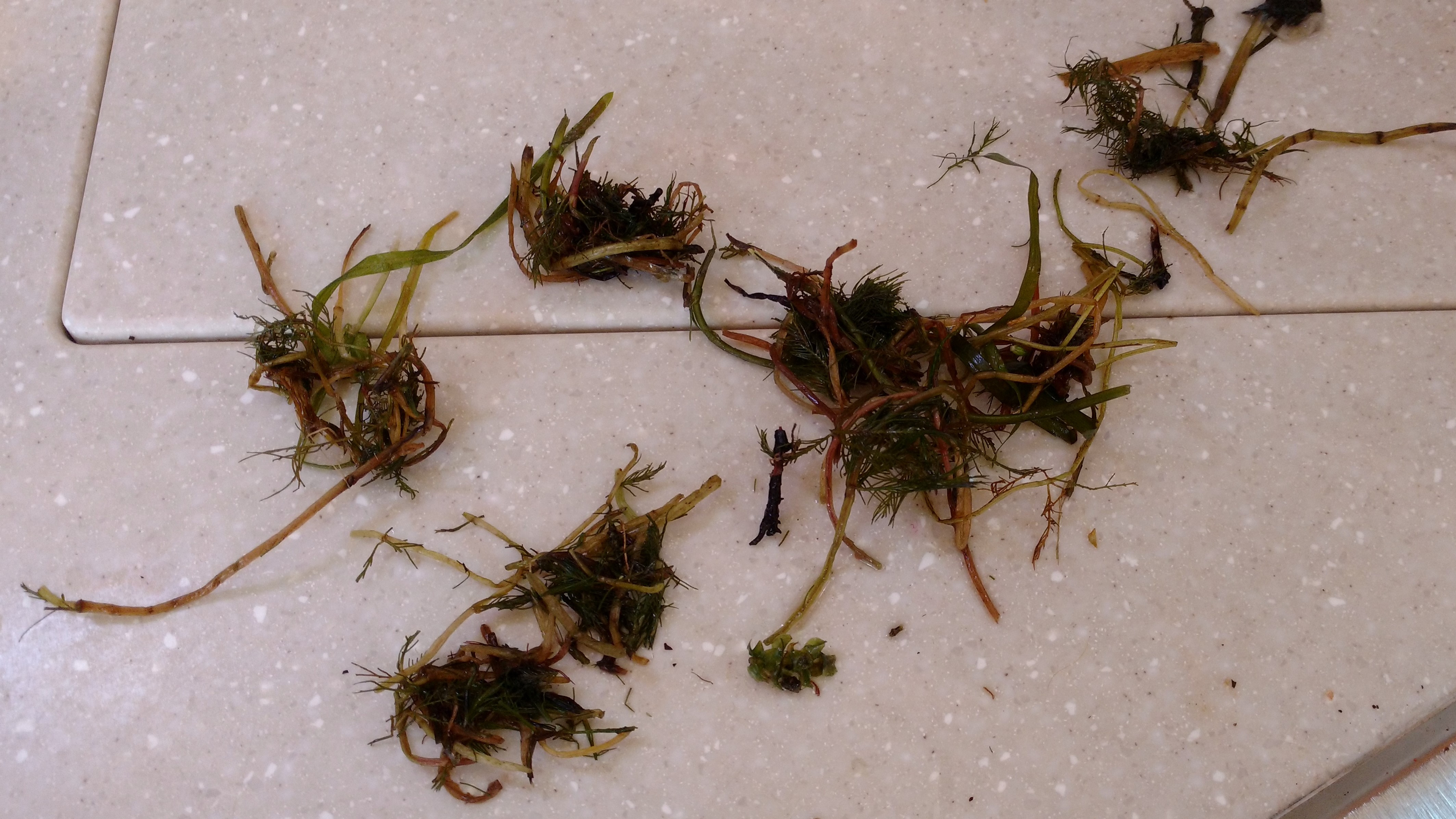
The chart on our iPad shows that Canal Lake has a 5 mile long, well-marked, narrow, shallow channel about 40 feet wide with water depth varying from 4.0 feet to 9.0 feet in the channel. "Cruising the Trent-Severn Waterway" by Skipper Bob tells us that Canal Lake has shallows, submerged deadheads (water logged wood lurking below the surface for decades), and heavy weed growth. He recommends traveling slowly and not following another boat closely. Our friends on Endeavor travelled Canal Lake at the end of June. They reported stopping 5 times in 5 miles and anchoring to clear weeds from prop and rudders. Our friends on Living Life travelled Canal Lake at the beginning of July. They reported that their boat was entangled with a mass of thick weeds. They were prepared to tow their sailboat with their dinghy when a kind local boater offered to tow them across Canal Lake behind his pontoon boat. Our friends on Tranquility 2 travelled Canal Lake a few days later with less difficulty. As we exited the last lock just prior to Canal Lake, we asked the lockmaster what he had heard about Canal Lake. He said, "Canal Lake is always very shallow and very weedy. We stopped for a few minutes to talk to 2 sailors who had just crossed Canal Lake going the opposite direction on a Catalina 27 with a 4 foot draft. They reported that they went aground when they were in the channel but off to one side of the channel. One of them went swimming and stood in muddy weedy water up to his chest while he pushed their sailboat back into deeper water in the center of the channel. All report that safely transiting Canal Lake requires travelling in the center of the channel and a willingness to swim and cut weeds, as needed.
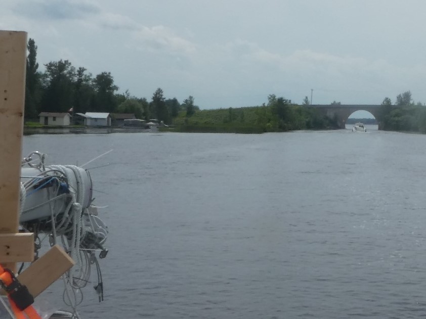
We entered the northeast end of Canal Lake early on Monday, July 10. Tom was at the helm with a swim suit and sharp knife close by. Tracy was sitting as lookout on the bow. They had a 4 foot 4 inch draft below them and an inboard motor with a prop well below the water surface which would require a swimmer to clear if entangled with weeds. Their Yanmar engine would overheat if the strainer clogged with weeds. Tom was prepared to drop anchor and clear the strainer, rudder or prop, as needed. We were braced to face whatever challenges lay ahead. Tom engaged the throttle just above idle speed steering Bucket List between the buoys in the deepest water shown on the iPad. He kept a close eye on the engine temperature gauge for any sign of overheating. Tracy sat on the bow reporting the location of upcoming buoys and let Tom know when they were in the center of the channel. She noted the green sheen of weed grown at the water surface just outside the channel. She also saw shredded weeds 2-5 inches in length floating on the water in the channel. As they approached the Hole in the Wall Bridge near the end of Canal Lake, Tom reported the shallowest water yet.
Hole in the Wall Bridge across Canal Lake where Bucket List dodged a bullet!
The depth finder showed 4.1 feet of water, but our 4.4 inch keel kept moving forward. We felt that the depth finder must be "reading" the tops of the weeds, not the mud at the bottom. After two hours of suspenseful travel, we reached the southwest end of Canal Lake without having to swim or clear the strainer. We encountered no deadheads. We attribute this success to our strategy of going slowly and staying in the deepest water. We also attribute our success to boaters who went before us. Their props mowed the weeds below the surface so that we could safely transit Canal Lake.
*****************************************************
OVERHEATING ENGINE
A sailboat motor which overheats is every bit as serious as a car engine overheating.
******************************************************
TRADITIONAL LOCKS OF THE TRENT SEVERN WATERWAY
We went through 41 traditional locks on the TSW. The day prior to entering the Trent Severn Waterway, we rode our bicycles up to the first lock to have a look.
Working manual gates on one of the TSW Locks
***************************************************
MANMADE MARVELS ON THE TRENT SEVERN WATERWAY
Three amazing examples of Canadian engineering make it worth the trip to the Trent Severn all by themselves.
#1. The Peterborough Lift Lock
Here is how the Lift Lock appears at its base.
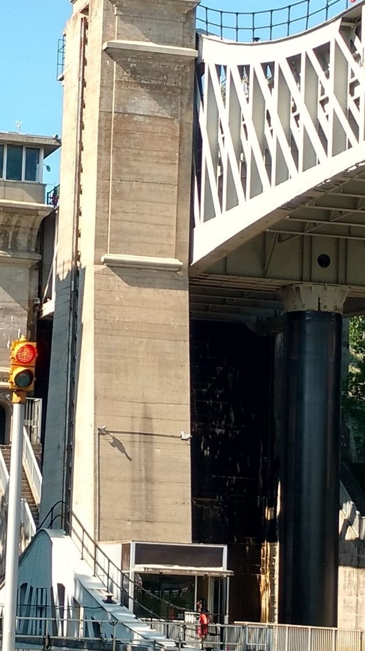
Here is how it appears at the top.
Approaching the Peterborough Lift Lock
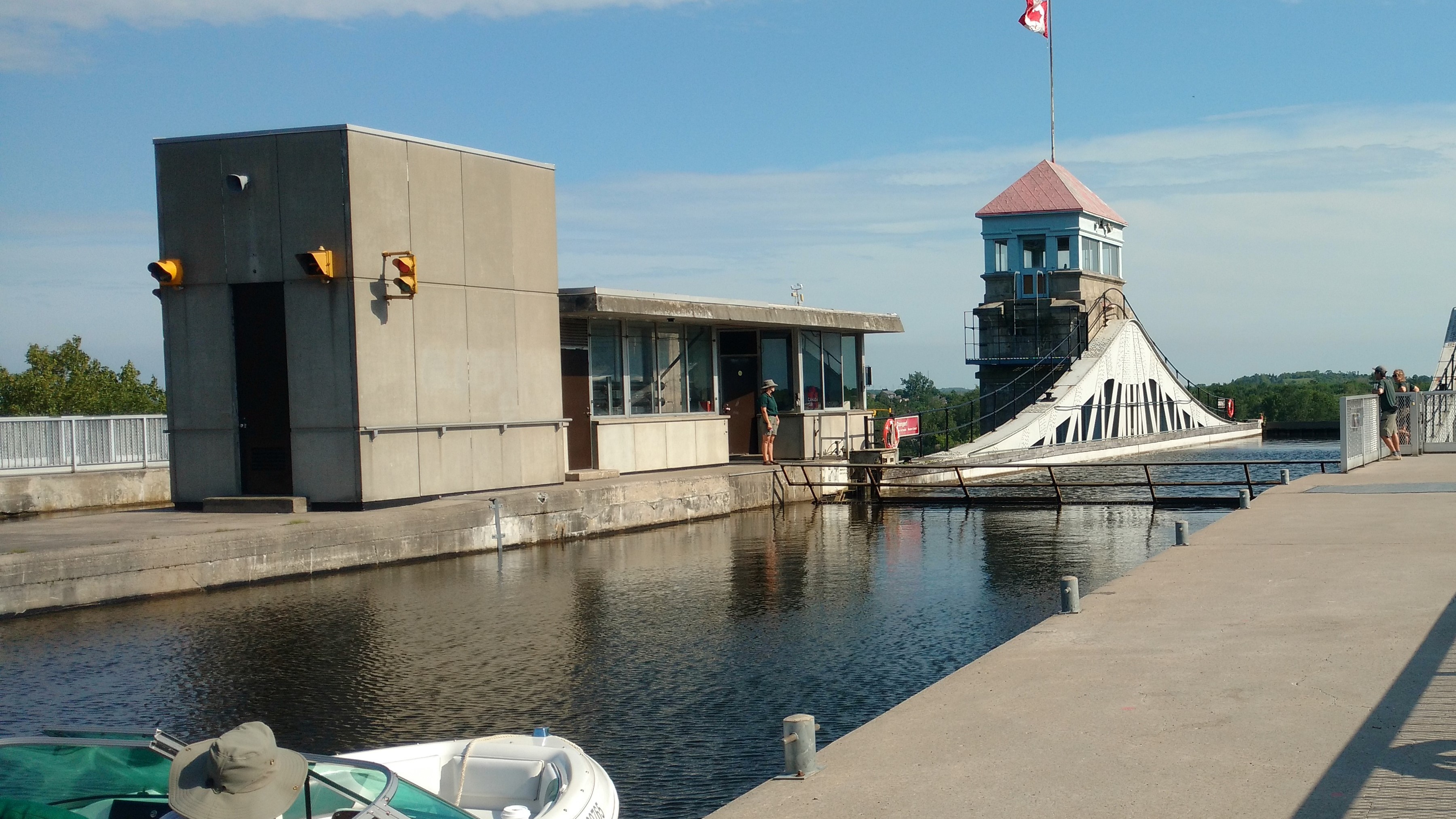
#2. The Kirkfield Lift Lock
What it looks like leaving the OTHER Hydraulic Lock on the TSW
Here is what it looks like in one of the "containers" filled with boats riding the lift lock down to the next level.
#3. The Big Chute Marine Railway
The Blue Line is where you wait to transit the lock (or in this case the Marine Railway)
Here is what it looks like entering the Big Chute from Bucket List
Here is a video of the Big Chute in action - with other boats.
Here is what it looks like Riding Bucket List over the Big Chute.
***********************************************
NATURAL BEAUTY ON THE TRENT SEVERN WATERWAY
One of the smaller towns on the TSW is Campbellford.
Natural Beauty on Lock #30 - one of two locks on the system accessible only by boat.
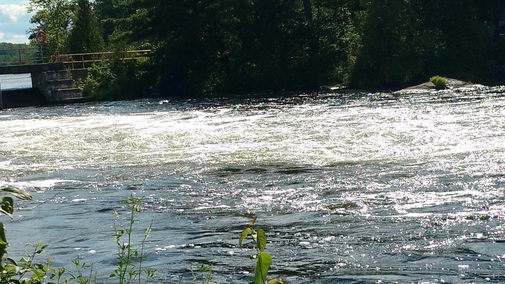
... and the raging flow of water over the dam at Lock #30
Relaxing at Healey Falls
**********************************************
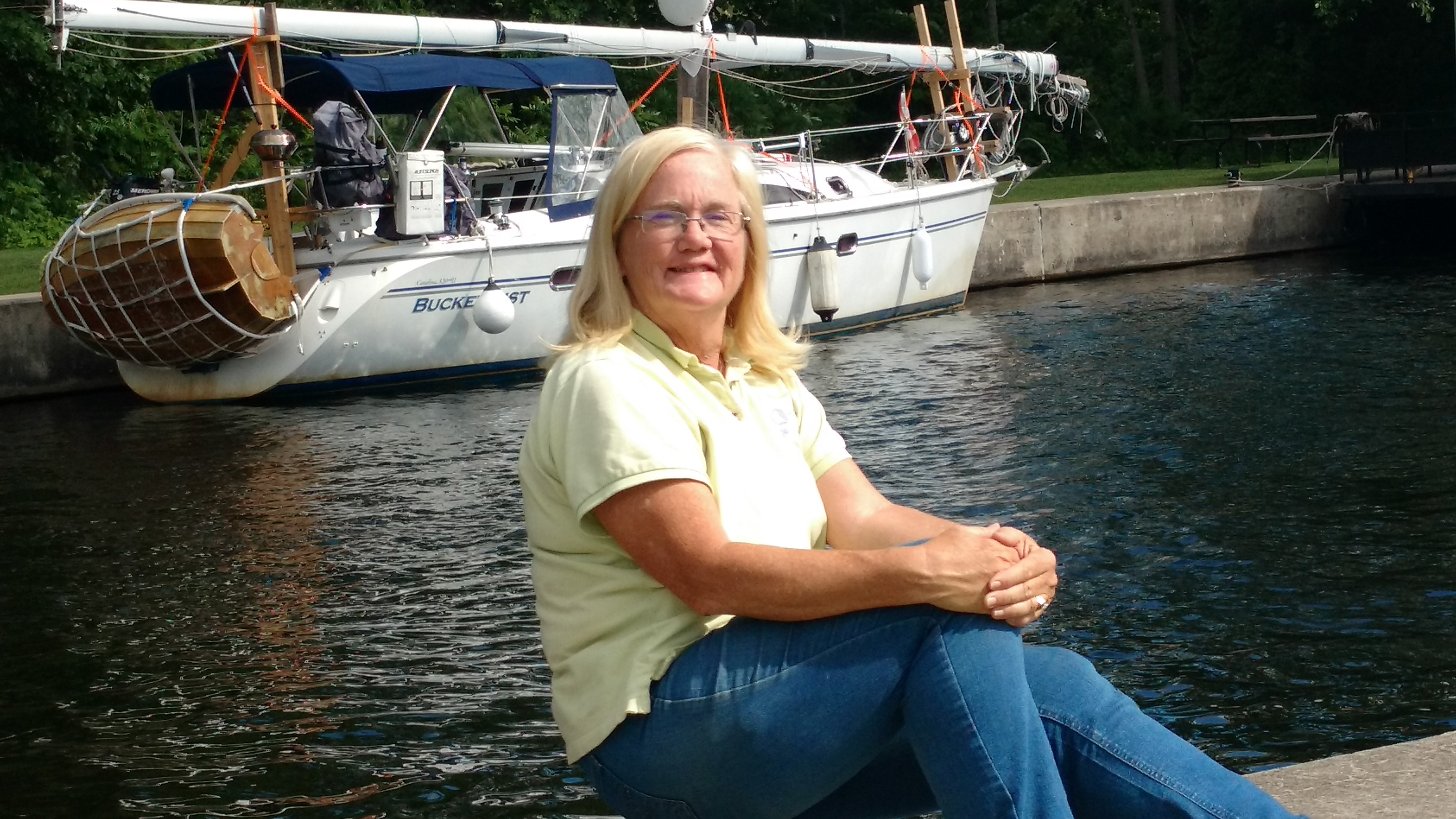
Kim Russo we met in Trenton at the beginning of the TSW
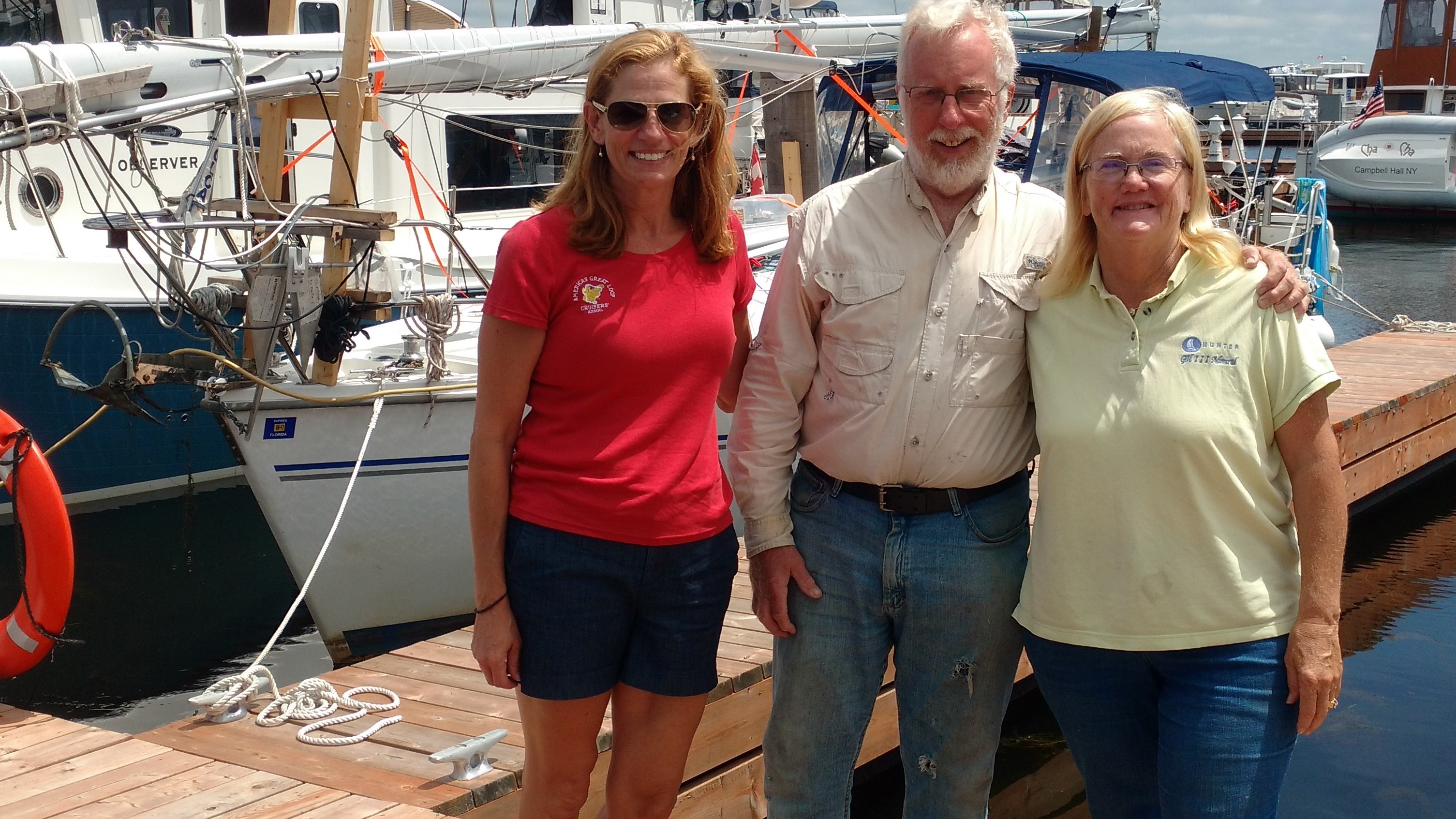
Our Canadian Looper Friends

who is online counter blog counter
We never heard of the Trent Severn Waterway (TSW) until we started researching America's Great Loop 11 years ago.
Entrance to the Trent Severn -
Geographically speaking, it is a series of natural rivers and lakes connected by man-made locks and canals, stretching from Trenton, Ontario on the edge of Lake Ontario to Port Severn on the edge of Lake Huron. Mathematically speaking, it is 240 statute miles of waterway which includes 35 locks going upward and 9 locks going downward. It begins at an elevation of 243 feet above sea level at Trenton and peaks at an elevation of 840 feet above sea level at Balsam Lake and ends at an elevation of 576 feet above sea level. Artistically speaking, the TSW includes incredible natural beauty and manmade marvels, such as the Peterborough Lift Lock, The Kirkfield Lift Lock and The Big Chute Marine Railway Personally speaking, the people on the TSW are amazingly generous, helpful, and outgoing. This includes citizens of towns, boaters and employees of Parks Canada. But this does not tell the whole story of the TSW. Emotionally speaking, it includes enough skinny water, raging currents, and narrow rock-lined channels to turn Tracy's knuckles white and cause Tom to nearly grind his teeth.
******************************************************
CANAL LAKE
Canal Lake is a small man-made body of water near the Port Severn end of the TSW. It is about 5 miles long and one mile wide. Boaters have reported significant difficulty transiting Canal Lake. It is a part of the TSW that cannot be avoided. There are no other options, no detours available. We actually lost sleep thinking about transiting Canal Lake.
The chart on our iPad shows that Canal Lake has a 5 mile long, well-marked, narrow, shallow channel about 40 feet wide with water depth varying from 4.0 feet to 9.0 feet in the channel. "Cruising the Trent-Severn Waterway" by Skipper Bob tells us that Canal Lake has shallows, submerged deadheads (water logged wood lurking below the surface for decades), and heavy weed growth. He recommends traveling slowly and not following another boat closely. Our friends on Endeavor travelled Canal Lake at the end of June. They reported stopping 5 times in 5 miles and anchoring to clear weeds from prop and rudders. Our friends on Living Life travelled Canal Lake at the beginning of July. They reported that their boat was entangled with a mass of thick weeds. They were prepared to tow their sailboat with their dinghy when a kind local boater offered to tow them across Canal Lake behind his pontoon boat. Our friends on Tranquility 2 travelled Canal Lake a few days later with less difficulty. As we exited the last lock just prior to Canal Lake, we asked the lockmaster what he had heard about Canal Lake. He said, "Canal Lake is always very shallow and very weedy. We stopped for a few minutes to talk to 2 sailors who had just crossed Canal Lake going the opposite direction on a Catalina 27 with a 4 foot draft. They reported that they went aground when they were in the channel but off to one side of the channel. One of them went swimming and stood in muddy weedy water up to his chest while he pushed their sailboat back into deeper water in the center of the channel. All report that safely transiting Canal Lake requires travelling in the center of the channel and a willingness to swim and cut weeds, as needed.
We entered the northeast end of Canal Lake early on Monday, July 10. Tom was at the helm with a swim suit and sharp knife close by. Tracy was sitting as lookout on the bow. They had a 4 foot 4 inch draft below them and an inboard motor with a prop well below the water surface which would require a swimmer to clear if entangled with weeds. Their Yanmar engine would overheat if the strainer clogged with weeds. Tom was prepared to drop anchor and clear the strainer, rudder or prop, as needed. We were braced to face whatever challenges lay ahead. Tom engaged the throttle just above idle speed steering Bucket List between the buoys in the deepest water shown on the iPad. He kept a close eye on the engine temperature gauge for any sign of overheating. Tracy sat on the bow reporting the location of upcoming buoys and let Tom know when they were in the center of the channel. She noted the green sheen of weed grown at the water surface just outside the channel. She also saw shredded weeds 2-5 inches in length floating on the water in the channel. As they approached the Hole in the Wall Bridge near the end of Canal Lake, Tom reported the shallowest water yet.
Hole in the Wall Bridge across Canal Lake where Bucket List dodged a bullet!
The depth finder showed 4.1 feet of water, but our 4.4 inch keel kept moving forward. We felt that the depth finder must be "reading" the tops of the weeds, not the mud at the bottom. After two hours of suspenseful travel, we reached the southwest end of Canal Lake without having to swim or clear the strainer. We encountered no deadheads. We attribute this success to our strategy of going slowly and staying in the deepest water. We also attribute our success to boaters who went before us. Their props mowed the weeds below the surface so that we could safely transit Canal Lake.
*****************************************************
OVERHEATING ENGINE
A sailboat motor which overheats is every bit as serious as a car engine overheating.
******************************************************
TRADITIONAL LOCKS OF THE TRENT SEVERN WATERWAY
We went through 41 traditional locks on the TSW. The day prior to entering the Trent Severn Waterway, we rode our bicycles up to the first lock to have a look.
Working manual gates on one of the TSW Locks
***************************************************
MANMADE MARVELS ON THE TRENT SEVERN WATERWAY
Three amazing examples of Canadian engineering make it worth the trip to the Trent Severn all by themselves.
#1. The Peterborough Lift Lock
Here is how the Lift Lock appears at its base.
Here is how it appears at the top.
Approaching the Peterborough Lift Lock
#2. The Kirkfield Lift Lock
What it looks like leaving the OTHER Hydraulic Lock on the TSW
Here is what it looks like in one of the "containers" filled with boats riding the lift lock down to the next level.
#3. The Big Chute Marine Railway
The Blue Line is where you wait to transit the lock (or in this case the Marine Railway)
Here is what it looks like entering the Big Chute from Bucket List
Here is a video of the Big Chute in action - with other boats.
Here is what it looks like Riding Bucket List over the Big Chute.
***********************************************
NATURAL BEAUTY ON THE TRENT SEVERN WATERWAY
One of the smaller towns on the TSW is Campbellford.
Natural Beauty on Lock #30 - one of two locks on the system accessible only by boat.
... and the raging flow of water over the dam at Lock #30
Relaxing at Healey Falls
**********************************************
Kim Russo we met in Trenton at the beginning of the TSW
Our Canadian Looper Friends
who is online counter blog counter
Comments
Bucket List's Photos - Leaving on the Loop (Main)
Photos 1 to 3 of 3 |
1 |
 |
 |
 |
1 |
 |
|
|
|
|
|
|
|
|
|
|
|
|
|
|
|
|
|
|
|
|
|
|
 |
 |
|
|
|
|
|
Loop Adventure in Beaver Island, LeLand and Frankfort dealing with high winds
4 Photos
Created 17 July 2016
|
 |
|