
Due West Adventures
The sailing adventures of Captain Kirk & Heidi, Tosh and Tikka Hackler . . .
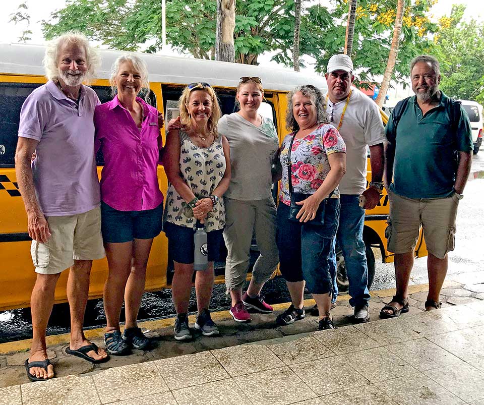
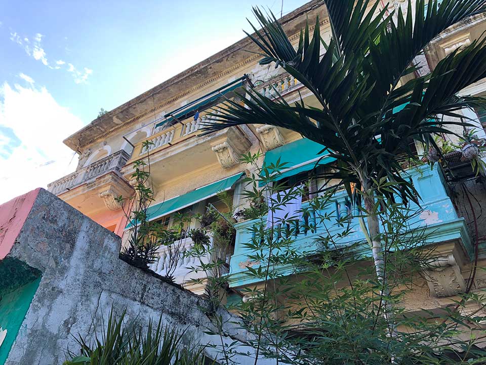
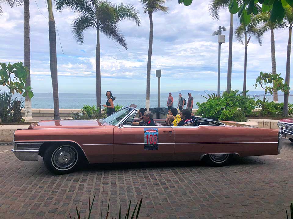
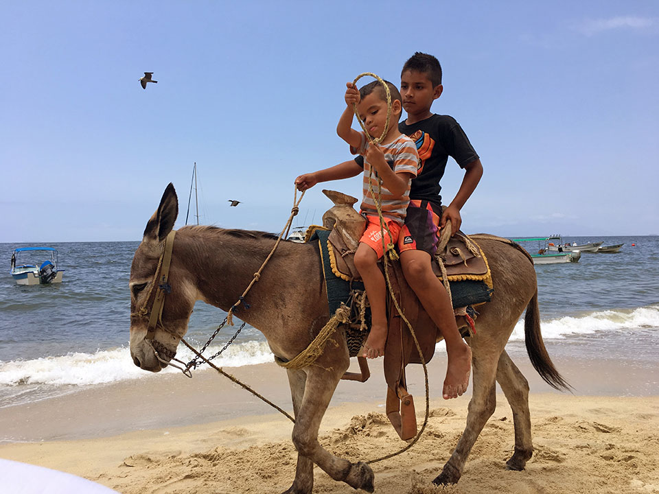
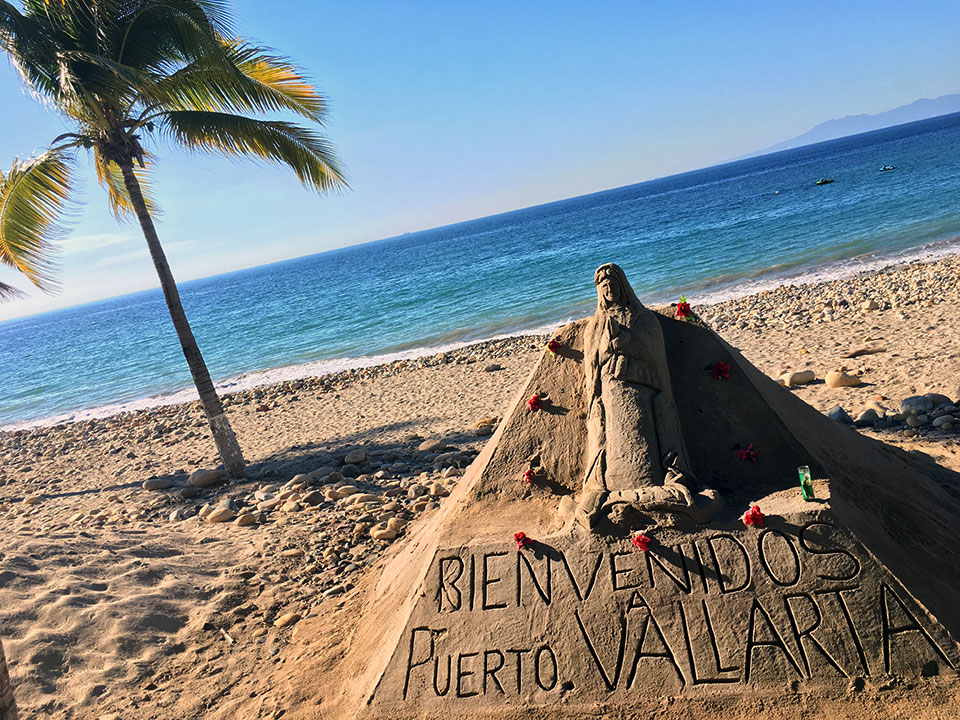
17 March 2019 | Puerto Vallarta
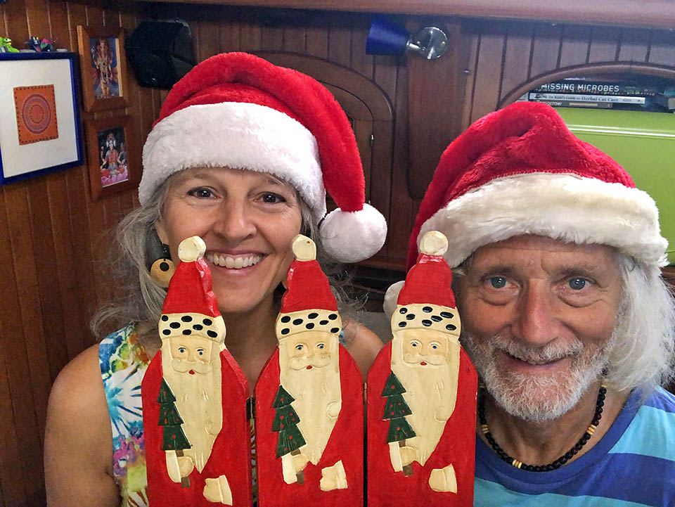
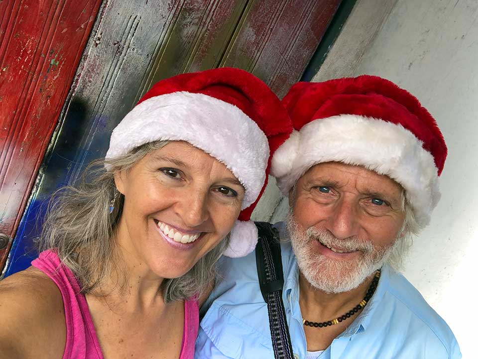
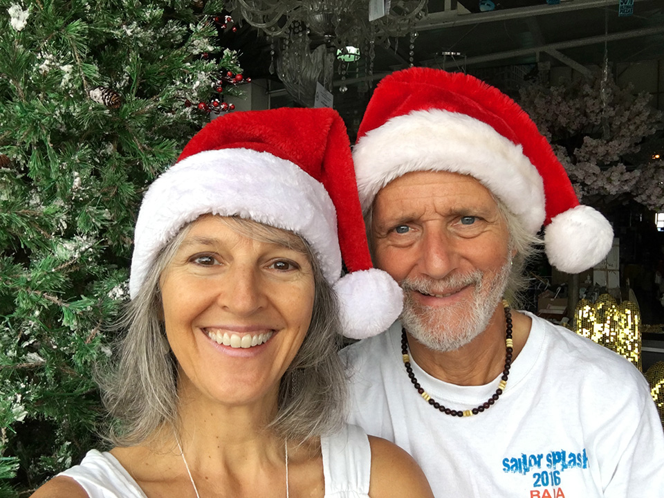
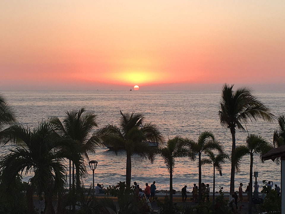
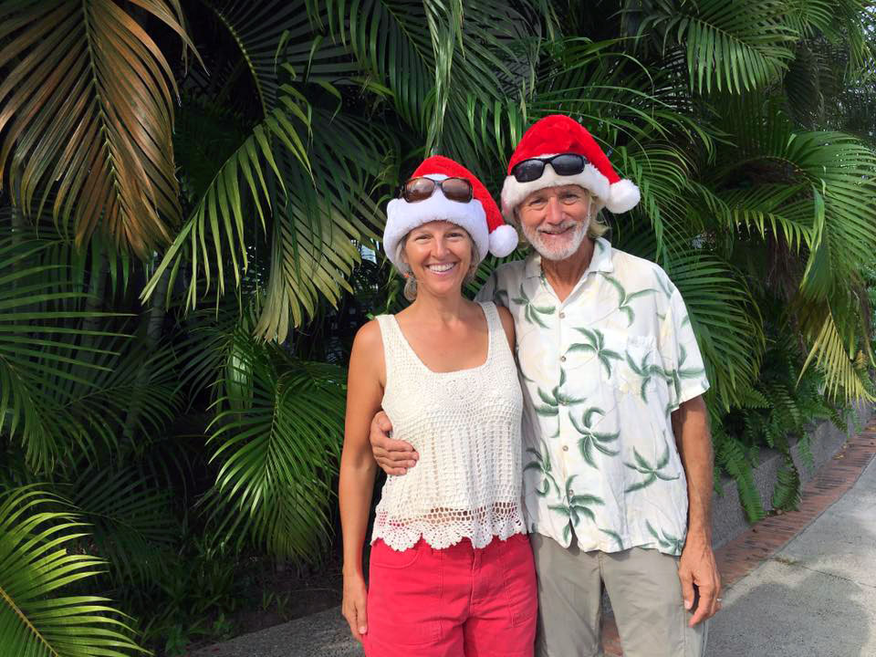
25 December 2018 | Puerto Vallarta, Jalisco, Mexico
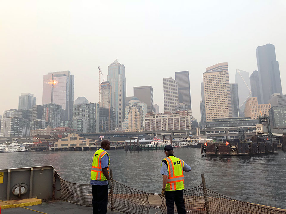
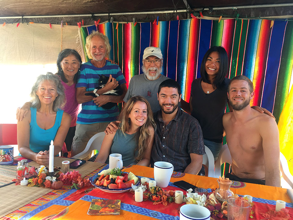
26 August 2018 | Puerto Vallarta MX, ABQ, NM, and SEA, WA
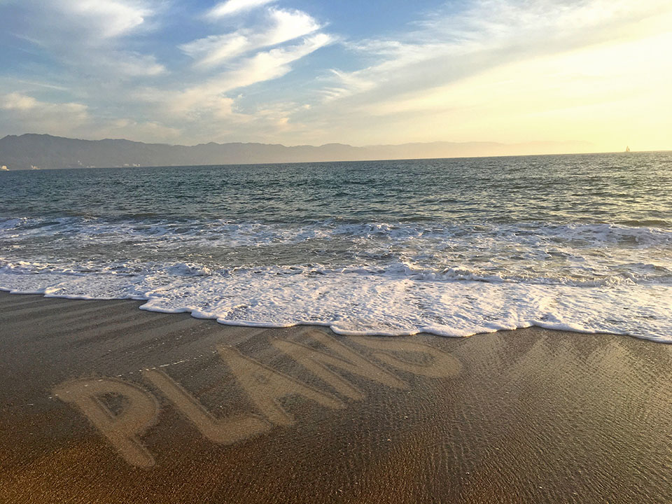
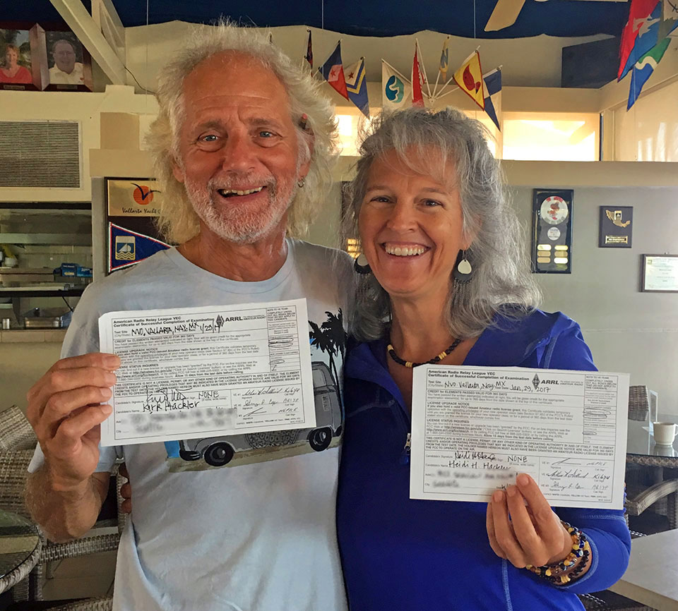
01 May 2018 | Puerto Vallarta, Jalisco, Mexico
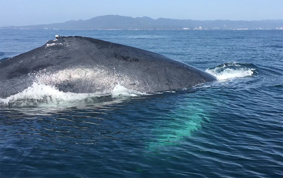
04 February 2018
24 December 2017 | Puerto Vallarta, Jalisco Mexico
02 November 2017 | Puerto Vallarta, Mexico
11 October 2017 | Puerto Vallarta, Mexico
16 September 2017 | Puerto Vallarta, Mexico
06 September 2017
29 June 2017 | Puerto Vallarta, Jalisco, MX
26 May 2017 | Puerto Vallarta, Jalisco, MX
07 April 2017 | Puerto Vallarta, Jalisco, MX
26 February 2017 | Puerto Vallarta, Jalisco, MX
30 January 2017 | La Cruz, Nayarit, MX
24 December 2016 | Banderas Bay, Mexico
20 December 2016 | Banderas Bay
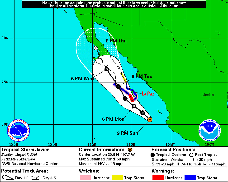
27 November 2016 | La Paz, B.C.S. Mexico
14 November 2016 | Bahia San Carlos Mexico
17 October 2016 | San Carlos, Sonora, Mexico
Leg 11: Monterey to Morro Bay to Santa Barbara ~ a.k.a. Things That Go Bump in the Night
26 November 2015
Monterey to Morro Bay to Santa Barbara Photo Gallery
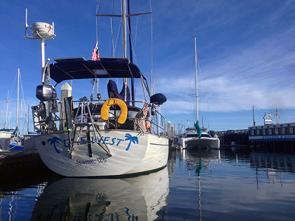
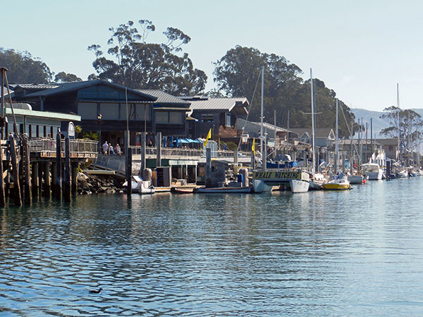
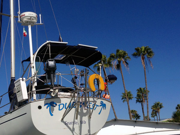
Due West in Monterey Harbor.
Our last week in Monterey was extended by a few days waiting for a calm weather window to head south. While the weather in Monterey was beautiful most of the time we were there, out at sea it was a different story. Storms from as far away as Alaska and Hawaii were converging offshore causing 35+ knots of wind and 20-25 foot seas. No Thanks! Even the fishermen and whale-watching boats were staying snug in the harbor. And we were constantly checking the weather, waiting for our window to leave.
This particular stretch of California Coast doesn't have a lot of places to stop along the way, nor to duck-in during inclement weather. So we had to time this leg of our trip to coincide with entering harbors during daylight hours, which meant traveling at night. Monterey to Morro Bay was calculated to be about a 20 hour trip so no way to do that all during daylight hours. As it turns out that leg took us about 18 hours (and would have taken us 17 hours but we slowed down to ensure arriving in daylight hours.)
The stretch from Morro Bay to Santa Barbara included rounding Pt. Conception, the biggest, baddest point on the whole west coast of the U.S. and even dubbed "The Cape Horn of the US." For you non-sailors, any point of land jutting out into the sea can create it's own weather including ocean currents, sea state, and wind.
As our fishermen friend TD pointed out to us, the ocean floor typography with its deep cold-water canyons coming up to meet points of land with warmer surface waters can really make for nasty conditions around Points. This is particularly true of Pt. Conception, and we've heard many tales of wild-and-crazy roundings of this notorious point. But Kirk had been around it several times before without any problems. And we were very keen to time our trip around Pt. Conception with a favorable weather window this time as well.
But first...back to our last week in Monterey: It was a bitter-sweet last few days, knowing we'd soon be saying good bye to our dear family-friend Sheila and her sweet little dog Bodhi who'd been our constant companions for 3-weeks. Heidi has known Sheila her whole life and we'd always visit her on our trips to the Monterey Bay area. We miss all of our wonderful meals and conversations with Sheila and her Scottish sense of humor too! Although she's probably still resting up from running us around on all of our errands...thank you Sheila and Bodhi!!
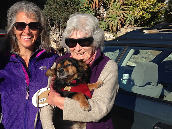
Heidi with dear friends Sheila and Bodhi.
We got in a few kayak paddles around the Bay and also enjoyed spending more time with our long-lost friends Laura & Greg whom we'd known 25 years ago in Seattle, and randomly ran into kayaking in Monterey Harbor, what a fun blast from the past! Another special treat a couple days before we left was a surprise visit from Heidi's step-dad-once-removed, Andy (Arne & Kari's step-dad.) Andy was visiting his family in the Bay Area and he and his sister Nancy took a day-trip down to Monterey just to see us and take us out to lunch. Such great fun to see Andy's wonderful smile. We reminisced about a fun week camping on the beach in Baja with Andy and family two Thanksgivings ago. We hope Andy will meet up with us again somewhere in our travels, and SO MUCH appreciate that he made the effort to come and visit us.
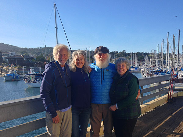
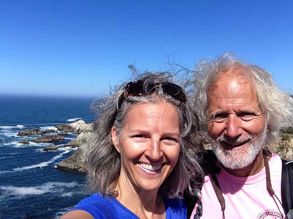
Kirk, Heidi, Andy, and Nancy...so much fun hanging out with extended family in Monterey!
We finished up a lot of boat projects (but still didn't get to some of them!) including wedging a few more nylon spacing washers into our gooseneck (where the boom connects to the mast) to stop it from twisting and squeaking. John Carscadden you'd be proud of our chasing-down-and-stopping-squeaks! And we bought pretty new blue mooring lines to replace our old ones, which had been through one-too-many Seattle winter storms! We checked all of the AIS wires for a fourth time, still no-dice. Grrrr...And we determined that the old depth-sounder does NOT work, however the new one is working like a charm so at least we're good there. As for the solar panels, they have yet to been installed...and the water maker still needs to be hooked up. Monterey was so filled visiting with fun friends and family it was hard to get our intended boat chores done!
We met another cruising couple, Kirsten & Eric, formerly from Seattle, more recently from Napa who were waiting out the same weather window to leave as we were. So we decided to buddy-boat together. After a few false-starts thinking we'd leave on Monday, then Tuesday or Wednesday, we finally got our window to leave on Thursday, November 19th. Weather was predicted to be 5-15 knots of wind from the northwest and seas 3-6 feet. Perfect for sailing south. We timed leaving Monterey to get us into Morro Bay in the morning, and left the fuel dock at 1500 hours (3pm.)
Kirsten & Eric had left a few hours before us because they travel a bit slower than we do. As we headed out of Monterey Harbor towards Pacific Grove and Carmel, the seas got increasingly bigger and bigger, and the winds were 15-18kts. Hum... this was not in the forecast, but possibly it was just the convergence at Pt. Pinos (see POINTS above.) Sheila and Bodhi were waving us goodbye from Pt. Pinos (shouldn't this point really have a tilde on the ñ and be called Point Piños?! Odd...who named this point?)
As we approached Pt. Pinos about a mile off-shore in 8-10-foot seas we could hear and feel and "thunk" in the boat. Heidi thought it was coming from under the cockpit, Kirk thought it was coming from up forward. We tried to listen in the wind, we felt the boat, and couldn't tell what was causing it. We thought maybe it was the auto-pilot working so hard in the large, confused seas. Then suddenly we realized that the lines holding down our scuba tank on the bow had loosened and the tank was rolling side-to-side, almost going airborne as we crashed through the waves. YIKES!!
Kirk made his way forward (with safety harness clipped into jackline), and dragged the tank back to the cockpit where we could secure it once again. Sheila was watching all of this through the binoculars on shore. She was worried about us in the big waves, but when she called us we assured her we were ok. As we continued on towards Carmel, the wind and waves were not getting any better. We tried to hoist the mainsail thinking it would help steady us in the steep waves, but the wind was directly behind us and even with a preventer line holding out the boom, the mainsail just wanted to slat and pop. Not wanting to trash our sail, we took it down and continued motoring, very thankful for our TRUSTY Lewmar reversible motor-drive auto-pilot. That thing rocks! We are still trying to think of a good name for our auto-pilot...any suggestions?
Poor Tikka got sick (even with doubling up on her Bonnine) then hid in her habi-trail-tube, while Tosh kept hunkered down in his basket under the salon table, and the boat rolled on. This has been the rolliest of trips we've ever experienced; less sailing, more motoring, more rolling back and forth than every before. This was not in the brochure...but apparently this is what El Niño has to offer us this year! Luckily Due West is a very sound, sturdy boat, and rides through the seas gracefully. Thank you Bob Perry!
We talked to Kirsten & Eric on the VHF radio, who were about 20-miles ahead of us. They told us our waves would abate soon, and we continued on our way, starting our 2-hour watch schedule.
On our offshore passages we make up the starboard settee (aka: living room couch!) with a sleeping bag and the lee cloth to hold us into the bunk when the boat heels or bounces around in the waves. We take turns with one person on watch and one sleeping in two-hour shifts. We can see the radar and chart plotter on our iPad, so if it's too cold or wet to sit at the helm we can sit on the top step of the companionway, keep an eye on the iPad radar/chartplotter, and look around every 10-15 minutes to make sure we're not missing anything out there. Kirk usually opts to sit at the helm, while Heidi prefers to stay warm on the top step if it's cold out, anyone surprised?!
Passing Pt. Lobos at sunset made us think of Heidi's grandparents Oxy and Wini who loved that place. Grandpa Oxy had been instrumental in turning Pt. Lobos into a State park, THANK YOU Grandpa!
Somewhere between Carmel and Point Lobos we heard a May-Day on the VHF radio for a man-overboard. Kirk was on watch and soon saw US Coast Guard boats and helicopters searching the waters as dusk was looming. It's an eerie feeling to know a fellow boater is in peril. We hoped for the best outcome. We are extremely safety conscious and hope that this never happens to us.
Further on down the coast it was dark by the time we passed Point Sur. Heidi was on watch looking out towards the west and the wide expanse of ocean while Kirk was asleep below. Suddenly about a mile away and low hanging in the sky flashed a bright red light. At first she thought it might be a mast-head navigation light of a sailboat, but no boats showed on the radar. Then a red and green light appeared in the sky right next to it. Hum... possibly the bright red light was a flare, and the red and green lights next to it were an airplane? It seemed about the right altitude. Was it was part of the USCG search? This seemed too far south. Then just as suddenly all three lights vanished, and shortly after four red lights appeared in sequence, one after another, in a straight horizontal line, and stayed lit for about 30 seconds before they all disappeared too. WHAT. WAS. THAT!?! Nothing on the radar, no sounds, no other lights around coming or going. UFO for sure... something unidentified! But what? So creeeeeepy and X-files-ish. No doubt our government testing something?
The moon and the stars were out and it was a beautiful night but the big waves and winds continued. On Heidi's watch at 2am she saw 32kts on the anemometer! By Kirk's watch two hours later the wind had died down and the seas finally started to calm. Somewhere in the night we received a text from Kirsten & Eric, saying they'd had some damage to their boat and were returning to Monterey. Cell coverage was really intermittent along that coast, but when we had coverage Heidi pulled up the NOAA weather forecast and saw that NOAA had changed the forecast to SCA (small craft advisory)!?!? The forecast was changed at 2pm that day, about the time we were leaving the dock in Monterey to head to the fuel dock, and we'd not checked the weather within the last two hours before leaving as the forecast had been steady for the last 2-days, and we were busy getting ready to head out.
With the SCA behind us, it was a gorgeous morning as we made our way into Morro Bay harbor past Morro Rock.
Morro Bay with its funky-fun architecture, shops, and restaurants lining the waterfront and docks along the way.
Due West with her boats-upon-boats (one dinghy and two kayaks) tied up to the Morro Bay Yacht Club 150' guest dock for $25/night.
Good thing we planned to stay at Morro Bay Yacht Club, as it turns out they are the ONLY dock in town where you can stay the night! You could also anchor out in the harbor, but since we were only staying one night and leaving again the next day we opted for a dock and easy access to walk around town rather than unpack and re-pack the dinghy.
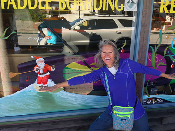
Heidi surfing with Santa in Morro Bay...Thanks for the awesome hoodie Laura!
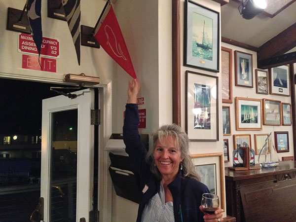
As guests at the YC we were invited to their Friday night cocktail hour complete with dinner. We even found our Lahaina YC burgee flying there, Aloha!
Morro Bay is a cute fishing harbor and we had a fun walk around town. But our weather window for Point Conception was calling us, and we had to head south the next day. We were chased off the Yacht Club dock at 12:30pm when the kids needed the dock for their youth dinghy races, which was a perfect time for us to head out anyway.
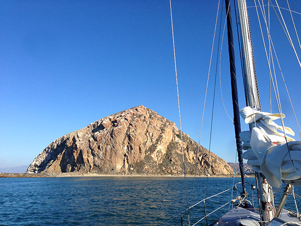
Morro Rock, at the entrance to Morro Bay, is a national bird sanctuary.
As we left Morro Bay, the sun was warm, the water blue, and we really hoped that NOAA wouldn't change this forecast for zero to 5 kts of wind with 2-3' seas for our Pt. Conception rounding.
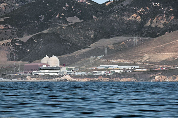
The infamous Diablo Canyon nuclear power plant looms large along Pt. Buchon. It's unbelievable that they built nuclear reactors right on the ocean?! What were they thinking...or not?!?
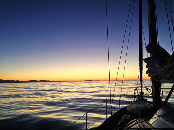
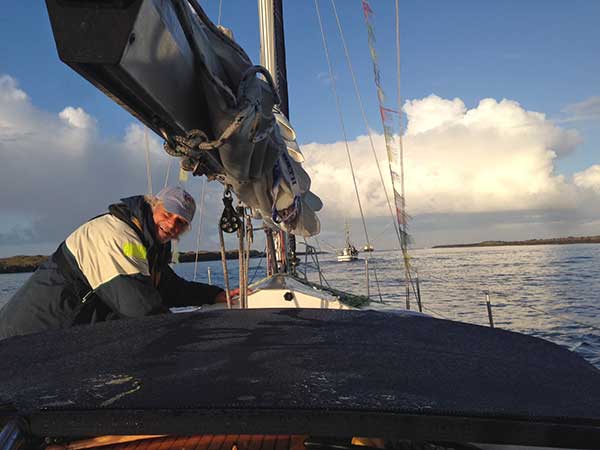
The forecast held as we motored all afternoon and into the night with no wind. Although we would have liked to sail, we definitely preferred no wind and calm seas to the alternative of the night before. As darkness set in we started our night watches, Tosh included.
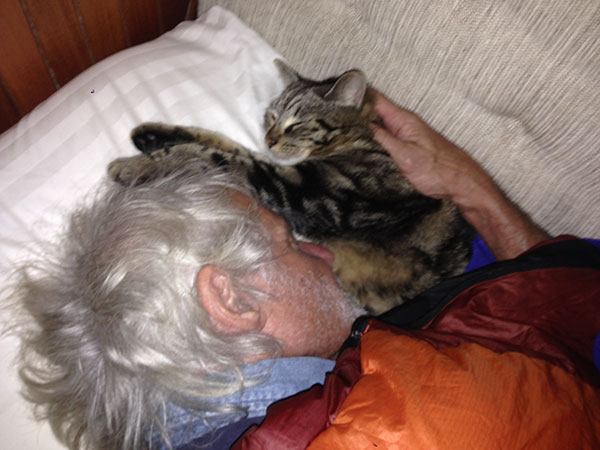
Tosh off-watch...
While Heidi was on watch about 2am the first of the many oil platforms loomed ahead in the night off of Pt. Arguello, with others in the distance looking like miniature island-cities. She noticed a red light off our starboard quarter about a mile to the northwest, low in the water. Nothing showed up on the radar and looking at the chart there was no buoy indicated in that location. Not another UFO? Why do these lights always show up on Heidi's watch?
She kept an eye on the light for an hour, as it stayed at the same bearing but got closer and closer. No other lights, just one red one. Likely another boat's red bow light, but why didn't it show up on the radar and why were there no other lights? When it was about ¼-mile away she could finally see the moonlight reflecting off the mast through the binoculars...it was another sailboat, motoring. No steaming light on, just running lights on the bow... a dark blue boat in the dark night, converging on our course, still not showing up on radar.
Heidi decided to wake Kirk up for a reality-check to make sure that's what she was really seeing. Kirk confirmed we were on a collision course and by now the other boat was only about 200' away so Heidi disengaged the autopilot and turned Due West 90° to port from the other boat. Without our altering course the other boat would have hit us. They had obliviously put their boat on autopilot and gone to bed, no one on watch, no lights on, not even obeying the rules of the road with no steaming light on. (The steaming light is a white light mid-mast height that indicates a sailboat is motoring.) We wondered if they had pre-programmed all of the oil platforms into their autopilot course to avoid hitting them, or if they would slam into one. Such a STUPID, crazy thing for them to do. But sadly there are boaters like that out there and all the more reason we keep a vigilant watch all the time. And with that spike of adrenaline it was time to change watches, and hard for Heidi to fall asleep, but she did see the Pt. Conception light just before nodding off.
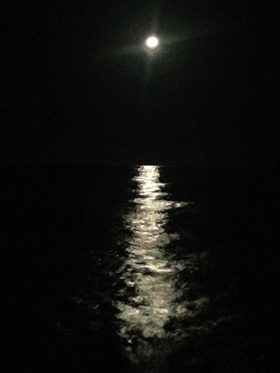
Moonlight Mile along Pt. Conception.
Kirk got the Pt. Conception on-watch, with a beautiful almost-full-moon on the transom and Jupiter, Venus, and Orion leading the way in glass-smooth seas. What a lonely lighthouse jutting out to sea from the California coast, flashing every 30 seconds, no other lights around. We could not have asked for a better rounding of Pt. Conception. Thank you Neptune!
As we motored on towards Santa Barbara in the early morning hours, past oil platform after oil platform, the air became thick with the smell of raw oil. It was so pungent, it smelled like someone was paving an asphalt road under our nose, rather than being out at sea. It turns out that oil is naturally seeping up from the sea floor along the coast, which creates oil slicks on the water and tar balls on the beaches there. We've been told that before the oil platforms were installed these oil slicks and tar balls were much worse, and that the oil platforms are actually helping. Huh, who'd a thunk?
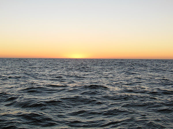
Beautiful morning sunrise with Santa Barbara in our sights.
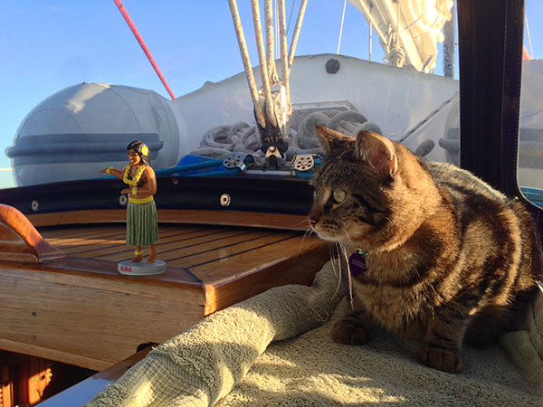
Tosh on-watch. Tikka was a bit shy this passage, but you'll see more of her next time.
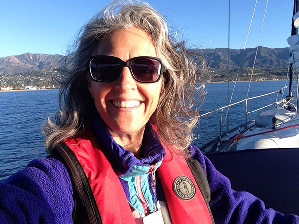
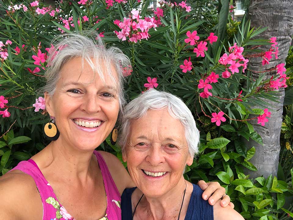
Heidi heading back "home" 51+ years after being born here, then moving away when she was 4.
The weather definitely took a change for the warmer after Pt. Conception. Even the evening's dew seemed to dry up after we rounded Pt. Conception. We are looking forward to spending a little time in Santa Barbara before heading south. We are eager to catch up with our friends Maryalice and Rick soon.
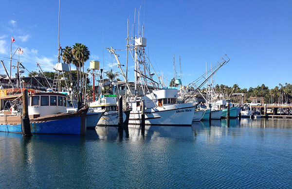
SUNNY Santa Barbara Harbor.
Happy Thanksgiving to all of our friends and family! We are so thankful for having all of you in our lives...and thanks for following along in our sailing adventures. Yes, one of these days we are actually going to SAIL and get to Mexico! ☺ For now we're glad we're still here as a very late-season Hurricane Sandra is looming towards Baja. Sending good vibes to all of our cruising friends who are already down there. xoxo
Due West in Monterey Harbor.
Our last week in Monterey was extended by a few days waiting for a calm weather window to head south. While the weather in Monterey was beautiful most of the time we were there, out at sea it was a different story. Storms from as far away as Alaska and Hawaii were converging offshore causing 35+ knots of wind and 20-25 foot seas. No Thanks! Even the fishermen and whale-watching boats were staying snug in the harbor. And we were constantly checking the weather, waiting for our window to leave.
This particular stretch of California Coast doesn't have a lot of places to stop along the way, nor to duck-in during inclement weather. So we had to time this leg of our trip to coincide with entering harbors during daylight hours, which meant traveling at night. Monterey to Morro Bay was calculated to be about a 20 hour trip so no way to do that all during daylight hours. As it turns out that leg took us about 18 hours (and would have taken us 17 hours but we slowed down to ensure arriving in daylight hours.)
The stretch from Morro Bay to Santa Barbara included rounding Pt. Conception, the biggest, baddest point on the whole west coast of the U.S. and even dubbed "The Cape Horn of the US." For you non-sailors, any point of land jutting out into the sea can create it's own weather including ocean currents, sea state, and wind.
As our fishermen friend TD pointed out to us, the ocean floor typography with its deep cold-water canyons coming up to meet points of land with warmer surface waters can really make for nasty conditions around Points. This is particularly true of Pt. Conception, and we've heard many tales of wild-and-crazy roundings of this notorious point. But Kirk had been around it several times before without any problems. And we were very keen to time our trip around Pt. Conception with a favorable weather window this time as well.
But first...back to our last week in Monterey: It was a bitter-sweet last few days, knowing we'd soon be saying good bye to our dear family-friend Sheila and her sweet little dog Bodhi who'd been our constant companions for 3-weeks. Heidi has known Sheila her whole life and we'd always visit her on our trips to the Monterey Bay area. We miss all of our wonderful meals and conversations with Sheila and her Scottish sense of humor too! Although she's probably still resting up from running us around on all of our errands...thank you Sheila and Bodhi!!
Heidi with dear friends Sheila and Bodhi.
We got in a few kayak paddles around the Bay and also enjoyed spending more time with our long-lost friends Laura & Greg whom we'd known 25 years ago in Seattle, and randomly ran into kayaking in Monterey Harbor, what a fun blast from the past! Another special treat a couple days before we left was a surprise visit from Heidi's step-dad-once-removed, Andy (Arne & Kari's step-dad.) Andy was visiting his family in the Bay Area and he and his sister Nancy took a day-trip down to Monterey just to see us and take us out to lunch. Such great fun to see Andy's wonderful smile. We reminisced about a fun week camping on the beach in Baja with Andy and family two Thanksgivings ago. We hope Andy will meet up with us again somewhere in our travels, and SO MUCH appreciate that he made the effort to come and visit us.
Kirk, Heidi, Andy, and Nancy...so much fun hanging out with extended family in Monterey!
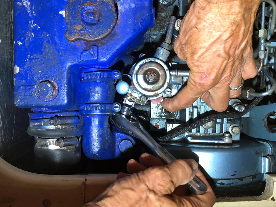
We finished up a lot of boat projects (but still didn't get to some of them!) including wedging a few more nylon spacing washers into our gooseneck (where the boom connects to the mast) to stop it from twisting and squeaking. John Carscadden you'd be proud of our chasing-down-and-stopping-squeaks! And we bought pretty new blue mooring lines to replace our old ones, which had been through one-too-many Seattle winter storms! We checked all of the AIS wires for a fourth time, still no-dice. Grrrr...And we determined that the old depth-sounder does NOT work, however the new one is working like a charm so at least we're good there. As for the solar panels, they have yet to been installed...and the water maker still needs to be hooked up. Monterey was so filled visiting with fun friends and family it was hard to get our intended boat chores done!
We met another cruising couple, Kirsten & Eric, formerly from Seattle, more recently from Napa who were waiting out the same weather window to leave as we were. So we decided to buddy-boat together. After a few false-starts thinking we'd leave on Monday, then Tuesday or Wednesday, we finally got our window to leave on Thursday, November 19th. Weather was predicted to be 5-15 knots of wind from the northwest and seas 3-6 feet. Perfect for sailing south. We timed leaving Monterey to get us into Morro Bay in the morning, and left the fuel dock at 1500 hours (3pm.)
Kirsten & Eric had left a few hours before us because they travel a bit slower than we do. As we headed out of Monterey Harbor towards Pacific Grove and Carmel, the seas got increasingly bigger and bigger, and the winds were 15-18kts. Hum... this was not in the forecast, but possibly it was just the convergence at Pt. Pinos (see POINTS above.) Sheila and Bodhi were waving us goodbye from Pt. Pinos (shouldn't this point really have a tilde on the ñ and be called Point Piños?! Odd...who named this point?)
As we approached Pt. Pinos about a mile off-shore in 8-10-foot seas we could hear and feel and "thunk" in the boat. Heidi thought it was coming from under the cockpit, Kirk thought it was coming from up forward. We tried to listen in the wind, we felt the boat, and couldn't tell what was causing it. We thought maybe it was the auto-pilot working so hard in the large, confused seas. Then suddenly we realized that the lines holding down our scuba tank on the bow had loosened and the tank was rolling side-to-side, almost going airborne as we crashed through the waves. YIKES!!
Kirk made his way forward (with safety harness clipped into jackline), and dragged the tank back to the cockpit where we could secure it once again. Sheila was watching all of this through the binoculars on shore. She was worried about us in the big waves, but when she called us we assured her we were ok. As we continued on towards Carmel, the wind and waves were not getting any better. We tried to hoist the mainsail thinking it would help steady us in the steep waves, but the wind was directly behind us and even with a preventer line holding out the boom, the mainsail just wanted to slat and pop. Not wanting to trash our sail, we took it down and continued motoring, very thankful for our TRUSTY Lewmar reversible motor-drive auto-pilot. That thing rocks! We are still trying to think of a good name for our auto-pilot...any suggestions?
Poor Tikka got sick (even with doubling up on her Bonnine) then hid in her habi-trail-tube, while Tosh kept hunkered down in his basket under the salon table, and the boat rolled on. This has been the rolliest of trips we've ever experienced; less sailing, more motoring, more rolling back and forth than every before. This was not in the brochure...but apparently this is what El Niño has to offer us this year! Luckily Due West is a very sound, sturdy boat, and rides through the seas gracefully. Thank you Bob Perry!
We talked to Kirsten & Eric on the VHF radio, who were about 20-miles ahead of us. They told us our waves would abate soon, and we continued on our way, starting our 2-hour watch schedule.
On our offshore passages we make up the starboard settee (aka: living room couch!) with a sleeping bag and the lee cloth to hold us into the bunk when the boat heels or bounces around in the waves. We take turns with one person on watch and one sleeping in two-hour shifts. We can see the radar and chart plotter on our iPad, so if it's too cold or wet to sit at the helm we can sit on the top step of the companionway, keep an eye on the iPad radar/chartplotter, and look around every 10-15 minutes to make sure we're not missing anything out there. Kirk usually opts to sit at the helm, while Heidi prefers to stay warm on the top step if it's cold out, anyone surprised?!
Passing Pt. Lobos at sunset made us think of Heidi's grandparents Oxy and Wini who loved that place. Grandpa Oxy had been instrumental in turning Pt. Lobos into a State park, THANK YOU Grandpa!
Somewhere between Carmel and Point Lobos we heard a May-Day on the VHF radio for a man-overboard. Kirk was on watch and soon saw US Coast Guard boats and helicopters searching the waters as dusk was looming. It's an eerie feeling to know a fellow boater is in peril. We hoped for the best outcome. We are extremely safety conscious and hope that this never happens to us.
Further on down the coast it was dark by the time we passed Point Sur. Heidi was on watch looking out towards the west and the wide expanse of ocean while Kirk was asleep below. Suddenly about a mile away and low hanging in the sky flashed a bright red light. At first she thought it might be a mast-head navigation light of a sailboat, but no boats showed on the radar. Then a red and green light appeared in the sky right next to it. Hum... possibly the bright red light was a flare, and the red and green lights next to it were an airplane? It seemed about the right altitude. Was it was part of the USCG search? This seemed too far south. Then just as suddenly all three lights vanished, and shortly after four red lights appeared in sequence, one after another, in a straight horizontal line, and stayed lit for about 30 seconds before they all disappeared too. WHAT. WAS. THAT!?! Nothing on the radar, no sounds, no other lights around coming or going. UFO for sure... something unidentified! But what? So creeeeeepy and X-files-ish. No doubt our government testing something?
The moon and the stars were out and it was a beautiful night but the big waves and winds continued. On Heidi's watch at 2am she saw 32kts on the anemometer! By Kirk's watch two hours later the wind had died down and the seas finally started to calm. Somewhere in the night we received a text from Kirsten & Eric, saying they'd had some damage to their boat and were returning to Monterey. Cell coverage was really intermittent along that coast, but when we had coverage Heidi pulled up the NOAA weather forecast and saw that NOAA had changed the forecast to SCA (small craft advisory)!?!? The forecast was changed at 2pm that day, about the time we were leaving the dock in Monterey to head to the fuel dock, and we'd not checked the weather within the last two hours before leaving as the forecast had been steady for the last 2-days, and we were busy getting ready to head out.
With the SCA behind us, it was a gorgeous morning as we made our way into Morro Bay harbor past Morro Rock.
Morro Bay with its funky-fun architecture, shops, and restaurants lining the waterfront and docks along the way.
Due West with her boats-upon-boats (one dinghy and two kayaks) tied up to the Morro Bay Yacht Club 150' guest dock for $25/night.
Good thing we planned to stay at Morro Bay Yacht Club, as it turns out they are the ONLY dock in town where you can stay the night! You could also anchor out in the harbor, but since we were only staying one night and leaving again the next day we opted for a dock and easy access to walk around town rather than unpack and re-pack the dinghy.
Heidi surfing with Santa in Morro Bay...Thanks for the awesome hoodie Laura!
As guests at the YC we were invited to their Friday night cocktail hour complete with dinner. We even found our Lahaina YC burgee flying there, Aloha!
Morro Bay is a cute fishing harbor and we had a fun walk around town. But our weather window for Point Conception was calling us, and we had to head south the next day. We were chased off the Yacht Club dock at 12:30pm when the kids needed the dock for their youth dinghy races, which was a perfect time for us to head out anyway.
Morro Rock, at the entrance to Morro Bay, is a national bird sanctuary.
As we left Morro Bay, the sun was warm, the water blue, and we really hoped that NOAA wouldn't change this forecast for zero to 5 kts of wind with 2-3' seas for our Pt. Conception rounding.
The infamous Diablo Canyon nuclear power plant looms large along Pt. Buchon. It's unbelievable that they built nuclear reactors right on the ocean?! What were they thinking...or not?!?
The forecast held as we motored all afternoon and into the night with no wind. Although we would have liked to sail, we definitely preferred no wind and calm seas to the alternative of the night before. As darkness set in we started our night watches, Tosh included.
Tosh off-watch...
While Heidi was on watch about 2am the first of the many oil platforms loomed ahead in the night off of Pt. Arguello, with others in the distance looking like miniature island-cities. She noticed a red light off our starboard quarter about a mile to the northwest, low in the water. Nothing showed up on the radar and looking at the chart there was no buoy indicated in that location. Not another UFO? Why do these lights always show up on Heidi's watch?
She kept an eye on the light for an hour, as it stayed at the same bearing but got closer and closer. No other lights, just one red one. Likely another boat's red bow light, but why didn't it show up on the radar and why were there no other lights? When it was about ¼-mile away she could finally see the moonlight reflecting off the mast through the binoculars...it was another sailboat, motoring. No steaming light on, just running lights on the bow... a dark blue boat in the dark night, converging on our course, still not showing up on radar.
Heidi decided to wake Kirk up for a reality-check to make sure that's what she was really seeing. Kirk confirmed we were on a collision course and by now the other boat was only about 200' away so Heidi disengaged the autopilot and turned Due West 90° to port from the other boat. Without our altering course the other boat would have hit us. They had obliviously put their boat on autopilot and gone to bed, no one on watch, no lights on, not even obeying the rules of the road with no steaming light on. (The steaming light is a white light mid-mast height that indicates a sailboat is motoring.) We wondered if they had pre-programmed all of the oil platforms into their autopilot course to avoid hitting them, or if they would slam into one. Such a STUPID, crazy thing for them to do. But sadly there are boaters like that out there and all the more reason we keep a vigilant watch all the time. And with that spike of adrenaline it was time to change watches, and hard for Heidi to fall asleep, but she did see the Pt. Conception light just before nodding off.
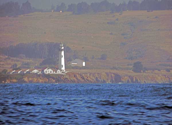
Moonlight Mile along Pt. Conception.
Kirk got the Pt. Conception on-watch, with a beautiful almost-full-moon on the transom and Jupiter, Venus, and Orion leading the way in glass-smooth seas. What a lonely lighthouse jutting out to sea from the California coast, flashing every 30 seconds, no other lights around. We could not have asked for a better rounding of Pt. Conception. Thank you Neptune!
As we motored on towards Santa Barbara in the early morning hours, past oil platform after oil platform, the air became thick with the smell of raw oil. It was so pungent, it smelled like someone was paving an asphalt road under our nose, rather than being out at sea. It turns out that oil is naturally seeping up from the sea floor along the coast, which creates oil slicks on the water and tar balls on the beaches there. We've been told that before the oil platforms were installed these oil slicks and tar balls were much worse, and that the oil platforms are actually helping. Huh, who'd a thunk?
Beautiful morning sunrise with Santa Barbara in our sights.
Tosh on-watch. Tikka was a bit shy this passage, but you'll see more of her next time.
Heidi heading back "home" 51+ years after being born here, then moving away when she was 4.
The weather definitely took a change for the warmer after Pt. Conception. Even the evening's dew seemed to dry up after we rounded Pt. Conception. We are looking forward to spending a little time in Santa Barbara before heading south. We are eager to catch up with our friends Maryalice and Rick soon.
SUNNY Santa Barbara Harbor.
Happy Thanksgiving to all of our friends and family! We are so thankful for having all of you in our lives...and thanks for following along in our sailing adventures. Yes, one of these days we are actually going to SAIL and get to Mexico! ☺ For now we're glad we're still here as a very late-season Hurricane Sandra is looming towards Baja. Sending good vibes to all of our cruising friends who are already down there. xoxo
Comments
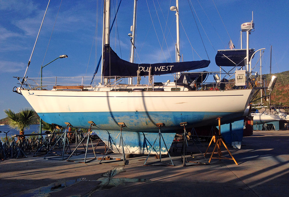
| Vessel Name: | Due West |
| Vessel Make/Model: | Passport 40 |
| Hailing Port: | Seattle, WA |
| Crew: | Captain Kirk & Heidi Hackler + Tosh & Tikka |
| About: | |
| Extra: | See pix of our boat here: Due West Interior Photos and in the Photo Gallery. |
| Home Page: | http://svduewest.com |
Due West's Photos - Main
 |
 |
 |
 |
 |
 |
 |
 |
 |
 |
 |
 |
 |
 |
 |
 |
 |
 |
 |
 |
 |
24 Photos
Created 7 April 2017
|
 |
 |
 |
 |
 |
 |
 |
 |
 |
38 Photos
Created 25 September 2016
|
 |
 |
 |
 |
 |
 |
 |
 |
 |
Things We Wish We’d Known Before Going Cruising...
19 Photos
Created 25 May 2016
|
 |
 |
 |
 |
 |
 |
 |
 |
 |
 |
 |
 |
 |
 |
 |
 |
 |
 |
 |
 |
 |
Leg 1 of our trip to San Francisco, sailing from Port Townsend, WA to Newport, OR. Ducked into Newport to avoid a gale at sea...
32 Photos
Created 29 August 2015
|
s/v Due West & Crew
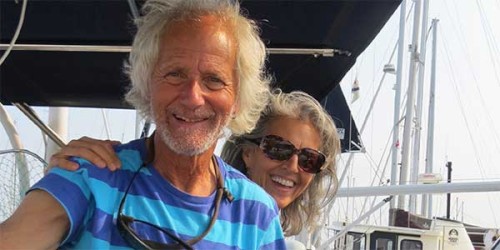
Who: Captain Kirk & Heidi Hackler + Tosh & Tikka
Port: Seattle, WA
Gallery


Check out recent posts here...
SailBlogs Friends
")


