Island Bound
28 March 2018 | Long Island
19 March 2018 | Conception Island
03 March 2018
03 March 2018 | Rock Sound, Eleuthera
18 February 2018 | Spanish Wells
10 December 2017 | Green Turtle Club, Abacos, Bahamas
21 November 2017 | Ft Pierce
14 November 2017
05 November 2017 | Georgetown SC
27 September 2017 | Southport NC
27 September 2017 | Southport NC
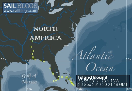
26 September 2017 | Southport Marina, Southport NC
01 June 2016
31 May 2016
07 April 2016
07 April 2016
07 April 2016 | Spanish Wells
23 March 2016 | Big Majors Spot
22 March 2016
12 March 2016 | Exuma Land & Sea Park
Long Island
28 March 2018 | Long Island
MG

Our string of good weather continued on Monday morning (3/19) and we motored smoothly across a flat ocean for the 3 1/2 hour trip to our anchorage on the northwest corner of Long Island. Although we travel in a sailboat and really enjoy "shaking the wrinkles out of the canvas" by taking Island Bound out for a nice sail now & then, we decided a long time ago that we would happily burn some fossil fuel in exchange for flat seas when traveling across open ocean. Maybe if we were true "blue water sailors" and made it a practice of crossing oceans on 1000 mile journeys we would think differently but for coastal cruising and island hopping we sure appreciate a nice calm passage (I guess that we are getting old). We had originally planned on traveling down the east coast of Long Island to Clarence Town and, after a couple of days, proceeding on to Crooked Island and Acklins Island. There is a gentleman on Crooked Island that a couple of friends of mine know and have recommended that I look up should we ever pass that way. The "friend of a friend" goes by Frenchie and has been building a marina on the west coast of Crooked. It turns out that the marina was devastated by one of the many recent hurricanes and construction has apparently stopped with no firm commitment for completion. I made an effort to contact the marina but there doesn't seem to be anybody there. Rather than beating into the trade winds to make the eastward jaunt to Crooked we decided to spend some time on the leeward side of Long Island.
Our first stop on Long Island was Cape Santa Maria located on the northwest tip of the island. Cape Santa Maria is home to, yet another, crescent shaped, uninhabited, white sand beach. We set our anchors in about 8 feet of water over a clear, deep sand bottom. We noticed on our past trips to the southern Bahamas Islands that it seemed that the farther south we travel the better the anchoring conditions become. Although there are many good anchorages in the north there are also many areas where sea grass has spread and the roots prevent good holding, as well as other areas where the bottom is a very hard sand or rock and anchors just have a hard penetrating. Of course, the south has those conditions in places too but there are so many good anchorages available that they are seldom an issue. After lowering the anchor down to the bottom and paying out a generous amount of chain while backing the boat downwind, it is very satisfying to feel the boat stop abruptly and the bow dip a bit as the anchor digs in and buries itself. It is not uncommon to find that the anchor is buried completely under the surface. When you see this you can sleep well even if the wind whips up unexpectedly. Cape Santa Maria is named after one of Christopher Columbus' ships, the "Santa Maria". This cape is supposedly one of the places that Columbus visited on his voyage. There is a monument located on a hilltop at the entrance to tidal pool on the very tip of the cape. One of our first orders of business after anchoring was to take the dinghies to the tidal pool and climb the hill to visit the monument. The monument itself was a stone pyramid shaped structure with a bronze plaque. The monument was not really that impressive but the view from the hilltop was well worth the trip. While taking in the scenery from this vantage point we were able to reflect on the fact that, although we consider Columbus a hero, not everyone does. The Bahamas were populated by the Lucayans when Columbus landed and over the course of the waves of explorers that followed the Lucayans were essentially all carried away and sold into slavery by the Spanish. From 1492 to around 1513 the Bahamas Islands were completely depopulated of indigenous people and they remained unpopulated for the next 130 years.
Well, after that bit of light history I'll get back to our travels. We stayed anchored in Cape Santa Maria for a couple of nights. There is a very nice resort, Cape Santa Maria Resort, just to the south and we took our dinghies around the corner to the restaurant for happy hour. They were reputed to have good pizza so we decided that an evening at a bar having pizza & beer was just what was needed. We were not disappointed. Excellent pizza. On the morning of our third day on Long Island we pulled anchor and headed south 25 miles or so to the small "town" of Salt a Pond on Thompson's Bay. As we were underway I watched our gps coordinates count down until we passed 23 deg 26' 13" N. We officially were in the tropics! Salt Pond lies just a few miles south of the Tropic of Cancer. We have been very close in the past but this marks the first time that we have been in the tropics aboard IB. There was supposed to be a good grocery store here and a nice weekly farmers market and we were starting to run low on some items. We have been moving quite regularly so we decided that we might spend several days in Salt Pond. As was the case in Cape Santa Maria, Island Bound came to an abrupt stop when backing down on the anchor. Great holding here too!
As I am writing this it is March 28 and we have been here for close to a week now. We've visited the grocery, liquor, and hardware stores, attended the farmers market, attended happy hour at Ty's Sou' Side Bar, had drinks Tiny's beach bar, rented a car & went snorkeling in Dean's Blue Hole, and had a very good lunch at a Chez Pierre restaurant. As a side note to an item on the list above - Dean's Blue Hole was considered the deepest blue hole in the world up until very recently when a deeper hole has been discovered somewhere. Dean's Blue Hole is 663' deep and maybe 80' across. It is located on the edge of an unassuming sand beach on the Atlantic side (east side) of Long Island, just north of Clarence Town. If you have ever watched the world free diving competition you have probably seen Dean's Blue Hole. When the competition is not being held the blue hole sits, relatively unmarked (there are a couple of small signs), at the edge of a rather plain sand beach. You can just wade off into the abyss with little fanfare. It gives you a strange feeling to snorkel over the hole, going from viewing shallow sand ridges and tropical fish one second to staring down into a 600' hole the next.
The weather has remained pleasant for our stay here but for the past couple of days the winds have kicked up considerably. We have been seeing consistent E & NE winds in the 20kt range and have had frequent gusts pushing 30kts. We are anchored on the protected west side of the island and are sitting in relatively calm water but this is not a good time for traveling. We will extend our stay here for a few more days until the wind lays and the seas calm before heading out for more adventure. I'll update again from our next stop.
Conception Island
19 March 2018 | Conception Island
MG
The windy conditions in Rock Sound subsided and we have moved on, so I guess that a blog update is in order. The weather was forecasted to be clear and calm on Friday morning (3/9) at Rock Sound so "Island Bound" along with our buddy boat "Elusive" hoisted our anchors and headed out of the sound shortly after first light. For a change, the weather forecast was accurate and we had no surprises as we traveled out of the sound, around the large shoal that protects the southern tip of Eleuthera, around the large north & south protrusions that make up the bottom tip of Eleuthera and finally, across a small stretch of open ocean as we made it to our next anchorage on Little San Salvador (aka Half Moon Cay). This Island is privately owned by the Holland America Cruise Line and is a regular stop for their cruise ships. We pulled into the anchorage around 4pm and we could see the cruise ship tender boats ferrying passengers from shore to the waiting ship. By the time we got our anchors set and settled in to our home for the remainder of the afternoon/evening, the cruise ship had hoisted anchor and was steaming away. Bret (Elusive) called the island authority and asked if we could come ashore and permission was immediately granted. We, along with the crews of the other four or five sailboats at anchor, splashed our dinghies and met on this beautiful beach. After a brief social time we went back to our respective boats for sundowners and, later, dinner and a good night's sleep.
The next morning we hoisted anchors after a leisurely breakfast and were underway by around 8:30; destination - Cat Island. Cat Island lies south and east of Little San Salvador and the forecast was for moderate east winds all day then shifting to southeast in the late afternoon/evening. Cat Island, like most Bahamian islands stretches north to south so we would be well protected from the east winds but when they shift southerly we would need to find some shelter. The northern part of Cat is only about 15 miles from Little San Salvador but good protection from southerly winds lies to the south so we headed southeast on a planned 25 mile trip to reach good protection near the southern part of Cat. We had not been underway long when it became obvious that the southerly shift in wind direction had come early and we found ourselves motoring southeast into a brisk southeast wind. After maybe an hour of motoring into the wind and the accompanying growing chop, Bret radioed and suggested that we change course to due east in order to get into the lee of the island, then turn south to our destination. This was a good idea and we turned toward the east and ran for Cat Island. The sea remained pretty rough as we made our way toward the island but as we got closer to land you could feel the chop getting smaller and the ride getting smoother. This segment of our journey ended up taking a little longer than we had planned but we finally pulled into the well protected water of Fernandez Bay, set anchor, and went ashore for appetizers and happy hour drinks. Another travel day behind us.
As illustrated by our changed route planning to Cat Island, the weather forecast for the next few days had changed. Now a new cold front was pressing down into the Bahamas and we were to expect locally strong thunderstorms and strong westerly winds associated with the front. This new pattern was forecasted to last for a couple of days before calming back to "normal". I guess that a map would illustrate it but it doesn't take much imagination to see that strong westerly winds are not good when one is anchored on the western shore of an island in the Atlantic. We decided that this would be a good time to find a protected Marina and tie up until the weather moderated. A quick look at our charts showed us that there was a marina on the south tip of Cat that was tucked up into a creek and it offered good protection from winds from any direction. Our anchorage at Fernandez Bay was only 10 miles from the marina so on the morning of 3/11 we motored the 2 hours to Hawk's Nest Marina. I think that I failed to mention that Hawk's Nest is the ONLY marina on Cat Island! Even as we were motoring on that Sunday morning we could see a cloud bank and hear thunder to our west. We managed to get tied up and settled into our slips before the rains hit. As it turned out, the storms were not severe but it still felt good to be tied to a substantial dock structure and to be out of the winds when the storms were coming through. Even after the initial front passed the west winds were still in the forecast so we ended up staying at Hawk's Nest for a total of 3 days.
We all kind of fell in love with Hawk's Nest Marina/Resort. This place is owned by a very nice couple from New Mexico. The staff is friendly and efficient, the service is fast, and the food was very good. This is like the triple crown for Bahamas restaurants/bars. You can get one or two of these attributes in one place but rarely do you get all three. The property that is now Hawk's Nest was once a transfer point for a drug running operation in the 1980s. It was (is) complete with an air strip, a marina, several buildings and roads - all complements of some, now imprisoned or dead, drug lord. Not sure how the New Mexico couple ended up with it but what a great little resort it has become. Congrats to them. I hope that we can come back some day.
One other thing to mention about Hawk's Nest Marina, it is primarily a fishing destination. The Marina owns a fishing boat that they both charter and use to gather the catch of the day for the restaurant. There are large sport fish boats here from all over and it seems that there is someone cleaning fish in the, get this, air conditioned fish cleaning station every day. Any time that fish are cleaned there is a dock cart devoted to transporting the offal for disposal. Rather than dumping the fish remains in the marina there is a designated spot along the creek where the marina's fuel dock is located. When you see the fish gut wagon headed for the fuel dock you must get there for the upcoming show. The local population of sharks have learned the routine and when the cart is rolled out onto the dock the frenzy is about to begin. Within seconds there are easily 20 to 30 sharks churning up the water. They range in size from 4 or 5 feet up to 10 to 12 feet. There are Lemon Sharks, Reef Sharks, Black Tip Sharks, and Nurse Sharks all mixed in the mass of muscle & teeth. It is amazing to watch and absolutely nightmarish. I've always been told that Nurse Sharks are not aggressive and are relatively harmless. Someone forgot to tell the ones that I saw holding their own in the feeding frenzy.
We left Hawk's Nest on the morning of 3/14 and headed back up the west coast of Cat Island to New Bight. This is close to the site where a 3/4 size replica of a European monastery was erected on top of the highest point in the Bahamas (206 ft). You could see the monastery from our anchorage so we had to go check it out. It is a mile or two walk from the beach to the monastery and it felt good to get a little exercise after a few days at the resort. Fr. Jerome Hawkes was the architect who built the monastery and he was an interesting guy. I won't elaborate here but he is easy to look up if you're interested.
The last couple of travel days we've had I noticed that our fuel usage has gone up considerably. I dove to inspect the bottom when tied up in Hawk's Nest Marina so I knew why our fuel burn rate was going up and our cruising speed was going down. Island Bound was due a bottom cleaning as the entire bottom was covered with a heavy growth of what looked like very dirty shag carpet from 1973. The day after our monastery visit was set aside for a days work on the boat bottom while anchored in the shallow water of New Bight. It was a major undertaking just digging out all of our seldom used scuba equipment from various storage locations all over the boat. Air tanks on the very bottom of the lazaret, under several feet of misc. stores of junk. The masks, snorkels, fins, and boots were on a shelf behind the water maker. The BCDs where located behind the starboard settee. The octopus regulators were located behind the port side settee. All of the lead weights were located in a bilge compartment. Finally, the wetsuits were on a shelf far in the back of our rear berth. Just digging this stuff out, assembling it, suiting up, and getting in the water is a major task; then the work begins! For the most part, the growth comes off with a few scrapes from a stiff plastic paint scraper. The discouraging part is that the scraper is 4" or 6" wide and the boat bottom is something like 38' long X 12.5' wide at the widest point X 5' draft. There is a LOT of boat to clean. I let all of the air out of my BCD and stood on the smooth sand bottom to clean the rudder, the keel, and the boat bottom that I could reach. And yes, I did think often of the shark feeding frenzy that I'd seen a couple of days before. Jan cleaned the near surface perimeter as far down as she could reach with snorkel gear. This might sound easier but I assure you it is harder to float and stay in contact with a boat while attempting to scrape the sides than it is to stand on the bottom (with one eye out for approaching man eaters). Once we got started we stayed with the task at hand and by a little after noon we were absolutely out of gas but the boat bottom was acceptably clean and Island Bound was once again ready for travel.
On Friday morning (3/16) we hoisted anchor and headed around the southern tip of Cat Island and set a course SE toward Conception Island. The weather was mild and travel on this day was very enjoyable as we were able to roll out our head sail and motor sail the entire trip. Conception Island is part of the Bahamas National Park system. The entire island is a nature preserve and is only inhabited by tropical birds and some crabs & lizards. Island Bound, Elusive, and one other boat had the entire place to ourselves. Extremely quite & serene. I will post some pictures but I promise that they won't come close to capturing the beauty of this place. The waters that surround Conception Island range from 2000 to 12000 feet deep. The island itself is almost completely surrounded by a coral reef. You can't get here on a cruise ship, you can't fly in here. The only way to see this place is by private boat. We appreciate how privileged we are to get to experience a place like this. In our lives, we've been to many beautiful beaches; many of the Caribbean islands, Florida pan handle, east coast of Australia, Mexico, Texas, California, Jan's been to Hawaii but admits that it was too long ago to compare, but we agree that this may be the most beautiful beach we've seen - anywhere. There is a mile long, white sand beach on the north west corner of this island. Tropical birds fly overhead all day and the trade winds blow steadily to keep flying bugs to a minimum. Because the beach is on the leeward side of the island, the plastic floatsum that contaminates many Bahamian and Caribbean beaches is kept to a minimum here and, of course, there are no party boats blasting out rap music, no jet skis, no airplanes flying banners overhead, no people - period. This is good! This may not be everyone's experience here but, in our opinion, this place is as good as it gets and we don't know what we've done to deserve to be here. If you ever get the chance - COME HERE AND SEE THIS PLACE!
After our first night at anchor in this paradise we decided to stay on at least another couple of days. On day one we just celebrated being here. We had Bloody Marys on the boat at happy hour and enjoyed the sunset from Island Bound's cockpit. On day two we took the dinghy ashore and joined Elusive for a short hike to the windward (East) side of the island. Because the windward side is exposed to the trade winds there is much more plastic washed ashore and the beach features much more exposed rock and surf. There is no safe anchorage on this side of the island unless there is a rare westerly wind and the very close in reef on the east side makes access difficult and the anchorage small so this is a place for a few pictures and to leave to Mother Nature. The rest of our day was spent on the leeward (west) side of the island. On this side there is a large anchorage area inside the surrounding reef and the entire anchorage area is clear white sand with a few, very easy to navigate around, coral heads. We dinghied around the leeward reefs and inspected the various corals with our "lookie buckets". A lookie bucket is a 3 to 5 gallon plastic bucket with the bottom cut out and replaced with a piece of plexiglass. When you place the bucket in the water you get a completely clear view of the bottom. We primarily use our lookie bucket to verify that our anchor has set properly. The great secondary use of the lookie bucket is to enjoy viewing marine life like we got to do on this day. We ended day two at Conception Island with Sundowners, of course, and dinner on the boat.
We began day three at Conception Island with a long dinghy ride. There is a river/creek/tidal estuary near the southern end of the island and it winds a long way into the interior. It needed to be explored. Our boats are anchored on the northwest corner on Conception Island, the mouth of the "river" is near the south tip of the island, this means that we were in for a long dinghy ride on open water just to start exploring. Normally, one would expect to get beat up on a dinghy jaunt across open ocean water - not this morning. The wind was dead calm and the Atlantic Ocean looked like the top of a blue felted pool table. As we were traveling at around 18 or 20 mph in our dinghy, the bottom was crystal clear and in perfect focus. I've never felt and/or seen anything quite like this. The water was so clear that I had a perfect sense of depth. As we passed over fields of massive coral heads at 20 mph it was obvious that they were plenty deep below us. The clarity was not degraded by the depth. We saw a ray resting on the bottom. At 20 mph we not only could see a ray as we passed but we could see that he was obviously resting on bottom. It actually felt as though we were flying over these rock formations in a small airplane. Jan and I have never experienced this before. At the risk of overusing the word awesome - it was awesome! As I have mentioned, this island is almost completely surrounded by coral reef. The entrance to the "river" is no exception and there is a particularly shallow chunk of coral (rock) blocking the entrance. At low tide the rock is practically awash but at near high tide there is plenty of water to pass over the top in a dinghy. We entered the river at about an hour before high tide and had no issues with depth. Since the tide was still rising, once inside the reef we shut down the engines and let the current carry us. Our silent dinghies did not scare the wildlife so we were treated to rays, sharks, turtles, barracudas, and various tropical fish in their natural habitat. Jan & I sometimes have to pinch ourselves to ensure that this kind of experience is real. Breathtaking! After about an hour of drifting inland on the current, the tide did what it always does and turned. When our dinghy drift ended a couple of miles up river, we reluctantly started our outboards and idled out of this special place. Once back on Island Bound it was time for lunch, then, per established procedure - a nap. After nap time we dug out our snorkel gear and explored some of the reefs in the vicinity. Spending the afternoon in a tropical fish aquarium was a treat and Jan & I retired to Island Bound after a complete day in paradise.
We are planning on heading south to Long Island in the morning so this is a good stopping place. Another update after some more adventures.
03 March 2018
Eleuthera
03 March 2018 | Rock Sound, Eleuthera
MG
At the end of the last update we were preparing to leave Spanish Wells on the 19th. Well, as usual, the weather gods had other plans for us. The 19th, our target departure date, dawned windy and rainy. A front had moved in and strong northerly then easterly winds set up and blew consistently for several days. The weather forecasting tools that we use had predicted that this front was going to stall somewhere north and west of our location and we were supposed to enjoy continued benign conditions. Instead, the front moved into our area and stalled right on top of us. As I have said before, we really like Spanish Wells and it is really not disappointing to get stuck there for a few extra days.
We continued to enjoy our trips into town and even worked in another golf cart bar crawl. By Feb 24th the winds had calmed considerably and we made our departure from Spanish Wells at around 9am. Because we ended up spending those extra days in S.W. we decided to skip the Royal Island anchorage and proceeded directly to Current Cut to wait for the flood tide to near it's crest so that we could transit the cut during the brief period of low current flow. Passing through Current Cut is one of those rituals that, if done correctly, is anti-climactic and one wonders what all the fuss is about. But - if you attempt to go at times of maximum current flow a six knot sailboat can meet it's match by currents that rival your boat's speed. If you attempt to enter the cut at maximum current flow opposing your direction you may not be able to progress through the cut. If you enter the cut with maximum current running with you, you may end up traveling the cut at a rate of speed that makes negotiating the required hard right turn at the east end very difficult. Ending up on a sand bar is a real possibility. In all honesty, despite all of the cautions and horror stories about Current Cut I have no first hand knowledge of anyone having real difficulties passing through. Out of respect for the cut we pulled to the side and sat on anchor to have some lunch and wait for the right conditions. About two hours after passing through Current Cut we sat our anchor just south of Eleuthera's Glass Window Bridge.
We expected our anchorage on the protected west side of Eleuthera to provide us with a nice peaceful nights sleep but it turned out to be one of the most rocky & rolly nights we've had at anchor in quite a while. The swells that kept bouncing the boat around were coming in at a right angle to the wind so about the time we were settling in for sleep we took a good shaking from side to side. The shaking lasted all night. As pretty as our surroundings were and as calm as wind conditions were there was very little sleep for us on this night. Our trip ashore the next morning made up for the sleepless night though. We took the dinghy to a nearby beach and hiked a short distance across the island to the "Queens Baths" on the Atlantic Ocean side. The Queens Baths is a set of rock pools that have been eroded out of the rock/coral shoreline and, when the waves are right, the surf crashes into shore and fills the pools with fresh seawater. Today was one of those days. Waves were crashing against the shore sending spray high into the air and water was running across the rock into the pools. It was an awesome sight (and sound) just standing near the crashing surf.
After taking in the Queens Baths we walked up the road maybe a half mile to the Glass Window bridge. This is a point on Eleuthera where the Atlantic has eroded the east coast away to the point that only 30 or 40 feet separate the ocean from Eleuthera Bay. There is deep blue, angry surf one one side of the bridge and, in contrast, glassy smooth (in spite of our uncomfortable night) emerald green water on the other side.
Because of our lack of sleep on the previous night we decided to hoist anchor and head down island to Hatchet Bay and spend our next night in the small, completely enclosed confines of this little bay. Hatchet Bay is a small, seemingly impoverished, little community located just 6 or 7 miles south of our Glass Window anchorage. The shoreline along this part of Eleuthera is pretty well solid rock cliffs maybe 20' to 40' high. Hatchet Bay is situated behind the rock walls and, but for a very narrow passage, you would never know there was a town or a small bay there. I don't know if the passage was blasted open or if the opening is natural but you can not see an opening in the cliff until you are literally right in front of it. The passage is little wider than a couple of boat widths. Once inside, the bay is glass smooth and we slept like rocks on this night. The next day we walked around Hatchet Bay for a while then took our dinghy out and met up with Bret & Theresa for a "Drink & Drift" and to watch the sunset.
Well rested after a couple of peaceful nights in Hatchet Bay we sat out down the island a few more miles to our next stop along the way. Because of the favorable weather forecast we decided that our next stop should be a beach so we decided to stop at Alabaster Bay, about 10 or 12 miles down from Hatchet Bay. There is really nothing at Alabaster Bay other than a pristine beach. There was a resort and restaurant nearby but it is now closed. There was also, farther in the past, a US naval base nearby just over on the Atlantic side. In spite of the lack of commerce in the immediate area the beach seemed to be well utilized by a combination of locals and intrepid tourists. After we got settled in and verified that our anchors were adequately set we set out to take a walk and explore the abandoned navy base. We asked directions from some beach patrons and, on the second try (the first folks hadn't a clue where the base was) we scored a ride! It is a good thing too because I'm not sure that we would have found it on our own. After the first group of beach attendees couldn't direct us to the base, Bret asked a couple that were driving by if they knew where the base was. They weren't sure but offered to take us to where they thought it was and even offered to bring us back if it turned out wrong. The four of us crowded into the back seat of the small suv and off we went. The base is still just like it was when the navy left except for the trees & vines growing up around the buildings. We couldn't tell what roll this base played for the navy as there is no harbor here. Just a stretch of beach along the Atlantic. After spending a little time on what used to be the navy's beach and walking through the remnants of the base we made our way back to Alabaster Bay and spent the rest of the afternoon wallowing (sitting in the sand having beers) at this beautiful beach.
After a peaceful night at anchor in Alabaster Bay we continued working our way down Eleuthera with the short trip to Governor's Harbor. Governor's Harbor is a pleasant town with fairly well maintained buildings and streets. Maybe not as clean & orderly as Spanish Wells but far nicer than Hatchet Bay. The charts for this bay indicate poor holding but Island Bound's Rockna anchor and Elusive's Mantas anchor both set satisfactorily on the first try and we enjoyed a couple of very relaxed nights "on the hook" in Governor's Harbor. There was a decent grocery store in town so we picked up a few items that we were running low on. Seems that we always need eggs & milk. We also found a local restaurant, The Buccaneer Club, that had a very good happy hour menu. We took advantage of the happy hour drinks and appetizers both days spent here.
On Friday, March 2nd the weather forecasts started indicating that another significant storm system was heading towards the US east coast and possibly on to our location in the east/central Bahamas. As the storm (another possible Bomb Cyclone event) approached we could expect to see strong winds clocking around from east, to south, then strengthening as the winds shifts to westerlies, and finally clocking north for the duration of the storm event. With the exception of maybe Hatchet Bay, Rock Sound near the southern end of Eleuthera offers the best protection from all direction winds so we decided to make the 25 mile trip to that protected body. The winds were already starting to pick up and shift to the west as we left Governors Harbor and the result was that we enjoyed a nice beam reach as we headed almost due south towards our destination. We got into the large sound before lunch and got anchors set in the deep sand. It is nice to feel the anchor dig in firmly when you are expecting a good blow. We let Island Bound loiter on the anchor for a while as we ate a bite of lunch. After lunch and after confirming that our anchor was truly set we lowered the dinghy and headed into town to explore and to take care of a little personal business. As we all know, it is tax time and being in the Bahamas does not let one off the hook. Jan and I needed get some emailed documents printed, sign them, get them back into electronic format, and get them sent home and it was Friday afternoon. Lots of the Bahamas business world shuts down on the weekends and we wanted to get this done before Monday if possible. After walking the length of town (only a few blocks) a couple of times we finally decided to try a local credit union office. A very helpful young lady cheerfully printed out documents for us and we got our signatures on all of the dotted lines. She did not have any way to scan our docs back in, so we settled for taking photographs of each page and returning them in JPG format. Let's hope that works. We met Bret & Theresa at a local bar near one of the public dinghy docks for a few beers then it was time to head back to the boat, prepare some dinner, and wait for whatever weather we would get. As I stated a little earlier, the westerly winds were slowly increasing but over night sometime they were forecast to clock a little to the north and to pick up intensity. After dinner we hoisted up the dink, checked the anchor snubber, and set two separate anchor drag alarms. For the next two days we are expecting winds in the upper teens to lower 20s with gusts in the upper 20s to near 30kts. Rock Sound is well protected but is quite large so some swell and chop is to be expected with these winds. It is Saturday afternoon (3/3/18) as I am writing this. The NW wind is blowing and gusting as forecasted. Jan & I are relaxing on board reading, writing, napping, and doing some light boat projects. These kind of days, as long as they don't happen too often, are welcome and we don't mind them a bit. In a few days, when this weather system blows itself out or moves on, we will resume our travels and I'll update this blog again when we get going.
Made it to Spanish Wells
18 February 2018 | Spanish Wells
MG
Well, in spite of the fact that I vowed to update this blog on a regular basis, here it is around 2 1/2 months after my last post and I'm just getting around to writing again. Here is a rundown on what we have been doing with all of that time.
The end of the last update had us tied to a slip on Green Turtle Cay waiting out some romping north winds, so I'll pick up from there. After a couple of days the wind, as it always does (eventually), settled and we threw off the lines and continued our journey south. In order to proceed south from Green Turtle Cay into the main body of the Sea of Abaco you must transit "the Whale". If you examine the Island of Abaco and the north to south line of Cays and Islands and reefs to the east of Abaco you will see that they surround a large body of shallow water known as the Sea of Abaco. The Sea of Abaco is generally much calmer than the deep, unprotected waters of the North Atlantic that lie just outside that protective boundary. The difference in conditions is often quite startling and transiting the "cuts" that provide access between the two bodies can be intimidating and even quite dangerous on days when the weather is not cooperating. It so happens that just to the south of Green Turtle Cay lies a shoal that extends from Abaco straight across the Sea of Abaco to Whale Cay. The entire area is too shallow for a sailboat to pass so you must exit the cut just north of Whale Cay, pass the Cay on the Atlantic Ocean side, then pass through the south Whale Cay cut to get back into the calm Sea of Abaco. About an hour after leaving Green Turtle Cay on a very calm day we ventured out into the Atlantic with all do respect to Neptune. Turns out that one could have paddled a canoe around the Whale on this day and our 3 or 4 mile transit was complete in less than an hour. Once back in the Sea of Abaco we set our course to Marsh Harbour on Abaco Island where we will meet back up with Bret & Theresa and will spend a few weeks at Mangoe's Marina before continuing down through the "Out Islands".
During our stay in Marsh Harbour we had the opportunity to enjoy several sets of visitors. Jack & Lori Kraft spent a little over a week with Kurt & Sharon, John & Cathy Kigin spent a week here with Jan & I, Dave & Julie Hilliard made it down for a week. They stayed with Bret & Theresa. Kurt's nieces, Kelly & Kristy Bemmes spent a week with Kurt & Sharon, one of Bret's past coworkers, Cathy, spent a week with Bret & Theresa, and, finally, my mother and two of my cousins made it to Marsh Harbor for a week. If you throw in Christmas, New Years, several cold fronts, and one massive Bomb Cyclone weather event we ended up hunkering down in Marsh Harbour through February 8th. Just shy of two months. We had a great time here, ate a lot of good food, and visited lots of local watering holes but by February - it was time to move on!
By the time we had pulled out of Marsh Harbor a period of strong easterly winds took over and venturing out into the Atlantic became untenable so we spent a few days cruising the waters of the southern Sea of Abaco waiting for the wind and waves to subside. We enjoyed nice anchorages near Tilloo Pond, Tahiti Beach, Hope Town, Firefly Resort, and Lynyard Cay before the seas calmed enough for a smooth transit of Little Harbour Cut and a very smooth trip south to Spanish Wells on February 16th.
When we entered Spanish Wells and got secured to Bandit's Moorings it was time to relax, have a "sundowner" on the boat & just kick back for the evening. The next morning we rented a golf cart and took a tour of the Island. That included - Bloody Marys at the Shipyard, Mexican Hipsters at the Sandbar, and beers and burgers at Budda's. We followed the golf cart tour up with a grocery run to the Spanish Wells Co-op. The next day's activities consisted of a high speed ferry trip to Dunmore Town to see the pink sand beach and explore this resort town.
That catches me up with the blog for now. Present plans are to leave Spanish Wells tomorrow (Feb 19) and anchor in the protected bay at Royal Island. The next day we plan to transit Current Cut and anchor off the Glass Window on Eleuthera. We will make our way south from there. I'll detail the results of those travels when I next update this blog.
Bahamas at last!
10 December 2017 | Green Turtle Club, Abacos, Bahamas
Bahamas!
I'm writing this update while securely tied to slip 7 of the Green Turtle Club on the island of Green Turtle Cay in the Abacos, Bahamas. A strong cold front has just passed and we were greeted this morning with romping north winds. We will be here, safe & sound, until the weather calms. A lot has happened between the here and now and the end of the last update from Ft Pierce, FL.
The Good Stuff
I'll start with the good stuff. While in Ft Pierce we reunited with our good friends and fellow Kentucky Lake alumni, Bret & Theresa, and their 42' Jenneau, "Elusive". It was great catching up with them and, per our plan, we will be traveling together through the Bahamas this year. We attended a Thanksgiving potluck that a group of Marina residents organized and, like most all Thanksgiving meals, there was way too much food and we ate way too much of it! After an all too brief recovery period, we met some more past Kentucky Lakers, Sonny & Vanessa. They have been living on the east coast of Florida for the last few years and drove up from Boynton Beach for a nice visit. For a brief time, at a cold outdoor tiki bar in Ft Pierce, it was old home night and we relived some good times on the lake and caught up with old friends. Very enjoyable! Take care Sonny & Vanessa, perhaps we will see you when we return in the spring. As a transient slip holder we were paying a daily rate that can quickly erode the cruising budget so on Saturday it was time to throw off the lines and move on. Bret & Theresa were to have some guests on board for the Gulf Stream crossing so were staying at Ft Pierce another day or two in order to get their guests settled in and final provisions loaded. The plan was to meet up with them somewhere down the ICW between Ft Pierce and Lake Worth (West Palm Beach).
Tentative plans had been made for three companion boats to travel across the Gulf Stream and into the Abacos. The third members of this group are Kurt & Sharon on "Byrd Ketcher". Kurt & Sharon are no strangers that we randomly met along the way. Jan & I traveled to the Bahamas with Byrd Ketcher and two other boats three years ago and we all (Island Bound, Sophia Jeanne, Byrd Ketcher, the other Island Bound) have become really good friends. Kurt & Sharon are also Kentucky Lake alums although, strangely, we hardly knew each other from there & then.
Kurt & Sharon had kept their boat at Indian Town Marina and had plans to meet up with us on the transit from Ft Pierce to Lake Worth. There is a lovely Marina in Stuart FL that Byrd Ketcher likes to make their final stop before crossing. The Marina, Sunset Bay, has a mooring field and since moorings are much cheaper than slips we decided to take Island Bound there to wait for the weather to be conducive for a pleasant trip across "The Stream".
It was really fun to meet up with Kurt & Sharon again after a year & a half separation. From the first moments that we got back together it was like we had seen each other just yesterday. The weather forecasts at the time did not show any good crossing weather (good crossing weather consists of generally very mild conditions with NO northern component in any wind predictions and seas in the 2 to 3 foot range) so we settled in for maybe a week or longer stay.
After a couple of days, Elusive, with full crew of four and fully provisioned, joined up with us at Stuart. At this point we are studying our weather sources daily and just waiting on the right conditions. Well, not quite. Here is the rest of what has been going on.
The Not So Good Stuff
When Byrd Ketcher left Indian Town Marina, the plan was for them to travel to Stuart, take on provisions, and to await our arrival. It didn't exactly work out that way. Byrd Ketcher had been having some engine overheating issues and when they departed Indian Town the issues returned and Kurt & Sharon had to return to dock and address the problem. It turned out that Bird Ketcher's heat exchanger was partially plugged and leaking through the tubes so they had to scramble and find a replacement. Fortunately, they found a replacement and got it installed within a few days and continued their journey. The only thing that was effected by Byrd Ketcher's overheating was their schedule. Instead of being fully provisioned when we met up in Stuart, Bird Ketcher was going to need a few days to load up before being ready to cross.
When Island Bound left Ft Pierce, the plan was to go to Stuart, meet up with Byrd Ketcher, wait a short time for Elusive, wait for weather and cross to the Bahamas. It didn't exactly work out that way. When backing out of the slip at Ft Pierce I noticed that the transmission did not "clunk" into forward as it usually does. It was more of an "ooze". Jan had mentioned to me several days and several miles earlier that the transmission didn't seem exactly right so I was kind of hyper tuned in to any abnormal responses. A few years ago, on Kentucky Lake, Island Bound's transmission failed in much the same way. It started by not going into forward crisply and quickly deteriorated to slipping while underway. Turns out that this is exactly how it was responding now. By the time we got to Stuart I could increase the throttle and tell that the transmission was starting to slip. No way are we going to go to the Bahamas like this! From the Ky Lake overhaul I had some viable components on board that I hoped would put us back in business so over our first couple of days in Stuart I spent my time removing, overhauling, and re-installing our transmission. After cleaning up the mess that I had made just to the point of being able to move around the cockpit we fired up and took a test run. The transmission "clunked" into gear (forward and reverse) just like it is supposed to. A good sign! We dropped the line to the mooring ball and went for a spin. At low rpms everything seemed fine, but as I increased the throttle position up towards full power it seemed to break loose and start to slip. Damn! It was much better than before but not acceptable for a season in a foreign country. Time for plan B.
I have mentioned that we stay in pretty close contact with our cruising friends so when it was obvious that I needed a transmission, Matt (Sophia Jeanne) got on the Internet and found a man in Florida that had advertised that he had my exact transmission available for a very reasonable price. I should mention that these units are no longer made or supported by the manufacturer. I called the contact and spoke with a very nice gentleman who, unfortunately, hasn't been updating his web site. He told me that he no longer had that unit but has had several opportunities to sell it. He referred me to a marine transmission shop in Ft Lauderdale who sold a new "replacement" for my transmission. I called the transmission shop and, sure enough, they did have, in stock, a transmission that would "drop in" (Ha!). All I would need in addition to this new transmission was a new bell housing, a spacer ring, an adapter plate, a new prop shaft coupling, some new motor mounts, and various bolts, nuts, etc. The very reasonable price for the "drop in" transmission effectively doubled in the length of my phone conversation. Still, I was talking to a very knowledgable and helpful source who had everything I needed in stock. The new transmission installation will also give Island Bound a major component that is available and supported by a current manufacturer. Jan and I rented a car and drove to Ft Lauderdale.
While I was playing mechanic behind Island Bound's engine, Elusive arrived in Stuart ready to travel. Unfortunately, neither Island Bound nor Byrd Ketcher were ready to travel. As I mentioned before Bret & Theresa (Elusive) had guests aboard who were planning to accompany them across to the Bahamas then fly home from Marsh Harbor. They had a limited time to stay and the clock was ticking. After a couple of days, and unexpectedly, a nice weather window happened to open up but Elusive was the only boat able to travel at that time. Because of their guest's schedules they decided to take advantage of the opportunity and make the trip solo. I understand that they had a very good crossing and we look forward to catching up to them in Marsh Harbor.
In the mean time the new transmission got installed on Island Bound, provisions got loaded up on Byrd Ketcher, a weather window appeared, and a reasonably pleasant crossing was made. It took us a couple of days to cross the Little Bahamas Bank and make our landfall on Green Turtle Cay but we are here now, all checked in with Customs, enjoying the Island and waiting for the weather to settle again.
| Vessel Name: | Island Bound |
| Vessel Make/Model: | Endeavour 38, aft cockpit |
| Hailing Port: | Grand Rivers KY |
| Crew: | Mark & Jan Guard |
| About: | Mark & Jan are the proud owners of Island Bound, our 1984 38' Endeavour sloop. We plan to throw the lines off and head south sometime in mid September. Tentative plans are to spend some time on the Florida Gulf coast and the Keys then move on across the Gulf Stream to the Bahamas. |
Island Bound's Photos - Main
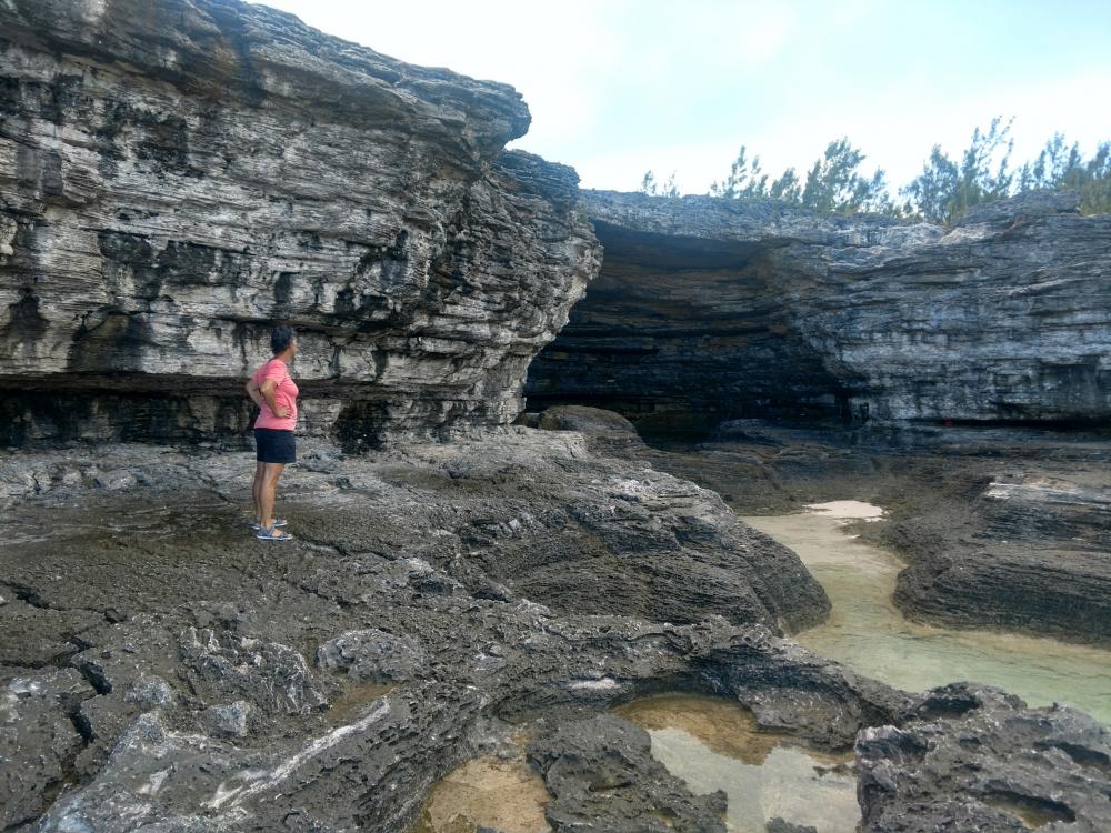 |
 |
 |
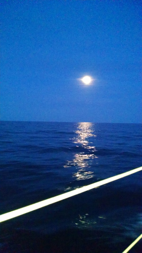 |
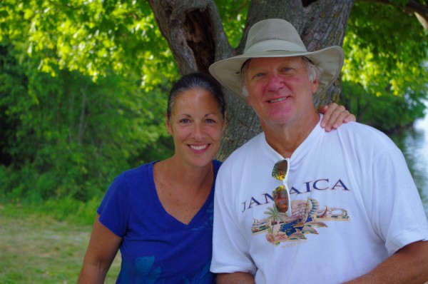 |
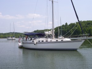
Who: Mark & Jan Guard
Port: Grand Rivers KY