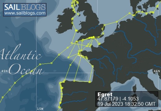
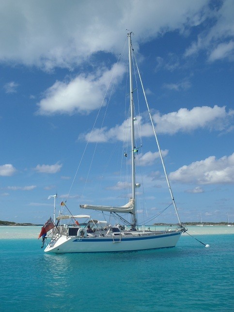
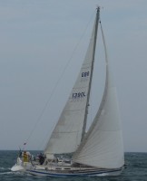
Egret
09 August 2022 | Picture: The Sunk Inner Light Vessel in the Thames Estuary
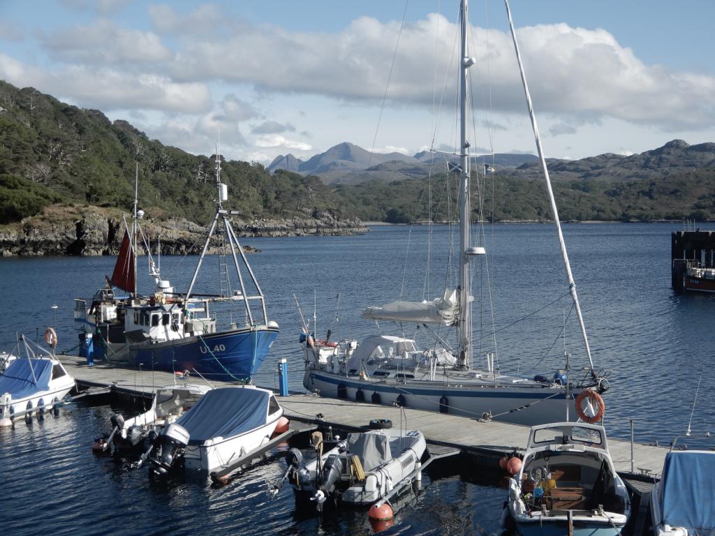
03 August 2022 | Egret at the Royal Norfolk and Suffolk Yacht Club, Lowestoft
23 July 2022 | Picture: One of the smaller locks at Holtenau
20 July 2022 | Picture: Patrick reminiscing with Juergen at Rostock
11 July 2022 | Picture: Egret at Stralsund, with the barque Gorch Fock beyond
04 July 2022 | Picture: Amanda on Bornholm
01 July 2022 | Picture: Kristianopol, with Egret at far right
26 June 2022 | Ernemar
19 September 2020 | Picture: Egret being lifted out at Ernemar, Sweden
08 September 2020 | Chart: our route from Mem into the Tjust Archipelago
01 September 2020 | Picture: the Carl Johans flight of seven locks
29 August 2020 | Picture: Egret (by G. Einefors)
27 August 2020 | Picture: Egret at Vadstena Castle
25 August 2020 | Picture: Norrkvarn Lock
23 August 2020 | Picture: Egret crossing Lake Vänern
19 August 2020 | Picture: Inside the lowest Trollhatte lock
17 August 2020 | Picture: The Gota Alv Bron in Gothenburg
16 August 2020 | Picture: the GKSS, Langedrag
13 August 2020 | Picture: Egret alongside (left) at Fisketangen
10 August 2019
140. São Miguel - the Fifth and Final Island
04 July 2015

The chart warns of "seismic activity which could cause bathymetry and minimum depths to change considerably", so we gave the Banco Dom Joaao de Castro a wide berth before laying a south-easterly course towards São Miguel, the largest island of the Azores. We had set out in the late afternoon from Angro do Heroísmo for the 95 mile overnighter, broad reaching with one reef in the main and the genoa rolled to its first mark. When the moon set at 0300 it left us in complete darkness, but within minutes we began to see the bright flashes of the Ponta da Ferraria lighthouse, 20 miles ahead. Gradually the lamps from the towns and villages appeared, and dawn had broken by the time we were abeam of the headland. As we closed the land, the wind headed and started to die, so we let out the reefs before breakfast and continued ghosting gently past the south side of the island. Low cloud obscured the cliffs but allowed the hills inland to peep out above them. Gradually from seaward, the sun broke through creating sparkling seas and a clear blue sky. After passing the airport we continued to the end of the long breakwater and entered the port at 1030, making fast alongside the marina's fuel dock in order to check in.
As always in our experience of the Azores, the officials were extremely welcoming. The harbour master told us that the AZAB (a double-handed race from Falmouth) fleet of seventy yachts along with the ARC fleet of thirty boats had both been berthed there until the previous week. Just as well we hadn't arrived any earlier! The Customs officer, on noticing the Indonesian stamp in our passport, told me about his experience visiting Timor on a United Nations peace-keeping mission during the independence crisis of 1999. He also raised the subject of problems concerning other ex Portuguese colonies, and somehow the conversation turned to the attempted invasion of Britain by the Spanish Armada in 1588. He was apologetic that the Portuguese had been involved, which happened only because they were under Spanish rule at the time!
Ponta Delgada Marina is vast, extending along the promenade immediately in front of the city, though divided into two parts by a cruise ship terminal. After moving to our berth, we were surprised to see a familiar yacht close by. It was the yawl Winter, nearing the end of an Atlantic circuit. Unfortunately we missed seeing her owners, members of our home sailing club, as they had flown home for a couple of weeks. A grand avenue runs along the waterfront and we were taken aback by the amount of traffic - we hadn't seen so much since Cape Town! Ponta Delgada is the administrative capital of the Azores and therefore has some of the largest buildings, many of them quite handsome. The streets and squares are paved with black and white cobbles in the Azorean manner, and monumental arches and tall church towers add to the grandeur. After a visit to the tourist office, we decided that we wouldn't spend much more time looking round the city, but would hire a car for two days to explore some of the spectacular scenery of the interior.
São Miguel is about 65km long by 14km wide, shaped a bit like a whale. Driving westwards out of Ponta Delgada, our first stop was near Pico das Eguas, at the start of the 5km long Serra Devassa trail. Red and yellow markers guided us along paths round three lakes situated in diminutive craters, taking us up to an altitude of about 800m. All around us, hills stretched as far as the eye can see, many perfectly conical and of obvious volcanic origin. At the edge of Lagoa Rasa, the largest of the three, there was a little stone hut, covered in moss and lichen, from which two pipelines led into the water. Inside was a hand pump which would have been used to start a siphon to extract water from the lake. Delivery pipes disappeared into the undergrowth, and we had previously seen arched stone aqueducts, covered in creeper, that would have conveyed the water across valleys towards the towns around the coast. Some of the paths that we walked were cut into the rock, presumably built originally to service the waterworks. The banks were now overgrown with trees and ferns and the ubiquitous white hydrangeas.
The most popular attraction at this end of the island is the pair of lakes - one called Blue and the other Green for immediately apparent reasons - which lies at the bottom of a crater about 4km in diameter. We chanced upon a fabulous vantage point from a park near Lagoa do Canário, before reaching the regular tour-guides' viewpoint called Vista do Rei. We drove down to the bottom of the crater, across the bridge which divides the lakes and into Sete Cidades. A crater floor seems an extraordinary place to build a town, but presumably the fertility of the surrounding farmland made it worthwhile. We visited the little church of S. Nicolau, approached by an avenue of pine trees and hydrangeas, and climbed to the top of its bell tower. Exiting over the opposite rim of the crater, we descended to the coast at Ponta da Ferraria, the western extremity of the island. There are signs of recent volcanic activity, and hot springs can raise the seawater temperature in a small rocky inlet to around 40ºC. The sea was too rough for swimming, and a dip of our toes proved that any hot water was being sluiced out to sea with every wave. Nevertheless, there was a small crowd of people sunbathing on the warm rocks. We paused for coffee and a custard tart in the adjoining spa hotel. Continuing clockwise around the coast, we dropped down into Mosteiros, a fishing and holiday village. It is well known for its offshore pillars of black rock - the remains of an eroded crater. Next we pulled over for a look at the immaculate red-and-white windmill at Pico Vermhelho. Finally, we drove into the town of Capelas, where there is a statue erected as a memorial to whalers lost at sea, before crossing the middle of the island back to Ponta Delgada.
Next day, we headed east. Our first stop was the Miradouro da Barrosa at an elevation of 900m, but it was very brief as we were in dense cloud with scarcely a glimpse beyond the protective wall. Happily, we obtained a reasonable view of Lagoa da Fogo from a point lower down. We crossed to the north coast and eventually reached Chá Gorreana, a tea plantation, dating from 1883. Tea was certainly not something we had associated with the Azores until our visit. We enjoyed a delightful walk through terraced rows of tea shrubs, where we watched the pickers at work, and up onto the hills above them. Back at the works, we saw where the sacks of leaves were hoisted from a tractor and trailer, to be sorted, cut, dried and packed by an intensive labour force aided by antiquated belt-driven machinery. We tasted several grades of tea and bought a few packets to take home.
In the afternoon, we drove to Furness, a town located at the bottom of another big crater, 7km in diameter. The area is unnervingly active, with bubbling mud pools, spurting jets of steam and hot springs, and one wonders again why one would choose to live at the bottom of a crater. Nevertheless, it is a popular spa resort, with the added attraction of the Terra Nostra Gardens, created in the 19th century. They have an appealing array of tropical plants and trees, follies, lily ponds, streams, grottoes and topiary like prehistoric animals and birds; and at its centre is a lake of warm, brown, sulphurous water. After taking a dip to soak up its health-giving minerals, we ate supper at one of the many restaurants in the town. We drove back to Ponta Delgada along part of the "Euroscut Açores Highway", which by-passes the tortuous coast road via some impressively high and slender viaducts. Construction was recently completed at a cost of €1.2 billion.
Comments
| Vessel Name: | Egret |
| Vessel Make/Model: | Sweden Yachts 390 |
| Hailing Port: | Chichester Harbour |
| Crew: | Patrick & Amanda Marshall |
Egret's Photos - Main
R.jpg) |
The Gota River, Trollhatte Canal, Lakes Vanern & Vattern and the Gota Canal
2 Photos | 9 Sub-Albums
Created 30 September 2020
|
 |
The Inner and Outer Hebrides, Orkney, Fair Isle, Shetland, Norway and Sweden's west coast.
1 Photo
Created 14 November 2019
|
.JPG) |
Normandy, Scilly, Pembrokeshire, Ireland, Isle of Man, Northern Ireland, Inner Hebrides and the Crinan Canal.
1 Photo
Created 14 November 2018
|
.JPG) |
 Marina Miss Mei II arriving.JPG) |
 |
|
Dune 7.JPG) |
.JPG) |
 |
Blogs 114-117
1 Photo | 5 Sub-Albums
Created 11 December 2014
|
 |
 |
, Pentecost, Naghol (Land diving)a.jpg) |
Amanda raising the Quarantine & New Zealand courtesy flagedit_edited-1 a.jpg) |
 |
 |
 |
 |
 |
Blogs 68-76
1 Photo | 9 Sub-Albums
Created 13 February 2013
|
 |
 |
|
|
|
|
|
|
Setting off on our circumnavigation
2 Sub-Albums
Created 16 August 2011
|
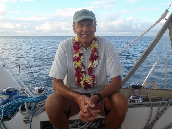
Egret
Who: Patrick & Amanda Marshall
Port: Chichester Harbour
Gallery
.JPG)
R Vinhas da Criacao Veha walking trail.jpg)
Amanda raising the Quarantine & New Zealand courtesy flagedit_edited-1 a.jpg)