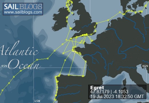
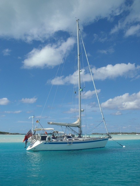
Egret
09 August 2022 | Picture: The Sunk Inner Light Vessel in the Thames Estuary
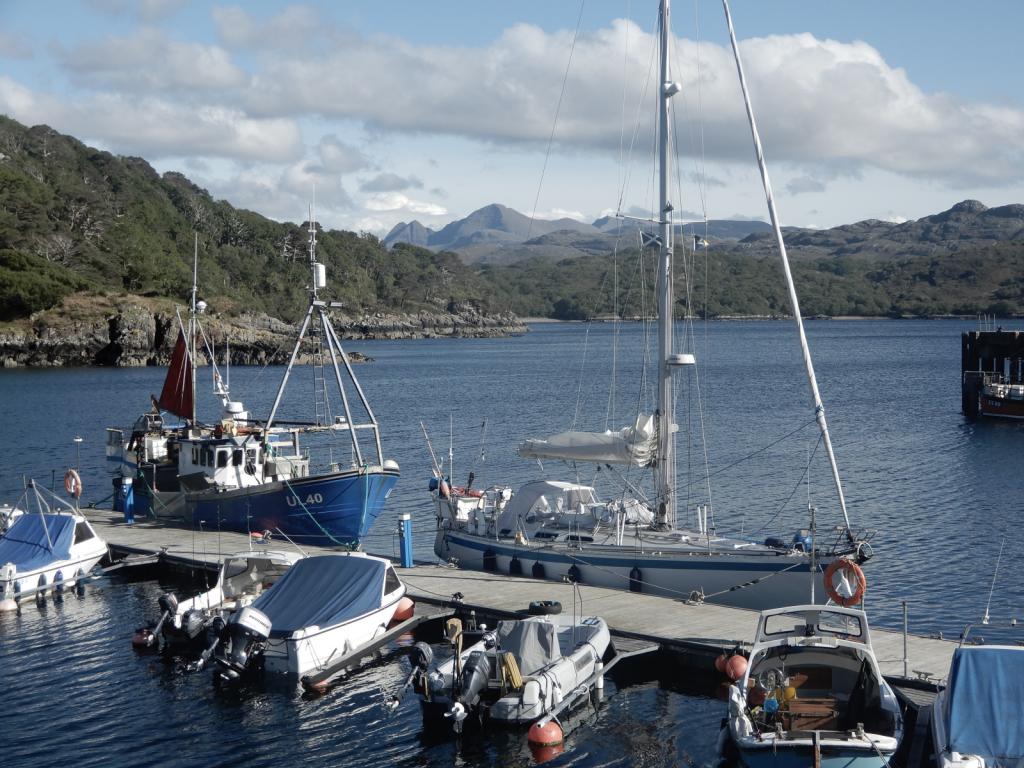
03 August 2022 | Egret at the Royal Norfolk and Suffolk Yacht Club, Lowestoft
23 July 2022 | Picture: One of the smaller locks at Holtenau
20 July 2022 | Picture: Patrick reminiscing with Juergen at Rostock
11 July 2022 | Picture: Egret at Stralsund, with the barque Gorch Fock beyond
04 July 2022 | Picture: Amanda on Bornholm
01 July 2022 | Picture: Kristianopol, with Egret at far right
26 June 2022 | Ernemar
19 September 2020 | Picture: Egret being lifted out at Ernemar, Sweden
08 September 2020 | Chart: our route from Mem into the Tjust Archipelago
01 September 2020 | Picture: the Carl Johans flight of seven locks
29 August 2020 | Picture: Egret (by G. Einefors)
27 August 2020 | Picture: Egret at Vadstena Castle
25 August 2020 | Picture: Norrkvarn Lock
23 August 2020 | Picture: Egret crossing Lake Vänern
19 August 2020 | Picture: Inside the lowest Trollhatte lock
17 August 2020 | Picture: The Gota Alv Bron in Gothenburg
16 August 2020 | Picture: the GKSS, Langedrag
13 August 2020 | Picture: Egret alongside (left) at Fisketangen
10 August 2019
2019.07 - Norway’s Fjordland
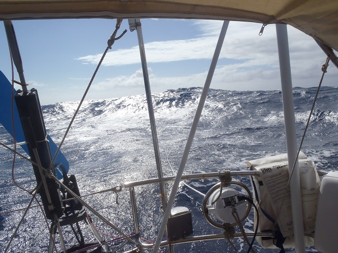
30 June 2019 | Picture: through the fjords
Norwegian marinas, we were to learn, are rarely manned. Procedures vary confusingly, but at Florø we had to buy a ticket by credit card from a machine, which usefully displayed a phone number with a helpful person at the other end to explain what to do. The ticket, which had to be attached to the boat, had a door-code for the facilities. There was a lounge area, immaculate loos, a free washing machine and dryer, and the cleanest showers we have ever seen. We even had to put on paper overshoes before entering! In the evening a couple of young traffic wardens wandered along the pontoons to check that all dues had been paid. The benefit of this paucity of labour was that berthing charges, at around £24, are less than half what we pay at home. (Do MDL and Premier really need such a battalion of staff in their offices?)
Norway is not in the EEC, so we assumed we would have to check in to Customs and Immigration. We asked the man at the end of the phone where to do this: "No, that's not necessary, you're in Schengen aren't you?" "Well no, actually." "Oh, that doesn't matter. There's a police station in the town, they will call on you if they think it necessary." We were still concerned, and asked the nice lady in the tourist office: "I'm a sailor too, we have a yacht. Nobody ever bothers with that round here." Oh well, at least we tried.
Florø is a pleasant little town of timber-clad buildings with, on the face of it, not much going on. It was founded in the mid 19th century as a centre for herring fishing and now services the oil industry and fish-farming. We walked over a hill behind the town to a newish museum on the banks of a neighbouring inlet. The charming young attendants made us coffee and gave well-informed advice about the exhibits. The first building illustrated the every-day life of the inhabitants of the town, and the second contained a fine collection of old wooden craft, with excellent descriptive labels (in Norwegian and English). A third building was dedicated to the oil industry, with models of different types of platforms, including the Gjoa, and clear explanations of the geological origins and extraction methods of oil.
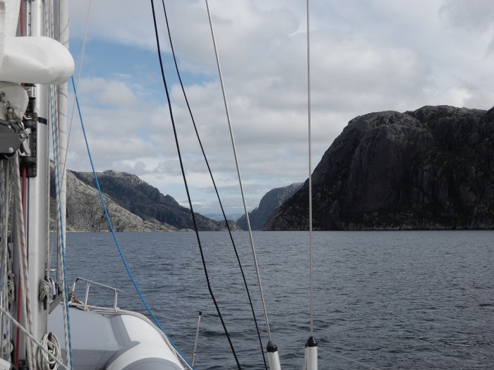
The crinkly bits of Norway's coastline, for which designer Slartibartfast won an award, as readers of the Hitchhiker's Guide to the Galaxy will know, extend southwards as far as Stavanger. Steep-sided fjords extend up to a hundred miles inland, and there are innumerable smaller inlets. An off-lying archipelago, ten miles or so wide, extends all the way down the coast. Some of the islands are minor skerries just a few metres high, and others are so long and so high that they create secondary fjords or sounds running parallel to the coast. Depths are generally very great, often 100m or more just tens of metres away from the rocks. This makes the discovery of safe anchorages a challenge, and as first-timers we had to rely on pilot books for guidance. The islands mean it is possible to sail most of the way from north to south along passages protected from offshore waves. But navigation is not easy. We had acquired a dozen folios, each containing ten or more charts, and a magnifying glass was needed to read some of the detail. These paper charts were essential for the careful planning of routes so as to avoid shallow reefs, blind leads, low bridges and power cables. We used electronic charts for confirming our actual position along the way.
We started our cruise south with an easy sailed of just 15 miles to the island of Svanøya. We were excited to spot a white eagle along the way, but soon realised that sea-birds generally are rarely seen in this region at this time of year, in stark contrast to the Scottish waters we had recently left. We anchored within an enclosed bay and went ashore by dinghy for a long walk, in rural surroundings, to the opposite side of the island.
For the first hour of next day's 30-mile leg, we had to beat into a steep chop down Stavfjorden, which was open to the sea, before turning down Granesundet, protected by skerries. Later we passed through a series of spectacular high-sided fjords before heading a short distance up Sognefjorden to Fløholm, a hidden mainland anchorage surrounded by rocky promontories and tree-lined slopes. The following day's 40-mile sail was more complex still, passing along at least six different fjords and sounds and under a 30m high bridge. We anchored for the night in Uttoskavgn, a secret harbour - invisible until almost at the narrow, twisting entrance. It lies amongst the skerries, just inshore of the outer island chain. The final stretch to Bergen passed through four more fjords and under two bridges. The bridge across the wide and deep Byfjorden was supported for most of its length on floats, with a 32m high cable-stayed section at one end to allow passage of vessels. As we approached the city, the slopes became increasingly built up with housing, eventually to be dominated by the gigantic cruise ships berthed outside the harbour.
Norway is not in the EEC, so we assumed we would have to check in to Customs and Immigration. We asked the man at the end of the phone where to do this: "No, that's not necessary, you're in Schengen aren't you?" "Well no, actually." "Oh, that doesn't matter. There's a police station in the town, they will call on you if they think it necessary." We were still concerned, and asked the nice lady in the tourist office: "I'm a sailor too, we have a yacht. Nobody ever bothers with that round here." Oh well, at least we tried.
Florø is a pleasant little town of timber-clad buildings with, on the face of it, not much going on. It was founded in the mid 19th century as a centre for herring fishing and now services the oil industry and fish-farming. We walked over a hill behind the town to a newish museum on the banks of a neighbouring inlet. The charming young attendants made us coffee and gave well-informed advice about the exhibits. The first building illustrated the every-day life of the inhabitants of the town, and the second contained a fine collection of old wooden craft, with excellent descriptive labels (in Norwegian and English). A third building was dedicated to the oil industry, with models of different types of platforms, including the Gjoa, and clear explanations of the geological origins and extraction methods of oil.
The crinkly bits of Norway's coastline, for which designer Slartibartfast won an award, as readers of the Hitchhiker's Guide to the Galaxy will know, extend southwards as far as Stavanger. Steep-sided fjords extend up to a hundred miles inland, and there are innumerable smaller inlets. An off-lying archipelago, ten miles or so wide, extends all the way down the coast. Some of the islands are minor skerries just a few metres high, and others are so long and so high that they create secondary fjords or sounds running parallel to the coast. Depths are generally very great, often 100m or more just tens of metres away from the rocks. This makes the discovery of safe anchorages a challenge, and as first-timers we had to rely on pilot books for guidance. The islands mean it is possible to sail most of the way from north to south along passages protected from offshore waves. But navigation is not easy. We had acquired a dozen folios, each containing ten or more charts, and a magnifying glass was needed to read some of the detail. These paper charts were essential for the careful planning of routes so as to avoid shallow reefs, blind leads, low bridges and power cables. We used electronic charts for confirming our actual position along the way.
We started our cruise south with an easy sailed of just 15 miles to the island of Svanøya. We were excited to spot a white eagle along the way, but soon realised that sea-birds generally are rarely seen in this region at this time of year, in stark contrast to the Scottish waters we had recently left. We anchored within an enclosed bay and went ashore by dinghy for a long walk, in rural surroundings, to the opposite side of the island.
For the first hour of next day's 30-mile leg, we had to beat into a steep chop down Stavfjorden, which was open to the sea, before turning down Granesundet, protected by skerries. Later we passed through a series of spectacular high-sided fjords before heading a short distance up Sognefjorden to Fløholm, a hidden mainland anchorage surrounded by rocky promontories and tree-lined slopes. The following day's 40-mile sail was more complex still, passing along at least six different fjords and sounds and under a 30m high bridge. We anchored for the night in Uttoskavgn, a secret harbour - invisible until almost at the narrow, twisting entrance. It lies amongst the skerries, just inshore of the outer island chain. The final stretch to Bergen passed through four more fjords and under two bridges. The bridge across the wide and deep Byfjorden was supported for most of its length on floats, with a 32m high cable-stayed section at one end to allow passage of vessels. As we approached the city, the slopes became increasingly built up with housing, eventually to be dominated by the gigantic cruise ships berthed outside the harbour.
Comments
| Vessel Name: | Egret |
| Vessel Make/Model: | Sweden Yachts 390 |
| Hailing Port: | Chichester Harbour |
| Crew: | Patrick & Amanda Marshall |
Egret's Photos - Main
R.jpg) |
The Gota River, Trollhatte Canal, Lakes Vanern & Vattern and the Gota Canal
2 Photos | 9 Sub-Albums
Created 30 September 2020
|
 |
The Inner and Outer Hebrides, Orkney, Fair Isle, Shetland, Norway and Sweden's west coast.
1 Photo
Created 14 November 2019
|
.JPG) |
Normandy, Scilly, Pembrokeshire, Ireland, Isle of Man, Northern Ireland, Inner Hebrides and the Crinan Canal.
1 Photo
Created 14 November 2018
|
.JPG) |
 Marina Miss Mei II arriving.JPG) |
 |
|
Dune 7.JPG) |
.JPG) |
 |
Blogs 114-117
1 Photo | 5 Sub-Albums
Created 11 December 2014
|
 |
 |
, Pentecost, Naghol (Land diving)a.jpg) |
Amanda raising the Quarantine & New Zealand courtesy flagedit_edited-1 a.jpg) |
 |
 |
 |
 |
 |
Blogs 68-76
1 Photo | 9 Sub-Albums
Created 13 February 2013
|
 |
 |
|
|
|
|
|
|
Setting off on our circumnavigation
2 Sub-Albums
Created 16 August 2011
|
Egret
Who: Patrick & Amanda Marshall
Port: Chichester Harbour
Gallery
Wildebeast.jpg)