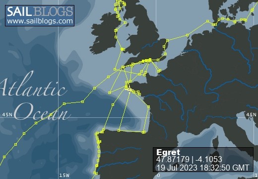
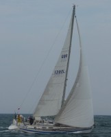
Egret
09 August 2022 | Picture: The Sunk Inner Light Vessel in the Thames Estuary
03 August 2022 | Egret at the Royal Norfolk and Suffolk Yacht Club, Lowestoft
23 July 2022 | Picture: One of the smaller locks at Holtenau
20 July 2022 | Picture: Patrick reminiscing with Juergen at Rostock
11 July 2022 | Picture: Egret at Stralsund, with the barque Gorch Fock beyond
04 July 2022 | Picture: Amanda on Bornholm
01 July 2022 | Picture: Kristianopol, with Egret at far right
26 June 2022 | Ernemar
19 September 2020 | Picture: Egret being lifted out at Ernemar, Sweden
08 September 2020 | Chart: our route from Mem into the Tjust Archipelago
01 September 2020 | Picture: the Carl Johans flight of seven locks
29 August 2020 | Picture: Egret (by G. Einefors)
27 August 2020 | Picture: Egret at Vadstena Castle
25 August 2020 | Picture: Norrkvarn Lock
23 August 2020 | Picture: Egret crossing Lake Vänern
19 August 2020 | Picture: Inside the lowest Trollhatte lock
17 August 2020 | Picture: The Gota Alv Bron in Gothenburg
16 August 2020 | Picture: the GKSS, Langedrag
13 August 2020 | Picture: Egret alongside (left) at Fisketangen
10 August 2019
20.03 – An Inland Voyage Begins
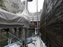
17 August 2020 | Picture: The Gota Alv Bron in Gothenburg
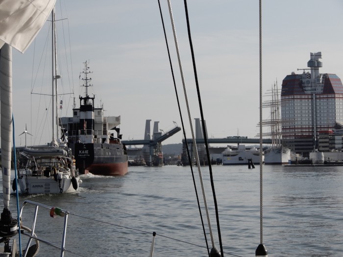
We cast off from Långredag at 0700 and motored for 6 miles up river into the heart of the city of Gothenburg. We passed under a high suspension bridge and beside container wharves, a power station, the Stena Line ferry terminal and high-rise blocks of offices and apartments. Huge cranes from earlier shipyards remain standing as monumental sculptures above the buildings. The city centre bridge, the Göta Älv Brön, with 18m clearance in its down position, is just too low for our mast. We knew that it would not open before 0900 but hadn't managed to find out exactly what time it would open after that. We had also heard that the old structure often gets jammed down on summer afternoons due to heat expansion, and this may be one of the reasons why a new bridge is under construction immediately upstream. We arrived below the bridge at 0830 and drifted around in a nearby dock so as to keep clear of the fast-moving ferries criss-crossing the river. We made contact with the bridge controller on VHF channel 9 and were requested to follow a ship and another yacht through at a couple of minutes past the hour. From the busyness of the city we entered the relative tranquillity of the upstream river, as old shipyards and industrial premises gave way to tree-lined banks interspersed by small towns.
The Göta Älv flows south-westwards out of Lake Vänern, the largest lake in Europe (excluding Russia), for 93 km and into the Kattegat near Gothenburg. A series of rapids and a narrow gorge in the upper reaches have been by-passed by the five locks of the Trollhätte Kanal. There is a sixth lock another 15 km downstream at Lilla Edet, and after that the river meanders through flood plains between low hills then through the archipelago to the open sea. The entire waterway is navigable for ships up to 87 m long and 12.6 m beam.
The ship had slowed ahead of us, waiting for the twin railway bridges to swing open, so we put on a spurt to get through close astern of her. The bridges and locks above Gothenburg have a central controller, in theory contactable by VHF but in practice it was easier to phone. Although we called them each time, they seemed to be expecting us and we never had to wait more than a few minutes for an opening. We chugged on upstream against a current of around 0.5 knots. It was getting hotter, but occasionally a fickle breeze would fill in when we could set the genoa to assist the engine. Regular beacons, cantilevered out from timber structures on either side, mark the deep-water channel. At Kungälv, the 14th century Bohus Fästning dominates an islet at the confluence with the distributary Nordre Älv. The fortress has been besieged fourteen times by Swedes, Norwegians and Danes, but never conquered. The scenery becomes more rural as the river widens along the valley plains. With farmland in the foreground, sometimes with cows grazing along the banks, homes are dotted along the lower slopes of the hills on either side.
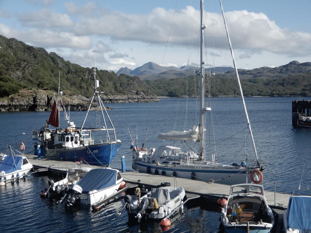
These hills begin to close in on either side, the river narrows, the banks steepen and the current strengthens. At the narrowest point we encountered about 1.5 knots, and this was in late summer after dry weather. We read that it could reach double this rate early in the season after rains. A bascule bridge appeared, then round the next corner is the first lock. A motor-boat waved us through ahead of them. We had hoped they would go in first and show us what to do, but they said they were going to hold station in the middle of the chamber. The sides were much too high to get a line ashore and there was no one there to help. We'd read that you could hang onto a ladder or one of the recessed bollards with a rope or boat-hook but this had seemed to us a bit haphazard. The bollards were a long way apart and beyond reach, so we each held a rope round the same ladder from amidships. The gates gently closed and imperceptibly we began to rise. There was no turbulence - the water fills through holes in the lock floor - and we stayed in position without effort.
Immediately above the lock is a tiny guest-haven within the lock island where we tied up for the night. We had travelled 35 nautical miles in 9 hours on our first day. Beyond the far bank of the haven, the full width of the upstream river flows towards a series of weirs and a hydro-electric power station, and across a bridge is the town. In the middle of the night the churning sound of propellers transmitted through the water as a ship moved otherwise silently through the lock beside us.
The Göta Älv flows south-westwards out of Lake Vänern, the largest lake in Europe (excluding Russia), for 93 km and into the Kattegat near Gothenburg. A series of rapids and a narrow gorge in the upper reaches have been by-passed by the five locks of the Trollhätte Kanal. There is a sixth lock another 15 km downstream at Lilla Edet, and after that the river meanders through flood plains between low hills then through the archipelago to the open sea. The entire waterway is navigable for ships up to 87 m long and 12.6 m beam.
The ship had slowed ahead of us, waiting for the twin railway bridges to swing open, so we put on a spurt to get through close astern of her. The bridges and locks above Gothenburg have a central controller, in theory contactable by VHF but in practice it was easier to phone. Although we called them each time, they seemed to be expecting us and we never had to wait more than a few minutes for an opening. We chugged on upstream against a current of around 0.5 knots. It was getting hotter, but occasionally a fickle breeze would fill in when we could set the genoa to assist the engine. Regular beacons, cantilevered out from timber structures on either side, mark the deep-water channel. At Kungälv, the 14th century Bohus Fästning dominates an islet at the confluence with the distributary Nordre Älv. The fortress has been besieged fourteen times by Swedes, Norwegians and Danes, but never conquered. The scenery becomes more rural as the river widens along the valley plains. With farmland in the foreground, sometimes with cows grazing along the banks, homes are dotted along the lower slopes of the hills on either side.
These hills begin to close in on either side, the river narrows, the banks steepen and the current strengthens. At the narrowest point we encountered about 1.5 knots, and this was in late summer after dry weather. We read that it could reach double this rate early in the season after rains. A bascule bridge appeared, then round the next corner is the first lock. A motor-boat waved us through ahead of them. We had hoped they would go in first and show us what to do, but they said they were going to hold station in the middle of the chamber. The sides were much too high to get a line ashore and there was no one there to help. We'd read that you could hang onto a ladder or one of the recessed bollards with a rope or boat-hook but this had seemed to us a bit haphazard. The bollards were a long way apart and beyond reach, so we each held a rope round the same ladder from amidships. The gates gently closed and imperceptibly we began to rise. There was no turbulence - the water fills through holes in the lock floor - and we stayed in position without effort.
Immediately above the lock is a tiny guest-haven within the lock island where we tied up for the night. We had travelled 35 nautical miles in 9 hours on our first day. Beyond the far bank of the haven, the full width of the upstream river flows towards a series of weirs and a hydro-electric power station, and across a bridge is the town. In the middle of the night the churning sound of propellers transmitted through the water as a ship moved otherwise silently through the lock beside us.
Comments
| Vessel Name: | Egret |
| Vessel Make/Model: | Sweden Yachts 390 |
| Hailing Port: | Chichester Harbour |
| Crew: | Patrick & Amanda Marshall |
Egret's Photos - Main
R.jpg) |
The Gota River, Trollhatte Canal, Lakes Vanern & Vattern and the Gota Canal
2 Photos | 9 Sub-Albums
Created 30 September 2020
|
 |
The Inner and Outer Hebrides, Orkney, Fair Isle, Shetland, Norway and Sweden's west coast.
1 Photo
Created 14 November 2019
|
.JPG) |
Normandy, Scilly, Pembrokeshire, Ireland, Isle of Man, Northern Ireland, Inner Hebrides and the Crinan Canal.
1 Photo
Created 14 November 2018
|
.JPG) |
 Marina Miss Mei II arriving.JPG) |
 |
|
Dune 7.JPG) |
.JPG) |
 |
Blogs 114-117
1 Photo | 5 Sub-Albums
Created 11 December 2014
|
 |
 |
, Pentecost, Naghol (Land diving)a.jpg) |
Amanda raising the Quarantine & New Zealand courtesy flagedit_edited-1 a.jpg) |
 |
 |
 |
 |
 |
Blogs 68-76
1 Photo | 9 Sub-Albums
Created 13 February 2013
|
 |
 |
|
|
|
|
|
|
Setting off on our circumnavigation
2 Sub-Albums
Created 16 August 2011
|
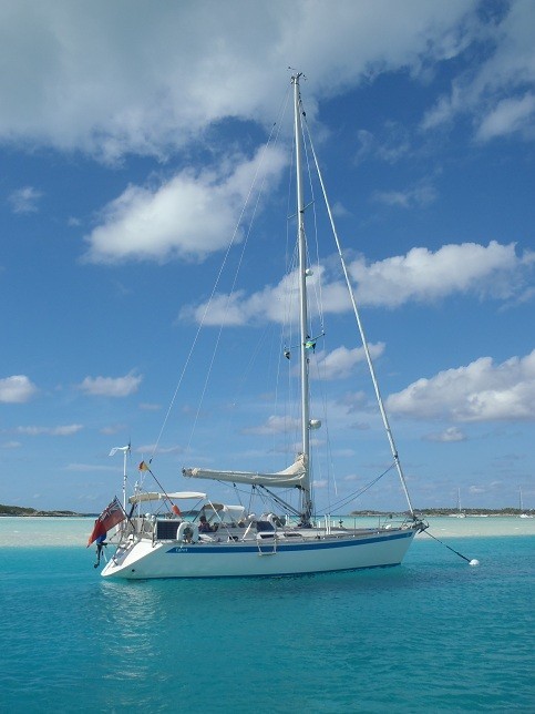
Egret
Who: Patrick & Amanda Marshall
Port: Chichester Harbour
Gallery
Headline.jpg)
 Rock Paintings.jpg)