s/v Far Niente - Cruising Log
Spring 2015 - The Florida Keys
12 June 2015 | Lady's Island, SC
11 March 2015 | Marathon, FL
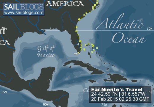
19 February 2015 | Marathon, FL
09 January 2015 | Vaca Key - Marathon, FL
10 December 2014 | West Palm Beach, FL
01 December 2014 | West Palm Beach
20 November 2014 | West Palm Beach, FL
05 October 2014 | Port Royal, SC
24 February 2014
17 February 2014 | South Carolina
01 June 2013 | Port Royal Landing Marina
16 May 2013 | Anchored Cocoa, FL
26 April 2013 | Marathon, FL
21 December 2012 | Harbour Cay Club, Marathon, FL
07 December 2012 | Mooring #30, St. Augustine Municipal Marina
31 August 2012 | Dataw Island Marina, SC
13 June 2012 | Conch House Marina, St. Augustine, FL
08 June 2012 | New Smyrna Beach, FL
03 June 2012 | Harbour Isle Marina, Ft. Pierce, FL, USA
29 May 2012 | Old Bahama Bay Marina at West End
North Bimini, to just west of the Berrys, The Bahamas
10 April 2012 | Location: On the Great Bahama Bank in 12' of water
Jeff
Leg Details:
Time: 9:54
Distance: 68.8 nm
Average Speed: 6.9 kts
We planned to take advantage of the great weather and cruise across the Great Bahama Bank today. We really did not know, exactly, where we'd drop the hook. Winds and seas had everything to say about that. And today wind was a very light 4-9 kts from the E, our direction of sail. So we did not sail today, didn't even try to fly the genoa. We just motored across the glassily calm Great Bahama Bank and marveled at the water clarity. Surprisingly, we did not spot much in the way of aquatic wildlife today. Flying fish or fish jumping out of the water once in awhile was the extent of the wild kingdom today.
We headed up the coast of Bimini and made a hard right at North Rock. From there our next waypoint was the mark/light at the north of Mackie Shoal. Once past the mark we headed a bit more southerly toward Northwest Shoal. We tucked in north of this shoal area in 12'-14' of water with a sandy bottom here and there as well as some weeds. The Rocna anchor grabbed the bottom like a teenage girl on her first roller coaster ride! Just to the south of us we see 3 other sailboats anchored and just like us, waiting on the new day to move further east and south. Our next planned stop is Frazers Hog Cay but we'll see what the wind and seas serve up to us. We may just head for Nassua from here. On there other hand, what's the rush. My goal for our Bahamas cruise was to try and keep daily sails to less than 30 miles. Take it easy, mon.
We had a wonderful lobster salad tonight made by the Sailing Chef (i.e. my dear wife) from the lobsters I bought in Bimini at $2/tail. Just excellent.
Not sure when this will post. Not much in the way of cell service or WiFi out here on the Great Bahama Bank.
Cheers,
Jeff
From Anchor to The Berry Islands Club
Time: 4:13
Distance: 28.2 nm
Average Speed: 6.7 kts
Location: On a mooring at The Berry Islands Club
25 25.3395N:77 50.207W
After a relatively calm first part of the night at anchor out on the Great Bahama Bank wind and seas picked up and bounced us around a bit but it was relatively tolerable. We pulled up a nice clean anchor (no mud to wash off) and headed for the Northwest Channel at 8:36 am. We passed the channel mark about 10:00 am and motored right into the ESE winds until hit our waypoint for Frazers Hog Cay.
The to the channel here at the east end of the island is a lesson in navigation charts. I have 3 different sets of charts on board for the Bahamas; a Bahamas chip formatted C-MAP NT+ on the Raymarine chart plotter, the Navionics HD package on the iPad and the traditional standby, but none the less essential, waterproof paper charts (Explorer Chartbook). The information on the depths and nab marks for the channel the leads up to the moorings at the Berry Islands Club is different in each of these sources. Not drastically different, but different enough to cause the Captain to wonder just which one to use as the primary reference. The C-Map system has a great track record of accuracy, but in this case it showed a string of RED/GREEN nab marks that were not present. The other 2 sources showed no marks. As we approached the channel we did spot a RED/GREEN pair, but nowhere near the mark locations on the C-MAP chart. The depths looked good, as did the water color and set course for a point right between the 2 marks, almost always a safe bet. Once through the marks the depth started to drop rather quickly and soon I was looking at < 1' under the keel and I could see the sand/rock bottom. Just before the marks I knocked down the speed to 3 kts just in case. Marjorie was on the bow spotting for me and guided me towards some deeper water. The depth increased to 8-10' and we crawled up the channel. I quick look at the Navionics chart showed that I had not turned far enough to port after marks and traversed an area of 5-6'. If I had been watching this chart and not the C-MAP plot, I may have set the correct course. We'll certainly get it correct on our way out.
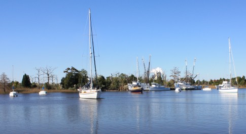
We picked up a mooring in 10-12' of water just south and east of the dock for the Berry Islands Club. There was another sailboat moored and a couple motor yachts up the channel anchored.
More on the BIC later. We had major problems with the mooring we were on. Combine a wicked current (4+ kts) with opposing winds of 30 kts and we had a couple terrible nights. Sunday morning we found we had a very badly damaged chock. The force necessary to bend this and pull it off the deck must have been amazing. We left BIC to move to a the protected marina at Chub Cay for Sunday night.
We arrived in Nassau Monday afternoon. The harbor was insanely busy with small boat traffic as it was 'Easter Monday' a holiday here in the Bahamas.
More on our BIC and Nassau experience in a day or so.
We are now in Nassau.
Time: 9:54
Distance: 68.8 nm
Average Speed: 6.9 kts
We planned to take advantage of the great weather and cruise across the Great Bahama Bank today. We really did not know, exactly, where we'd drop the hook. Winds and seas had everything to say about that. And today wind was a very light 4-9 kts from the E, our direction of sail. So we did not sail today, didn't even try to fly the genoa. We just motored across the glassily calm Great Bahama Bank and marveled at the water clarity. Surprisingly, we did not spot much in the way of aquatic wildlife today. Flying fish or fish jumping out of the water once in awhile was the extent of the wild kingdom today.
We headed up the coast of Bimini and made a hard right at North Rock. From there our next waypoint was the mark/light at the north of Mackie Shoal. Once past the mark we headed a bit more southerly toward Northwest Shoal. We tucked in north of this shoal area in 12'-14' of water with a sandy bottom here and there as well as some weeds. The Rocna anchor grabbed the bottom like a teenage girl on her first roller coaster ride! Just to the south of us we see 3 other sailboats anchored and just like us, waiting on the new day to move further east and south. Our next planned stop is Frazers Hog Cay but we'll see what the wind and seas serve up to us. We may just head for Nassua from here. On there other hand, what's the rush. My goal for our Bahamas cruise was to try and keep daily sails to less than 30 miles. Take it easy, mon.
We had a wonderful lobster salad tonight made by the Sailing Chef (i.e. my dear wife) from the lobsters I bought in Bimini at $2/tail. Just excellent.
Not sure when this will post. Not much in the way of cell service or WiFi out here on the Great Bahama Bank.
Cheers,
Jeff
From Anchor to The Berry Islands Club
Time: 4:13
Distance: 28.2 nm
Average Speed: 6.7 kts
Location: On a mooring at The Berry Islands Club
25 25.3395N:77 50.207W
After a relatively calm first part of the night at anchor out on the Great Bahama Bank wind and seas picked up and bounced us around a bit but it was relatively tolerable. We pulled up a nice clean anchor (no mud to wash off) and headed for the Northwest Channel at 8:36 am. We passed the channel mark about 10:00 am and motored right into the ESE winds until hit our waypoint for Frazers Hog Cay.
The to the channel here at the east end of the island is a lesson in navigation charts. I have 3 different sets of charts on board for the Bahamas; a Bahamas chip formatted C-MAP NT+ on the Raymarine chart plotter, the Navionics HD package on the iPad and the traditional standby, but none the less essential, waterproof paper charts (Explorer Chartbook). The information on the depths and nab marks for the channel the leads up to the moorings at the Berry Islands Club is different in each of these sources. Not drastically different, but different enough to cause the Captain to wonder just which one to use as the primary reference. The C-Map system has a great track record of accuracy, but in this case it showed a string of RED/GREEN nab marks that were not present. The other 2 sources showed no marks. As we approached the channel we did spot a RED/GREEN pair, but nowhere near the mark locations on the C-MAP chart. The depths looked good, as did the water color and set course for a point right between the 2 marks, almost always a safe bet. Once through the marks the depth started to drop rather quickly and soon I was looking at < 1' under the keel and I could see the sand/rock bottom. Just before the marks I knocked down the speed to 3 kts just in case. Marjorie was on the bow spotting for me and guided me towards some deeper water. The depth increased to 8-10' and we crawled up the channel. I quick look at the Navionics chart showed that I had not turned far enough to port after marks and traversed an area of 5-6'. If I had been watching this chart and not the C-MAP plot, I may have set the correct course. We'll certainly get it correct on our way out.
We picked up a mooring in 10-12' of water just south and east of the dock for the Berry Islands Club. There was another sailboat moored and a couple motor yachts up the channel anchored.
More on the BIC later. We had major problems with the mooring we were on. Combine a wicked current (4+ kts) with opposing winds of 30 kts and we had a couple terrible nights. Sunday morning we found we had a very badly damaged chock. The force necessary to bend this and pull it off the deck must have been amazing. We left BIC to move to a the protected marina at Chub Cay for Sunday night.
We arrived in Nassau Monday afternoon. The harbor was insanely busy with small boat traffic as it was 'Easter Monday' a holiday here in the Bahamas.
More on our BIC and Nassau experience in a day or so.
We are now in Nassau.
Comments
| Vessel Name: | formerly - Far Niente |
| Vessel Make/Model: | formerly - Island Packet 45 (#33) |
| Hailing Port: | Beaufort, SC |
| Crew: | Marjorie and Jeff Graham |
| About: | CRUISERS June 2010 to May 2015. |
formerly - Far Niente's Photos - Main
 |
A collection of photos from spring in the Bahamas
6 Photos
Created 1 April 2012
|
 |
 |
A collection of photos taken along the way as we made our way from the Chesapeake to South Carolina
17 Photos
Created 9 November 2011
|
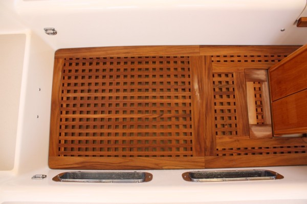 |
Pictures of the newly installed cockpit grate.
10 Photos
Created 7 July 2011
|
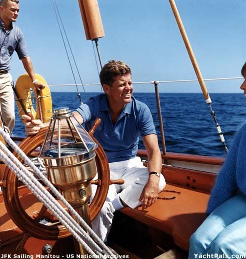 |
Photos of JFK's Presidential sailing yacht, Manitou
10 Photos
Created 26 June 2011
|
 |
Photos of the various places we are stopping as we make our way back north for summer 2011.
3 Photos
Created 28 April 2011
|
 |
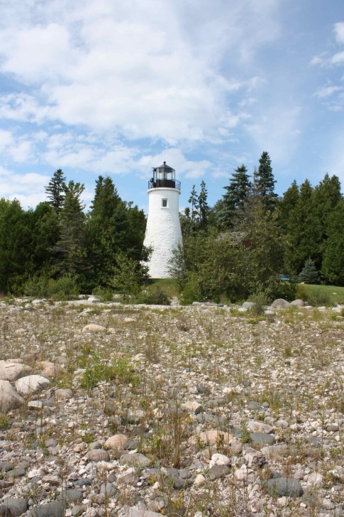
A collection of photos, including some from the Turtle Hospital.
5 Photos
Created 26 March 2011
|
 |
Pictures of a variety of projects underway or completed on Far Niente
3 Photos
Created 7 March 2011
|
 |
 |
 |
First batch of pix from our stay in Beaufort and a few from our previous stop, Charleston. Maybe the 2 best stops the entire journey.
18 Photos
Created 2 December 2010
|
 |
 |
A couple photos taken by Tom Jones (original owner of Far Niente when it was Christiana) Tom was on a fall delivery on a Grand Banks Eastbay 38 from the Great Lakes to Annapolis. On a very windy, cool early Sunday morning 50 miles north of Annapolis, they were motoring south on the Chesapeake at 23 kts and just happened to spot us exiting the Sassafras River headed for Annapolis for the sailboat show. What are the odds? A chance but great encounter none the less.
2 Photos
Created 1 November 2010
|
 |
 |
 |
Photos from our stop in NY and NJ (Liberty Landing)
5 Photos
Created 14 September 2010
|
 |
A selection of photos from our stay in Troy and Catskill, NY including stepping our mast.
18 Photos
Created 10 September 2010
|
 |
 |
 |
A couple of pictures of our ongoing excellent dining experience and the Credit Village Marina we are staying at
10 Photos
Created 11 August 2010
|
 |
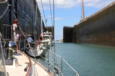 |
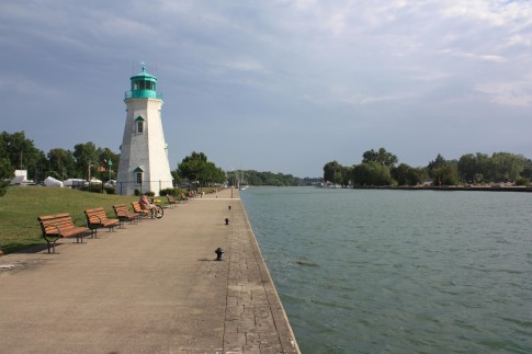
Pictures from our transit of the Welland Canal, down bound from Lake Erie to Lake Ontario
11 Photos
Created 9 August 2010
|
 |
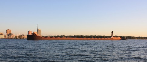
Photos from our leg from DeTour to Lake St. Clair
8 Photos
Created 27 July 2010
|
 |
 |
Photos from the Mack Island and the after regatta party
7 Photos
Created 20 July 2010
|
 |
Collection of photos from June 22 to July 17 from our travels around Charlevoix, Beaver Island and Mackinaw.
17 Photos
Created 18 July 2010
|
 |
A few photos of some of the things we changed/added to Far Niente in the summer of 2009.
3 Photos
Created 3 April 2010
|
 |
 |
Interior photos for friends and family who have not been aboard....YET!
18 Photos
Created 22 February 2010
|
 |
It's been a lovely cruise.....
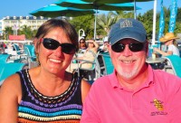
Who: Marjorie and Jeff Graham
Port: Beaufort, SC