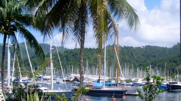
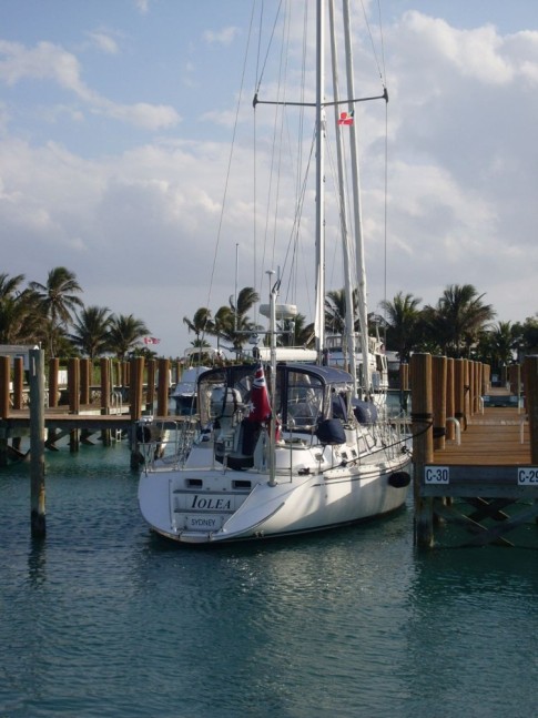
IOLEA 2019
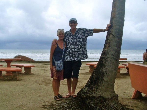
We are an Australian couple who have been cruising on our Hylas 49 since 2010. We are currently in Alaska having sailed from NZ via French Polynesia and Hawaii last year.

IOLEA
Who: Paul and Kate
Port: Sydney, Australia
Gallery


USEFUL LINKS
- 2019 Alaska
- 2017 Vanuatu
- 2017 Solomon Islands
- 2017 Kosrae
- 2016-17 The Marshall Islands
- 2016 Kiribati
- 2016 Vanuatu
- 2015 Fiji
- Boat systems
- 2013 Panama to Galapagos
- 2013 galapagos to Marquesas
- 2013 Marquesas
- 2013 Rarotonga
- 2013 Niue
- 2011-12 Trinidad
- 2013-15 New Zealand
- 2013 Tonga
- 2013 French Polynesia
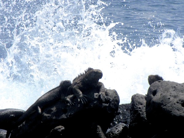
- 2013 Galapagos
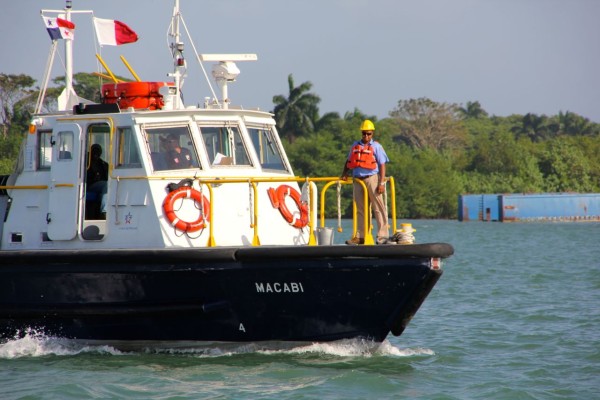
- 2012-13 Panama
- 2012 Columbia
- 2012 Bonaire
- 2011 East Caribbean
- 2011 Bahamas
- 2010-11 Florida
- 2010 Annapolis - ICW
- Show All Posts
12 July 2020
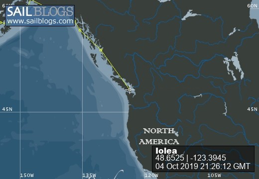
04 October 2019
17 September 2019
08 September 2019
27 August 2019
15 August 2019
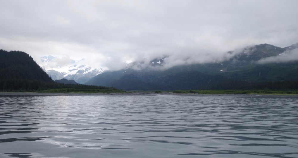
29 July 2019 | Prince William Sound: Snug Harbor
19 July 2019
17 July 2019
16 July 2019 | Aialik Bay, Kenai Peninsular
15 July 2019
14 July 2019 | Northwestern Glacier
13 July 2019 | Kenai Penninsular
12 July 2019 | Pilot Harbor, Kenai Peninsular
11 July 2019 | Kenai Peninsular
10 July 2019 | Kenai Peninsular
09 July 2019 | Afognak Island
08 July 2019 | Afognak Island
06 July 2019 | Afognak Island
05 July 2019 | Kodiak Island
Kwajalein Atoll, The Marshall Islands
08 March 2017 | Kwajalein
Kwajalein Atoll is home to the Ronald Reagan Ballistic Missile Defense Test Site and missile testing is undertaken periodically. We saw one of these from Rongerik one night. It looked like a larger than normal meteor at first then blew apart into fiery fragments that eventually burned out. Tests are announced on SSB 2716 on the hour and we monitored this as we made our way to the atoll.
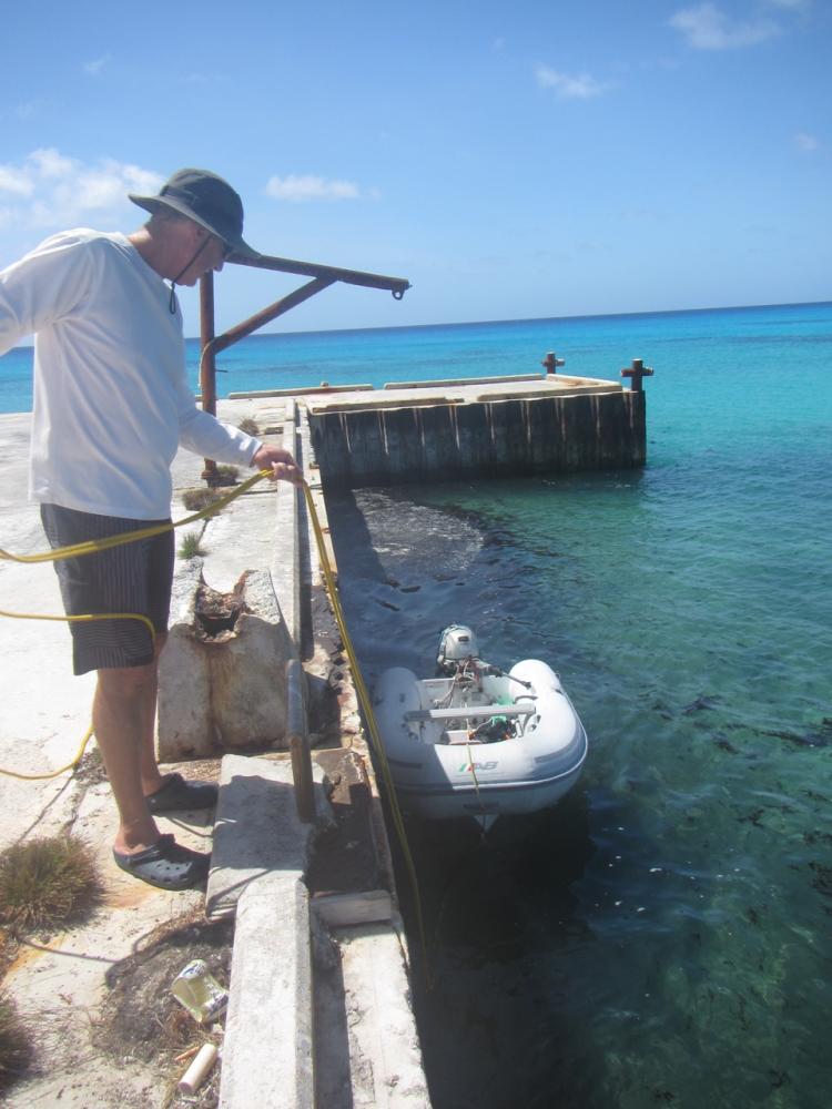
The US military occupy several islands but the main two are Roi Namur in the north and Kwajalein in the south which is the main base. These areas are off limits without a permit which can be acquired only if you are sponsored by someone on the bases and takes 2 weeks or more. However, while we cannot verify this, there is a daily quota of day passes to Kwajalein for Ebye residents and it may be possible to obtain one of these through the police on Ebye (the station is directly off the small boat basin on the southeast of Ebye). Beyond these islands the atoll is open to cruising and it has some lovely cruising areas.
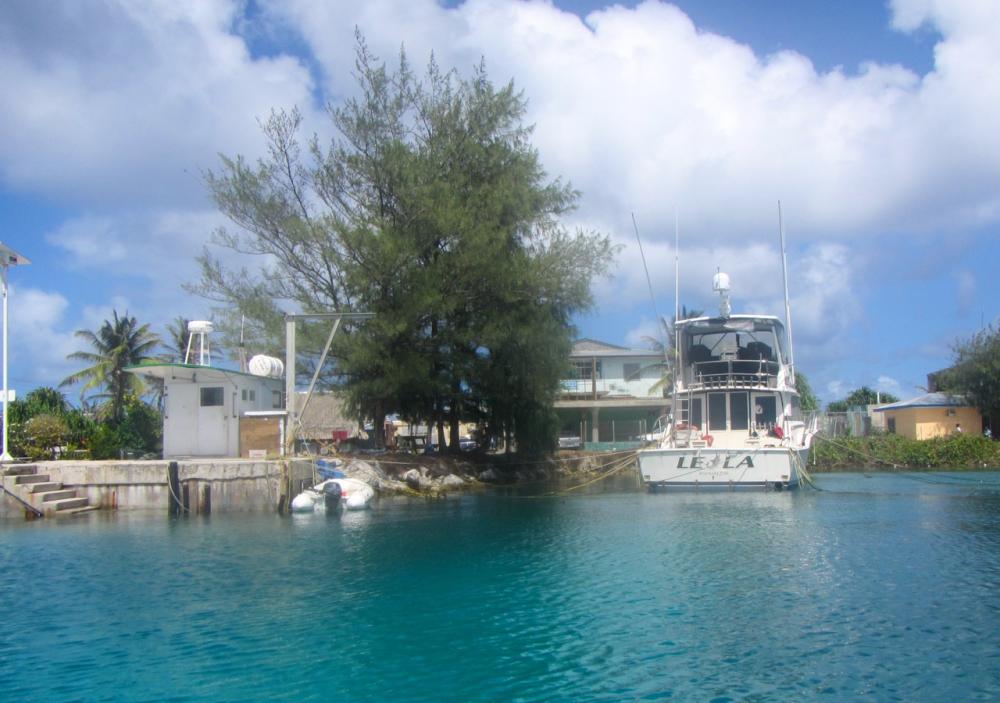 Small boat basin
 Police station is the green building on the right
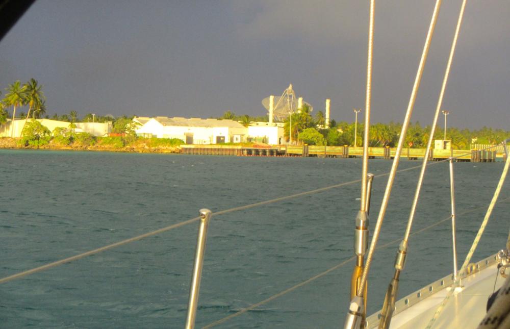
We arrived at Roi Namur after a beat from Bikini and anchored to the west of the main dock in about 8 metres. Roi Namur is flat and garden like with a few houses, offices, and units, which are dominated by a large tracking dish which was surprisingly agile; one moment seemingly targeted on us and the next swinging around to the north after a more interesting object.
We went ashore on the eastern dock where local workers transit to work from their homes on nearby Enniburr island. There is a shop with a modest but good selection of products for locals and diesel can also be bought here with permission. We were particularly fortunate on our visit because we met Laura who runs the shop and overseas cultural and other activities on the base. She was very helpful and we invited her and her partner Mike who is a techie on the base for sundowners the next evening. Mike owns the only local yacht moored off Roi Namur and is a keen sailor so had lots of questions about Iolea. They were good company and showered us with fresh produce, seafood and wine which was a real treat.
Between the first two channel markers into the anchorage at Roi Namur is the wreck of a Japanese zero; apparently in good condition. We searched for it but the visibility wasn't great and we gave up after 30mins. It was probably just metres away for us.
With our visas to The Marshalls about to expire we headed down to Ebye to gain an extension. Belina was there also and it was good to catch up with Benno and Marlene who were about to head off to Kiribati.
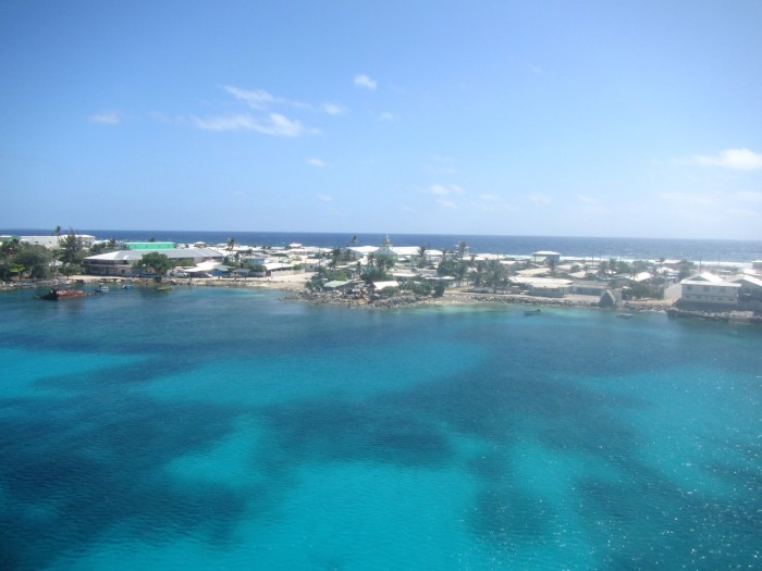
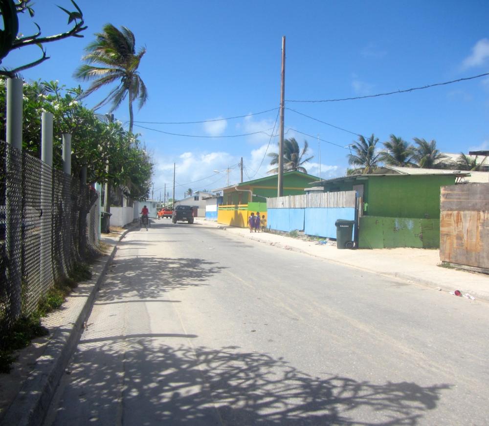
We anchored off the south eastern corner with the main dock providing protection from the northerly swell. Ebye is much maligned but often by people who have not visited the island. It is one of the most concentrated populations on earth with 15,000+ living on a handkerchief of 0.3 square Kilometres (80 acres). 64% of the population are children so how the atoll will manage to absorb them and their children in the future beggars belief. Despite the density and poverty, they are very cheerful and polite people and the warren of streets are well swept of garbage. At night around 10.30pm a vehicle with a siren sounding traverses the island to tell children its time to go home to bed.
Ebye, with all its shortcomings (see below) became an easy, friendly base for us with the added advantage of some really nice snorkelling off Little Bustard islet to the south. From there we sailed to Bigej which is a very pretty island with nice bombies. A slight northerly swell can make a stern anchor necessary unless the wind is East or south of East.
.jpg)
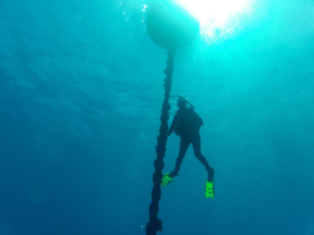
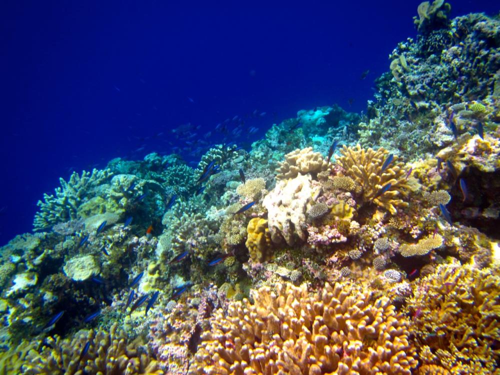
Our favourite spot was Nell Pass on the north western side of Kwajalein. There are a lovely reef off One-tree islet and the islet next to it and along Ennumet Gurer and Eru islands you can drift snorkell along a wall of hard coral through schools of fish with the occasional reef shark wandering by.
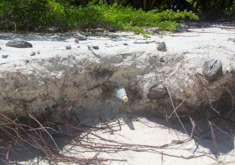
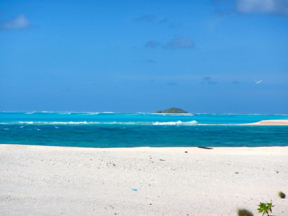
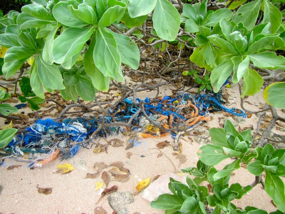
Around 2 hours before low tide its possibe to walk across the reefs linking Ennumet, islands and beachcomb the layers of flotsam and jetsam.
One evening we joined State of Mind and a local sailboat from Kwajalein for an evening on the beach. Nell pass is a popular destination for boats from the Kwajalein Base yacht club.
We thoroughly enjoyed our stay at Kwajalein Atoll and the fact that it allowed us to make a circuit of our travels north and to sail as far as Bikini without having to beat back to Majuro was an added bonus. The officials in Kwajalein are very friendly and accomodating and the atoll itself has a lot to offer divers, beachcombers, and those interested in the history of the region. But, for anyone planning to spend time on Kwajalein atoll be aware that there are no ATMs and it is not possible to change money at the bank - so bring all the cash you think you will need.
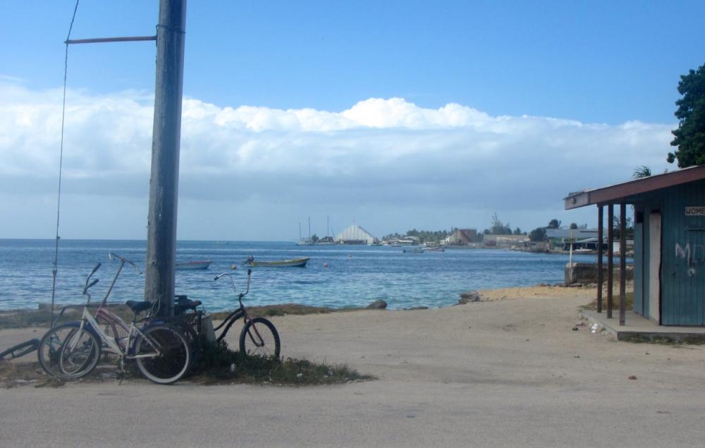
Ebye has several shops selling all sorts of odds and ends and one supermarket that carries a variety of imported foods and the usual semifrozen fresh produce (apparently some local vegetables are grown in the culverts under the causeway that connects Ebye with the islands to the north east but we did not see any of these). However, the stock available here is basic and the ship bringing produce not always reliable so stock up well in Majuro on your favourites, particularly wine and spirits, cheese, if you want them. There are restaurants but they are pretty ordinary - mostly Chinese and from what we saw not the best examples of that cuisine.
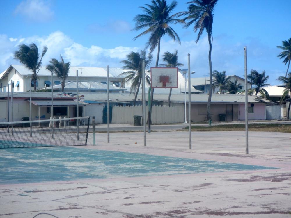
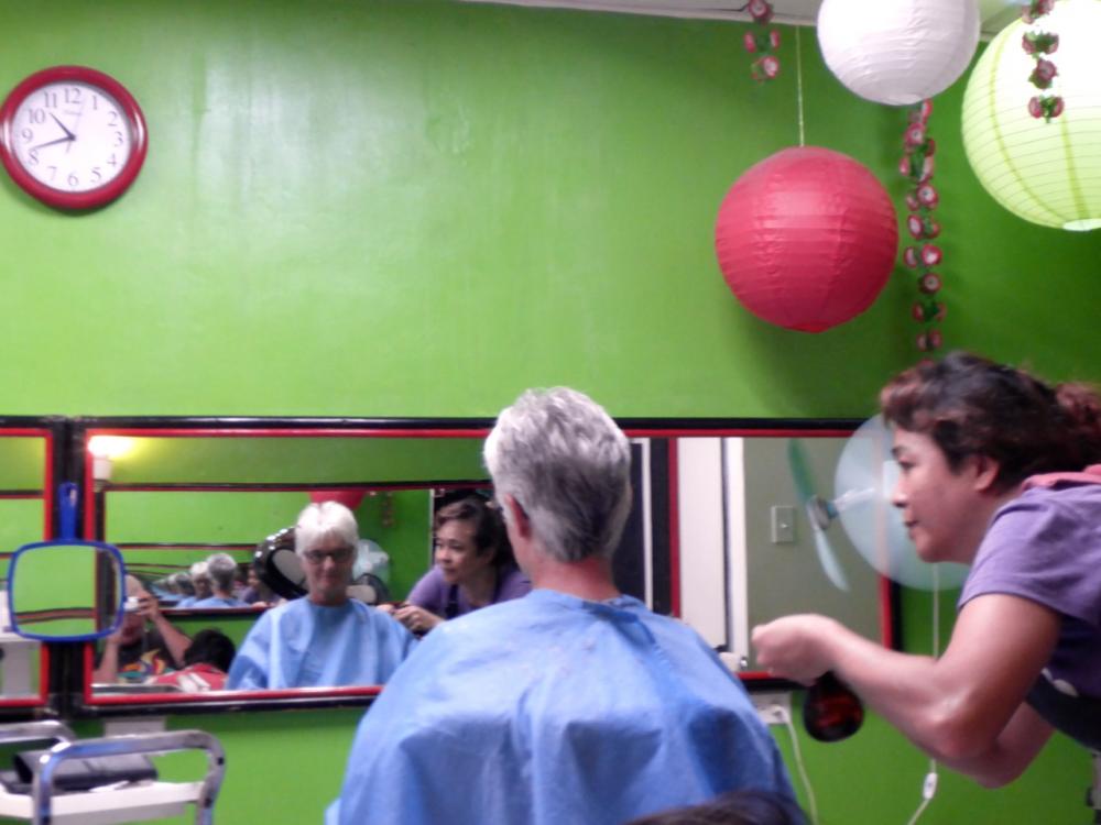
Gas can be found but you will need to gravity feed from their bottle and their bottles are 20 lbs. Diesel may or may not be available so don't count on being able to do a substantial refuel. There are laundries. There is a good one next to the large white church on the north west corner of Ebye. The church is clearly visible from the main dock. The only downside is the lady who runs it has a penchant for bleach and I now have blotches on some of my clothes and linen so maybe check the machine before clothes go in. I had my hair cut by a delightful Philippine hairdresser whose salon was hidden at the back of a house to the east of the basketball courts which are just across from immigration and customs. Internet was good near town and we used our account which had supposedly been turned off in Majuro. They just reconnected us in Ebye.
 The white building in the distance is the church with the laundry next to it
All in all we would happily return to Ebye is going north for the cyclone season.
The US military occupy several islands but the main two are Roi Namur in the north and Kwajalein in the south which is the main base. These areas are off limits without a permit which can be acquired only if you are sponsored by someone on the bases and takes 2 weeks or more. However, while we cannot verify this, there is a daily quota of day passes to Kwajalein for Ebye residents and it may be possible to obtain one of these through the police on Ebye (the station is directly off the small boat basin on the southeast of Ebye). Beyond these islands the atoll is open to cruising and it has some lovely cruising areas.
Small boat basinPolice station is the green building on the rightWe arrived at Roi Namur after a beat from Bikini and anchored to the west of the main dock in about 8 metres. Roi Namur is flat and garden like with a few houses, offices, and units, which are dominated by a large tracking dish which was surprisingly agile; one moment seemingly targeted on us and the next swinging around to the north after a more interesting object.
We went ashore on the eastern dock where local workers transit to work from their homes on nearby Enniburr island. There is a shop with a modest but good selection of products for locals and diesel can also be bought here with permission. We were particularly fortunate on our visit because we met Laura who runs the shop and overseas cultural and other activities on the base. She was very helpful and we invited her and her partner Mike who is a techie on the base for sundowners the next evening. Mike owns the only local yacht moored off Roi Namur and is a keen sailor so had lots of questions about Iolea. They were good company and showered us with fresh produce, seafood and wine which was a real treat.
Between the first two channel markers into the anchorage at Roi Namur is the wreck of a Japanese zero; apparently in good condition. We searched for it but the visibility wasn't great and we gave up after 30mins. It was probably just metres away for us.
With our visas to The Marshalls about to expire we headed down to Ebye to gain an extension. Belina was there also and it was good to catch up with Benno and Marlene who were about to head off to Kiribati.
We anchored off the south eastern corner with the main dock providing protection from the northerly swell. Ebye is much maligned but often by people who have not visited the island. It is one of the most concentrated populations on earth with 15,000+ living on a handkerchief of 0.3 square Kilometres (80 acres). 64% of the population are children so how the atoll will manage to absorb them and their children in the future beggars belief. Despite the density and poverty, they are very cheerful and polite people and the warren of streets are well swept of garbage. At night around 10.30pm a vehicle with a siren sounding traverses the island to tell children its time to go home to bed.
Ebye, with all its shortcomings (see below) became an easy, friendly base for us with the added advantage of some really nice snorkelling off Little Bustard islet to the south. From there we sailed to Bigej which is a very pretty island with nice bombies. A slight northerly swell can make a stern anchor necessary unless the wind is East or south of East.
Our favourite spot was Nell Pass on the north western side of Kwajalein. There are a lovely reef off One-tree islet and the islet next to it and along Ennumet Gurer and Eru islands you can drift snorkell along a wall of hard coral through schools of fish with the occasional reef shark wandering by.
Around 2 hours before low tide its possibe to walk across the reefs linking Ennumet, islands and beachcomb the layers of flotsam and jetsam.
One evening we joined State of Mind and a local sailboat from Kwajalein for an evening on the beach. Nell pass is a popular destination for boats from the Kwajalein Base yacht club.
We thoroughly enjoyed our stay at Kwajalein Atoll and the fact that it allowed us to make a circuit of our travels north and to sail as far as Bikini without having to beat back to Majuro was an added bonus. The officials in Kwajalein are very friendly and accomodating and the atoll itself has a lot to offer divers, beachcombers, and those interested in the history of the region. But, for anyone planning to spend time on Kwajalein atoll be aware that there are no ATMs and it is not possible to change money at the bank - so bring all the cash you think you will need.
Ebye has several shops selling all sorts of odds and ends and one supermarket that carries a variety of imported foods and the usual semifrozen fresh produce (apparently some local vegetables are grown in the culverts under the causeway that connects Ebye with the islands to the north east but we did not see any of these). However, the stock available here is basic and the ship bringing produce not always reliable so stock up well in Majuro on your favourites, particularly wine and spirits, cheese, if you want them. There are restaurants but they are pretty ordinary - mostly Chinese and from what we saw not the best examples of that cuisine.
Gas can be found but you will need to gravity feed from their bottle and their bottles are 20 lbs. Diesel may or may not be available so don't count on being able to do a substantial refuel. There are laundries. There is a good one next to the large white church on the north west corner of Ebye. The church is clearly visible from the main dock. The only downside is the lady who runs it has a penchant for bleach and I now have blotches on some of my clothes and linen so maybe check the machine before clothes go in. I had my hair cut by a delightful Philippine hairdresser whose salon was hidden at the back of a house to the east of the basketball courts which are just across from immigration and customs. Internet was good near town and we used our account which had supposedly been turned off in Majuro. They just reconnected us in Ebye.
The white building in the distance is the church with the laundry next to itAll in all we would happily return to Ebye is going north for the cyclone season.
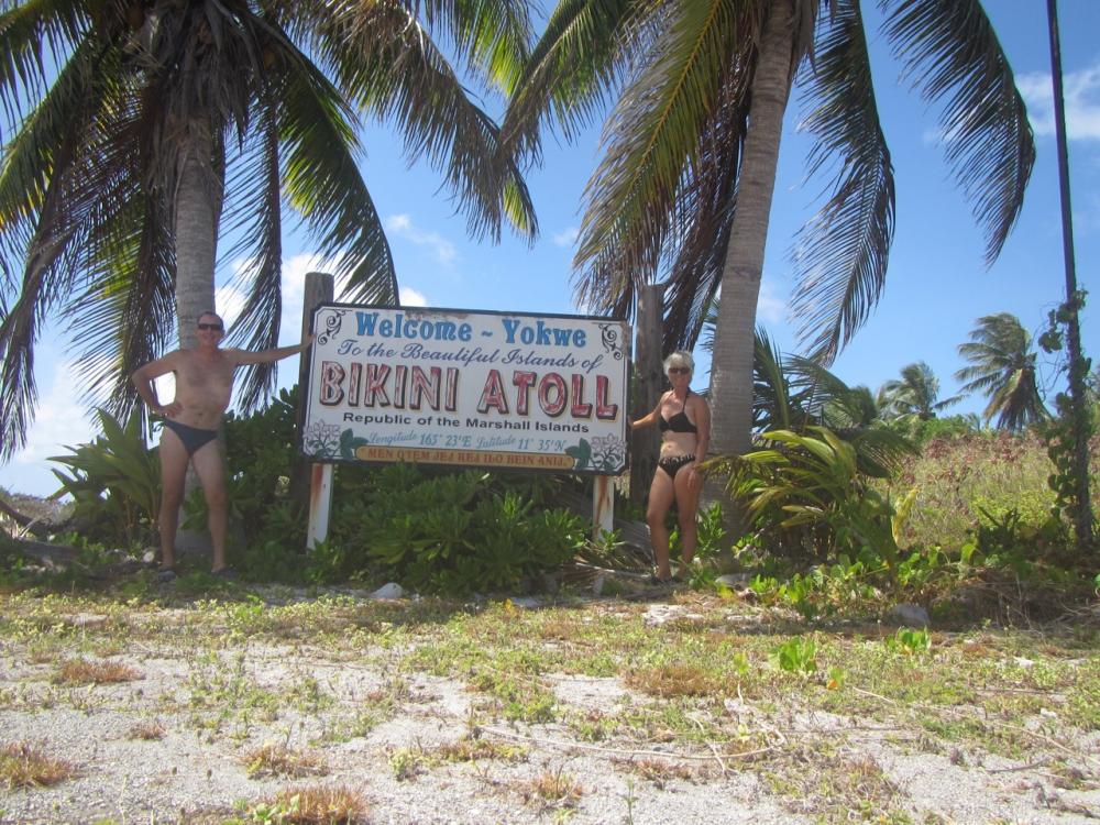
Bikini
02 March 2017 | Bikini Atoll
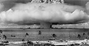
Our primary motivation for going to Bikini had been to dive the Saratoga - the aircraft carrier that lies in 50 metres of water. We tried to get permission to dive but the Bikinians were having a conference in Hawaii and all their focus was on making their way there. Still, we managed to get a permit to visit the atoll for USD25. This was fortunate because just as we left Majuro the Bikinians, in their wisdom, increased the permit price to a whopping USD5,000. God knows what they were thinking but they've stopped dead any future cruising to Bikini (we think it has to do with a planned USD1,000 fee for visitors arriving on cruise ships). This fee was clearly news to their people in Bikini because just recently one of them asked on the Yokwe net when they might expect more yachts because they need some diesel. They were told they were unlikely to see one until the permit became more reasonable.
Bikini was the site for nuclear tests conducted by the US from 1946 to 1958. The initial tests were conducted under the code "Operation Crossroads" and the later and more notorious test which contaminated Rongelap and Rongerik Atolls in 1954 was operation Castle Bravo. The reasons for conducting the Crossroads tests, the logistics, and the obstacles they faced, as well as the results of the explosions, are outlined in a frank, well written report called "Bombs at Bikini" by Joint Task Force One. It starts.....
The gray-green dawn of July 25,1946, enveloped
Bikini Atoll. The target fleet lay still, with
'Yoke" flags flying to signify all personnel had been
evacuated. Like moving shadows the support vessels
slowly filed out of the Lagoon. Last to leave was the
flagship MT. McKINLEY. The Lagoon was deserted.
Just over the eastern horizon puffs of cumulus
clouds appeared, heralding perfect weather for the
flnal atomic test at Bikini. As the time for the explosion
approached, men paced the decks, adjusted
their binoculars, studied the deserted target fleet to
fix in their minds the steel pattern soon to be shattered.
Clearly visible was the doomed SARATOGA, floating
majestically as she had throughout the war; among the
forest of masts could be seen the tall thin mast of
LSM-60, the ship from which the bomb was suspended.
Closer -- fatally close -- lay the mighty ARKANSAS.
Men stared fascinated as the relentless count began.
In a few seconds the awful explosion would come. Not
few; Two ! OneI
The results are history. Ships were crushed, and
sank; two million tons of water and spray buried
scores of ships. Even more deeply buried -- lost in the drama of the moment -- were the underlying
problems, the guiding motive. Why plan an
Operation Crossroads'? Why send 42,000 men,
242 ships, 156 airplanes, 4 television transmitters,
750 cameras, 5000 pressure gages, 25,000
radiation recorders, 204 goats, 200 pigs, 5000 rats
and why transport Numbers 4 and 5 of the
atomic bomb family thousands of miles across
land and sea for two brief moments of majestic
destruction?
The book goes on to answer those questions and to give the results of the experiments that were conducted. If your interested here is a link Bombs at Bikini
In hindsight it was an immoral thing to do. To render people homeless and to contaminate the environment in such a way, but in the context of the time it seems less so. The focus was on the experiment and the consequences for one small atoll with a few hundred people was just one of hundreds of considerations for a successful outcome in their eyes.
Today Bikini is a ghost town. Even less populated than Rongelap. The station is on Bikini island in the north which has a wonderfully protected anchorage. It houses the caretakers. When we were there they were collecting turtles and fledgling boobies for a feast on Kili Island where Bikinians live today. It was sad to see half a dozen turtles on their backs waiting their fate. On the machine shed there is a reminder of what the Bikinians have lost.
.jpg)
But Bikini is also beautiful and bountiful. The view from the closed bar is stunning but unfortunately it only operates when divers come in in the less windy months in summer. We were not game to try to catch lobster here given their tendency to process coral but there are definitely some large specimens here.
.jpg)
.jpg)
We did manage to locate the Saratoga using our depth sounder and we also noticed an oil slick near where the Japanese ship the Nagato sank and assume it is still slowly leaking oil even this many years later.
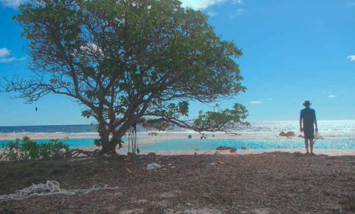
We spent the last few days on Bikini Atoll at Enya island in the south east. It hosts the airport and is a graveyard for earth moving equipment. The dock is a challenge for dinghies since it has been constructed in completely the wrong direction and is subject to swell. The reef off the airstrip can be quite nice for snorkelling but can be murky. The reef itself is interesting to explore and has a lot of cruising reef sharks.
Most people associate Bikini with the swimsuit but it was revealed 4 days after the first nuclear bomb on Bikini by the frenchman Louis Reard who thought it might create as much sensation as the bomb itself - it did.
Bikini was the site for nuclear tests conducted by the US from 1946 to 1958. The initial tests were conducted under the code "Operation Crossroads" and the later and more notorious test which contaminated Rongelap and Rongerik Atolls in 1954 was operation Castle Bravo. The reasons for conducting the Crossroads tests, the logistics, and the obstacles they faced, as well as the results of the explosions, are outlined in a frank, well written report called "Bombs at Bikini" by Joint Task Force One. It starts.....
The gray-green dawn of July 25,1946, enveloped
Bikini Atoll. The target fleet lay still, with
'Yoke" flags flying to signify all personnel had been
evacuated. Like moving shadows the support vessels
slowly filed out of the Lagoon. Last to leave was the
flagship MT. McKINLEY. The Lagoon was deserted.
Just over the eastern horizon puffs of cumulus
clouds appeared, heralding perfect weather for the
flnal atomic test at Bikini. As the time for the explosion
approached, men paced the decks, adjusted
their binoculars, studied the deserted target fleet to
fix in their minds the steel pattern soon to be shattered.
Clearly visible was the doomed SARATOGA, floating
majestically as she had throughout the war; among the
forest of masts could be seen the tall thin mast of
LSM-60, the ship from which the bomb was suspended.
Closer -- fatally close -- lay the mighty ARKANSAS.
Men stared fascinated as the relentless count began.
In a few seconds the awful explosion would come. Not
few; Two ! OneI
The results are history. Ships were crushed, and
sank; two million tons of water and spray buried
scores of ships. Even more deeply buried -- lost in the drama of the moment -- were the underlying
problems, the guiding motive. Why plan an
Operation Crossroads'? Why send 42,000 men,
242 ships, 156 airplanes, 4 television transmitters,
750 cameras, 5000 pressure gages, 25,000
radiation recorders, 204 goats, 200 pigs, 5000 rats
and why transport Numbers 4 and 5 of the
atomic bomb family thousands of miles across
land and sea for two brief moments of majestic
destruction?
The book goes on to answer those questions and to give the results of the experiments that were conducted. If your interested here is a link Bombs at Bikini
In hindsight it was an immoral thing to do. To render people homeless and to contaminate the environment in such a way, but in the context of the time it seems less so. The focus was on the experiment and the consequences for one small atoll with a few hundred people was just one of hundreds of considerations for a successful outcome in their eyes.
Today Bikini is a ghost town. Even less populated than Rongelap. The station is on Bikini island in the north which has a wonderfully protected anchorage. It houses the caretakers. When we were there they were collecting turtles and fledgling boobies for a feast on Kili Island where Bikinians live today. It was sad to see half a dozen turtles on their backs waiting their fate. On the machine shed there is a reminder of what the Bikinians have lost.
But Bikini is also beautiful and bountiful. The view from the closed bar is stunning but unfortunately it only operates when divers come in in the less windy months in summer. We were not game to try to catch lobster here given their tendency to process coral but there are definitely some large specimens here.
We did manage to locate the Saratoga using our depth sounder and we also noticed an oil slick near where the Japanese ship the Nagato sank and assume it is still slowly leaking oil even this many years later.
We spent the last few days on Bikini Atoll at Enya island in the south east. It hosts the airport and is a graveyard for earth moving equipment. The dock is a challenge for dinghies since it has been constructed in completely the wrong direction and is subject to swell. The reef off the airstrip can be quite nice for snorkelling but can be murky. The reef itself is interesting to explore and has a lot of cruising reef sharks.
Most people associate Bikini with the swimsuit but it was revealed 4 days after the first nuclear bomb on Bikini by the frenchman Louis Reard who thought it might create as much sensation as the bomb itself - it did.
Rongelap, The Marshall Islands
13 February 2017 | Rongelap Atoll
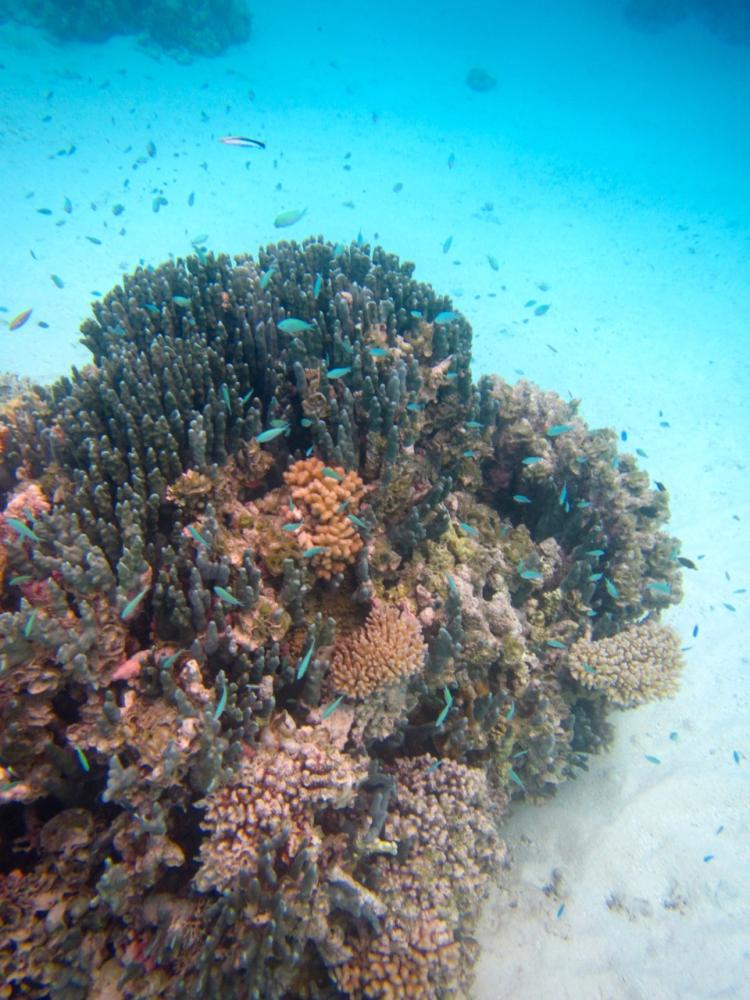
If we had our time over we would spend a month in Rongelap. Its a beautiful atoll with comfortable anchorages, long stretches of sandpits,islands for beach combing, and some excellent snorkelling/diving. Rongerlap is virtually uninhabited thanks to unintended fallout from the Bravo test at Bikini. Scientists had underestimated the fission reaction by 2.5 times and so instead of 5 megatons it was almost 15 megatons of TNT. Making matters worse the wind sheer changed to the east which caused the fallout to drop onto Rongelap. The head scientist had full discretion over the timing of detonation but decided to proceed because a delay would ruin all their preparation in setting up timed measures.
Rongelap residents were evacuated 48 hrs after Bravo then returned in 1957 after Rongelap was declared safe for re-habitation by the Atomic Energy Commission. It was soon evident that the land was still contaminated. Eventually in 1985 Greenpeace evacuated residents to Kwajalein Atoll. Now there are caretakers on Rongelap island where there is a fully built village with modern amenities, an airstrip that can take large planes, a new airport building, and paved roads throughout. The problem is that the islanders do not trust that Rongelap is inhabitable and its hard to blame them given the behaviour of the US. There are no doubt other factors such as lack of communication (according to Fred the wifi hasn't worked since 2012 and Marshall Air is notoriously unreliable). Hopefully Rongelap will be fit to re-inhabit one day but for us, who are passing through, it was wonderful because the Atoll's natural resources are very much intact.
A rather pink Fred thanks to an incorrect setting on the camera. Fred is the elder on Rongelap and was involved in the Greenpeace evacuations
Rongelap Airport
An innovative way to use fishing floats and an example of the modern housing built here
The staff make copra on the side and the pigs benefit too
Paul pondering how to use the yellow floats that are strung though nets. We discovered in The Solomon Islands that these are treasured by longboat owners. They join two together and use them to roll their boats ashore
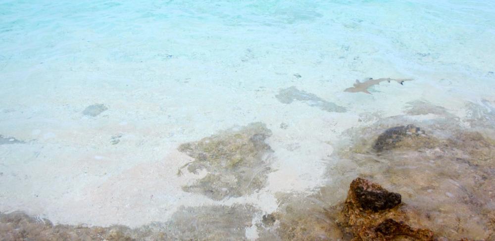
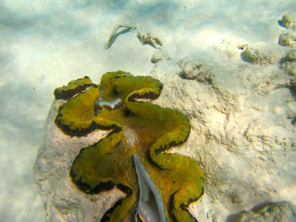
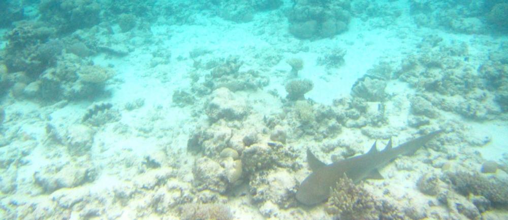
Black tip reef shark
This reef is part of a wall along the south facing pass east of Mellu Island We saw sharks, devil rays, turtles and much more here
Rongelap residents were evacuated 48 hrs after Bravo then returned in 1957 after Rongelap was declared safe for re-habitation by the Atomic Energy Commission. It was soon evident that the land was still contaminated. Eventually in 1985 Greenpeace evacuated residents to Kwajalein Atoll. Now there are caretakers on Rongelap island where there is a fully built village with modern amenities, an airstrip that can take large planes, a new airport building, and paved roads throughout. The problem is that the islanders do not trust that Rongelap is inhabitable and its hard to blame them given the behaviour of the US. There are no doubt other factors such as lack of communication (according to Fred the wifi hasn't worked since 2012 and Marshall Air is notoriously unreliable). Hopefully Rongelap will be fit to re-inhabit one day but for us, who are passing through, it was wonderful because the Atoll's natural resources are very much intact.
A rather pink Fred thanks to an incorrect setting on the camera. Fred is the elder on Rongelap and was involved in the Greenpeace evacuations
Rongelap Airport
An innovative way to use fishing floats and an example of the modern housing built here
The staff make copra on the side and the pigs benefit too
Paul pondering how to use the yellow floats that are strung though nets. We discovered in The Solomon Islands that these are treasured by longboat owners. They join two together and use them to roll their boats ashore
Black tip reef shark
This reef is part of a wall along the south facing pass east of Mellu Island We saw sharks, devil rays, turtles and much more here
Rongerik, the Marshall Islands
05 February 2017 | Rongerik Atoll
When my brothers and I were young our family used to take holidays in a small fishing town called Bermagui which is on NSW's South Coast. We stayed in one of a line of fibro holiday flats that stepped down the hillside and that were overflowing with passionfruit vines. Bermagui was untouched by development in those days and we would spend hours chasing soldier crabs on the mud flats, playing hide-and-seek in the dunes, and sitting on the dock watching the day's catch being unloaded; a bag of hot chips in our laps. But what I recall most from those early days is how wild and empty it was - just endless beaches backed by tufted dunes and strewn with the flotsam of winter storms.
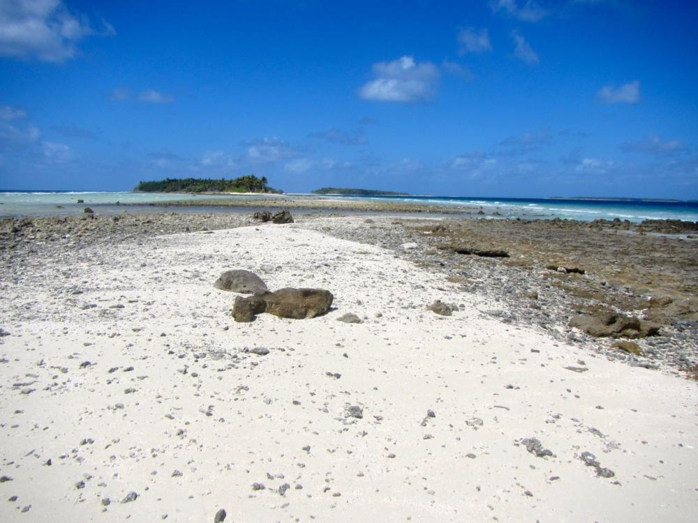
Rongerik Atoll reminds me of those days despite it being tropical. It is rarely visited, even by its owners on Rongelap just 30 miles to its west. There are rumours that it is cursed which seems to have come about because there is no reliable water source and fish which can be eaten on other islands are poisonous here (we think this is ciguatera). In 1946 the Americans relocated the 162 Bikini Islanders to Rongerik. Rongerik was the preferred location of the Bikinians but it has no reliable water and so they were moved to another atoll. Apart from some graves and slabs of concrete in the underbrush, there is no evidence of those settlements today.
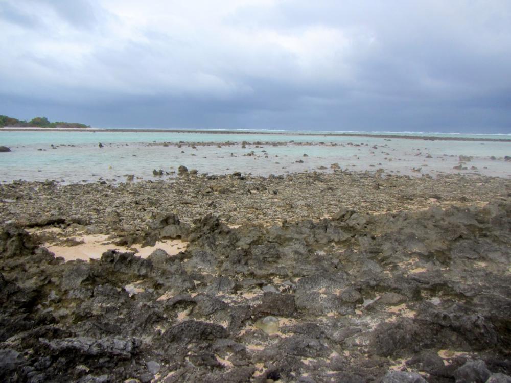
We entered Rongerik through the southern pass in the early morning. The pass is narrow but very clear and we had no difficulty working our way to the north eastern corner. Only towards the end did the bombies cluster. Otherwise they were isolated and easy to see. The north east corner has three islands that provide reasonable protection from the north-east through to the east. Steep beaches extend to sand spits and the ocean swell from the north rolls through the lagoon and into waves as it meets the incoming tide over the reefs to the north east. Its an odd sight seeing waves in an atoll lagoon.
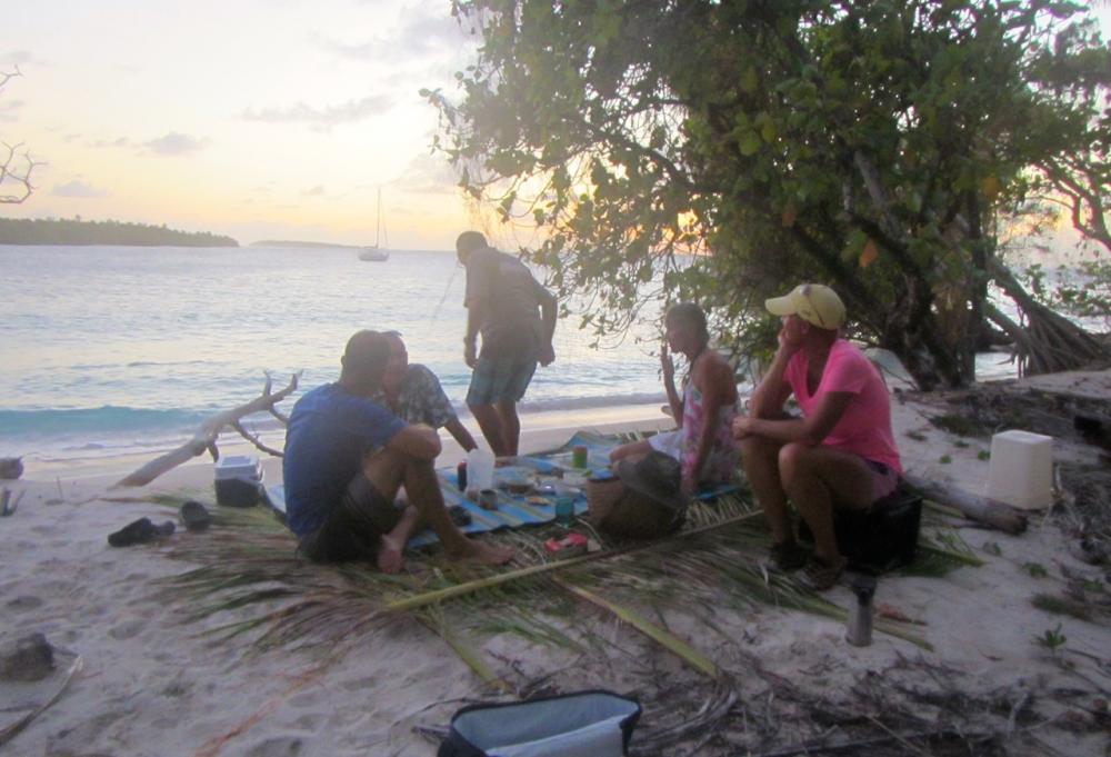
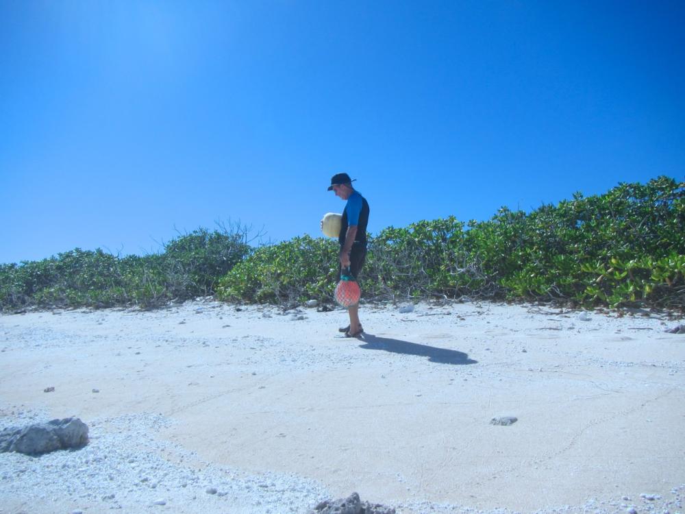
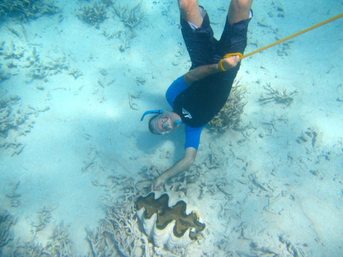
Shortly after we arrived, our friends Rod and Brenda on State of Mind sailed in from Iluk Atoll and we spent a week with them exploring the islands, beachcombing, snorkelling, catching lobster, and fishing (this was really only Brenda and she gave up fishing from the boat when she kept losing tackle to the atoll sharks who had worked out that her fishing was an easy feed for them).
At night lobsters climb onto the reef to feed and at the right tide you can literally pick them out of crevices
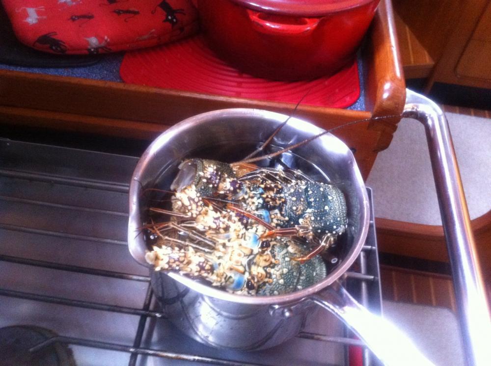
4 lobster leftovers to make a stock
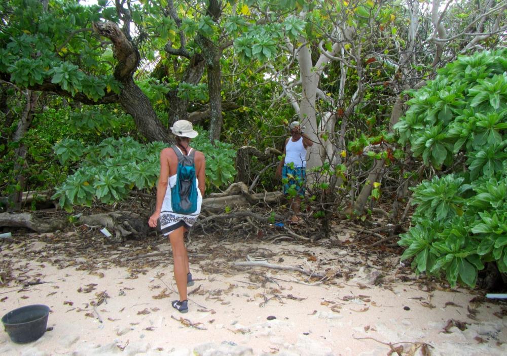
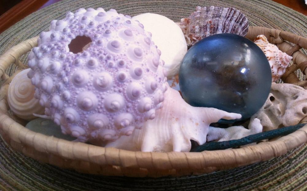
Rod and Brenda searching among the flotsom for Japanese fishing balls made from glass. They take a bit of spotting but we had all found several by the time we left.
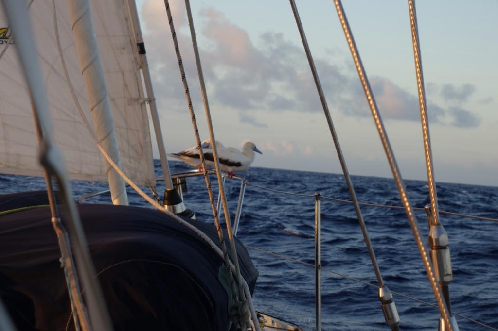
Bigonattan island is a breeding ground for brown and red footed boobies and frigate birds. Fledgling boobies have no fear although they get a little nervous if you come too close.
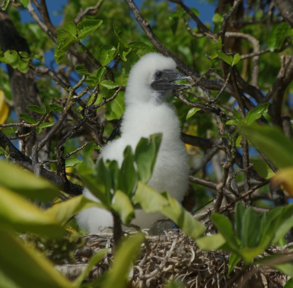
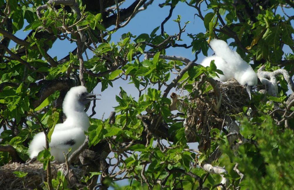
One trying to work out how to get down and the other just shaking its head
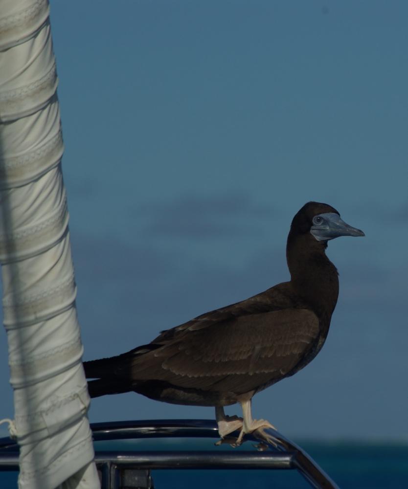
Our resident Brown Booby
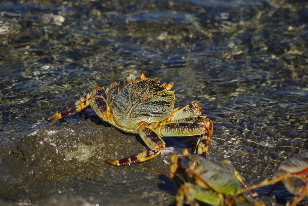
These colourful creatures are everywhere and we noticed a pattern in the direction of crab skeletons (molting's). They all seem to face west
Rongerik Atoll reminds me of those days despite it being tropical. It is rarely visited, even by its owners on Rongelap just 30 miles to its west. There are rumours that it is cursed which seems to have come about because there is no reliable water source and fish which can be eaten on other islands are poisonous here (we think this is ciguatera). In 1946 the Americans relocated the 162 Bikini Islanders to Rongerik. Rongerik was the preferred location of the Bikinians but it has no reliable water and so they were moved to another atoll. Apart from some graves and slabs of concrete in the underbrush, there is no evidence of those settlements today.
We entered Rongerik through the southern pass in the early morning. The pass is narrow but very clear and we had no difficulty working our way to the north eastern corner. Only towards the end did the bombies cluster. Otherwise they were isolated and easy to see. The north east corner has three islands that provide reasonable protection from the north-east through to the east. Steep beaches extend to sand spits and the ocean swell from the north rolls through the lagoon and into waves as it meets the incoming tide over the reefs to the north east. Its an odd sight seeing waves in an atoll lagoon.
Shortly after we arrived, our friends Rod and Brenda on State of Mind sailed in from Iluk Atoll and we spent a week with them exploring the islands, beachcombing, snorkelling, catching lobster, and fishing (this was really only Brenda and she gave up fishing from the boat when she kept losing tackle to the atoll sharks who had worked out that her fishing was an easy feed for them).
At night lobsters climb onto the reef to feed and at the right tide you can literally pick them out of crevices
4 lobster leftovers to make a stock
Rod and Brenda searching among the flotsom for Japanese fishing balls made from glass. They take a bit of spotting but we had all found several by the time we left.
Bigonattan island is a breeding ground for brown and red footed boobies and frigate birds. Fledgling boobies have no fear although they get a little nervous if you come too close.
One trying to work out how to get down and the other just shaking its head
Our resident Brown Booby
These colourful creatures are everywhere and we noticed a pattern in the direction of crab skeletons (molting's). They all seem to face west
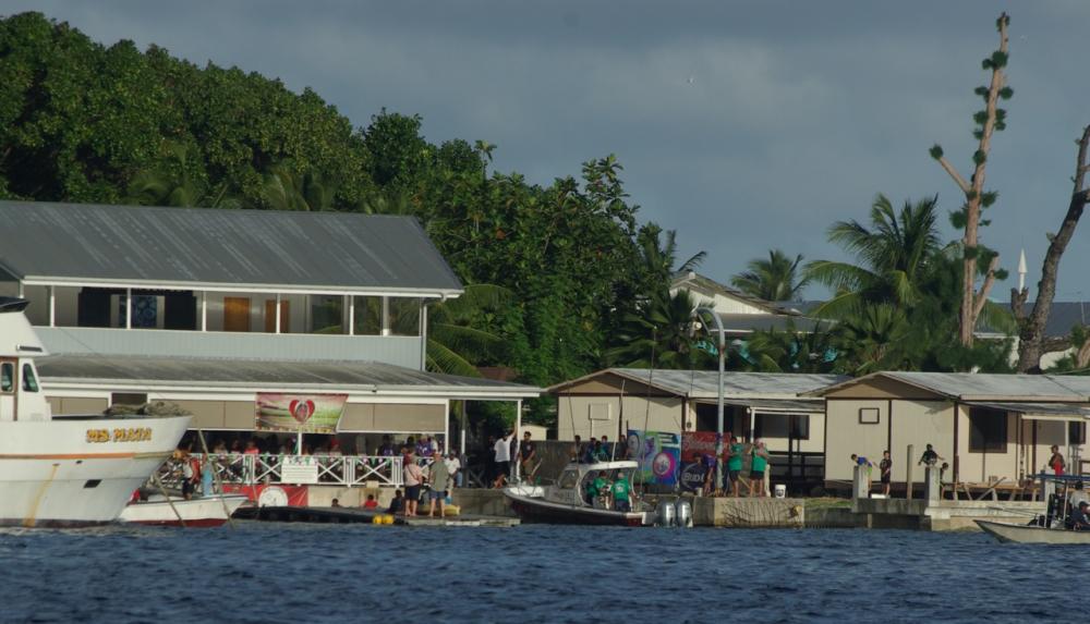
Majuro, The Marshall Islands
29 January 2017 | Majuro
Virtually every blog we have read on their experiences of the 3 day passage to Majuro has complained about the weather conditions - "we had no wind", "we had head winds and steep seas" - some have even had to give up trying to get Majuro for some weeks or at all because of the north-easterly winds. Our passage fell into the "no wind" category for 24 hours, light winds for the next 24, then boisterous downwind sailing with squalls for the last leg from Killi to Majuro.
Three of us set off to Majuro from Tarawa within 24 hours of each other. Sam with Danny and Mo on board were first since Sam is 34ft and loaded to the hilt. Benno and Marlene left that evening in their Cat Belina and we left at dawn the next morning. Just north of Butaritari there is a surprisingly strong east-going current which helped with our sail angle in the ENE winds but stirred the seas a little. Sam and we beat up the east of Killi Atoll before turning towards Majuro which gave us fast downwind sailing. Benno's sailing philosophy is to go with the flow and so Belina went with the current We all arrived in Majuro within 20 hrs of each other but Belina had travelled an extra 150miles! (that's catamarans for you).
Our first night in Majuro was on a mooring off Enamenot Island. The moorings are provided by the Meico Yacht club and maintained by its members. Its a beautiful spot with nice little bommies and the wrecks of a cruising yacht, helicopter, and plane to dive on.


The next morning we settled on a mooring in the north anchorage off Riemers Enterprises who own the moorings, the RRE Hotel and quite a lot else on Majuro. It was so nice to be in clear water after Tarawa's soup. The striking difference between Majuro and Kiribati is the housing. Here it is mostly westernised with cinder or fibro walls and tin roofs to catch the regular rainfall. Majuro is dominated by a few families that own the majority of the land (Marshallese) and businesses (largely Chinese). Most of the people living on Majuro lease their houses (land) and there is little/no regulation of the leasing terms. Agreements over improving a house or building on the land seem to be verbal only and so lessees rely on the integrity of the land owner not to increase the rent or terminate the lease.
View Reimers' Dock where the annual Bill Fish competition is having its weigh-in
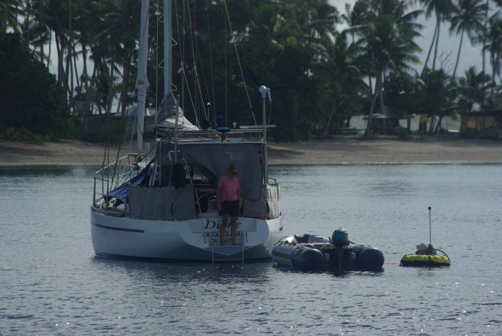
Sue on Dione keeps an eye on Glen as he cleans the hull
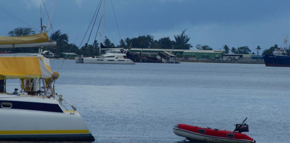
If you look closely you can see the Trading Boat behind the catamaran which is sinking. It went down very fast
Paul had been feeling unwell since we arrived in Kiribati. He was having dizzy spells and finding it hard to breathe at times so we visited the local hospital to see what was wrong. It became our home away from home for the first week as we waited with other outpatients to see a doctor and collect pathology results. The waiting was a minor inconvenience for a service that cost just $20. They did a variety of blood tests and found nothing serious thank goodness. They thought it was heat exhaustion and advised him to eat more and increase his intake of salt and other electrolytes. The heat had reduced our appetites and as westerners living mostly in a cooler climate we tend to minimise our salt intake. After upping both of these he began to feel much better.

Given the US influence in The Marshalls, we had envisioned supermarkets full of products to entice us after 6 months in Vanuatu and Kiribati. The supermarkets are certainly better stocked than in Tarawa but fresh local produce is limited despite land for gardens, and produce coming from the USA has almost no shelf life (we had been warned about that). A daily market operates next to the Marshall Islands Resort and has odds and ends, but mostly coconuts, and a Taiwanese aid initiative to encourage gardening runs a market with locals twice a month which has good produce but a bit expensive - so it is available if you look for it.
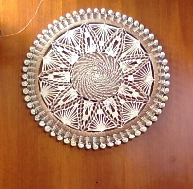
What is produced in the Marshalls and is exceptional is their weaving which is intricate and varied. Baskets, flowers, and Oban (round wall hangings) are the most common forms of decorative weaving. The Japanese have influenced the designs used in Oban and I find them a bit doily-like for my taste but there is no denying the superb workmanship. The first photo below is of a typical Oban woven in Majuro. The second is of an Oban hanging in RRE Hotel. No-one could tell me its origin - not even the museum - but having visited Kosrae now I wonder whether its influence is from The Federated States of Micronesia.

We had read before travelling north that Majuro has a cinema and bowling alley which sounded fun. Well we were disappointed. The bowling alley was taken over by the bank after its owner defaulted and then eventually closed. Now its just a shell. The local cinema had been popular but couldn't compete with pirated DVDs. So apart from some Karoke bars there is little left in the way of entertainment in Majuro now and as luck would have it, the internet was closed down just after Xmas to repair optic fibre cable near Kwajalein atoll. It was out for almost a month which probably saved us a fortune in unspent dollars on Amazon but was very frustrating.
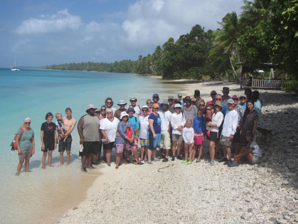
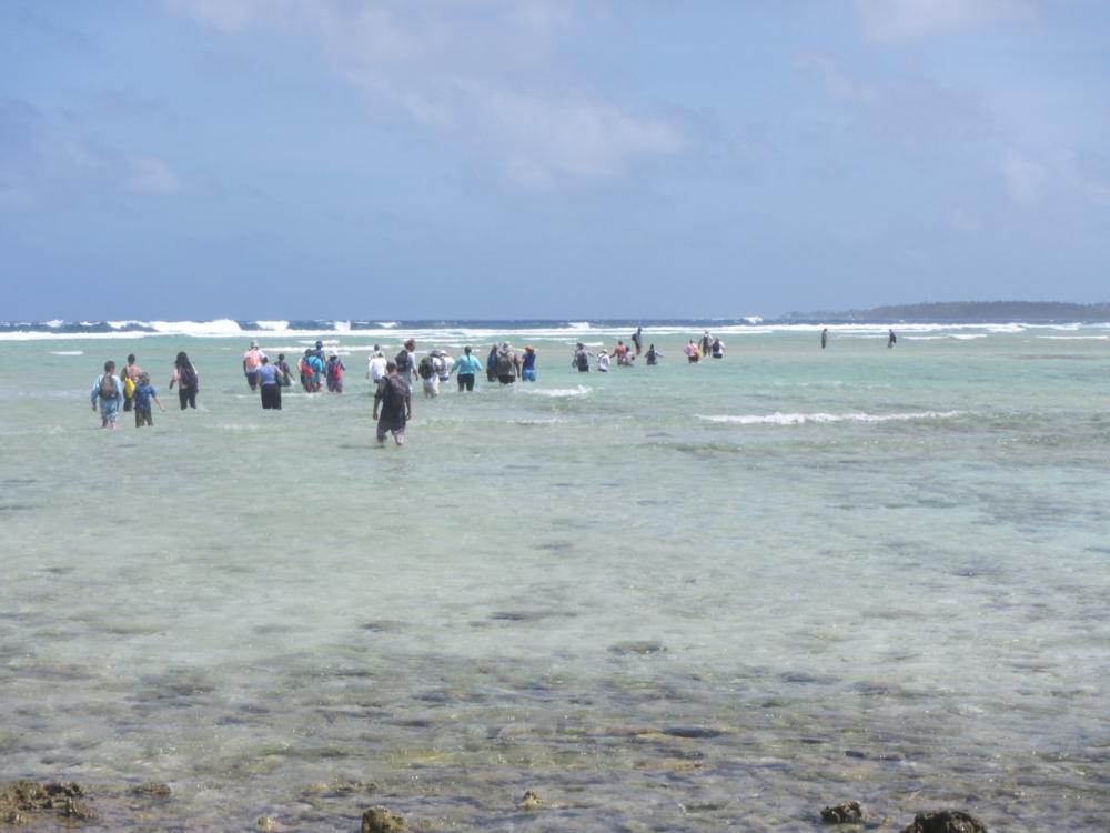
Fortunately, there is the Mieco Yacht club (MYC) and Carey and Karen on the yacht Seal who keep an active social agenda going for yachties and Expats alike which was a lot of fun. They also run the Yokwe net on 6224 for boats travelling in the Marshalls and have been supported by Janet and David on Navire who have a fabulous SSB. Unfortunately, for the net Navire is heading back to New Zealand and taking their wonderful radio with them. The MYC has regular Tuesday night dinners and a monthly quiz. They also arrange other events. One of these was a reef walk from Enamenot Island. We and sv Seal took 50 people between us out to the island in the morning. We walked and waded back to Majuro with only a few retiring early from the challenge of currents and waves.
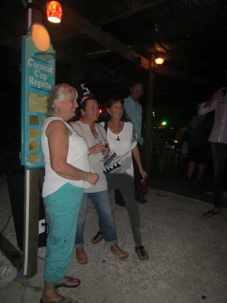
The MYC spins off other events too. This is Ana's 50th birthday at MI Resort.
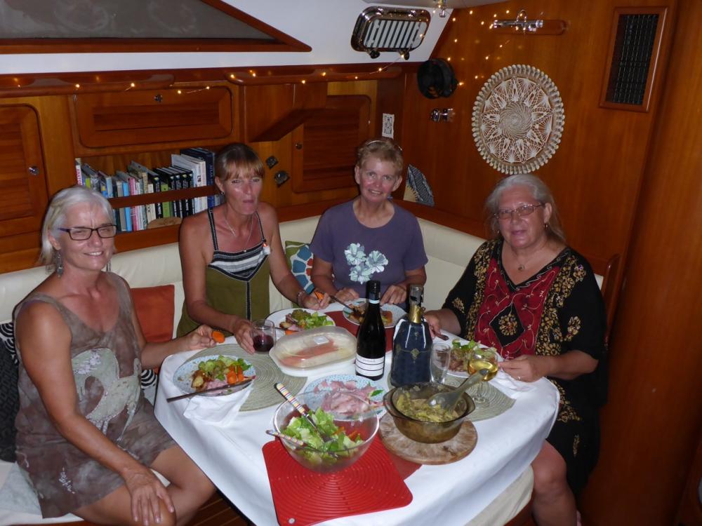
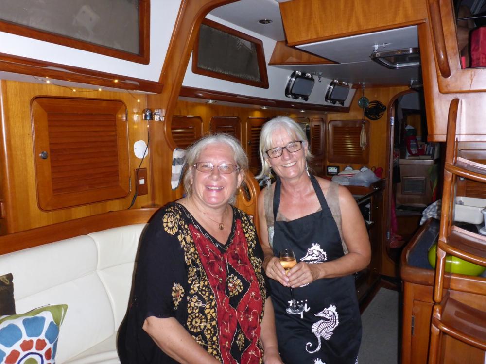
Xmas and New Year was a social time in Majuro with plenty of options to keep us busy and happy. We had Xmas Eve on Iolea with our friends on Dione, Belina, and State of Mind. Then on Xmas day we sailed to Aneko Island, a few miles from Majuro with lovely beaches and snorkelling, and met up with Sam and Seal and expats Ana and Trevor for a Xmas day celebration.
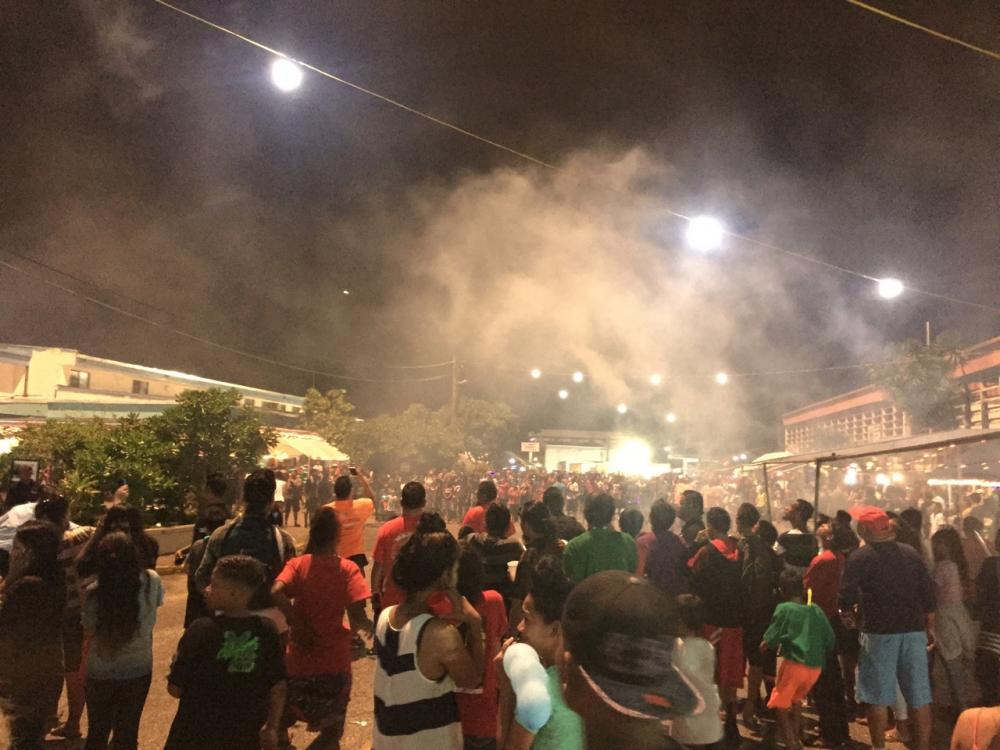
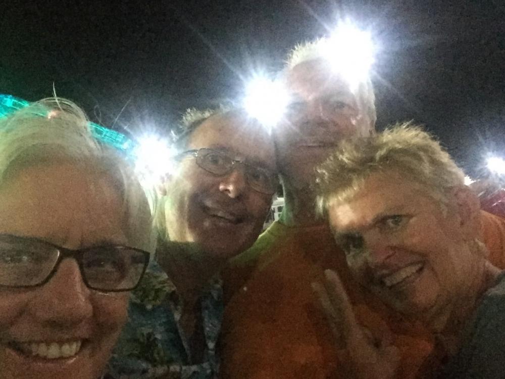
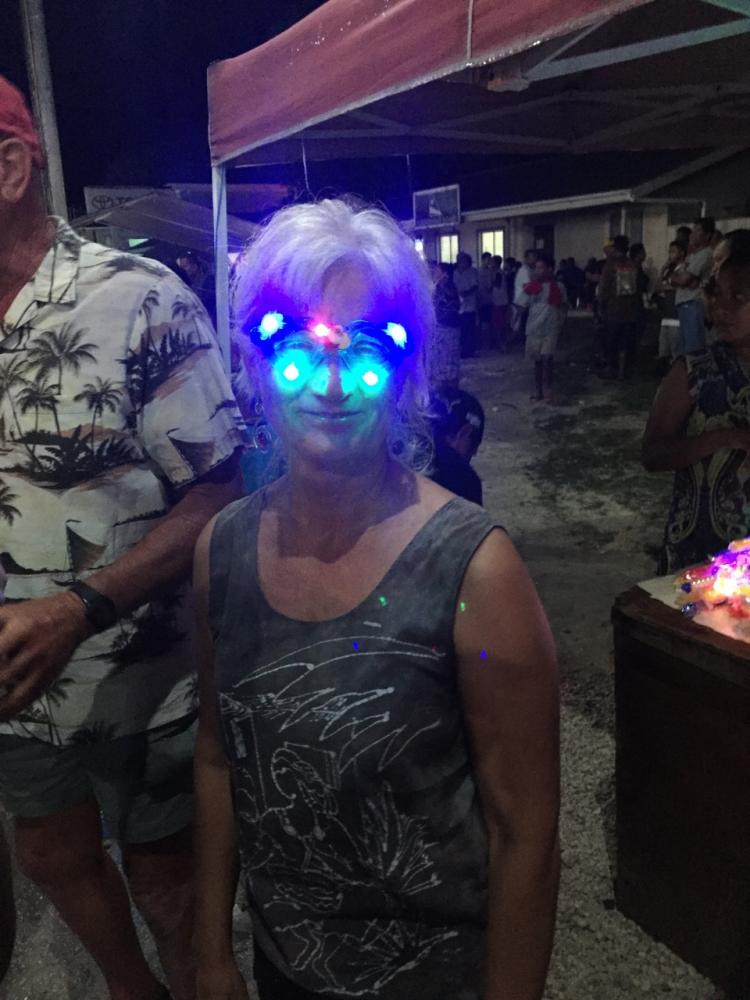
In Majuro, New Years Eve is The Block Party where the main road is blocked off for 200 metres or so and there are food booths and live bands and entertainment. We started the evening on State of Mind with other yachts in the anchorage and headed into town around 10pm. The streets were full of families and bands played at intervals along the road. A popular purchase from booths were flashing light glasses. However, apart from these the mood was relatively quiet and when midnight came there was no central countdown just general confusion. Only one booth of young people got their act together and did a group countdown. Anyway, it was a fun night just not as exuberant as we are used to.
We had managed to put in orders for boat parts and other items from Amazon before the internet went down and in early January they started to arrive; all except our boat order which was to arrive FEDEX, the most expensive form of shipping by a mile. Well, while USP managed to get all our packages to us within 2 weeks, FedEx managed to lose our parcel, then discovered it had been sent to Alaska!. We finally received it 3 weeks after it was sent and it delayed our departure for the outer islands by a week. We have not had a good experience with FEDEX while in the Pacific so we will stop beating our head on the brick wall from now on.
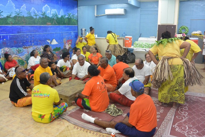
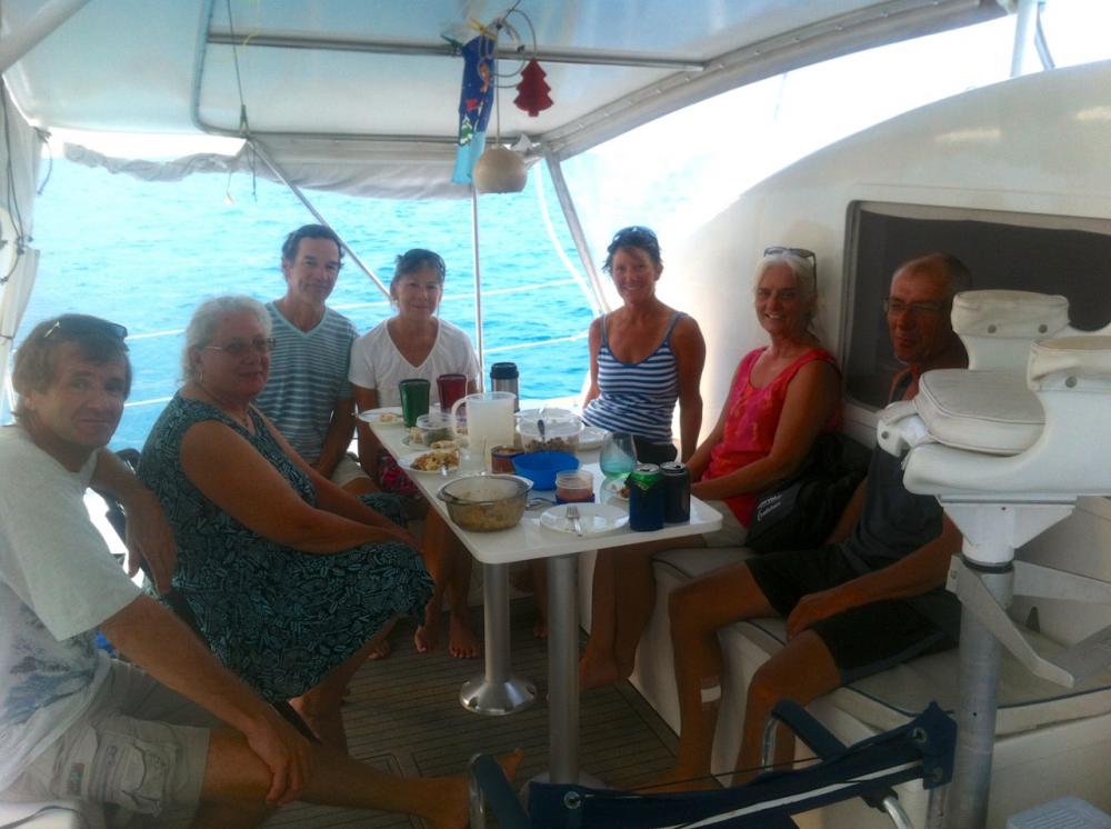
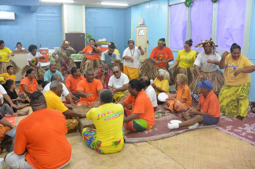
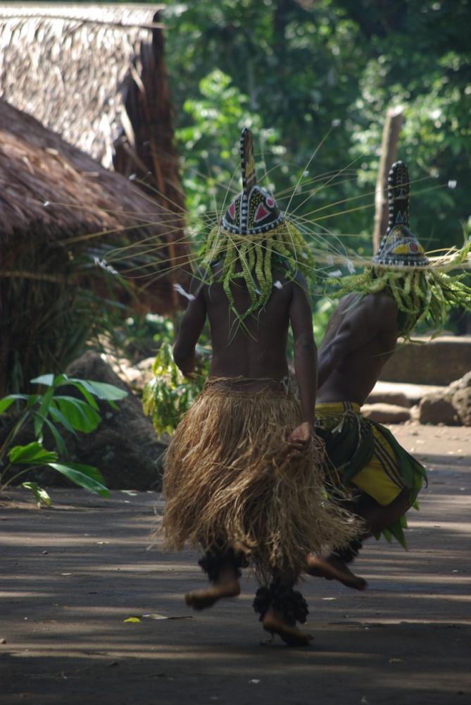
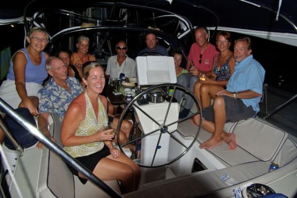
The upside of our delays were spending time with Mona and Filo and their family who are Nanumeans from Tuvalu living in The Marshalls. Sue and Glen on Dione became part of their family in Tuvalu and kindly asked if we could join the celebration of Tefolaha's Day which is the national day for Nanumeans. On this day Nanumeans gave up their old gods and accepted christianity as their faith. Tefolaha was the god they worshipped and in celebrating the day in his name they celebrate both their history and change in faith. Part of the celebration includes challenges between family groups. In the photo below and at the beginning of the blog the challenge was drumming and dance which built to a crescendo of noise and sweat - quite exhilarating. We had a wonderful time and to repay them we had a day out on Iolea at Enamenot.
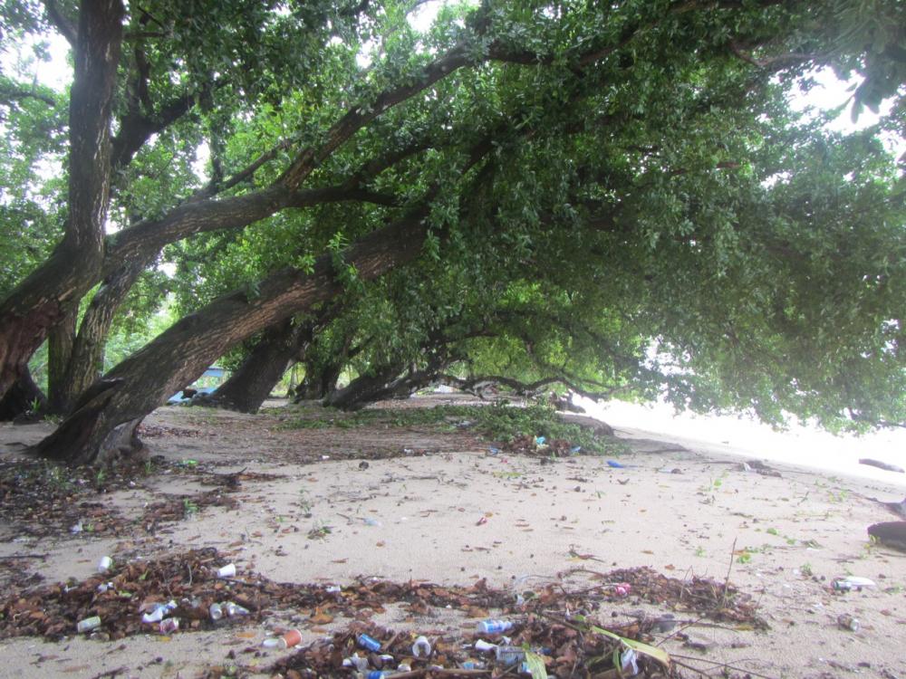
We also hired a car with Glen and Sue and drove up to Laura in the west. A beautiful area used by locals but marred by the garbage they leave behind. The lagoon becomes shallow here and the sand flats seem to extend out forever.

North Majuro
We left Majuro for the outer islands at the end of January. Sad to say goodbye to the people we had met there but pleased to be on our way and away from the ever present persaners and mother ships.
Three of us set off to Majuro from Tarawa within 24 hours of each other. Sam with Danny and Mo on board were first since Sam is 34ft and loaded to the hilt. Benno and Marlene left that evening in their Cat Belina and we left at dawn the next morning. Just north of Butaritari there is a surprisingly strong east-going current which helped with our sail angle in the ENE winds but stirred the seas a little. Sam and we beat up the east of Killi Atoll before turning towards Majuro which gave us fast downwind sailing. Benno's sailing philosophy is to go with the flow and so Belina went with the current We all arrived in Majuro within 20 hrs of each other but Belina had travelled an extra 150miles! (that's catamarans for you).
Our first night in Majuro was on a mooring off Enamenot Island. The moorings are provided by the Meico Yacht club and maintained by its members. Its a beautiful spot with nice little bommies and the wrecks of a cruising yacht, helicopter, and plane to dive on.
The next morning we settled on a mooring in the north anchorage off Riemers Enterprises who own the moorings, the RRE Hotel and quite a lot else on Majuro. It was so nice to be in clear water after Tarawa's soup. The striking difference between Majuro and Kiribati is the housing. Here it is mostly westernised with cinder or fibro walls and tin roofs to catch the regular rainfall. Majuro is dominated by a few families that own the majority of the land (Marshallese) and businesses (largely Chinese). Most of the people living on Majuro lease their houses (land) and there is little/no regulation of the leasing terms. Agreements over improving a house or building on the land seem to be verbal only and so lessees rely on the integrity of the land owner not to increase the rent or terminate the lease.
View Reimers' Dock where the annual Bill Fish competition is having its weigh-in
Sue on Dione keeps an eye on Glen as he cleans the hull
If you look closely you can see the Trading Boat behind the catamaran which is sinking. It went down very fast
Paul had been feeling unwell since we arrived in Kiribati. He was having dizzy spells and finding it hard to breathe at times so we visited the local hospital to see what was wrong. It became our home away from home for the first week as we waited with other outpatients to see a doctor and collect pathology results. The waiting was a minor inconvenience for a service that cost just $20. They did a variety of blood tests and found nothing serious thank goodness. They thought it was heat exhaustion and advised him to eat more and increase his intake of salt and other electrolytes. The heat had reduced our appetites and as westerners living mostly in a cooler climate we tend to minimise our salt intake. After upping both of these he began to feel much better.
Given the US influence in The Marshalls, we had envisioned supermarkets full of products to entice us after 6 months in Vanuatu and Kiribati. The supermarkets are certainly better stocked than in Tarawa but fresh local produce is limited despite land for gardens, and produce coming from the USA has almost no shelf life (we had been warned about that). A daily market operates next to the Marshall Islands Resort and has odds and ends, but mostly coconuts, and a Taiwanese aid initiative to encourage gardening runs a market with locals twice a month which has good produce but a bit expensive - so it is available if you look for it.
What is produced in the Marshalls and is exceptional is their weaving which is intricate and varied. Baskets, flowers, and Oban (round wall hangings) are the most common forms of decorative weaving. The Japanese have influenced the designs used in Oban and I find them a bit doily-like for my taste but there is no denying the superb workmanship. The first photo below is of a typical Oban woven in Majuro. The second is of an Oban hanging in RRE Hotel. No-one could tell me its origin - not even the museum - but having visited Kosrae now I wonder whether its influence is from The Federated States of Micronesia.
We had read before travelling north that Majuro has a cinema and bowling alley which sounded fun. Well we were disappointed. The bowling alley was taken over by the bank after its owner defaulted and then eventually closed. Now its just a shell. The local cinema had been popular but couldn't compete with pirated DVDs. So apart from some Karoke bars there is little left in the way of entertainment in Majuro now and as luck would have it, the internet was closed down just after Xmas to repair optic fibre cable near Kwajalein atoll. It was out for almost a month which probably saved us a fortune in unspent dollars on Amazon but was very frustrating.
Fortunately, there is the Mieco Yacht club (MYC) and Carey and Karen on the yacht Seal who keep an active social agenda going for yachties and Expats alike which was a lot of fun. They also run the Yokwe net on 6224 for boats travelling in the Marshalls and have been supported by Janet and David on Navire who have a fabulous SSB. Unfortunately, for the net Navire is heading back to New Zealand and taking their wonderful radio with them. The MYC has regular Tuesday night dinners and a monthly quiz. They also arrange other events. One of these was a reef walk from Enamenot Island. We and sv Seal took 50 people between us out to the island in the morning. We walked and waded back to Majuro with only a few retiring early from the challenge of currents and waves.
The MYC spins off other events too. This is Ana's 50th birthday at MI Resort.
Xmas and New Year was a social time in Majuro with plenty of options to keep us busy and happy. We had Xmas Eve on Iolea with our friends on Dione, Belina, and State of Mind. Then on Xmas day we sailed to Aneko Island, a few miles from Majuro with lovely beaches and snorkelling, and met up with Sam and Seal and expats Ana and Trevor for a Xmas day celebration.
In Majuro, New Years Eve is The Block Party where the main road is blocked off for 200 metres or so and there are food booths and live bands and entertainment. We started the evening on State of Mind with other yachts in the anchorage and headed into town around 10pm. The streets were full of families and bands played at intervals along the road. A popular purchase from booths were flashing light glasses. However, apart from these the mood was relatively quiet and when midnight came there was no central countdown just general confusion. Only one booth of young people got their act together and did a group countdown. Anyway, it was a fun night just not as exuberant as we are used to.
We had managed to put in orders for boat parts and other items from Amazon before the internet went down and in early January they started to arrive; all except our boat order which was to arrive FEDEX, the most expensive form of shipping by a mile. Well, while USP managed to get all our packages to us within 2 weeks, FedEx managed to lose our parcel, then discovered it had been sent to Alaska!. We finally received it 3 weeks after it was sent and it delayed our departure for the outer islands by a week. We have not had a good experience with FEDEX while in the Pacific so we will stop beating our head on the brick wall from now on.
The upside of our delays were spending time with Mona and Filo and their family who are Nanumeans from Tuvalu living in The Marshalls. Sue and Glen on Dione became part of their family in Tuvalu and kindly asked if we could join the celebration of Tefolaha's Day which is the national day for Nanumeans. On this day Nanumeans gave up their old gods and accepted christianity as their faith. Tefolaha was the god they worshipped and in celebrating the day in his name they celebrate both their history and change in faith. Part of the celebration includes challenges between family groups. In the photo below and at the beginning of the blog the challenge was drumming and dance which built to a crescendo of noise and sweat - quite exhilarating. We had a wonderful time and to repay them we had a day out on Iolea at Enamenot.
We also hired a car with Glen and Sue and drove up to Laura in the west. A beautiful area used by locals but marred by the garbage they leave behind. The lagoon becomes shallow here and the sand flats seem to extend out forever.
North Majuro
We left Majuro for the outer islands at the end of January. Sad to say goodbye to the people we had met there but pleased to be on our way and away from the ever present persaners and mother ships.
| Vessel Name: | Iolea |
| Vessel Make/Model: | Hylas 49 |
| Hailing Port: | Sydney, Australia |
| Crew: | Paul and Kate |
| About: | We are an Australian couple on a 2003 Hylas 49 and have been cruising from the Caribbean to the South Pacific since 2010. We are now in Alaska after 6 years in the tropical Pacific |
| Social: |
|
Iolea's Photos - Main
 |
 |
 |
 |
 |
 |
 |
.jpg) |
 |
 |
 |
 |
 |
 |
Another visit to Minca and 10 days anchoring in Tayrona Park
34 Photos
Created 18 August 2012
|
 |
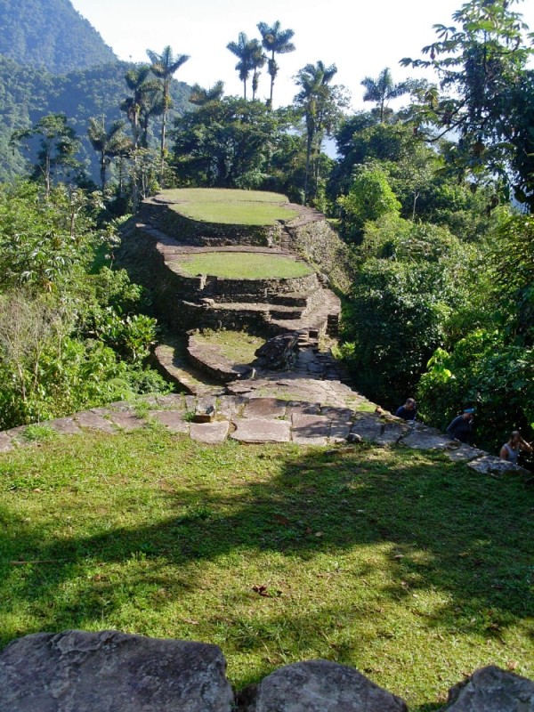 |
6 day hike to Cuidad Perdida (the Lost City) in Columbia
39 Photos
Created 17 August 2012
|
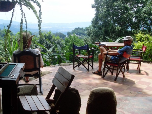 |
Today we took a taxi with bob and Vicky from FoxSea to the foothills of Sierra Nevada de Santa Marta to a place called Minca. It sits in heavy rainforest. Basic concete dwellings ,cafes, and restaurants and music and children everywhere. We visited a local artist, Leila, and her agronomist husband Guillame and I plan to take an afternoon class with her to make paper and build a visual diary - I'm looking forward to it, they are delightful people. Above the town via the stairs next to the church, across the concrete basketball field for the high school and up 200 stairs sits a hostel with hammocks, cold beer and views to the coast. Its run by Stephanie who is English and a refugee from London. Her dog Lola took us for a walk through the forest earlier in the day - very deliberate and well mannered
5 Photos
Created 19 June 2012
|
 |
The colour of the sunset is not enhanced. That is how it looked - blood red.
The remaining three photos are arriving in Santa Marta
9 Photos
Created 19 June 2012
|
 |
 |
 |
Will get to this tomorrow
22 Photos
Created 29 February 2012
|
 |
 |
 |
 |
 |
 |
 |
 |
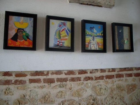 |
photos of artworks
43 Photos
Created 17 May 2011
|
 |
 |
 |
 |
IOLEA
Who: Paul and Kate
Port: Sydney, Australia
Gallery
USEFUL LINKS
- 2019 Alaska
- 2017 Vanuatu
- 2017 Solomon Islands
- 2017 Kosrae
- 2016-17 The Marshall Islands
- 2016 Kiribati
- 2016 Vanuatu
- 2015 Fiji
- Boat systems
- 2013 Panama to Galapagos
- 2013 galapagos to Marquesas
- 2013 Marquesas
- 2013 Rarotonga
- 2013 Niue
- 2011-12 Trinidad
- 2013-15 New Zealand
- 2013 Tonga
- 2013 French Polynesia
- 2013 Galapagos
- 2012-13 Panama
- 2012 Columbia
- 2012 Bonaire
- 2011 East Caribbean
- 2011 Bahamas
- 2010-11 Florida
- 2010 Annapolis - ICW
- Show All Posts