Kaimusailing
s/v Kaimu Wharram Catamaran
| Vessel Name: | Kaimu |
| Vessel Make/Model: | Wharram Custom |
| Hailing Port: | Norwalk, CT |
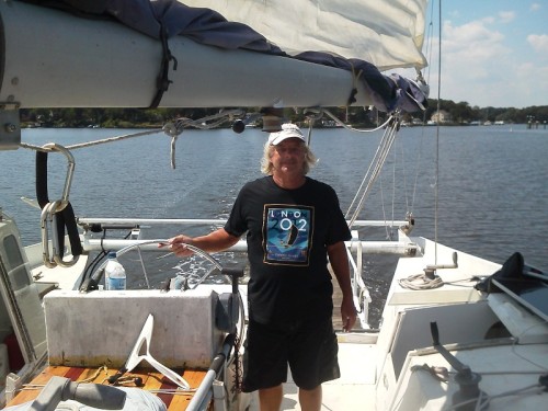
| Crew: | Andy and the Kaimu Crew |
| About: | Sailors in the Baltimore, Annapolis, DC area. |
23 April 2024 | St Marys, GA
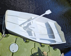
D4 Launchie
The laptop pooped the bed, so I have to scurry around with alternatives. Not as bad as typing on the phone.
17 April 2024 | St Marys, GA
Dinghy Skeg
I was suffering with what seemed like a cold and also had allergy symptoms. I awoke and felt fine. The green pollen that was coating everything was gone. Maybe it will return.
07 April 2024 | St. Marys, GA
Clammy Hands
Items came in from TEMU, the Chinese cut rate retailer. One was a nice little drone that cost about twelve and a half dollars. It looked like an easy thing to play with while I coughed and sneezed. I was fighting a summer cold, even though it is not summer elsewhere, it seems like it here. A nice [...]
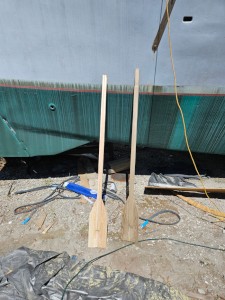
02 April 2024 | St. Marys, GA
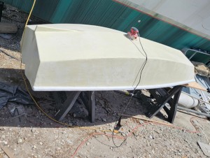
Sun Doggie
After laminating the cedar strips onto the gunwales of the dinghy I found the screws I used wouldn’t come out. The epoxy had seized them. The screw heads were stripped so I cut a straight slot in the heads with the cut off wheel. The cedar smoked when the screw heads got red hot. I could remove [...]
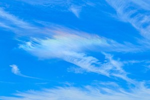
21 March 2024 | St. Marys, GA
Just Add Water
The rainy weekend started off with overcast and fog but no rain. It looked like I might be able to get something done on the D4 dinghy. I wanted to change the bow seat which is really the bow deck. The sailing option uses the deck to hold the freestanding mast. I didn’t like how the deck looked, [...]
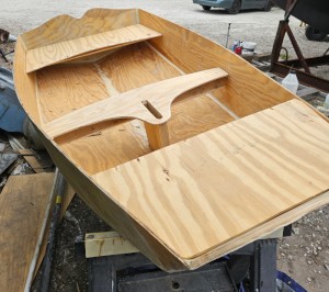
01 March 2024 | St. Marys, GA
D4 Dinghy Alternative Seats
The rain event was more wind than rain, strong winds with gusts up to 44 mph. We drove into town to see what the harbor was like. There was a small sailboat that had dragged anchor and was sitting close to shore. The tide was out. We left and played with Bleu at Notter’s Pond.
Barefoot to Georgetown, SC
.
When I awoke in the morning after our previous night’s Mexican Happy Hour, I had a stupendous tequila hangover. Tequila sunrise. I still was able to get underway by 9 AM. I had done a U-turn to tie up at Barefoot Landing, now I had to do a U-turn to continue my journey. There was a fuel dock right across the way and I needed fuel. Unfortunately the did not have any gasoline, just diesel. They directed me to another marina about 5 miles up the ICW.
.
On my way up to the marina that had fuel I saw some amazing houses and took photos of some of them. There was a strong current and we could only make 3 knots and change. The marina, Grande Dunes Marina, is way upscale with many large power yachts and the neighborhood matches it. The fellow who operates the fuel dock said building lots go for about 2 million dollars.
.
I first went into the North entrance of the marina, but there was no fuel dock there and I had a terrible time getting Kaimu back out so I could try the other entrance. When I came into the South entrance I could not see a fuel dock there either, but the marina sign had the word fuel on it. I tied up at an empty dock and hiked to the marina office. When the manager pointed out where the fuel dock was I could see it would be a long hike. He said I could use a dock cart, but it would be a long slog. Then the fuel dock guy came by in an electric golf cart with some trash in the back. If I could wait a little bit, he would cart me and the jerry cans to the fuel dock and back again.
.
Soon I was back aboard Kaimu with the fuel. When I tied up to the dock the stern was hanging out past the dock. This turned out to be a blessing, I looped the stern line around the cleat and threw it back on deck, then removed the bow line. I backed Kaimu down against the stern line and the boat swung out from the dock and pointed at the ICW. Now I could bring the stern line aboard and head out.
.
It was rather tedious going along at 3.8 knots even though the engine was almost full throttle. I was putting the last of the bad fuel into the portable tank using the Baja filter funnel and all was running fine. I kept track of how much fuel we were using per hour and it seemed to be about a gallon an hour. When I ran the engine harder, it used up more fuel and did not really go much faster than about 5 knots. Capn Brad told me that I would get aided by the current once I got to where the Waccamaw River emptied into the ICW. The flooding that was causing the current was on both the Waccamaw and the Pee Dee Rivers. When I got to a swing bridge that was listed on the chart as having 11 feet of vertical clearance when closed, the scale of vertical clearance that is mounted on the bridge, “Read Vertical Clearance from Scale”, the scale said 7 feet of clearance. In other words the river was 4 feet above normal. On the NOAA weather forecasts they predicted the rivers would continue to rise. I now looked on shore and could see some homes had water in their yards. Of course the giant McMansions had raised stonework and beautiful landscaping. No danger of flooding there. One home had a giant staircase leading down to the water. No thanks, that would be like climbing up and down a mountain.
.
I did finally get to that spot where my speed increased. Now I had 16 miles to go to a waypoint just short of Georgetown and I was doing 6 knots. But it was close to sundown. I looked up in the sky and the moon was almost full and had already risen. I would be navigating on the rivers, not in the narrow ICW canal. I took a chance that I could travel at night although it was always a rule, no ICW at night. There is danger of hitting unlit daymarks amongst other things.
.
It was also turning into a long day. The autopilot was not working the way it had back when I first installed the new control head. My guess is that the hydraulic steering had lost some fluid and that means air got in and now there is excessive play in the steering. It is not a big job to bleed the system. I was hand steering the whole way and tired of standing in the pilothouse, but out on deck where I could sit in the helm seat it was too cold. So I went back and forth.
.
The most dangerous part was pulling into Georgetown waterfront, littered with unlit vessels. With the moonlight I was able to keep from crashing into things and found a place to drop anchor. The days tally was 11 1/2 hours and about 15 gallons of gasoline.
.
I made a quick soup out of shrimp ramen and a can of tuna. Just an experiment. It was OK, I could have some wine and get some sleep
.
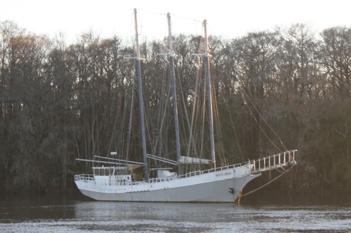
The photo is of a three masted schooner, not a common sight on the ICW.