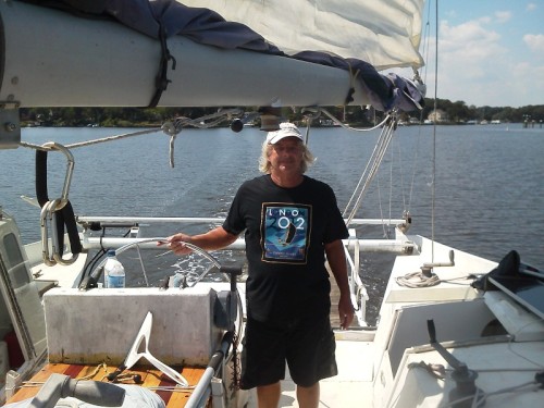
Kaimusailing
s/v Kaimu Wharram Catamaran
| Vessel Name: | Kaimu |
| Vessel Make/Model: | Wharram Custom |
| Hailing Port: | Norwalk, CT |
| Crew: | Andy and the Kaimu Crew |
| About: | Sailors in the Baltimore, Annapolis, DC area. |
17 April 2024 | St Marys, GA
Dinghy Skeg
I was suffering with what seemed like a cold and also had allergy symptoms. I awoke and felt fine. The green pollen that was coating everything was gone. Maybe it will return.
07 April 2024 | St. Marys, GA
Clammy Hands
Items came in from TEMU, the Chinese cut rate retailer. One was a nice little drone that cost about twelve and a half dollars. It looked like an easy thing to play with while I coughed and sneezed. I was fighting a summer cold, even though it is not summer elsewhere, it seems like it here. A nice [...]

02 April 2024 | St. Marys, GA
Sun Doggie
After laminating the cedar strips onto the gunwales of the dinghy I found the screws I used wouldn’t come out. The epoxy had seized them. The screw heads were stripped so I cut a straight slot in the heads with the cut off wheel. The cedar smoked when the screw heads got red hot. I could remove [...]
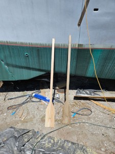
21 March 2024 | St. Marys, GA
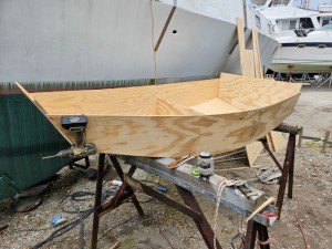
Just Add Water
The rainy weekend started off with overcast and fog but no rain. It looked like I might be able to get something done on the D4 dinghy. I wanted to change the bow seat which is really the bow deck. The sailing option uses the deck to hold the freestanding mast. I didn’t like how the deck looked, [...]
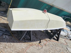
01 March 2024 | St. Marys, GA
D4 Dinghy Alternative Seats
The rain event was more wind than rain, strong winds with gusts up to 44 mph. We drove into town to see what the harbor was like. There was a small sailboat that had dragged anchor and was sitting close to shore. The tide was out. We left and played with Bleu at Notter’s Pond.
23 February 2024 | St. Marys, GA
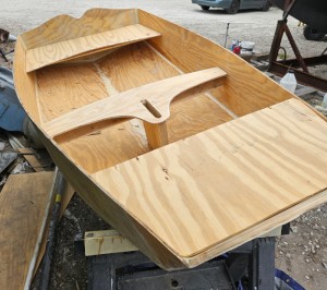
D4 Inside Seams
Day two of the dinghy build started out with me finishing wiring the hull bottoms together on the centerline of the bottom panels. This was much easier than the wiring of the chine edges of the bottom panels and the side panels.
Cove Point to Shark Shoal
.
Ihad planned a route that took us South down the Bay to Kedges Straight and planned the route through to Tangier Sound. I found out how to make a route on my cell phone also. The wind was a mild SW breeze. The anchor line was leading aft along the stbd side and the breeze was holding us against it. I was able to partly raise the main and get the wind to spin us to stbd and thus head into the wind. I raised the sails with the sheets slacked, then slowly brought the anchor line and anchor aboard. I tied it off on the pulpit, maybe 4 tie offs of the 100 feet or so of anchor rode. The anchor was stowed on deck with the short section of chain wrapped over the pulpit and cleated down on deck.
.
We began sailing out of Cove Point cove. A sailboat was nearby with a red official looking RIB tied to it. It was either the Coast Guard or Towboat/US. I hoped it wasn’t the CG stopping any Labor Day boaters and issuing fines. As we sailed off to the South and got farther away I relaxed and concentrated on keeping as close to the wind as I could. We would have to tack at some point, I wanted to be as far down the Bay as possible.
.
When we were still quite a ways off the Eastern Shore I was shocked to see 30 on the depth sounder. We had just been in over 100 feet of water. I quickly tacked away toward the West, toward the Potomac. So far it had been a pleasant easy sail.
.
Our clear sky was being encroached by a storm front. The approaching dark clouds brought high winds, like a microburst, that lasted for an hour or so. Also they brought rain and hail. The Bay was whipped into large choppy waves. I held SUNSPLASH into the wind with both sails eased. I wondered how long the genoa could take the whipping in that wind.
.
At some point I was wondering where we are, what is around us, I couldn’t use the cell phone navigation app because of the rain, the storm obscured anything on shore. It was close to dusk and some navigation aids were lit, buoys and shore facilities, but nothing was visible. I had left the cell phone in the cabin, wisely, to keep it dry and charged. I couldn’t leave the helm for a second in the wind and storm. I kept an eye on the depth gauge and it consistently read about 50 feet.
.
The wind and rain eased up slowly, and I could see the military installation at Cove Point again. I thought we must have gone miles, but we are probably no further than before. A lot of wind and commotion and then calm and no gain. We were drifting in almost no wind, strange after having that storm batter us around. I had some steerage and pointed the boat out into the Bay.
.
My plan was to use the ebb tide as a boost to get down to Kedges Straight, then use the flood tide to carry us into Tangier Sound. We had about 40 miles to go, maybe 10-15 hours if all went well. It was now dark and lights to the South of us turned out to be a ship. I was sure our running lights were not all working so I shined my trusty Walmart work light at the ship. Whether it saw us or not, it did not turn toward us and passed by. My try at getting the boat going faster by taking a stbd tack out into the Bay didn’t help much. Plus it puts us in danger.
.
I felt threatened sitting in the middle of the Bay with all that ship traffic and me with inadequate running lights. I decided to sail to the Eastern Shore and take advantage of the shoal we had been on. It deep enough for SUNSPLASH. We crossed the Bay to the edge of the Hooper’s Island Shoal. We had just under 30 feet of water. There were two flashing navigation aids, one white and one red. Our course passed between them. A ship going South passed us and I felt relieved to be in depth of water they could not sail through, they could not ram us even if they tried. As it passed to the South another set of ship’s lights grew as that ship came North and passed us. I was so glad to be out of the ship channel.
.
The approach to Hooper’s Island Straight is deep and wide, it narrows but only shallows in a few spots.At times the boat almost naturally goes wing and wing with the main on one side and the genoa on the other. The moon peeks through the slot between the sails. Good sailing. The wind has been good and we’ve gotten up to 5.4 knots at times, I’m very tired but glad to put away distance at this rate.
.
I kept the cell phone on deck and had the problem of using reading glasses to look at it, but in the couple of minutes of looking at it the boat would start to stray off course. I had a couple of unintended jibes and noticed after one of them the boom vang had come loose from the mast. The vang keeps the leech of the mainsail tight. Now the sail lost some of its shape.
.
I didn’t plan on using this channel, it’s complicated, narrow in places, and I don’t think a vessel that is restricted to sail only can always use it. I used it because the tide was turning and to use the flood tide I had to use what was available. I could never have done this without perfect weather (almost), dry so I could use the cell phone on deck, a fair wind, now, full moon with clouds dissipating. Clear enough to see all the navigation aids. We certainly need them on this part of the trip.
.
The channel of the straight is like a fishhook lying point up, the point is where we exit. The wind seems to go light, but we will make it through. The forecast had a warning about a cold front and high winds. They arrived, knocking us down, but we are almost through the Straight.
It is a fight to sail a 135 genoa in 20 knot winds, You have to drive the boat, then let it stand up, head up, bear off to keep steerage. We were not making the next buoy marking Shark Shoal Channel.
.
We were being driven onto the shoal. I headed up, tightened the helm to keep us pointed into the wind, went forward to deploy the anchor. The boat tacks over anyway and the genoa almost sends me to my grave. It was very lumpy. stay low and hang on. I had meant to use a technique of heaving to, dropping the anchor, then lowering sails. Cannot do that now. Glad I left the anchor on deck with most of its line and its little chain. Unchained it and fed out line. The anchor line became taught. Undid the genoa halyard, clawed it down on deck and jammed it between the stanchions and the dinghy on the foredeck. Dropped the main and tied it off with the too long reefing gaskets. Glad they are long enough. Very rough place to anchor, on a shoal with a gear buster pushing big waves on us. Cell phone gps says we are underway at .6 knots, set marker on the cell phone display and we haven’t moved. Guess the anchor line stretches enough to give false moves. Tied off a loose halyard, must be for the spinnaker.
.
Sent a text at 3:22 that I'm anchored on the Tangier Sound side of Hooper Island Straight. Very bouncy. I take my blood pressure medicine, eat a stack of Ritz crackers with peanut butter and take benedryl and ibuprofen along with some wine. I continue to check the gps display and we are anchored solid. I fall asleep immediately.
.
I was awakened at 6:30 AM by a phone call from the Coast Guard. Someone had reported a sailboat in danger, adrift on Shark Shoal, which is where we were. The shoal is about 10 feet deep so we are in no danger. I assure the CG that we are OK, do not need assistance, thank them for their work. Now I can’t get back to sleep. Darn.
.
I loll around, make breakfast of the last 3 eggs and a brioche roll. Whether I like it or not I am awake. I look at the halyard I tied off in the middle of the night and it’s the mainsail halyard. It had a figure 8 knot in the end to keep it from going up the mast. Glad I tied it off. I looked at the boom vang. The eye strap on the mast that secured that end of the vang had snapped. It won’t be too hard to repair with a proper strap. Some of the genoa had gone overboard and I pulled it up on deck. I tried to haul in the anchor but the wind was too strong, still, so I decided to retreat to the cabin and write up my trip.
.
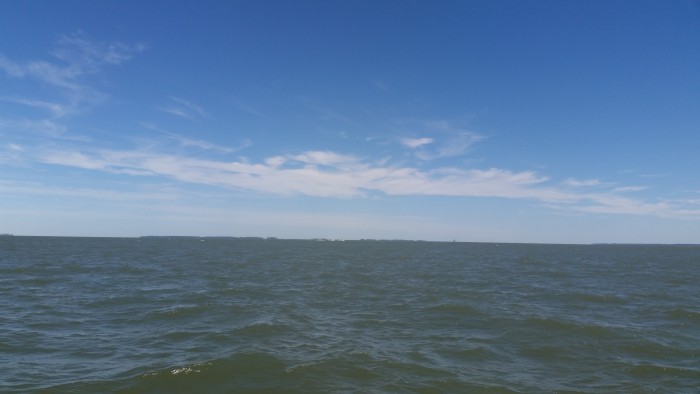
The photo is of the waters of Hooper’s Island Straight.