The First Mate's Journal
Where to next?
Great Lakes to The Bahamas
Who: Wayne & Pat
Port: Jackson
Favorites
05 November 2009 | Deltaville, VA
16 October 2009 | Deltaville, VA
27 May 2009 | Deltaville
26 May 2009 | Deltaville
25 May 2009 | Deltaville
24 May 2009 | Fishing Bay (N37*32.418 W76*20.203) to Deltaville
23 May 2009 | Great Bridge VA (N36*43.285 W76*14.508) to Fishing Bay VA (N37*32.418 W76*20.203)
22 May 2009 | Buck Island, NC (N36*16.034 W75*57.520) to Great BridgeVA (N36*43.285 W76*14.508)
21 May 2009 | The Alligator River Bridge, NC (N35*53.847 W76*02.024) to Buck Island, NC (N36*16.034 W75*57.520)
20 May 2009 | Alligator River Bridge, NC
19 May 2009 | Alligator River Swing Bridge, NC
17 May 2009 | The Pungo River, NC (N35*33.715 W76*28.557) to Alligator Swing Bridge, NC (N35*53.874 W76*02.024)
16 May 2009 | Eastham Creek Anchorage NC (N35*17.680 W76*36.514) to The Pungo River, NC (N35*33.715 W76*28.557)
15 May 2009 | Town Creek Marina, Beaufort NC (N34*43.519 W76*39.898) to Eastham Creek, NC (N35*17.680 W76*36.514)
14 May 2009 | Town Creek Marina, Beaufort, NC
13 May 2009 | Taylor Creek, Beaufort, NC (34*42.860 76*39.831) to Town Creek Marina, Beaufort, NC
12 May 2009 | Mile Hammock Bay (N34*33.163 W77*19.528) SM#244.5 to Taylor Creek, Beaufort, NC (34*42.860 76*39.831)
11 May 2009 | Wrightsville Beach NC (N34*12.441 W77*47.965) SM#283.2 to Mile Hammock Bay (N34*33.163 W77*19.528) SM#244.5
10 May 2009 | Shallottes Inlet, NC (N33*54.913)SM330 to Wrightsville Beach Anchorage (N34*12.447 W77*47.953)
09 May 2009 | Bull Creek, SC (N33 36.667 W79 06.228) to Shallottes Inlet, NC (N33*54.913)
Gassing with the big boys
03 November 2008 | Pungo River Anchorage depth 10 ft at anchor (N35*33.608 x W076*28.258) to Broad Creek Anchorage depth 8 ft at anchor (N35*05.424 x W076*37.594)
Winds E 10-15 in morning, 15-20 towards evening; waves 2-3 ft, showers in the afternoon

Started out foggy about 52 outside. We calculated our gas consumption and compared it to the reading on the fuel monitor and decided we'd better stop for gas. It's rough when you're not sure how much gas you have. Unfortunately the gas stops are few & far between right here but there was diesel at a place called RE Mayo Co. near the Hobucken Bridge. They appear to be a fish/shrimper facility where the shrimp boats dock and load supplies and unload their catches. When we pulled in, there were several large shrimp boats tied at the dock but there was nobody around at the dock. We circled and called out and someone dragging a bushel heard us "do you have diesel?" "yup over there" so we pulled in. The guy dragging the bushel was sorting fish into bushels, hosing them off and putting them in a big warehouse building that looked temperature controlled because it had those long plastic curtains separating the building from the outer concrete area that he was working in.
It was an interesting setup there and the gas was for the commercial fishing boats. They made sure that we had a commercial I.D. before they'd sell to us, then we had to watch how many gallons we put in and report back to the office to let them know how much we took. According to Skipper Bob's manual they also have dockage if you need it, but probably ONLY if you really NEED it. The major focus here is on fishing/shrimping commercially (I'm thinking). Definitely worth a stop and it gives a local flavor for the shrimp industry here. Nice folks. It was odd that while I was calling out to see if anyone was here originally nobody was here, but as we were leaving, 4-5 guys appeared out of one of the shrimp boats. Later in the day while we were fighting larger waves one of the shrimp boats caught up to us and passed us. It came pretty close, I figured for a look see at us, and rocked the heck out of us, but I got a picture of it anyways.
We pulled into Broad Creek around 4 and anchored in 7-8 ft of water towards the back of the creek near a boat called Blackfoot (Pam & Frank). They motored over to say hi before going to meet some friends on shore and to tell us about a new marina here (River Dunes Marina) that they were going to be going to the next day along with an Island Packet that's anchored nearby. Everyone is putting in for the next couple days due to the weather that's heading our way. There's now a small craft advisory in effect until Thursday morning so we're going to leave the chart plotter on to use its anchor alarm.
Comments
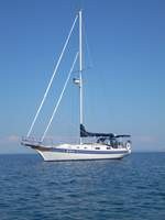
| Vessel Name: | Kolibrie |
| Vessel Make/Model: | Bayfield 36 |
| Hailing Port: | Jackson |
| Crew: | Wayne & Pat |
| About: | Back in Michigan for Hurricane Season 2009... |
| Extra: | Our boat is a Bayfield 36. Not the fastest little thing, but a nice little cruiser that we like to call home. |
| Home Page: | www.kolibrie.us |
Gallery not available
Great Lakes to The Bahamas
Who: Wayne & Pat
Port: Jackson