L'Eau Commotion Westabout
An (other) attempt to sail non stop Westabout around the world
| Vessel Name: | L'Eau Commotion |
| Vessel Make/Model: | Northshore 38 |
| Hailing Port: | Brisbane Australia |
| Crew: | Bill Hatfield |
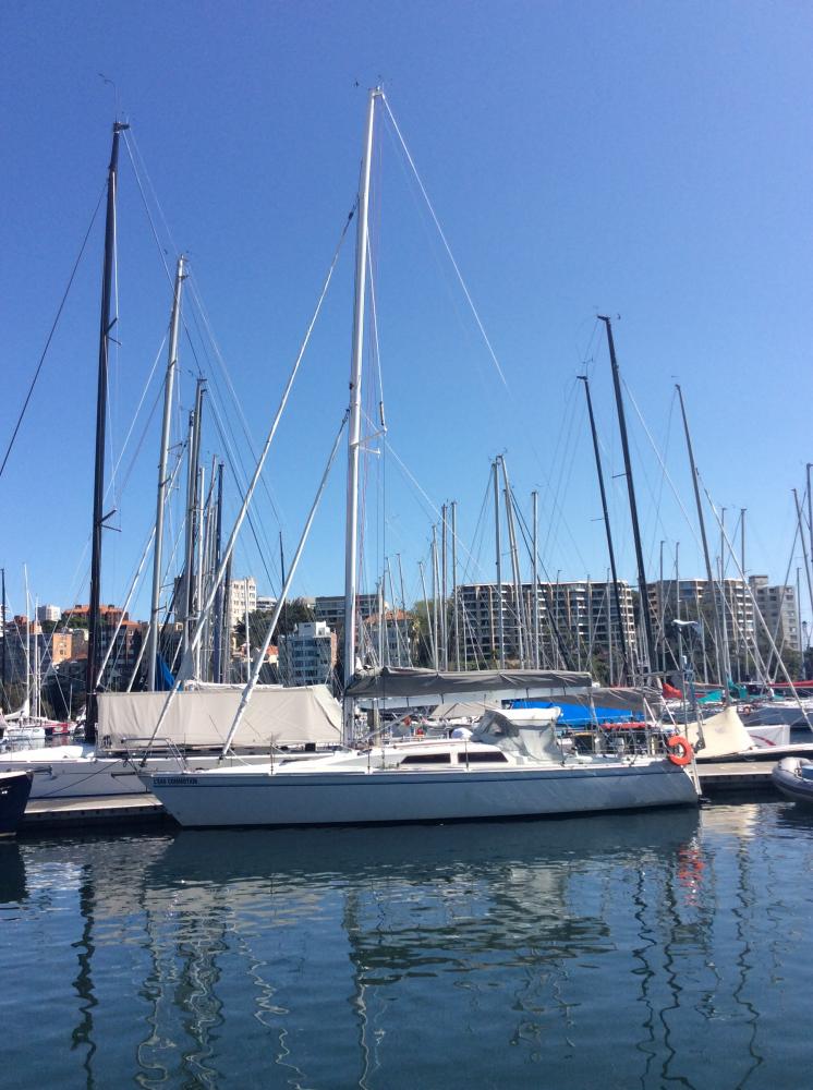
25 February 2020 | Scarborough Marina, Brisbane
21 February 2020
21 February 2020 | 59 Miles To Go
20 February 2020 | 114 Miles East Of Australia
19 February 2020 | 220 Miles East Of Gold Coast Seaway
19 February 2020 | 262 Miles To Gold Coast Seaway
18 February 2020 | 304 Miles East Of Gold Coast Seaway
18 February 2020 | 328 Miles To Go
17 February 2020 | 423 Miles To Go
17 February 2020 | 423 Miles To Go
16 February 2020 | 505 Miles East Of The Gold Coast
15 February 2020 | 617 Miles To Go
14 February 2020 | 755 Miles To Go
13 February 2020 | 888 Miles To The Gold Coast
12 February 2020 | 1032 Miles To The Gold Coast
11 February 2020 | 580 Miles North Of The Waikato
11 February 2020 | 1167 Miles To Home
10 February 2020 | 1300 Miles To Home
10 February 2020 | 1309 Miles To The Gold Coast
09 February 2020 | 1460 Miles To The Gold Coast Seaway
Recent Blog Posts
20 February 2020 | 114 Miles East Of Australia
ETA Looking Likely
Day 258 6am Friday 21st February 2020
19 February 2020 | 220 Miles East Of Gold Coast Seaway
Amended ETA
Day 257 6am Thursday 20th February 2020
19 February 2020 | 262 Miles To Gold Coast Seaway
Amended ETA
Day 256 10:30pm Wednesday 19th February 2020 ( UTC+10 )
The Route
12 January 2020 | 760 Miles NE Of Pitcairn Island
Day 219 12 Noon Sunday 12th January 2020 ( UTC-8 )
On my large scale charts I don't have King George Islands marked so to give you an idea of what's in mind I plan to pass under the Tuomotus, of which Isles Gambier or Mangareva is the South Eastern outlier and then under the Austral Group Of which Rapa is the South Eastern outlier. Looking at Jimmy and Ivan Cornell's Wind Atlas this should still be in the Trades while trying as much as possible to keep South of the North West Monsoon influence and at the same time lie in a belt of approximately 20S to 25S which is favoured by current Grib Files. I would also like to not have to thread my way if further North through the numerous atolls of the Tuomotus, a.k.a. The Dangerous Archipelago. A very quiet night has been followed all morning by welcome freshening of the North East breeze.
On my large scale charts I don't have King George Islands marked so to give you an idea of what's in mind I plan to pass under the Tuomotus, of which Isles Gambier or Mangareva is the South Eastern outlier and then under the Austral Group Of which Rapa is the South Eastern outlier. Looking at Jimmy and Ivan Cornell's Wind Atlas this should still be in the Trades while trying as much as possible to keep South of the North West Monsoon influence and at the same time lie in a belt of approximately 20S to 25S which is favoured by current Grib Files. I would also like to not have to thread my way if further North through the numerous atolls of the Tuomotus, a.k.a. The Dangerous Archipelago. A very quiet night has been followed all morning by welcome freshening of the North East breeze.
Comments
L'Eau Commotion's Photos - Main
 |
|
|
 |
|