A Little About The Cape Fear Region
03 August 2008
by Keith, cool, calm evening - I think I can hear something eating something off the hull
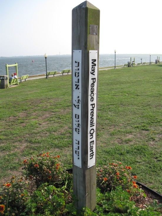
We are traveling through a very historic area for the United States (and the Confederacy). Southport is located at the mouth of the Cape Fear Inlet, one of the main capes and inlets on the east coast of the US. Beyond the inlet are the frying pan shoals extending for many miles out to sea. The markers placed and maintained by the government take boats large and small by the shoals safely to open ocean. There are many, many wreaks littering the shoals. The long, deep Cape Fear River flows to the sea here. I traveled it today for 10 miles from from the cut to Carolina Beach. It was nice to be in deep water (40 feet plus) and not constantly watching the depth meter (I did anyway, but not as much). The largest ammunition loading platform in the eastern US was/is located up the Cape Fear River. Transports exit the river into the Atlantic and then head for Europe or Vietnam... now the Middle East. The original photo I chose for this entry wouldn't download. It is a memorial for the crew of a transport ship that was torpedoed by a German U-Boat outside of Cape Fear. During the civil war, the south controlled the entrance to the Cape Fear River and used that to undermine the North's attempted blockade of Cape Fear inlet and to further prevent the Northern ships from entering Cape Fear river and taking Wilmington. The futuristic looking iron topped steam battle ships were placed here to guard the entrance (and because they were too heavy and underpowered to take to sea). Eventually, of course, it all fell to the North. Now Southport is a city of peace.

Comments