The Modern Chartplotter Is Installed
25 August 2008
• Hilton Head
by Keith, variable, getting hot and humid again
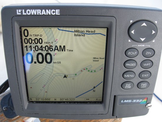
It's Monday morning and the mechanic came early to finish up so I can mozie along. This was the chartplotter I salvaged from the Catalina 25. There are pictures of it navigating me across the Sea of Cortez last year if you go back to that time in the blog. As you can see it is far superior to the 1995 technology that came with the old magellin. It comes with US maps that go into great detail and even include many of the major nav aids. That is going to help considerably as I head the last 500 miles south down the east coast of Georgia and Florida. If I want, I can buy map cards for the Bahamas or anyplace else in the world and it will chart my boat's position via GPS on the maps. This baby is fully programmable so I can customize the screens to match the exact data I want for each situation. It is lightening fast, far more accurate, and just a real asset to cruising safety. Look how it plots my exact position in this creek off of the waterway. The magellen couldn't get closer than a 30 mile view without cards that I couldn't find. This thing will zoom in to 50 feet, but that wouldn't be of much use to me except maybe in heavy fog and even then I wouldn't trust it. It uses the waas technology that airplanes use for their gps tracking. After installing the chartplotter, we did a few odds and ends to get the boat in ship shape. I ran the engine for about 20 minutes to make sure everything was working and not leaking or overheating. Now we're good to go. I've literally fixed/serviced everything I know of to fix so the boat is pretty much in perfect order. I'm sure that won't last long, but its feels good for now. I'll clean up and get it ready to travel, pay my bill this afternoon, and head out either later this afternoon or first thing tomorrow morning. Maybe I can get a ride to the grocery to provision and perhaps a dinner on the town before heading off. Why rush.

Comments